Showing 2927 items matching "australian maps"
-
 Clunes Museum
Book, Fred Cahir, My Country All Gone The White Men Have Stolen It - The Invasion of the Wadawurrung Country 1800-1870, 2019
THIS BOOK REALLY BEGAN ON THE NULLABORE PLAIN IN 1983 WHEN I WAS CYCLING SOLO ACROSS AUSTRALIA FROM PERTH TO MELBOURNE...Soft Cover book , depicts a young Aboriginal women wrapped in a possum skin cloak standing in front of an early topographical map of Port Phillip. 348 pages.non-fictionTHIS BOOK REALLY BEGAN ON THE NULLABORE PLAIN IN 1983 WHEN I WAS CYCLING SOLO ACROSS AUSTRALIA FROM PERTH TO MELBOURNE...first nations history, wadawurrung country -
 Bendigo Military Museum
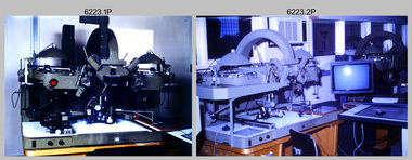
Photograph - AUTOMAP 2 Production - Army Survey Regiment, Fortuna, Bendigo, c1986
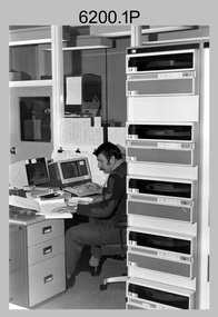
This collection of 23 photos of map production on the AUTOMAP 2 computer-based system in Air Survey and Cartographic Squadrons, was most likely taken in 1986. The AUTOMAP 2 system was an upgrade to the AUTOMAP 1 system, comprising Intergraph graphic edit workstation terminals networked to VAX 750/785 main frame computers. Unlike AUTOMAP 1, operators could display digital topographic features on monitors for editing. Successful adaptation of this system meant RASvy was at the forefront of digital mapping/cartographic systems in Australia and overseas. The system comprised Input (Wild B8 Aviograph feature extraction) Raster Scanning (digitising from compilation sheets, Graphic Edit (cartographic completion) and Plot Verification Sub Systems. The system was operational from 1984 to its ‘Newheart’ upgrade in 1993. Throughout its life, the system was progressively refined with productivity gains, achieved from award winning technical development in-house by talented and innovative Army Survey Regiment personnel.This is a set of 23 photograph of AUTOMAP 2 production at the Army Survey Regiment at Fortuna, Bendigo, c1986. The photographs were on 35mm colour slides and were scanned at 96 dpi. Photos .5P and .6P are also printed on photographic and scanned at 300 dpi. They are part of the Army Survey Regiment’s Collection. .1) - Photo, colour, c1986, AUTOMAP 2 Production - Army Survey Regiment, Fortuna, Bendigo. c1986. .2) - Photo, colour, c1986, AUTOMAP 2 Wild B8 Aviograph stereoplotter. .3) - Photo, colour, c1986, AUTOMAP 2 Wild B8 Aviograph stereoplotter feature extraction, unidentified technician. .4) - Photo, colour, c1986, Wild B8 Aviograph stereoplotter feature extraction, LCPL Raelene (Munting) Brodie. .5) - Photo, colour, c1986, AUTOMAP 2 computer tape maintenance, SPR Steve Linane. .6) - Photo, colour, c1986, AUTOMAP 2 Graphic Edit Workstation, SPR Steve Linane. .7) to .8) - Photo, colour, c1986, AUTOMAP 2 Graphic Edit Workstation, unidentified technician. .9 to .10) - Photo, colour, c1986, AUTOMAP 2 Graphic Edit Workstation. .11) - Photo, colour, c1986, AUTOMAP 2 Graphic Edit Workstation feature coding and command menu. .12) - Photo, colour, c1986, AUTOMAP 2 high resolution computer monitor. .13) to .16) - Photo, colour, c1986, AUTOMAP 2 production output comparison to AUTOMAP 1. .17) to .18) - Photo, colour, c1986, AUTOMAP 2 computer system components. .19) - Photo, colour, c1986, AUTOMAP 2 Intergraph 7596 verification plotter. .20) - Photo, colour, c1986, AUTOMAP 2 Benson verification plotter, SPR Steve Coulson. .21) - Photo, colour, c1986, AUTOMAP 2 drainage, contour, roads and cultural digital data verification plot. .22) - Photo, colour, c1986, AUTOMAP 2 drainage, contour, roads and cultural digital data on computer monitor. .23) - Photo, colour, c1986, AUTOMAP 2 3D digital terrain model on computer monitor. .1P to .23P - Some of the equipment is annotated on the frame of the 35mm slides. .5P & .6P prints annotated incorrectly ‘Steve Lenane’. Correct spelling is - ‘Steve Linane’ royal australian survey corps, rasvy, army survey regiment, army svy regt, fortuna, asr, automap 2 -
 Bendigo Military Museum
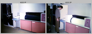
Photograph - AUTOMAP 1 Production – Army Survey Regiment, Fortuna, Bendigo, c1978-1980
This collection of 17 photos was most likely taken in c1978-1980. The AUTOMAP 1 computer assisted cartography and mapping system was introduced in 1975. The components of AUTOMAP 1 were the Input Sub-System of four Wild B8s stereoplotters and three Gradicon digitising tables, the Optical Line Following Sub-System – Gerber OLF, the Verification Sub-System – Gerber 1442 drum plotter, the General Purpose Sub-system – HP21MX computer and the Output Sub-System – Gerber 1232 flatbed plotter). The first map was published in 1978 (Strickland 3665-3, 1:50,000). AUTOMAP 1 was the first computer assisted cartography and mapping system utilised by the Survey Corps and was the first system used by Australian mapping organisations. The history of the AUTOMAP 1 system is covered in more detail with additional historic photographs, in pages 116-118 of Valerie Lovejoy’s book 'Mapmakers of Fortuna – A history of the Army Survey Regiment’ ISBN: 0-646-42120-4. See items 6122.20P, 6410.24P, 6183.19P, 6184.20P, and 6200.5P for additional photographs of the AUTOMAP 1 system.This is a set of 17 photographs of Air Survey Squadron military and civilian personnel operating AUTOMAP 1 equipment at the Army Survey Regiment at Fortuna, Bendigo, c1978-1980. The photographs were on 35mm colour slides and were scanned at 96 dpi. They are part of the Army Survey Regiment’s Collection. .1) - Photo, colour, c1978-1980, Gerber 1442 verification drum plotter. .2) - Photo, colour, c1978-1980, Gerber 1442 verification drum plotter, SPR Garry Ames. In background - Hewlett Packard (HP) 2100A Minicomputer Input Subsystem controlling Wild B8 Aviograph stereo plotters. .3) - Photo, colour, c1978-1980, Gerber 1442 verification drum plotter. .4) - Photo, colour, c1978-1980, digitising topographic features with a Wild B8 Aviograph stereo plotter, CPL Adrian Rynberk. .5) to .6) - Photo, colour, c1978-1980, Wild PEB8 stereo profiler. .7) - Photo, colour, c1980, HP 9640A Programming System. .8) - Photo, colour, c1980, HP 9640A Programming System, L to R: unidentified, SGT Alan Toogood. .9) - Photo, colour, c1978-1980, Gerber Optical Line Follow (OLF), CAPT Rob Bridge. .10) - Photo, colour, c1978-1980, Gerber OLF. .11.) to .12) - Photo, colour, c1978-1980, Gerber OLF, SPR Gerry Gunn. .13) - Photo, colour, c1978-1980, Gerber OLF. .14) - Photo, colour, c1979, Gradicon edit table. .15) to .16) - Photo, colour, c1981, Gradicon edit table, SPR Chris Gordon. .17) - Photo, colour, c1981, Gradicon edit table, L to R: SPR Chris Brown, unidentified..1P to .17P - Some of the equipment is annotated on the frame of the 35mm slides.royal australian survey corps, rasvy, army survey regiment, army svy regt, fortuna, asr, automap 1 -
 Bendigo Military Museum
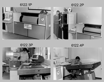
photograph - AUTOMAP 1 Production – Army Survey Regiment, Fortuna, Bendigo, c1980
This collection of 20 photos was most likely taken in 1980. The AUTOMAP 1 computer assisted cartography and mapping system was introduced in 1975. The components of AUTOMAP 1 were the Input Sub-System of four Wild B8s stereoplotters and three Gradicon digitising tables, the Optical Line Following Sub-System – Gerber OLF, the Verification Sub-System – Gerber 1442 drum plotter, the General Purpose Sub-system – HP21MX computer and the Output Sub-System – Gerber 1232 flatbed plotter). The first map was published in 1978 (Strickland 3665-3, 1:50,000). AUTOMAP 1 was the first computer assisted cartography and mapping system utilised by the Survey Corps and was the first system used by Australian mapping organisations. The history of the AUTOMAP 1 system is covered in more detail with additional historic photographs, in pages 116-118 of Valerie Lovejoy’s book 'Mapmakers of Fortuna – A history of the Army Survey Regiment’ ISBN: 0-646-42120-4. See items 6410.24P, 6183.19P, 6184.20P, 6200.5P, and 6222.17P for additional photographs of the AUTOMAP 1 system.This is a set of 20 photographs of Air Survey Squadron military and civilian personnel operating AUTOMAP 1 equipment at the Army Survey Regiment at Fortuna, Bendigo, c1980. The photographs were on 35mm negative film and were scanned at 96 dpi. They are part of the Army Survey Regiment’s Collection. Photos .19P and .20P are printed on photographic and scanned at 300 dpi. .1) - Photo, black & white, c1980, Gerber plotter. .2) - Photo, black & white, c1980, Gerber plotter, LT Rob John .3) - Photo, black & white, c1980, Gradicon edit table, SPR Jamie McRae .4) - Photo, black & white, c1980, Gradicon edit table, SPR Steve Linane .5) - Photo, black & white, c1980, 1130 System administration, unidentified. .6) - Photo, black & white, c1980, Wild B8 stereo plotter, SPR Van Dalen? .7) - Photo, black & white, c1980, Wild B8 stereo plotter, SPR Van Dalen? .8) - Photo, black & white, c1980, Gerber Optical Line Follower (OLF). .9) - Photo, black & white, c1980, Gerber OLF. .10) - Photo, black & white, c1980, Gerber OLF. .11) - Photo, black & white, c1980, Gerber OLF. .12) - Photo, black & white, c1980, Gerber OLF. .13) - Photo, black & white, c1980, Data management, CPL Greg Gilbert. .14) - Photo, black & white, c1980, Data management, CPL Greg Gilbert. .15) - Photo, black & white, c1980, 1130 Operating System administration, SGT Denis Marshall. .16) - Photo, black & white, c1980, Programming System, L to R: unidentified, SGT Alan Toogood. .17) - Photo, black & white, c1980, Programming System, L to R: Robert Cox, WO1 Bob Mason, John Dean. .18) - Photo, black & white, c1980, Programming System, L to R: Robert Cox, WO1 Bob Mason, John Dean. .19) - Photo, black & white, c1980, Gradicon edit table, CPL Chris Carter. .20) - Photo, black & white, c1980, Gerber plotter, LT Rob John..1P to .18P - No personnel are identified .19P - ‘CPL Chris Carter’ annotated on backroyal australian survey corps, rasvy, army survey regiment, army svy regt, fortuna, asr, air survey, automap -
 Bendigo Military Museum
Photograph - AUTOMAP 1 Production – Army Survey Regiment, Fortuna, Bendigo, c1979
This collection of 19 photos was most likely taken in 1980. The AUTOMAP 1 computer assisted cartography and mapping system was introduced in 1975. The components of AUTOMAP 1 were the Input Sub-System of four Wild B8s stereoplotters and three Gradicon digitising tables, the Optical Line Following Sub-System – Gerber OLF, the Verification Sub-System – Gerber 1442 drum plotter, the General Purpose Sub-system – HP21MX computer and the Output Sub-System – Gerber 1232 flatbed plotter). The first map was published in 1978 (Strickland 3665-3, 1:50,000). AUTOMAP 1 was the first computer assisted cartography and mapping system utilised by the Survey Corps and was the first system used by Australian mapping organisations. The history of the AUTOMAP 1 system is covered in more detail with additional historic photographs, in pages 116-118 of Valerie Lovejoy’s book 'Mapmakers of Fortuna – A history of the Army Survey Regiment’ ISBN: 0-646-42120-4. See items 6122.20P, 6410.24P, 6184.20P, 6200.5P, and 6222.17P for additional photographs of the AUTOMAP 1 system.This is a set of 19 photographs of Air Survey Squadron military and civilian personnel operating AUTOMAP 1 equipment at the Army Survey Regiment at Fortuna, Bendigo, c1979. The photographs were on 35mm negative film and were scanned at 96 dpi. They are part of the Army Survey Regiment’s Collection. .1) - Photo, colour, c1979, Gradicon edit table, SSGT John Bennett. .2) - Photo, colour, c1979, Gradicon edit table. .3) - Photo, colour, c1979, HP21MX computer General Purpose Sub-system. .4) - Photo, colour, c1979, HP21MX computer General Purpose Sub-system. L to R: CAPT Graham Baker, SPR Ian Belmont. .5) - Photo, colour, c1979, Gerber verification drum plotter. 1130 System administration, unidentified. .6) - Photo, colour, c1979, Gerber Optical Line Follower (OLF). .7) - Photo, colour, c1979, Gerber OLF .8) - Photo, black & white, c1979, Programming and system administration, L to R: WO1 Don Taylor, Robert Cox, Tony Spurling, SSGT John Bennett, SGT Alan Toogood. .9) to .14) - Photo, black & white, c1979, .15) - Photo, black & white, c1979, Gerber OLF, unidentified. .16) - Photo, black & white, c1979, Gerber verification drum plotter, unidentified using Gradicon edit table. .17) to .18) - Photo, black & white, c1979, - Photo, black & white, c1979, Programming and system administration, SSGT John Bennett. .19)- Photo, black & white, c1979, - Photo, black & white, c1979, HP21MX computer General Purpose Sub-system..1P to .19P No personnel are identified.royal australian survey corps, rasvy, army survey regiment, army svy regt, fortuna, asr, automap 1 -
 Bendigo Military Museum
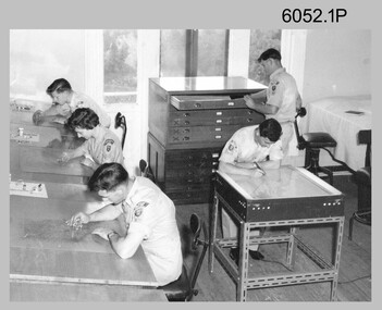
Photograph - Scribing at the Army Survey Regiment, c1950s to 1979
These 10 photographs were taken over two decades from the late 1950s to 1979 at the Army Survey Regiment, Fortuna, Bendigo. The two photos taken in 1961 are annotated with named personnel and the date. The other photos are not annotated with dates, locations and names of personnel, although the technicians in the last three photos taken in 1979 are positively identified. The photos were most likely taken in the Ballroom, Ante Room and Attic, Cartographic Squadron’s main production rooms on the top floor of Fortuna Villa. Scribing was the cartographic process of drafting topographic features such as drainage, relief, vegetation, roads and culture on specially coated map reproduction material. The cartographic technician scribed out the map feature such as a creek to a specified line width on the map sheet, using a tool affixed with a metal or sapphire tipped cutter.This is a set of 10 photographs of technicians scribing topographic features at the Army Survey Regiment, Bendigo. The photographs were printed on photographic paper and are part of the Army Survey Regiment’s Collection. The photographs were scanned at 300 dpi. .1) - Photo, black & white, c1950s. unidentified personnel in Cartographic Squadron .2) - Photo, black & white, c1960s. unidentified personnel in Cartographic Squadron .3) - Photo, black & white, c1960s. unidentified personnel in Cartographic Squadron Attic .4) - Photo, black & white, c1960s. Cartographic Squadron Attic .5) - Photo, black & white, Oct 1961. L to R: PTE P. Carseldine, PTE H.S. Pasley, PTE C.A. Brown, WO2 M.A. McLaren, CPL Jennifer H. Murray. Cartographic Squadron .6) - Photo, black & white, Oct 1961. CPL Jennifer H. Murray. Cartographic Squadron .7) - Photo, black & white, 1979. SPR Mick Ellis in Cartographic Squadron .8) - Photo, black & white, 1979. SPR Mark Casey in Cartographic Squadron .9) - Photo, black & white, 1979. SPR Sharon (Jones) Treble in Cartographic Squadron .10) - Photo, black & white, 1961. PTE BJ Madex. Cartographic Squadron.1 to .4 - annotated “Scribing” .5 – annotated “Scribing PTE P. Carseldine, PTE H.S. Pasley, PTE C.A. Brown, WO2 M.A. McLaren, CPL Jennifer H. Murray. Oct 1961” .6 - annotated “Scribing CPL Jennifer H. Murray. Oct 1961” .7 to .9 - annotated “Scribing” .10 – annotated “PTE Madex Oct 61”royal australian survey corps, rasvy, army survey regiment, army svy regt, fortuna, asr, carto -
 Bendigo Military Museum
Photograph - AUTOMAP 1 Production – Army Survey Regiment, Fortuna, Bendigo, c1980
This collection of five photos was most likely taken in c1980. The AUTOMAP 1 computer assisted cartography and mapping system was introduced in 1975. The components of AUTOMAP 1 were the Input Sub-System of four Wild B8s stereoplotters and three Gradicon digitising tables, the Optical Line Following Sub-System – Gerber OLF, the Verification Sub-System – Gerber 1442 drum plotter, the General Purpose Sub-system – HP21MX computer and the Output Sub-System – Gerber 1232 flatbed plotter). The first map was published in 1978 (Strickland 3665-3, 1:50,000). AUTOMAP 1 was the first computer assisted cartography and mapping system utilised by the Survey Corps and was the first system used by Australian mapping organisations. The history of the AUTOMAP 1 system is covered in more detail with additional historic photographs, in pages 116-118 of Valerie Lovejoy’s book 'Mapmakers of Fortuna – A history of the Army Survey Regiment’ ISBN: 0-646-42120-4. See items 6410.24P, 6122.20P, 6183.19P, 6184.20P and 6222.17P for more photos of the AUTOMAP 1 computer system.This is a set of five photographs of Air Survey Squadron military personnel operating AUTOMAP 1 equipment at the Army Survey Regiment at Fortuna, Bendigo, c1980. Black and white photos are on photographic paper and were scanned at 300 dpi. They are part of the Army Survey Regiment’s Collection. .1) - Photo, black & white, c1980, SGT Cliff Webb operating AUTOMAP 1 terminal. .2) - Photo, black & white, c1980, HP21MX computer General Purpose Sub-system. .3) - Photo, black & white, c1980, Gerber verification drum plotter. .4) and .5) - Photo, black & white, c1980, unidentified personnel operating AUTOMAP 1 terminal. .1P to .5P - No personnel are identified.royal australian survey corps, rasvy, army survey regiment, army svy regt, fortuna, asr, automap 1 -
 The Beechworth Burke Museum
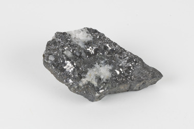
Geological specimen - Galena (with quartz), unknown
Galena is the natural compound of lead and classed as a sulphide, it crystallises in a cubic pattern and its chemical formula is PbS. Galena is a primary source of both lead and silver. This specimen of Galena comes from Broken Hill. Broken Hill has one of the world’s largest and most significant deposit of ore for the production of lead. Mining of Galena at Broken Hill began with the staking of land by Charles Rasp in 1883. By the following year, in 1884, Rasp and six others had formed Broken Hill Mining Company. Broken Hill Mining Company eventually evolved into BHP group limited and is currently the largest mining company in the world and the largest company in Australia. There is archaeological evidence from artefacts discovered in Turkey that humans have been extracting lead from galena by the process of smelting since at least 6500 BCE. This specimen also has quartz on the top surface which is frequently discovered alongside Galena. This mineral specimen is of historic significance as a sample of Galena extracted from Broken Hill during the 19th century. Mining for Galena in Broken Hill begin in 1883 by Charles Rasp and evolved into the world’s largest mining company – BHP Group Limited. Broken Hill is one of the world’s most significant deposits of ore for the production of lead. This specimen is part of a larger collection of geological and mineral specimens collected from around Australia (and some parts of the world) and donated to the Burke Museum between 1868-1880. A large percentage of these specimens were collected in Victoria as part of the Geological Survey of Victoria that begun in 1852 (in response to the Gold Rush) to study and map the geology of Victoria. Collecting geological specimens was an important part of mapping and understanding the scientific makeup of the earth. Many of these specimens were sent to research and collecting organisations across Australia, including the Burke Museum, to educate and encourage further study.A flat, hand-sized, grey sulphide specimen that is the natural compound of lead with a quartz formation on the top surface. Existing Label: GALENA / (with quartz) / Locality: Broken Hill / N.S.W 120 x 70 x 29geological specimen, geology, geology collection, burke museum, beechworth, galena, galena quartz, quartz, charles rasp, broken hill mining company, bhp group limited, bhp, lead, ore, lead sulphide, sulphide, silver, broken hill -
 The Beechworth Burke Museum
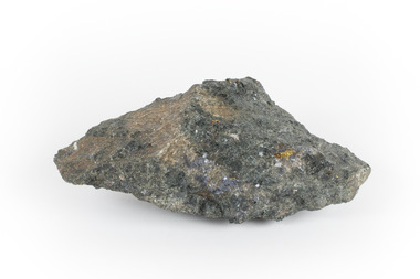
Geological specimen - Mangan Hedenbergite
This specimen was recovered from Broken Hill, NSW. It was given the name Mangan Hedenbergite in 1819 by Jöns Jakob Berzelius in honor of Mr. Anders Ludvig of Hedenberg who was the first to define hedenbergite as a mineral. Hedenbergite, belongs in the pyroxene group having a monoclinic crystal system. The mineral is extremely rarely found as a pure substance. Mangan Hedenbergite is a manganese bearing variety of Hedenbergite. Manganese is the world’s fourth most used mineral after iron, aluminium, and copper primarily because it has no satisfactory substitute in its major applications. Globally, the steel industry is the primary user of manganese metal, utilizing it as an alloy to enhance the strength and workability of steel and in the manufacture of tin cans. Manganese is a key component of certain widely used aluminium alloys and, in oxide form, dry cell batteries used in electric vehicles. These batteries are in high demand. Another potential use for manganese may as an additive to help coat and protect a car’s engine. Manganese is also used for non-metallurgical purposes such as plant fertilizers, animal feed, and colorants for bricks. This specimen is part of a larger collection of geological and mineral specimens collected from around Australia (and some parts of the world) and donated to the Burke Museum between 1868-1880. A large percentage of these specimens were collected in Victoria as part of the Geological Survey of Victoria that begun in 1852 (in response to the Gold Rush) to study and map the geology of Victoria. Collecting geological specimens was an important part of mapping and understanding the scientific makeup of the earth. Many of these specimens were sent to research and collecting organisations across Australia, including the Burke Museum, to educate and encourage further study.A hand-sized mineral specimen in shades of silver and blackmanganese, open cut mine, manganese ore processing, bell bay, tasmania, northern territory, steel industry, zinc-carbon batteries, alkaline batteries, tin cans -
 Bendigo Military Museum
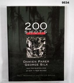
Book - PICTORIAL, WW2, Neil McDonald and Peter Brune, "200 SHOTS", 1999
Item in the collection of "William John SULLIVAN" VX57829. Refer Cat No. 9523P for his service details. From front cover; "200 SHOTS AND THE AUSTRALIANS AT WAR IN NEW GUINEA" War photography - by Damien PARER and George SILK.Soft Cover book. Cover - cardboard, white, black and green print on front, spine and back. Front cover illustrated small green tones photograph of a soldier amongst jungle plants. general background, green and black jungle scene. 197 pages, cut, plain white paper. Pictorial book, illustrated black and white photographs, maps and sketches. Handwritten inscription on title page.Handwritten inscription - blue ink pen. "This book/ belongs to Pat Rae/ 2002".books, ww2, new guinea, william john sullivan -
 Victorian Railway History Library
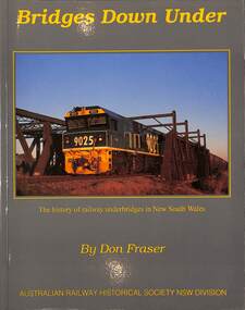
Book, Fraser, Don, Bridges Down Under: The history of Railway underbridges in New South Wales, 2016
A history of railway underbridges (structures that support a railway line) in New South Walesindex, ill, maps, p.202.A history of railway underbridges (structures that support a railway line) in New South Walesrailway construction - new south wales - history, bridges -- new south wales -- design and construction -
 Victorian Railway History Library
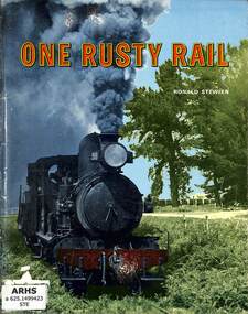
Book, Stewien, Ronald, One Rusty Rail, 1973
A history of the narrow gauge 3'6" and broad gauge 5'3" railways in South-East South Australia centered on Naracoorte and Mt Gambier.ill, maps, p.65.A history of the narrow gauge 3'6" and broad gauge 5'3" railways in South-East South Australia centered on Naracoorte and Mt Gambier.railway construction - australia, narrow gauge railroads - south australia - history -
 Victorian Railway History Library
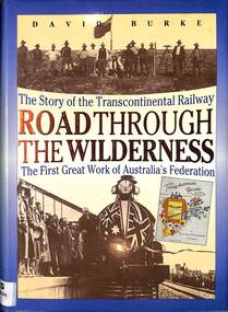
Book, Burke, David, Road Through The Wilderness: The Story of the Transcontinental Railway, 1991
... of Australia's federation. index, ill, maps, p.280. Road Through ...A history of the building of the Transcontinental railway from Port Augusta to Kalgoorlie, the first great work of Australia's federation.index, ill, maps, p.280.A history of the building of the Transcontinental railway from Port Augusta to Kalgoorlie, the first great work of Australia's federation.railway construction - australia, trans-australian railway - history -
 Victorian Railway History Library
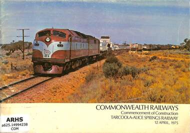
Booklet, Commonwealth Railways, Commonwealth Railways Commencement of Construction Tarcoola-Alice Springs Railway, 1975
A commemorative booklet to mark the start of the building of the standard gauge railway from Tarcoola to Alice Springs on 12th April 1975.ill, maps, p.16.A commemorative booklet to mark the start of the building of the standard gauge railway from Tarcoola to Alice Springs on 12th April 1975.railway construction - australia, trans-australian railway - history -
 Victorian Railway History Library
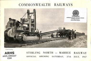
Booklet, Commonwealth Railways, Commonwealth Railways Stirling North - Maree Railway, 1957
A commemorative booklet to mark the start of the building of the standard gauge railway from Stirling North to Maree on 27th July 1957.ill, maps, p.16.A commemorative booklet to mark the start of the building of the standard gauge railway from Stirling North to Maree on 27th July 1957.railway construction - australia, north australia railway - australia - history -
 Bendigo Historical Society Inc.
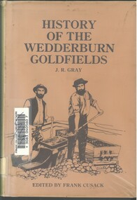
Book - HISTORY OF THE WEDDERBURN GOLDFIELDS, 1888
Gold was first discovered in 1852 on what was then named Korong or Mt Korong goldfields. It was soon found that the area was not suitable for alluvial mining because of a lack of water but quartz mining was more successful. The township of Wedderburn was surveyed 1856/57. The first public crushing works was established in 1859.Hardcover book with printed dust jacket and plastic cover. 92 pages with black and white illustrations, fold out map and index. Covers the history of the Wedderburn Goldfields and the discovery of gold generally in Australia from the 1850s until c1880s. Written by Joshua R Gray and edited by Frank Cusack.Joshua R Gray and Frank Cusack.gold, goldfields, goldfield -
 Montmorency–Eltham RSL Sub Branch
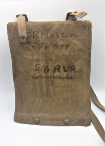
Equipment - Map Case No. 2, 1942
This 1942-dated Map Case was still in use post-1982 when it was used by a member of the 5/6 Royal Victoria Regiment. This new Melbourne-based battalion was created on the 17 August 1982. Open-sided with a khaki canvas flap attached to a resin-impregnated board.. Hinged to the top edge is a celluloid cover. Four clips holds the cover (and any map) to the backing board. The flap is secured by a pair of Carr Australia press studs on the back. The underside of the flap has four loops for chinagraph pencils and a wider pocket and loop for a Protractor. Two brass buckles are provided for a web shoulder sling. C. G. Hartley & Co. 1942 ORMISTON 3200879 5/6 RVR -
 Eltham District Historical Society Inc
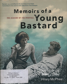
Book, Miegunyah Press, Memoirs of a Young Bastard: the diaries of Tim Burstall compiled by Hilary McPhee, 2012
Diaries of Tim Burstall November 1953 to December 1954. Tim Burstall lived in Eltham. Tim Burstall, the celebrated director of Stork, Alvin Purple and numerous other definitive 'ocker' comedies, is credited with shaking the moribund Australian film industry out of its torpor. But long before that, in the early 1950s, he began keeping a diary to record the world of the group of 'arties' and 'intellectuals' he was living among in Eltham, then a rural area outside Melbourne, where cheap land was available for mudbrick houses and studios, and where suburban rigidities could be mercilessly flouted. Burstall was in his mid-twenties, with two young sons and an open marriage with his wife, Betty. Eager to become a writer, to go against the grain, he kept a record almost daily-of the parties and the talk in pubs and studios, about art and politics and sex, of Communist Party branch meetings and film societies, of political rallies and the first Herald Outdoor Art Show. Somehow, while holding down a public relations job in the Antarctic Division and juggling his love affairs and obsession with the beautiful, brainy Fay, he wrote 500 words almost every day. Betty, according to the diaries, kept the show on the road, feeding friends after the pub, milking goats and working in her pottery making bowls and mugs, which Tim sometimes decorated at weekends. These Memoirs of a Young Bastard, as Burstall dubbed himself and them, are among the most evocative Australian diaries of modern times. Burstall can write. He has an eye for the telling detail, an unerring ear for cant and pomposity and, most endearingly, an ability to mock himself-always from the perspective of a bloke of his generation. Source: Publisherxxiv, 343 p., [18] p. of plates : ill., maps, ports., facsims. ; 27 cm.ISBN 9780522858143diary, motion picture director, film director, author -
 Melbourne Tram Museum
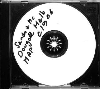
Map - CD - Sands McDougal Map Melbourne c1906, Sands McDougall
Detailed scan of the Sands McDougal Map in colour showing Melbourne's cable trams, railways, Essendon Tramways, NMETL and the Victorian Railways line to Brighton from St Kilda. Includes the MTOCo horse tram lines and the Caulfield horse tram lines. See Reg item 6572 for the actual map. Yields information about Melbourne and its tramways in 1906CD in a plastic case - black with clear cover.CD marked "Sands & McDougal Map c1906"cable trams, tramways, map, sands mcdougal, nmetl, vr trams, horse trams -
 Bendigo Historical Society Inc.
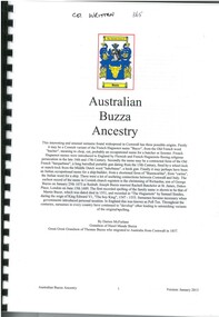
Document - AUSTRALIAN BUZZA ANCESTRY, 2013
Thomas Buzza (1833-1904) was a Cornish born miner who came to Bendigo in 1853. He bought the BAckCreek sawmill (1861-1865). He had several other sawmilling enterprises and later operated a hay and corn produce store. He also built and operated paddle-steamers in the Murray Darling system. He left Myers Flat in 1893 and died in Goolwa, SA in 1904. He had married Emily Rainsdon (1852-1926) in 1867.Printed family history spiral bound with perspex cover. Contents page - no index. Contains family trees, summary of Thomas Buzza and his migration from Cornwall, details of descendants of Thomas Buzza, photographs, maps and images of birth, death and marriage certificates.Darren McFarlanegenealogy, family, cornish, buzza, bendigo, eaglehawk -
 Flagstaff Hill Maritime Museum and Village
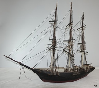
Craft - Ship model, Johann A. Landmann, Wilhelmsburg, 1853
This ship model of the Wilhelmsburg was made by Johann Landmann during his journey on the very vessel, the sailing ship Wilhelmsburg. It was donated to Flagstaff Hill by the wife of Landmann's great-grandson. Landmann (or Landman, also known as August Landmann) was born in 1826 in Ganhor, Silesia, Prussia. At the age of 20, he travelled through Europe, working from town to town as a cabinet maker. At 26 years old he returned to Germany, married Anna Rosina in Wahlstatt, Prussia, and on the same day sailed for Australia on the Wilhelmsburg in 1853, the year the ship was registered. The Wilhelmsburg was a three-masted, square-rigged sailing ship built at Reiherstieg, Hamburg, and registered in Hamburg on 27th April 1853. On her maiden voyage in 1853, the ship sailed from Hamburg, Germany, to Australia with 510 passengers on board, including emigrants under the Bounty Scheme. Johan Landmann was one of the passengers. The Wilhelmsburg arrived in Hobson’s Bay, Melbourne after sailing for 100 days. Johann spent a week in Melbourne then travelled to Warrnambool aboard the Merry Kitty, arriving fourteen days later. Johann had landed in Melbourne with only 16 shillings in his pocket and by the time he arrived in Warrnambool, he only had one shilling and sixpence left. He also had very limited ability to speak English. He settled in the Allansford area, near Warrnambool, together with other families from Germany and went on to play a significant role in the history of Warrnambool. Johann worked as a cabinet maker in Warrnambool, making the first coffin in the Warrnambool cemetery. He also worked as a general merchant. He built many of the earliest shops in Warrnambool, and the first paddle boat used on the local Hopkins River. He made models of Warrnambool’s Ozone Hotel and Presbyterian Church; the model of the Hotel is now in the Warrnambool Art Gallery, and the model of the Presbyterian Church has been in the care of the Warrnambool & District Historical Society since around 2017. One of Landmann's residences was a two-storey building in Henna Street Warrnambool where he, lived upstairs and operated his business downstairs. After he retired Landmann built a ‘handsome stone residence’ at 30 Mickle Street, Warrnambool, where he lived until his death in June 1920; he was aged ninety-five. “Landmann Street” in Warrnambool has been named after Johann and appears on a map in 1872. He has also been honoured on Warrnambool’s Pioneer Memorial Board which is displayed at the Warrnambool and District Historical Society. Landmann's son Adolph Fritz Landmann (Fritz Landmann) born in 1861, was a Councillor from 1905 to 1915, and Mayor of Warrnambool from 1912 to 1915. The Wilhelmsburg sailed from Hamburg in 1863 heading for Queensland, Australia, but in December the vessel was wrecked off the coast of Holland during storms, with the loss of 247 lives.The ship model of the Wilhelmsburg is significant historically, having a connection to the maiden voyage of a ship that holds the record for the number of passengers carried in one journey on such a small vessel. It is also significant as it is believed to be the only existing model or representation of the ship. Johann Landmann, the maker of the model, was one of the earliest residents in Warrnambool and is a significant historical figure in colonial Warrnambool. He has the honour of appearing on the Memorial Pioneers’ Board. Landmann used his craftsmanship skills to make several early Warrnambool buildings, the first coffin in the cemetery, the first paddle boat on the Hopkins River as well as models of significant local buildings. Model of the sailing ship Wilhelmsburg, carved in wood by Johann Carl Augustus Landmann in 1853. The three-masted model barque is painted black. It has a long bow spit. flagstaff hill, flagstaff hill maritime museum, maritime museum, warrnambool, barque, wilhelmsburg, landmann, johann landmann, augustus landmann, landman, ozone hotel warrnambool, presbyterian church warrnambool, 30mickle street warrnambool, ship model, shipwreck coast, 1853, fritz landmann, warrnambool councillor, warrnambool mayor, anna rosina, maiden voyage, bounty scheme, hobson's bay, hamburg, merry kitty, coffin maker, cabinet maker, paddle boat, henna street, landmann street, pioneer memorial board -
 Bendigo Military Museum
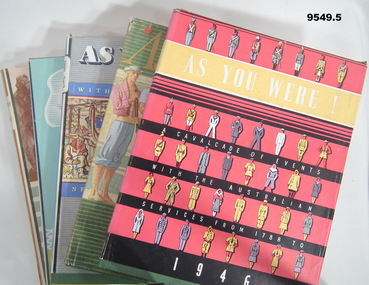
Book - AS YOU WERE SERIES, 1946 -1950, The Australian Military Forces by Australian War Memorial Canberra, A.C.T, "R.A.N., A.M.F. and R.A.A.F.", 1946-1950
For this series - refer to Cat No's, 9546.7, 9547.4, 9548.4, 9549.5. Items in the collection of "William John Sullivan" VX 57829. Refer Cat No. 9523P for his service details.1. - 5. Hard cover book with dust cover. Hardcover - cardboard with green buckram. Dark blue print on front and spine. All pages - cut, plain off white colour paper. Illustrated in black and white, and colour photographs, paintings, maps, sketches and diagrams. 172-202 pages. Dust cover - paper. All end papers illustrated. 1. "AS YOU WERE!/ A CAVALCADE OF EVENTS/ WITH THE AUSTRALIAN/ SERVICES FROM 1788/ TO 1946" 1946 Hard cover illustration - silhouette of three servicemen. Dust cover - white colour print front and spine. Illustrated - five rows of service personnel in various uniforms. 2. "AS YOU WERE/ with the / AUSTRALIAN SERVICES/ FROM 1788 TO/ 1947", 1947. Hardcove4r illustration - silhouette portrait of three servicemen. Dust cover - front gold colour print on front, beige colour print on spine. Illustrated - six service personnel in various uniforms in colour. Back - painting and information "AUSTRALIAN WAR MEMORIAL, ANZAC DAY 1947". 3. "AS YOU WERE/ WITH THE AUSTRALIAN/ SERVICES FROM 1788 TO/ 1948", 1948. Dust cover, white, black and yellow print on front and spine. Illustrated - colour - various service personnel in montage collection. 4. "AS YOU WERE/ 1949", 1949. Hardcover - print on spine only. Dust cover - yellow and blue print on front and spine. Illustrated - stylised colour sketch of three service personnel. 5. "AS YOU WERE/ 1950", 1950. Hardcover - small silhouette illustration of two servicemen, Navy and Army with two aircraft above. Dust cover - black and green print on front and spine. Background horizontal lines, green, white and brown. Illustrated - sepia tones drawing of a group of service personnel. book series, as you were, military history, biographies, william john sullivan -
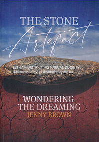 Eltham District Historical Society Inc
Book, Jenny Brown, The stone artefact : wondering the dreaming, 2022
The discovery in a Melbourne park (opposite the Osborne Peninsula, North Warrandyte) of an enigmatic Aboriginal stone tool led writer Jenny Brown on a fascinating journey that connected her with expert anthropologists, archeologists, Indigenous elders and knowledge holders to discover what it was. The stone tool invited many interpretations and spun off just as many amazing stories and experiences. It also afforded Jenny the appropriate canvas to tell of her own time-warping encounters with the extraordinary "otherness" of Aboriginal Australia, and with an especially marvelous character, the late Elder of the Yuin Tribe of southern NSW, Guboo Ted Thomas.193 pages : illustrations (chiefly colour), maps, portraits ; 30 cmindigenous history, aboriginal artefacts, warrandyte, archaeology -
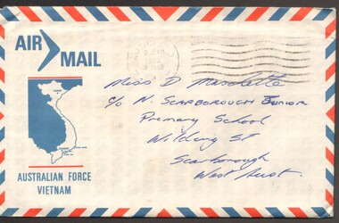 National Vietnam Veterans Museum (NVVM)
Letter - Letter & Envelope
A letter written by 8RAR soldier in Vietnam to "Dear De" outlining events about an incident with the detonation of a mine, number killed and injured. The writer states he was not involved in the incident as he was serving at the fire support base, not the battle front.An envelope and a two paged letter written on Australian Forces Vietnam letterhead paper, dated Sunday 1st March. The envelope is addressed to Mis D Maschette and the letter starts off with "Dear De". It is written in blue ink. The envelope has a red and blue striped border with the "Air Mail" symbol in the top left hand corner. A map of Vietnam is located under the air mail symbol. Australian Force Vietnam Coat of arms header/ Blue ink/ 8RAR/ Air Mailletter, wayne maschette, aust. force vietnam, sig pl, suppt co, 8rar -
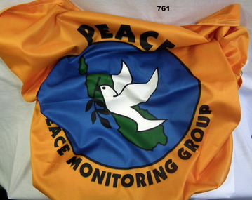 Bendigo Military Museum
Flag - FLAG PEACE MONITORING, Screen Graphics, c.2000
The item was brought back from Peace Monitoring in Bougainville by Phillip Chapman Australian Army.Peace monitoring flag Bougainvillea, orange with white trim. A white dove holding black laurel branch on green Bougainvillea Island map, blue water in background. Peace Monitoring Groupflags, military, peace keeping force -
 Tatura Irrigation & Wartime Camps Museum
Document, Otto von Drehnen
Otto von Drehnen was a prominent Adelaide citizen from the late 1800s, a successful businessman. He was elected President of the Deutsche Club & appointed the Consul General for Austro-Hungary. He was subsequently interned in Camp 1. Documents relating to Otto von Drehnen, previous Consul General of Austro-Hungary & prominent Adelaide businessman, interned in WWII. Black A3 folder containing newspaper articles, invitations, programmes, etc. from von Drehnen's term as Consul General & some biographical information. Also excerpts from Barbara Winter's book "The Most Dangerous Man in Australia?" in which he is mentioned.|Had to put broadsheet newspaper cartoon & two attached newspaper clippings in large plastic sleeve in map drawer. Wouldn't fit entirely in A3 folder.tatura, internment camps, german consul, documents, newspapers, invitations, programmes -
University of Melbourne, Burnley Campus Archives
Map - Topographic Survey, Ararat, 1970
... Australia 1:100,000 Topographic Survey map of Ararat district ...Australia 1:100,000 Topographic Survey map of Ararat district, Victoria dated 1970. Sheet 7423 (Edition 1) Series R 652. Produced by the Royal Australian Survey Corps.royal australian survey corps, ararat area, stawell area -
University of Melbourne, Burnley Campus Archives
Map - Topographic Survey, Grampians, 1969
... Australia 1:100,000 Topographic Survey Map of the Grampians ...Australia 1:100,000 Topographic Survey Map of the Grampians, Victoria dated 1969. Sheet 7323 (Edition 1) Series R 652. Produced by the Royal Australian Survey Corps.grampians, royal australian survey corps, topographic survey -
 Stawell Historical Society Inc
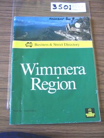
Book, UBD, UBD Business and Street Directory - Wimmera Region, 1992
... Yellow section, In Map of Australia: UBD Business & Street..., In Map of Australia: UBD Business & Street Directory Green ...List of businesses with contact information in the Wimmera Region. as well as maps of Various TownsPaper cover with colour photograph of Boroka Lookout. below a yellow strip with black print and black representation of Australia. below green section with white and black print. black square in lower left with yellow printYellow section, In Map of Australia: UBD Business & Street Directory Green Section: Wimmera Region Victoria 42nd Edition In Black Square: UBD The Business Sourcestawell -
 Stawell Historical Society Inc
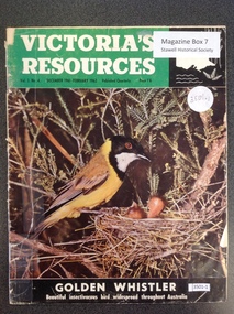
Book, Natural Resources Conservation, Victoria's Resources - Vol 3 No 4, 1962
Departments, Regions, Municipalities and Organisations which are members of the Conservation League. These books were provided free of charge to residents.Paper cover: 3/4 Green strip with white & black print. Black section containing map of Victoria below a colour picture of a nesting mother bird with chicks below black strip with white printVictori's Resources Vol 3. No. 4. December 1961 February 1962. Published Quarterly Price 1'6 Golden Whistler Beautiful Insectivorous bird widespread thoughout Australiatourism