Showing 6210 items
matching what's on
-
 Bendigo Historical Society Inc.
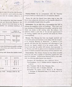
Document - PETER ELLIS COLLECTION: LETTER
Photocopies of some pages mentioning the Museum. Part of a letter by P H MacGillivray, President, Report on the Botany Class, Report on the Chemistry and Metallurgy Classes, The Museum, including what exhibits, attendance of visitors and opening times. A number of pages of Donations to the Museum from 1/7 1891 to 30/6/1892, including the names and address of the donors. There is a list of the Classification of Specimens (received during the year). Also mentioned is Botany - Lecturer - J B Lillie Mackay and Zoology - Lecturer - J B Lillie Mackay. There is also a part of the printing about Architectural and Geometrical Drawing, Machine and Building Construction - Teacher - W H E Nicolai.museums, peter ellis collection, bendigo school of mines, dr macgillivray, rev j garlick, dr colquhoun, mr g alec thomson, mr j eardsley edwards, dr quick, j m harcourt, j robshaw, r bloomfield rees, j d crofts, w h carwardine, dr dendy, professor marshall hall, professor baldwin spencer, department of education, sir frederick mccoy, baron von mueller, j w faul, john robshaw, henry jackson, j b lillie mackay, melbourne university, mr a south, department of forestry, mr perrin, the pharmacy board of victoria, education department -
 City of Kingston
Photograph - Black and white, c. 1908
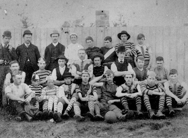
Australian rules football began being played on a regular basis in Cheltenham in 1890. Teams would not only play locally but travel by train fairly long distances, such as to Ballarat, for the day, play a game, turn around and come home. The Cheltenham home games were played on a paddock on the corner of Park and Charman roads in Cheltenham. In 1907 the Cheltenham progress committee made an application to the board of land works for land in Weatherall Road for recreational service to the public. That application was received and granted, then developed where Cheltenham Recreational Reserve now stands. The ground was opened in 1909 and the first Cheltenham side entered in the newly formed Federal Football League along with seven other foundation members, Mordialloc, Mentone, Moorabbin, Frankston, Glenhuntly, Elsternwick, and Ellindale. The grand final for that year, 1909 was a hard encounter between Cheltenham and Ellindale with Cheltenham coming out victors, thus becoming the inaugural Federal Football League premiers. The Federal Football League (FFL), also known simply as the Federal League, was an Australian rules football competition in the south-eastern suburbs of Melbourne, Victoria. The competition was in existence from 1909 to 1981 and was regarded as one of the strongest metropolitan leagues in Melbourne.Black and white image of the players and officials of the Cheltenham Football Club. Back (left to right) G Puttick, Franklyn (sic), Unkown, Unknown, C Corstorphine, D Arland, Dave Hughes, H Bryant, Centre: T Elliott, S Parsons, F Judd, H Foreman, N Corstorphine, J McCormack, S Chandler, H Orr. Front: H Clayton - no other names recorded. The players are wearing what appears to be a range of club jumpers, with some in street wear. Some players seated in the front row have mud visible on the soles of their shoes, indicating they may have already played a gam. The ball on the ground in front of the group is round.Round red sticker on reverse with handwritten text: X10 Handwritten in blue ink: A11, with a circle around it Handwritten in red ink: 50%sport, football, cheltenham, teams, federal football league -
 Port of Echuca
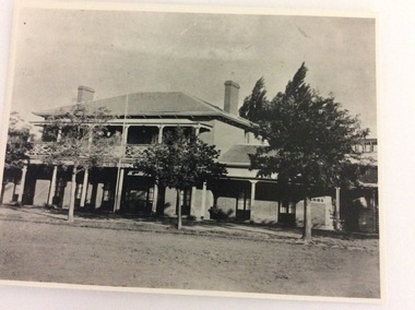
A black and white photograph, The Bridge Hotel, in 1896, showing Silky Oak trees, 1970's
The Bridge Hotel was built by Henry Hopwood to house visitors to the town crossing the Murray River on his punt crossing, which was situated just below the Bridge Hotel on the Murray River. The accommodation was spacious and grand! In the right back corner of the photograph, the 'lantern' roof of the St Georges Hall can be seen. The street is level with the front entrance to the Hotel, which is very different to what it is today.The photograph shows hotel activities and accommodation in the late 19th Century.A black and white photograph of the Bridge Hotel taken from the Hopwood Gardens. The photograph shows four silky oak trees growing along the front of the building. There is an empty flag pole outside the front of the building. The right wing advertises billiards, whilst the left wing apparently was a bar.Written on the building can be seen the words; HOTEL and BILLIARDS. Written in pen on the back of the photograph are the words "Bridge Hotel. Probably 1896, showing Silky Oak trees.bridge hotel, henry hopwood, silky oak trees, lantern roof, st georges hotel -
 Eltham District Historical Society Inc
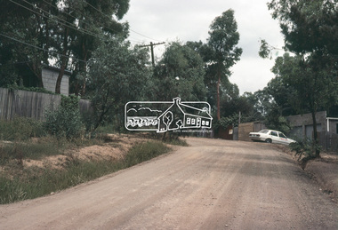
Slide, Adam Crescent, Montmorency, c. Feb. 1981
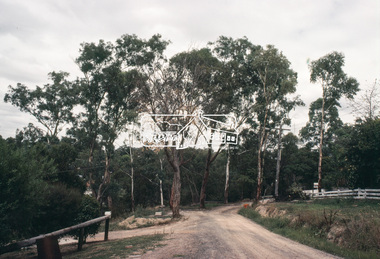
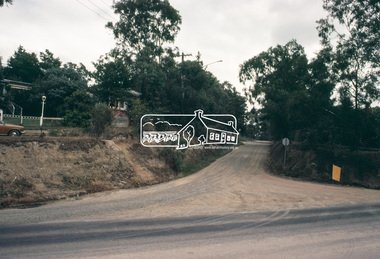
One of a series of images of road infrastructure focussed on Adam Crescent in Montmorency taken by Eltham Shire Council Planning and Engineering officers. They provide perspective of the changes in housing styles and road development that began sweeping in from the mid 1970s with increasing urbanisation of what was once more outlying suburbs and regions. All images have been identified with GPS though house numbers have changed35 mm colour positive transparency (1 of 21) Mount - Kodak Kodachrome CardProcessed Feb 1981adam crescent, infrastructure, montmorency, roads -
 Eltham District Historical Society Inc
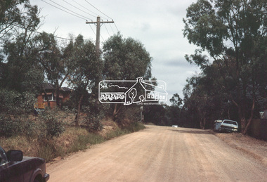
Slide, Adam Crescent, Montmorency, c. Feb. 1981
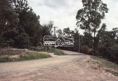
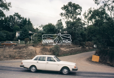
One of a series of images of road infrastructure focussed on Adam Crescent in Montmorency taken by Eltham Shire Council Planning and Engineering officers. They provide perspective of the changes in housing styles and road development that began sweeping in from the mid 1970s with increasing urbanisation of what was once more outlying suburbs and regions. All images have been identified with GPS though house numbers have changed35 mm colour positive transparency (1 of 21) Mount - Kodak Kodachrome CardProcessed Feb 1981adam crescent, infrastructure, montmorency, roads -
 Eltham District Historical Society Inc
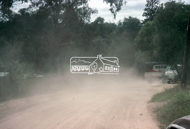
Slide, Adam Crescent, Montmorency, c. Feb. 1981
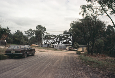
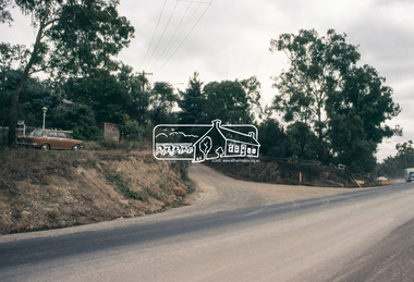
One of a series of images of road infrastructure focussed on Adam Crescent in Montmorency taken by Eltham Shire Council Planning and Engineering officers. They provide perspective of the changes in housing styles and road development that began sweeping in from the mid 1970s with increasing urbanisation of what was once more outlying suburbs and regions. All images have been identified with GPS though house numbers have changed35 mm colour positive transparency (1 of 21) Mount - Kodak Kodachrome CardProcessed Feb 1981adam crescent, infrastructure, montmorency, roads, gordon grove -
 Eltham District Historical Society Inc
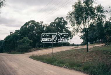
Slide, Adam Crescent, Montmorency, c. Feb. 1981
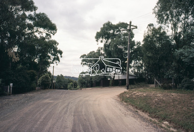
One of a series of images of road infrastructure focussed on Adam Crescent in Montmorency taken by Eltham Shire Council Planning and Engineering officers. They provide perspective of the changes in housing styles and road development that began sweeping in from the mid 1970s with increasing urbanisation of what was once more outlying suburbs and regions. All images have been identified with GPS though house numbers have changed35 mm colour positive transparency (1 of 21) Mount - Kodak Kodachrome CardProcessed Feb 1981adam crescent, infrastructure, montmorency, roads -
 Eltham District Historical Society Inc
Slide, Adam Crescent, Montmorency, c. Feb. 1981
One of a series of images of road infrastructure focussed on Adam Crescent in Montmorency taken by Eltham Shire Council Planning and Engineering officers. They provide perspective of the changes in housing styles and road development that began sweeping in from the mid 1970s with increasing urbanisation of what was once more outlying suburbs and regions. All images have been identified with GPS though house numbers have changed35 mm colour positive transparency (1 of 21) Mount - Kodak Kodachrome CardProcessed Feb 1981adam crescent, infrastructure, montmorency, roads, gordon grove -
 Eltham District Historical Society Inc
Slide, Adam Crescent, Montmorency, c. Feb. 1981
One of a series of images of road infrastructure focussed on Adam Crescent in Montmorency taken by Eltham Shire Council Planning and Engineering officers. They provide perspective of the changes in housing styles and road development that began sweeping in from the mid 1970s with increasing urbanisation of what was once more outlying suburbs and regions. All images have been identified with GPS though house numbers have changed35 mm colour positive transparency (1 of 21) Mount - Kodak Kodachrome CardProcessed Feb 1981adam crescent, infrastructure, montmorency, roads -
 Eltham District Historical Society Inc
Slide, Adam Crescent, Montmorency, c. Feb. 1981
One of a series of images of road infrastructure focussed on Adam Crescent in Montmorency taken by Eltham Shire Council Planning and Engineering officers. They provide perspective of the changes in housing styles and road development that began sweeping in from the mid 1970s with increasing urbanisation of what was once more outlying suburbs and regions. All images have been identified with GPS though house numbers have changed35 mm colour positive transparency (1 of 21) Mount - Kodak Kodachrome CardProcessed Feb 1981adam crescent, infrastructure, montmorency, roads, gordon grove -
 Eltham District Historical Society Inc
Slide, Adam Crescent, Montmorency, c. Feb. 1981
One of a series of images of road infrastructure focussed on Adam Crescent in Montmorency taken by Eltham Shire Council Planning and Engineering officers. They provide perspective of the changes in housing styles and road development that began sweeping in from the mid 1970s with increasing urbanisation of what was once more outlying suburbs and regions. All images have been identified with GPS though house numbers have changed35 mm colour positive transparency (1 of 21) Mount - Kodak Kodachrome CardProcessed Feb 1981adam crescent, infrastructure, montmorency, roads -
 Eltham District Historical Society Inc
Slide, Adam Crescent, Montmorency, c. Feb. 1981
One of a series of images of road infrastructure focussed on Adam Crescent in Montmorency taken by Eltham Shire Council Planning and Engineering officers. They provide perspective of the changes in housing styles and road development that began sweeping in from the mid 1970s with increasing urbanisation of what was once more outlying suburbs and regions. All images have been identified with GPS though house numbers have changed35 mm colour positive transparency (1 of 21) Mount - Kodak Kodachrome CardProcessed Feb 1981adam crescent, infrastructure, montmorency, roads, gordon grove -
 Eltham District Historical Society Inc
Slide, Adam Crescent, Montmorency, c. Feb. 1981
One of a series of images of road infrastructure focussed on Adam Crescent in Montmorency taken by Eltham Shire Council Planning and Engineering officers. They provide perspective of the changes in housing styles and road development that began sweeping in from the mid 1970s with increasing urbanisation of what was once more outlying suburbs and regions. All images have been identified with GPS though house numbers have changed35 mm colour positive transparency (1 of 21) Mount - Kodak Kodachrome CardProcessed Feb 1981adam crescent, infrastructure, montmorency, roads, sherbourne road -
 Kiewa Valley Historical Society
Veil - Nurse's
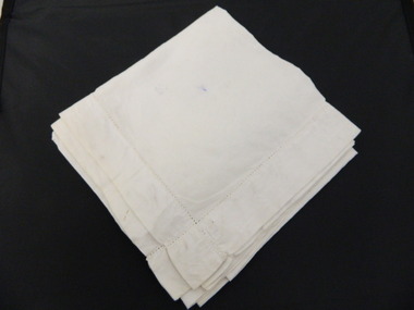
This nurses veil is preventative of what was part of nurses uniforms in the mid 1900's. Tawonga and district hospital was the only hospital in the Upper Kiewa Valley and was then moved to Mt Beauty to cater for the increased population due to the Kiewa Hydro Scheme. Many of the hospital equipment KVHS has in its collection is from the time when the hospital was moved to Mt Beauty. This veil could also be from this period.This has historic significance due to being representative of what nurses wore in the Tawonga and district hospital during the mid 1900's. As KVHS has many hospital instruments in its collection from the towns hospital the veil has good interpretive capacity and is in a good condition to be placed on display. White linen fabric with 3-4 cm bound edging.nurse's uniform. civilian uniform. veil. headwear. tawonga and district hospital. -
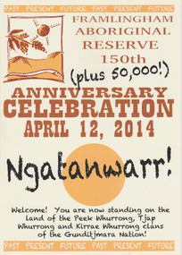 Warrnambool and District Historical Society Inc.
Booklet - 150 plus Framlingham Aboriginal Reserve, 2014
The Framlingham Aboriginal Trust is a shareholder- owned organization established under Victorian law in 1971. The Trust owns and manages part of what was the old Aboriginal Reserve established in 1861 under the auspices of the Church of England. In 1865 the Reserve was officially established as a Government-managed aboriginal station. By 1970 the original area of 3,500 acres was whittled down to 585 acres and handed over to the Framlingham Aboriginal Trust. Framlingham is today one of only two discrete aboriginal communities in Victoria where aborigines live on aboriginal land and is an important part of the district cultural life. The celebration of the 150th anniversary of Framlingham’s establishment in 2014 was therefore a significant event in the district’s history and the booklet is a permanent reminder of this.This is a small booklet of 8 pages containing information on the 150th celebrations of Framlingham Aboriginal Reserve in 2014. The cover has a cream background with illustrations and printed material in yellow, black and brown. The pages are stapled. The booklet includes photographs, maps, illustrations and printed material. Front cover: ‘Framlingham Aboriginal Reserve 150th Anniversary Celebration, April 12, 2014, Ngatanwarr’ etc Back cover: Acknowledgements of sponsors and written material framlingham aboriginal trust, western district aborigines, peek whurrong, kirrae whurrong, gunditjmara, tjap whurrong -
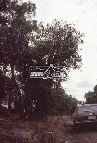
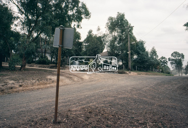
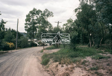
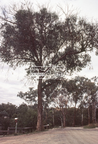
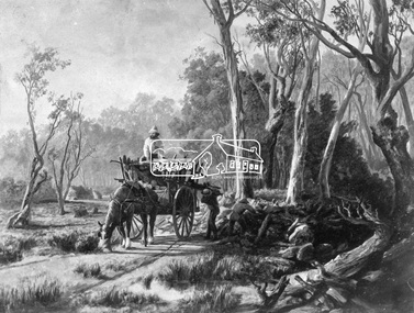 Eltham District Historical Society Inc
Photograph, Collection of wood
Etching of country scene, a horse pulling a rudimentary cart with three men collecting wood and possibly stones from underneath trees on a rough track. Two huts are in the background. Early settlers often had to make use of what was available in their local environment to build their shelters. Today roadside collection of firewood is regulated by the State government. Unknown location, unknown artist and unknown date.This photo forms part of a collection of photographs gathered by the Shire of Eltham for their centenary project book," Pioneers and Painters: 100 years of the Shire of Eltham" by Alan Marshall (1971). The collection of over 500 images is held in partnership between Eltham District Historical Society and Yarra Plenty Regional Library (Eltham Library) and is now formally known as 'The Shire of Eltham Pioneers Photograph Collection.' It is significant in being the first community sourced collection representing the places and people of the Shire's first one hundred years.Digital imagesepp, shire of eltham pioneers photograph collection, other areas, pioneer life, country scene, country roads -
 Glen Eira Historical Society
Map - Kooyong Road, Caulfield North
A sepia photograph of Kooyong Road (61 x 87mm) undated and unattributed. Accompanied by an undated, unattributed handrawn map of road (42mm x 87mm) and explanatory handwritten notes detailing what is depicted in the photograph: looking towards a field and church at the intersection of Kooyong and Glen Eira Roads. Map and handwritten explanatory notes have been photocopied from the back of one sepia photograph.kooyong road, glen eira road, derby parade, brighton road, caulfield north -
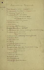 Federation University Historical Collection
Document, Ballarat Junior Technical School: Furnishings Required for Each Room, c1921
The Ballarat Junior Technical School was a division of the Ballarat School of Mines. The furnishing requirements list what is needed for each room within the new school - Ballarat Junior Technical School - that was built near the Ballarat School of Mines. One sheet indicates the furniture already on hand. This would be the items that were owned by the Junior Technical School while they were located at Dana Street State School.Handwritten lists on foolscap paperballarat junior technical school, ballarat school of mines, buildings, furnishings, steane, dana street, new school -
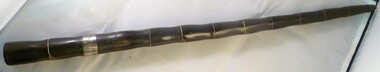 National Vietnam Veterans Museum (NVVM)
Equipment - Equipment, Army, Engraved Swagger Stick
Swagger stick with engraving, 1965, buffalo horn. Presented to major Ian McKeown, Australian Army training Team Vietnam (AATTV). Maj Ian McKeown served with the AATTV from May 1964 until March 1965. This swagger stick was presented to him by the grateful men he helped to train. He does not know what became of them. On loan courtesy the collection of Ian McKeown. Made from buffalo horn. Engraved.swagger stick, maj mckeown, aattv, australian army training team vietnam (aattv)