Showing 3211 items
matching road maps
-
 Camberwell Historical Society
Ephemera - Objects, John Niemann et al, Camberwell Urban Conservation Study, 1989-1992
Letters re: Urban Conservation Study with map, Conserving Camberwell questionnaire, Urban Conservation Study booklet, and City of Camberwell mapcamberwell, urban conservation study -
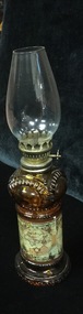 Mont De Lancey
Lamp - Kerosene
1. Lamp has clear glass chimney, an amber glass reservoir with historical map design and amber glass base. One screw at side to adjust the flame. 2. Small blue glass night light with glass chimney.kerosene lamps, lamps -
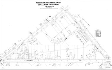 Camberwell Historical Society
Map (Item) - MMBW map, Melbourne and Metropolitan Board of Works, Melbourne and Metropolitan Board of Works - Shire of Boroondara and Camberwell - Detail Plan no. 1851, July 1904
Lithographer JEM, exd. JWD, July 1904, no. 81, 40P. 15W.melbourne and metropolitan board of works, map, camberwell, cartography -
 Camberwell Historical Society
Map (Item) - MMBW map, Melbourne and Metropolitan Board of Works, Melbourne and Metropolitan Board of Works - Shire of Boroondara and Camberwell - Detail Plan no. 1852, August 1904
Lithographer L.E, exd W.A.L., August 1904, no. 95. 40P. 15Wmelbourne and metropolitan board of works, map, camberwell, cartography -
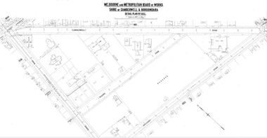
 Camberwell Historical Society
Map (Item) - MMBW map, Melbourne and Metropolitan Board of Works, Melbourne and Metropolitan Board of Works - Shire of Boroondara and Camberwell - Detail Plan no. 1858, August 1904
Lithographer E.H.H., Exd J.W.D, Aug 1904, No. 103. 40P.15W.melbourne and metropolitan board of works, map, camberwell, cartography -
 Camberwell Historical Society
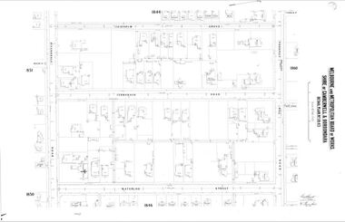
Map (Item) - MMBW map, Melbourne and Metropolitan Board of Works, Melbourne and Metropolitan Board of Works - Shire of Boroondara and Camberwell - Detail Plan no. 1845, August 1904
Lithographer JEM, exd. JWD, June 1904, no. 71. 40P.15W.melbourne and metropolitan board of works, map, camberwell, cartography -
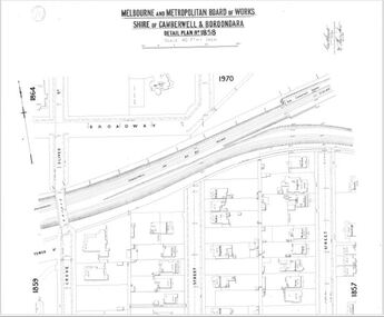
 Camberwell Historical Society
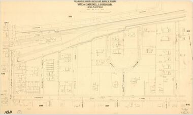
Map (Item) - MMBW map, Melbourne and Metropolitan Board of Works, Melbourne and Metropolitan Board of Works - Shire of Boroondara and Camberwell - Detail Plan no. 1860, August 1904
Lithographer E.H.H., Exd J.W.D, June 1904, No. 70. 40P.15W.melbourne and metropolitan board of works, map, camberwell, cartography -
 Wodonga & District Historical Society Inc
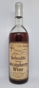
Functional object - Bottle - Schmidt's Strawberry Wine 1976
Schmidt’s Strawberry Farm is set on acres of lush strawberry fields in Allans Flat, approximately 5 kilometres from Yackandandah and 24 kilometres from Wodonga. Schmidt's is the oldest strawberry winery in Australia, owned and operated by brothers Martin and Michael Schmidt who are third generation strawberry growers/winemakers.This item originates from the oldest strawberry winery in AustraliaA bottle of Schmidt's Strawberry Wine from their 1975 harvest. The bottle bears a beige label with brown text. Their is also a sticker on the back of the bottle containing information about the wine.Front Label below a district map: 1975 Harvest/ Schmidt's /(GENUINE)/ Strawberry/ Wine/ Grown & Bottled by / J.F., D. F. & G. SCHMIDT/ ALLANS FLAT, VICTORIA/ PRODUCT OF AUSTRALIA/ .740 LITRES" On sticker across back: "Fermented from fresh strawberries with no artificial flavour or/ preservatives. This strawberry wine has been the house specialty/ of the Schmidt family for many generations - with the advent of/ improved growing techniques, this dessert wine is now introduced/ to the wine lovers of Australia."strawberry wine, schmidt’s strawberry farm, martin and michael schmidt -
 Wodonga & District Historical Society Inc
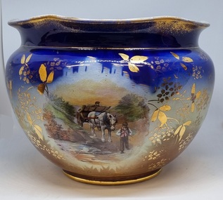
Decorative object - Decorative ceramic bowl, early 20th century
This bowl was used in the home of Mrs. Laura Sommer nee Costa grandmother of one of the life members of Wodonga & District Historical Society who donated this item to our collection. It is representative of decorative household items in the early to mid 20th century.This item is an outstanding example of popular decorative household items from the 19th and early 20th century.A large ceramic decorative bowl featuring rural images. The primary colours of the bowl is a deep blue with gilt edges and markings. It features 2 rural scenes showing men with horses and a cart. The top edge is slightly contoured. There is a maker's mark underneath the bowl.Maker's map on base: A small flower within and larger flower shape with "MADE IN ENGLAND" written around it.decorative bowls, domestic items, ceramics, english ceramics and porcelain -
 Wodonga & District Historical Society Inc
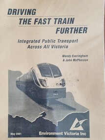
Booklet - Driving the Fast Train Further, Wendy Everingham and John McPherson, May 2001
This document is a response by Environment Victoria to the Fast Train Report. It advocates the establishment of an integrated transport approach in Victoria including the need for a Rural and Regional Planning Strategy to be developed in conjunction with the Metropolitan StrategyA publication of 34 pages produced by Environment Victoria Inc. It has brown cover featuring an image of a locomotive superimposed over an outline map of Victoria. It consists of 36 pages including appendices, references, a map of an Environment Victoria Enhanced Victorian Passenger Rail Network and a map of the Victoria's Regional and Rural Bus service.fiction This document is a response by Environment Victoria to the Fast Train Report. It advocates the establishment of an integrated transport approach in Victoria including the need for a Rural and Regional Planning Strategy to be developed in conjunction with the Metropolitan Strategyrailways environmental impact, victorian railways, environment victoria -
 Wodonga & District Historical Society Inc
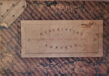
Booklet - Descriptive Surveys - Wodonga - Tallangatta Line, 1890s
The first section of the Wodonga to Tallangatta line opened in 1889 and was further extended in 1891. It was a vital community link until the passenger service closed in September 1961. The last regular goods train on the line ran on 21st April 1978. These maps give detail of the surveying and building of the line.A collection of replicas of survey maps acquired to build the Wodonga to Tallangatta Railway line. Each survey includes a diagram of a portion of the line showing survey measurements and details of the land which that portion of the line will run through. It also includes the name of the landowner from whom the necessary land was acquired.The first section of the Wodonga to Tallangatta line opened in 1889 and was further extended in 1891. It was a vital community link until the passenger service closed in September 1961. The last regular goods train on the line ran on 21st April 1978. These maps give detail of the surveying and building of the line.victorian railways, wodonga to tallangatta rail service -
 Wodonga & District Historical Society Inc
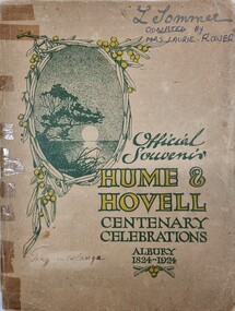
Booklet - Hume and Hovell Centenary Celebrations Booklet, 1924
This souvenir was created as part of the celebrations to commemorate the journey of Hume and Hovell from New South Wales (Near Yass) to Port Phillip Bay, passing through the site of modern day Albury and Northeast Victoria.A small booklet printed for celebrations to commemorate the centenary of the journey of Hume and Hovell, including maps and advertising.fictionThis souvenir was created as part of the celebrations to commemorate the journey of Hume and Hovell from New South Wales (Near Yass) to Port Phillip Bay, passing through the site of modern day Albury and Northeast Victoria.hume & hovell, hume & hovell centenary -
 Wodonga & District Historical Society Inc
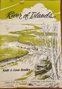
Book - River of Islands, Kath & Leon Bentley, 1985
A detailed guide to the Murray RIver, including descriptions of the terrain and settlements along the river as well as detailed charts of the river from Yarrawonga to the Hume WeirAn A4 sized publication including text, photos and maps describing the history and surrounds of the Murray River from Yarrawonga to the Hume Weir.A detailed guide to the Murray RIver, including descriptions of the terrain and settlements along the river as well as detailed charts of the river from Yarrawonga to the Hume Weirmurray river navigation, murray river settlement, leisure activities - boating -
 Wodonga & District Historical Society Inc
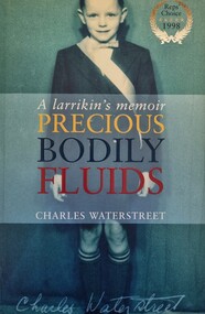
Book - Precious Bodily Fluids: A Larrikan's Memoir, Charles Waterstreet, 1998
This publication tells the story of the battle to introduce fluoridation to eh water supply of Albury in New South Wales. The events are described through the eyes of the author, Charles Wallstreet wo was a11 years old when the battle raged.A publication of 262 pages. Soft cover includes images with the synopsis published on the back. The inside cover includes a map of the Albury district .non-fictionThis publication tells the story of the battle to introduce fluoridation to eh water supply of Albury in New South Wales. The events are described through the eyes of the author, Charles Wallstreet wo was a11 years old when the battle raged. albury nsw social conditions, albury 1960s -
 Wodonga & District Historical Society Inc
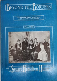
Book - Beyond the Border, Stuart Hamilton Hume, 1991
This publication traces the achievements of descendants of Hamilton Hume and connected families. This includes the Mitchell, Hume, Kennedy and Huon pastoral families who had strong links to North East VIctoria.A publication of 216 pages includes a detailed account of descendants of the Hume family and their achievements. It includes genealogical tables, portraits, and index and maps on the inside covers.This publication traces the achievements of descendants of Hamilton Hume and connected families. This includes the Mitchell, Hume, Kennedy and Huon pastoral families who had strong links to North East VIctoria. hamilton hume, australian pioneers, pioneer life -
 Wodonga & District Historical Society Inc
Uniform - Hamilton-Smith Collection - Red Cross Uniform
The Hamilton-Smith collection was donated by the children of Grace Mary Hamilton-Smith nee Ellwood (1911-2004) and John Hamilton-Smith (1909-1984) who settled in Wodonga in the 1940s. The Ellwood family had lived in north-east Victoria since the late 1800s. Grace’s mother, Rosina Ellwood nee Smale, was the first teacher at Baranduda in 1888, and a foundation member of the C.W.A. Rosina and her husband Mark retired to Wodonga in 1934. The collection contains significant items which reflect the local history of Wodonga, including handmade needlework, books, photographs, a wedding dress, maps, and material relating to the world wars. Grace and John married at St. David’s Church, Albury in 1941. John was a grazier, and actively involved in Agricultural Societies and the Belvoir Wodonga Rotary Club. Grace was an active member of several organisations including the CWA, Red Cross, the Wodonga Show Ladies' Auxiliary and the Victorian Agricultural Societies Association. This uniform was owned by Grace Hamilton-Smith. She achieved recognition for more 20 years of service to the Red Cross.This item has well documented provenance and a known owner. It is part of a significant collection from the Hamilton-Smith family of Wodonga and reflects important aspects of social history including the roles of women and their contribution to the community. A tan coloured Red Cross uniform and badges worn C1940sred cross australia, hamilton-smith collection, wodonga red cross -
 Wodonga & District Historical Society Inc
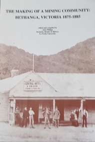
Book - The Making of a Mining Community: Bethanga, Victoria 1875 - 1885, Published 1993
A publication by La Trobe University to support the teaching of V.C.E History Unit 1: Local History. It is presented as 6 investigations focused on aspects of community through a case study of the Upper Bethanga district in Northeast Victoria from 1875 to 1885.A publication by La Trobe University to support the teaching of V.C.E History Unit 1: Local History. It consists of 94 pages including images, maps and document extracts.A publication by La Trobe University to support the teaching of V.C.E History Unit 1: Local History. It is presented as 6 investigations focused on aspects of community through a case study of the Upper Bethanga district in Northeast Victoria from 1875 to 1885.local history, vce resources, bethanga community, bethanga history -
 Wodonga & District Historical Society Inc
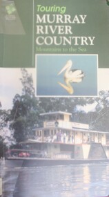
Book - Touring Murray River Country, Stone, Derrick I & Stone, Sascha C, 1996
A touring guide of the Murray RIver, Australia from its source in the mountains following its journey to the sea. The first sections cover information about the area of the Upper Murray, including Lake Hume and the Albury-Wodonga area.A publication of 128 pages includes 230 full colour photos, 42 illustrations and 19 colour route maps. A touring guide of the Murray RIver, Australia from its source in the mountains following its journey to the sea. The first sections cover information about the area of the Upper Murray, including Lake Hume and the Albury-Wodonga area.murray river, australia - tourism -
 Wodonga & District Historical Society Inc
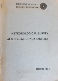
Book - Meteorological Study Albury Wodonga District March 1974, Australian Government Publishing Service
A compilation of historical records, tables, maps and data documenting meteorological observations throughout the Albury- Wodonga district. Records for Albury date from 1860 and those for Wodonga date from 1898. Other areas documented include Beechworth, Yackandandah and Corowa.A plain covered publication. Pages are stapled stapled together down the left side of pages.A compilation of historical records, tables, maps and data documenting meteorological observations throughout the Albury- Wodonga district. Records for Albury date from 1860 and those for Wodonga date from 1898. Other areas documented include Beechworth, Yackandandah and Corowa.meteorology wodonga, meteorology albury, historical weather statistics, climate albury-wodonga -
 Wodonga & District Historical Society Inc
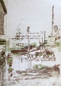
Book - Wodonga Central Area Study, Loder and Bayly, Planning & Engineering Consultants, March 1975
This report was the result of an investigation into the potential future development and town planning for the central area of Wodonga. Chapters of the final report are:- Chapter 1: Summary: Conclusions and Recommendations, Chapter 2: Setting the scene, Chapter 3: Possible futures, Chapter 4: Objectives, Chapter 5: Growth Options, Chapter 6: Recommended approaches, Chapter 7: Plan elements and Chapter 8: Ways and Means.A report of 134 pages, including illustrations and maps. The report was presented to the Albury-Wodonga Development Corporation and the Rural City of Wodonga.This report was the result of an investigation into the potential future development and town planning for the central area of Wodonga. Chapters of the final report are:- Chapter 1: Summary: Conclusions and Recommendations, Chapter 2: Setting the scene, Chapter 3: Possible futures, Chapter 4: Objectives, Chapter 5: Growth Options, Chapter 6: Recommended approaches, Chapter 7: Plan elements and Chapter 8: Ways and Means.wodonga town planning, albury-wodonga development, rural city of wodonga -
 Wodonga & District Historical Society Inc
Album - Hume Reservoir Australia Album - Plans and Progress Photos - River Murray Water Scheme, Department of Public Works, N.S.W, 1927
This set of photos is from a leather bound album bearing the inscription "HUME RESERVOIR AUSTRALIA" plus 'The Rt. Hon. L. C. M. S. Amery, P. C., M .P.' all inscribed in gold. It was presented to The Rt. Hon. L. C. M. S. Amery, P. C., M. P, Secretary of State for Dominion Affairs on the occasion of his visit to the Hume Reservoir on 2nd November 1927. This album is of local and national significance as it documents the planning and development of the Hume Reservoir up to 1927. It was the largest water reservoir in the British Empire. The album records the pioneering engineering work that went into its construction.1. Locality Plan and Plan of Dam. The dam is about ten miles by road upstream from Albury and about three-quarters of a mile below the confluence of the Mitta Mitta River and the Murray River. Its main features consist of a concrete portion across the bed of the river with earth embankment at both ends. The foundations throughout are on hard granite, found at an average depth of about 40 feet below the surface, the centre line being located to take advantage of the most favourable rock levels.Heading on page "WORKS UNDER RIVER MURRAY WATERS AGREEMENT/HUME RESERVOIR" Beneath top diagram "FIG. 1. ELEVATION" Beneath second diagram "FIG. 2. PLAN" On map "LOCALITY PLAN"hume reservoir australia, river murray waters scheme, hume weir diagrams, hume weir location -
 Wodonga & District Historical Society Inc
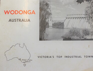
Book - Wodonga Australia - Victoria's Top Industrial Town, Wodonga Promotions Committee, 1966
Winning the top award for "Industrial Development" in the Victorian Premier Town Contest 1964, Wodonga was recognised and declared the chief industrially developing town outside the Melbourne metropolitan area. This publication outlines the key features of Wodonga supplemented with photos and maps.non-fictionWinning the top award for "Industrial Development" in the Victorian Premier Town Contest 1964, Wodonga was recognised and declared the chief industrially developing town outside the Melbourne metropolitan area. This publication outlines the key features of Wodonga supplemented with photos and maps.wodonga description and travel, wodonga development -
 Wodonga & District Historical Society Inc
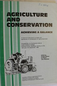
Book - Agriculture and Conservation - Achieving a Balance, Australian Institute of Agricultural Science, September 1984
This publication documents the proceedings of a conference held at Clyde Cameron College, Nordsvan Drive, Wodonga, Victoria on the 10th and 11th September, 1984. It includes maps, diagrams and bibliographical references. Some of the topics included in the keynote addresses are:- soil degradation, the use of chemicals in agriculture, agriculture and the use of public land, prime agricultural land, management of native plants and animals on farms, water resource management, economics of conservation and rights and responsibilities of individuals in the use of freehold land.non-fictionThis publication documents the proceedings of a conference held at Clyde Cameron College, Nordsvan Drive, Wodonga, Victoria on the 10th and 11th September, 1984. It includes maps, diagrams and bibliographical references. Some of the topics included in the keynote addresses are:- soil degradation, the use of chemicals in agriculture, agriculture and the use of public land, prime agricultural land, management of native plants and animals on farms, water resource management, economics of conservation and rights and responsibilities of individuals in the use of freehold land.agriculture, conservation, land degradation -
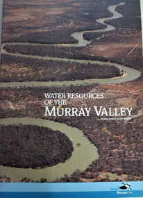 Wodonga & District Historical Society Inc
Book - Water Resources of the Murray Valley, Department of Water Resources New South Wales, 1992
A study of the Murray River water management and resources, including illustrations and maps.non-fictionA study of the Murray River water management and resources, including illustrations and maps.water resources development, water quality management -- murray river region, murray river -
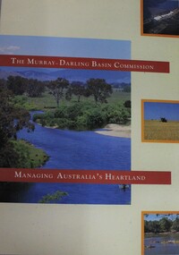 Wodonga & District Historical Society Inc
Booklet - Murray-Darling Basin Commission: Managing Australia's Heartland, 1992
This 16 page booklet outlines the role of the Murray-Darling Commission and water management strategies. It includes colour illustrations and maps.non-fictionThis 16 page booklet outlines the role of the Murray-Darling Commission and water management strategies. It includes colour illustrations and maps.murray-darling basin management, natural resources, murray-darling basin commission (australia) -
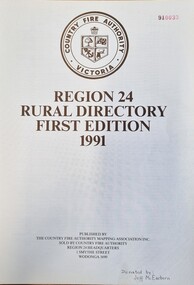 Wodonga & District Historical Society Inc
Booklet - CFA Region 24 Rural Directory, Country Fire Authority Mapping Association, 1991
... , map legends and a road index. Country Fire Authority Victoria ...This publication was been prepared to meet the need in the rural community for a "Rural Directory". Its primary purpose was to decrease the time taken by fire brigades and other services responding to emergency calls. It provides maps of the whole region as well as selected towns. It also includes a localities index, map legends and a road index.An A4 sized directory of 119 pages including an index and maps. The volume has black plastic spiral binding and laminate cover.This publication was been prepared to meet the need in the rural community for a "Rural Directory". Its primary purpose was to decrease the time taken by fire brigades and other services responding to emergency calls. It provides maps of the whole region as well as selected towns. It also includes a localities index, map legends and a road index.victorian country fire authority, fire protection regions, cfa region 24 -
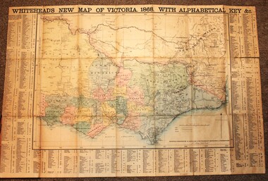 Wodonga & District Historical Society Inc
Map - Whiteheads New Map of Victoria, E. Whitehead & Co., engravers & lithographers, 1868
Edward Whitehead was a printer and publisher active in Melbourne during the latter half of the 19th century. Whitehead founded his printing business at 67 Collins Street East in 1864 and, though not focused on maps, began publishing his own series of maps of Victoria in 1867. He focussed on producing highly detailed folding maps of Victoria which included a very detailed index of place names. His series of maps of Victoria became one of the most successful and most profitable series of regional maps of Australia ever produced.This is a very early map of Victoria showing Belvoir (Wodonga)A detailed early map of Victoria with counties clearly marked and shaded and a detailed index. It also shows roads, post office towns, railways, telegraphs, gold mining areas and notes on topography. Relief shown by hachures and spot heights. Includes a list of towns with distances from Melbourne on 3 sides of map. It is produced on paper mounted on linen.victoria cartography, rare maps victoria, whiteheads maps -
 Wodonga & District Historical Society Inc
Map - Tulloch & Brown's Map of the Colony of Victoria, Tulloch & Brown, 1856
The map was created by Tulloch and Brown. David Tulloch was one of the earliest engravers and lithographers in the state of Victoria. He arrived in Melbourne from Greenock, Scotland, on 3 January 1849. Following the discovery of gold Tulloch went to the Victorian goldfields in 1851, commissioned to make sketches of the diggers and the diggings for Ham’s Illustrated Australian Magazine. In November 1852 Tulloch set up in business as engraver, draughtsman, copperplate printer and lithographer. Tulloch took a map engraver, James Davie Brown, into partnership in March 1853; the several maps and specimens of commercial engraving they showed at the 1854 Melbourne Exhibition were awarded a bronze medal. That year Tulloch and Brown also received a silver medal at the Victorian Industrial Exhibition. The partnership was dissolved towards the end of 1856.This is a very early map of the Colony of Victoria including Belvoir (now know as Wodonga).A foldable map mounted on linen and with a board cover. It records the Colony of Victoria according to Surveyor's Records revised in 1857. Areas of the map are shaded to highlight different counties.At bottom right hand section of map: Tulloch & Brown's map of the Colony of Victoria : comprising part of New South Wales, the boundaries, counties, also seaport & inland townships, the gold fields with the latest discoveries, roads, tracks, &c. &c. / compiled from drawings in the Survey Office and correctly revised till 1857. Respectfully dedicated by Permission, to the Honorable Captain Andrew Clarke R.E. Surveyor General of Victoria by His Obediant Servants Tulloch & Brown, Engravers & Publishers, Melbourne". At bottom right below border : Published as the Act directs by the Proprietors, Melbourne, 1st Feb. 1856. tulloch and brown maps, rare maps victoria, victorian cartography -
 Wodonga & District Historical Society Inc
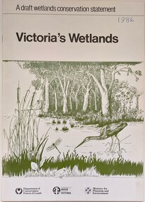
Book - Victoria's Wetlands, Dept. of Conservation, Forests & Lands, 1986
This publication was the result of an inquiry into the state of wetland environments in Victoria. It produced a draft strategy for conservation of threatened areas in the future.An 22 page book containing maps and illustrationsThis publication was the result of an inquiry into the state of wetland environments in Victoria. It produced a draft strategy for conservation of threatened areas in the future.wetland protection, wetlands victoria, water conservation -
 Wodonga & District Historical Society Inc
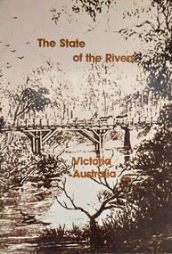
Book - The State of the Rivers, Victoria Australia, Constable, D & Smith, K, 1983
Rivers play an essential part in the life and wealth of our society. They are also the most striking feature of the landscape, contributing much to the beauty of rural and urban surroundings as well as to the recreation, peace and happiness of our people. This report includes historical colour and black and white photos and maps. It aimed to give an accurate account of the condition of the rivers of Victoria. It was produced by the Standing Consultative Committee on River Improvement.A 64 page volume including text, black and white and colour images and maps.Rivers play an essential part in the life and wealth of our society. They are also the most striking feature of the landscape, contributing much to the beauty of rural and urban surroundings as well as to the recreation, peace and happiness of our people. This report includes historical colour and black and white photos and maps. It aimed to give an accurate account of the condition of the rivers of Victoria. It was produced by the Standing Consultative Committee on River Improvement.rivers in victoria, conservation victoria, water supply victoria