Showing 5249 items
matching view road
-
 Eltham District Historical Society Inc
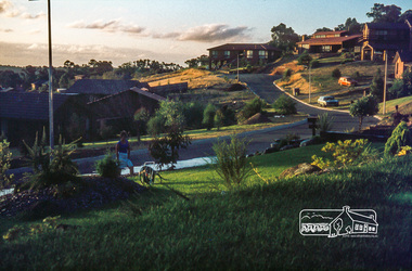
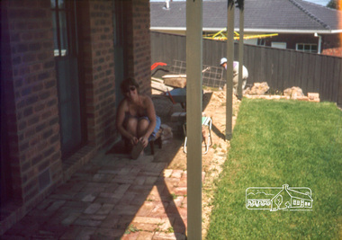
Photograph, Front garden looking towards end of court, May 1981
14 Stokes Place (Lot 83) was the home of Peter and Carla Vermey. The land was purchased in May 1979 and construction commenced September 1979. The home was built by Peter and Carla Vermey after the developer, Macquarie Builders went bankrupt. Sold October 2017 by Morrison and Kleeman Real Estate. Stokes Place was part of the Stokes Orchard Estate which was developed from the break-up of the the orchard owned by Frank Stokes who lived on the northeast corner of Nyora Road and Eucalyptus Road. His daughter Beryl advised that the Shire had levied a rate assessment on individual parcels of land within the orchard which became unaffordable resulting in its sub-division and sell off. The Stokes Orchard Estate was developed by Macquarie Builders in two stages starting with stage 1 in 1976. Stokes Place was part of Stage 2 in 1979. The Estate was bounded between Nyora Road, Eucalyptus Road, Diosma Road and Stokes Place. The original orchard only just reached the left most portions of Stokes Place and did not go fully up to Diosma, rather to just beyond the extant of Stokes Place. Stokes Place was known within the family as "The Oats" as that is where they grew oats. Frank Stokes moved to Eltham c.1945 after visiting Harold Bird to view his orchard, located diagonally opposite Stokes Orchard from the intersection of Eucalyptus Road, Pitt Street and Nyora Road. It was on Harold Bird's recommendation that Frank purchased the land.The Stokes Orchard Estate collection is typical of housing developments of the late 1970s and 1980s. It was one of the earliest estates in Eltham following the nearby Woodridge Estate development.Digital fileScanned by EDHS from 49 x 35mm colour transparencies provided on loanstokes place, eltham, stokes orchard, stokes orchard estate, streets, houses, peter and carla vermey -
 Eltham District Historical Society Inc
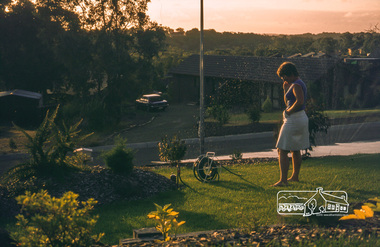
Photograph, Carla in front garden using sprinkler, May 1981
14 Stokes Place (Lot 83) was the home of Peter and Carla Vermey. The land was purchased in May 1979 and construction commenced September 1979. The home was built by Peter and Carla Vermey after the developer, Macquarie Builders went bankrupt. Sold October 2017 by Morrison and Kleeman Real Estate. Stokes Place was part of the Stokes Orchard Estate which was developed from the break-up of the the orchard owned by Frank Stokes who lived on the northeast corner of Nyora Road and Eucalyptus Road. His daughter Beryl advised that the Shire had levied a rate assessment on individual parcels of land within the orchard which became unaffordable resulting in its sub-division and sell off. The Stokes Orchard Estate was developed by Macquarie Builders in two stages starting with stage 1 in 1976. Stokes Place was part of Stage 2 in 1979. The Estate was bounded between Nyora Road, Eucalyptus Road, Diosma Road and Stokes Place. The original orchard only just reached the left most portions of Stokes Place and did not go fully up to Diosma, rather to just beyond the extant of Stokes Place. Stokes Place was known within the family as "The Oats" as that is where they grew oats. Frank Stokes moved to Eltham c.1945 after visiting Harold Bird to view his orchard, located diagonally opposite Stokes Orchard from the intersection of Eucalyptus Road, Pitt Street and Nyora Road. It was on Harold Bird's recommendation that Frank purchased the land.The Stokes Orchard Estate collection is typical of housing developments of the late 1970s and 1980s. It was one of the earliest estates in Eltham following the nearby Woodridge Estate development.Digital fileScanned by EDHS from 49 x 35mm colour transparencies provided on loanstokes place, eltham, stokes orchard, stokes orchard estate, streets, houses, peter and carla vermey -
 Eltham District Historical Society Inc
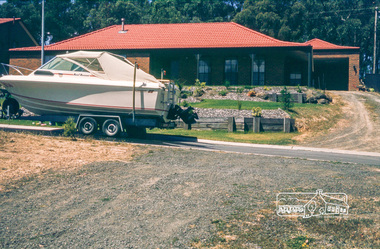
Photograph, Boat parked in front of house, May 1981
14 Stokes Place (Lot 83) was the home of Peter and Carla Vermey. The land was purchased in May 1979 and construction commenced September 1979. The home was built by Peter and Carla Vermey after the developer, Macquarie Builders went bankrupt. Sold October 2017 by Morrison and Kleeman Real Estate. Stokes Place was part of the Stokes Orchard Estate which was developed from the break-up of the the orchard owned by Frank Stokes who lived on the northeast corner of Nyora Road and Eucalyptus Road. His daughter Beryl advised that the Shire had levied a rate assessment on individual parcels of land within the orchard which became unaffordable resulting in its sub-division and sell off. The Stokes Orchard Estate was developed by Macquarie Builders in two stages starting with stage 1 in 1976. Stokes Place was part of Stage 2 in 1979. The Estate was bounded between Nyora Road, Eucalyptus Road, Diosma Road and Stokes Place. The original orchard only just reached the left most portions of Stokes Place and did not go fully up to Diosma, rather to just beyond the extant of Stokes Place. Stokes Place was known within the family as "The Oats" as that is where they grew oats. Frank Stokes moved to Eltham c.1945 after visiting Harold Bird to view his orchard, located diagonally opposite Stokes Orchard from the intersection of Eucalyptus Road, Pitt Street and Nyora Road. It was on Harold Bird's recommendation that Frank purchased the land.The Stokes Orchard Estate collection is typical of housing developments of the late 1970s and 1980s. It was one of the earliest estates in Eltham following the nearby Woodridge Estate development.Digital fileScanned by EDHS from 49 x 35mm colour transparencies provided on loanstokes place, eltham, stokes orchard, stokes orchard estate, streets, houses, peter and carla vermey -
 Eltham District Historical Society Inc
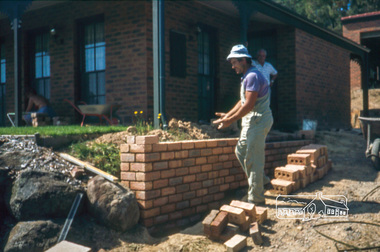
Photograph, Nick building brick wall along driveway, February 1982
14 Stokes Place (Lot 83) was the home of Peter and Carla Vermey. The land was purchased in May 1979 and construction commenced September 1979. The home was built by Peter and Carla Vermey after the developer, Macquarie Builders went bankrupt. Sold October 2017 by Morrison and Kleeman Real Estate. Stokes Place was part of the Stokes Orchard Estate which was developed from the break-up of the the orchard owned by Frank Stokes who lived on the northeast corner of Nyora Road and Eucalyptus Road. His daughter Beryl advised that the Shire had levied a rate assessment on individual parcels of land within the orchard which became unaffordable resulting in its sub-division and sell off. The Stokes Orchard Estate was developed by Macquarie Builders in two stages starting with stage 1 in 1976. Stokes Place was part of Stage 2 in 1979. The Estate was bounded between Nyora Road, Eucalyptus Road, Diosma Road and Stokes Place. The original orchard only just reached the left most portions of Stokes Place and did not go fully up to Diosma, rather to just beyond the extant of Stokes Place. Stokes Place was known within the family as "The Oats" as that is where they grew oats. Frank Stokes moved to Eltham c.1945 after visiting Harold Bird to view his orchard, located diagonally opposite Stokes Orchard from the intersection of Eucalyptus Road, Pitt Street and Nyora Road. It was on Harold Bird's recommendation that Frank purchased the land.The Stokes Orchard Estate collection is typical of housing developments of the late 1970s and 1980s. It was one of the earliest estates in Eltham following the nearby Woodridge Estate development.Digital fileScanned by EDHS from 49 x 35mm colour transparencies provided on loanstokes place, eltham, stokes orchard, stokes orchard estate, streets, houses, peter and carla vermey -
 Eltham District Historical Society Inc
Photograph, Carla Vermey under front verandah cleaning bricks, February 1982
14 Stokes Place (Lot 83) was the home of Peter and Carla Vermey. The land was purchased in May 1979 and construction commenced September 1979. The home was built by Peter and Carla Vermey after the developer, Macquarie Builders went bankrupt. Sold October 2017 by Morrison and Kleeman Real Estate. Stokes Place was part of the Stokes Orchard Estate which was developed from the break-up of the the orchard owned by Frank Stokes who lived on the northeast corner of Nyora Road and Eucalyptus Road. His daughter Beryl advised that the Shire had levied a rate assessment on individual parcels of land within the orchard which became unaffordable resulting in its sub-division and sell off. The Stokes Orchard Estate was developed by Macquarie Builders in two stages starting with stage 1 in 1976. Stokes Place was part of Stage 2 in 1979. The Estate was bounded between Nyora Road, Eucalyptus Road, Diosma Road and Stokes Place. The original orchard only just reached the left most portions of Stokes Place and did not go fully up to Diosma, rather to just beyond the extant of Stokes Place. Stokes Place was known within the family as "The Oats" as that is where they grew oats. Frank Stokes moved to Eltham c.1945 after visiting Harold Bird to view his orchard, located diagonally opposite Stokes Orchard from the intersection of Eucalyptus Road, Pitt Street and Nyora Road. It was on Harold Bird's recommendation that Frank purchased the land.The Stokes Orchard Estate collection is typical of housing developments of the late 1970s and 1980s. It was one of the earliest estates in Eltham following the nearby Woodridge Estate development.Digital fileScanned by EDHS from 49 x 35mm colour transparencies provided on loanstokes place, eltham, stokes orchard, stokes orchard estate, streets, houses, peter and carla vermey -
 Eltham District Historical Society Inc
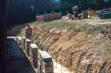
Photograph, Peter Vermey standing on foundation for retaining wall on the back, February 1982
14 Stokes Place (Lot 83) was the home of Peter and Carla Vermey. The land was purchased in May 1979 and construction commenced September 1979. The home was built by Peter and Carla Vermey after the developer, Macquarie Builders went bankrupt. Sold October 2017 by Morrison and Kleeman Real Estate. Stokes Place was part of the Stokes Orchard Estate which was developed from the break-up of the the orchard owned by Frank Stokes who lived on the northeast corner of Nyora Road and Eucalyptus Road. His daughter Beryl advised that the Shire had levied a rate assessment on individual parcels of land within the orchard which became unaffordable resulting in its sub-division and sell off. The Stokes Orchard Estate was developed by Macquarie Builders in two stages starting with stage 1 in 1976. Stokes Place was part of Stage 2 in 1979. The Estate was bounded between Nyora Road, Eucalyptus Road, Diosma Road and Stokes Place. The original orchard only just reached the left most portions of Stokes Place and did not go fully up to Diosma, rather to just beyond the extant of Stokes Place. Stokes Place was known within the family as "The Oats" as that is where they grew oats. Frank Stokes moved to Eltham c.1945 after visiting Harold Bird to view his orchard, located diagonally opposite Stokes Orchard from the intersection of Eucalyptus Road, Pitt Street and Nyora Road. It was on Harold Bird's recommendation that Frank purchased the land.The Stokes Orchard Estate collection is typical of housing developments of the late 1970s and 1980s. It was one of the earliest estates in Eltham following the nearby Woodridge Estate development.Digital fileScanned by EDHS from 49 x 35mm colour transparencies provided on loanstokes place, eltham, stokes orchard, stokes orchard estate, streets, houses, peter and carla vermey -
 Eltham District Historical Society Inc
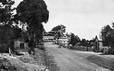
Negative - Photograph, Tom Prior, Main Road near Eltham Railway Station, c.1910
View looking south along Main Road, Eltham from near present day Luck Street. On the immediate right is a fence with the words “Hot Water” painted on it followed by William J Capewell’s butcher shop, then the slaughter yard and saleyards with the entrance access to the railway station. Contained within the saleyards facing the street, a small shelter with the name H.H. Clark upon it. Horace Harold Clark was the son of Eltham State School’s first Head Teacher, David George Clark. As well as being a farmer, he was an Estate Agent and conducted auction sales, presumably from this shelter. The large weatherboard building on the corner (opposite present-day Arthur Street) with signs for Summer Drinks and Hot Water painted on the side is Luther and Ada Haley’s General Store and Bakery, built 1902. This was the first building in what is now Eltham’s present shopping town centre. Haley previously ran the General Store and Bakery on the corner of Main Road and York Street until his lease expired and the premises were bought by Mrs Sarah Burgoyne in 1902. The store later was known as Staff's Store. In the distance approximately mid-way between the Butcher shop and the Bakery are the tops of what appears to be two cypress trees, which could well be the trees in front of the Shillinglaw Cottage facing Main Road. On the eastern (left) side of Main Street is Haley’s Paddock, which was used on occasions for community picnics. Capable of holding 10,000 people, with ample shade and hilly surroundings it was an ideal place for any community gathering such as the State Schools’ Picnic in 1904. Picture dated as c.1910 based on similar picture published in the Weekly Times, Feb. 1912. Kerb and channelling added 1923. Cross Ref: 610 (looking north), 611 (later stage), 613. Same as 705 (though in better condition)This photo forms part of a collection of photographs gathered by the Shire of Eltham for their centenary project book,"Pioneers and Painters: 100 years of the Shire of Eltham" by Alan Marshall (1971). The collection of over 500 images is held in partnership between Eltham District Historical Society and Yarra Plenty Regional Library (Eltham Library) and is now formally known as the 'The Shire of Eltham Pioneers Photograph Collection.' It is significant in being the first community sourced collection representing the places and people of the Shire's first one hundred years.Digital image 4 x 5 inch B&W Neg 120 format B&W negative (spare)shire of eltham pioneers photograph collection, eltham, main road, butcher, eltham railway station, railway station, w.j. capewell, baker, eltham town centre, general store, luther haley, reynolds prior collection, shops, haley's paddock, hot water, m.m. clark, sign, summer drinks, eltham sale yards, eltham slaughter yard, staffs general store -
 Eltham District Historical Society Inc
Negative - Photograph, Rose Stereograph Company, View at Eltham, Vic, c.1920
View at Eltham, Vic. Looking from Main Road near Henry Street towards Montmorency showing the railway trestle bridge. Henry Street road reserve on west side of Main road in foreground. c.1920 Copy of Rose Series Postcard P. 4348. (The Rose Stereograph Company) George Rose founded the Rose Stereograph Company in 1880 and was joined by Herbert (Bert) Cutts in the early 20th Century. The pair formed a lifetime working partnership and strong personal friendship. Assisted by George’s two sons, Herbert George and Walter, and later by Neil Cutts, the Rose Stereograph Company continued its operations for more than 140 years. The company was initially built on stereographs, but as cinema took over and stereographs fell out of fashion, the Rose Stereograph Company developed Australia’s first commercially viable photographic postcard business. Specialising in postcards of iconic historical moments and significant landmarks, The Rose Stereograph Company became a staple of the Australian travel industry. This photo forms part of a collection of photographs gathered by the Shire of Eltham for their centenary project book,"Pioneers and Painters: 100 years of the Shire of Eltham" by Alan Marshall (1971). The collection of over 500 images is held in partnership between Eltham District Historical Society and Yarra Plenty Regional Library (Eltham Library) and is now formally known as 'The Shire of Eltham Pioneers Photograph Collection.' It is significant in being the first community sourced collection representing the places and people of the Shire's first one hundred years.Digital image 4 x 5 inch B&W Negbridge street, eltham, eltham railway trestle bridge, postcard, rose stereograph company, shire of eltham pioneers photograph collection, trestle bridge -
 Eltham District Historical Society Inc
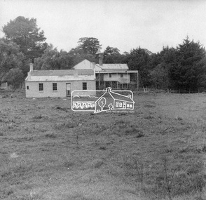
Negative - Photograph, George W. Bell, Re-erection of Shillinglaw Cottage, c.1966
View looking up from near the Eltham Railway Trestle Bridge over what was to become the Eltham Common at Shillinglaw Cottage in its new location prior to restoration. The former Gahan house, seen in the background was demolished in 1968 when the Main Road was duplicated in this section. The Eltham Common was taken over with the construction of the new Eltham Library which opened in 1994.Shillinglaw Cottage is itself historically, aesthetically and socially significant to the Shire of Nillumbik and is registered on the Victorian Heritage Database. This photo forms part of a collection of photographs gathered by the Shire of Eltham for their centenary project book, "Pioneers and Painters: 100 years of the Shire of Eltham" by Alan Marshall (1971). The collection of over 500 images is held in partnership between Eltham District Historical Society and Yarra Plenty Regional Library (Eltham Library) and is now formally known as 'The Shire of Eltham Pioneers Photograph Collection.' It is significant in being the first community sourced collection representing the places and people of the Shire's first one hundred years.Digital image 4 x 5 inch B&W Negsepp, shire of eltham pioneers photograph collection, eltham, shillinglaw cottage, eltham shire office, gahan house, derril, gahan, george w. bell collection, houses, main road -
 Eltham District Historical Society Inc
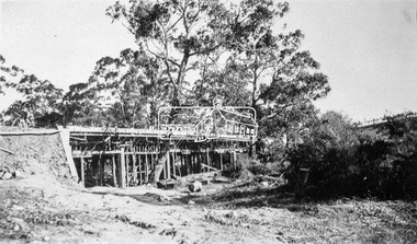
Negative - Photograph, Construction of the new concrete bridge over the Diamond Creek on Main Road, Eltham, c.May 1926
... Creek on Main Road, Eltham, c.May 1926. Viewed from present day... Creek on Main Road, Eltham, c.May 1926. Viewed from present day ...Construction of the new concrete bridge over the Diamond Creek on Main Road, Eltham, c.May 1926. Viewed from present day Wingrove Park. The original long suspension bridge over the Diamond Creek on Main Road at Eltham collapsed during flooding of the Diamond Creek on October 13 and 14, 1923. The original bridge was built around 1840 for the coach road when Cobb & Co.'s coach was the only conveyance between Eltham and Melbourne. Widespread damage was done in Melbourne and surrounding areas by floods resulting from the overflow of the Yarra at many points along its banks. A temporary bridge rigged up was severely damaged by the flooding of the creek and was closed to vehicular traffic in April 1924. A new concrete bridge was constructed to replace it and by May 1926 all the concrete piles and abutments had been completed. The bridge was finally completed and opened for traffic in September 1926, almost three years after it initially collapsed.This photo forms part of a collection of photographs gathered by the Shire of Eltham for their centenary project book,"Pioneers and Painters: 100 years of the Shire of Eltham" by Alan Marshall (1971). The collection of over 500 images is held in partnership between Eltham District Historical Society and Yarra Plenty Regional Library (Eltham Library) and is now formally known as the 'The Shire of Eltham Pioneers Photograph Collection.' It is significant in being the first community sourced collection representing the places and people of the Shire's first one hundred years.Digital image 4 x 5 inch B&W Neg Print 9 x 12.5 cmshire of eltham pioneers photograph collection, eltham, eltham lower park, main road bridge, eltham south, bridge, diamond creek (creek), wingrove park, bridge construction -
 Eltham District Historical Society Inc
Negative - Photograph, Bridge on Main Road, Eltham, c.1890
Possibly produced as a postcard. Caption in lower right hand corner reads: Bridge (at) Main Road Eltham. The long wooden suspension bridge over the Diamond Creek on Main Road at Eltham collapsed during flooding of the Diamond Creek on October 13 and 14, 1923. The original bridge was built around 1840 for the coach road when Cobb & Co.'s coach was the only conveyance between Eltham and Melbourne. Widespread damage was done in Melbourne and surrounding areas by floods resulting from the overflow of the Yarra at many points along its banks. A temporary bridge rigged up was severely damaged by the flooding of the creek and was closed to vehicular traffic in April 1924. A new concrete bridge was constructed to replace it and by May 1926 all the concrete piles and abutments had been completed. The bridge was finally completed and opened for traffic in September 1926, almost three years after it initially collapsed. Viewed from Antoinette Boulevard looking northwest towards Falkiner Street. The building in the distance believed to be Souters Cottage. On the far right on the very edge of the road verge are two Eucalypt trees, one of which is believed to be the large dead trunk still standing in present day.This photo forms part of a collection of photographs gathered by the Shire of Eltham for their centenary project book,"Pioneers and Painters: 100 years of the Shire of Eltham" by Alan Marshall (1971). The collection of over 500 images is held in partnership between Eltham District Historical Society and Yarra Plenty Regional Library (Eltham Library) and is now formally known as the 'The Shire of Eltham Pioneers Photograph Collection.' It is significant in being the first community sourced collection representing the places and people of the Shire's first one hundred years.Digital image 4 x 5 inch B&W Neg Black and white print 35mm positive transparencyshire of eltham pioneers photograph collection, eltham, main road bridge, eltham south, bridge, diamond creek (creek), significant tree, souters cottage, eltham lower park, main road, sepp -
 Eltham District Historical Society Inc
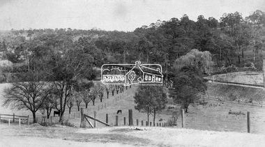
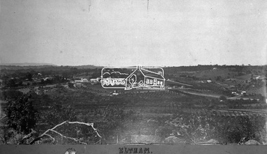
Negative - Photograph, Eltham, Vic, c.1890
View looking northeast from present day Ely Street (near intersection of present day Cronus Court and Porter Street) across what will become the site of Eltham High School towards Main Road showing the Eltham Courthouse and Police station. View is very similar to the sketch of Eltham published in 'The Illustrated Australasian News', December 26, 1884, p212. Note the large bluestone cell block behind police house and stable. George Knapman's Shoeing Forge next to the courthouse and the concentration of buildings around the Evelyn Hotel and Watson's Eltham Hotel on opposite sides of Main Road at Pitt street. Also note George Stebbing's cottage (c.1860) on Pitt Street behind the courthouse and 'Sunnyside' (home of W.J. Taylor built c.1885) at the top of the hill on Bible Street. In the foreground are orchards running up to the main street, Maria Street and also between Brougham Street and Dalton Street bordered by Bible Street.This photo forms part of a collection of photographs gathered by the Shire of Eltham for their centenary project book,"Pioneers and Painters: 100 years of the Shire of Eltham" by Alan Marshall (1971). The collection of over 500 images is held in partnership between Eltham District Historical Society and Yarra Plenty Regional Library (Eltham Library) and is now formally known as the 'The Shire of Eltham Pioneers Photograph Collection.' It is significant in being the first community sourced collection representing the places and people of the Shire's first one hundred years.Digital image 4 x 5 inch B&W Negshire of eltham pioneers photograph collection, eltham, 1890, bible street, brougham steet, dalton street, eltham courthouse, eltham hotel, evelyn hotel, franklin street, grant house, knapmans forge, main road, maria street, orchards, police residence, police station, pre 1900, stebbing cottage, sunnyside, w.b. andrew corn store, watsons hotel, little eltham -
 Eltham District Historical Society Inc
Photograph, Looking west along Bridge Street, Eltham from Main Road; 15 April 1989, 15/04/1989
[from EDHS Newsletter No. 65, March, 1989:] ELTHAM HERITAGE WALK The Society's contribution to Heritage Week this year will be a guided walk around Eltham featuring a number of buildings and locations of historical and environmental interest. Three dates are listed as official Heritage Week events, Sundays 16th and 23rd April and Saturday 22nd. In addition, there will be a walk on Saturday 15th for Society Members. All walks will start at 1:00 p.m. in Panther Place near Shillinglaw Cottage. Each will take about four hours and the distance is about 5km. Old photos of locations visited will be available for viewing.Two colour photographsactivities, bridge street, eltham, heritage excursion, main road -
 Eltham District Historical Society Inc
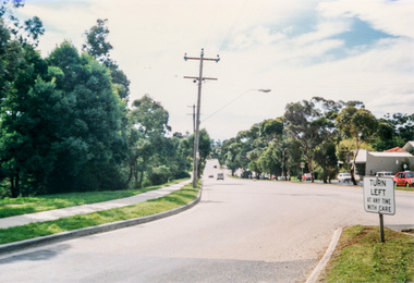
Photograph, Looking north along Bridge Street, Eltham from Main Road; 15 April 1989, 15/04/1989
[from EDHS Newsletter No. 65, March, 1989:] ELTHAM HERITAGE WALK The Society's contribution to Heritage Week this year will be a guided walk around Eltham featuring a number of buildings and locations of historical and environmental interest. Three dates are listed as official Heritage Week events, Sundays 16th and 23rd April and Saturday 22nd. In addition, there will be a walk on Saturday 15th for Society Members. All walks will start at 1:00 p.m. in Panther Place near Shillinglaw Cottage. Each will take about four hours and the distance is about 5km. Old photos of locations visited will be available for viewing.Colour photographactivities, bridge street, eltham, heritage excursion, main road -
 Eltham District Historical Society Inc
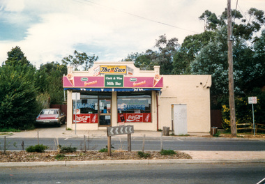
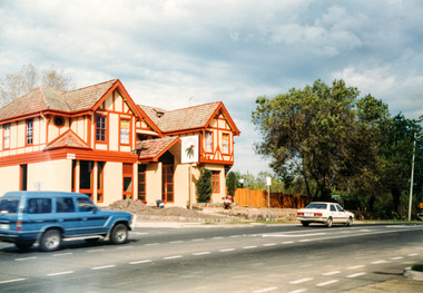
Photograph, Clark and Wise, Milk Bar, former Burgoyne shop, 820 Main Road, Eltham; 15 April 1989, 15/04/1989
[from EDHS Newsletter No. 65, March, 1989:] ELTHAM HERITAGE WALK The Society's contribution to Heritage Week this year will be a guided walk around Eltham featuring a number of buildings and locations of historical and environmental interest. Three dates are listed as official Heritage Week events, Sundays 16th and 23rd April and Saturday 22nd. In addition, there will be a walk on Saturday 15th for Society Members. All walks will start at 1:00 p.m. in Panther Place near Shillinglaw Cottage. Each will take about four hours and the distance is about 5km. Old photos of locations visited will be available for viewing.Colour photographactivities, heritage excursion, main road, burgoyne store, milk bar, shops -
 Eltham District Historical Society Inc
Photograph, Former CBA bank, 810 Main Road, Eltham near John Street; 15 April 1989, 15/04/1989
[from EDHS Newsletter No. 65, March, 1989:] ELTHAM HERITAGE WALK The Society's contribution to Heritage Week this year will be a guided walk around Eltham featuring a number of buildings and locations of historical and environmental interest. Three dates are listed as official Heritage Week events, Sundays 16th and 23rd April and Saturday 22nd. In addition, there will be a walk on Saturday 15th for Society Members. All walks will start at 1:00 p.m. in Panther Place near Shillinglaw Cottage. Each will take about four hours and the distance is about 5km. Old photos of locations visited will be available for viewing.Colour photographactivities, heritage excursion, main road, eltham, john street, cba bank -
 Eltham District Historical Society Inc
Photograph, Uniting Church, cnr Main Road and John Street, Eltham; 15 April 1989, 15/04/1989
[from EDHS Newsletter No. 65, March, 1989:] ELTHAM HERITAGE WALK The Society's contribution to Heritage Week this year will be a guided walk around Eltham featuring a number of buildings and locations of historical and environmental interest. Three dates are listed as official Heritage Week events, Sundays 16th and 23rd April and Saturday 22nd. In addition, there will be a walk on Saturday 15th for Society Members. All walks will start at 1:00 p.m. in Panther Place near Shillinglaw Cottage. Each will take about four hours and the distance is about 5km. Old photos of locations visited will be available for viewing.Colour photographactivities, heritage excursion, main road, eltham, john street, uniting church -
 Eltham District Historical Society Inc
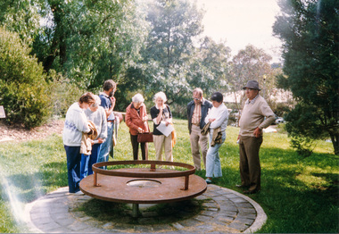
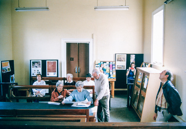
Photograph, Monument and Time Capsule, Eltham Community Centre, cnr Main Road and Pitt Street, Eltham; 15 April 1989, 15/04/1989
... visited will be available for viewing. heritage excursion main ...L-R: Phyllis McDonald, Dolly Smith, Russell Yeoman, Joyce McMahon, Opal Smith, Brian Smith, Lu Robertson, Jack Shallard [from EDHS Newsletter No. 65, March, 1989:] ELTHAM HERITAGE WALK The Society's contribution to Heritage Week this year will be a guided walk around Eltham featuring a number of buildings and locations of historical and environmental interest. Three dates are listed as official Heritage Week events, Sundays 16th and 23rd April and Saturday 22nd. In addition, there will be a walk on Saturday 15th for Society Members. All walks will start at 1:00 p.m. in Panther Place near Shillinglaw Cottage. Each will take about four hours and the distance is about 5km. Old photos of locations visited will be available for viewing.Colour photographheritage excursion, main road, eltham, 150th anniversary monument, 20th anniversary, activities, eltham community centre, pitt street, plaques, time capsule -
 Eltham District Historical Society Inc
Photograph, Eltham Hotel, cnr Main Road and Pitt Street; 15 April 1989, 15/04/1989
[from EDHS Newsletter No. 65, March, 1989:] ELTHAM HERITAGE WALK The Society's contribution to Heritage Week this year will be a guided walk around Eltham featuring a number of buildings and locations of historical and environmental interest. Three dates are listed as official Heritage Week events, Sundays 16th and 23rd April and Saturday 22nd. In addition, there will be a walk on Saturday 15th for Society Members. All walks will start at 1:00 p.m. in Panther Place near Shillinglaw Cottage. Each will take about four hours and the distance is about 5km. Old photos of locations visited will be available for viewing.Colour photographheritage excursion, activities, main road, eltham hotel -
 Eltham District Historical Society Inc
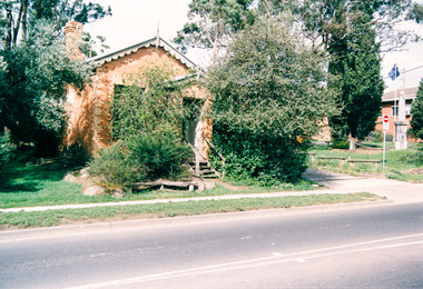
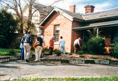
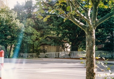
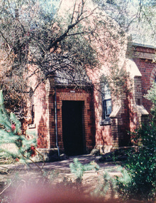
Photograph, Former Police Residence, 728 Main Road, Eltham; 15 April 1989, 15/04/1989
[from EDHS Newsletter No. 65, March, 1989:] ELTHAM HERITAGE WALK The Society's contribution to Heritage Week this year will be a guided walk around Eltham featuring a number of buildings and locations of historical and environmental interest. Three dates are listed as official Heritage Week events, Sundays 16th and 23rd April and Saturday 22nd. In addition, there will be a walk on Saturday 15th for Society Members. All walks will start at 1:00 p.m. in Panther Place near Shillinglaw Cottage. Each will take about four hours and the distance is about 5km. Old photos of locations visited will be available for viewing.Colour photographheritage excursion, activities, main road, police residence -
 Eltham District Historical Society Inc
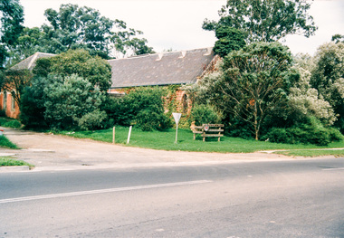
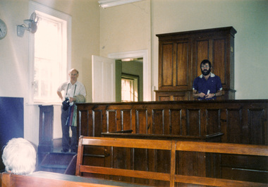
Photograph, Eltham Courthouse, 730 Main Road, Eltham; 15 April 1989, 15/04/1989
L-R: Doug Orford, Russell Yeoman [from EDHS Newsletter No. 65, March, 1989:] ELTHAM HERITAGE WALK The Society's contribution to Heritage Week this year will be a guided walk around Eltham featuring a number of buildings and locations of historical and environmental interest. Three dates are listed as official Heritage Week events, Sundays 16th and 23rd April and Saturday 22nd. In addition, there will be a walk on Saturday 15th for Society Members. All walks will start at 1:00 p.m. in Panther Place near Shillinglaw Cottage. Each will take about four hours and the distance is about 5km. Old photos of locations visited will be available for viewing.Colour photographheritage excursion, activities, doug orford, russell yeoman, eltham courthouse -
 Eltham District Historical Society Inc
Photograph, Eltham Courthouse, 730 Main Road, Eltham; 15 April 1989, 15/04/1989
[from EDHS Newsletter No. 65, March, 1989:] ELTHAM HERITAGE WALK The Society's contribution to Heritage Week this year will be a guided walk around Eltham featuring a number of buildings and locations of historical and environmental interest. Three dates are listed as official Heritage Week events, Sundays 16th and 23rd April and Saturday 22nd. In addition, there will be a walk on Saturday 15th for Society Members. All walks will start at 1:00 p.m. in Panther Place near Shillinglaw Cottage. Each will take about four hours and the distance is about 5km. Old photos of locations visited will be available for viewing.Colour photographheritage excursion, activities, eltham courthouse, opal smith, sue law -
 Eltham District Historical Society Inc
Photograph, Jarrold Cottage, Main Road, Eltham, opposite Dalton Street; 15 April 1989, 15/04/1989
[from EDHS Newsletter No. 65, March, 1989:] ELTHAM HERITAGE WALK The Society's contribution to Heritage Week this year will be a guided walk around Eltham featuring a number of buildings and locations of historical and environmental interest. Three dates are listed as official Heritage Week events, Sundays 16th and 23rd April and Saturday 22nd. In addition, there will be a walk on Saturday 15th for Society Members. All walks will start at 1:00 p.m. in Panther Place near Shillinglaw Cottage. Each will take about four hours and the distance is about 5km. Old photos of locations visited will be available for viewing.Colour photographheritage excursion, activities, eltham, jarrold cottage, main road -
 Eltham District Historical Society Inc
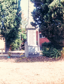
Photograph, War Memorial at front of Eltham RSL, Main Road, Eltham, April 1989, 1989
[from EDHS Newsletter No. 65, March, 1989:] ELTHAM HERITAGE WALK The Society's contribution to Heritage Week this year will be a guided walk around Eltham featuring a number of buildings and locations of historical and environmental interest. Three dates are listed as official Heritage Week events, Sundays 16th and 23rd April and Saturday 22nd. In addition, there will be a walk on Saturday 15th for Society Members. All walks will start at 1:00 p.m. in Panther Place near Shillinglaw Cottage. Each will take about four hours and the distance is about 5km. Old photos of locations visited will be available for viewing.Colour photographeltham rsl sub-branch, main road -
 Eltham District Historical Society Inc
Photograph, Uniting Church, cnr Main Road and John Street, Eltham, April 1989, 1989
... visited will be available for viewing. John Street Main Road ...[from EDHS Newsletter No. 65, March, 1989:] ELTHAM HERITAGE WALK The Society's contribution to Heritage Week this year will be a guided walk around Eltham featuring a number of buildings and locations of historical and environmental interest. Three dates are listed as official Heritage Week events, Sundays 16th and 23rd April and Saturday 22nd. In addition, there will be a walk on Saturday 15th for Society Members. All walks will start at 1:00 p.m. in Panther Place near Shillinglaw Cottage. Each will take about four hours and the distance is about 5km. Old photos of locations visited will be available for viewing.Colour photographjohn street, main road, uniting church -
 Eltham District Historical Society Inc
Photograph, Odyssey House Victoria, 28 Bonds Road, Lower Plenty, 6 March 1990
Odyssey House drug rehabilitation centre in Bonds Road, Lower Plenty is a distinctive landmark, especially when viewed from across the Yarra at Templestowe. It was built in the 1950’s as a seminary for the Blessed Sacrament Fathers. Because of the poor and circuitous road access, a suspension footbridge was built across the river. As well as providing easy access for the priests residents of Templestowe could attend services at the seminary. The bridge is now part of the Yarra Trails system.Colour photographlower plenty, bonds road, odyssey house -
 Eltham District Historical Society Inc
Photograph, Henley Bridge, Spring Excursion, Exploring the Upper Yarra, 22 October 1995, 22/10/1995
[article by Bettina Woodburn in EDHS Newsletter No. 105, November 1995:] EXPLORING THE UPPER YARRA - We enjoyed the Spring Excursion, this year "Exploring the Upper Yarra" - in spite of the constant rain and the countryside under the cloud cover, especially in the valleys, being mainly shiny shades of green. The occasional fields of buttercups, clumps of arum lilies and splendid rhododendron and other flowering bushes became very special. The Cobb and Co coach was warm and a cosy retreat as we zig-zagged on the highways and byways to glimpse the Yarra River, upstream and down, its secret places, and particularly the many bridges. Russell excelled as 'Poet Laureate', reading from Dacre Smyth's book. This 1979 publication includes paintings of all the bridges along the river with poems and brief descriptions of each one. Some of the bridges are in out-of-the-way places and are not very well known. We looked forward to hearing the poetry as much as seeing the 'constructions'… Big Pat (was he short or tall, lean or fat? - he did win the £200 reward for discovering gold and had the creek named after him), about the 'Eddies'?, and the disliked 'meccano' bridge in Warburton, etc. etc. The hot roast lunch in the old Reefton Hotel was also most welcome. It was easy to imagine it peopled by miners and early settlers. Starting by crossing the new (1974) concrete bridge at Warrandyte we headed through Wonga Park with views to the Christmas Hills and to the escarpment of the Yering Gorge, which causes flood waters to back up through the Yarra Glen plain, so avoiding disasters downstream. At the end of a long driveway we found the wooden, privately owned Henley Bridge (1935 after the 1934 floods). This facilitates access to different parts of Henley Farm and to Lilydale. Everard Park, named after Blanche Shallard's father, a State Member for 17 years, below the Highway Yarra crossing was in need of care. It is 10 miles from Yarra Glen by road but, as "Yarra Marra” canoeists well know, 32 winding miles down by water. After more delightful countryside scenes we joined the Warburton Highway at Woori Yallock. From the old Railway Station at Launching Place the Centennial Trail for walkers, cyclists and horse riders has replaced the rails. The line from Lilydale was opened in 1901, and the last diesel freight train ran to Warburton in 1965. It continued to rain as we had morning tea in Warburton in a shelter between footbridges. From here we continued upstream past the Bridge to O'Shannassy Lodge and Reservoir, Starvation Creek, and the Peninsular tunnel (miners dug it as at Pound Bend) which we visited (scrambling down those steps!) on our return after lunch. Our furthermost point was the Upper Yarra Dam Reserve (and vast catchment area). Finished in 1957 after ten years' work and 100 years after Yan Yean, it supplies much of Melbourne's water. After crossing the 30m Launching Place Bridge to the Eltham side of the Yarra and Healesville, we saw in the distance the Yarra Glen Timber Trestle Bridge over the river flats "the longest for years in the land it was said!" Harry's dream of "better weather over the Divide" unfortunately didn't come true, but I'm sure we 36 members will retain happy memories of a day that was wet and green and filled with Bridges. Situated on the Yarra River, 5.5 kms south of Christmas Hills on private property. This timber trestle bridge is said to have been built some time after 1907 by Melbourne master-builder, David Mitchell (the father of Dame Nellie Melba), to connect his two "Henley Farm" properties with Lilydale. In earlier days, when the McPhersons owned the property, their children used a punt to cross the river to attend Yering Primary School. This private bridge is best viewed from the end of Wendy Way. - Source: Christmas Hills Past and Present, Yarra Glen & District Historical Society, 2004.Two colour photographsactivities, henley bridge, upper yarra -
 Eltham District Historical Society Inc
Photograph, Spring Excursion, Exploring the Upper Yarra, 22 October 1995, 22/10/1995
[article by Bettina Woodburn in EDHS Newsletter No. 105, November 1995:] EXPLORING THE UPPER YARRA - We enjoyed the Spring Excursion, this year "Exploring the Upper Yarra" - in spite of the constant rain and the countryside under the cloud cover, especially in the valleys, being mainly shiny shades of green. The occasional fields of buttercups, clumps of arum lilies and splendid rhododendron and other flowering bushes became very special. The Cobb and Co coach was warm and a cosy retreat as we zig-zagged on the highways and byways to glimpse the Yarra River, upstream and down, its secret places, and particularly the many bridges. Russell excelled as 'Poet Laureate', reading from Dacre Smyth's book. This 1979 publication includes paintings of all the bridges along the river with poems and brief descriptions of each one. Some of the bridges are in out-of-the-way places and are not very well known. We looked forward to hearing the poetry as much as seeing the 'constructions'… Big Pat (was he short or tall, lean or fat? - he did win the £200 reward for discovering gold and had the creek named after him), about the 'Eddies'?, and the disliked 'meccano' bridge in Warburton, etc. etc. The hot roast lunch in the old Reefton Hotel was also most welcome. It was easy to imagine it peopled by miners and early settlers. Starting by crossing the new (1974) concrete bridge at Warrandyte we headed through Wonga Park with views to the Christmas Hills and to the escarpment of the Yering Gorge, which causes flood waters to back up through the Yarra Glen plain, so avoiding disasters downstream. At the end of a long driveway we found the wooden, privately owned Henley Bridge (1935 after the 1934 floods). This facilitates access to different parts of Henley Farm and to Lilydale. Everard Park, named after Blanche Shallard's father, a State Member for 17 years, below the Highway Yarra crossing was in need of care. It is 10 miles from Yarra Glen by road but, as "Yarra Marra” canoeists well know, 32 winding miles down by water. After more delightful countryside scenes we joined the Warburton Highway at Woori Yallock. From the old Railway Station at Launching Place the Centennial Trail for walkers, cyclists and horse riders has replaced the rails. The line from Lilydale was opened in 1901, and the last diesel freight train ran to Warburton in 1965. It continued to rain as we had morning tea in Warburton in a shelter between footbridges. From here we continued upstream past the Bridge to O'Shannassy Lodge and Reservoir, Starvation Creek, and the Peninsular tunnel (miners dug it as at Pound Bend) which we visited (scrambling down those steps!) on our return after lunch. Our furthermost point was the Upper Yarra Dam Reserve (and vast catchment area). Finished in 1957 after ten years' work and 100 years after Yan Yean, it supplies much of Melbourne's water. After crossing the 30m Launching Place Bridge to the Eltham side of the Yarra and Healesville, we saw in the distance the Yarra Glen Timber Trestle Bridge over the river flats "the longest for years in the land it was said!" Harry's dream of "better weather over the Divide" unfortunately didn't come true, but I'm sure we 36 members will retain happy memories of a day that was wet and green and filled with Bridges.Two colour photographsactivities, upper yarra, upper yarra dam -
 Eltham District Historical Society Inc
Photograph, Yarra River from Henley Bridge, Kangaroo Ground, Spring Excursion, Exploring the Upper Yarra, 22 October 1995, 22/10/1995
[article by Bettina Woodburn in EDHS Newsletter No. 105, November 1995:] EXPLORING THE UPPER YARRA - We enjoyed the Spring Excursion, this year "Exploring the Upper Yarra" - in spite of the constant rain and the countryside under the cloud cover, especially in the valleys, being mainly shiny shades of green. The occasional fields of buttercups, clumps of arum lilies and splendid rhododendron and other flowering bushes became very special. The Cobb and Co coach was warm and a cosy retreat as we zig-zagged on the highways and byways to glimpse the Yarra River, upstream and down, its secret places, and particularly the many bridges. Russell excelled as 'Poet Laureate', reading from Dacre Smyth's book. This 1979 publication includes paintings of all the bridges along the river with poems and brief descriptions of each one. Some of the bridges are in out-of-the-way places and are not very well known. We looked forward to hearing the poetry as much as seeing the 'constructions'… Big Pat (was he short or tall, lean or fat? - he did win the £200 reward for discovering gold and had the creek named after him), about the 'Eddies'?, and the disliked 'meccano' bridge in Warburton, etc. etc. The hot roast lunch in the old Reefton Hotel was also most welcome. It was easy to imagine it peopled by miners and early settlers. Starting by crossing the new (1974) concrete bridge at Warrandyte we headed through Wonga Park with views to the Christmas Hills and to the escarpment of the Yering Gorge, which causes flood waters to back up through the Yarra Glen plain, so avoiding disasters downstream. At the end of a long driveway we found the wooden, privately owned Henley Bridge (1935 after the 1934 floods). This facilitates access to different parts of Henley Farm and to Lilydale. Everard Park, named after Blanche Shallard's father, a State Member for 17 years, below the Highway Yarra crossing was in need of care. It is 10 miles from Yarra Glen by road but, as "Yarra Marra” canoeists well know, 32 winding miles down by water. After more delightful countryside scenes we joined the Warburton Highway at Woori Yallock. From the old Railway Station at Launching Place the Centennial Trail for walkers, cyclists and horse riders has replaced the rails. The line from Lilydale was opened in 1901, and the last diesel freight train ran to Warburton in 1965. It continued to rain as we had morning tea in Warburton in a shelter between footbridges. From here we continued upstream past the Bridge to O'Shannassy Lodge and Reservoir, Starvation Creek, and the Peninsular tunnel (miners dug it as at Pound Bend) which we visited (scrambling down those steps!) on our return after lunch. Our furthermost point was the Upper Yarra Dam Reserve (and vast catchment area). Finished in 1957 after ten years' work and 100 years after Yan Yean, it supplies much of Melbourne's water. After crossing the 30m Launching Place Bridge to the Eltham side of the Yarra and Healesville, we saw in the distance the Yarra Glen Timber Trestle Bridge over the river flats "the longest for years in the land it was said!" Harry's dream of "better weather over the Divide" unfortunately didn't come true, but I'm sure we 36 members will retain happy memories of a day that was wet and green and filled with Bridges.Colour photographactivities, upper yarra, henley bridge -
 Eltham District Historical Society Inc
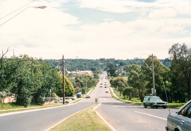
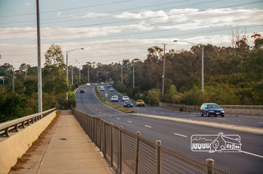
Photograph, Looking north from Fitzsimons Lane Bridge, c.May 2001
Viewed from the boundary of Eltham, Lower Plenty and TemplestoweRoll of 35mm colour negative film, 7 stripsAgfa HDC 200 plus-2eltham, streets, main road, fitzsimons lane, fitzsimons lane bridge