Showing 1059 items matching "boundaries"
-
 Bendigo Historical Society Inc.
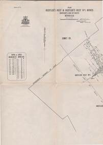
Map - STRUGNELL COLLECTION: HUSTLER'S LINE OF REEF, September 1913
Map, Hustler's Line of Reefs, Hustler's Reef & Hustler's Reef No.1 Mines Bendigo.Plate No. X1V (14) Comet Co. .Bulletin No 33 Signed H.A.Whitelaw. Drawing shows reef boundary lines .There is an explanatory box showing depth in feet and inches of the mines .Underground Survey Office, Bendigo.map, bendigo, hustler's reef & hustler's reef 1 -
 Port Melbourne Historical & Preservation Society
Programme - Photocopy, Program, Charity football match, Boundary Rovers and Billiard Hall Stars, Aug 1947
Photocopies of program for charity football match between the Boundary Rovers (Rising Sun Hotel) and the Billiard Hall Stars August 1947. Mounted for display on brown paper, inserted in mylar sleeve. Lists both teams. Ref. item 1335 for photo of team.sport - australian rules football, charities and appeals, a 'nappy' ollington, j dobson, w hales, p murray, k trainor, a sawtell, s bullpit, j collins, g beaton, n gent, w watts, w bowers, a love, s harrison, j millar, m maller, s hall, l coy, l dobson, f palmer, m stephens, c pike, g palmer, b thompson, e earle, k maskell, k powell, g fisher, mr kercher, a chiver, norm goss snr, h kulken, b barfoot, j irvine, a mcdonald, f james, b whimpy, b mcdonald, j leslie -
 Surrey Hills Historical Society Collection
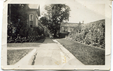
Digital photo, 45 Wandsworth Road, Surrey Hills, 1956
According to the donor, the photo was taken before the driveway was constructed. The house was later extended at the rear and was re-roofed. The donor's grandparents Daniel Patrick Liddy and Beatrice Bridget Tyner (known as 'Beat') were married in at her parents' home in Glencoe, South Australia on 13 December 1908. They lived in the Carlton / North Melbourne area before moving to Surrey Hills. Electoral rolls list them at 92 Curtain Street, North Carlton in 1913. According to the donor, they rented several properties before purchasing 45 Wandsworth Road. They are listed at Albert Crescent in 1914 and 1919, but also lived in Zetland Road. They purchased 45 Wandsworth Road in c1923 and are listed in the electoral rolls there in 1924. The donor's mother Ellen Dorothy Liddy (known as Eileen) was born in 1909; her brother Daniel John Liddy was born in 1911, both in Carlton. Daniel Patrick Liddy died in 1955; his wife Beatrice died in 1959. They are buried in Box Hill Cemetery (RC183-0045). 45 Wandsworth Road was their home for over 30 years.This image is material evidence of a property that has been demolished.A black and white photo taken from the street looking up a path or narrow driveway. On the LHS is part of a weatherboard house, Edwardian in style. On the RHS is the boundary fence against which is a garden border separated from the driveway by a section of grass. In the background is a glasshouse.Rear along top edge in blue biro: "Aunty Eileens house / before she was married" - according to the donor, this is his cousin's writing. Aunty Eileen was Ellen Dorothy Liddy who married Hugh Turnbull in 1936. Along LH edge, perhaps in a different hand " 23-10-1956" Photo laboratory processing stamp in black ink " 2 48", stamped twice.wandsworth road, daniel patrick liddy, beatrice bridget tyner, beatrice bridget liddy, ellen dorothy liddy, daniel john liddy, box hill cemetery, gardens -
 Lakes Entrance Historical Society
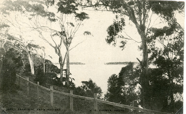
Postcard - The Entrance, Bulmer H D, 1910c
Black and white postcard of the man made entrance through the hummocks, taken from the cliff top at Kalimna. Shows an indistinct distant view of the entrance, natural vegetation in foreground behind simple timber and chicken wire boundary fence. Lakes Entrance VictoriaLakes Entrance from Kalimnawaterways, topography, islands -
 Falls Creek Historical Society
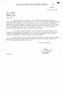
Document - Falls Creek Tourist Management Committee Directive
Bob Hymans Collection Bob (Herman) Hymans (a former member of the Royal Netherlands Navy was born in Bloemendaal, Holland on 30th September 1922. During World War II he fought against the Japanese in the Dutch East Indies (now Indonesia) and was imprisoned in Changi and on the Burma Railway. After gaining qualifications as a Ski Instructor, Bob arrived in Falls Creek in May 1950. Working as an Instructor and Supervisor at Bogong Lodge, Bob decided his future was in accommodation. He was successful in negotiating an indenture for land from the State Electricity Commission (SEC). It took Bob two years to build his Grande Coeur Chalet but, tragically, it was burned down in August 1961. Bob also built the first Chairlift in Australia. This was a single chairlift and the structure was built from wooden electricity poles. He was constantly full of new ideas and proposals for the village. Bob Hymans died on 7th July 2007. This Collection of documents and letters tells the story of Bob’s endeavours to develop Falls Creek into the ski village it is today.This document is significant because it documents an aspect of Bill Hymans' interaction with the Falls Creek Management Committee.A single page document sent to Bob Hymans by the Falls Creek Tourist Management Committee on 31 July 1959. The directive stated that materials and property owned by him needed to be neatly stored and stacked within the boundaries of the site for which he held a license.bob hymans, falls creek alpine village advisory committee -
 Greensborough Historical Society
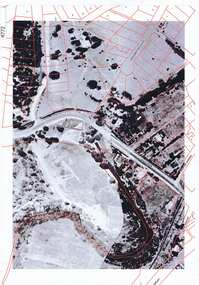
Aerial Photograph, Greensborough aerial with property overlay, 1945_
Enlargements of section of 1945 aerial survey photographs of central Greensborough, with property overlay boundaries and some street numbers by Noel WithersTwo photocopied enlargements with property overlay markingsStreet names and some property numbers. Overlays by Noel Withers.greensborough, plenty river -
 Greensborough Historical Society
Map, Municipality of Heidelberg Plan No. 481, 23/9/1949
Central area of Greensborough, South boundary Grimshaw Street, showing river and buildings in green and gradients in red. Adjoins Map No. 480 to West.Black & white map with features in red and green. Scale: 160 feet to 1 inch.greensborough, grimshaw street greensborough -
Robin Boyd Foundation
Document - Invoice, McCay & Thwaites (Barristers & Solicitors), 25.08.1966
Invoice to Robin Boyd regarding legal costs in connection with the discrepancy between title and occupation boundaries at 290 Walsh St, South Yarra. -
 Bayside Gallery - Bayside City Council Art & Heritage Collection
Map, Department of Crown Lands and Survey, Moorabbin, County of Bourke, c. 1918
The cadastral map of the Parish of Moorabbin in Victoria (L.6104) shows parish boundaries and land ownership c. 1918 when Sandringham was a Borough.moorabbin, county of bourke, map, plan, land subdivision, land titles, foreshores, sndringham, hampton, beaumaris, highett, cheltenham, department of lands and survey, land owners, cartographic material, borough of sandringham, brighton -
 Bendigo Historical Society Inc.
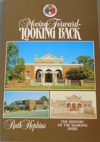
Book - Aileen and John Ellison collection: Moving Forward, Looking Back
The first meeting of the Marong Shire was held at Lockwood on 29th December 1864 but for several years there were disputes about the actual boundaries of the Shire.Hundred twenty pages book. "Moving Forward, Looking Back" by Ruth Hopkins. The History of the Marong Shire. Published for the Shire of Marong by C.G.P. Printing and Publishing, Bendigo in 1985.marong, marong shire -
Port Melbourne Historical & Preservation Society
Flyer, City of Port Melbourne, Vintage Port Worth Preserving, 13 Oct 1993
"Vintage Port Worth Preserving" Blue flyer with black print. City of Port Melbourne logo at top. Notice is for a public meeting about the new City of Melbourne boundaries which impact on Port Melbourne. "Cr, Liana THOMPSON, Mayor" at bottom right cornerlocal government - city of port melbourne, port melbourne town hall, liana thompson, mayors, roger hallam, jeff kennett, amalgamation -
 Bendigo Historical Society Inc.
Map - LONG GULLY HISTORY GROUP COLLECTION: MAP OF LONG GULLY AREA
map of Long Gjully and California Gully area from Craig Street to Barrell Street. Indicators show location of the mental hygiene Austhority, Agricultural Showgrounds and Recreation Reserve. The boundary between the Borough of Eaglehawk and Bendigo is shown by a dotted line along McGowan Street.eaglehawk, history, street map long gully/california gully. -
 Hume City Civic Collection
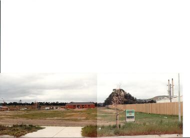
Photograph, early 1990s
The series of 5 photographs feature different views of the Woodlands housing development which opened up land bounded by Gap and Anderson Roads, Cornish Street and Elizabeth Drive in the early 1990s. It was a large housing development built close to Sunbury township.A view of the northern boundary of the Woodlands housing development in Anderson Road. A paling fence divides the estate from the 'Malley' factory, now 'Storage King' which is on the corner of Cornish Street and Anderson Road. A 'For Sale' sign is in the foreground and a partly built house is in the middle distance.housing developments, anderson road, george evans collection -
 Kew Historical Society Inc
Photograph - Civic event in Stradbroke Park, 1976
Stradbroke Park. Extent: Kilby Road to Harp Road at Burke Road. Historical Documentation: 1851 - Portion 91 purchased by Edward Glynn; 1888 - The Harp of Erin Estate (which included Section 91) offered for sale; 1896 - The area now known as Stradbroke Park was bisected by a creek that flowed from the Yarra via Hay's Paddock (q.v.) and extended through to Burke Road; 1943 - W.D. Birrell, Town Clerk of Kew, proposed that the creek be filled and a reserve created; 1954 - Entire area designated as 'open space' and named 'Stradbroke Park'. The line of the creek that ran through the Park created a further reserve on the north side of High Street, now known as 'Harrison Reserve'. Existing Condition: The park is largely of mown grass that has mature trees set into it It is possible that a number of these are remnant of the original vegetation, while there are also a number of exotic trees introduced, particularly at the northern end of the park. The southern end is dominated by playing fields. (Source: Sanderson, P 1988. Kew Conservation Study)Colour photographic positive (with colour degradation) of sporting teams at a civic event in Stradbroke Park in Kew East in May 1976. The event was officiated by the Mayor of Kew, Cr Alan Hutchinson. Stradbroke Park is situated on the western boundary of Kew and bordered by Burke and Harp Roads.stradbroke park, cr alan hutchinson, team sports -- kew (vic.) -
 City of Kingston
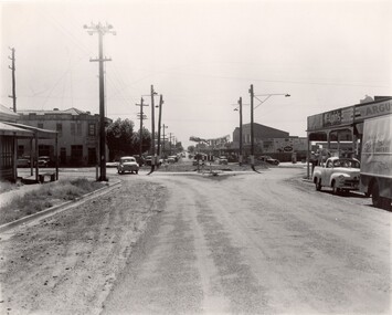
Photograph - Black and white, c. 1956
Strip shopping and ample parking were features of suburbs in the middle of the twentieth centuries. Cars were still considered a luxury, although that would soon change, and local, independent shops serviced local areas.During the post-war years, the municipality of Moorabbin experienced a population boom. The 'newcomers' were predominantly returnees from the war who were marrying and establishing families; those from the old inner-suburban areas who were moving away from rented premises to establish their own homes on cheap land. The 1950s were a time of immense growth for the area now known as City of Kingston.Black and white photograph of the intersection of Centre and East Boundary roads, Bentleigh East. Several cars are visible both in the foreground and background, and the intersection includes a roundabout. The street is lined with poles to carry electricity cables, and the roundabout is dotted with four poles for electric street lights.Handwritten in blue ink: 56 - 230 Handwritten in red ink: 82% Handwritten in black ink: Ch. 6shopping strip, cars, suburbs -
 Ringwood and District Historical Society
Photograph, Boundary Photo across Dandenong Ck towards Ringwood (H E Parker Reserve). 1979
Written on back of photograph, "Jan. 79 - boundary photo. Looking across Dandenong Creek towards Ringwood (H.E. Parker Reserve) - ?? South East corner of Ringwood. From children's playground end of Derwent (?) St." -
 Hume City Civic Collection
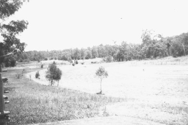
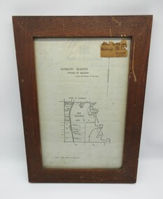
Plans, SUNBURY RESERVE PARISH OF HOLDEN
This object is a plan of a proposed recreation ground at Munro's. This was unfenced land between Evans and Barkly Streets adjacent to the Asylum boundary, now Jacksons Hill.A wooden framed plan of a proposed recreation ground.sunbury, sunbury asylum, george evans collection -
 Melbourne Tram Museum
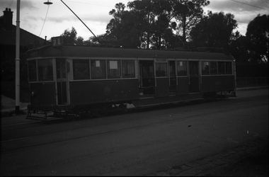
Negative - CW5 681 Riversdale Road, at Boundary Road, Wal Jack, c1940
Based on the pole number (178), photo most likely at Boundary (Warragul) Rd and Riversdale Road - see item 3644 for a map of pole numbers.Yields information about tram CW5 681 in Riversdale Road c1940Black and white negative, by Wal Jack, CW5 681, (City, route 71). Undated, c1940.trams, tramways, cw5 class, route 71, tram 681, riversdale road -
 Orbost & District Historical Society
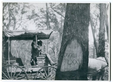
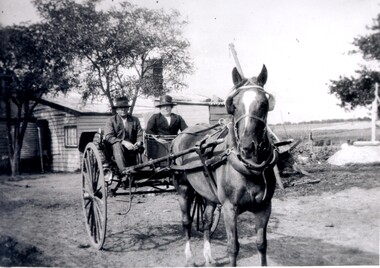
black and white photograph, 1913
When marking a boundary for a registered plan, a surveyor would place “Reference Marks” with a stated bearing and distance to a boundary corner. These trees were typically marked by cutting the bark of the tree in a shield or blaze. Until July 1886, surveyors were only able to use trees as reference marks to boundary corners. After July 1886 surveyors were able to use “permanent marks” which were either a glass bottle, gas pipe or iron bolt (for homestead surveys only). This photograph shows the reference tree, 83 miles from Marlo via the original surveyed road v ia Sydenham Inlet and Tamboon, south of Mount Drummer to the New South Wales border - now the Princes Highway.This is a pictorial record of an old survet tree. Knowledge of their location, abundance and condition not only provide important insights to past survey practice, but also provide a lasting legacy of a regions land-use history. Old survey trees serve as one of the few remaining physical legacies of early European land settlement history.A large black / white photograph of a horse and buggy pulled up alongside a reference tree which has notches and markings of Roman numerals.on back - " Refernce tree 83 miles from Marlo........to N.S.W. Border"survey-tree reference-tree -
 Port Melbourne Historical & Preservation Society
Photograph - J Kitchen & Sons perimeter survey, Boundary Street, Dec 2013
As the former j Kitchen & Sons site was being cleared, Lionel Layfield, who had worked at the site for many years undertook several pictorial perimeter surveys. These photos were taken in Dec 2013.Series 1 of colour photographs taken by Lionel Layfield as he walked around the perimeter of the J Kitchen & Sons Pty Ltd factory site during the early demolition of most of the buildings. .37-.45 - along Boundary Street past White Street to Normanby Roadindustry - manufacturing, built environment - industrial, business and traders - soaps/candles, j kitchen & sons pty ltd, symex holdings ltd, north port oval, port melbourne cricket and football oval -
 Ballarat Tramway Museum
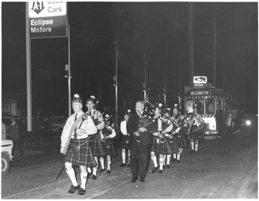
Photograph - Black & White Photograph/s, Harvey Studios, 19/09/1971 12:00:00 AM
Yields information about the closure of the SEC operated Ballarat tram system and the people involved.Photograph of a pipe band piping the last tram from Sebastopol over the town boundary into the City of Ballarat with the Ford Eclipse Motors in the background. Cr. N. F. Donald, the Mayor of Sebastopol is part of the band. For The Courier newspaper photographs of the event see Reg Item 3335.On rear is the Photography stamp - "N.L. Harvey & Son - Photographers - 131 Sturt St, Ballarat" with phone numbertrams, tramways, closure, sebastopol, last tram, city of ballaarat, borough of sebastopol, closure, pipe band, tram 40 -
 Surrey Hills Historical Society Collection
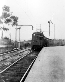
Photograph, Early electric train at Mont Albert Station, c1926, 1926
Date is approximate. Electric trains replaced steam locomotives in 1922. Mr William Holmes of 'Lugano', Mont Albert Road was in charge of the design and introduction of the electrification of the Melbourne rail system.Black and white photo of an early electric train approaching the platform at Mont Albert station. A couple of spindly eucalyptus trees can be seen beyond the picket fence marking the boundary of the platform.Black and white photo mounted on card; measures 16.3 cm x 23.4 cm.mont albert station, railways, trains, norman carter -
 Bendigo Historical Society Inc.
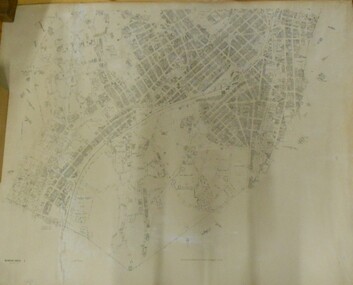
Map - BENDIGO SHEET 2
Parish map showing the southern section of the City of Bendigo. It shows the city boundary running along Murphy Street, Grave (Patterson) Street, and the turns at the south end of Macdougall Road, the corner of Alder and Aspinal Streets and the corner near the Specimen Hill - Marong roads intersectionH.J. Green Govt. Printer, Melbournemap, bendigo, city streets, parish map, city boundary -
 City of Kingston
Photograph - Black and white, c. 1920
Vic Peterson and his mother, Ida Peterson, are seated in a carriage with a horse harnessed to the front. Their property was between East Boundary and Brady Road, East Bentleigh.Black and white image of a horse and cart, with a man and woman sitting in the cart.Black ink printed on white round sticker on reverse: 335 Handwritten in red ink on reverse: 70%horse drawn wagon, east bentleigh -
 Ringwood and District Historical Society
Photograph, Boundary photo. Heatherdale Rd. looking north east from Shibor Drive, Vermont. Jan. 1979
Written on back of photograph, "Jan. 79 - Boundary photo. Heatherdale Rd. looking north east. Taken at end of Shibor Dve (Vermont) (on high part end corner of school ground). One of 3 that join up." -
 Bendigo Historical Society Inc.
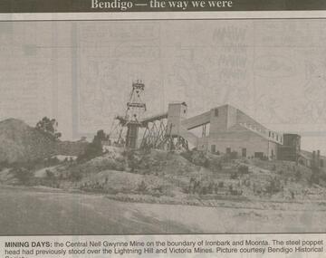
Newspaper - JENNY FOLEY COLLECTION: MINING DAYS
Bendigo Advertiser ''The way we were'' from 2000. Mining days: the Central Nell Gwynne Mine on the boundary of Ironbark and Moonta. The steel poppet head had previously stood over the Lightning Hill and Victoria Mines. Picture courtesy Bendigo Historical Society. The clip is in a folder.newspaper, bendigo advertiser, the way we were -
 Bendigo Historical Society Inc.
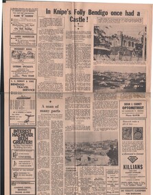
Document - BASIL MILLER COLLECTION: TRAMS AND KNIPE'S CASTLE/FOLLY'
Newspaper clipping, Bendigo Advertiser, Saturday April 15, 1972.'In Knipe's Folly Bendigo once had a castle', by Toora, (alias Amy Huxtable). John Hanlon Knipe bought land from W. E. Walleston, located in Boundary Street, (now known as Valentine Street).person, individual, basil miller -
 Kew Historical Society Inc
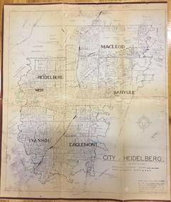
Plan, City Engineers Department (Heidelberg), City of Heidelberg Plan: Scale 20 chns to 1 inch, 1970-1993
Gwen Barton McWilliam (nee: Nelson), OAM, BA (1933- ). Gwen McWilliam is well known as an authority on the history of Boroondara and the author of a large number of books and pamphlets about the City. She was awarded the medal of the Order of Australia in 2001 ‘for service to the community of Hawthorn and district, particularly through the research, documentation and publication of its history.’ Primary source annotated by a distinguished local historian.Plan of number of areas in the City of Heidelberg showing municipal and ward boundaries, subsequently annotated by the historian Gwen McWilliam, identifying significant landholdings, subdivisions and key dates.The base map was printed in 1970 and annotated c.1993. The plan was donated to the Kew Historical Society by Gwen McWilliam. Handwritten annotations by Gwen McWilliam, 1993city of heidelberg, maps -- heidelberg (vic.), gwen mcwilliam -
 Bacchus Marsh & District Historical Society
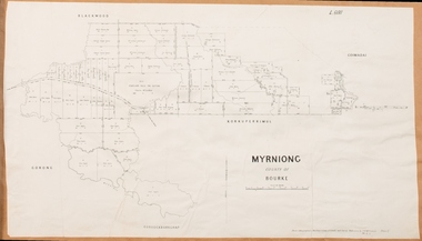
Map, Myrniong Parish Map 1904
A single page paper map showing the map for the Parish of Myrniong in the County of Bourke. A cadastral map showing parish boundaries and land ownership. The map is pasted into a bound volume containing 76 maps or plans in total. High resolution digital image stored on BMDHS computer network. myrniong parish plan, myrniong parish maps, bacchus marsh region parish plans