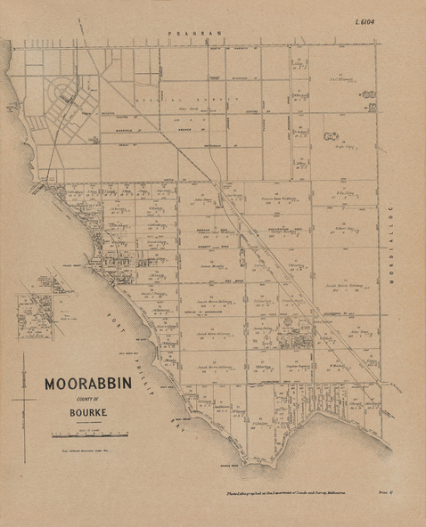
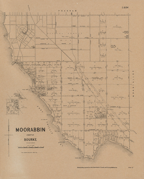
Map, Department of Crown Lands and Survey, Moorabbin, County of Bourke, c. 1918
Moorabbin, County of Bourke
Reuse this media
Can you reuse this media without permission?No (with exceptions, see below)
Conditions of use
All rights reserved
This media item is licensed under "All rights reserved". You cannot share (i.e. copy, distribute, transmit) or rework (i.e. alter, transform, build upon) this item, or use it for commercial purposes without the permission of the copyright owner. However, an exception can be made if your intended use meets the "fair dealing" criteria. Uses that meet this criteria include research or study; criticism or review; parody or satire; reporting news; enabling a person with a disability to access material; or professional advice by a lawyer, patent attorney, or trademark attorney.
Attribution
Please acknowledge the item’s source, creator and title (where known)
Department of Lands and Survey, Melbourne, Moorabbin, County of Bourke c. 1918, photolithograph, 39.5 x 32 cm. Bayside City Council Art and Heritage Collection.
Department of Lands and Survey, Melbourne, Moorabbin, County of Bourke c.1918, photolithograph, 39.5 x 32 cm. Bayside City Council Art and Heritage Collection.
The cadastral map of the Parish of Moorabbin in Victoria (L.6104) shows parish boundaries and land ownership c. 1918 when Sandringham was a Borough.
Physical description
Photolithograph. Printed in black ink on cream paper, the map shows street names, subdivision of blocks, sizes of the blocks and the names of the landowners. Port Phillip Bay is on the left, with land extending from Sandringham foreshore through to Cheltenham. The most detail is between Brighton Beach Railway Station (to the north) and just past Rickett's Point (to the south) but the map extends to North Road, Brighton at top.