Showing 3 items matching "sndringham"
-
 Bayside Gallery - Bayside City Council Art & Heritage Collection
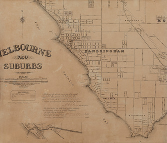
Map, Department of Crown Lands and Survey, Melbourne and Suburbs, City of Sandringham, 1917-1926
... ...sndringham...Bayside Gallery - Bayside City Council Art & Heritage Collection Corner Wilson and Carpenter Streets Brighton melbourne map plan foreshores sndringham hampton beaumaris cheltenham department of lands and survey cartographic material borough of sandringham moorabbin black rock street map City of Sandringham Photolithograph. ...map, plan, foreshores, sndringham, hampton, beaumaris, cheltenham, department of lands and survey, cartographic material, borough of sandringham, moorabbin, black rock, street map, city of sandringham -
 Bayside Gallery - Bayside City Council Art & Heritage Collection
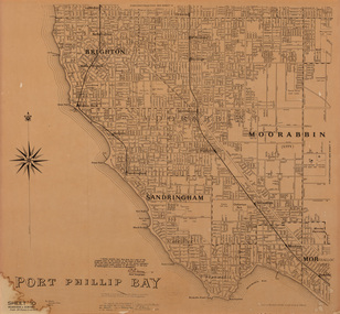
Map, Department of Lands and Survey, Land under the control of the City of Sandringham, 1962
... ...sndringham...Bayside Gallery - Bayside City Council Art & Heritage Collection Corner Wilson and Carpenter Streets Brighton melbourne The cadastral map showing land under the control of the City of Brighton in 1962. map plan foreshores sndringham hampton beaumaris cheltenham department of lands and survey cartographic material moorabbin black rock street map City of Sandringham Board of Lands and Works Print. ...The cadastral map showing land under the control of the City of Brighton in 1962.map, plan, foreshores, sndringham, hampton, beaumaris, cheltenham, department of lands and survey, cartographic material, moorabbin, black rock, street map, city of sandringham, board of lands and works -
 Bayside Gallery - Bayside City Council Art & Heritage Collection
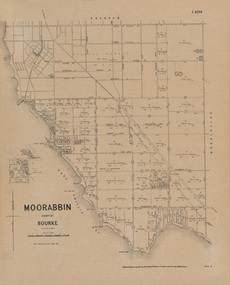
Map, Department of Crown Lands and Survey, Moorabbin, County of Bourke, c. 1918
... ...Sndringham...Moorabbin County of Bourke Map Plan land subdivision land titles Foreshores Sndringham Hampton Beaumaris Highett Cheltenham Department of Lands and Survey Land owners cartographic material Borough of Sandringham Brighton Photolithograph. ...The cadastral map of the Parish of Moorabbin in Victoria (L.6104) shows parish boundaries and land ownership c. 1918 when Sandringham was a Borough.moorabbin, county of bourke, map, plan, land subdivision, land titles, foreshores, sndringham, hampton, beaumaris, highett, cheltenham, department of lands and survey, land owners, cartographic material, borough of sandringham, brighton