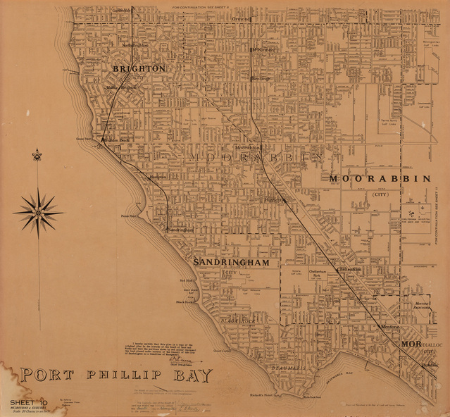
Map, Department of Lands and Survey, Land under the control of the City of Sandringham, 1962
Land under the control of the City of Sandringham
Reuse this media
Can you reuse this media without permission?No (with exceptions, see below)
Conditions of use
All rights reserved
This media item is licensed under "All rights reserved". You cannot share (i.e. copy, distribute, transmit) or rework (i.e. alter, transform, build upon) this item, or use it for commercial purposes without the permission of the copyright owner. However, an exception can be made if your intended use meets the "fair dealing" criteria. Uses that meet this criteria include research or study; criticism or review; parody or satire; reporting news; enabling a person with a disability to access material; or professional advice by a lawyer, patent attorney, or trademark attorney.
Attribution
Please acknowledge the item’s source, creator and title (where known)
Department of Lands and Survey, Land under the control of the City of Sandringham 1962, print, 71 x 77 cm. Bayside City Council Art and Heritage Collection. 0000-045
The cadastral map showing land under the control of the City of Brighton in 1962.
Physical description
Print. Map in black ink on cream paper by the Department of Lands and Survey, Melbourne that indicates area placed under control of the Council of City of Sandringham, on 7th February 1962. Stamp certifies that the land under Sandringham's control is indicated in red colour, however there is no red colour visible. The map shows Boundaries of Municipalities of Sandringham, Brighton and Moorabbin with dotted lines and the districts within the municipalities.