Showing 716 items
matching land allotments
-
 City of Moorabbin Historical Society (Operating the Box Cottage Museum)
Flyer - Ozone Hill Estate, Cheltenham, 1923
The train line from the city to Frankston was electrified in 1922 which intensified the sale in the municipality of Moorabbin, particularly land which was in the vicinity of the railway stations.Example of the progress of the Municipality of MoorabbinPhotocopy of Advertising flyer for sale of real estate sales - plan of building blocks for saleOzone Hill Estate, Cheltenham 41 choice residential allotments.victor avenue, weatherall road, cheltenham, real estate, auction -
 City of Moorabbin Historical Society (Operating the Box Cottage Museum)
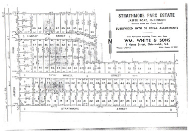
Flyer - Strathmore Park Estate, Jasper Road McKinnon, 1942
After WWII there was a decline in the market gardens in the City of Moorabbin, as the value of the land was more profitable than the crops.Example of the progress of the Municipality of MoorabbinPhotocopy of advertising flyer for auction of real estate sales - plan of building blocks for saleStrathmore Park Estate, Jasper Road Bentleigh Subdivided into 98 Ideal Allotmentsstrathmore street, wavell street, lindsay street, jasper road, mckinnon, bentleigh, real estate, auction -
 Bendigo Historical Society Inc.
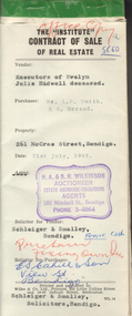
Document - H.A. & S.R. WILKINSON COLLECTION: CONTRACT OF SALE
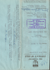
Contract of sale of real estate dated 21st July, 1965 between Sandhurst and Northern district Trustees Executors and Agency Company Limited of View Street, Bendigo as executors of the estate of Evelyn Julie Bidwell deceased (seller) and Mr. L.B. Smith & Mr. A. Heraud (buyers). Solicitor for vendor: Schleiger & Smalley, Bendigo. Solicitor for purchaser: E.S. Cahill & Son, View Street, Bendigo. Property at No.261 McCrae Street, Bendigo being part of Crown allotment 6 section 92C being land described in certificate of title volume 4507 folio 334, together with all floor coverings, blinds, curtains and electric light fittings and shades. Price 1,300 pounds.organization, business, h.a. & s.r wilkinson real estate -
 Bendigo Historical Society Inc.
Document - H.A. & S.R. WILKINSON COLLECTION: CONTRACT OF SALE
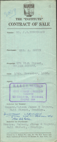
... Contract of sale of land dated 11th May, 1957 between Mr... part allotment 7 section 31A land described in Crown grant ...Contract of sale of land dated 11th May, 1957 between Mr. W.B. Nicholls (seller) and Misses D.M. & L.G. Smith. For land being lot 8 on vendor's plan of subdivision by Mr. Surveyor Pritchard, dated 2nd May, 1957 having a frontage of 59 feet to Alamein Court by a depth of 100 feet, being part allotment 7 section 31A land described in Crown grant volume 8113 folio 731. Subject to any registered appurtenant easements. Price 3,600 pounds.organization, business, h.a. & s.r wilkinson real estate -
 Bendigo Historical Society Inc.
Document - H.A. & S.R. WILKINSON COLLECTION: CONTRACT OF SALE
Contract of sale dated 26th September, 1957 between Mr. W.B. Nicholls (seller) and Mr. G. Stekelenburg (buyer). Solicitor for vendor: Messrs. Hyett, Willis & Hyett, Bull Street, Bendigo. Solicitor for purchaser: Messrs. Hyett, Willis & Hyett, Bull Street, Bendigo. For lot 34, Alamein Court, Golden Square being lot 34 on plan of subdivision lodged in the office of titles No. A389550 being part of Crown allotment 7 section 31A, being land described in Crown grant volume 8113 folio 731. Price 3,850 pounds.organization, business, h.a. & s.r wilkinson real estate -
 Bendigo Historical Society Inc.
Document - H.A. & S.R. WILKINSON COLLECTION: CONTRACT OF SALE
Contract of sale dated 19th October, 1957 between Miss A.M. Sanger (seller) and Mr. C. Smith (buyer). Solicitor for vendor: Messrs. Tatchell, Dunlop, Smalley & Balmer, Williamson Street, Bendigo. Solicitor for purchaser: Messrs. Watson, James & Rogers, Bull Street, Bendigo. For property No.121 Wills Street, Bendigo being part of Crown allotments 2 and 3 section 116C together with a right of carriage way over the road colored brown on the map on the title, being land described in certificate of title volume 8149 folio 666. Price 1,500 poundsorganization, business, h.a. & s.r wilkinson real estate -
 Bendigo Historical Society Inc.
Document - H.A. & S.R. WILKINSON COLLECTION: CONTRACT OF SALE
... . For Property No.579 High Street, Golden Square, being Crown allotment.... For Property No.579 High Street, Golden Square, being Crown allotment ...Contract of sale dated 17th November, 1958 between Mr. J.S. Henderson (seller) and Mrs. A. Smith (buyer). Solicitor for vendor: Messrs. Watson, James & Rogers, Bull Street, Bendigo. Solicitor for purchaser: Messrs. Watson, James & Rogers, Bull Street, Bendigo. For Property No.579 High Street, Golden Square, being Crown allotment 16 section 13A land described in certificate of title volume 1190 folio 879, together with all linos, inside and outside blinds, curtains, lamp shades, gas stove, gas copper and electric bath heater. Price 1,600 poundsorganization, business, h.a. & s.r wilkinson real estate -
 Bendigo Historical Society Inc.
Document - H.A. & S.R. WILKINSON COLLECTION: CONTRACT OF SALE
... Streets, Bendigo part of allotment 420A section K land being... of land dated 28th November, 1958 between Mrs. V. Hunt (seller ...Contract of sale of land dated 28th November, 1958 between Mrs. V. Hunt (seller) and Mrs. L.M. Salis (buyer). Solicitor for vendor: Messrs. Hyett, Willis & Hyett, Bull Street, Bendigo. Solicitor for purchaser: Messrs. Watson, James & Rogers, Bull Street, Bendigo. For so much and such parts as lie above the depth of fifty feet below the surface of land being lot 1 on the vendor plan of subdivision situate at the corner of Victoria and Prout Streets, Bendigo part of allotment 420A section K land being delineated and colored red, blue and brown on the map in the margin hereof, together with all buildings thereon and with all floor coverings, internal and external blinds, curtains and electric light fittings and shades. Price 2,000 pounds.organization, business, h.a. & s.r wilkinson real estate -
 Bendigo Historical Society Inc.
Document - H.A. & S.R. WILKINSON COLLECTION: CONTRACT OF SALE
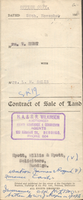
Contract of sale dated 20th March, 1959 between Mr. M.N. Robertson (seller) and Mr. R.W. & Mrs. B. Stretton (buyer). Solicitor for vendor: Messrs. E.S. Cahill & Son, View Street, Bendigo. Solicitor for purchaser: Messrs. Watson, James & Rogers, Bull Street, Bendigo. For property No. 40 Wade Street, corner McKenzie Street, Golden Square, land being part of Crown allotment 0 section 44B described in certificate of title volume 7100 folio 878, together with blinds and linos as inspected. Price 1,550 pounds.organization, business, h.a. & s.r wilkinson real estate -
 Bendigo Historical Society Inc.
Document - H.A. & S.R. WILKINSON COLLECTION: CONTRACT OF SALE
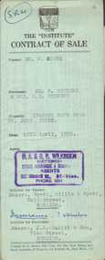
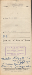
Contract of sale dated 15th April, 1959 between Mr. F. Kupke (seller) and Mr. P. 7 Mrs. F.E. Stevens (buyers). Solicitor for vendor: Hyett, Willis & Hyett, Bull Street, Bendigo. Solicitor for purchaser: E.S. Cahill & Son, View Street, Bendigo. Property in Sparrow Hawk Road, St. Just Point being allotments 65 and 66 section L containing 15 acres, 17 perches and being land described in Crown grant volume 7615 folio 125, together with all buildings and erections thereon, also stainless steel sink and cupboards. Also State Rivers and Water Supply Authority to irrigate for 3 acres. Price 1,000 pounds.organization, business, h.a. & s.r wilkinson real estate -
 Bendigo Historical Society Inc.
Document - H.A & S.R. WILKINSON COLLECTION: CONTRACT OF SALE
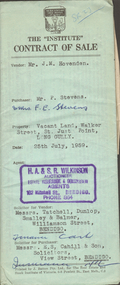
... of Crown allotment 563 section K land described in certificate... of titles being part of Crown allotment 563 section K land described ...Contract of sale dated 29th April, 1959 between Mr. L.C. Powell (seller) and Mrs. R.E. Steffan (buyer). Solicitor for vendor: Messrs. Tatchell, Dunlop, Smalley & Balmer, Williamson Street, Bendigo. Solicitor for purchaser: Messrs. Hyett, Willis & Hyett, Bull Street, Bendigo. For property at No. 8 Thomas Street, California Gully, Bendigo being lot 3 on plan of subdivision No. 17846 lodged in the office of titles being part of Crown allotment 563 section K land described in certificate of title volume 7150 folio 604, together with linos, blinds, curtains and electric light fittings and shades. Price 1,300 pounds.organization, business, h.a. & s.r wilkinson real estate -
 Bendigo Historical Society Inc.
Document - H.A & S.R. WILKINSON COLLECTION: CONTRACT OF SALE
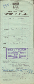
Contract of sale dated 25th July, 1959 between Mr. J.M. Hovendon (seller) and Mr. P. & Mrs. F.E. Stevens (buyer). Solicitor for vendor: Messrs. Tatchell, Dunlop, Smalley & Balmer, Williamson Street, Bendigo. Solicitor for purchaser: Messrs. E.S. Cahill & Son, View Street, Bendigo. For vacant land, Walker Street, St. Just Point, Long Gully, being part of Crown allotment 429, section A at St. Just Point, Parish of Sandhurst, County of Bendigo land described in certificate of title volume 8046 folio 521. Price 180 pounds.organization, business, h.a. & s.r wilkinson real estate -
 Bendigo Historical Society Inc.
Document - H.A. & S.R. WILKINSON COLLECTION: CONTRACT OF SALE
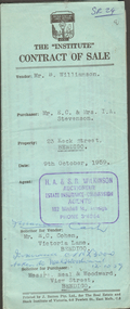
... of subdivision no. 16993 and being part of Crown allotment 441B section H... no. 16993 and being part of Crown allotment 441B section H land ...Contract of sale dated 9th October, 1959 between Mr. B. Williamson (seller) and Mr. E.C. & Mrs. I.A. Stevenson (buyers). Solicitor for vendor: E.C. Cohen, Victoria Lane, Bendigo. Solicitor for purchaser: Messrs. Neal & Woodward, View Street, Bendigo. For property at No.23 Keck Street, Bendigo being lot 77 on plan of subdivision no. 16993 and being part of Crown allotment 441B section H land described in certificate of title volume 7389 folio 628, together with all floor coverings, blinds, curtains, lamp shades and electric stovette. Price 3,900 pounds.organization, business, h.a. & s.r wilkinson real estate -
 Bendigo Historical Society Inc.
Document - H.A. & S.R. WILKINSON COLLECTION: CONTRACT OF SALE
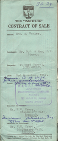
Contract of sale dated 3rd November, 1959 between Mrs. A. Hemley (seller) and Mr. G.F. * Mrs. P.E. Stacey (buyer). Solicitor for vendor and purchaser: H.E. Every, Dispensary Walk, Bendigo. Property at 44 Wood Street, Long Gully, being part of Crown allotment 4 section P described in certificate of title volume 8088 folio 607. Also that piece of land comprised in certificate of title volume 8202 folio 301 and that piece of land comprised in certificate of title volume 8202 folio 302. Together with all floor coverings, blinds, curtains, electric light fittings and shades. Price 3,700 pounds. Attached 2 copies of statement pursuant to section 34 of the estate agents act 1956 signed by H.A. Wilkinson and 1 copy of engagement or appointment in writing pursuant to section 33 of the estate agents act 1956 signed by the vendor.organization, business, h.a. & s.r wilkinson real estate -
 Bendigo Historical Society Inc.
Document - H.A. & S.R. WILKINSON COLLECTION: CONTRACT OF SALE
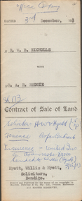
Contract of sale of land dated 3rd December, 1953 between Mr. W.B. Nicholls (seller) and Mr. A.R. Reddie (buyer) for that piece of land that lies above the depth of 50 feet below the surface of lot 12 on plan of subdivision lodged at the office of titles in red ink No. 5394259 dated 19/1/1953 and being part of allotment 12 section 10 township Kangaroo Flat, together with all improvements thereon. Price 2,850 pounds.organization, business, h.a. & s.r wilkinson real estate -
 Bendigo Historical Society Inc.
Document - H.A. & S.R. WILKINSON COLLECTION: CONTRACT OF SALE
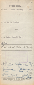
contract of sale of land dated 12th January, 1954 between Mr. C.H. Boyle (seller) and Mr. Keith Harold Roy (buyer) for land being parts of Crown allotment 144 section K at Iron Bark Gully described in certificate of title volume 7007 folio 363 and situate 25 Bannerman Street, Bendigo. Together with 5-roomed weatherboard dwelling and all sundry, also all window blinds, curtains and linos on kitchen and back bedroom floors and all electric light fittings and shades. Price 1,600 pounds.organization, business, h.a. & s.r wilkinson real estate -
 Bendigo Historical Society Inc.
Document - H.A & S.R. WILKINSON COLLECTION: CONTRACT OF SALE
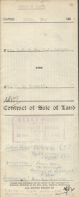
Contract of sale of land dated 29th May, 1954 between Mrs. E.M. & Mr. H.A. Knight (sellers) and Mr. W.H. Randall (buyer) for land being lot 2 on plan of subdivision No. 19227 being parts of lots 27 and 28 on plan of subdivision No. 4134 being part of Crown allotment 97 and being the balance of the land comprised in certificate of titles volume 6441 folios 021 and 022 and situate Albion Street, Bendigo. Together with weatherboard dwelling and all sundry. Price 2,200 pounds.organization, business, h.a. & s.r wilkinson real estate -
 Bendigo Historical Society Inc.
Document - H.A. & S.R. WILKINSON COLLECTION: CONTRACT OF SALE
... of Crown allotment 240 section E, land described in certificate...) and Mr. R.A. Rae for land being part of Crown allotment 240 ...Contract of sale of land dated 7th April, 1955 between Miss G.M. Lee (seller) and Mr. R.A. Rae for land being part of Crown allotment 240 section E, land described in certificate of title volume 2708 folio 415 and situate 83 Arnold Street corner Uley Street, Bendigo. Together with weatherboard dwelling and all sundry, including all furniture, curtains and blinds. Price 850 pounds.organization, business, h.a. & s.r wilkinson real estate -
 Bendigo Historical Society Inc.
Document - H.A. & S.R. WILKINSON COLLECTION: CONTRACT OF SALE
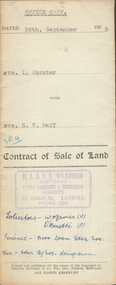
Contract of sale of land dated 26th September, 1955 between Mrs. I. Forster (seller) and Mrs. E.V. Raff (buyer) for land being lot 2 on plan of subdivision No.3905 lodged at the office of titles being part of Crown allotment 8 section 8 portion B described in certificate of title volume 4045 folio 961 situate No. 142 Myrtle Street, Bendigo. Together with right of carriage way over land at rear of property with weatherboard dwelling and all sundry, also all floor coverings, blinds, curtains, electric light fittings and shades and 'Pope' washing machine. Price 3,200 pounds.organization, business, h.a. & s.r wilkinson real estate -
 Bendigo Historical Society Inc.
Document - H.A. & S.R. WILKINSON COLLECTION: CONTRACT OF SALE
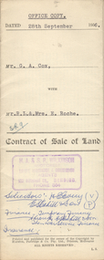
Contract of sale of land dated 28th September, 1956 between G.A. Cox (seller) and Mr. R.L. & Mrs. E. Roche (buyer) for land being lot 1 on plan of subdivision No. 18242 part of Crown allotment 337 section E described in certificate of title volume 7132 folio 389 and situate no. 150 White Hills Road, Bendigo, together with 5-roomed brick dwelling and all sundry. Price 4,750 pounds.organization, business, h.a. & s.r wilkinson real estate -
 Bendigo Historical Society Inc.
Document - H.A. & S.R. WILKINSON COLLECTION: CONTRACT OF SALE
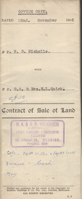
Contract of sale of land dated 22nd November, 1956 between Mr. W.N. Nicholls (seller) and Mr. G.A. & Mrs. M.L. Quirk (buyers) for piece of land being lot 17 of plan of subdivision No. 33303 lodged in the office of titles being part of Crown allotment 16 section 7A, Kangaroo Flat and situate corner Camp and carpenter Streets, Kangaroo Flat, together with brick veneer dwelling and all sundry, also all electric light fittings and shades. Price 4,500 pounds.organization, business, h.a. & s.r wilkinson real estate -
 Bendigo Historical Society Inc.
Document - H.A. & S.R. WILKINSON COLLECTION: CONTRACT OF SALE
Contract of sale of land dated 24th October, 1956 between D.E. Thomas & G.L. Thomas (sellers) and K.P. Robertson (buyer) part of Crown allotment 228A and 228B section A being the whole land described in certificate of title volume 6230 folio 888 and situate at the corner of Creeth and Arms Streets, Long Gully, together with all improvements thereon and all lines, blinds and light fittings. Price 2,300 poundsorganization, business, h.a. & s.r wilkinson real estate -
 Bendigo Historical Society Inc.
Document - H.A. & S.R. WILKINSON COLLECTION: CONTRACT OF SALE
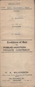
Conditions of sale by private contract dated 11th September, 1930 between J. Beercroft (seller) and J. Smith (buyer) for pieces of land outlined in red on the plan hereon and owned and or occupied by the vendor at Epsom, being part of allotments 2, 3 and 4 section 8 in the Parish of Huntly. Price 200 pounds. Attached plan of the land sold.organization, business, h.a. & s.r wilkinson real estate -
 Bendigo Historical Society Inc.
Document - H.A. & S.R. WILKINSON COLLECTION: CONTRACT OF SALE
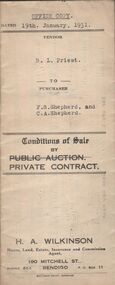
Conditions of sale by private contract dated 19th January, 1931 between R.L. Priest (seller) and F.S. Shepherd & C.A. Shepherd (buyer) for land situate Epsom Road, Eaglehawk Flat, being conditional purchase lease of special settlement area land from the Crow, entered in the register book volume 1001 folio 200107, allotments 152B and 152C section N, containing 15 acres no roods 27 perches at the present occupied by Mr. Hummel as tenant. Together with 5-roomed weatherboard dwelling and all sundry. Price 250 poundsorganization, business, h.a. & s.r wilkinson real estate -
 Bendigo Historical Society Inc.
Document - H.A. & S.R. WILKINSON COLLECTION: CONTRACT OF SALE
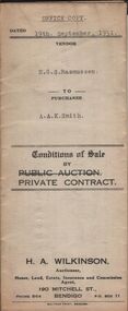
Conditions of sale by private contract dated 19th September, 1931 between E.G.S. Rasmussen (seller) and A.A.K. Smith (buyer) for land situate 213-215 Mundy Street, Bendigo being part of Crown allotment 5 section 12C described in deed of conveyance, memorial No. 959 book No. 527, together with the right of carriage way described in the deed of conveyance, together with all buildings. Price 955 pounds. Office copyorganization, business, h.a. & s.r wilkinson real estate -
 Bendigo Historical Society Inc.
Document - H.A. & S.R. WILKINSON COLLECTION: CONTRACT OF SALE
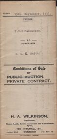
Conditions of sale by private contract dated 19th September, 1931 between E.G.S. Rasmussen (seller) and A.A.K. Smith (buyer) for land situate 213-215 Mundy Street, Bendigo being part of Crown allotment 5 section 12C described in deed of conveyance, memorial No. 959 book No. 527, together with the right of carriage way described in the deed of conveyance, together with all buildings. Price 955 pounds. Vendor copy.organization, business, h.a. & s.r wilkinson real estate -
 Bendigo Historical Society Inc.
Document - H.A. & S.R. WILKINSON COLLECTION: CONTRACT OF SALE
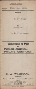
Conditions of sale by private contract dated 25th January, 1932 between A.P. Booth (seller) and C.L.H. Seymour (buyer) for land situate 32 Condon Street, Bendigo being Crown allotment 250 section H described in certificate of title volume 5433 folio 1086448, together with 6-roomed weatherboard dwelling and all sundry. Also gas stove, gas copper, bath heather, electric light fittings, shaving cabinet, duck blind on sleep out, gas fire in front room, clothes line, built-in presses, wire doors and wire screens on windows. Price 825 pounds.organization, business, h.a. & s.r wilkinson real estate -
 Bendigo Historical Society Inc.
Document - H.A. & S.R. WILKINSON COLLECTION: CONTRACT OF SALE
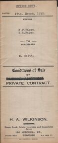
Conditions of sale by private contract dated 17th March, 1932 between E.F. Fagan & H.R. Fagan (sellers) and M. Scott (buyer) for land situate 69 Neale Street Bendigo being Crown allotment 102, section H described in certificate of title volume 4451 folio 890162, together with 5-roomed weatherboard and brick dwelling and all sundry. Price 300 pounds. Vendor copy.organization, business, h.a. & s.r wilkinson real estate -
 Bendigo Historical Society Inc.
Document - H.A. & S.R. WILKINSON COLLECTION: CONTRACT OF SALE
Conditions of sale by private contract dated 17th March, 1932 between E.F. Fagan & H.R. Fagan (sellers) and M. Scott (buyer) for land situate 69 Neale Street Bendigo being Crown allotment 102, section H described in certificate of title volume 4451 folio 890162, together with 5-roomed weatherboard and brick dwelling and all sundry. Price 300 pounds. Office copy.organization, business, h.a. & s.r wilkinson real estate -
 Bendigo Historical Society Inc.
Document - H.A. & S.R. WILKINSON COLLECTION: CONTRACT OF SALE
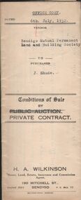
Conditions of sale by private contract dated 6th July 1932 between Bendigo Mutual Permanent Land and Building Society (seller) and J. Shade (buyer) for land situate Wood Street, California Gully, at present occupied by Mrs. Dumble as tenant, containing three roods thirty-five and two-tenths perches, having a frontage of 500 links to Wood Street by a depth of 193 links being Crown allotment 1 section P described in Crown grant volume 2129 folio 425693, together with 5-roomed weatherboard dwelling and all sundry. Also ''Lux'' wood fire stove, bath and venetian blinds. Price 340 pounds.organization, business, h.a. & s.r wilkinson real estate