Showing 37428 items
matching orbost-shire-council
-
 Eltham District Historical Society Inc
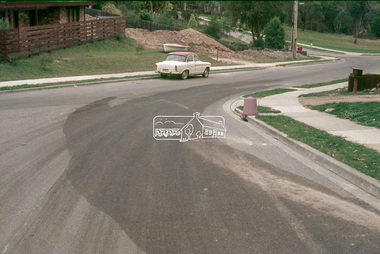
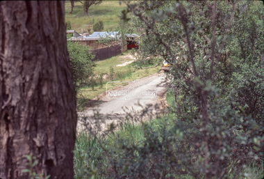
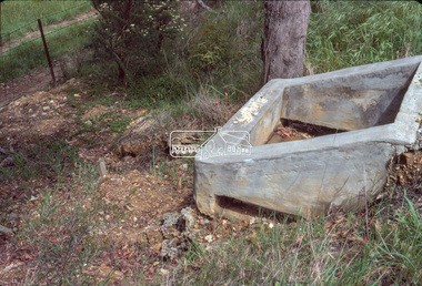
Slide - Photograph, Eltham Shire Council, Unidentified road; Infrastructure works, roads, footpaths and drainage, Shire of Eltham, c.1972
35mm colour positive transparency blue Agfacolour Service plastic mount1972, footpaths and gutters, infrastructure, road construction, road drainage, roadworks, shire of eltham, unidentified -
 Eltham District Historical Society Inc
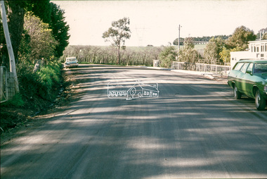
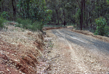
Slide - Photograph, Eltham Shire Council, Unidentified road, possibly Kangaroo Ground; Infrastructure works, roads, footpaths and drainage, Shire of Eltham, c.1972
35mm colour positive transparency blue Agfacolour Service plastic mount1972, footpaths and gutters, infrastructure, road construction, road drainage, roadworks, shire of eltham, unidentified, kangaroo ground -
 Eltham District Historical Society Inc
Slide - Photograph, Eltham Shire Council, Unidentified road; Infrastructure works, roads, footpaths and drainage, Shire of Eltham, c.1972
35mm colour positive transparency blue Agfacolour Service plastic mount1972, footpaths and gutters, infrastructure, road construction, road drainage, roadworks, shire of eltham, unidentified -
 Eltham District Historical Society Inc
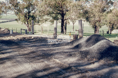
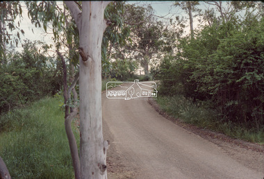
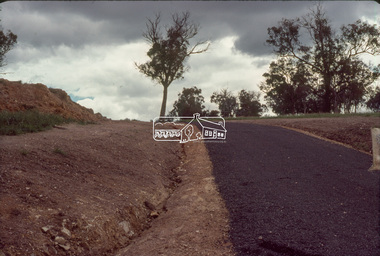
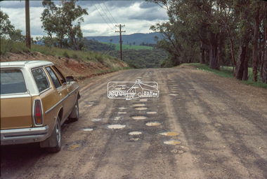
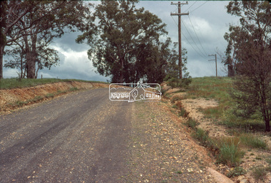
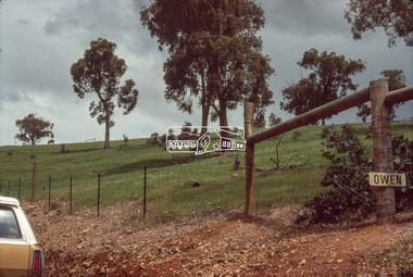
Slide - Photograph, Eltham Shire Council, Unidentified rural road within the Shire of Eltham, c.Nov. 1980
35mm colour positive transparency Kodak Kodachrome cardboard mountProcessed Nov 1980infrastructure, rural areas, rural road, unidentified -
 Eltham District Historical Society Inc
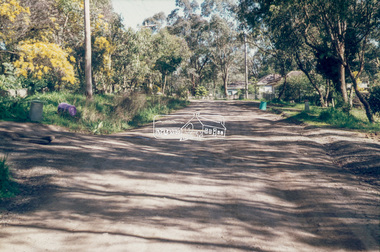
Slide - Photograph, Eltham Shire Council, Unidentified rural road within the Shire of Eltham, c.Nov. 1980
35mm colour positive transparency Kodak Kodachrome cardboard mountProcessed Nov 1980infrastructure, rural areas, rural road, unidentified -
 Eltham District Historical Society Inc
Slide - Photograph, Eltham Shire Council, Unidentified rural road within the Shire of Eltham, c.Nov. 1980
35mm colour positive transparency Kodak Kodachrome cardboard mountProcessed Nov 1980infrastructure, rural areas, rural road, unidentified -
 Eltham District Historical Society Inc
Slide - Photograph, Eltham Shire Council, Unidentified rural road within the Shire of Eltham, c.Nov. 1980
35mm colour positive transparency Kodak Kodachrome cardboard mountProcessed Nov 1980infrastructure, rural areas, rural road, unidentified -
 Eltham District Historical Society Inc
Slide - Photograph, Eltham Shire Council, Unidentified rural road within the Shire of Eltham, c.Nov. 1980
35mm colour positive transparency Kodak Kodachrome cardboard mountProcessed Nov 1980infrastructure, rural areas, rural road, unidentified -
 Eltham District Historical Society Inc
Slide - Photograph, Eltham Shire Council, Unidentified rural road within the Shire of Eltham, c.Nov. 1980
35mm colour positive transparency Kodak Kodachrome cardboard mountProcessed Nov 1980infrastructure, rural areas, rural road, unidentified -
 Eltham District Historical Society Inc
Slide - Photograph, Eltham Shire Council, Unidentified rural road within the Shire of Eltham, c.Nov. 1980
35mm colour positive transparency Kodak Kodachrome cardboard mountProcessed Nov 1980infrastructure, rural areas, rural road, unidentified -
 Eltham District Historical Society Inc
Slide - Photograph, Eltham Shire Council, Unidentified rural road within the Shire of Eltham, c.Nov. 1980
35mm colour positive transparency Kodak Kodachrome cardboard mountProcessed Nov 1980infrastructure, rural areas, rural road, unidentified -
 Eltham District Historical Society Inc
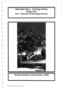
Document, Nillumbik Shire Council, Nillumbik Shire Heritage Study Stage One Vol. 1 Review & Heritage Survey, Graeme Butler & associates, 1996, 1996
Provide the foundation for future planning assessments in the shire76 A4 pages (single sided), spiral bound with clear pastic front and covers.ISBN 0 646 294547nillumbik shire heritage study, graeme butler -
 Eltham District Historical Society Inc
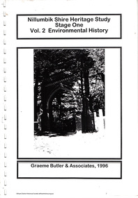
Document, Nillumbik Shire Council, Nillumbik Shire Heritage Study Stage One Vol. 1 Environmental History, Graeme Butler & associates, 1996, 1996
Provide the foundation for future planning assessments in the shire81 A4 pages (single sided) and 9 A3 (single sided) fold-out pages, spiral bound with clear pastic front and covers.ISBN 0 646 294547nillumbik shire heritage study, graeme butler -
 Eltham District Historical Society Inc
Document, Nillumbik Shire Council, Nillumbik Shire Heritage Study Appendix 1, Graeme Butler & Associates, 2001, 2001
Provide the foundation for future planning assessments in the shire86 A4 pages (double sided) pages (photocopied) no binding or covers. Title page and pages 1, 74,75 and 76 missingnillumbik shire heritage study, graeme butler -
 Eltham District Historical Society Inc
Document, Nillumbik Shire Council, Nillumbik Shire Heritage Study Stage Two, Significant Places, Graeme Butler & associates, 1997, 1997
Contents: Introduction Background Tage Two Team Significance Criteria Community Contacts Citation Structure List of Heritage Places Heritage Place Citations Appendices: Themes Criteria BibliographyProvide the foundation for future planning assessments in the shire106 A4 pages (single sided) pages (photocopied) no binding or covers. Appendices page 15 missing and Appendices page 16 a copy of a damaged pagenillumbik shire heritage study, graeme butler -
 Lakes Entrance Historical Society
Book, East Gippsland Shire Council, East Gippsland Shire Proposed Environmental Strategy 2008, 2008
A report of the proposed environmental strategy resulting from an extensive consultation process with various agencies having an environment profile East Gippsland Victoriaenvironment, waste disposal, water supply -
 Narre Warren and District Family History Group
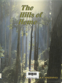
Book, Arthur P Winzenried et al, The Hills of Home - A Bicentennial History of the Shire of Sherbrooke, 1988
A Bicentennial History of the Shire of Sherbrooke, including captioned colour and black & white photographs of the area.x, 374 p.; 26 cmnon-fictionA Bicentennial History of the Shire of Sherbrooke, including captioned colour and black & white photographs of the area. shire of sherbrooke, bicentennial history -
 Learmonth and District Historical Society Inc.
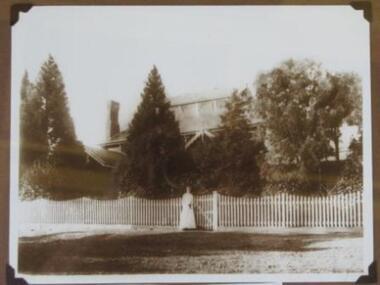
Photo -Dawbarn, Miss Katrina Dawbarn outside Ballarat Shire Offices, 1985 (estimated)
This photo (sepia) of Miss Katrina Dawbarn was taken "circa 1909" standing outside the old Ballarat Shire Office. Miss Dawbarn was the daughter of Gilbert Dawbarn who was the Shire Secretary.Historical photo of the Ballarat Shire Office in1909.Sepia photo of Ballarat Shire Office 1909,with Katrine Dawbarn, daughter of Shire Engineer (Gilbert Dawbarn).Ballarat Shire Office 1909. Katrine Dawbarn daughter of Shire Engineer. Photo coutesy Kate Kellydawbarn katrina, ballarat shire offices 1909 -
 Orbost & District Historical Society
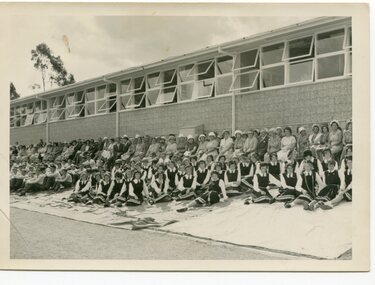
black and white photograph, 13 March 1962
This photograph was taken at the Golden Jubilee of Orbost High School in 1962.Orbost High School / Orbost Secondary College has played a significant part in the education of senior students in the Orbost district . It is the sole senior educational institution. This item is representative of its historyA black / white photograph of uniformed students and others sitting in front of the Orbost High School.on back - "Orbost H.S. Golden Jubilee 1962"orbost-high-school-jubilee -
 Orbost & District Historical Society
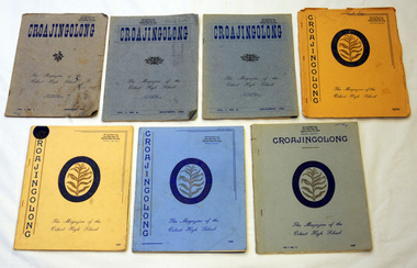
magazines, Orbost High School, Croajingalong, 1954-1959
These are the magazines of Orbost High School (now Orbost Secondary College) from 1954 -1959. They were owned by Mr F. Lay. Seven copies of the Croajingalong magazine, a magazine produced by Orbost High School.Mr & Mrs F. Lay P.O. Box 134 McCrae Plaza, Vic 3938magazine croajingalong orbost-high-school -
 Orbost & District Historical Society
pamphlets, Princes Freeway - Orbost Section, 1976
Opened by the Hon. J A Rafferty, Minister for Transport, 25 November 1976, the bridge was the first of four bridges to be built as part of the freeway bypass of Orbost. Construction cost $2.4 million. This construction was an important development along the Princes Highway corridor through East Gippsland. The original highway approached the Snowy River at a very poor alignment, and several serious accidents had occurred at the Orbost end. In times of heavy flood, the highway on both sides of the river had been cut by floodwaters and during the 1971 floods, the highest ever recorded, the river was a mile wide at the crossing. Construction of the bridges commenced in January 1975, with an expectation to open the bridge across the Snowy River as soon as possible. Less than two years later, on 25 November 1976, the bridge across the Snowy River was opened to traffic, allowing the old bridge to be demolished. The remainder of the Orbost Bypass, both the floodplain crossings and the eastern section around the township itself, was declared ‘Princes Freeway’ and opened to traffic in December 1977. (ref http://mrv.ozroads.com.au) The Country Roads Board was the government authority for the construction and maintenance of main roads in Victoria between 1913 and 1983. It was succeeded by the Road Construction authority on 1 July 1983 and later merged with the Road Traffic Authority on July 1 1989 to form the Roads Corporation. James Cameron, an Orbost farming pioneer and Member of the Legislative Assembly, fathered the Country Roads Board. The opening of this Snowy River Bridge was an important development in the accessibility to the township of Orbost.Three coloured Country Roads pamphlets for the 'Princes Freeway - Orbost Section". On the front is a coloured photograph of the new construction over the Snowy River at Orbost. Inside is a program for a ceremony for the opening of the new Snowy River Bridge. There is also a black print map of the project. -
 Orbost & District Historical Society
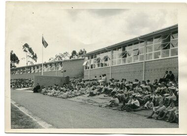
black and white photograph, 1962
This photograph was taken at the Golden Jubilee celebrations of the Orbost High School in 1962.Orbost High School / Orbost Secondary College has played a significant part in the education of senior students in the Orbost district . It is the sole senior educational institution. This item is representative of its historyA black / white photograph of students and other sitting on lawns outside the Orbost High School.on back - "Orbost H.S. Golden Jubilee 1962"education-orbost orbost-high-school-golden-jubilee -
![Sign, Shire of Eltham, St Faiths Road, Shire of Eltham [street sign], 1970c](/media/collectors/4f729f5697f83e03086015b8/items/67db7068b13536720ddd1c08/item-media/67f21867e76666667ba84bc9/item-fit-380x285.jpg) Greensborough Historical Society
Greensborough Historical SocietySign, Shire of Eltham, St Faiths Road, Shire of Eltham [street sign], 1970c
Road sign pre 1994 of St Faiths Road, Montmorency, formerly in the Shire of Eltham. Following the redistribution of local government areas in 1994, St Faiths Road was allocated to the City of Banyule.Double Sided Metal sign painted yellow with green writing and Shire of Eltham Logo and Nameshire of eltham, sign, st faiths road montmorency -
 Orbost & District Historical Society
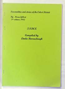
book, Personalities and Stories of the Orbost District 3rd Edition 1992 Index, 1993
"Personalities and Stories of Early Orbost' was written by historian , teacher and prominent Orbost local, Mary Gilbert. The stories were gathered from writings of the early pioneers orb their children. Other information derives from obituaries and newspaper reports. The third edition was organised by the Orbost & District Tourist Association and was re-printed after her death. This index was compiled by Linda BarracloughA soft covered stapled booklet with a lime green cover and the title in black print. It is an index to the 1992 third edition of Mary Gilbert's book, "Personalities and Stories of the Orbost District". -
 Orbost & District Historical Society
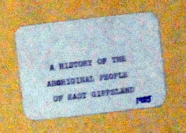
Document - File Folder, A History of Aboriginal People of East Gippsland, January 1985
This item is a useful reference tool on the history of Indigenous People in East Gippsland and the Orbost district. A manilla folder with typed pages. On the cover is a label, "History of Aboriginal People of East Gippsland". On the inside cover is a letter addressed to the librarian at the Shire of Orbost Library. The letter is clipped to the inside of the folder.on front cover - a stamp -"Orbost Historical Society"aboriginal australians, gippsland aboriginal history, kurnai, brabawooloong peoples, tatungooloong peoples, krowathunkooloong peoples -
 Lakes Entrance Historical Society
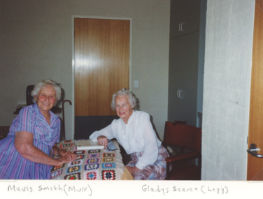
Photograph, M Holding, Lochial House , Nursing Home: Orbost, Victoria, 1993
Life time friends since school days at Lakes Entrance taken at Nursing Home Lochial House in Orbost, VictoriaColour photograph of Mavis Smith nee Muir on left and Gladys Scarce nee Legg on right, people, nursing home, accommodation -
Tatura Irrigation & Wartime Camps Museum
stationery, Shire of Rodney stationery
Shire of Rodney stationery 1886 - 1997Two sheets of Shire of Rodney stationery (A4), including Shire logo, Phone No 2, Box No 13. two copies, pre 1925Shire of Rodney 1886 - 1997shire of rodney, official stationery, council stationery -
 Orbost & District Historical Society
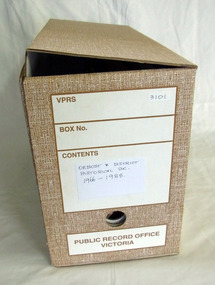
box of documents, 1966 - 1985
These documents show the beginnings of the society with a committee in 1966 leading to the formation in 1967,These documents record the history of the Orbost & District Historical Society.A cardboard box of documents of Orbost & District Historical Society, It contains minutes, correspondence, accounts, receipt and cheque books. There are also two keys. orbost-history-documents -
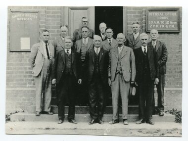 Orbost & District Historical Society
black / white photograph, first half 20th century
This is a photograph of some of the Orbost Shire councillors standing outside their council chambers. This photograph was taken before 1969 outside the previous council offices in Orbost. The current building was opened on Friday 28th February 1969 by the Premier of Victoria, The Hon. Sir Henry E. Bolte, K.C.M.G., M.P. The Shire of Orbost was a local government area about 380 kilometres east of Melbourne, the state capital of Victoria, Australia. The shire covered an area of 9,347 square kilometres and existed from 1892 until 1994. Originally, Orbost was part of the Bairnsdale Road District which was created on 30 April 1867. Splitting away as part of the Shire of Tambo in 1882, Orbost was first incorporated as a shire in its own right as the Shire of Croajingolong on 30 May 1892. It received its present name on 17 February 1893. On 3 January 1913 part of its western riding was annexed to Tambo as its Cunninghame Riding. Local governments play an important role in the lives of citizens in Australia. Local government authorities exist to provide services and amenities to local communities, and are also responsible for regulating and providing services for land and property in their district. This item is representative of a time when Orbost had its own Shire Council. A black / white photograph of a group of men standing in front of an open door of a brick building. On the left of the building is a Shire of Orbost notice board and on the right wall is a notice of the office opening hours - 10AM - 12 NOON 2PM - 4PMorbost-shire-council local government