Showing 306 items matching "yarra river - history"
-
 Kew Historical Society Inc
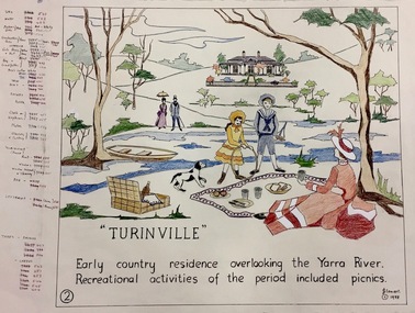
Work on paper, Joy Stewart, 2. Turinville, 1988
Kew Tapestry The eight panels depict the history of Kew. This was a 1988 Australian Bi-Centennial Project carried out under the auspices of City of Kew Council and the Kew Historical Society Incorporated. Nearly 600 citizens including many children participated in the production by adding a few or more stitches. A book records their names and the panels upon which they worked. Artist: Joy Stewart Co-ordinator: Dorothy BenyeiSydney Joy (Joy) Stewart was born in Melbourne 1925. She studied at Swinburne Technical College Art School from 1941-1945, then the National Gallery Art School 1946-1948. Her career included employment positions as a display artist, designer/painter, gallery assistant, and art teacher. Joy relocated to Cairns in 1981. Solo exhibitions in Melbourne and Cairns, including 'Done By Me' at Cairns Regional Gallery in 1999. Group exhibitions at Cairns Regional Gallery, 'The Fish John West Regrets, 1993' and 'Facets of Life' 1994. Joy Stewart died in Cairns in 2018.2. Turinville. A Handcoloured cartoon created by the artist Joy Stewart as a template for the second of a series of embroidered panels depicting the history of Kew. Wool colour codes at left. Inscription: "TURINVILLE. Early country residence overlooking the Yarra River. Recreational activities of the period included picnics." Signed by the artist "(c) JStewart, 1988"bicentennial project (kew), turinville, joy stewart -
 Kew Historical Society Inc
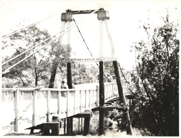
Photograph - Photograph (copy), Kanes Bridge, Studley Park, 195-1955
In 1928 a footbridge was erected to link Kew with the public golf course across the Yarra. The total cost of construction came to 250 pounds and the bridge became known as Kane's Bridge. During the 1934 floods the bridge was washed downstream, and was subsequently rebuilt. The present form of the bridge resembles the earlier bridge which crossed from the Yarra Bend Asylum to Kew, further upstream. (VHD)This work forms part of the collection assembled by the historian Dorothy Rogers, that was donated to the Kew Historical Society by her son John Rogers in 2015. The manuscripts, photographs, maps, and documents were sourced by her from both family and local collections or produced as references for her print publications. Many were directly used by Rogers in writing ‘Lovely Old Homes of Kew’ (1961) and 'A History of Kew' (1973), or the numerous articles on local history that she produced for suburban newspapers. Most of the photographs in the collection include detailed annotations in her hand. The Rogers Collection provides a comprehensive insight into the working habits of a historian in the 1960s and 1970s. Together it forms the largest privately-donated collection within the archives of the Kew Historical Society.A photographic copy of an older photograph of Kanes Bridge."Kanes Bridge"kanes bridge, yarra river, bridges - kew (vic.) -
 Kew Historical Society Inc
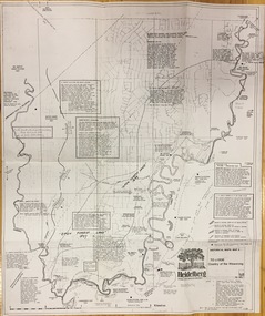
Plan, Loder & Bayly, Heidelberg: Historic River Landscape Assessment, 1982
Gwen McWilliam is well known as an authority on the history of Boroondara and the author of a large number of books and pamphlets about the City. She was awarded the medal of the Order of Australia in 2001 ‘for service to the community of Hawthorn and district, particularly through the research, documentation and publication of its history.’ This map from her collection was donated to the Kew Historical SocietyPlan of Heidelberg, annotated with details about the occupancy pre and post European settlement. The plan also contains geological references. The plan is included and analysed in volume 2 of the Heidelberg Conservation Study (1985). The original plan was published created in 1982. Printed annotationscity of heidelberg, yarra valley, historic plans -- heidelberg -
 Kew Historical Society Inc
Photograph, Wade's Farm, Kilby Road, Nineteenth Century
""The public trial of reaping machines, under the auspices of the Port Phillip Farmers' Society, advertised to take place on Friday, last, but postponed on account of the weather, came off December 27. The place selected (Mr. Wade's farm, Belford, near Kew) is undulating ground, with a remarkably heavy crop of wheat upon it. This, taken in connection with, the state of the ground, still soft from the recent rains, made the trial an uncommonly severe one. ..."(South Australian Advertiser, 15 January 1859) Some bricks used in Kew buildings came from the brickworks on Wade's Farm at the end of Belford Road near the Yarra River (now part of the Kew Golf Club). (History of RSL by John Torpey)Wade's Farm, Kilby Road, Kew.wade's farm, farming (kew), kilby road, north kew, belford road, kew, kew golf club -
 Kew Historical Society Inc
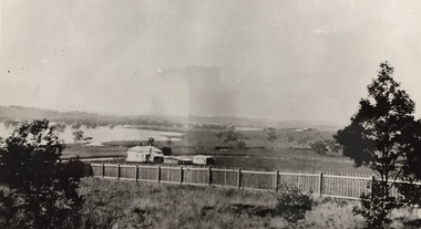
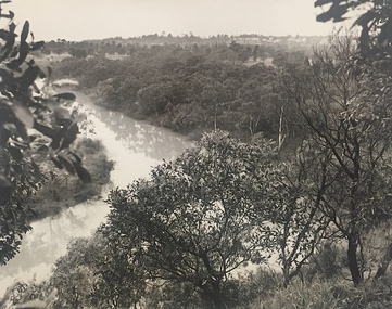
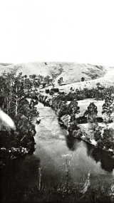
Photograph, J E & B L Rogers, View of Yarra from Cliffs, Studley Park, 1958
This work forms part of the collection assembled by the historian Dorothy Rogers, that was donated to the Kew Historical Society by her son John Rogers in 2015. The manuscripts, photographs, maps, and documents were sourced by her from both family and local collections or produced as references for her print publications. Many were directly used by Rogers in writing ‘Lovely Old Homes of Kew’ (1961) and 'A History of Kew' (1973), or the numerous articles on local history that she produced for suburban newspapers. Most of the photographs in the collection include detailed annotations in her hand.The Rogers Collection provides a comprehensive insight into the working habits of a historian in the 1960s and 1970s. Together it forms the largest privately-donated collection within the archives of the Kew Historical Society.Back and white photograph of the Yarra River at Kew. In the distance the towers of the Kew Asylum are visible."View of Yarra from Cliffs, Studley Park" / "Studley Park" / "Jim's" / "58"yarra river -- kew (vic), landscape photography -
 Kew Historical Society Inc
Map, MMBW, River Yarra Beautification Schemes, c.1913
The Melbourne and Metropolitan Board of Works (MMBW) was established by an act of the Victorian Parliament in 1890 to prepare for and to implement a sewerage and water reticulation system across what was then inner Melbourne, its surrounding and middle distance suburbs, including Kew. The MMBW was disbanded in 1991.The map collection of the Kew Historical Society has at its core the historic maps assembled and originally stored in the City Engineer's Department of the City of Kew. These include maps in a number of scales. The vast majority of maps were produced by the MMBW in the first two decades of the twentieth century, and are solid working maps, backed by linen for durability. These maps are historically significant to Kew, the City of Boroondara and to the history of the development of state utilities in Victoria. A number of the Kew maps have additional details added by former municipal officers, including the levels reached by various floods. As these were working documents, information was added to them long after the period of their initial production and distribution.Map of the City of Kew showing part of the River Yarra Beautification Schemes. The map shows development to date and the flood levels reached in 1923 and 1924. This map may have been adapted from an earlier map, as most development in central Kew and Studley Park had occurred by this date yet numerous streets are not represented. Public buildings and institutions are clearly represented and named on the map as are significant public transport infrastructure (eg the Outer Circle railway).MELBOURNE AND METROPOLITAN BOARD OF WORKS / RIVER YARRA BEAUTIFICATION SCHEMES / SCHEME / SCALE 10 CHAINS TO AN INCHmelbourne & metropolitan board of works, mmbw maps, mmbw plans, city of kew, flood levels -- kew (vic.), cartography -
 Kew Historical Society Inc
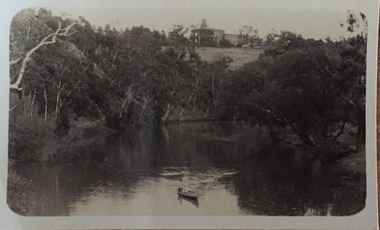
Photograph - Zig-zag Bridge on the Yarra River at Kew, Henry Beater Christian, 1920-28
... history — — photographs yarra river -- studley park -- kew (vic ...Henry Christian (c.1809-91), the grandfather of the photographer, was one of the first settlers in Kew. He arrived in Victoria with his wife Agnes and son Orlando in 1855 on the Gypsy Queen. He established a rope-making business in Bulleen Road by 1858 but was declared insolvent two years later. In his final years, he was celebrated as one of the oldest living settlers of the district. His son, Orlando Henry Beater Christian (c.1853-1930) became a member of the Hawthorn Band and a foundation member of the Willsmere Swimming Club. Orlando and his wife Elizabeth had four children of which Henry Beater Christian (1886-1962) was the eldest.Small black and white photograph of the Yarra River at Studley Park. In the middle ground, a man is paddling a canoe upstream. On the horizon, the tower and buildings of Raheen in Studley Park Road can be seen.henry christian (1886-1962), landscape photography, kew canoe club history — — photographs, yarra river -- studley park -- kew (vic.), christian-washfold collection -
 Mrs Aeneas Gunn Memorial Library
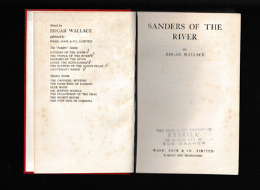
Book, Edgar Wallace, Sanders of the river, 1945
Charged with the task of engaging with the indigenous peoples of Nigeria during the colonial period, Sanders takes a no-nonsense approach that, though it may offend the sensibilities of current-day readers, is unquestionably effective. Offering readers an action-packed glimpse into a period of history that is often overlooked. Sanders of the River should be on the must-read list of every action-adventure junkie.p.190.fictionCharged with the task of engaging with the indigenous peoples of Nigeria during the colonial period, Sanders takes a no-nonsense approach that, though it may offend the sensibilities of current-day readers, is unquestionably effective. Offering readers an action-packed glimpse into a period of history that is often overlooked. Sanders of the River should be on the must-read list of every action-adventure junkie. england - fiction, african fiction -
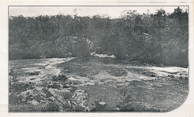
![Photograph (sub-item) - Black and White, The Wonga Park ‘swimming pool’ in the Yarra River, 1940’s – now in Jumping Creek Reserve (1985) [This may be the swimming pool in Jumping Creek Reserve or may be the swimming pool in Clifford Park in use in the 1948-9 Pan-Pacific Jamboree]](/media/collectors/5c7716e021ea6a1a60039fee/items/631b95b3d61f455ba20ef2cb/item-media/631b961fd61f455ba20ef417/item-fit-380x285.jpg) Wonga Park Community Cottage History Group
Wonga Park Community Cottage History GroupPhotograph (sub-item) - Black and White, The Wonga Park ‘swimming pool’ in the Yarra River, 1940’s – now in Jumping Creek Reserve (1985) [This may be the swimming pool in Jumping Creek Reserve or may be the swimming pool in Clifford Park in use in the 1948-9 Pan-Pacific Jamboree]
THE ROSE SERIES P. 922 SWIMMING POOL, RIVER YARRA, WONGA PARK, VIC. -
 Wonga Park Community Cottage History Group
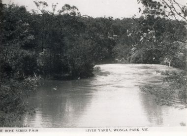
Photograph (sub-item) - Black and White, Viewing the camp from across the river at the 1948 Jamboree
THE ROSE SERIES P. 919 RIVER YARRA, WONGA PARK -
 Wonga Park Community Cottage History Group
Photograph (sub-item) - Black and White, ‘Horseshoe Bend’ on the Yarra River at Wonga Park, in 1929
-
 Wonga Park Community Cottage History Group
Photograph (sub-item) - Black and White, Looking across Yarra River from ‘Yarra Brae’, 1940
-
 Wonga Park Community Cottage History Group
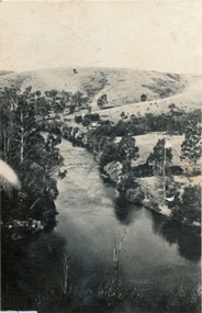
Photograph (sub-item) - Black and White, A view of the Yarra River from Wonga Park in 1929. [Mt Lofty in background, house is Mr. Witton’s ‘Crooning Waters’ at the confluence of Brushy Creek and Yarra River and what was to become Witton’s Reserve to the right
-
 Wonga Park Community Cottage History Group
Photograph (sub-item) - Black and White, The junction of the Yarra River with Watson’s Creek, on ‘Yarra Brae’ northern boundary in 1940
ROSE SERIES P. CROSSROADS, WONGA PARK, VIC. -
 Wonga Park Community Cottage History Group
Photograph (Item) - Black and White, Wonga Park: A view of the Yarra River
Wonga Park: A view of the Yarra RiverPhoto is named 14880031.jpg on CD -
 Wonga Park Community Cottage History Group
Photograph (Item) - Black and White, Wonga Park: Yarra River with Crooning Waters house and Mt Lofty
Wonga Park: A view of the Yarra River with Crooning Waters house and Mt LoftyPhoto is named 14880031.jpg on CD -
 Wonga Park Community Cottage History Group
Work on paper (Item) - Report, Undated Review of Statement of Planning Policy Nos. 3 & 4 Dandenong Ranges and River Yarra: Supplementary Report on the Policy Areas
-
 Wonga Park Community Cottage History Group
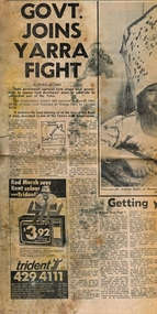
Newspaper (Item) - Cutting, Wonga Park: Herald newspaper cutting 16/9/1972 Govt Joins Yarra Fight
State Government agencies have joined local government to oppose lan developers' plans to subdivide an untouched pat of the Yarra. The subdivision involves 565 hectares (Yarra Brae and Stane Brae) and more than 16 kms of bush river frontage at Wonga Park in Lillydale Shire -
 Wonga Park Community Cottage History Group
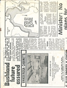
Work on paper - Newspaper cutting, Wonga Park: 17 Nov 1981 Lillydale and Yarra Valley Express: "Bushland future assured" re Acquisition of Yarra River frontage for State Park
-
Canterbury History Group
Book, Richard Broome, Remembering Melbourne 1850-1960, 2016
A book of over 700 black and white illustrations and photographs of early Melbourne scenes, mainly buildings, which have been demolished or significantly changed. The first half of the book concentrates on the CBD but includes public gardens and the Yarra River. The second half of the book looks at a number of the inner suburbs including Footscray.Large red covered book with black and white dust cover featuring panoramic view of Princes Bridge looking North. 366 pages : photographs, 1 map, portraits. Includes bibliographical references and indexnon-fictionA book of over 700 black and white illustrations and photographs of early Melbourne scenes, mainly buildings, which have been demolished or significantly changed. The first half of the book concentrates on the CBD but includes public gardens and the Yarra River. The second half of the book looks at a number of the inner suburbs including Footscray.historical buildings - melbourne, melbourne - history, canterbury - history -
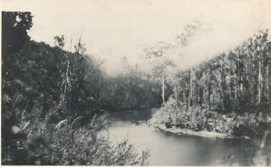
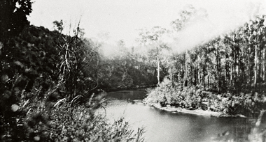
![Photograph (sub-item) - Black and White, A view up the Yarra River from Wonga Park in the 1940’s. [Scouts on Mount Lofty looking upstream] ??](/media/collectors/5c7716e021ea6a1a60039fee/items/63185440823216272c277dad/item-media/63185498823216272c2785f4/item-fit-380x285.jpg) Wonga Park Community Cottage History Group
Wonga Park Community Cottage History GroupPhotograph (sub-item) - Black and White, A view up the Yarra River from Wonga Park in the 1940’s. [Scouts on Mount Lofty looking upstream] ??
-
University of Melbourne, Burnley Campus Archives
Newspaper - Newspaper Cutting, Progress Leader, Standing on Sacred Ground, 2001
... . Article describing early history of the lower Yarra River... Dunckley. Article describing early history of the lower Yarra River ...Article in "Progress Leader" 13.08.2001 by Mathew Dunckley. Article describing early history of the lower Yarra River, Richmond Park and Burnley Horticultural College.progress leader, mathew dunckley, yarra river, richmond park, burnley horticultural college, history, the yarra trail guide, corroboree tree -
 Eltham District Historical Society Inc
Book, Jenny Brown et al, Out of the Mist; Osborne Peninsula, 2024
The Osborne Peninsula on the Yarra River at Warrandyte accommodates a limited number of properties and residents (70 households). The area is rich in geology and ecology, and an unusually rich endowment of human, built and creative history. Contents: Welcome: The landform: The River: Aboriginal occupation: The Miners: North Warrandyte :The Subdivision: The Lowes: The Osbornes: The Last Osborne: The Elders: The Relics: Dray Track: Water Wheel"Kauri Plaque: River track: Pines: Windmill Creek Bridge: The Koornong School: The Houses" Man Cave: MidCentury Classic: Enduring Original" Masterwork: The Muddies: The State Park: The Saving of Koornong Reserve: The Landcare Story: Flora and Fauna: The Vulnerable, Endangered and threatened: Birds: Mammals: "Waring" the wombat: Reptiles: Fish: Invertebrates: Flora: Fire. Published by the North Warrandyte (Osborne Peninsula) Landcare Group. Includes photos from EDHS collection.64 p. : ill., map ; 29.7 x 21 cm. (2 copies)yarra river, birrarung, dray track, fauna, geology, houses, indigenous history, koornong reserve, koornong school, lowe family, mining, mudbrick houses, north warrandyte, osborne family, warrandyte state park, water wheel, north warrandyte (osborne peninsula) landcare group, osborne peninsula -
 Whitehorse Historical Society Inc.
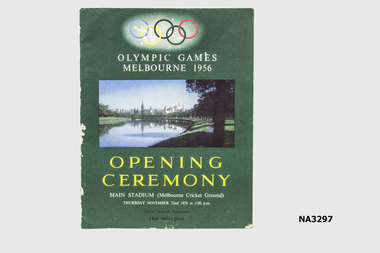
Programme - Programme - Opening Ceremony 1956 Olympic Games, c1956
Used at Opening Ceremony by Edward Arrowsmith, 1956Green coloured programme. Five Olympic Rings in blue, yellow, black, green and red. Photograph of Melbourne including Yarra River. Thirty-one pages including history of Olympic movement.'Opening Ceremony. Main Stadium (MCG) Thursday November 22nd 1956 at 3 p.m. Official Souvenir Programme. Two shillings. Olympic Gamesdocuments, programmes -
 Eltham District Historical Society Inc
Negative - Photograph, Possibly the Bassett-Smith property at Menzies Road, Kangaroo Ground, c.1980
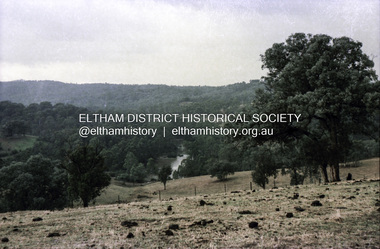
Record of the Society's history of activities - The Society members would have picnics on the Bassett-Smith propertyRoll of 35mm colour negative film, 4 stripsKodacolor IIshire of eltham historical society, activities, kangaroo ground, bassett-smith, film - kodacolor ii, scan - 35mm negative, yarra river -
 Eltham District Historical Society Inc
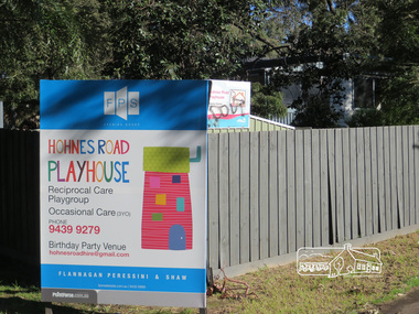
Photograph, Liz Pidgeon, Hohnes Road Playhouse, 1 July 2017
Photo taken as part of an EDHS Heritage Excursion - Saturday 1st July - Eltham Lower Park - Walk and Talk. "Eltham Lower Park has played an important part in the history of our area since the early days of European settlement when it was used by local residents as an informal racecourse. Prior to that its location at the junction of the Diamond Creek and the Yarra River made it an important meeting place for the Wurundjeri people. The park combines formal elements and sporting facilities with remnant bushland that is of environmental significance. It is home to sporting and horse riding clubs, popular play spaces and the Diamond Valley Miniature Railway, which attracts large numbers of visitors.The park will be the venue for our July excursion which will comprise a walk of about 3.5 km around the park and adjacent areas. Along the way we will discuss the history and natural history of the area. The path along the creek and the river provides a pleasant and scenic walk.This walk on Saturday 1st July is about 3.5 km in length and will take 2 to 2.5 hours. It will start at 2pm at the Main Road car park at the front of the park. (Melway ref 21 H 10)". Newsletter No., 234, June 2017 Born Digitalheritage excursion, activities, eltham district historical society, eltham lower park, sign, hohnes road playhouse -
 Eltham District Historical Society Inc
Photograph - Digital Photograph, Alan King, Downing-Le Gallienne house, Yarra Braes Road, Eltham, 30 January 2008
The property is a classic example of what made Eltham famous from the late 1940s to the 1960s. Covered under Heritage Overlay, Nillumbik Planning Scheme. Published: Nillumbik Now and Then / Marguerite Marshall 2008; photographs Alan King with Marguerite Marshall.; p149 The first view of the large double-storey house at Yarra Braes Road, Eltham South, is of a jutting roofline over a balcony, reminiscent of a large sailing vessel or galleon – very appropriate, considering the name of one of the first owners, Le Gallienne. The Downing-Le Gallienne property is a classic example of what made Eltham famous from the late 1940s to the 1960s and attracted so many artists and intellectuals to the area. Set in a largely indigenous bush-style garden, the mud-brick and timber house was built by Alistair Knox. It was built for economist Richard Downing, to become a founder of the welfare state in Australia and Chairman of the Australian Broadcasting Commission, and musician and composer Dorian Le Gallienne. Le Gallienne was a pioneering composer of modern music in Victoria before 1945, whose works included the Symphony in E.1 He wrote several pieces of film music for Eltham Films, including The Prize, working with its writer and artistic director Tim Burstall. Le Gallienne was also a music critic for The Argus and later for The Age. In 1967 the music critic Roger Covell argued that Le Gallienne’s Symphony, was ‘still the most accomplished and purposive . . . written by an Australian’. According to Alan Marshall the main inspiration behind the building that evolved from 1948 to 1964 was Le Gallienne. ‘He was able to see value in the simplest things and many who worked there had their eyes opened for the first time to the Eltham environment, to the bush and the trees and the fauna which lived there.’ The garden included no formality, no lawns, nor exotic plants. ‘Natural informal growth came right up to their doors and so did the indigenous birdlife.’ This informal style – consisting of mass and void – was to be developed and popularised by landscaper Gordon Ford from the 1950s. The large mud-brick and timber house, which was built in four stages and has three separate but linked sections, began as a small weekend retreat for the couple. In 1948, Downing and Le Gallienne (Dick and Dor to their friends), asked Knox to build the 36 x18 foot (11mx5.4m) building with a pitched slate roof. It was built on a concrete slab and included a fireplace, which is still in use. The second wing was built in 1954 after Downing had returned from working at the International Labour Office and the couple decided to live there full-time. The third section was built after the death of Le Gallienne in 1963, aged 48. He is buried in the Eltham Cemetery. When Downing married widow, Jean Norman (nee McGregor) and had to accommodate a large family, including her six children and one of their own, the last stage was built by 1964. At that time the house was considered one of the largest mud-brick houses in Victoria. It consists of five living areas, including a small ballroom. Several artists helped Knox build the Downing-Le Gallienne house, which was one of his first of mud-brick. They included painter Clifton Pugh, artist John Howley and actor Wynn Roberts. Ellis Stones had landscaped the first wing and Gordon Ford set the boulder steps and made a pool as part of the landscaping he completed. Inside, the mud-bricks are largely whitewashed with pine-lined ceilings and Oregon beams. A winding timber staircase in the front extends behind a glass window from the ground floor to the top. The property, of a little more than 0.5 ha, is bordered by Parks Victoria land, which extends to the Yarra River.This collection of almost 130 photos about places and people within the Shire of Nillumbik, an urban and rural municipality in Melbourne's north, contributes to an understanding of the history of the Shire. Published in 2008 immediately prior to the Black Saturday bushfires of February 7, 2009, it documents sites that were impacted, and in some cases destroyed by the fires. It includes photographs taken especially for the publication, creating a unique time capsule representing the Shire in the early 21st century. It remains the most recent comprehenesive publication devoted to the Shire's history connecting local residents to the past. nillumbik now and then (marshall-king) collection, dorian le gallienne, downing-le gallienne house, eltham, mudbrick construction, mudbrick houses, richard downing, yarra braes road -
 Melbourne Tram Museum
Pamphlet, Yarra Trams, "Essendon Depot Centenary", 2006
Double sided A4 sheet, on plain paper, printed in colour, titled "Essendon Depot Centenary", looking at the history of the Essendon tram depot, its opening, depot staff and wages, routes and the depot today - 2004. Has the Yarra Trams logotrams, tramways, essendon depot, centenary, yarra trams, saltwater river, 100 years of electric trams -
 Melbourne Tram Museum
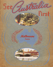
Book, Murray Views, "See Australia First - Melbourne Victoria", c1950
Book - 16 pages, including grey card covers, titled "See Australia First - Melbourne Victoria" featuring 12 pages of postcard photographs of Melbourne. Inside rear cover has a details of Melbourne's history, the city and its features. Produced by Murray Views of Gympie Qld, printed by Samuel Lee and Co. Images post second world war - late 1940's to early 1950's. Features images of: Alexandra Gardens River Yarra and Princes Bridge Flinders St Station St Kilda Road - tram track work being undertaken Flinders St and the Forum theatre The Exhibition Buildings Collins St Parliament House Bourke St - with cable tram tracks and the Metropole Hotel, Myer, Foys Aerial view of Melbourne Captains Cook's Cottage St Kilda Road with W2 287 Burns Memorial St Kilda Road St Paul's and Princes Bridge Town Hall Royal Melbourne Hospital Collins St with W2 turning Queen Victoria Gardenstrams, tramways, melbourne, flinders st station, collins st, town hall, princes bridge, st kilda rd -
 Melbourne Tram Museum
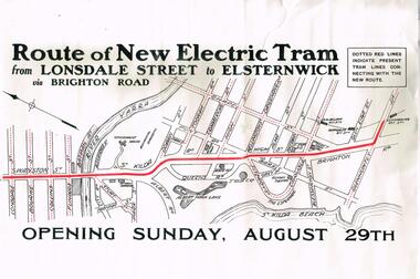
Poster, Melbourne & Metropolitan Tramways Board (MMTB), "Route of New Electric Tram from Lonsdale Street to Elsternwick via Brighton Road - Opening Sunday August 29th", Original 1926
Poster - special size, titled "Route of New Electric Tram from Lonsdale Street to Elsternwick via Brighton Road - Opening Sunday August 29th". Shows the tram rote in red and other tram lines dotted, including the Yarra River. Given its condition - a reproduction poster. From the Don Storey tram history notes - 1926 - 29 August - "he Elsternwick - St Kilda Junction line was opened, replacing the Brighton Road cable line together with an extension to Glenhuntly Road, and was built as double track." .1 - Laminated A3 version - added 30/6/2021trams, tramways, st kilda rd, brighton rd, lonsdale st, new tramway, conversion, elsternwick