Showing 10531 items
matching land
-
 Bendigo Historical Society Inc.
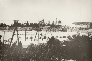
Photograph - CENTRAL BLUE MINE, 1912
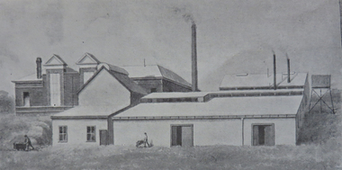
Black and white photo: mine site with poppet head, mine buildings at rear right . Trestles and cables carrying rectangular bins across open land. Large mound of material behind main building. Trees and weatherboard building in foreground. On back written in ball point pen and underlined ' flying Fox' Central Blue Mine to Crushing Battery 1912 'mine, gold, central blue, bendigo, mines and mining, surface equipment, place, mining, surface equipment, flying fox, poppet head -
 Bendigo Historical Society Inc.
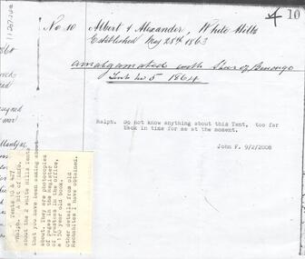
Document - INDEPENDENT ORDER OF RECHABITES COLLECTION: DOCUMENTS, 1863-1911
Documents. No. 10 Albert & Alexander, White Hills, Established May 28th 1863. Amalgated with Star of Bendigo, Tent No. 5 1864. Pride of the Hills White hills established July 6th 1906, registered March 9th, 1908. George Dower, John Brown, Fred P. Morris. The Rechabite, July 8th , 1911. Temperance Halls on Crown land. -
 Bendigo Historical Society Inc.
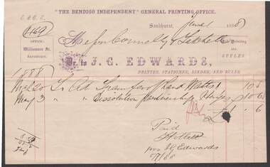
Document - CONNELLY, TATCHELL, DUNLOP COLLECTION: INVOICE J.G.EDWARDS, THE BENDIGO INDEPENDENT
Invoice to Connelly, Tatchell & Dunlop from 'The Bendigo Independent' General printing office, William St., Sandhurst. Written underneath main heading is 'Dr. to J.G. Edwards, Printer, Stationer, Binder and Ruler. Invoice for transfer of land Watts and dissolution partnership Hayes. 1/-/6. Receipted as paid by F. Hollett (?) per J.G. Edwards, 5/7/88business, legal, bendigo independent, connelly, tatchell & dunlop, j.g. edwards, bendigo independent -
 Port Melbourne Historical & Preservation Society
Photograph - Savings Bank and Riall Bros Printers, Bay Street, Port Melbourne, c. 1900
COPYRIGHT PUBLIC RECORDS OFFICE Digital image of black and white photo of the "Savings Bank" (later State Savings bank of Victoria) and Riall Bros Printers in Bay St. Approx date 1900. The Port Melbourne branch of the Savings Bank opened on 1 March 1886 in leasehold premises. Land was purchased in 1890 and a new building was erected in 1891.built environment - commercial, state savings bank of victoria, bay street, business and traders - printers, riall brothers pty ltd -
 National Vietnam Veterans Museum (NVVM)
Model, L5 105mm Pack Howitzer
Italian designed Light weight artillery gun able to be used in normal artillery or anti-tank role. Range of 10,000 metres, eight rounds per minute maximum or 3-4 sustained. Crew of seven easily towed by jeep or land rover, lifted by a Chinook helicopter. Easily assembled and disassembled into twelve parts, replaced by M101A1Howitzer in 1967l5 105mm pack howitzer, artillery gun, model -
Bendigo Historical Society Inc.
Document - LAND AND SURVEY CIRCULARS 1876 - 1883, 1876 - 1883
Document: land and survey circulars - brown paper covered journal tied with string along spine. On front cover top LH corner '04A' Stuck to front cover is blue foolscap handwritten letter from Office of Lands and Survey ( Occupation Branch) Melbourne 15th. March 1876. Journal contains copies of letters signed by District Surveyor, Sandhurst.Office of Lands and Surveyorganization, lands and survey, bendigo, bendigo, sandhurst, land sales, land surveys, office of lands and survey -
 Bendigo Historical Society Inc.
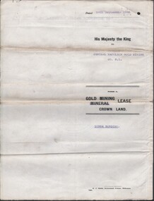
Document - MCCOLL, RANKIN AND STANISTREET COLLECTION COLLECTION: CENTRAL NAPOLEON GOLD MINING CO. N.L, 26th September 1938
Document: Gold Mining Lease Crown Land No. 10964 Bendigo, Entered in the register books, Vol. 322 Fol. 33571, Embossed seals of Central Napoleon and King George VI, Map: Mining District of Bendigo, County of Bendigo, Parish of Sandhurst, located at Harvey and Inglis Streets, During the reign of King George VI (Originally marked Edward VIII).organization, business, industry - mining, mccoll rankin & stanistreet, mining, gold mining, central napoleoon -
Whitehorse Historical Society Inc.
Letter - Correspondence, Office of Lands and Survey, 1861
Copy of letter written by W. Fletcher, Office of Lands and Survey, Melbourne, 2 Nov 1861.Copy of letter written by W. Fletcher, Office of Lands and Survey, Melbourne, 2 Nov 1861. Reporting that charcoal burners in the Parish of Nunawading are using wood for that purpose without a license and suggesting the policeman at Whitehorse by informed. Attached note suggests author is possibly Walter Thomas Fletcher, early owner of land that included what is now Matheson's orchard (1988).Copy of letter written by W. Fletcher, Office of Lands and Survey, Melbourne, 2 Nov 1861.charcoal burning, fletcher, w, forest hill, parish of nunawading -
 Whitehorse Historical Society Inc.
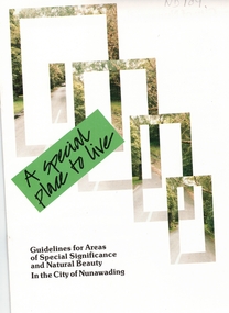
Pamphlet, A Special place to live, 1985 (addendum 1988)
A publication of the City of NunawadingA publication of the City of Nunawading explaining the regulations applying to the Special Residential (Nunawading) Zone No 5. The regulations cover proportions of land which may be built on and identifies trees which must be preserved. An addendum issued in 1988 includes a map of the area and identifies National Trust classified streets in Blackburn and the buffer areas in which less stringent regulations apply.A publication of the City of Nunawadingcity of nunawading, national trust of australia (victoria), special residential (nunawading) zone no. 5, jeffery street, blackburn, laurel grove, linum street, boongarry avenue, hill street, land use, by-laws, town planning, acacia avenue, waratah crescent -
 Whitehorse Historical Society Inc.
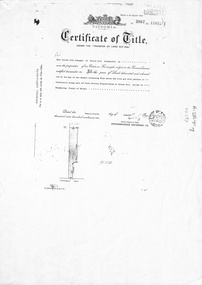
Document, Forest Hill, 24/08/1932
Photocopy of Certificate of TitlePhotocopy of Certificate of Title Vol 5807 Fol 1161261 to Carl Julius Otto Draeger for four acres of land being part of Crown Portion 93 at Forest Hill; with verso of C/T Vol 1900 Fol 37984 recording transfers to Lydia Esther Lovell, Lillian Sarah Frances Lovell, William John and Mabel Jessie Brown.Photocopy of Certificate of Title draeger, carl julius otto, canterbury road, forest hill, glen valley road, lovell, lydia esther, lillian sarah frances, brown, william john, mabel jessie -
 Whitehorse Historical Society Inc.
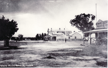
Photograph, North Corner of Whitehorse & Mitcham Road, Mitcham, c1920's
Black and white photo of the northern cnr Whitehorse and Mitcham Roads, Mitcham, showing Hughs Produce Store, with his white horse and delivery waggon outside. This was later the site of Mirama Court, later to be refurbished as shops and offices.|The vacant land on the far corner became a grocers shop and later the Westpac Bank. It is currently (2005) a computer sales shop.hughes produce store, mitcham road, mitcham, whitehorse road mitcham, mirama court mitcham, westpac bank -
 Southern Sherbrooke Historical Society Inc.
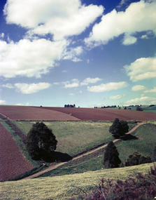
Photograph - Farmland, Menzies Creek
Three colour photographs taken from the Belgrave-Gembrook Rd looking north, towards Ridge Rd over farmland at Menzies Creek. Land in the foreground belongs to Sam Frazzetto. Photos dated 1958 and copied from the National Archives of Australia.The fourth photo (from 14th August 2019) is taken by Will Ashburner from the Daffodil Farm as a comparison. -
 Bendigo Historical Society Inc.
Document - IAN DYETT COLLECTION: AUCTION CATALOGUE - HARCOURT CO-OPERATIVE LIMITED
Red covered auction catalogue with black printing for a sale held on the 20th March 1975 at the Harcourt Co-operative Limited. For sale was extensive hardware stocks, workshop & general plant, timber and motor vehicles. Also approx. 2 1/2 acres Freehold Land and some buildings. J. H. Curnow & Son Pty Ltd. were the auctioneers.business, auctioneers, j h curnow & son pty ltd, ian dyett collection - auction catalogue - harcourt co-operative limited, geoff o harrison hall & rose, j h curnow & son pty ltd, f c dyett, c hill, i m dyett, bolton bros print -
 Bendigo Historical Society Inc.
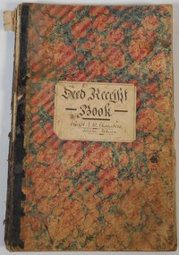
Document - Deed Receipt Book Ernest J. W. Chambers, Solicitor, Echuca, 1885 - 1891
Deed Receipt Book Ernest J. W. Chambers, Solicitor, Echuca. The ledger is ruled into the following columns: 1. Number 2. Date of Deed 3. Name of Client 4. Description of Deed and Land 5. Names of Parties 6. Date of Receipt 7. Signatures and Comments Memos, Comments and notes are either pinned, pasted or taped throughout the book. history, echuca, ernest chambers, j.w.chambers -
 Bendigo Historical Society Inc.
Document - FORTUNA COLLECTION: DOCUMENT
Document - titled : Preliminary Results 'Geographic Information: A Survey of the Department of Defence' Additional written information on title page reads: 'by P. Thwaites at The Deparment of Surveying and Land Information University of Melbourne. Sponsored by: Deparment of Defence (through the Post Graduate Study Award Scheme, Date: June 1988. ' Document is 17 single pages in length including a Contents page. -
 Kew Historical Society Inc
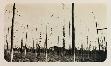
Photograph - Yarra at Kew, 1925
Henry Beater Christian (1886-1962) , was a descendant of one of the earliest settler families in Kew. Employed at the Kew Asylum as a 'public servant', he was a skilled amateur photographer, photographing numerous scenes in Kew and on his travels around Victoria. The majority of his photographs date from 1916 to 1929. His finest photographs are housed in two photograph albums. Digital copy of a photograph from page 4 of the 47-page photograph album containing 261 gelatinous silver images, loaned by Diane Washfold with permission given to digitise and hold a copy in our collection. This photograph of hop farming coveys the various uses for which low lying fertile flood prone land beside the Yarra River was used."Yarra at Kew"henry beater christian (1886-1962), landscape photography, kew (vic.) — yarra river, christian-washfold collection, photograph albums, agriculture, hop farms -
 Surrey Hills Historical Society Collection
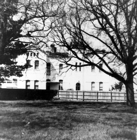
Photograph, Nethercourt Private Hospital in Union Road Surrey Hills, 1976
The 3 front blocks facing Union Road were subdivided off in circa 1967, so this building now faces Barton Street. Since 1984 it has been a private residence. It was originally built in c1890 and from 1896 it was used as facilities for Surrey College, a private boys' boarding school. Dr F Darling was Principal. From 1935-1960s it became Nethercourt Private Hospital. This had previously operated from 1921 in Wilson Street. Later it was known as St Jude's Hospital; this closed in 1983.Black and white photo of Nethercourt Private Hospital taken from Union Road. It shows a 3 storey brick rendered building painted in a light colour. It is fronted by a paling fence and with a vacant area in the foreground, on which there is a bare-leafed mature tree to the right and an evergreen tree to the left. The fence appears to be new suggesting that the photo was taken at the time of subdivision of the land.The original has the following inscriptions: Top: In black biro "D Hall our collection / hall / family" in Jocelyn Hall's writing. Below in lead pencil "Old entrance of / St Judes" - unknown hand; presumed to be Duncan Hall's. In black biro in Jocelyn Hall's hand: "Taken c. 1976." nethercourt private hospital, the surrey college, norwich hall, st judes hospital, barton street, medical services, education, dr f darling -
University of Melbourne, Burnley Campus Archives
Plan - Photocopy, Keilor Planning Scheme, 1993
Photocopies. 18.02.1993. (1) 5 copies Map user guide - Keilor Planning Scheme, List of Zones Reservations and additional Planning Controls. (2) Keilor Planning Scheme - Local Section. Zones and Reserved Land Map No. 7. (3) Map No 9. Also 3 photocopies of maps joined together. Used in planning Native Garden Woodland Section.keilor, native garden, reservations -
 Melbourne Tram Museum
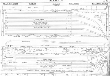
Drawing, Melbourne & Metropolitan Tramways Board (MMTB), "Malvern Depot", c1938
Set of three photocopied plans or drawings on A3 sheets of "Malvern Depot" - 15-3-1937 .1 - P7873 - Plan showing details of car sheds .2 - P7894 - Plan of Land showing overall site plan .3 - P8342 - showing details of buildings, including offices, Club Rooms in Stanhope St, No. 28 Stanhope St and sub-station.trams, tramways, drawings, depots, property, substation, malvern depot -
 Melbourne Tram Museum
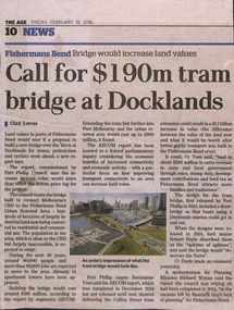
Newspaper, The Age, "Call for $190m tram bridge at Docklands", 19/02/2016 12:00:00 AM
Newspaper clipping from The Age, 19/2/2016, written by Clay Lucas, titled "Call for $190m tram bridge at Docklands", about a report by Port Phillip Council, recommending a lifting bridge over the Yarra. Refers to a AECOMM report, increase in land values. The line would serve the Fisherman's bend area. Quotes the Councillor Mayor, Cr Vosstrams, tramways, bridges, docklands, fishermen's bend -
 Bendigo Historical Society Inc.
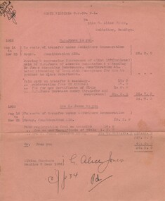
Document - MISS G ALICE JONES COLLECTION: ACCOUNT
North Virginia G. M. Co. N. L. to Miss G. Alice Jones. Pink paper dated Aug 14 to Nov 25, 1933, and 8 Dec 1933. H. E. Jones to you. Details of expenses for transfer of land. Total cost £8.5.9. "R583 delivered 11/12/33" written in the top left corner.miss g alice jones - solicitor - account, north virginia g m co n l, h e jones, cullens, mrs c jones -
 Federation University Historical Collection
Booklet - Booklet - Prospectus, Bairnsdale District School of Mines, Prospectus, 1904, 1904
Higher education in east Gippsland dates back to 1890, and the opening of the Bairnsdale District School of Mines, In 1986 the Bairnsdale School of Mines and the Sale and Bairnsdale Technical schools amalgamated to form the East Gippsland Community College of TAFE. In 1995 it became the East Gippsland Institute of Technology, and in 2011 changed its name to Advance TAFE. The Bairnsdale District School of Mines Prospectus includes the members of council, a photographic image of the school, teaching staff, rules relating to students and instructors, Constitution, and a prospectus of subjects including Mining and Science Subjects, Diploma Courses, Preliminary Training, Metallurgy Course, Mining Engineering Course, Battery Manager's Certificate, Assayer's Certificate. It also includes a scale of fees, information on the Metallurgical Plant, Chemistry, Assaying and Metallurgy, Geology, Mining Geology, Mining, Petrology, Dynamics and Heat, Magnetism & Electricity, Mechanics Applied to Mining, Land Surveying, Mine Surveying, Algebra, Euclid, Trigonometry, Mechanical Drawing, Practical Plane Geometry, Practical Solid Geometry, Engineering Drawing, Art Subjects, and a list of certificates issued by the school since 1892.Grey soft covered book of 68 pages. The Bairsndale District School of Mines Prospectus includes the members of council, an photographic image of the school, teaching staff, rules relating to students and instructors, Constitution, and a prospectus of subjects including Mining and Science Subjects, Diploma Courses, Preliminary Training, Metallurgy Course, Mining Engineering Course, Battery Manager's Certificate, Assayer's Certificate. It also includes a scale of fees, information on the Metallurgical Plant and its chares, Chemistry, Assaying and Metallurgy, Geology, Mining Geology, Mining, Petrology, Dynamics and Heat, Magnetism & Electricity, Mechanics Applied to Mining, Land Surveying, Mine Surveying, Algebra, Euclid, Trigonometry, Mechanical Drawing, Practical Plane Geometry, Practical Solid Geometry, Engineering Drawing, Art Subjects, and a list of certificates issued by the school since 1892.bairnsdale district school of mines, bairnsdale, school of mines, donald clark, francis w. sewell, j.v.r. anderson, a.d. pleydell, walter seehusen, director, mining engineering, metallurgy, academy of arts, municipal surveyor, 1914 -
 Greensborough Historical Society
Photograph - Digital Image, Happy Hollow plaque, 05/02/1840o
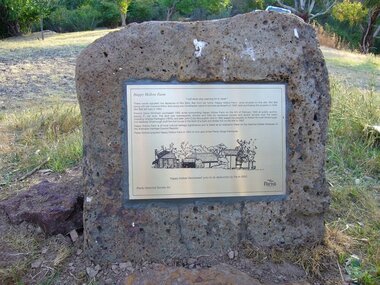
The land surrounding Happy Hollow farm at Plenty was purchased by Francis Wickham in 1840. The land was later subdivided and held by various owners including Charles Partington (1875) and John McLaughlin who leased the property in 1892 to Robert Emmett Whatmough who erected the first dwelling on the property. The land was later owned by Mrs Betty Bell and was purchased by Parks Victoria in 1994 to form part of the Plenty Gorge Parklands. This plaque was laid by Plenty Historical Society.Happy Hollow was an example of early settlement along the Plenty River.Digital copy of colour photograph. Plaque at Plenty Gorge Parklands.plenty river, happy hollow, happy hollow farm, robert emmett whatmough, betty bell, john mclaughlin, charles partington, parks victoria -
Glenelg Shire Council Cultural Collection
Souvenir - Souvenir glasses - St. George Anglican Church, Dartmoor, c. 1985
The former St George Anglican Church, Dartmoor property is now privately owned. The first church building was constructed in 1864. The present building was erected in 1885 on private land. In 1952 the new owner, Mr James McIntyre donated the land to the Diocese of Ballarat.Set of 4 sherry or port glasses, celebrating the centenary of St. George Anglican Church, Dartmoor. 1885 - 1985. Gold rim and printing and image of church.church, place of worship, st george anglican church, dartmoor, souvenir -
 Warrnambool and District Historical Society Inc.
Subdivision plan, Part of Preston Estate Parish of Wappan
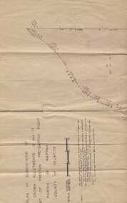
This map possibly relates to land of John Bostock at Preston, Delatite. Part of a collection of papers relating to the Bostock family one of the earliest pioneering families in Warrnambool.Cream coloured map printed in black with sections coloured in pink. Plan of subdivision of part of crown allotments 15 and 17 and part of Preston pre- emptive right, Parish of Wappan, County of Delatite.warrnambool,bostock,augustus bostock map, delatite map,district of wappan map, -
 Bendigo Military Museum
Programme - MENU, WATER TRANSPORT UNIT, DISBANDMENT DINNER, Melbourne Water Transport Unit, 1981
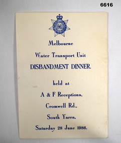
Melbourne Water Transport Unit carried supplies by land and sea.Single sheet of cardboard, off white, folded once. Printing is in blue ink. Front cover, RAACT badge, titled "Melbourne Water Transport Unit, Disbandment Dinner" plus "Held at A & F Receptions, Cromwell Rd, South Yarra - Saturday 28 June 1986". Inside are faint pictures of L.A.R.C.S. Printing of toasts, guests and menu is in red ink. Includes after dinner mints! Dining President WO2 R. Brown CSM.water transport, larcs, passchendaele barracks trust -
 Greensborough Historical Society
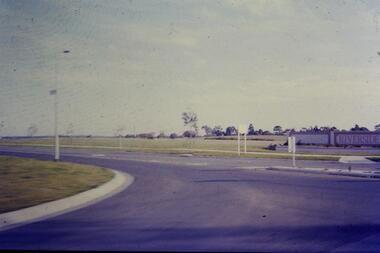
Slide - Photograph, John Ramsdale, Riverside: Slide 1, 1990s
Photograph shows a new land subdivision, with the name "Riverside" on a wall.Part of the John Ramsdale collection of slides and audio visual material.Colour photograph scanned from slide.No maker's marks or captions -
 Federation University Historical Collection
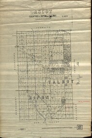
Plan - map, Ascot: Counties of Ripon and Talbot, 18/12/1920
Cadastral map showing parish boundaries and land ownership. "L5270"Maps parishes located in Ascot area. Photo-Lithographed at the Dept. of Lands and Survey.Highlighted parish labelled, Mrs E.C.Sutherland.parish, map, ascot, counties, e. c. sutherland, a. cameron, sweeney, w. j. clarke, mount hollowback, tourello, burrumbeet, glendaruel, dowling forest, a. j. mullett, w. j. butson, 1920, william coghill, chatham, chatham family collection, mrs e.c.sutherland. -
 Port Melbourne Historical & Preservation Society
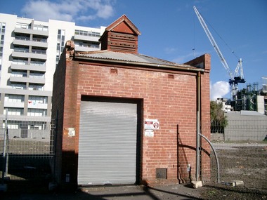
Photograph - Electrical sub-ststaion on block cleared for Muir development, Bay Street, Port Melbourne, Glen Stuart, Jun 2005
On land cleared for proposed "Muir" development not continued.at this point in 20052 colour photos of CitiPower sub-station left standing in block cleared for redevelopment on Bay Street.built environment - commercial, muir, sub-station -
 Ballarat Heritage Services
Photograph - Photograph - Colour, Clare Gervasoni, Hamburg Port, Germany, 2001, 27/08/2001
Many immigrants left for their new land from Hamburg, GermanyWaterside buildings at the Port at Hamburg, Germanyhamburg, germany, immigration, emigrations, port, german