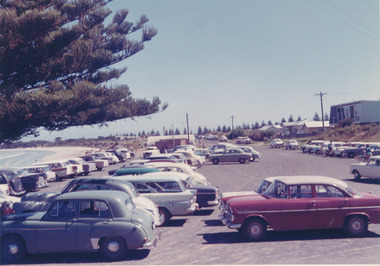
Showing 1504 items matching " car parks"
-
 Ringwood and District Historical Society
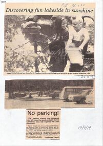
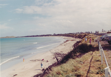
Newspaper, Various newspaper articles about car parks, children's tiles and improvements to Ringwood Lake 1955 - April 1990
... Various newspaper articles about car parks, children's tiles and improvements to Ringwood Lake 1955 - April 1990. ...Various newspaper articles about car parks, children's tiles and improvements to Ringwood Lake 1955 - April 1990. ...Various newspaper articles about car parks, children's tiles and improvements to Ringwood Lake 1955 - April 1990. ...Various newspaper articles about car parks, children's tiles and improvements to Ringwood Lake 1955 - April 1990. -
 Surrey Hills Historical Society Collection
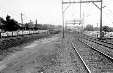
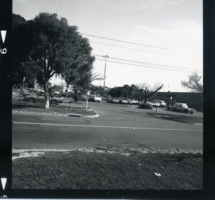
Photograph, Surrey Hills Station and car park
... Surrey Hills Station and car park......car parks...According to Roderick Smith, a local railway enthusiast, originally there had been 3 railway houses at the Mont Albert end of the northern car park. These were demolished to extend the car park. ...A palm tree is prominent in the station car park to the north....A palm tree is prominent in the station car park to the north. Surrey Hills Station and car park Photograph Photograph ...There are 3 tracks; the third track was built in 1971, which gives an approximate date for the photo. At this time the original station buildings were demolished and replaced by buildings constructed from concrete bricks and a second subway replaced the overhead footbridge. According to Roderick Smith, a local railway enthusiast, originally there had been 3 railway houses at the Mont Albert end of the northern car park. These were demolished to extend the car park. Certainly 8 Bedford Avenue, built as the station master's house was demolished at this time. The palm tree had been planted in the station master's front garden and was retained in a small garden bed within the car park. A black and white photograph of a station with cars parked on both sides of the 3 tracks. A Harris train is departing the station heading towards Mont Albert. A palm tree is prominent in the station car park to the north.1971, surrey hills station, railway stations, car parks, public transport, trains, railway lines, palm tree -
 Whitehorse Historical Society Inc.
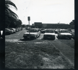
Photograph, Coles car park c. 1987, c. 1987
... Coles car park c. 1987......car parks...Coles and car park were built on original site of Mitcham Primary School...Coles and car park were built on original site of Mitcham Primary School Coles car park c. 1987 Photograph Photograph ...Black and white photograph of the Coles Car Park in Mitcham Road, Mitcham., looking west. c. 1987 Note palm trees at left. Coles and car park were built on original site of Mitcham Primary Schoolcoles supermarket, mitcham, car parks, mitcham road, mitcham primary school, no. 2904 -
 Port Fairy Historical Society Museum and Archives
Photograph - photocopy
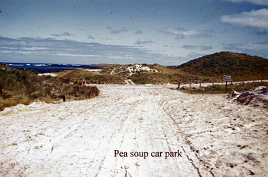
... ...car park...Pea soup car park...pea soup car park...Port Fairy Historical Society Museum and Archives 30 Gipps Street Port Fairy great-ocean-road Pea soup car park Pea soup car park sand road track pea soup car park Photograph photocopy ...Pea soup car parkpea soup car parkpea soup, car park, sand, road, track -
 Whitehorse Historical Society Inc.
Photograph, Car park - Coles, c 1987
... Car park - Coles...car parks...Black and white photograph of the Coles Car park taken from the corner of Mitcham Road and Victoria Street. c 1987...Whitehorse Historical Society Inc. 2-10 Deep Creek Road Mitcham melbourne car parks coles supermarket mitcham mitcham road victoria street Black and white photograph of the Coles Car park taken from the corner of Mitcham Road and Victoria Street. c 1987 Car park - Coles Photograph Photograph ...Black and white photograph of the Coles Car park taken from the corner of Mitcham Road and Victoria Street. c 1987car parks, coles supermarket, mitcham, mitcham road, victoria street -
 Whitehorse Historical Society Inc.
Photograph, Mitcham Shopping Centre Car Park, 2012
... Mitcham Shopping Centre Car Park......car parks...Coloured photograph of the 2-tire car park that serves the Mitcham shops on the north side of the Whitehorse Road. ...Whitehorse Historical Society Inc. 2-10 Deep Creek Road Mitcham melbourne mitcham shopping centre car park car parks Coloured photograph of the 2-tire car park that serves the Mitcham shops on the north side of the Whitehorse Road. ...Coloured photograph of the 2-tire car park that serves the Mitcham shops on the north side of the Whitehorse Road. Shows both levels-2012mitcham shopping centre car park, car parks -
 Port Fairy Historical Society Museum and Archives
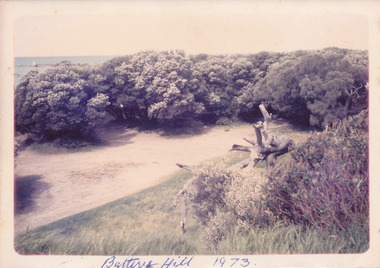
Photograph, Battery Hill 1973
... ...car park...East Beach car park in the 1970’s ...Coloured photograph of Battery Hill car park surrounded by trees...Port Fairy Historical Society Museum and Archives 30 Gipps Street Port Fairy great-ocean-road East Beach car park in the 1970’s Battery hill car park east beach tea tree Coloured photograph of Battery Hill car park surrounded by trees Battery Hill 1973 Photograph Photograph ...East Beach car park in the 1970’s Coloured photograph of Battery Hill car park surrounded by treesbattery hill, car park, east beach, tea tree -
 Melbourne Tram Museum
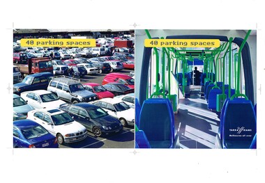
Poster, Yarra Trams, "40 parking spaces", "on your way", "140 Commuters", c2003
... ... Car Parks...Set of three posters, A3 landscape with motor vehicles or car parks and C class trams, promoting travel by tram. .1 - Titled "40 parking spaces" - show a full car park against the interior of a tram. .2 - titled "In your way" against "on your way" - C class tram - number removed, .3 - titled "140 commuters" = showing Hoddle St Richmond against tram C 3035. ...Melbourne Tram Museum 8 Wallen Road Hawthorn melbourne Trams tramways Yarra Trams Hoddle St Richmond Route 96 St Kilda Beach C Class Car Parks tram 3035 On rear in ink: .1 - "Brunswick St Melbourne" .2 - "Punt Road Windsor" .4 - "St Kilda Junction" Set of three posters, A3 landscape with motor vehicles or car parks and C class trams, promoting travel by tram. .1 - Titled "40 parking spaces" - show a full car park against the interior of a tram. .2 - titled "In your way" against "on your way" - C class tram - number removed, .3 - titled "140 commuters" = showing Hoddle St Richmond against tram C 3035. ...Set of three posters, A3 landscape with motor vehicles or car parks and C class trams, promoting travel by tram. .1 - Titled "40 parking spaces" - show a full car park against the interior of a tram. .2 - titled "In your way" against "on your way" - C class tram - number removed, .3 - titled "140 commuters" = showing Hoddle St Richmond against tram C 3035. Printed by Yarra Trams, possibly as trial posters as have printer registration marks. Have Yarra Trams Melbourne all over logo in the bottom right hand cornerOn rear in ink: .1 - "Brunswick St Melbourne" .2 - "Punt Road Windsor" .4 - "St Kilda Junction"trams, tramways, yarra trams, hoddle st, richmond, route 96, st kilda beach, c class, car parks, tram 3035 -
 Port Fairy Historical Society Museum and Archives
Photograph
... ...car park...East beach car park and sand...Coloured photograph of Expanse of East Beach from the car park people playing on sand...Port Fairy Historical Society Museum and Archives 30 Gipps Street Port Fairy great-ocean-road East beach car park and sand East beach car park sandcastle caras dune Coloured photograph of Expanse of East Beach from the car park people playing on sand Photograph Photograph ...East beach car park and sandColoured photograph of Expanse of East Beach from the car park people playing on sandeast beach, car park, sandcastle, caras, dune -
 Port Fairy Historical Society Museum and Archives
Photograph
... ...car park...East Beach Car Park...Coloured photograph East Beach car park around 1970’s with weatherboard house on right...Port Fairy Historical Society Museum and Archives 30 Gipps Street Port Fairy great-ocean-road East Beach Car Park East beach car park cars half round shed Coloured photograph East Beach car park around 1970’s with weatherboard house on right Photograph Photograph ...East Beach Car ParkColoured photograph East Beach car park around 1970’s with weatherboard house on righteast beach, car park, cars, half round shed -
 Glen Eira Historical Society
Map - a'Beckett Street, 11, East St Kilda
... ... Car parks...Detail shows that the address is now a car park...Detail shows that the address is now a car park a’Beckett Street East St Kilda Car parks Streetscapes Aerial Photographs Map a'Beckett Street, 11, East St Kilda ...Print of a Google map of 11 a’Becket Street, East St Kilda downloaded & printed on November 26, 2010 by Sud Abbas (role unknown). Detail shows that the address is now a car parka’beckett street, east st kilda, car parks, streetscapes, aerial photographs -
 Northern District School of Nursing. Managed by Bendigo Historical Society Inc.
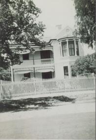
Photograph - Mayfort House
... Now demolished, site of present-day car park....Now demolished, site of present-day car park....Now demolished, site of present-day car park. Photograph Mayfort House ...The Northern District School of Nursing opened in 1950 in to address the issues around nurse recruitment, training and education that had previously been hospital based. The residential school was to provide theoretical and in-house education and practical training over three years. The students would also receive practical hands-on training in the wards of associated hospitals. The Northern District School of Nursing operated from Lister House, Rowan Street, Bendigo. It was the first independent school of nursing in Victoria and continued until it closed in 1989.B&W photograph of Mayfort House, nurses' accommodation, 148 Wattle Street, Bendigo. Now demolished, site of present-day car park.Mayfort House, nurses' accommodation, 148 Wattle Street, Bendigo. Now demolished, site of present-day car park.ndsn, nursing -
 Melbourne Tram Museum
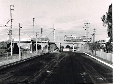
Photograph - Black & White Photograph/s, Public Transport Corporation (PTC), c1987
... ... Car Parks...Black and White photograph, looking south towards the railway Thornbury overpass, Miller Street of the Epping line (the hump) for trams. Shows the car park under formation and the rebuilt bridge to provided access under the bridge for cars. ...Shows the car park under formation and the rebuilt bridge to provided access under the bridge for cars. ...Black and White photograph, looking south towards the railway Thornbury overpass, Miller Street of the Epping line (the hump) for trams. Shows the car park under formation and the rebuilt bridge to provided access under the bridge for cars. Note the new concrete pier alongside there railway replacing a former wooden or steel pier.On the rear in ink "New carpark appearing east of PWS c1987"trams, tramways, preston workshops, car parks, bridges, the hump, thornbury -
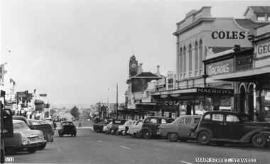
 Stawell Historical Society Inc
Photograph, Main Street Stawell before the Mall
... Earles Supermarket on left Commonwealth Bark on right. Cars parked in Street....Black and white photographs of street scene with shops either side and cars parked along the street....Earles Supermarket on left Commonwealth Bark on right. Cars parked in Street. stawell streetscape Black and white photographs of street scene with shops either side and cars parked along the street. ...Stawell Main street before Mall looking West. Earles Supermarket on left Commonwealth Bark on right. Cars parked in Street.Black and white photographs of street scene with shops either side and cars parked along the street.stawell streetscape -
 Sunshine and District Historical Society Incorporated
Photograph - Albion Railway Station Car Park 1991 Photographs, Sharon Cavanagh, 13th March 1991
... Albion Railway Station Car Park 1991 Photographs...These photographs were taken by the The Advocate Newspaper after the City of Sunshine Mayor Bernard Reilly complained about the state of the Albion Station Car Park with the overgrown thistles, and the overflow of cars using the station into the surrounding streets...Bernard Reilly Ten Pin Bowling Centre Car Park St. Albans Road 13th March 1991 Sharon Cavanagh...These photographs were taken by the The Advocate Newspaper after the City of Sunshine Mayor Bernard Reilly complained about the state of the Albion Station Car Park with the overgrown thistles, and the overflow of cars using the station into the surrounding streets These photographs provide a glimpse of the Albion Railway Station and its car park with the John Darling Flour Mills in the background. ...These photographs were taken by the The Advocate Newspaper after the City of Sunshine Mayor Bernard Reilly complained about the state of the Albion Station Car Park with the overgrown thistles, and the overflow of cars using the station into the surrounding streetsThese photographs provide a glimpse of the Albion Railway Station and its car park with the John Darling Flour Mills in the background.Bernard Reilly Ten Pin Bowling Centre Car Park St. Albans Road 13th March 1991 Sharon Cavanaghsunshine ten pin bowling, ballarat road, sunshine, albion railway station, john darling flour mills, albion, bernard reilly -
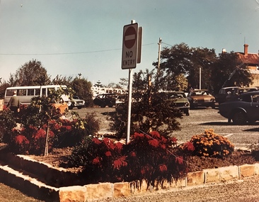 Stawell Historical Society Inc
Photograph, Car Park in Sloane Street looking towards Main Street Stawell c 1978 - Large coloured photograph
... Car Park in Sloane Street looking towards Main Street Stawell c 1978 - Large coloured photograph....Colour photograph of Car Park Sloane Street looking towards Main Street Stawell. ...The photo has a bus on the left hand side and cars in the car park. The photo is taken in front of a garden bed with a No Entry sign in the middle of the photograph....Car Park in Sloane Street looking towards Main Street Stawell c 1978 - Large coloured photograph. ...Colour photograph of Car Park Sloane Street looking towards Main Street Stawell. The car park was created when Main St. Stawell became a Pedestrian Mall c 1978Large coloured photograph taken from Sloane Street, looking towards Main St. The photo has a bus on the left hand side and cars in the car park. The photo is taken in front of a garden bed with a No Entry sign in the middle of the photograph.stawell -
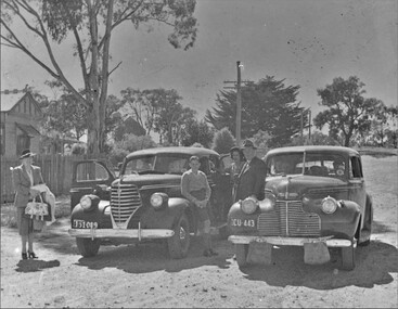 Stawell Historical Society Inc
Photograph, Bennet family home 51 Smith Street Stawell with cars parked in front c.1943
... Bennet family home 51 Smith Street with two cars parked in front. First church of England is just visible in background. ...Two 1940's cars parked with a group of people posing for photo....Stawell Industry Two 1940's cars parked with a group of people posing for photo. ...Bennet family home 51 Smith Street with two cars parked in front. First church of England is just visible in background. Lady on left is Jessica Bennett. Young lad leaning on mudguard Graeme Bennett born 1933 later mayor of Stawell. The lady at center is Margaret Bennett. and gentleman with hat is John Bennett Senior, original owner of North Western Woolem Mills. Photo taken outside john Bennetts home in smith street with no kerb or nature strip, looking towards Seaby Street. Note the canvas Water bags on front of one car to keep water cool. John Bennet Sen born in 1895 in Yorkshire. his wife Jessie Brown married in Warrnambool.Two 1940's cars parked with a group of people posing for photo.stawell industry -
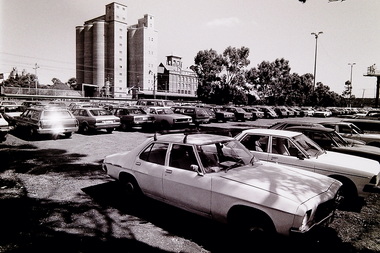
 University of Melbourne, Burnley Campus Archives
Photograph - Black and white print, Entrance Near Bull Paddock Staff Car Park, 1941
... Entrance Near Bull Paddock Staff Car Park......staff car park...The latter were closed off by a cyclone type gate and fence located at the present rockery (near exit to present staff car parks) (also near Cork Oak). The gates are certainly not on the Swan Street frontage."...Entrance to Egglaying Competition and School near what became the Bull Paddock Staff Car Park...Entrance to Egglaying Competition and School near what became the Bull Paddock Staff Car Park Entrance Near Bull Paddock Staff Car Park Photograph Black and white print ...Note by T.H. Kneen 13 May 1992, "Suggest this is a common entry to Egg-Laying Competition and School of Horticulture & Primary Agriculture grounds. The latter were closed off by a cyclone type gate and fence located at the present rockery (near exit to present staff car parks) (also near Cork Oak). The gates are certainly not on the Swan Street frontage."Black and white photograph. Entrance to Egglaying Competition and School near what became the Bull Paddock Staff Car ParkOne of a group of photographs inscribed, "Xmas break-up December 1941."bull paddock, 1941, egg laying competition, school of horticulture and primary agriculture, staff car park, entrance gates -
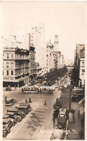 Ballarat Tramway Museum
Postcard - Cable tram - Bourke and Queen Sts, Kodak, late 1930s
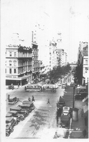
... ...car parks...Shows the car parking arrangements in Queen St and many parked cars. The intersection is not fitted with traffic signals....Shows the car parking arrangements in Queen St and many parked cars. The intersection is not fitted with traffic signals. ...Postcard - has "Melbourne Vic" along the bottom edge looking south in Queen St towards Flinders St with a Bourke Street cable tram passing over the intersection. There is a second cable tram about to cross the intersection on the right side of the photograph. Shows the car parking arrangements in Queen St and many parked cars. The intersection is not fitted with traffic signals.Yields information about the intersection of Queen and Bourke St in the late 1930s and car parking arrangements.Black and white photograph - Kodak produced postcard formatin pencil on the rear "$2"tramways, cable trams, bourke st, queen st, car parks -
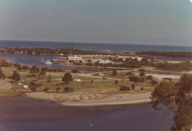 Lakes Entrance Historical Society
Photograph - View of Apex Park, Bullock Island, Lakes Entrance Victoria, 1/04/1979 12:00:00 AM
... Bullock Island, Apex Park and cars parked on Marine Parade New Works area and Entrance channel in distance Lakes Entrance Victoria...Colour photograph taken from Kalimna Heights showing road and bridge to Bullock Island, Apex Park and cars parked on Marine Parade New Works area and Entrance channel in distance Lakes Entrance Victoria...Lakes Entrance Historical Society 4 Marine Parade Lakes Entrance gippsland Bullock Island, Apex Park and cars parked on Marine Parade New Works area and Entrance channel in distance Lakes Entrance Victoria Parks Business Islands Colour photograph taken from Kalimna Heights showing road and bridge to Bullock Island, Apex Park and cars parked on Marine Parade New Works area and Entrance channel in distance Lakes Entrance Victoria Photograph View of Apex Park, Bullock Island, Lakes Entrance Victoria ...Bullock Island, Apex Park and cars parked on Marine Parade New Works area and Entrance channel in distance Lakes Entrance VictoriaColour photograph taken from Kalimna Heights showing road and bridge to Bullock Island, Apex Park and cars parked on Marine Parade New Works area and Entrance channel in distance Lakes Entrance Victoriaparks, business, islands -
 Whitehorse Historical Society Inc.
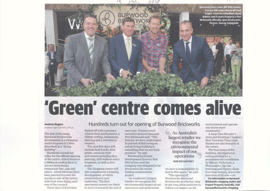
Article, 'Green' Centre Comes Alive, 09/12/2019
... With a 2000 sq. m. rooftop farm and 250 trees to cover the northern side of the centre & fruit trees lining each row of the car park....Burwood Brickworks has been officially opened as a living building with a 2000 sq. m. rooftop farm and 250 trees to cover the northern side of the centre & fruit trees lining each row of the car park....Burwood Brickworks has been officially opened as a living building with a 2000 sq. m. rooftop farm and 250 trees to cover the northern side of the centre & fruit trees lining each row of the car park. 'Green' Centre Comes Alive Article Article Whitehorse Leader ...Burwood Brickworks has been officially opened as a living building.Burwood Brickworks has been officially opened as a living building with a 2000 sq. m. rooftop farm and 250 trees to cover the northern side of the centre & fruit trees lining each row of the car park.Burwood Brickworks has been officially opened as a living building. brickworks, shopping centre, environment, trees -
 Melbourne Tram Museum
Photograph - Cable tram - Bourke and Queen Sts, late 1930s
... ...Car Parks...Shows the car parking arrangements in Queen St and many parked cars. The intersection is not fitted with traffic signals....Shows the car parking arrangements in Queen St and many parked cars. The intersection is not fitted with traffic signals. ...Black and white print or copy photograph from a postcard - has "Melbourne Vic" along the bottom edge looking south in Queen St towards Flinders St with a Bourke Street cable tram passing over the intersection. There is a second cable tram about to cross the intersection on the right side of the photograph. Shows the car parking arrangements in Queen St and many parked cars. The intersection is not fitted with traffic signals.Yields information about the intersection of Queen and Bourke St in the late 1930s and car parking arrangements.Black and white copy print with a plain back taken from a postcard.tramways, cable trams, bourke st, queen st, car parks -
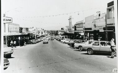
 Stawell Historical Society Inc
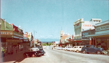
Photograph, Main Street Stawell looking West with Geo. Mitchell shop on the right c 1955 -- Coloured
... Either side of the street has cars parked at an angle with a soft canopy car parked on the left side....This coloured photo has shops either side in view and cars parked at an angle along the street. Coles, Macrows and Geo. ...Either side of the street has cars parked at an angle with a soft canopy car parked on the left side. stawell business streetscape Colour photograph looking down Main St Stawell with the Grampians in the distance c 1955. ...Coloured photo c 1955 Main Street Scene looking West. Geo Mitchell Draper on right with Coles and Macrows. On the left E. Dale & Co. shop sign is visible. Either side of the street has cars parked at an angle with a soft canopy car parked on the left side.Colour photograph looking down Main St Stawell with the Grampians in the distance c 1955. This coloured photo has shops either side in view and cars parked at an angle along the street. Coles, Macrows and Geo. Mitchell shops are on the right and E. Dale & Co shop sigh is visible on the left.stawell business streetscape -
 Melbourne Legacy
Slide, Operation Float 1963, 1963
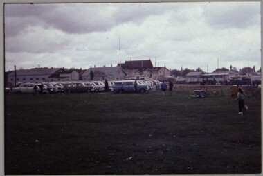
... A colour slide of many cars parked together. They would have been the transport to bring children together for Operation Float in 1963. ...Colour slide of many cars parked in plastic mount that is white on the front and navy blue on the reverse....Colour slide of many cars parked in plastic mount that is white on the front and navy blue on the reverse. ...A colour slide of many cars parked together. They would have been the transport to bring children together for Operation Float in 1963. Operation Float was an event run by Melbourne Legacy to take Junior legatees on an outing. It could have been to naval boats such as HMAS Cerberus or to a Yacht club. It gave the junior legatees the opportunity to see a naval boat in action, spend time on the water or try sailing. Part of a set of slides that are printed on Ektachrome and discoloured to a pink tinge. Was with many other slides taken in the 1950s and 1960s. The slides have been photographed to make digital images and moved to archive quality sleeves. In many cases the original images were not well focussed and the digital image the best available.A record of outings being organised for children.Colour slide of many cars parked in plastic mount that is white on the front and navy blue on the reverse.Handwritten in black pen ' Operation Float 1963'.operation float, junior legatee outings -
 Musculoskeletal Health Australia (now held by the Glen Eira Historical Society)
Photograph - Group photo, 1992
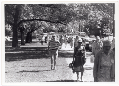
... They are walking along a path with some cars parked along it....There are some cars parked to the left of the walking group....There are some cars parked to the left of the walking group. ...As part of the 1992 National Arthritis Week events, there was a Joint Walk through the Melbourne Royal Botanic Gardens. This photo depicts a large group of people taking part in the walk. They are walking along a path with some cars parked along it.B&W photo of a large group of people walking along a wide path in a park. There are several large trees along the path, with their branches overhanging above the path. There are some cars parked to the left of the walking group.arthritis foundation of victoria, afv, national arthritis week, naw, joint walk, royal botanic gardens, trees, melbourne, 1992 -
 Stawell Historical Society Inc
Photograph, Main Street Stawell looking West with the Coles Variety Store on the right c 1950 -- Postcard
... Main Street Stawell looking West. The view show cars parked at an angle down Main St. and shops mainly along one side. ...The scene is of many 1950 cars parked along the street with Coles Variety Store, Macrows and Geo stores dominating to the right of the photo....Main Street Stawell looking West. The view show cars parked at an angle down Main St. and shops mainly along one side. ...Post Card Valentines c 1950. Main Street Stawell looking West. The view show cars parked at an angle down Main St. and shops mainly along one side. The town hall clock can be seen above the building with the Coles sign, Macrows and Geo on the right hand edge.Valentine's Post card of Main St., Stawell looking West. The scene is of many 1950 cars parked along the street with Coles Variety Store, Macrows and Geo stores dominating to the right of the photo."VII" "Main Street, Stawell" (on the front) "Valentine's Post Card sending you greetings" (on the back)stawell business streetscape -
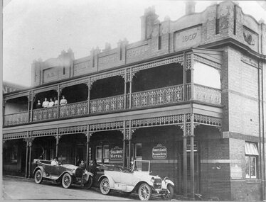 Stawell Historical Society Inc
Photograph, Bull & Mouth Hotel in Main Street Stawell built 1907, with cars out at the front c1921
... Like most hotels it changed hands many times and was finally demolished to make way for a car park for Earles Supermarket in 1985. ...Two story brick Hotel with group of ladies on top verandah. Two 1920's cars parked at front ...Two 1920's cars parked at front Bull & Mouth Hotel in Main Street Stawell built 1907, with cars out at the front c1921 Photograph ...Bull & Mouth Hotel Main Street Stawell Built 1907. Photo c1921 with cars in front. The original wooden Hotel was built by Dawkin & Hickory in 1863. George Dawkin had the first license. It had 4 bedrooms and two sitting rooms. John Hunter had the license from 1876 to 1889 when he died. During this time it boasted 16 rooms with commodious premises. In 1907 when owned by H. Edhouse of Bryant & Co Brewery the old wooden building was pulled down and a new one erected. Tenders for this were in the vicinity of 2000 pounds. After the rebuilding Mary Oliver held a license from 1908 until 1921. Like most hotels it changed hands many times and was finally demolished to make way for a car park for Earles Supermarket in 1985. Two story brick Hotel with group of ladies on top verandah. Two 1920's cars parked at front hotel -
 Lakes Entrance Historical Society
Photograph - Esplanade Lakes Entrance Victoria c1995, Lakes Entrance Tidy Town Committee
... Car park to west of Peels Launches booking office showing Post Office and Esplanade Motel and Cafe on opposite side of Esplanade plus a hoarding advertising the proposed Harbour View Apartment and Subway food outlet Lakes Entrance Victoria...Colour photograph taken from car park showing Post Office and Esplanade Motel and Cafe on opposite side of Esplanade plus a board advertising the proposed Harbour View Apartment and Subway food outlet Lakes Entrance Victoria...Car park to west of Peels Launches booking office showing Post Office and Esplanade Motel and Cafe on opposite side of Esplanade plus a hoarding advertising the proposed Harbour View Apartment and Subway food outlet Lakes Entrance Victoria Accommodation Businesses Postal Services Roads and Streets Colour photograph taken from car park showing Post Office and Esplanade Motel and Cafe on opposite side of Esplanade plus a board advertising the proposed Harbour View Apartment and Subway food outlet Lakes Entrance Victoria Photograph Esplanade Lakes Entrance Victoria c1995 Lakes Entrance Tidy Town Committee ...Car park to west of Peels Launches booking office showing Post Office and Esplanade Motel and Cafe on opposite side of Esplanade plus a hoarding advertising the proposed Harbour View Apartment and Subway food outlet Lakes Entrance VictoriaColour photograph taken from car park showing Post Office and Esplanade Motel and Cafe on opposite side of Esplanade plus a board advertising the proposed Harbour View Apartment and Subway food outlet Lakes Entrance Victoriaaccommodation, businesses, postal services, roads and streets -
Glen Eira Historical Society
Document - Glen Eira Residents Association
... Park... South Caulfield... Glen Eira City Council... Local Government... Councillors... Brennan Martin... Victorian Local Government Association (VLGA)... Erlich Mayor... Project Manikato... Caulfield Racecourse... Caulfield Racecourse Flat... Racecourses... Parks... Car...The minutes cover a range of routine meeting items, as well as the postponed release of the Princes Park Master Plans and the proposed construction of car parks at Caulfield Racecourse. 2/A copy of Glen Eira Residents’ Association Inc.’s 30/05/2003 newsletter, notifying members of matters presently before Glen Eira City Council for purposes of evaluation. ...The minutes cover a range of routine meeting items, as well as the postponed release of the Princes Park Master Plans and the proposed construction of car parks at Caulfield Racecourse. 2/A copy of Glen Eira Residents’ Association Inc.’s 30/05/2003 newsletter, notifying members of matters presently before Glen Eira City Council for purposes of evaluation. ...Six items pertaining to Glen Eira Residents Asssociation Inc. 1/Two copies of the minutes of a Committee Meeting of Glen Eira Residents Association Inc., held on 04/12/2001. The minutes cover a range of routine meeting items, as well as the postponed release of the Princes Park Master Plans and the proposed construction of car parks at Caulfield Racecourse. 2/A copy of Glen Eira Residents’ Association Inc.’s 30/05/2003 newsletter, notifying members of matters presently before Glen Eira City Council for purposes of evaluation. Matters include an admonishment to the Council to sort out anomalies between the C25 Amendment (80/20 Plan) and the Melbourne 2030 Plan, the success at convincing the Ministerial panel to adopt GERA’s views regarding the C14 Council Plan for the Caulfield Racecourse, a request for information from the Council regarding the previous year’s rate increase, a request for information from the Council regarding spending on planning for improvements to Princes Park, a call for the Council to improve its consultative procedures, a recommendation that the purpose of Glen Eira News be expanded to the making of suggestions for city improvement, and a notification of the measures implemented to improve the visibility of Caulfield Racecourse’s usability by the public. Includes a black-and-white photograph of Orrong Road, Elsternwick, illustrating what Glen Eira’s roads would look like if lined with trees, which was excluded from Glen Eira News on account of a current prohibition on the making of suggestions for city improvements. 3/Four copies of a booklet entitled ‘A Short Guide to Planning Procedures’, composed 08/2006, which endeavours to explain, as concisely as possible, the methodology by which Glen Eira City Council approves real estate developments and issues planning permits. 4/A booklet containing the minutes of the 05/10/2009 Annual General Meeting of Glen Eira Residents’ Association Inc. Details both routine items and more specific matters of discussion, such as inappropriate charges on the part of the Glen Eira City Council and the proposed inception of a questionnaire to evaluate local residents’ opinion of the Council. 5/A booklet announcing the 07/10/2010 Annual General Meeting of Glen Eira Residents’ Association Inc. at St. John’s Uniting Church, Elsternwick. Front cover details agenda and contains four colour photographs pertaining to public transport (buses, trams, trains) within the city. Interior features president Don Dunstan reflecting on issues relevant to GERA occurring over the preceding twelve months, with an emphasis on the dubious behaviour of the City Council, as well as two colour photographs: one of Dunstan himself and one of traffic at Elsternwick Junction. The rear cover contains the Financial Statement presented to the Meeting. 6Two copies of a printout of an article from the website of Glen Eira Residents’ Association Inc., accessed 19/06/2012, explaining the affects wrought as a result of the implementation of Planning Scheme Amendment C87. Said amendment changes the Planning Scheme protecting neighbourhood character by replacing the previous Significant Character Area (SCA) designation with the new designations of Neighbourhood Character Overlay (NCO) and Design and Development Overlay (DDO). In developing the Amendment, Glen Eira City Council commissioned Planisphere to procure the Planisphere Final Report, in which recommendations regarding the expansion, creation and deletion of SCAs were offered. The article contains a summary of said recommendations.glen eira residents’ association inc., clubs and associations, glen eira, meetings, minutes, campbell jack, dunstan don, marwick geoff, pleydell max, teseriero dominic, robins kevin, princes park, south caulfield, glen eira city council, local government, councillors, brennan martin, victorian local government association (vlga), erlich mayor, project manikato, caulfield racecourse, caulfield racecourse flat, racecourses, parks, car parks, kennedy cr., kennedy norman mr., crown land, glen eira road, rippon lea, c25 plan (80/20), melbourne 2030 plan, c14 council plan, rates, orrong road, elsternwick, trees, station street, caulfield north, neerim road, glenhuntly, glenhuntly park, orrong ward, grossbard cr., martens cr., building permits, delegated planning committee (dpc), steward joy, brohier peter, campbell fliss, scutt alex, ray darren, hannah brian, st. john’s uniting church, mees paul dr., elsternwick club, sandham street, melbourne weekly bayside, glen eira debates, walsh investigation, whelen investigation, forge cheryl cr., whiteside helen mayor, save our suburbs (sos), walsh mary, walsh kevin, french christine, elsternwick junction, planning scheme, planning scheme amendment c87, significant character areas (scas), planisphere final report, oakdene crescent, carnegie, blackwood street, housing diversity areas, urandaline grove, caulfield, normanby road/park crescent, kambrook road, balaclava road, hawthorn road tramway estate, caulfield south, ulupna road, ormond, murray street, prentice street, kambea grove, chestnut street, mcpherson avenue, queens avenue, caulfield east, derby crescent, clarinda street, st. james parade/downshire road, exhibition street, mckinnon, field street, boyd park, murrumbeena, lindsay avenue, lydson street -
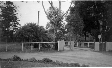
 Ringwood and District Historical Society
Photographs, Eastland Car park Construction, Ringwood, 1992-93
... Eastland Car park Construction, Ringwood, 1992-93...11064A: 21.2.92 Eastland car park development from near Safeway 11064B: 21.2.92 Eastland car park development from Adelaide St 11064C: 4.1.93 Eastland car park development from Warrandyte Road from Op. ...Ringwood and District Historical Society 125A Warrandyte Road Ringwood North melbourne 11064A: 21.2.92 Eastland car park development from near Safeway 11064B: 21.2.92 Eastland car park development from Adelaide St 11064C: 4.1.93 Eastland car park development from Warrandyte Road from Op. ...B&W photograph taken by Ringwood Historical Research Group. Also added extract from Melways showing the roads before the Bypass (1987) showing the planned Bypass cutting these two roads, and Melways (2018) showing new alignment with Bypass11064A: 21.2.92 Eastland car park development from near Safeway 11064B: 21.2.92 Eastland car park development from Adelaide St 11064C: 4.1.93 Eastland car park development from Warrandyte Road from Op. Bond St. 11064D: 4.1.93 New Myer Eastland car park viewed from Safeway's Roof 11064E: 17.1.93 Eastland car park near where Esso Garage was 11064F: 21.2.92 Eastland car park from cnr of Adelaide St and Eastland