
Showing 63 items matching " north road south railway station"
-
 Glen Eira Historical Society
Article - Ormond, Francis
... railway station... Ormond Francis Jnr... Judges... Point Ormond... Ormond... Graziers... Public benefactor... Warrein railway station... Murray Road... North Road South...Ormond Francis Ormond railway station Ormond Francis Jnr Judges Point Ormond Ormond Graziers Public benefactor Warrein railway station Murray Road North Road South railway station Leila Road Tucker Road Koornang Road Thomas Street Blackshaw Street Article Ormond, Francis ...This file contains six items Hand written information regarding naming of Ormond Station, and details on Francis Ormond, taken from Dictionary of Australasian Biography by Mennell and other sources; four pages. Four pages of printed and hand written, unsigned and undated research on Francis Ormond with references. Copy of article on Hon. Francis Ormond, M.L.C taken from Australasian Biography Dictionary by Serle. Reprinted article on Hon Francis Ormond, M.L.C achievements in his public and pastoral pursuits. Printed page on Francis Ormond taken from Sand Swamp and Heath. Printed page from Wikipedia on Francis Ormond, History and Today, date of print 25/08/2002.ormond francis, ormond railway station, ormond francis jnr, judges, point ormond, ormond, graziers, public benefactor, warrein railway station, murray road, north road south railway station, leila road, tucker road, koornang road, thomas street, blackshaw street -
 City of Moorabbin Historical Society (Operating the Box Cottage Museum)
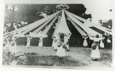
Photograph, Black & White x4 Maypole Dance Moorabbin State School 1922, 1922
... Road and Chapel Lane, had to agree to close to meet pupil number requirements. Charles Sadgrove was head teacher of the new State School when it opened on October 1st 1872 and he remained until 1878. The school was renamed South Brighton in 1887 to accord with the nearby railway station which opened around that time. The main part of the present building dates from 1890. By the early 1900s the school had been extended to the north...Road and Chapel Lane, had to agree to close to meet pupil number requirements. Charles Sadgrove was head teacher of the new State School when it opened on October 1st 1872 and he remained until 1878. The school was renamed South Brighton in 1887 to accord with the nearby railway station which opened around that time. The main part of the present building dates from 1890. By the early 1900s the school had been extended to the north ...In October 1872, State School 1111 Box Rise opened on the corner of Worthing Road and Dane Road. In order for this school to open, School No 442, a Wesleyan School, on the corner of Wickham Road and Chapel Lane, had to agree to close to meet pupil number requirements. Charles Sadgrove was head teacher of the new State School when it opened on October 1st 1872 and he remained until 1878. The school was renamed South Brighton in 1887 to accord with the nearby railway station which opened around that time. The main part of the present building dates from 1890. By the early 1900s the school had been extended to the north. . The school contains a plaque for Harry G Hawker, one of the pioneers of aviation, who attended the school in the closing years of the nineteenth century. The school was renamed Moorabbin in 1909.During the 1940s and 1950s population in the area surged and school enrolments peaked to over 800 under head teacher CS Lansell. Enrollments decreased to 470 in 1969. By the 1990s however, enrollments began to increase again. ( G Whitehead KCC Historian) Since 1890 Moorabbin Primary School No.1111 has been socially significant at a local level providing education for the families of the early settlers in Moorabbin ( South Brighton) Black & White photographs x 4 of pupils at Moorabbin State School Maypole Dancing c1922keys robert, marriott charles, gregg barriecity of moorabbin, county of bourke, moorabbin roads board, parish of moorabbin, shire of moorabbin, henry dendy's special survey 1841, were j.b.; bent thomas, o'shannassy john, king richard, charman stephen, highett william, ormond francis, maynard dennis, methodist church wickham road, box rise state school no.1111, methodist chapel cheltenham, education, early settlers -
 Ringwood and District Historical Society
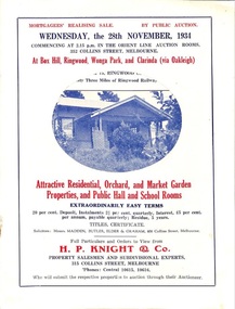
Flyer, Stillwell & Stephens Pty. Ltd, Brochure - Multiple Properties for Public Auction at Box Hill, Ringwood, Wonga Park and Clarinda - 28th November, 1934
... Wonga Park via Ringwood - "Holme Bush" off Warrandyte Road, Part of Lots 14 and 15, Ringwood Orchard Estate, approximatgely three miles (north) of Ringwood Railway Station - 64 Acres. 2. 17 Bishop Street, Box Hill - timber residence. 3. Greenwood Avenue, Ringwood - On East Side, 150 feet 3 inches South...Wonga Park via Ringwood - "Holme Bush" off Warrandyte Road, Part of Lots 14 and 15, Ringwood Orchard Estate, approximatgely three miles (north) of Ringwood Railway Station - 64 Acres. 2. 17 Bishop Street, Box Hill - timber residence. 3. Greenwood Avenue, Ringwood - On East Side, 150 feet 3 inches South ...Seven-page brochure advertising Mortgagees' Realising Sale by Public Auction on Wednesday, 28th November, 1934 for properties at Box Hill, Ringwood, Wonga Park, and Clarinda (via Oakleigh), including photographs, property descriptions, and terms of sale.Auction Commencing at 2.15 p.m. in the Orient Line Auction Rooms, 352 Collins Street, Melbourne. Solicitors: Messrs. Madden, Butler, Elder & Graham, 406 Collins Street, Melbourne. (Agents) H.P. Knight & Co. Property Salesmen and Subidivisional Experts, 315 Collins Street, Melbourne, 'Phones: Central 10615, 10616. Attractive Residential, Orchard, and Market Garden Properties, and Public Hall and School Rooms. 1. Wonga Park via Ringwood - "Holme Bush" off Warrandyte Road, Part of Lots 14 and 15, Ringwood Orchard Estate, approximatgely three miles (north) of Ringwood Railway Station - 64 Acres. 2. 17 Bishop Street, Box Hill - timber residence. 3. Greenwood Avenue, Ringwood - On East Side, 150 feet 3 inches South of Bedford Road - timber attic residence. 4. Ringwood - Wantirna Road, South-east corner of Canterbury Road - Orchard Property of approx. 11-1/2 Acres. 5. Box Hill - Whitehorse Road, South-east corner of Linsley Street - Timber building utilised as a Public Hall and Private School. 6. Clarinda vic Oakleigh, Talbot Crescent, off Centre Road - Home on 10 acres of land. -
 Ringwood and District Historical Society
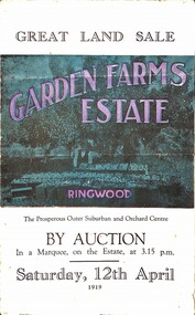
Pamphlet, G.A. Green, Auction Sale Brochure - Garden Farms Estate, Ringwood, Victoria - 1919, 1919
... railways junction here. The passengers from Ringwood Station cityward, in one year, number 250,000. Ringwood will be the terminus of the Outer Suburban Electric Eastern Railway. Its natural boundaries are the River Yarra on the North, Dandenong Creek on the South, the popular town of Croydon on the East, and the suburb of Mitcham on the West. This is a large territory that is steadily being converted from intense culture, and then it might be called (as regards its gardens) "The Devon Territory of Victoria." ARMSTRONG ROAD...railways junction here. The passengers from Ringwood Station cityward, in one year, number 250,000. Ringwood will be the terminus of the Outer Suburban Electric Eastern Railway. Its natural boundaries are the River Yarra on the North, Dandenong Creek on the South, the popular town of Croydon on the East, and the suburb of Mitcham on the West. This is a large territory that is steadily being converted from intense culture, and then it might be called (as regards its gardens) "The Devon Territory of Victoria." ARMSTRONG ROAD ...Multi-fold brochure advertising public auction of one-acre, 2-acre, 5-acre and 8-acre allotments in Ringwood and Bayswater on Saturday 12th April, 1919. Brochure includes terms of sale, description of subdivision features and local facilities, and photographic images of the area.Subdivison includes Canterbury Road Heathmont, Armstrong Road Heathmont, Armstrong Road Bayswater, Bungalook Road Heathmont, Bungalook Road Bayswater, and Orchard Road Bayswater. Road shown as Bayswater Road to Bayswater became Mountain Highway Bayswater. Vendor: H.E.B.Armstrong, Auctioneers: Coghill & Haughton, 79 Swanston Street Melbourne, Telephone Central 2793, in conjunction with J.B. McAlpin, Ringwood, Opposite Station, Telephone Ringwood 7. (Map) Woodcock & McCormack, Civil Engineers Architects & Surveyors, 430 Little Collins Street, Melbourne, Phone 3241 Central. MOST OF THE MONEY COMES OUT OF THE LAND. And more money can be obtained from anb acre of fruit than from an acre of any other produce. But you do not have to grow fruit on Garden Farms Estate. You can go in for - Outer Suburban Home - Market Garden - Orchard - Pig Raising - Poultry Farm - Small Dairy Farm - Small Fruits - Floral Culture - Scent and Bee Farm - Or just for a Week-end Home. RINGWOOD - THE PLACE TO LIVE. The Beautiful Ringwood District has so many natural attractions, that half a Land Agent's work is done in just showing a prospective buyer round and about. Ringwood has a pull of its own that attracts folk, proved beyond doubt by its rapid development within the last decade (spite the war). First, it is high and healthy, picturesque and undulating, convenient of access, sufficiently close to the Metropolis for City and Business folk to live at Ringwood. Its development is solid, because most of its people are industrious husbandmen, real producers, who have turned idle hills into smiling gardens. These are the kind of real people to live amongst; ones who wear out their spades. The rapidly-developing town has excellent Stores, Trade and Repair Shops Churches, Banks, Telephone Exchange, Weekly General Market, Cool Stores, and good Private and State Schools, etc.; is Electrically lit, has Metropolitan Water Supply, and generally provides so that practically all shopping can be done locally. WHY RINGWOOD MUST GROW. Ringwood is a great centre and must be a greater. Two rapidly-developing railways junction here. The passengers from Ringwood Station cityward, in one year, number 250,000. Ringwood will be the terminus of the Outer Suburban Electric Eastern Railway. Its natural boundaries are the River Yarra on the North, Dandenong Creek on the South, the popular town of Croydon on the East, and the suburb of Mitcham on the West. This is a large territory that is steadily being converted from intense culture, and then it might be called (as regards its gardens) "The Devon Territory of Victoria." ARMSTRONG ROAD. This new road traverses Garden Farms Estate from its northern boundary on the main Canterbury Road, across Dandenong Creek, to its southern boundary on the main Bayswater Road, and will provide a long-desired additional link of communication between Bayswater and Ringwood. The 1-acre building sites on Bayswater Road are within 8 minutes' walk of the Bayswater Railway Station, and the Canterbury Road frontages are only 1-1/2 miles from Ringwood Station, and 1/2 mile from the Railway Station site of Canterbury Road; therefore, the whole Estate is easy of access and there should be a large demand for land so favourably placed. (Image) Cultivation Field - Potatoes on Lot 28 (Image) Picture of Bayswater Creek Flats. (Image) View from "Korumbeen" where Mr. Armstrong lived on Garden Farms Estate. Estate outlined in white ring. (Image) Site of New Bridge over Dandenong Creek. (Image) On one of the timbered lots adjoining railway. (Image) This Dandenong Creek traveres the Estate. (Image) Main Fern Tree Gully Line bisects the Estate. -
 Eltham District Historical Society Inc
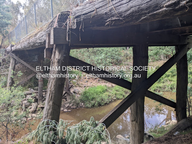
Photograph, Tess Justine (Nillumbik Shire Council), Murray's Bridge over the Diamond Creek, Eltham North, 19 Feb 2022
... railway should be located on his land, closer to half-way between Eltham and Hurstbridge stations. The Railways Commissioners warned that the locals would have to fund these works themselves. The Glen Park Estate residents initially had difficulty accessing Eltham by road, with only an old low-level bridge over Diamond Creek at the south end of their estate. A new timber trestle bridge across the creek, now on Wattletree Road, was opened in 1915. Road access to the north...railway should be located on his land, closer to half-way between Eltham and Hurstbridge stations. The Railways Commissioners warned that the locals would have to fund these works themselves. The Glen Park Estate residents initially had difficulty accessing Eltham by road, with only an old low-level bridge over Diamond Creek at the south end of their estate. A new timber trestle bridge across the creek, now on Wattletree Road, was opened in 1915. Road access to the north ...Murray's Bridge over the Diamond Creek on the Diamond Creek Trail just prior to demolition and replacement with a new steel bridge. Heritage advice obtained by Nillumbik Shire Council, following a suggestion by the Eltham District Historical Society (EDHS), is that the original bridge appears to have been a simplified version of the Country Roads Board’s (CRB) standard timber bridge design of the early-to-mid 1920s. In c1990 Murray’s bridge was renovated with three recycled steel girders as part of a bike/pedestrian path in the reserve. During these alterations many parts of the bridge were removed, and some were replaced. Heritage advice indicates the condition of Murray’s bridge is poor. The remaining original parts are all in poor condition, with severe weathering, splitting and rot, especially to the stringers retained on the bridge. Heritage advice is that Murray’s Bridge does not have sufficient significance in the cultural history of the Nillumbik area to warrant inclusion in the Nillumbik Shire Heritage Overlay and also does not have sufficient significance as a rare survivor to warrant inclusion in the Nillumbik Shire Heritage Overlay. There are no indications in the historical record that this site was individually important to the cultural history of this area. EDHS is comfortable with the heritage advice provided to Council and has worked closely on this project with Council. EDHS has suggested some of the removed timbers be used in the vicinity of the bridge for landscaping and possibly seating, so as to retain these remnants close to the site of the original bridge, which is the last old timber bridge along the lower reaches of the Diamond Creek. Mary (Sweeney) Murray and John Wright Murray selected 80 acres, Lot C Section 16 and Lot 5 Section 17 Parish of Nillumbik, under an occupation license in 1866. John died in 1867 and freehold was granted to his son John in 1873. The farm was known as ‘Laurel Hill’. John Junior was an Eltham Shire councillor and sometime president from 1887 up until 1897. He added Lot A Section 16 to the farm in ca1888. John and his younger brother James arranged to rent/purchase Lot B Section 17, across Diamond Creek to the west, in ca1900. It appears that John and James farmed separately for a few years, with a new homestead built for James ad family on the high point of Lot B Section 17 in ca1910. John sold off Lot 5 Section 17 in 1912. When John died in 1912 James took over the land on both sides of the Diamond Creek. The old homestead on the west side of the Creek disappeared. A farm bridge over Diamond Creek from this period may have been located close to the northern boundary of the farm. John Langlands, owner of the farm known as ‘Ihurst’ on the west side of Diamond Creek to the south of the Murray’s land, died in 1907. In 1909 his land was then subdivided into 100 lots to become the ‘Glen Park Estate’. Other similar subdivisions of nineteenth century farms around Eltham in this period included the ‘Franktonia (or Beard’s) Estate’ to the northeast and ‘Bonsack’s Estate’ between Eltham and Greensborough. Soon after the opening of the railway extension line from Eltham to Hurstbridge in 1912, Glen Park and nearby residents including James Murray agitated for a railway station or siding to be located half-way between Eltham and Hurstbridge, so that the Glen Park residents who used the railway daily did not have to walk into the Eltham or Hurstbridge stations. Some believed Coleman’s Corner (opposite Edendale Farm) was an appropriate spot for the platform. James Murray was among those who thought the railway should be located on his land, closer to half-way between Eltham and Hurstbridge stations. The Railways Commissioners warned that the locals would have to fund these works themselves. The Glen Park Estate residents initially had difficulty accessing Eltham by road, with only an old low-level bridge over Diamond Creek at the south end of their estate. A new timber trestle bridge across the creek, now on Wattletree Road, was opened in 1915. Road access to the north was gained in 1927 when the new Murray’s Road, which crossed the Murray’s land, was built. Residents continued to agitate for a Glen Park station. By 1926 the Railways Commissioners’ preferred site was on the Murray’s land. They arranged an estimate of cost of a full-length platform. The estimate was too much for the locals, who in 1928 argued unsuccessfully for a shorter and hence cheaper platform. By 1929 Murray had agreed to donate the land, but the locals would still have to fund the works. Murray decided, unilaterally it would appear, to commence work on a timber trestle road bridge over Diamond Creek to link the new Murray Road to the proposed station. Late in 1929 he stopped work on the bridge, for reasons unknown, but started work again and completed the bridge in 1931. There is no further newspaper evidence of the campaign for the Glen Park station until 1939, when Murray and another local, Mr Maxwell, met the Railways Commissioner. The Glen Park locale now included 45 homes on the west side of the creek and 20 on the Eltham side. Most of the residents used the train every day. The Commissioner remained adamant that only a full-length platform could be built for safety reasons. It appears the campaign dissolved at this point. The increasing move to cars may have had an impact. There is no evidence of Murray’s bridge ever being connected to Murray’s Road, or of it having wide use for any purpose by locals. James Murray died in 1947 and the farm was taken over by his son James (Jim). Jim started to sell off parts of the farm in the 1980s, retaining a few acres around the ca1910 homestead and building a new house there. Recreation reserves were established along the creek. In ca1990 Murray’s bridge was renovated with steel girders as part of a bike/pedestrian path in the reserve. The old farmhouse was demolished in ca2014. * * * A theory posted on local community Facebook groups was that the bridge was built in the 1860s and was built to be more robust than was necessary for the movement of cows from one side of the creek to the other. It was suggested the robustness was necessary to support the weight of gold ore being transferred from a mine on Murray’s land to a railway siding near Murrays Bridge (presumably for transfer and processing at Diamond Creek). Perhaps this may have been one of the motivators for Murray, who really knows? Knowing when mining operations ceased on his land and how that fits the overall timeline would be useful but at the time the bridge was built, local gold production was minimal at best. The known facts are: • The railway line came to Eltham in 1902. • The extension of the railway from Eltham to Hurstbridge was constructed in 1912 so no railway line even existed through Murray's property until 1912 and the Victorian Railways maps at the time show no such siding on Murray’s property. • In 1923 a new company was formed in anticipation of the old Diamond Creek Gold Mine being re-opened. The mine had been previously closed and flooded. It was noted in the press at the time that the mine was within a mile of the railway. Nothing really came of this. • Construction of Murrays Bridge was commenced by James Murray in early 1929 in anticipation of a proposed flag station being nominated on his land, but work ceased shortly afterwards. The proposed flag station was commonly referred to as Glen Park as the residents of the Glen Park Estate wanted Option 1, located near them with the platform adjacent to Colemans corner. This was probably never going to fly as it was virtually in eyesight of Eltham station. Allandale Road was the third option, but the Commissioners' preferred option was No. 2 - on Murray's property. • The Railway Commissioners were not going to finance any such station and the works had to be funded by private landowners and residents, hence Murray investing in this himself. • Murray recommenced work two years later and finished his bridge in 1931 but unfortunately for him, the proposed flag station never eventuated. The bluestone siding you reference may well have been built by Murray as part of the proposed station platform. • Up until then, apart from the Main Road bridge, which was washed away in 1924, virtually all local crossings over the Diamond Creek were low lying bridges – Kaylocks Bridge at Brougham Street, Diamond Street bridge, Glen Park Road bridge. It is expected that Murray also had a low-lying bridge to connect his land either side of the creek. These were all washed away or severely damaged multiple times in the 1920s. Lessons were learnt, and Murrays Bridge appears to have been built in accordance with Country Road Board standards of the time. Flood damage was ongoing, and even more recently constructed raised bridges kept getting washed away, e.g., the new Wattle Tree Road bridge in 1958 just months after completion. Murray’s bridge was reinforced with steel some 30 years ago presumably to provide additional floodwater resistance, given the history of bridges disappearing in floodwaters. • In March 1932 it was reported in the Advertiser that there were still some prospectors operating around Eltham North who apart from further scarring the face of the earth over the previous two years had gained significant experience but little gold - hardly a driving factor for constructing a dedicated railway siding and bridge to transfer gold ore. It is far more probable that James Murray was hoping to have the railway station located on his property and invested his money by building the bridge to lead to it as well as a station platform. Had the station eventuated, it may well have driven up the value of his land for subdivision and new housing estates like the Glen Park Estate. That did not eventuate. Whilst the bridge was indeed old (90 years), the core structure being completed in 1931, it had been modified substantially from original and hence had no significant historic value – i.e., it was not a representative example of its type, construction, and age. Given that the bridge was not worthy of saving, the Eltham District Historical Society with Council’s support, and the Eltham Woodworkers group endeavoured to see what suitable sized timbers were salvageable to fabricate a commemorative seat. Unfortunately, the experts at the Woodworkers group were unable to salvage any suitable length/width timbers to fabricate the seat due to the presence of rot. Last remaining wooden trestle bridge on the Diamond Creek Trail just prior to demolition and replacementBorn digital image (27)diamond creek (creek), diamond creek trail, murrays bridge, ‘laurel hill’, john wright murray, mary (sweeney) murra, john murray jnr, james murray, john langlands, ‘ihurst’, ‘glen park estate’, beard's estate, franktonia, bonsack's estate, glen park estate, glen park railway station -
 Eltham District Historical Society Inc
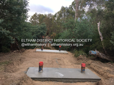
Photograph, Tess Justine (Nillumbik Shire Council), Construction work on replacement of Murray's Bridge over the Diamond Creek, Eltham North, 31 Mar 2022
... railway should be located on his land, closer to half-way between Eltham and Hurstbridge stations. The Railways Commissioners warned that the locals would have to fund these works themselves. The Glen Park Estate residents initially had difficulty accessing Eltham by road, with only an old low-level bridge over Diamond Creek at the south end of their estate. A new timber trestle bridge across the creek, now on Wattletree Road, was opened in 1915. Road access to the north...railway should be located on his land, closer to half-way between Eltham and Hurstbridge stations. The Railways Commissioners warned that the locals would have to fund these works themselves. The Glen Park Estate residents initially had difficulty accessing Eltham by road, with only an old low-level bridge over Diamond Creek at the south end of their estate. A new timber trestle bridge across the creek, now on Wattletree Road, was opened in 1915. Road access to the north ...Construction work on replacement of Murray's Bridge over the Diamond Creek on the Diamond Creek Trail Mary (Sweeney) Murray and John Wright Murray selected 80 acres, Lot C Section 16 and Lot 5 Section 17 Parish of Nillumbik, under an occupation license in 1866. John died in 1867 and freehold was granted to his son John in 1873. The farm was known as ‘Laurel Hill’. John Junior was an Eltham Shire councillor and sometime president from 1887 up until 1897. He added Lot A Section 16 to the farm in ca1888. John and his younger brother James arranged to rent/purchase Lot B Section 17, across Diamond Creek to the west, in ca1900. It appears that John and James farmed separately for a few years, with a new homestead built for James ad family on the high point of Lot B Section 17 in ca1910. John sold off Lot 5 Section 17 in 1912. When John died in 1912 James took over the land on both sides of the Diamond Creek. The old homestead on the west side of the Creek disappeared. A farm bridge over Diamond Creek from this period may have been located close to the northern boundary of the farm. John Langlands, owner of the farm known as ‘Ihurst’ on the west side of Diamond Creek to the south of the Murray’s land, died in 1907. In 1909 his land was then subdivided into 100 lots to become the ‘Glen Park Estate’. Other similar subdivisions of nineteenth century farms around Eltham in this period included the ‘Franktonia (or Beard’s) Estate’ to the northeast and ‘Bonsack’s Estate’ between Eltham and Greensborough. Soon after the opening of the railway extension line from Eltham to Hurstbridge in 1912, Glen Park and nearby residents including James Murray agitated for a railway station or siding to be located half-way between Eltham and Hurstbridge, so that the Glen Park residents who used the railway daily did not have to walk into the Eltham or Hurstbridge stations. Some believed Coleman’s Corner (opposite Edendale Farm) was an appropriate spot for the platform. James Murray was among those who thought the railway should be located on his land, closer to half-way between Eltham and Hurstbridge stations. The Railways Commissioners warned that the locals would have to fund these works themselves. The Glen Park Estate residents initially had difficulty accessing Eltham by road, with only an old low-level bridge over Diamond Creek at the south end of their estate. A new timber trestle bridge across the creek, now on Wattletree Road, was opened in 1915. Road access to the north was gained in 1927 when the new Murray’s Road, which crossed the Murray’s land, was built. Residents continued to agitate for a Glen Park station. By 1926 the Railways Commissioners’ preferred site was on the Murray’s land. They arranged an estimate of cost of a full-length platform. The estimate was too much for the locals, who in 1928 argued unsuccessfully for a shorter and hence cheaper platform. By 1929 Murray had agreed to donate the land, but the locals would still have to fund the works. Murray decided, unilaterally it would appear, to commence work on a timber trestle road bridge over Diamond Creek to link the new Murray Road to the proposed station. Late in 1929 he stopped work on the bridge, for reasons unknown, but started work again and completed the bridge in 1931. There is no further newspaper evidence of the campaign for the Glen Park station until 1939, when Murray and another local, Mr Maxwell, met the Railways Commissioner. The Glen Park locale now included 45 homes on the west side of the creek and 20 on the Eltham side. Most of the residents used the train every day. The Commissioner remained adamant that only a full-length platform could be built for safety reasons. It appears the campaign dissolved at this point. The increasing move to cars may have had an impact. There is no evidence of Murray’s bridge ever being connected to Murray’s Road, or of it having wide use for any purpose by locals. James Murray died in 1947 and the farm was taken over by his son James (Jim). Jim started to sell off parts of the farm in the 1980s, retaining a few acres around the ca1910 homestead and building a new house there. Recreation reserves were established along the creek. In ca1990 Murray’s bridge was renovated with steel girders as part of a bike/pedestrian path in the reserve. The old farmhouse was demolished in ca2014. Born digital image (5)diamond creek (creek), diamond creek trail, murrays bridge, ‘laurel hill’, john wright murray, mary (sweeney) murra, john murray jnr, james murray, john langlands, ‘ihurst’, ‘glen park estate’, beard's estate, franktonia, bonsack's estate, glen park estate, glen park railway station -
 Eltham District Historical Society Inc
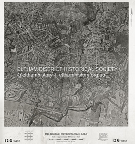
Photograph - Aerial Photograph, Central Plan Office, Eltham, Jan. 1960
... Centred on Bolton Street and Brougham Street, Eltham bounded by Progress Road to north, Yarra River to south, Andrews Street and Euclyptus Road to east and Greensborough Railway Station to west. ...Centred on Bolton Street and Brougham Street, Eltham bounded by Progress Road to north, Yarra River to south, Andrews Street and Euclyptus Road to east and Greensborough Railway Station to west. ...Centred on Bolton Street and Brougham Street, Eltham bounded by Progress Road to north, Yarra River to south, Andrews Street and Euclyptus Road to east and Greensborough Railway Station to west. Historic Aerial Imagery Source: Central Plan Office Neg. No. 21451 (Print) Dept. of Lands & Survey and the Melb. & Metro. Board of Works. Aerial Photo Details: MELBOURNE METROPOLITAN AREA Section : 12 G West Date : Jan./Feb. 1960 Scale : 800 feet to 1 inch 37°43'18.2"S 145°08'13.0"E Melways : 21 J6 (ed. 42)aerial photo, lower plenty, main road, montmorency, eltham, eltham lower park, heidelberg golf club, hurstbridge railway line, main road eltham, yarra river, 1960-01, andrews street, arthur street, bolton street, briar hill, brougham steet, dave lyon house, eltham north, eltham-yarra glen road, ernie andrew house, eucalyptus road, greensborough railway station, henry street, karingal road, melway 21j6, montmorency railway station, mount pleasant road, progress road, railway road, southernwood, were street -
 Eltham District Historical Society Inc
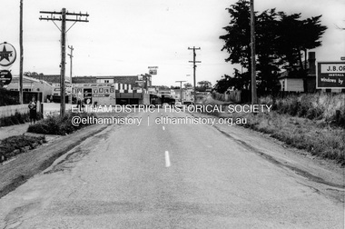
Photograph, Looking south along Main Road from Diamond Street Railway Crossing, Eltham, February 1968, Feb 1968
... north along Main Road through the shopping centre to just north of Elsa Court covering the length of the section of Main Road which was duplicated shortly thereafter. Shows the condition and environment of the streesscape of Main Road, Eltham immediately prior to the duplication between Pitt Street and Elsa Court through the shopping centre. Also shows a number of shops and businesses that operated at that time. duplication eltham main road diamond street railway line railway crossing caltex service station supa-value self service Black and white photograph Looking south ...Luck Street enters Main Road from the left behind the Caltex garage. Note the house on right hand land.In February 1968 an unknown person took a series of photos from the Eltham Hotel at Pitt Street heading north along Main Road through the shopping centre to just north of Elsa Court covering the length of the section of Main Road which was duplicated shortly thereafter. Shows the condition and environment of the streesscape of Main Road, Eltham immediately prior to the duplication between Pitt Street and Elsa Court through the shopping centre. Also shows a number of shops and businesses that operated at that time.Black and white photographduplication, eltham, main road, diamond street, railway line, railway crossing, caltex service station, supa-value self service -
Glen Eira Historical Society
Article - ORMOND RAILWAY STATION
... North Road... Caulfield South... South Caulfield... North Road Railway Station...This file contains two items: 1/ Six letters of correspondence to and from Victorian Railways regarding the decision to change the name of North Road Railway Station to South Caulfield and ultimately Ormond Station. ...This file contains two items: 1/ Six letters of correspondence to and from Victorian Railways regarding the decision to change the name of North Road Railway Station to South Caulfield and ultimately Ormond Station. ...This file contains two items: 1/ Six letters of correspondence to and from Victorian Railways regarding the decision to change the name of North Road Railway Station to South Caulfield and ultimately Ormond Station. The letters date from March 1891 til August 1897. 2/ An article from the Glen Eira/Port Phillip Leader dated 12/04/2013 regarding planning and construction works being undertaken to grade-separate the North Road level crossing.north road, caulfield south, south caulfield, north road railway station, ormond, oakley e., warrein, pritchard t. h., caulfield, caulfield shire council, glen huntly station, glenhuntly station, hyams jamie, railway stations, railways, mayors, stations, public transport, railway crossings, correspondence, local officials and employees, local government, engineering, railways construction, glen eira/port phillip leader -
Glen Eira Historical Society
Letter - Rosstown Railway
... Railway Station... Rosstown... Rosstown Railway... Thomas Street... Bay Street... Kooyong Road... Melbourne and Brighton Railway... Hawthorn Road... Bambra Road... Caulfield and Frankston Railway... Booran Road... Grange Road... Koornang Road... Murrumbeena Road... North Road... North Road Railway Station... East Brighton Railway Station... South...Garden Vale Elsternwick Elsternwick Railway Station Rosstown Rosstown Railway Thomas Street Bay Street Kooyong Road Melbourne and Brighton Railway Hawthorn Road Bambra Road Caulfield and Frankston Railway Booran Road Grange Road Koornang Road Murrumbeena Road North Road North Road Railway Station East Brighton Railway Station South Road Railway Routes Railway Lines Railways Land Transport Murphy J. ...This file contains four items: 1/A black and white photocopy of a letter dated either 07/08/1889 or 09/08/1889, from Robert Lundon to an unidentified recipient discussing an agreement reached between the author – on behalf of the recipient – and Soon Hang Hi in regard, in regards to the allotment known as Webber’s. The agreement is outlined in the letter in what appears to be Chinese characters, and includes the marks of Robert Lundon and Soon Hang Hi. File note from Joy Wu states that the calligraphy is not Mandarin or traditional Chinese. 2/Three sheets of hand-written working notes with information taken from the Victorian Government Gazette on THE ROSSTOWN AND MURRUMBEENA LAND COMPANY LIMITED, THE ROSSTOWN JUNCTION RAILWAY AND PROSPERITY COMPANY LIOMITED, and THE ROSSTOWN JUNCTION, ELSTERNWICK, AND OAKLEIGH RAILWAY COMPANY LIMITED, covering dates between 1887 and 1894. The notes concern meetings and creditors claims relevant to the companies, with reference numbers for the information source. Date and author of the notes are not recorded. 3/A black and white photocopy of the a partial map of the Rosstown Railway and surrounding area, undated. The map includes the names of landholders in the areas of Brighton, Garden Vale and Elsternwick, as well as other railway lines present in the region. 4/A fold-out map and guide of the Rosstown Rail Trail, including a brief general history of Caulfield as well as a more extensive biography of William Murray Ross and the Rosstown Railway. The map marks and describes significant sites along the trail, including photographs of some of these sites, provided by DF Jowett.documents, correspondence, webber’s, lundon robert, chinese characters, ethnic communities, signatures, text, settlements, taxes, fraser john grieves, lovell r.h., price davies, meetings, communication activities, soon hang hi, commercial events and activities, the rosstown and murrumbeena land company limited, victorian government gazette, bulmer richard, parry john, osment henry, shareholders, creditors claims, the rosstown junction railway and property company limited, finch and best, lawyers, the rosstown junction elsternwick and oakleigh railway company limited, cameron w.c., phillips p.d., garden vale, elsternwick, elsternwick railway station, rosstown, rosstown railway, thomas street, bay street, kooyong road, melbourne and brighton railway, hawthorn road, bambra road, caulfield and frankston railway, booran road, grange road, koornang road, murrumbeena road, north road, north road railway station, east brighton railway station, south road, railway routes, railway lines, railways, land transport, murphy j., caulfield, hamilton t.f., dane p., holloway, webb, ailee john, payne t.b., brodie chas, dane john, o’neil h., mccombie john, mcmillane a., smyth c.d., cooper, ebden, landholders, jeffrey j.d., gill j., balcombe a.e., cooper h., mcnab j., white j., sutherland j., greeves a.f.a., newton m.c., chamley f.b., fowler j., inglis p., grant t., stooke j., swanson g., cochrane c., adams e.b., mccombie thas, keyes robert, brighton cemetery, burials grounds and graveyards, war-ein road, were j.b., holland j., mcmahon c., winter t.l.m., dendy henry, mitchell w., jackson s., were j.e., wickham francis dawe, bryant jane, east brighton railway station, railway stations, maps, allotments, land titles, roads and streets, rosstown rail trail, city of glen eira, tourism, trains, tourism information bureaus, tours, pamphlets, elsternwick railway park, oakleigh junction, princes park, ee gunn reserve, packer park, sites, jowett d.f., weickhardt i.g., return to rosstown: railways land sales and sugar beet ventures in caulfield, land sales, walking trails, ross william murray, transport objects, locomotion, walking, cycling, driving, sports, country mansions, people, caulfield john, builders, construction and demolition workers, occupations, careers, professionals, topography, geology, landforms, horticulture, market gardens, primary industry workers, city of caulfield, mood kee, pennington harold, annual general meetings, caulfield town hall, glen eira city council, carnegie, carnegie station, rosstown station, people by circumstance, migrants, sugar beet, sugar beet mill, sugar beet industry, mills, factories, sea beach lines, bent thomas, parliamentary representatives, neville street, miller street, lemann’s swamp reserve, koornang park, cane sugar industry, breweries, rabbit processing plants, health establishments, hospitals, food production establishments, abattoirs, thieves, social problems, vagrants, theft, squatting, financial economics, debt, finance industry, insurance companies, company managers, bentleigh, ross leila, the grange, leila road, wild cherry road, financial trouble, mortgages, gisborne street, archibald street, riddell parade, victoria railways, glen huntly road, clarence street, college street, gladstone parade, parrell street, aileen avenue, seaview street, land subdivisions, dover street, sussex street, landfill, marara road, booran road, woodville avenue, dorothy avenue, ormond park, royal avenue, ormond railway station, oakleigh road, melten avenue, miller street, munro avenue, lord reserve, neerim road, toolambool road, the rosstown hotel, rosanna street, murrumbeena crescent, commercial establishments, the national bank, rosstown road, kangaroo road, poath road, freda street, hughesdale kindergarten, oakleigh council, hughesdale community centre, civic establishments, galbally reserve, plaques, warrigal road, out and about brochures, orion estate -
Glen Eira Historical Society
Article - VICTORIAN RAILWAYS
... railway Station on Saturday 19/12/1981 to celebrate the centenary of the railway line to Mordialloc. Story mentions that in 1881, the Caulfield to Mordialloc line was a single track and that passengers can also board the special train at Caulfield Station. Image is of steam train with red ‘tait’ carriages (undated). Victorian Railways Caulfield Glenhuntly Glen Huntly Elsternwick Carnegie Murrumbeena Ormond Steam Train Glenhuntly Road Glen Huntly Road Ripponlea North Road Rosstown Rosstown Junction Railway Ross William Murray Railways Trains South ...File contains 3 items: 1/Original handwritten notes by Leo J Harrington (VR Melbourne) and T O’Callaghan titled ‘Victorian Railways to ‘62’. Notes include dates of electrification of lines, station openings, valuations, railway station names and their origins. Reference to council minutes regarding request to change the name of Elsternwick station to Caulfield in June 1871. 2/Original newspaper article from ‘The Age’ dated 10/06/1978 by Graeme Davidson titled ‘A case study of Railway politics’. Article refers to a publication called ‘Return to Rosstown, Railway, Land Sales and Sugar Beet ventures in Caulfield’ by D. F. ‘Return to Rosstown’ recounts the story of the Rosstown Junction railway and its creator, William Murray Ross. Tells of Ross’ life since coming to Australia from Liverpool and how he prospered as a land speculator owning large tracts of land in Caulfield, the sugar mill and his plans to operate a railway. 3/Original newspaper article (and image) from ‘Moorabbin Standard’ dated 25/11/1981, titled ‘Centenary train to carry mayors’. Article reports that a special train will run from Spencer Street Station to Mordialloc railway Station on Saturday 19/12/1981 to celebrate the centenary of the railway line to Mordialloc. Story mentions that in 1881, the Caulfield to Mordialloc line was a single track and that passengers can also board the special train at Caulfield Station. Image is of steam train with red ‘tait’ carriages (undated).victorian railways, caulfield, glenhuntly, glen huntly, elsternwick, carnegie, murrumbeena, ormond, steam train, glenhuntly road, glen huntly road, ripponlea, north road, rosstown, rosstown junction railway, ross william murray, railways, trains, south caulfield, grange road, railway stations, mirrambeena, caulfield city council, sugar mill, electrification. -
Glen Eira Historical Society
Newspaper - GLENHUNTLY
... South Primary School... Gardenvale Central Primary School... Norman Peter... Rubbish bins... Koornang Road Shopping Centre... Carnegie Neighbourhood Study... Car Parks... Caulfield City Council... Homestead Handyman Hardware... Hardware Stores... Liberal Party... Railway Crossings... North Road... Ormond Railway Station...‘Glenhuntly News’ Glenhuntly Primary School Primary Schools Fires Dolphin Bill St Anthony’s School Dalton Des Caulfield South Primary School Gardenvale Central Primary School Norman Peter Rubbish bins Koornang Road Shopping Centre Carnegie Neighbourhood Study Car Parks Caulfield City Council Homestead Handyman Hardware Hardware Stores Liberal Party Railway Crossings North Road Ormond Railway Station Strong Chris Mr. ...This file contains one item pertaining to Glenhuntly: 1/A copy of the 11/1981, Vol. 1, No. 1 edition (that is, the first edition) of the Glenhuntly News, a local newspaper. Each of its 8 pages except pages 6 and 8 contain material of relevance to Glen Eira. Page 1 features 3 items: an article about the action taken in the wake of a fire occurring at Glenhuntly Primary School on 29/10/1981, a short article about Caulfield resident’s misuse of rubbish bins, and an article (continued on page 7) about the beautification of the Koornang Road Shopping Centre. Page 2 features 2 items: an advertisement for Homestead Handyman Hardware, and an article in which the Liberal candidate for the seat of Glenhuntly, Peter Norman, comments on the State Government’s decision not to extend trading hours for large retailer. Page 3 features 4 items: 2 advertisements for volunteer work for the regional branch of the Liberal Party, an article about the many difficulties people face using an underpass at a railway crossing in North Road, and an article describing the aims of the newly-established newspaper itself. Pages 4 and 5 feature 1 item: an article about Peter Norman; his life, work and opinions. Page 6 features 1 item: an article(continued on page 7) by three American children – Anita, Fabos and Adrian (surnames unspecified) – detailing their visit to Melbourne. There does not appear to be anything of relevance to Glen Eira. Page 7 features 5 items: the continuations of the articles from pages 1 and 6, an advertisement for a pool party for young Caulfield/Glenhuntly Liberals, an advertisement for an antiques sale, and an article about the establishment of a technical school on the site of former Holmesglen Construction Factory in Malvern (not relevant to Glen Eira). Page 8 features 2 items: an article about the three certificates the Royal Life Saving Society of Australia offers children for swimming competency, and an advertisement for an automobile called the Gemini Sandpiper II. Neither is relevant to Glen Eira). Numerous black and white photographs throughout the newspaper illustrate the subjects at hand.‘glenhuntly news’, glenhuntly primary school, primary schools, fires, dolphin bill, st anthony’s school, dalton des, caulfield south primary school, gardenvale central primary school, norman peter, rubbish bins, koornang road shopping centre, carnegie neighbourhood study, car parks, caulfield city council, homestead handyman hardware, hardware stores, liberal party, railway crossings, north road, ormond railway station, strong chris mr., kendall press, norman carol, ormond east primary school, norman stuart, norman cameron, estrella kindergarten, solway primary school, higgins electorate committee, higgins area finance committee, national stationers and office suppliers association, oakleigh chamber of commerce, anti-c3 action group (actag), haywood don, ireland jim, ramsay jim, gardner barry, sessler kurt, thompson lindsay, booran holden, glenhuntly road, caulfield -
Glen Eira Historical Society
Document - GLEN HUNTLY (HISTORY OF)
... Road... Sunday Schools... Clergy Residences... ‘See’ Anglican News Magazine... Lees Archbishop... Booth Archbishop... Glen Huntly Presbyterian Church... El Nido Grove... Tennis Courts... Bollard V. W. Right Rev.... Waratah Avenue... Royal Avenue... Munster Avenue... James Street... Rothschild Street... Peace Memorial Organ... Singers... Bremner Marie... Scotland Betty... Carden Joan... Rosstown Railway... South Caulfield... Plants... Marata Road... Curraweena Road... Bambra Road... Ross William Murray... Ross Leila... Ross Constance... Vautin Constance... ‘The Grange’... North Road... Leila Road... Wild Cherry Road... Caulfield Roads Board... Elsternwick... Land Sales... Sugar Mills... Koornang Road... Woornack Road... Elsternwick Railway Station...Road Sunday Schools Clergy Residences ‘See’ Anglican News Magazine Lees Archbishop Booth Archbishop Glen Huntly Presbyterian Church El Nido Grove Tennis Courts Bollard V. W. Right Rev. Waratah Avenue Royal Avenue Munster Avenue James Street Rothschild Street Peace Memorial Organ Singers Bremner Marie Scotland Betty Carden Joan Rosstown Railway South Caulfield Plants Marata Road Curraweena Road Bambra Road Ross William Murray Ross Leila Ross Constance Vautin Constance ‘The Grange’ North Road Leila Road Wild Cherry Road Caulfield Roads Board Elsternwick Land Sales Sugar Mills Koornang Road Woornack Road Elsternwick Railway Station Riddell Parade Clarence Street Dover Street Oakleigh Road Murrumbeena Crescent Carlisle Crescent Railways Trains Parks and Reserves Caulfield Council Sussex Street Caulfield City Council Swamps Rosstown Sugar Mill Rosstown Estate ‘The Swagman’s Retreat’ Arnott Herb Rosstown Carnegie ‘Ross’s Folly’ Carnegie Andrew Rosstown Hotel Dandenong Road Rosstown Road Rosstown Plate Horse Race Caulfield Racecourses Ames Avenue Rosstown Court Hostels Murrumbeena Cinemas Innovations (Cabinetry Film) Films Music Pianos Manchester Grove Safeway Store Squash Courts Airports Lord Reserve Aeroplanes Air Navigation Act 1921 Neville Street Larkin Sopwith Aviation Company of Australasia Lyons Street Morgan Street Bookmakers Nightsoil Poultry Weatherboard Buildings Glen Huntly Railway Station Rosedale Avenue Rifle Clubs Scout Groups 1st Glen Huntly Troop ANA Dowding Jack Mr. ...This file contains one item: 1/A loose-leaf, 23-page document titled ‘The History of Glen Huntly’, by Alfred R. Jones, dated 20/06/1991, describing the history of the suburb. The author has drawn heavily from the 4 sources noted in the bibliography. Subjects covered include the ship the suburb is named after, the suburb’s State School, the suburb’s churches, the Rosstown Railway and Sugar Mill, the origin of the name of Carnegie, the suburb’s aerodrome, and the beautification of the Glen Huntly Shopping Centre. The final 12 pages consist of 9 appendices relating to the aforementioned subjects. Appendix A is a typewritten letter from Ron McLeod, secretary of the Place Names Committee, to Mr. D. R. Aylen, CEO of the City of Caulfield, notifying the latter of the alteration of the name ‘Glenhuntly’ to ‘Glen Huntly’. Appendix B is a list of the ministers of St. David’s Uniting Church from its formation in 1916 to the present. Appendix C identifies the persons portrayed in St. David’s stained glass windows. Appendix D is a poster announcing the auction of 41 blocks of land between Hawthorn and Bambra Road formerly owned by William Ross, plus a map identifying said land blocks and another for locality. Appendix E is an A4 plan of the Rosstown Railway. Appendix F is a drawing of the Rosstown Sugar Mill. Appendix G is a poem titled ‘The Swagman’s Retreat’, by Herb Arnott, about the failure of the Mill. Appendix H is a map of Caulfield’s horse tramways plus a list of opening and closing dates. Appendix J is a list of streets explaining the meanings of their names.glen huntly, glenhuntly, local history, ‘glen huntly’ (ship), ‘glen huntlely’ (ship), quarantine stations, glen huntly road, lake street, mernda avenue, glen huntly state school no. 3703, ormond francis, ormond, garden avenue, grange road, churches, congregational church, glen huntly presbyterian church, st. david’s, st. david’s uniting church, anglican church, jenkin william ‘boss’, methodist church, wattle avenue, smith a. w. mr., glen huntly post office, glen huntly road, king f. l. mr., uniting church, child care centre, presbyterian church of eastern australia, glen huntly methodist church, sun aria, miller mary, stained glass, phrenologists, trinity congregational church, primitive methodists, ‘the victorian independent’, mercy mr., greek orthodox original old calendar church, wanalta road, salvation army, halls, myrtle street, catholic church, st. anthony’s roman catholic church, foundation stones, neerim road, mannix archbishop, st. agnes’ anglican church, booran road, sunday schools, clergy residences, ‘see’ anglican news magazine, lees archbishop, booth archbishop, glen huntly presbyterian church, el nido grove, tennis courts, bollard v. w. right rev., waratah avenue, royal avenue, munster avenue, james street, rothschild street, peace memorial organ, singers, bremner marie, scotland betty, carden joan, rosstown railway, south caulfield, plants, marata road, curraweena road, bambra road, ross william murray, ross leila, ross constance, vautin constance, ‘the grange’, north road, leila road, wild cherry road, caulfield roads board, elsternwick, land sales, sugar mills, koornang road, woornack road, elsternwick railway station, riddell parade, clarence street, dover street, oakleigh road, murrumbeena crescent, carlisle crescent, railways, trains, parks and reserves, caulfield council, sussex street, caulfield city council, swamps, rosstown sugar mill, rosstown estate, ‘the swagman’s retreat’, arnott herb, rosstown, carnegie, ‘ross’s folly’, carnegie andrew, rosstown hotel, dandenong road, rosstown road, rosstown plate horse race, caulfield racecourses, ames avenue, rosstown court, hostels, murrumbeena, cinemas, innovations (cabinetry film), films, music, pianos, manchester grove, safeway store, squash courts, airports, lord reserve, aeroplanes, air navigation act 1921, neville street, larkin sopwith aviation company of australasia, lyons street, morgan street, bookmakers, nightsoil, poultry, weatherboard buildings, glen huntly railway station, rosedale avenue, rifle clubs, scout groups, 1st glen huntly troop, ana, dowding jack mr., glen huntly infant welfare and family planning clinic, vermador private hospital, watson grove, rowlands (drapers), bones plant nursery, caulfield railway station, bridges, trams, horse tramways, glen eira road, elsternwick railway station, kooyong road, aboriginal peoples, truganini road, hannan lyn mrs. (urban planning officer), glen huntly shopping centre, sculptures, street beautification scheme, “flying the yellow flag”, moore olive, “return to rosstown”, jowett d. f., weickhardt i. s., “from sand swamp and health”, murray peter r., wells john c., caulfield historical society, newsletters, place names committee, mcleod ron, aylen d. r. mr., jones hugh rev., king joseph, scarfe james, vertigan sidney, vertigan earle, rance victor, flavell cameron, denholm robin, moorhead ken, taliai siupeli, eccles james leslie, little agnes, hutchins william r., dickie may a., gordon ivey agnes, theobald a. a. mrs., brownbill lloyd norman, ash georgette, land sales, auctions, messrs. crews & arkle, street names -
 Eltham District Historical Society Inc
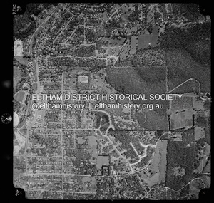
Photograph - Aerial Photograph, Landata, Eltham, Vic, Apr. 1972
... Centred on present day Woodridge Estate, Eltham bounded by Park Road to north, Mount Pleasant Road to south, Stokes Orchard Estate to east and Eltham Railway Station to west. ...Centred on present day Woodridge Estate, Eltham bounded by Park Road to north, Mount Pleasant Road to south, Stokes Orchard Estate to east and Eltham Railway Station to west. ...Centred on present day Woodridge Estate, Eltham bounded by Park Road to north, Mount Pleasant Road to south, Stokes Orchard Estate to east and Eltham Railway Station to west. Historic Aerial Imagery Source: Landata.vic.gov.au Aerial Photo Details: Project No :985 Project : MELBOURNE 1972 Run : 27 Frame : 46 Date : 04/1972 Film Type : B/W Camera : RC10 Flying Height : 5700 Scale : 9600 Film Number : 2636 GDA2020 : 37°42'49"S, 145°09'46"E MGA2020 : 338053, 5824365 (55) Melways : 22 C5 (ed. 42)aerial photo, neil webster collection, 1972-04, eltham, eltham railway station, melway 22c5, mount pleasant road, park road, stokes orchard estate, woodridge estate -
 Eltham District Historical Society Inc
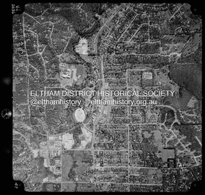
Photograph - Aerial Photograph, Landata, Eltham, Vic, Apr. 1972
... Road to north, Napoleon Street to south, Woodridge Estate to east and Ryans Road to west. Historic Aerial Imagery Source: Landata.vic.gov.au Aerial Photo Details: Project No :985 Project : MELBOURNE 1972 Run : 27 Frame : 47 Date : 04/1972 Film Type : B/W Camera : RC10 Flying Height : 5700 Scale : 9600 Film Number : 2636 GDA2020 : 37°42'45"S, 145°09'12"E MGA2020 : 337223, 5824470 (55) Melways : 22 A4 (ed. 42) Aerial Photo Neil Webster Collection 1972-04 Eltham Eltham Railway Station Woodridge Estate Eltham Shops Main Road Melway 22A4 Napoleon Street Park West Road Pryor Street Ryans Road Digital jpg and electronic PDF file Eltham, Vic. ...Centred on present day Main Road at Pryor Street, Eltham bounded by Park West Road to north, Napoleon Street to south, Woodridge Estate to east and Ryans Road to west. Historic Aerial Imagery Source: Landata.vic.gov.au Aerial Photo Details: Project No :985 Project : MELBOURNE 1972 Run : 27 Frame : 47 Date : 04/1972 Film Type : B/W Camera : RC10 Flying Height : 5700 Scale : 9600 Film Number : 2636 GDA2020 : 37°42'45"S, 145°09'12"E MGA2020 : 337223, 5824470 (55) Melways : 22 A4 (ed. 42)aerial photo, neil webster collection, 1972-04, eltham, eltham railway station, woodridge estate, eltham shops, main road, melway 22a4, napoleon street, park west road, pryor street, ryans road -
Glen Eira Historical Society
Letter - Bromfield, Margery
... South Caulfield... Kooyong Road... Hawthorn Road... Sycamore Road... Poplar Street... North Road... Glenhuntly Road... Orrong Road... Tranmere Avenue... Carnegie... Fairfield Grove... Caulfield... Bambra Road... Younger Avenue... Shoobra road... Gardenvale Road... Laura Street... Koornang Road... Alder Street... Wallen Road... Caulfield Tow Hall... Elsternwick Station... Gardenvale Station... Caulfield Council... Caulfield State School... Glenhuntly State School... Coxe’s Hill... O’Neil Convent... Rosstown Sugar works... Carnegie Sugar Works... Market gardens... Renown picture theatre... Brighton Cemetery... Caulfield Military Hospital... Bethlehem Hospital... Congregational Hall... Rosstown railway...Reed Ruth Reed Rose Abbot Ruth Kelly Maurice Schwiger Percy Rev Peck Mr Needham Nancy Hart T J Green Mrs Begbie family Reid Dr Sherwin Dr McLaven Dr Williams Mr Whitburn Mr Whitburn Miss Williamson Miss Frost Miss Roberts Mr Taylor Miss Pretty Miss Kellow Miss Hanley Miss Younger Mr Cleland Tom Sheridan family Millard Tom Reed Mrs Reed Martin Caulfield Historical Society School teachers Nathan Grove South Caulfield Kooyong Road Hawthorn Road Sycamore Road Poplar Street North Road Glenhuntly Road Orrong Road Tranmere Avenue Carnegie Fairfield Grove Caulfield Bambra Road Younger Avenue Shoobra road Gardenvale Road Laura Street Koornang Road Alder Street Wallen Road Caulfield Tow Hall Elsternwick Station Gardenvale Station Caulfield Council Caulfield State School Glenhuntly State School Coxe’s Hill O’Neil Convent Rosstown Sugar works Carnegie Sugar Works Market gardens Renown picture theatre Brighton Cemetery Caulfield Military Hospital Bethlehem Hospital Congregational Hall Rosstown railway line Peck’s hotel Trams Steam trains Horse drawn carts Hansom cabs Dairy farms Livestock Bagpipe bands Clelands property Sheridans Glen Eira mansion Rose Craddock Fairfield mansion Swagmen Sanitary and municipal engineering OST Lodge Clothing shops Reed Margery Chinese community Letter Bromfield, Margery ...1/ Handwritten notes (3 different sets) on the history of Caulfield from 1910, by longtime resident Margery Bromfield, dated 1974. 2/ Includes original typed correspondence from Caulfield Historical Society to and from M Bromfield in 1974 and 1975. 3/Also includes a small original, undated, newspaper photograph of Margery as a little girl at St Catherines Church.reed ruth, reed rose, abbot ruth, kelly maurice, schwiger percy rev, peck mr, needham nancy, hart t j, green mrs, begbie family, reid dr, sherwin dr, mclaven dr, williams mr, whitburn mr, whitburn miss, williamson miss, frost miss, roberts mr, taylor miss, pretty miss, kellow miss, hanley miss, younger mr, cleland tom, sheridan family, millard tom, reed mrs, reed martin, caulfield historical society, school teachers, nathan grove, south caulfield, kooyong road, hawthorn road, sycamore road, poplar street, north road, glenhuntly road, orrong road, tranmere avenue, carnegie, fairfield grove, caulfield, bambra road, younger avenue, shoobra road, gardenvale road, laura street, koornang road, alder street, wallen road, caulfield tow hall, elsternwick station, gardenvale station, caulfield council, caulfield state school, glenhuntly state school, coxe’s hill, o’neil convent, rosstown sugar works, carnegie sugar works, market gardens, renown picture theatre, brighton cemetery, caulfield military hospital, bethlehem hospital, congregational hall, rosstown railway line, peck’s hotel, trams, steam trains, horse drawn carts, hansom cabs, dairy farms, livestock, bagpipe bands, clelands property, sheridans, glen eira mansion, rose craddock, fairfield mansion, swagmen, sanitary and municipal engineering, ost lodge, clothing shops, reed margery, chinese community -
 Sunshine and District Historical Society Incorporated
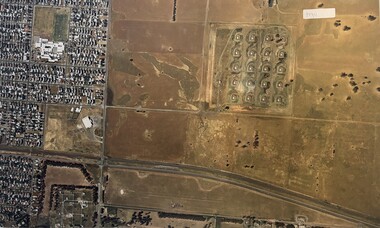
Photograph - Aerial Photographs Of Melbourne Metropolitan Area 1989, Qascophoto, 17th November 1989 & 28th November 1989
... 953.01 - Aerial Photographs Of Melbourne Metropolitan Area 1989.JPG Suburb(s): Ardeer, Deer Park (Now Derrimut), Sunshine West Area bounded by: Railway Parade (North), Paramount Bouvard (South), Allison Street (East), Approx Station Road (West) Points of Interest: IVI Explosive Bunkers, Railway Siding into ICI off Forrest Street, Former Railway Station Tilburn Road, Sunshine Technical School Annex, Croatian Catholic Centre Sunshine Fitzgerald Road 953.02 - Aerial Photographs Of Melbourne Metropolitan Area 1989.JPG Suburb(s): Brooklyn, Yarraville Area bounded by: South of Somerville Road (North), Westgate Freeway (South), Urwin Street (East). ...Melbourne Aerial Photograph 953.01 - Aerial Photographs Of Melbourne Metropolitan Area 1989.JPG Suburb(s): Ardeer, Deer Park (Now Derrimut), Sunshine West Area bounded by: Railway Parade (North), Paramount Bouvard (South), Allison Street (East), Approx Station Road (West) Points of Interest: IVI Explosive Bunkers, Railway Siding into ICI off Forrest Street, Former Railway Station Tilburn Road, Sunshine Technical School Annex, Croatian Catholic Centre Sunshine Fitzgerald Road 953.02 - Aerial Photographs Of Melbourne Metropolitan Area 1989.JPG Suburb(s): Brooklyn, Yarraville Area bounded by: South of Somerville Road (North), Westgate Freeway (South), Urwin Street (East). ...953.01 - Aerial Photographs Of Melbourne Metropolitan Area 1989.JPG Suburb(s): Ardeer, Deer Park (Now Derrimut), Sunshine West Area bounded by: Railway Parade (North), Paramount Bouvard (South), Allison Street (East), Approx Station Road (West) Points of Interest: IVI Explosive Bunkers, Railway Siding into ICI off Forrest Street, Former Railway Station Tilburn Road, Sunshine Technical School Annex, Croatian Catholic Centre Sunshine Fitzgerald Road 953.02 - Aerial Photographs Of Melbourne Metropolitan Area 1989.JPG Suburb(s): Brooklyn, Yarraville Area bounded by: South of Somerville Road (North), Westgate Freeway (South), Urwin Street (East). West of McDonald Road (West) Points of Interest: State Electricity Commission of Victoria (SECV) Stores, Brooklyn Wool Stores, Brooklyn Primary School, Half Moon Caravan Park, Footscray Cemetery, Rheems, James Hardy 953.03 - Aerial Photographs Of Melbourne Metropolitan Area 1989.JPG Suburb(s): Ascot Vale, Maribyrnong Area bounded by: Raleigh Road (North), River Street and James Street (South), Holdsworth Street (East), West of Van Ness Avenue (West) Points of Interest: Highpoint City, Fairbairn Park, Hume Pipes, Riverside Golf Course, ICI Laboratories 953.04 - Aerial Photographs Of Melbourne Metropolitan Area 1989.JPG Suburb(s): Albion, Ardeer, Sunshine, Sunshine West Area bounded by: Dubbo Street (North), South of Glengala Road (South), West of Sydney Street (East), Vernon Crescent (West) Points of Interest: Ainsworth Reserve, Selwyn Park, St. Paul Church, Marian College, Ardeer Primary School, Glengala Road Shopping Centre, 953.05 - Aerial Photographs Of Melbourne Metropolitan Area 1989.JPG Suburb(s): Deer Park Area bounded by: Station Road (East), Marcellin Court (West), Irvine Street (North), Deer Street (South) Points of Interest: Deer Park Primary School, Deer Park Play Kindergaten, Deer Park Shopping Centre, St. Peter Chanel Church & School 953.06 - Aerial Photographs Of Melbourne Metropolitan Area 1989.JPG Suburb(s): Derrimut Area bounded by: Future Ring Road (North), South of Boundary Road (South), East of Andersons Swamp (East), West of Fitzgerald Road (West) Points of Interest: Andersons Swamp 953.07 - Aerial Photographs Of Melbourne Metropolitan Area 1989.JPG Suburb(s): Sunshine West Area bounded by: East of Fairbairn Road (East), East of Fitzgerald Road (West), North of Mailey Street (North), South of Talintyre Road (South) Points of Interest: Sunshine West High School, Sunshine Heights Primary School, Castley Reserve, Talintyre Reserve, Talintyre Road Shops, St. Peters School, Sunshine Golf Course, Ralph Reserve, Glengala Primary School 953.08 - Aerial Photographs Of Melbourne Metropolitan Area 1989.JPG Suburb(s): Derrimut, Ravenhall Area bounded by: East of Station Road, now Derrimut Road (East), West of Robinsons Road (West), South of Railway Line (North), North of Future Deer Park Bypass Points of Interest: Old Farms and Quarries 953.09 - Aerial Photographs Of Melbourne Metropolitan Area 1989.JPG Suburb(s): Sydenham, Taylors Lakes, Taylors Hill Area bounded by: Taylors Creek (North), Future Hume Drive (South), West of Future Parmelia Drive (East), Future Hawthorn Grove (West) Points of Interest: Sydenham Reservoir, Sydenham Railway Station, Sydenham Memorial Hall, Sydenham Primary School, Sydenham Recreation Reserve, Catholic Regional College Sydenham, Kingdom Hall of Jehovah's Witnesses 953.10 - Aerial Photographs Of Melbourne Metropolitan Area 1989.JPG Suburb(s): Brooklyn, Tottenham Area bounded by: Stony Creek (North), South of Somerville Road (South), Holmwood Road (East), West of McDonald Road (West) Points of Interest: Monsanto, Dalgety's, Wool Stores, Sims Metals, Farmer & Graziers, Olex Cables, Redbrook Carpets, May & Baker, Cargil Oil, Smorgans 953.11 - Aerial Photographs Of Melbourne Metropolitan Area 1989.JPG Suburb(s): Brooklyn Area bounded by: South of Fourth Avenue (North), South of Bunting Road (South), West of McDonald Road, East of Fitzgerald Road (West) Points of Interest: Market Road, Bunting & Jones Road Quarries, Monsanto, ANI, Market Timber 953.12 - Aerial Photographs Of Melbourne Metropolitan Area 1989.JPG Suburb(s): Brooklyn, Laverton North Area bounded by: South of Bunting Road (North), Buchanan Road (South), Cypress Avenue (East). Little Boundary Road (West) Points of Interest: Jones Road and Old Geelong Road Quarries, Brooklyn Go Kart Track, Sims Metal Foundry, Ralphs, Guiding Star Hotel, Gas & Fuel Substation 953.13 - Aerial Photographs Of Melbourne Metropolitan Area 1989.JPG Suburb(s): Sunshine, Sunshine West Area bounded by: Parsons Street (North), South of Fourth Avenue (South), Alfred Street (East), West of Kororoit Creek (West) Points of Interest: Parsons Reserve, Wheat Silos, H.V. McKay Trade Wing, Tottenham Hotel, Sunshine Carvan Park 953.14 - Aerial Photographs Of Melbourne Metropolitan Area 1989.JPG Suburb(s): Derrimut, Mt. Derrimut, Sunshine West, Area bounded by: East of Allison Street (East), Mt. Derrimut (West), Hilma Street (North), South of old Sunshine Golf Course (South) Points of Interest: Mt. Derrimut, Sunshine Golf Course 953.15 - Aerial Photographs Of Melbourne Metropolitan Area 1989.jpeg Suburb(s): Avondale Height, Braybrook, Sunshine North Area bounded by: Canning Street (North), North of Cranwell Street (South), Medway Golf Course (East), Nottingham Street (West) Points of Interest: Duke Street Quarries, Cranwell Park, Pennell Reserve 953.16 - Aerial Photographs Of Melbourne Metropolitan Area 1989.jpeg Suburb(s): All of City of Sunshine Area bounded by: Maribyrnong River (North), Westgate Freeway (South), Nicholson Street (East), Robinsons Road (West) Points of Interest: General overall of the City of Sunshine 953.17 - Aerial Photographs Of Melbourne Metropolitan Area 1989.jpeg Map is missing 953.18 - Aerial Photographs Of Melbourne Metropolitan Area 1989.jpeg Suburb(s): Braybrook, Maidstone, Sunshine Area bounded by: Ballarat Road (North), North of South Road (South), East of Ashley Street (East), West of Duke Street (West) Points of Interest: Skinner Reserve, Kinder Smith Reserve, Churchill Avenue Shops, St. John College, Industrial Engineering, Invita Carpets, Tottenham Technical School, Carolone Chisholm College, Christ The King Primary School, Sunshine East Primary School, Dyecraft 953.19 - Aerial Photographs Of Melbourne Metropolitan Area 1989.JPG Suburb(s): Laverton North, Sunshine West Area bounded by: North of Boundary Road (North), Sewer Out Fall (South), East of Little Boundary Road (East), East of Future Ring Road (West). Points of Interest: Factories in Laverton Northmelbourne, aerial photograph -
 Sunshine and District Historical Society Incorporated
Administrative record - City of Sunshine - Commissioner Mr Alexander "Alex" George Gillon Collection 1976 - 1982 - Minutes of the Ordinary Meeting of Council Held on 3rd October 1978, City of Sunshine, 3rd October 1978
... Road...Maribyrnong...Railway Parade...Sunshine...Monsanto...Somerville Road...Footscray West...Fairbairn Road...Sunshine West...J.L. MacTaggart (Australia) Pty Ltd...Bruce Street...Albion...Links Street...Princess Street...St. Albans...Gould Street...Churchill Avenue...Braybrook...Main Road West...Furlong Road...Sunshine North...Neale Road...Station Road...Wright Street...Hampshire Road...McIntyre Road...Tamar Drive...Billingham Road...Judge Street...Norman Street...Geelong Road...Brooklyn...Carrington Drive...Gee Street...St. Albans Hotel...McKechnie Street...Hulett Street...Pineneedle Court...Mitchell Street...Navigator Street...Marshall Street...Kevin Dennis Motors...Annersley Street...Balfour Avenue...Sydney Street...Gooding Street...Ashley Street...South...Road Maribyrnong Railway Parade Sunshine Monsanto Somerville Road Footscray West Fairbairn Road Sunshine West J.L. MacTaggart (Australia) Pty Ltd Bruce Street Albion Links Street Princess Street St. Albans Gould Street Churchill Avenue Braybrook Main Road West Furlong Road Sunshine North Neale Road Station Road Wright Street Hampshire Road McIntyre Road Tamar Drive Billingham Road Judge Street Norman Street Geelong Road Brooklyn Carrington Drive Gee Street St. Albans Hotel McKechnie Street Hulett Street Pineneedle Court Mitchell Street Navigator Street Marshall Street Kevin Dennis Motors Annersley Street Balfour Avenue Sydney Street Gooding Street Ashley Street South ...Minutes of the Ordinary Meeting of Council Held on 3rd October 1978 Reports on the Town Clerk's Department Report of the Town Clerk Victorian Beer Alcoholic Content Proposal for Reduction Land Transfer Adjacent to Deer Park Hotel Medway Golf Club Payment in Lieu of Rates Diamond Avenue Infant Welfare Centre Non-Availability of Subsidy Untied Grants Proposed Library Highpoint West Shopping Centre Land Transfer Discontinued Right of Way Rear of Railway Parade Deer Park Supplementary Valuations Community Youth Support Scheme Report of the Chief Health Inspector Nuisance Condition at 403 Ballarat Road Sunshine Removal of Dwelling Outside the Municipality Health Act Registrations Monsanto Application for Approval to Install Septic Tank Recirculating Sand Filter System at the Stansfield Steel Project Fairbairn Road Sunshine West Health (Tent) Regulations 1978 Draft Rubbish In and Around Flats Quarry Hole Commonwealth Land J.L. MacTaggart (Australia) Pty Ltd Noise By-Law Application for Transfer of Proprietorship of Premises Under the Health Act Infectious Diseases Sewerage Overflow 2 Bruce Street Albion Smoking in Public Buildings Immunisation Sunshine North Institute of Weights & Measures Annual National Conference Report of the Chief By-Laws Officer Court Proceedings Parking and Traffic Infringements Prohibited Parking Links Street Prohibited Parking Princess Street Area Prohibited Parking Gould Street Report of the City Librarian Bookmobile sites Municipal library Subsidy 1978/79 Bookmobile Seminar Children's Literature seconds National Seminar September 1st to 5th 1978 Report of the Municipal Recreation Officer Municipal Recreation Service Gound Allocations School Summer Season Holiday Programmes September 1978 Report of the City Engineer Proposed Children's Reception Centre for Erection in the City of Sunshine Planning Permit Application Illuminated Sign Churchill Avenue Planning Permit Application Grazing of Horses Furlong Road Planning Permit Application Offices Main Road West Planning Permit Application Extension to Exising Car Sales Yard Rosamond Road Planning Permit Application Corner of Neale Road and Station Road Deer Park Proposed Amendment No 81 to the Melbourne Metropolitan Planning Scheme Proposed Widening of Station Road Planning Permit Application Motor Repair Station Wright Street Planning Permit Application Sky Sign Hampshire Road Planning Permit Application Extension to Existing Warehouse McIntyre Road Planning Permit Application Consulting Rooms, Pharmacy, Service Premises and Caretaker's Dwelling Corner of Tamar Drive and Billingham Road Planning Permit Application Horse Grazing Judge Street & Norman Street Planning Permit Application Signs Geelong Road Planning Permit Application Factory Extension Carrington Drive Planning Permit Application Sky Sign Ballarat Road Sunshine Planning Permit Application Factory and Office Gee Street Sunshine North Planning Permit Application Drive in Bottle Shop and Extensions to St. Albans Hotel McKechnie Street Planning Permit Application Sky Sign & Fascia Signs Ballarat Road Sunshine Planning Permit Application Store Addition to Existing Office Geelong Road Plan of Subdivision Boral Resources Ballarat Road & Hulett Street Plan of Subdivision R.D.C. Projects Evergreen Avenue and Pineneedle Court Plan of Subdivision McPhersons Mitchell Street Plan of Subdivision Navigator Street Consolidation of Title Marshall Street Consolidation of Title Kevin Dennis Motors Ballarat Road and Annersley Street Consolidation of Title Lots 37 & 38 Balfour Avenue Contract Playground Equipment Various Reserves Contract Reconstruction of Sydney Street Contract Gooding Street 40 Hour Week Victorian Sewerage and Drainage Contractors' Group Declaration of Sewered Properties General Notice Sewerage Facilities M.M.B.W. Allocation of Funds 1978/79 Joint Works Unclassified Roads Telecom Australia Modernisation of Public Telephones St. Albans Area Ashley Street / South Road Proposed Traffic Lights Maribyrnong River Flood Plan Acting Commissioner of Police Sewerage Facilities St. Albans (Albanvale) Warrs Road Northern Section Private Street Scheme Use of C.R.B. land McIntyre Road for Recreation Purposes Garaging of Meals on Wheels Vehicles at Maidstone Hall Thomson Street Maidstone Relocation of Steel Framed Steel Clad Sheds to Errington Reserve and Robert Bruce Reserve Rosamond Bowling Club Report of the Building Surveyor Building Over Easement 135 Devonshire Road Sunshine Building Over Easement 10 Sproul Street Sunshine North Building Over Easement Lot 552 Oakwood Road St. Albans Building Over Easement 6 Haven Close Sunshine West Building Over Easement 75 Norwood Street Albion Building Over Easement182 Wright Street Sunshine West Building Over Easement 176 McIntyre Road Sunshine North Installation of Underground Tanks Corner Raleigh Road and Navigator Street Maribyrnong Ruinous and Dangerous Building Lots 6 & 7 Furlong Road Sunshine North Orders of the Day Accounts for Payment as at 15th September 1978, 26th September 1978 Extraordinary Business Report of the City Engineer Planning Permit Application Medical Consulting Rooms Clarke Street Sunshine Planning Permit Application Take away Food Premises Cafe Amusement Parlour Highpoint City Rosamond Road city of sunshine, alexander "alex" george gillon, deer park hotel, ballarat road, deer park, medway golf club, omar street, maidstone, diamond avenue infant welfare centre, diamond avenue, albanvale, highpoint west shopping centre, rosamond road, maribyrnong, railway parade, sunshine, monsanto, somerville road, footscray west, fairbairn road, sunshine west, j.l. mactaggart (australia) pty ltd, bruce street, albion, links street, princess street, st. albans, gould street, churchill avenue, braybrook, main road west, furlong road, sunshine north, neale road, station road, wright street, hampshire road, mcintyre road, tamar drive, billingham road, judge street, norman street, geelong road, brooklyn, carrington drive, gee street, st. albans hotel, mckechnie street, hulett street, pineneedle court, mitchell street, navigator street, marshall street, kevin dennis motors, annersley street, balfour avenue, sydney street, gooding street, ashley street, south road, maribyrnong river, warrs road, maidstone hall, thomson street, errington reserve, robert bruce reserve, rosamond bowling club, main road east, devonshire road, sproul street, oakwood road, haven close, norwood street, raleigh road, clarke street, highpoint city -
Ballarat Tramway Museum
Document, Hector Bell Junior, "Street passenger transport system of Geelong Urban Area", 1949
... Said the tramway system was obsolete, should be a rail service between North and South Geelong, set up a street transport body, replan the Geelong railway station, additional roads to service the North Shore area. ...Said the tramway system was obsolete, should be a rail service between North and South Geelong, set up a street transport body, replan the Geelong railway station, additional roads to service the North Shore area. ...Report by Hector H Bell Junior of the MMTB early 1949, titled "Street passenger transport system of Geelong Urban Area". Looks at the history of public transport in Geelong, tramway data, financial analysis, the Geelong bus system, buses servicing the North Shore industries - principally the Ford Works, the condition of the bus fleet, taxi and private car hire services, functions of a street transport authority, town planning, populations and traffic surveys, relative values of passenger vehicles, trolley buses, industry and recommendations. Said the tramway system was obsolete, should be a rail service between North and South Geelong, set up a street transport body, replan the Geelong railway station, additional roads to service the North Shore area. Refers to attachments. Has a list of people involved in the preparation of the report. See item 112 for the AETA response of April 1949 to this report.Yields information about the Geelong tram and bus services in 1948/49 and how it could be developed or reformed. Has a close association with Hector Bell Junior, the son of the then MMTB Chairman.Document - 18 foolscap sheets photocopied and stapled in three places along the side.tramways, secv, geelong, statistics, history, passenger services, reports, aeta -
 Ballarat Tramway Museum
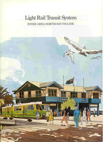
Book, Metropolitan Transit Authority (MTA), "Light Rail Transit System - Inner Area North-South Link", c1986
... North-South Link", published by the Metropolitan Transit Authority detailing the conversion of the former heavy electric suburban railway lines to St Kilda and Port Melbourne to electric trams or Light Rail. Has foreword by Tom Roper, Minister for Transport, Describes the proposed system, vehicles, development of articulated vehicles (2001, 2002), interchange with rail services, travel times and a map showing the proposed route, including a possible extension along Mitford St. and Broadway to Glenhuntly Road. Has a number of artists impressions of the vehicles at Station...North-South Link", published by the Metropolitan Transit Authority detailing the conversion of the former heavy electric suburban railway lines to St Kilda and Port Melbourne to electric trams or Light Rail. Has foreword by Tom Roper, Minister for Transport, Describes the proposed system, vehicles, development of articulated vehicles (2001, 2002), interchange with rail services, travel times and a map showing the proposed route, including a possible extension along Mitford St. and Broadway to Glenhuntly Road. Has a number of artists impressions of the vehicles at Station ...Sixteen page book, A4 portrait format, saddle stapled, titled "Light Rail Transit System - Inner Area North-South Link", published by the Metropolitan Transit Authority detailing the conversion of the former heavy electric suburban railway lines to St Kilda and Port Melbourne to electric trams or Light Rail. Has foreword by Tom Roper, Minister for Transport, Describes the proposed system, vehicles, development of articulated vehicles (2001, 2002), interchange with rail services, travel times and a map showing the proposed route, including a possible extension along Mitford St. and Broadway to Glenhuntly Road. Has a number of artists impressions of the vehicles at Station Pier and South Melbourne station. Includes colour photographs of the vehicles, conductors and photos of other light rail systems in Hanover and Amsterdam. Published c1986.trams, tramways, melbourne, light railways, mta, st kilda, port melbourne, articulated trams -
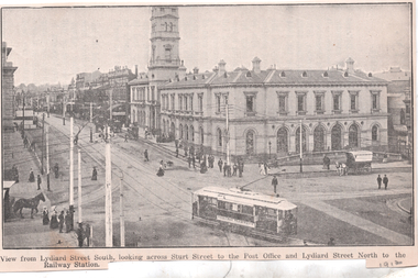 Ballarat Tramway Museum
Photograph - Illustration, WTP, "View from Lydiard Street South looking across Sturt St", c1907
... road space on the left-hand side of the photograph. The caption along the bottom edge "View from Lydiard Street South looking across Sturt Street to the Post Office and Lydiard Street North to the Railway Station. ...road space on the left-hand side of the photograph. The caption along the bottom edge "View from Lydiard Street South looking across Sturt Street to the Post Office and Lydiard Street North to the Railway Station. ...Illustration of the intersection of Sturt St and Lydiard St Nth with the Ballarat Post Office being the primary feature. Has an ESCo tram turning from Sturt St into Lydiard St. Shows the trackwork at this location and has several horse-drawn vehicles in the photograph. Note the building in the road space on the left-hand side of the photograph. The caption along the bottom edge "View from Lydiard Street South looking across Sturt Street to the Post Office and Lydiard Street North to the Railway Station. On the rear has an item about Ballarat itself and its history. See also item 6245 for a postcard of this view. Yields information about the post office corner at the time of the opening of the tramway and demonstrates printing techniques.Black and white Illustration cut from a journaltramways, trams, sturt st, esco, post office, lydiard st north -
 Ballarat Tramway Museum
Album - Photo Album, c1970
... railway station. No. 11 showing special. .5 - photo of three people on the tour. .6 - Trams reversing at the Victoria St terminus .7 - ditto .8 - 11, 42 and 12? in Lydiard St North by railway station. .9 - Three trams at Sebastopol terminus. .10 - View in Albert St Sebastopol looking north along the track on the side of the road. .11 - View of the tram crossing in Albert St. .12 - 27 and 42 crossing Albert St Sebastopol. .13 - View of Albert St from the tram, north of the crossing looking at the reserved track 14. - Lydiard St North looking south .15 - 42 at the railway level crossing. .16 - View south of the railway level crossing, three trams, with passengers alighting....railway station. No. 11 showing special. .5 - photo of three people on the tour. .6 - Trams reversing at the Victoria St terminus .7 - ditto .8 - 11, 42 and 12? in Lydiard St North by railway station. .9 - Three trams at Sebastopol terminus. .10 - View in Albert St Sebastopol looking north along the track on the side of the road. .11 - View of the tram crossing in Albert St. .12 - 27 and 42 crossing Albert St Sebastopol. .13 - View of Albert St from the tram, north of the crossing looking at the reserved track 14. - Lydiard St North looking south .15 - 42 at the railway level crossing. .16 - View south of the railway level crossing, three trams, with passengers alighting. ...Set of 16 photos of Ballarat tram system taken 1970c on a tour by an unknown Qld based person.Photo album containing 16 colour prints. Photo album has heavy card covers, covered in black textured plastic containing 12 clear plastic photo sleeves held with a white comb binder. Photos of Ballarat prior to closure, c1970. Photographer unknown. Donated by Peter Hyde of Brisbane Tramway Museum to BTM 3/2/2010, from a deceased estate. Photos apparently taken on a tram tour. .1 - No. 42 and a single trucker inbound in Sturt St. .2 - taken from tram ascending Bakery St hill in Victoria St. .3 - End of No. 42, with the destination "Haddon St via Drummond Nth" .4 - No. 11 and 42 in Lydiard St Nth, near the railway station. No. 11 showing special. .5 - photo of three people on the tour. .6 - Trams reversing at the Victoria St terminus .7 - ditto .8 - 11, 42 and 12? in Lydiard St North by railway station. .9 - Three trams at Sebastopol terminus. .10 - View in Albert St Sebastopol looking north along the track on the side of the road. .11 - View of the tram crossing in Albert St. .12 - 27 and 42 crossing Albert St Sebastopol. .13 - View of Albert St from the tram, north of the crossing looking at the reserved track 14. - Lydiard St North looking south .15 - 42 at the railway level crossing. .16 - View south of the railway level crossing, three trams, with passengers alighting.trams, tramways, ballarat, albert st, sebastopol, victoria st, sturt st, lydiard st nth, railway crossing -
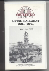 Ballarat Tramway Museum
Film - Video cassette tape and box, Chris Long, "Living Ballarat 1901 - 1941", 1990
... South St Music Festivals, Coliseum and fire. 56.25 - Ballarat Floral Festival March 1938 - Victorian Railways arch of welcome. 57.25 - segment in the shot of 12 and 19? in Sturt St 57.45 - colour segment of the festival, 58.39 - Grenville St tram shelter, Bridge St, Sturt St, arches, Main Road, Council Road Roller, Victoria St, Eureka Stockade Reserve, Botanic Gardens, setting up the flowers, wax papers. 1.01.48 - decorated tram, north side of Sturt St, details of the materials used, Crockers. 1.03.20 - Hospital Fund Raising Gala Day - March 1938, special trains arriving Ballarat Railway Station, fund raising procession, pageant at the Showgrounds, fly past. 1.07.35 - 1939 Summer, motor cycle races at Learmonth, City Oval fire brigade demonstrations, Ballarat (East) Fire Station decorated for the 1939 Floral Festival with tram in the background and No. 29, Floral Tram and others. 1.09.25 - July 1914 - Ballarat at War parade, troops. 1.10.10 - credits. ...South St Music Festivals, Coliseum and fire. 56.25 - Ballarat Floral Festival March 1938 - Victorian Railways arch of welcome. 57.25 - segment in the shot of 12 and 19? in Sturt St 57.45 - colour segment of the festival, 58.39 - Grenville St tram shelter, Bridge St, Sturt St, arches, Main Road, Council Road Roller, Victoria St, Eureka Stockade Reserve, Botanic Gardens, setting up the flowers, wax papers. 1.01.48 - decorated tram, north side of Sturt St, details of the materials used, Crockers. 1.03.20 - Hospital Fund Raising Gala Day - March 1938, special trains arriving Ballarat Railway Station, fund raising procession, pageant at the Showgrounds, fly past. 1.07.35 - 1939 Summer, motor cycle races at Learmonth, City Oval fire brigade demonstrations, Ballarat (East) Fire Station decorated for the 1939 Floral Festival with tram in the background and No. 29, Floral Tram and others. 1.09.25 - July 1914 - Ballarat at War parade, troops. 1.10.10 - credits. ...Yields information through movie films of the 1960's of Ballarat trams operating in the streets of Ballarat and has a strong association with the maker - National Film and Sound Archives and Chris Long.Video cassette in a plastic case, titled "Living Ballarat - 1901 - 1941, National Film and Sound Archive (1990)". Copyright provisions - National Film and Sound Archive - segments may not be used without their permission, viewing only. Synopsis: based on time - 0.00 - intro, 1901 film, Melbourne, first film in Ballarat, Royal visit to Ballarat, Boer War Monument, first feature length film in Ballarat. 2.50 - Bridge St and Sturt St scenes, filmed from a flat truck pushed by an electric tram, including No. 11 going to City Oval to Lydiard St. 5.00 - Sturt St Military parade, with trams in background and tram running alongside. 6.54 - scene of Alfred Hall and films. 7.32 - scene on Lake Wendouree and paddle steamer - Living Ballarat film - Pathe's Ballarat Gazette local film unit, football ground scene. a children's beauty competition, tree planting at Macarthur St state school, 1911 Ballarat Show, unveiling of the Boer War statue name plates, Lake Wendouree 1912. 13.22 - St Patricks David Pde with trams in the background. 14.24 - Ballarat Kennel club dog show. 15.50 - Royal visit in 1920, Arch of victory opening 17.48 - Day at Macarthur St state school and tree plantation 20.55 - Bakery Hill - Stones Corner with tram tracks, cars, little trams, Sturt St with a tram leaving Grenville St, ESCo 9 turning from Lydiard St to run down to Grenville St. 22.15 - Ballarat Show, Coliseum Hall, 1925, races, machinery shows, boxing troupe. 25.20 - Botanic Gardens Gates, Lake Wendouree area. 25.30 - Gem Picture travelling show - film 26.16 - Formal visit of English pressman to Ballarat, 1925, Botanic Gardens, Eureka Stockade, Avenue of Honor, Moorabool Reservoir. 29.15 - 1927 Fed Govt doco of Ballarat, Black Hill, 1927 Home to Ballarat Festival, Ballarat Commemorative song, Craigs Hotel, Ballarat Post Office, tram centre poles in Lydiard St, tram climbing Sturt St, Town Hall, tram at Lydiard St terminus coursing, 8, Sturt St, view of ESCo Sebastopol car leaving Grenville St, Selkirks Brickworks, the Welcome nugget, Peter Lalor statue, Eureka stockade, sewerage plant, modern housing, Sturt St west, water supply - golf club, the High School, the orphanage, fine homesteads around Ballarat, Lake Wendouree. 41.00 Opening of the Ballarat Aerodrome. 43.11 - Depression work and leading into radio broadcasting - 3BA open 1930, typewriters, radio transmission equipment, radio aerials, boys listening to crystal sets 47.50 - Bluebirds Children session tour to the Gardens, mentions the BTPS, trams 13, 3? and 14 carrying visitors arriving and getting off and picnic. 48.50 - expansion of 3BA transmitter capacity 51.30 - 1934 visit of the Duke of Gloucester - visit to the Lucas factory, views of the work floor and the factory history and then South St band competition at the Showgrounds. 55.10 - South St Music Festivals, Coliseum and fire. 56.25 - Ballarat Floral Festival March 1938 - Victorian Railways arch of welcome. 57.25 - segment in the shot of 12 and 19? in Sturt St 57.45 - colour segment of the festival, 58.39 - Grenville St tram shelter, Bridge St, Sturt St, arches, Main Road, Council Road Roller, Victoria St, Eureka Stockade Reserve, Botanic Gardens, setting up the flowers, wax papers. 1.01.48 - decorated tram, north side of Sturt St, details of the materials used, Crockers. 1.03.20 - Hospital Fund Raising Gala Day - March 1938, special trains arriving Ballarat Railway Station, fund raising procession, pageant at the Showgrounds, fly past. 1.07.35 - 1939 Summer, motor cycle races at Learmonth, City Oval fire brigade demonstrations, Ballarat (East) Fire Station decorated for the 1939 Floral Festival with tram in the background and No. 29, Floral Tram and others. 1.09.25 - July 1914 - Ballarat at War parade, troops. 1.10.10 - credits. Box has images of a tram and town hall on the front and details of the contents on the rear and who made it etc. See images for details. ballarat, 3ba, floral tram, royal visit, buildings, esco -
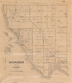 Bayside Gallery - Bayside City Council Art & Heritage Collection
Map, Department of Crown Lands and Survey et al, Moorabbin, County of Bourke, Government Roads, 1920
... roads are coloured in red pencil. Port Phillip Bay is on the left, with land extending from Sandringham foreshore through to Cheltenham. The most detail is between Brighton Beach Railway Station (to the north) and just past Rickett's Point (to the south) but the map extends to North Road, Brighton at top. ...roads are coloured in red pencil. Port Phillip Bay is on the left, with land extending from Sandringham foreshore through to Cheltenham. The most detail is between Brighton Beach Railway Station (to the north) and just past Rickett's Point (to the south) but the map extends to North Road, Brighton at top. ...The cadastral map of the Parish of Moorabbin in Victoria (L.6104) shows parish boundaries and land ownership 1920 when Sandringham was a Town. The government roads have been coloured in red pencil.moorabbin, county of bourke, map, plan, land subdivision, land titles, foreshores, hampton, beaumaris, highett, cheltenham, department of lands and survey, land owners, cartographic material, brighton, sandringham, town of sandringham, government roads -
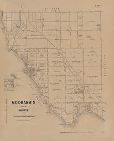 Bayside Gallery - Bayside City Council Art & Heritage Collection
Map, Department of Crown Lands and Survey, Moorabbin, County of Bourke, c. 1918
... The most detail is between Brighton Beach Railway Station (to the north) and just past Rickett's Point (to the south) but the map extends to North Road, Brighton at top....The most detail is between Brighton Beach Railway Station (to the north) and just past Rickett's Point (to the south) but the map extends to North Road, Brighton at top. ...The cadastral map of the Parish of Moorabbin in Victoria (L.6104) shows parish boundaries and land ownership c. 1918 when Sandringham was a Borough.moorabbin, county of bourke, map, plan, land subdivision, land titles, foreshores, sndringham, hampton, beaumaris, highett, cheltenham, department of lands and survey, land owners, cartographic material, borough of sandringham, brighton -
 Sunshine and District Historical Society Incorporated
Document - Solomon Heights Ecological Assessment Final Report, Ecology and Heritage Partners Pty Ltd, 22nd January 2016
... roads. The estate is named after Michael Solomon, an early pastoralist whose 1830s sheep station and nearby Solomon’s Ford were key early European landmarks on the Maribyrnong River. This report was undertaken to identify and characterise the vegetation on-site, to determine the presence (or likelihood thereof) of any significant flora and fauna species and/or ecological communities and address any implications under Commonwealth and State environmental legislation. The area of Solomon Heights covered by this report is the southern half, Whitehill Avenue to the North, Munro Avenue to the South, Vermont Avenue to the East and the railway...roads. The estate is named after Michael Solomon, an early pastoralist whose 1830s sheep station and nearby Solomon’s Ford were key early European landmarks on the Maribyrnong River. This report was undertaken to identify and characterise the vegetation on-site, to determine the presence (or likelihood thereof) of any significant flora and fauna species and/or ecological communities and address any implications under Commonwealth and State environmental legislation. The area of Solomon Heights covered by this report is the southern half, Whitehill Avenue to the North, Munro Avenue to the South, Vermont Avenue to the East and the railway ...Solomon Heights in Sunshine North is a 1920s subdivision that was never built, later rezoned industrial, and today remains an undeveloped patchwork of grasslands, quarries, and paper roads. The estate is named after Michael Solomon, an early pastoralist whose 1830s sheep station and nearby Solomon’s Ford were key early European landmarks on the Maribyrnong River. This report was undertaken to identify and characterise the vegetation on-site, to determine the presence (or likelihood thereof) of any significant flora and fauna species and/or ecological communities and address any implications under Commonwealth and State environmental legislation. The area of Solomon Heights covered by this report is the southern half, Whitehill Avenue to the North, Munro Avenue to the South, Vermont Avenue to the East and the railway line to the West.The results of the report found 78 flora species (35 indigenous and 43 non-indigenous), 2 native reptiles, 2 introduced mammals, 12 birds (8 natives and 4 introduced) and 1 native invertebrate were recorded in the study area.Final Report Ecological Assessment, Solomon Heights (Munro Avenue to Whitehill Avenue) Sunshine North, Victoria Prepared for Glen Ora Estate Pty Ltd January 2016 Ecology and Heritage Parnters Pty Ltdsolomon heights, sunshine north -
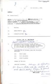 Sunshine and District Historical Society Incorporated
Administrative record - City of Sunshine - Commissioner Mr Alexander Alex George Gillon Collection 1976 - 1982 - Notice of Ordinary Meeting 9th October 1976, City of Sunshine, 5th November 1976
... North...Railway Parade...Deer Park...St. Albans Sports Club...Errington Reserve...Main Road East...St. Albans...G.W. Pennell Pty Ltd...Olex Cables...Sunshine Road...Tottenham...Perth Avenue...Albion...Watt Street Child Care Centre...Maidstone Hall...Thomson Street...Maidstone...Navigator Street...Maribyrnong...McIntyre Road...South Road...Braybrook...Paw Paw Road...Brooklyn...Burgess Road...Berkshire Road...Cornhill Reserve...Conrhill Street...Somers Street...Fairbairn Road...Tottenham Parade...Footscray West...Bunting Road...McDonald Road...Drummartin Street...Mark Street...Sunshine West...St. Albans Road...Fourth Avenue...Furlong Road...Tallintyre Road...Albion Reid...Ballarat Road...Sanford Avenue...Main Road West...Robinsons Road...Abercairn Court...Stayton Close...Warrs Road...Station...North Railway Parade Deer Park St. Albans Sports Club Errington Reserve Main Road East St. Albans G.W. Pennell Pty Ltd Olex Cables Sunshine Road Tottenham Perth Avenue Albion Watt Street Child Care Centre Maidstone Hall Thomson Street Maidstone Navigator Street Maribyrnong McIntyre Road South Road Braybrook Paw Paw Road Brooklyn Burgess Road Berkshire Road Cornhill Reserve Conrhill Street Somers Street Fairbairn Road Tottenham Parade Footscray West Bunting Road McDonald Road Drummartin Street Mark Street Sunshine West St. Albans Road Fourth Avenue Furlong Road Tallintyre Road Albion Reid Ballarat Road Sanford Avenue Main Road West Robinsons Road Abercairn Court Stayton Close Warrs Road Station ...Report of the Town Clerk Compensation Lots 43 & 44 Northumberland Road Sale of Lots 43 & 44 Railway Parade Errington Reserve Request by St. Albans Sports Club to act as Committee of Management Proposed Indoor Heated Swimming Pool Subsidy from Department of Youth, Sport & Recreations Proposed Lease of The Hub Offer by the State Department Request For Financial Assistance Report of the Chief Health Inspector Prosecutions Proceedings Sunshine Magistrates Court G.W. Pennell Pty Ltd Offensive Trades Shifted to Shepparton Pollution Control M.M.B.W. Advice Olex Cables Amusements Parlours 39 Perth Avenue & 191 Sunshine Road Report of the Medical Officer of Health Report of the Welfare Officers Watt Street & Maidstone Hall Child Care Centres Family Day Care Report of the City Engineer State Emergency Service Proposed Amalgamation of Commonwealth Bureau of Roads and Bureau of Transport Economics Private Street Scheme Navigator Street Drainage McIntyre Road Construction South Road Drain Paw Paw Road Burgess Road Construction Berkshire Road Construction Cornhill Reserve Drain Somers Street Drain Grading Main Road East, McIntyre Road & Fairbairn Road Tottenham Parade Underground Service Investigation Bunting Road Corner McDonald Road Pot Hol Repair Driveways Modifications Mark Street & Drummartin Street St. Albans Road Shoulders Repaired Report on Contract Glengala Estate Stage 3 Private Street Scheme Report on Contract Garfield Street Private Street Scheme Report on Contract Dalton Street Private Street Scheme Report on Contract Fourth Avenue Private Street Scheme Private Subdivision Furlong Road Stage 7 Private Subdivision Furlong Road Stage 6 Private Subdivision Furlong Road Stage 5 Private Subdivision Furlong Road Stage 3 & 4 Private Subdivision Furlong Road Stages 1 & 2 Private Subdivision Western Gate Stage 1B Private Subdivision Western Gate Stage 2 Private Subdivision Western Gate Stages 3a & 3B Private Subdivision Shopping Centre Car Park Corner Tallintyre Road and Fairbairn Road and Fairbairn Road Rappaport Housing Commission Private Subdivision Albanvale Stage 17 & 18 Neale Road Estate Stage 1 Private Subdivision Western Gate Stage 1A Extractive Industries and Waste Disposal in the Western Region (Maunsell Report) Western Region Commission Plan of Subdivision Entally Drive R.D.C. Projects Transfer o Sealing Fee Albion Reid Pty Ltd Ballarat Road Consolidation to Title 23 Sanford Avenue Plan of Subdivision Stage 25 Albanvale Estate Main Road West and Robinsons Road Plan of Subdivision Robinsons Road, Abercairn Court, Stayton Close Warrs Road Closure to Through Traffic Report of the Chief Planner Tree Preservation Control Proposed Road Widening Station Road Parking Restrictions Murray Street Land Use Permit Furlong Road Proposed Freeeway Land Use Permit Proposed Sunshine Hospital Cash in Lieu Flats Lots 3 & 4 Craddock Court Cash in Lieu Flats Lots 7 & 8 Craddock Court Brick Garage 6 Ainsworth Street Outbuildings 49 Rhodes Street Fencing Lot 343 Annley Place Widith of Frantage Lot 43 & 44 Railway Parade Land Use Permit Extension to Existing Factory Lot 23 Carrington Drive Land Use Permit Car Park Main Road West Land Use Permit Display Homes Camelot Drive & Trafalgar Street Land Use Permit Alteration to Existing Service Station Caltex Oil Lot 3 St. Albans Road Land Use Permit Subdivision and Detached House Glenmaggie Drive Cricket Nets at Lloyd Reserve No Standing Anytime Simmie Street Proposed Rezoning Corner Sydney Street & Drummartin Street for a Laundrette Proposed Rezoning of Land Ballarat Road between Hampshire Road & Anderson Road Cash in Lieu Flats 16 Forrest Street Land Use Permit Application Car Sales 36 McIntyre Road Parking Restrictions Sunshine Road Land Use Permit Application Veterinary Clinic and Residence 98 Anderson Road Land Use Permit Application Flats Corner Matthews Street & Walter Street Cash in Lieu Flats 1 Lorraine Court Flammable Liquid Store Cargo Newpack Industries Lot 1 Victoria Drive Land Use Permit Application Motor Cycle Sales and Accessories Lot 1 South Road Proposed Pedestrian Operated Signals Hampstead Road North of Mitchell Street Land Use Permit Flats Ballarat Road Land Use Permit Application Subdivision & erection of Detached House 100 The Esplanade Land Use Permit Application Flats Belvedere Close Land Use Permit Flats Middle Road Land Use Permit Flats Warrs Road & Febian Court Land Use Permit Application Car Sales Yard Mitchell Street Objections Schedule city of sunshine, alexander "alex" george gillon, the hub, sun crescent, sunshine, northumberland road, sunshine north, railway parade, deer park, st. albans sports club, errington reserve, main road east, st. albans, g.w. pennell pty ltd, olex cables, sunshine road, tottenham, perth avenue, albion, watt street child care centre, maidstone hall, thomson street, maidstone, navigator street, maribyrnong, mcintyre road, south road, braybrook, paw paw road, brooklyn, burgess road, berkshire road, cornhill reserve, conrhill street, somers street, fairbairn road, tottenham parade, footscray west, bunting road, mcdonald road, drummartin street, mark street, sunshine west, st. albans road, fourth avenue, furlong road, tallintyre road, albion reid, ballarat road, sanford avenue, main road west, robinsons road, abercairn court, stayton close, warrs road, station road, murray street, craddock court, ainsworth street, rhodes street, annley place, carrington drive, camelot drive, trafalgar street, glenmaggie drive, lloyd reserve, camperdown avenue, simmie street, sydney street, hampshire road, anderson road, forrest street, matthews street, walter street, lorraine court, victoria drive, hampstead road, the esplanade, belvedere close, middle road, febian court, mitchell street -
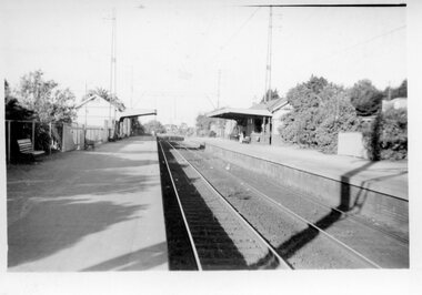 Surrey Hills Historical Society Collection
Digital photo, George L Coop, Mont Albert Railway Station c 1956, c1956
... station taken from the north platform adjacent to High Street, looking towards Box Hill. It clearly shows the bend in the line beyond the platforms. it also shows both the original buildings; the one on the north side having been demolished. There is a lady on the south platform adjacent to Hamilton Street. The roof line only of one of the Hamilton Road shops can be seen. Mont Albert Railway ...The donor George Lister Coop was about 19 years of age when he took this photo. It is one of a small series of photos donated by him that relate to Mont Albert and Surrey Hills stations. He has always had an interest in railways and there are other examples of his documentation of railway history in other collections contributing to this database. This documents the original building on the northern platform of the Mont Albert station. The railway line was extended out to Lilydale with work commencing in 1882. It is not known exactly when the Mont Albert station was built, but it opened in 1890. It is presumed that this building was demolished when the third line was constructed in 1971. At this time the nearby Surrey Hills original station buildings were demolished.A black & white photo of Mont Albert station taken from the north platform adjacent to High Street, looking towards Box Hill. It clearly shows the bend in the line beyond the platforms. it also shows both the original buildings; the one on the north side having been demolished. There is a lady on the south platform adjacent to Hamilton Street. The roof line only of one of the Hamilton Road shops can be seen.george lister coop, mont albert station, 1956, hamilton street shops -
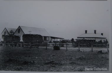 Melton City Libraries
Photograph, Chaff cutting and hay-pressing mills, 1909
... road Melton South. By 1906 Charles Ernest and James Edwin were in partnership in the Station Road mill when a connecting rail line across Brooklyn Road for a siding was constructed to the Melton Railway Station. In 1911 the Mill’s letterhead shows C.E. BARRIE Hay Pressing and Chaff Cutting Mills. This Mill as sold to H S K Ward in 1916 and stood until 1977 when it burnt down in a spectacular fire. Local identities pioneer families agriculture Owned by C.E Barrie. Buildings were on the west side of Station Road in Melton South, 100 metres north ...In the early 1900’s Charles Ernest Barrie and his brother Ted were in partnership in a Chaff cutting and Ha y processing Mill on the corner of Station and Brooklyn road Melton South. By 1906 Charles Ernest and James Edwin were in partnership in the Station Road mill when a connecting rail line across Brooklyn Road for a siding was constructed to the Melton Railway Station. In 1911 the Mill’s letterhead shows C.E. BARRIE Hay Pressing and Chaff Cutting Mills. This Mill as sold to H S K Ward in 1916 and stood until 1977 when it burnt down in a spectacular fire.Owned by C.E Barrie. Buildings were on the west side of Station Road in Melton South, 100 metres north of Brooklyn Roadlocal identities, pioneer families, agriculture -
 Melton City Libraries
Newspaper, Oral History Day, 1992
... Railway Station. If it had of got over the railway they said it would have gone into Werribee. A lot was burnt out in that strip. Mary nee Nixon Collins: 18 houses burnt that day. Audience question, did Melton get burnt that day? Ray: No. It came down through the Toolern Vale road and cut across about a mile and a half from the cross roads at Toolern Vale from north westerly to the south...Railway Station. If it had of got over the railway they said it would have gone into Werribee. A lot was burnt out in that strip. Mary nee Nixon Collins: 18 houses burnt that day. Audience question, did Melton get burnt that day? Ray: No. It came down through the Toolern Vale road and cut across about a mile and a half from the cross roads at Toolern Vale from north westerly to the south ...Mary Tolhurst M&DHS - March 29th Dunvegan Willows Park Melton 1992 Ladies Oral History Day Graham Minns President Ray Radford MC Sound recording transfer to CD 2011 by Tom Wood Edited typescript by Wendy Barrie 2013 I was born in Rockbank, and when I was five years old moved to Toolern Vale and started and finished school there. Toolern Vale only consisted of the Store, Post Office and shop, where you could buy your fodder, and pollard supplies, the Hall, the little Church and the bluestone School. The School changed shape three times from the 1800s[1869] til the time I went there. There was four generations of my family that went there and it was destroyed by fire in 1965. Marjorie nee Myers Butler. Yes, I remember along with it your lovely Ronisch piano. Mary, quite true! Marj what you say about the Ronisch piano. When I came the age to learn music my mum and dad couldn’t really afford it, but still what parents do for their children. They had Marj go along with them and pick this lovely Ronisch piano. It was known round the district. Everyone commented about the loss that lovely piano. After leaving school it was war time, 1939, then it was work, When I was 7 year old I was put out into the cow yard. In 1940 when the soldiers were going away our milk was confiscated it had to go to Bacchus Marsh. It used to go the Sunbury to be brine cooled and then go to Melbourne. Then they took it then to the Lifeguard Milk Factory at Bacchus Marsh. It had to go as condensed milk to the soldiers. This year is 50 years of the Land Army. I was an unofficial Land Army but they still kept check on me. I went onto married life and I followed the cows right through [howls of laughter] and we went on until the 1965 fire. That’s when we got out of the cows. Marjorie asks, was Granny Watts your grandmother or great grandmother? Mary: She was my great grandmother, the midwife of Melton. The 1965 fire started ¾ of a mile above our place, Frank Ryan’s sheds were burnt and his house was saved, then it wiped the School out, the Hall, the Church the Post Office and Store and little house that was Charlie Charlton’s in the early days. Mrs Wilson’s place was saved by the Fire Brigade by pulling boards off the side, and from there it went over the hill and it was stopped at the Rockbank Railway Station. If it had of got over the railway they said it would have gone into Werribee. A lot was burnt out in that strip. Mary nee Nixon Collins: 18 houses burnt that day. Audience question, did Melton get burnt that day? Ray: No. It came down through the Toolern Vale road and cut across about a mile and a half from the cross roads at Toolern Vale from north westerly to the south east and cut through over the Keilor road. Mary: It came in across the creek at Funstons in Toolern, then through Jim Minns. Dorothy was it your place then [nee Knox Beaty] to Ken Beatty’s and from there it went through to Doug McIntosh’s and to Cockbills and the wind changed and it came across to the railway line, and that is where they stopped it. [the cause of the fire was controversial, they had been burning off the night before and there was some talk of someone starting it. It was very hot and very strong wind, it was a terrible day] Ray: When the fire went through McIntosh’s they had a haystack on the north side of their house and the haystack got caught and the fire burnt a hole through the side of the house and the boys pyjamas on the bed. The house was saved. It came through like and express train roaring at you, I was at McIntosh’s when it went roaring past. You couldn’t see, dust and ash and tremendous heat. The fire started about 12 o’clock Jack [husband] said to me, fire, I said where, where? Just up the road, what have I got to do? and he went out and he had gone to the fire and left me. I tried to get the animals and I put out buckets of water, putting the buckets of water out saved my life. Chas Jones and another friend of his came in and they picked up the buckets of water, I thought I had better get out because the fire was on the haystack up the paddock and when I went to go out through the north side of the house and couldn’t get out, I’ll go through the front gate so I went around the other side of the house. I got caught there and Chassy Jones and his friend came round carrying the bucket of water and I panicked. He threw the bucket of water over me. Well that is what saved my life because I was damp, whenever we tried to leave the ball of fire came over me and over my shoulder and my hair was scorched. Chassy Jones lost his truck and Keith Watt his big truck because he had the water tank on it and they couldn’t get out of the yard. Granny Watt’s house, the first private hospital had condemned and Jack and I pulled it down and had it moved up to Toolern and had it in the yard a fortnight and it was all burnt and we didn’t get the shed we wanted. Every 13 years right up until Ash Wednesday fires, there has always been fire close at hand. The 1952 fire went down the back of the house, the 1965 fire took the house, and the house that I live in now, it is the third house that has been on that spot. When the Hunters owned it, Mrs Hunter was nearly burnt in her bed. They had a 13 roomed house. In 1924 the house burnt down, and there was another house was built there and that was the one that burnt down. Edna: So Mary built a brick veneer house. Marjorie: like the three little pigs [laughter] Collins - Mary M &DHS - March 29th 1992 Ladies oral history day at Dunvegan, Willows Park Melton. Graham Minns President Ray Radford MC Sound recording transferred to CD 2011 Edited typescript by Wendy Barrie 2013 Mary Collins nee Nixon born in Terang 1907 down in the Western District and we shifted to Melton when I was 5 and a half then I started school here in Melton, and spent all my school life at Melton State School, next to the Church of England, it’s called the Primary School now. I got my Qualifying and Merit Certificate then I left School because there wasn’t a High School. When I was 16 I got and job in the Melton Post Office and I worked there, I was the first girl in Melton to deliver the mail, and worked on the telephone and the Bank business. Mrs Ross and myself behind the counter, there were about 500 – 600 people in the Shire at that time and now when I go into the new Post Office there is 36,000 here there’s still 2 people behind the counter [laughter from the audience] and wait in a queue right out to the door. Times haven’t changed much have they! There was a manual telephone and you had to ring the handle, and there were eight subscribers when I went there and when I left there were 46 I had coaxed that number to join the telephone, even the police station didn’t have the phone on. The two Hotels and the two Chaff mills and Mr Ernie Barrie, Parkers the butcher, the Shire Office was No 8, and the Police house was next to the Courthouse on the corner. They were number 9. I can remember a lot of the numbers still. The Post Office was the Agency for the Commonwealth Bank [comment from audience member] I used to do the Bank business too, I left after four years there, mother wasn’t very well. The Inspector who used to come up to the Post Office asked me if I would take up casual Post Mistress and to go around the different districts but I refused and when Mrs Ross’s holidays were due I was the replacement. I wasn’t 21. I loved my work meeting everybody and most people had horse and jinkers and when the elderly would come in there would be Mr Tom Morrow, he only had one arm and Mrs Dunn came from Bulman’s road in their horse and jinker. They were elderly I would see them pull up out the front and quickly get their mail and run out to them because they didn’t have to get out of the jinker to tie up their horse. If someone had a baby in arms I would tear out and hold the baby while they got down. Mrs Ross was very very strict. I had to sweep the Post Office, she had a couple of mats and there would be a threepence or a sixpence under the mats show she knew whether I lifted the mat, I was whether I was honest or not. Graham: How much were your wages? I got 27/7 pence a week for a 52 hour week. I had to work every holiday except Good Friday and Christmas Day and even when it was Monday holiday I always had to go to work from 9am - !0 am, the Post Office was always open. In the winter I had to wait until twenty past six in case there were any telegrams to deliver. I delivered them on a push bike. One time Tom Barrie told me this years afterwards. I used to go home for lunch. We lived on the Keilor road and I used to ride my bike home. On the hot days the boys used to go and swim in the swimming pool down near a turn in the creek there was a hole where the boys would swim in the nude, they didn’t have any bathers and they didn’t have any watches in those days. Tom Barrie said they always used to watched for me as I was always about 3 minutes past 1, my lunch hour was from 1-2. One particular day they missed seeing me and swam on, and of course they were all late for school when they got back and were all kept in a night. I did get a fortnight holiday. I loved my work and I knew everyone in the district right from Toolern Vale to the Marsh and everybody at Melton South. Did you listen into conversations on the Switchboard? Oh no. [laughter] Melton did not have electricity then. I had to fill the lamps everyday with kerosene. The Staughton Memorial was outside the Post Office. It had four posts with the chain looped around it, and that’s where the people used to tie up their horses. Marjorie nee Myers Butler comments about sitting and swinging on the chains. Mr Fred Coburn lit the acetylene gas light in the Memorial. It was the only streetlight in Melton. There was no electricity until 1939. Ray Radford comments about another gas street light which was on the corner of Station road. [later] Mary passes around her school photos. Mary mentions the names of those who have passed away, Maisie McDonald, ,Marian Wraith, Hilda McCreey, and Valda McDonald. I have written the names on the back. Marjorie comments about Marie Jongebloed and Greta are the only two girls left out of big family of ten I think there were [hesitates] 4 or 5 girls and the rest were boys. Mary. Flora Woodley, Dorrie Flynn and Margaret McDonald are still alive. They are my age we were all born about 1907. Marjorie points out herself in a later photo [1921 and 1922 School ] Mary mentions the name Walsh and identyfies following names, the Parker boys, Ken Beaty, Malc and Linda Cameron, Maisie Mc Donald, Ted Radford, George Nixon, Norman Minns, he was later the Shire Secretary of Werribee. One of the Woodley girls. [Maisie Arthur] Marjorie: Rosie Shearwood, June Whiting Mary. Lily Mc Donald, she has passed away. Isabel Harrison nee Tinkler, she lives at Werribee, Doreen Rogers, Marjorie Walker, Jess McIntosh, Mary Gillespie. Mr Malone was the Junior teacher Mr Roe and Miss Cooke. Fred Myers, my sister [Elizabeth] and the year was 1921. Myers (Barrie) School Photo Collection. Many of the names were identified at the 1970 Centenary of Melton State School No. 430. Edna Barrie organised, compiled and typed the lists to accompany these photos for the year 1921. The 1922 photo shows the higher grades. Ladies Oral History Day event held by Melton and District Historical Society, article featured in the Telegraphlocal identities, local special interest groups
