
Showing 58 items matching " route 41"
-
 Melbourne Tram Museum
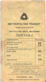
Ephemera - Timetable - route 48, The Met, Nov. 1943
... ...route 41...Timetable published The Met or Metropolitan Transit - Nov. 1983 for the North Balywn tram route, giving route information sections, and timing points as well the timetables. Covers routes 24, 40, 41 and 29....Timetable published The Met or Metropolitan Transit - Nov. 1983 for the North Balywn tram route, giving route information sections, and timing points as well the timetables. Covers routes 24, 40, 41 and 29. Yields information about route 48 timetables. tramways timetables Route 48 route 24 route 40 route 41 route 29 has various notations in pencil. ...Timetable published The Met or Metropolitan Transit - Nov. 1983 for the North Balywn tram route, giving route information sections, and timing points as well the timetables. Covers routes 24, 40, 41 and 29.Yields information about route 48 timetables.Timetable printed on yellow paper - 8 foldhas various notations in pencil.tramways, timetables, route 48, route 24, route 40, route 41, route 29 -
 Melbourne Tram Museum
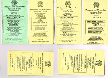
Ephemera - Timetable/s, Melbourne & Metropolitan Tramways Board (MMTB), "MMTB Tram Timetables", 1974
... ... Route 41...All printed on yellow paper unless noted otherwise. .1 - Route 48, 41, 40, 29, 74, 75, 76, 28 - North Balwyn and Burwood - City - Saturdays and Sundays - Feb. 1974, printed on green paper. .2 - Route 42, 23, 44, 45 and 37, Mont Albert - City - May 1974 .3 - Route 48, 41, 40, 29, 74, 75, 76, 28 - North Balwyn and Burwood - City - Feb. 1974 .4 -Route 59, 49, 52, 51, 81 - Essendon Airport - City - Oct. 1974 .5 - Route 70, 71 and 76 - Wattle Park - City - Feb. 1974 .6 - Route 72, 32 and 73 - Camberwell - City - Feb. 1974...Trams tramways MMTB Timetables Melbourne Fares Route 23 Route 24 Route 28 Route 29 Route 32 Route 37 Route 40 Route 41 Route 42 Route 44 Route 45 Route 48 Route 49 Route 51 Route 52 Route 59 Route 70 Route 71 Route 72 Route 73 Route 75 Route 76 Route 81 Set of 6 MMTB Tram timetables, folded sheets, generally 10 sections, providing timetables for specific routes, day of week giving information on tram times at specific time points, route map, sections and fares and organisation address - 616 Little Collins St. ...Set of 6 MMTB Tram timetables, folded sheets, generally 10 sections, providing timetables for specific routes, day of week giving information on tram times at specific time points, route map, sections and fares and organisation address - 616 Little Collins St. Melbourne. All printed on yellow paper unless noted otherwise. .1 - Route 48, 41, 40, 29, 74, 75, 76, 28 - North Balwyn and Burwood - City - Saturdays and Sundays - Feb. 1974, printed on green paper. .2 - Route 42, 23, 44, 45 and 37, Mont Albert - City - May 1974 .3 - Route 48, 41, 40, 29, 74, 75, 76, 28 - North Balwyn and Burwood - City - Feb. 1974 .4 -Route 59, 49, 52, 51, 81 - Essendon Airport - City - Oct. 1974 .5 - Route 70, 71 and 76 - Wattle Park - City - Feb. 1974 .6 - Route 72, 32 and 73 - Camberwell - City - Feb. 1974trams, tramways, mmtb, timetables, melbourne, fares, route 23, route 24, route 28, route 29, route 32, route 37, route 40, route 41, route 42, route 44, route 45, route 48, route 49, route 51, route 52, route 59, route 70, route 71, route 72, route 73, route 75, route 76, route 81 -
 Melbourne Tram Museum
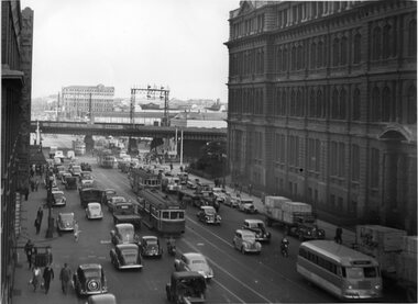
Photograph - set of 9 Black & White Photograph/s, Melbourne & Metropolitan Tramways Board (MMTB), 1966
... ... Route 41...Has "G3" in pencil on rear. .2 - similar view but with a different vehicle mix - W2 317 (Richmond Route 28), an SW6 route 27 and another W2 (route 41). Includes one large truck carrying Land Rover boxes. ...Has "G3" in pencil on rear. .2 - similar view but with a different vehicle mix - W2 317 (Richmond Route 28), an SW6 route 27 and another W2 (route 41). Includes one large truck carrying Land Rover boxes. ...Series of 9 black and white photographs of the traffic congestion in the CBD during 1951. .1 - view looking south along Spencer St from Collins St showing the VR Head office, and the railway viaduct with a Berger Paint advertisement, Has one wide body tram with dash canopy lighting and three W2's. Also one small bus. Has "G3" in pencil on rear. .2 - similar view but with a different vehicle mix - W2 317 (Richmond Route 28), an SW6 route 27 and another W2 (route 41). Includes one large truck carrying Land Rover boxes. Typed on rear "Enlargement of No. 72 - Sheet No. 26 (Report P25/1/8) and in ink initials and "For Testing Engs 1/11/51". .3 - View looking north along Swanston St Princes Bridge with a route 6 tram and Princes Bridge Station and St Pauls Cathedral. On rear in pencil "11/2" .4 - Spencer St - trams crossing Spencer St bridge - W5 781 (Route 10) and a W2 649, route 9, South Melbourne Beach. .5 - Queensbridge under bridge - showing many cars jammed and the railway viaduct. .6 - ?? - Collins St - National Mutual and Shaw Savill Line offices - has a Safety Zone stand. .7 - Collins St looking east from Market St - with many trams in the view and many cars. .8 - Collins at Market St with a SW6 with dash canopy lighting - route 45, followed by a route 9A .9 - same location - total chaos. See also Reg 4520 for another 7 photos of the same series.trams, tramways, traffic control, congestion, spencer st, route 27, route 28, route 41, route 6, princes bridge, swanston st, w2 class, sw6 class, route 10, route 9, spencer st bridge, market st, collins st, route 45, route 9a, tram 317, tram 781, tram 649 -
 Melbourne Tram Museum
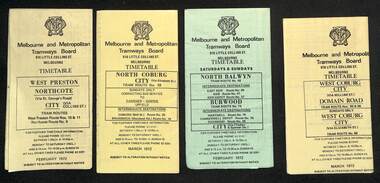
Ephemera - Timetables - MMTB trams - set of 7, Melbourne & Metropolitan Tramways Board (MMTB), 1972
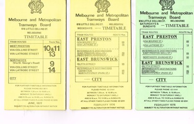
... ...route 41...Timetables - provide information on ticketing, fares, timing points, with a description of the route and a map. 1 - West Preston - Northcote - City - routes 9, 10, 11 - Feb. 1972 2 - North Coburg with connecting bus to Fawkner and Gowrie - Upfield on Sundays route 19, 20 and 18 - March 1972 3 - North Balwyn Burwood - City - routes 48, 40, 41, 37, 74, 75, 76, 28 - Feb. 1972 4 - West Coburg - Domain Road and West Coburg City on Sundays - routes 55, 56 and 68 - March 1972 5 - West Maribyrnong - City - (bus routes on Sunday only) - routes 57, 54, 60, 58 and 50 - Feb. 1972 6 - Essendon Aerodrome - City - route 49, 49, 52 and 51 - March 1972 7 - Footscray - Moonee Ponds - bus route on Saturday afternoons and Sundays - route 82 Feb. 1972...Timetables - provide information on ticketing, fares, timing points, with a description of the route and a map. 1 - West Preston - Northcote - City - routes 9, 10, 11 - Feb. 1972 2 - North Coburg with connecting bus to Fawkner and Gowrie - Upfield on Sundays route 19, 20 and 18 - March 1972 3 - North Balwyn Burwood - City - routes 48, 40, 41, 37, 74, 75, 76, 28 - Feb. 1972 4 - West Coburg - Domain Road and West Coburg City on Sundays - routes 55, 56 and 68 - March 1972 5 - West Maribyrnong - City - (bus routes on Sunday only) - routes 57, 54, 60, 58 and 50 - Feb. 1972 6 - Essendon Aerodrome - City - route 49, 49, 52 and 51 - March 1972 7 - Footscray - Moonee Ponds - bus route on Saturday afternoons and Sundays - route 82 Feb. 1972 Yields information about MMTB tram services during 1972 timetable MMTB route 10 route 9 route 11 route 19 route 18 route 20 route 48 route 40 route 41 route 37 route 74 route 75 route 76 route 28 route 55 route 56 route 68 route 57 route 54 route 60 route 58 route 50 route 59 route 49 route 52 route 51 route 82 Set of seven MMTB tram timetables - multifolded printed on yellow or green paper. ...Timetables - provide information on ticketing, fares, timing points, with a description of the route and a map. 1 - West Preston - Northcote - City - routes 9, 10, 11 - Feb. 1972 2 - North Coburg with connecting bus to Fawkner and Gowrie - Upfield on Sundays route 19, 20 and 18 - March 1972 3 - North Balwyn Burwood - City - routes 48, 40, 41, 37, 74, 75, 76, 28 - Feb. 1972 4 - West Coburg - Domain Road and West Coburg City on Sundays - routes 55, 56 and 68 - March 1972 5 - West Maribyrnong - City - (bus routes on Sunday only) - routes 57, 54, 60, 58 and 50 - Feb. 1972 6 - Essendon Aerodrome - City - route 49, 49, 52 and 51 - March 1972 7 - Footscray - Moonee Ponds - bus route on Saturday afternoons and Sundays - route 82 Feb. 1972Yields information about MMTB tram services during 1972Set of seven MMTB tram timetables - multifolded printed on yellow or green paper.timetable, mmtb, route 10, route 9, route 11, route 19, route 18, route 20, route 48, route 40, route 41, route 37, route 74, route 75, route 76, route 28, route 55, route 56, route 68, route 57, route 54, route 60, route 58, route 50, route 59, route 49, route 52, route 51, route 82 -
 Melbourne Tram Museum
Ephemera - Timetable/s, Melbourne & Metropolitan Tramways Board (MMTB), "MMTB Tram Timetables", 1977
... ... Route 41...All printed on yellow paper unless noted otherwise. .1 - Route 9, 10, 11, 13 and 14 - West Preston - City - June 1977 .2 - Route 14, 88, 89, 90, 95, 96, 97 - East Preston and East Brunswick - City - Feb. 1977 .3 - ditto - Saturday and Sundays - printed on green paper. .4 - Routes 48, 24, 40, 41, 29, 74, 76. 28 - August 1977 .5 - Routes 42, 23, 44, 45, 47 - Mont Albert line - Sept 1977...Trams tramways MMTB Timetables Melbourne Fares Route 9 Route 10 Route 11 Route 13 Route 14 Route 23 Route 42 Route 44 Route 45 Route 47 Route 88 Route 89 Route 90 Route 95 Route 96 Route 97 Route 48 Route 24 Route 40 Route 41 Route 29 Route 74 Route 76 Route 28 Set of 5 MMTB Tram timetables, folded sheets, generally 10 sections, providing timetables for specific routes, day of week giving information on tram times at specific time points, route map, sections and fares and organisation address - 616 Little Collins St. ...Set of 5 MMTB Tram timetables, folded sheets, generally 10 sections, providing timetables for specific routes, day of week giving information on tram times at specific time points, route map, sections and fares and organisation address - 616 Little Collins St. Melbourne. All printed on yellow paper unless noted otherwise. .1 - Route 9, 10, 11, 13 and 14 - West Preston - City - June 1977 .2 - Route 14, 88, 89, 90, 95, 96, 97 - East Preston and East Brunswick - City - Feb. 1977 .3 - ditto - Saturday and Sundays - printed on green paper. .4 - Routes 48, 24, 40, 41, 29, 74, 76. 28 - August 1977 .5 - Routes 42, 23, 44, 45, 47 - Mont Albert line - Sept 1977trams, tramways, mmtb, timetables, melbourne, fares, route 9, route 10, route 11, route 13, route 14, route 23, route 42, route 44, route 45, route 47, route 88, route 89, route 90, route 95, route 96, route 97, route 48, route 24, route 40, route 41, route 29, route 74, route 76, route 28 -
 Melbourne Tram Museum
Ephemera - Timetable/s, Melbourne & Metropolitan Tramways Board (MMTB), "MMTB Tram Timetables", 1971 and 1973
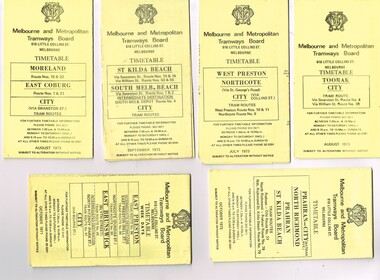
... ... Route 41...All printed on yellow paper unless noted otherwise. .1 - Route 8 and 38, Toorak - City - August 1973 .2 - Route 9, 10 and 11, West Preston, Northcote - City - July 1973 .3 - Route - 1, 2, 4, 15, 16, 53, 55 - St Kilda Beach, south Melbourne Beach - City - September 1973 .4 - Route 1, 21, 15, 22 - Moreland, East Coburg - City - August 1973 .5 - Route 77, 78, 79 - Prahran - City, North Richmond, St Kilda Beach - October 1973 .6 - Route 88, 89, 90, 97 - East Preston, East Brunswick - City - October 1971 .7 - ditto - printed on green paper for Saturdays and Sundays. .8 - Route 59 - Essendon - City - June 1961 .9 - Route 8 - Toorak - City - Oct 1961, printed on yellow paper .10 - Routes 48, 40, 41, 37 and 74, 75, 76, 28 - North Balwyn or Burwood to City - March 1972 lists all the short routes by name and printed on yellow paper. .11 - Route 55, 56 and 68 - West Coburg - City or Domain Road - March 1972 - printed on yellow paper. .12 - Routes 48, 24, 40, 41, 29, 74, 75, 76 and 28 - North Balwyn or Burwood to City - March 1976 - printed on yellow paper. .13 - as for .12, Saturdays and Sundays - printed on green paper, ,14. - Route 19, 20 and 18 - Coburg - March 1972 - includes connecting bus to Upfield ,15 - Routes 1, 21, 15 and 22 - Moreland and East Coburg - March 1972 .16 - Routes 64, 65, 62 and 61 - East Brighton - June 1973 .17 - Route 3 - East Malvern - June 1973 ,18 - Route 5, 35 - June 1973 .19 - Route 82 - Footscray - Moonee Ponds - Oct. 1974 - bus Saturday afternoons and Sundays .20 - Route 67, 37 and 66 - Carnegie - June 1973...Trams tramways MMTB Timetables Melbourne Upfield Fares Route 1 Route 2 Route 3 Route 4 Route 5 Route 8 Route 9 Route 10 Route 11 Route 15 Route 16 Route 18 Route 19 Route 20 Route 21 Route 22 Route 38 Route 35 Route 37 Route 53 Route 55 Route 66 Route 67 Route 77 Route 78 Route 79 Route 88 Route 89 Route 90 Route 96 Route 97 Route 59 Route 48 Route 40 Route 41 Route 37 Route 74 Route 75 Route 76 Route 82 Route 28 Route 55 Route 56 Route 68 Route 29 Route 24 Set of 20 MMTB Tram timetables, folded sheets, generally 10 sections, providing timetables for specific routes, day of week giving information on tram times at specific time points, route map, sections and fares and organisation address - 616 Little Collins St. ...Set of 20 MMTB Tram timetables, folded sheets, generally 10 sections, providing timetables for specific routes, day of week giving information on tram times at specific time points, route map, sections and fares and organisation address - 616 Little Collins St. Melbourne. All printed on yellow paper unless noted otherwise. .1 - Route 8 and 38, Toorak - City - August 1973 .2 - Route 9, 10 and 11, West Preston, Northcote - City - July 1973 .3 - Route - 1, 2, 4, 15, 16, 53, 55 - St Kilda Beach, south Melbourne Beach - City - September 1973 .4 - Route 1, 21, 15, 22 - Moreland, East Coburg - City - August 1973 .5 - Route 77, 78, 79 - Prahran - City, North Richmond, St Kilda Beach - October 1973 .6 - Route 88, 89, 90, 97 - East Preston, East Brunswick - City - October 1971 .7 - ditto - printed on green paper for Saturdays and Sundays. .8 - Route 59 - Essendon - City - June 1961 .9 - Route 8 - Toorak - City - Oct 1961, printed on yellow paper .10 - Routes 48, 40, 41, 37 and 74, 75, 76, 28 - North Balwyn or Burwood to City - March 1972 lists all the short routes by name and printed on yellow paper. .11 - Route 55, 56 and 68 - West Coburg - City or Domain Road - March 1972 - printed on yellow paper. .12 - Routes 48, 24, 40, 41, 29, 74, 75, 76 and 28 - North Balwyn or Burwood to City - March 1976 - printed on yellow paper. .13 - as for .12, Saturdays and Sundays - printed on green paper, ,14. - Route 19, 20 and 18 - Coburg - March 1972 - includes connecting bus to Upfield ,15 - Routes 1, 21, 15 and 22 - Moreland and East Coburg - March 1972 .16 - Routes 64, 65, 62 and 61 - East Brighton - June 1973 .17 - Route 3 - East Malvern - June 1973 ,18 - Route 5, 35 - June 1973 .19 - Route 82 - Footscray - Moonee Ponds - Oct. 1974 - bus Saturday afternoons and Sundays .20 - Route 67, 37 and 66 - Carnegie - June 1973trams, tramways, mmtb, timetables, melbourne, upfield, fares, route 1, route 2, route 3, route 4, route 5, route 8, route 9, route 10, route 11, route 15, route 16, route 18, route 19, route 20, route 21, route 22, route 38, route 35, route 37, route 53, route 55, route 66, route 67, route 77, route 78, route 79, route 88, route 89, route 90, route 96, route 97, route 59, route 48, route 40, route 41, route 37, route 74, route 75, route 76, route 82, route 28, route 55, route 56, route 68, route 29, route 24 -
 Melbourne Tram Museum
Ephemera - Timetable/s, Metropolitan Transit Authority (MTA), "MMTB Bus Timetables", 1982
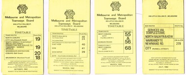
... ... Route 41...All printed on yellow paper unless noted otherwise. .1 - Routes 19, 20, 18 - North Coburg, and bus service to Fawkner, Gowrie, Upfield - nightly Monday to Saturday and all day Sunday - Oct. 1982 .2 - Route 48, 24, 40, 41, 29 - North Balwyn - City - March 1982 .3 - Route 55, 56 68 - Sunday only via Elizabeth St - March 1982 .4 - Route 276, 278 and 279 - Services via Templestowe, Warrandyte and Newmans Road - City - July 1982 .5 - Route 57, 357 (bus Sundays only), 54, 60, 58, 50 - West Maribyrnong - City - Jan. 1982 .6 - Route 59, 49, 52, 51 and 81 - Essendon Airport - City - March 1982 .7 - Route 203, 204, 205, 206, 208. 209 - Bulleen, North Kew, Belford Road, Kew, Collingwood and Nicholson and Johnson St - City - Sept. 1982...Trams tramways MMTB Timetables Melbourne Fares Buses Bus Replacement Trams Upfield Route 18 Route 19 Route 20 Route 24 Route 29 Route 40 Route 41 Route 48 Route 49 Route 50 Route 52 Route 51 Route 54 Route 55 Route 56 Route 57 Route 58 Route 59 Route 60 Route 68 Route 81 Route 357 Warrandyte Doncaster Templestowe Kew Set of 7 MMTB Tram and Bus timetables, folded sheets, generally 8 or 10 sections, providing timetables for specific routes, day of week giving information on tram times at specific time points, route map, sections and fares and organisation address - 616 Little Collins St. ...Set of 7 MMTB Tram and Bus timetables, folded sheets, generally 8 or 10 sections, providing timetables for specific routes, day of week giving information on tram times at specific time points, route map, sections and fares and organisation address - 616 Little Collins St. Melbourne. All printed on yellow paper unless noted otherwise. .1 - Routes 19, 20, 18 - North Coburg, and bus service to Fawkner, Gowrie, Upfield - nightly Monday to Saturday and all day Sunday - Oct. 1982 .2 - Route 48, 24, 40, 41, 29 - North Balwyn - City - March 1982 .3 - Route 55, 56 68 - Sunday only via Elizabeth St - March 1982 .4 - Route 276, 278 and 279 - Services via Templestowe, Warrandyte and Newmans Road - City - July 1982 .5 - Route 57, 357 (bus Sundays only), 54, 60, 58, 50 - West Maribyrnong - City - Jan. 1982 .6 - Route 59, 49, 52, 51 and 81 - Essendon Airport - City - March 1982 .7 - Route 203, 204, 205, 206, 208. 209 - Bulleen, North Kew, Belford Road, Kew, Collingwood and Nicholson and Johnson St - City - Sept. 1982trams, tramways, mmtb, timetables, melbourne, fares, buses, bus replacement, trams, upfield, route 18, route 19, route 20, route 24, route 29, route 40, route 41, route 48, route 49, route 50, route 52, route 51, route 54, route 55, route 56, route 57, route 58, route 59, route 60, route 68, route 81, route 357, warrandyte, doncaster, templestowe, kew -
 Melbourne Tram Museum
Ephemera - Timetables - Metropolitan Transit - set of 22, Metropolitan Transit Authority (MTA), 1983 and 1984
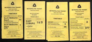
... ...route 41...Timetables - provides information on fare sections and a route map. 1 - Routes 1, 2 & 4 - South Melbourne - City - July 1984 2 - Route 1 & 21 - East Coburg - City August 1983 3 - Route 5 and 35 - Malvern Burke Road - July 1984 4 - Route 3 and 377 - East Malvern (Darling Road) and bus route on Sundays only - Jan. 1984 5 - Route 6, 36 and 7 - Glen Iris - July 1984 6 - Route 8 and 38 - Toorak - June 1984 7 - Route 9 and 14 - Northcote - June 1984 8 - Route 10 & 11, 13 - West Preston - May 1984 9 - Route 15 & 22 - Moreland - July 1983 10 - Route 15 & 16, 53 & 55 - St Kilda Beach - July 1983 11 - Route 19, 20 and 18 (MMTB) - North Coburg - Oct. 1982 12 - Route 42, 23, 44, 45 and 47 - Mont Albert - July 1984 13 - Route 48, 24, 40, 41 and 29 - North Balwyn - Nov. 1983 14 - Route 57, 357, 54, 60, 58 and 50 - West Maribyrnong - bus on Sundays - July 1984 15 - Route 64, 65, 62 and 61 - East Brighton - Jan. 1984 16 - Route 67, 37, and 66 - Carnegie - Jan. 1984 17 - route 70, 71 and 76 - Wattle Park - June 1984 18 - route 75, 74, 76 and 28 - East Burwood - JIan. 1984 19 - route 77, 78 and 79 - Prahran - North Richmond - July 1984 20 - route 82 and 223 - Footscray - Moonee Ponds and bus on Sundays and Saturdays - June 1984 21 - route 88, 14, 89 and 90 - East Preston - July 1983 22 - route 96, 95 and 97 - East Brunswick - July8 1984...Timetables - provides information on fare sections and a route map. 1 - Routes 1, 2 & 4 - South Melbourne - City - July 1984 2 - Route 1 & 21 - East Coburg - City August 1983 3 - Route 5 and 35 - Malvern Burke Road - July 1984 4 - Route 3 and 377 - East Malvern (Darling Road) and bus route on Sundays only - Jan. 1984 5 - Route 6, 36 and 7 - Glen Iris - July 1984 6 - Route 8 and 38 - Toorak - June 1984 7 - Route 9 and 14 - Northcote - June 1984 8 - Route 10 & 11, 13 - West Preston - May 1984 9 - Route 15 & 22 - Moreland - July 1983 10 - Route 15 & 16, 53 & 55 - St Kilda Beach - July 1983 11 - Route 19, 20 and 18 (MMTB) - North Coburg - Oct. 1982 12 - Route 42, 23, 44, 45 and 47 - Mont Albert - July 1984 13 - Route 48, 24, 40, 41 and 29 - North Balwyn - Nov. 1983 14 - Route 57, 357, 54, 60, 58 and 50 - West Maribyrnong - bus on Sundays - July 1984 15 - Route 64, 65, 62 and 61 - East Brighton - Jan. 1984 16 - Route 67, 37, and 66 - Carnegie - Jan. 1984 17 - route 70, 71 and 76 - Wattle Park - June 1984 18 - route 75, 74, 76 and 28 - East Burwood - JIan. 1984 19 - route 77, 78 and 79 - Prahran - North Richmond - July 1984 20 - route 82 and 223 - Footscray - Moonee Ponds and bus on Sundays and Saturdays - June 1984 21 - route 88, 14, 89 and 90 - East Preston - July 1983 22 - route 96, 95 and 97 - East Brunswick - July8 1984 Yields information about Metropolitan Transit services during the mid 1980s. timetable Metropolitan Transit The Met route 1 route 2 route 4 route 21 route 5 route 35 route 3 route 377 route 6 route 36 route 7 route 8 route 38 route 9 route 14 route 10 route 11 route 13 route 15 route 22 route 16 route 53 route 55 route 19 route 18 route 20 route 42 route 23 route 44 route 45 route 47 route 48 route 24 route 40 route 41 route 29 route 57 route 357 route 54 route 60 route 58 route 50 route 64 route 65 route 62 route 61 route 67 route 37 route 66 route 70 route 71 route 76 route 75 route 74 route 28 route 77 route 78 route 79 route 82 route 223 route 99 route 89 route 90 route 96 route 95 route 97 Set of 22 Metropolitan Transit tram timetables - multifold printed on yellow paper. ...Timetables - provides information on fare sections and a route map. 1 - Routes 1, 2 & 4 - South Melbourne - City - July 1984 2 - Route 1 & 21 - East Coburg - City August 1983 3 - Route 5 and 35 - Malvern Burke Road - July 1984 4 - Route 3 and 377 - East Malvern (Darling Road) and bus route on Sundays only - Jan. 1984 5 - Route 6, 36 and 7 - Glen Iris - July 1984 6 - Route 8 and 38 - Toorak - June 1984 7 - Route 9 and 14 - Northcote - June 1984 8 - Route 10 & 11, 13 - West Preston - May 1984 9 - Route 15 & 22 - Moreland - July 1983 10 - Route 15 & 16, 53 & 55 - St Kilda Beach - July 1983 11 - Route 19, 20 and 18 (MMTB) - North Coburg - Oct. 1982 12 - Route 42, 23, 44, 45 and 47 - Mont Albert - July 1984 13 - Route 48, 24, 40, 41 and 29 - North Balwyn - Nov. 1983 14 - Route 57, 357, 54, 60, 58 and 50 - West Maribyrnong - bus on Sundays - July 1984 15 - Route 64, 65, 62 and 61 - East Brighton - Jan. 1984 16 - Route 67, 37, and 66 - Carnegie - Jan. 1984 17 - route 70, 71 and 76 - Wattle Park - June 1984 18 - route 75, 74, 76 and 28 - East Burwood - JIan. 1984 19 - route 77, 78 and 79 - Prahran - North Richmond - July 1984 20 - route 82 and 223 - Footscray - Moonee Ponds and bus on Sundays and Saturdays - June 1984 21 - route 88, 14, 89 and 90 - East Preston - July 1983 22 - route 96, 95 and 97 - East Brunswick - July8 1984Yields information about Metropolitan Transit services during the mid 1980s.Set of 22 Metropolitan Transit tram timetables - multifold printed on yellow paper.timetable, metropolitan transit, the met, route 1, route 2, route 4, route 21, route 5, route 35, route 3, route 377, route 6, route 36, route 7, route 8, route 38, route 9, route 14, route 10, route 11, route 13, route 15, route 22, route 16, route 53, route 55, route 19, route 18, route 20, route 42, route 23, route 44, route 45, route 47, route 48, route 24, route 40, route 41, route 29, route 57, route 357, route 54, route 60, route 58, route 50, route 64, route 65, route 62, route 61, route 67, route 37, route 66, route 70, route 71, route 76, route 75, route 74, route 28, route 77, route 78, route 79, route 82, route 223, route 99, route 89, route 90, route 96, route 95, route 97 -
 Melbourne Tram Museum
Ephemera - Timetable/s, Melbourne & Metropolitan Tramways Board (MMTB), "MMTB Tram Timetables", 1977 to 1978
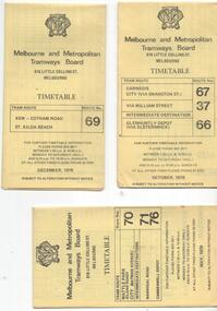
... ... Route 41.... - Route 67, 37 and 66 - Carnegie - City via Swanston St (67), via William St (37) and Glenhuntly Depot (66) - dated Oct. 1978. .2 - Route 69 - Kew Cotham Road - St Kilda Beach dated Dec. 1978 .3 - Route 70, 71 and 76 - Wattle Park - Batman Ave, Arraign Road (Route 71) and Camberwell Depot (Route 76), dated May 1978 .4 - Route 72, 32 and 73 - Camberwell City via Swanston St (72), via William St (32) and Camberwell Junction (73) dated Sept, 1978. .5 - Route 82 - Moonee Ponds - Footscray - Highpoint West - dated Sept. 1977 .6 - Route 88, 14, 89 and 90, 96, 95 and 97 - East Preston via Bourke St (88), via Latrobe St (14), East Preston Bell St (89) and Northcote Dundas St (90) to the city and East Brunswick (96), Exhibition (95) and North Fitzroy (Park St), dated May 1978. .7 - Routes 48, 24, 40, 41, 29, 74, 76. 28 - July 1978 .8 - ditto - Weekends, July 1978, printed on green paper. .9 - Bus routes 284 (East Kew - Doncaster North) and 270 (East Kew - Shoppingtown) - dated August 1978...Trams tramways MMTB Timetables Melbourne Fares Route 14 Route 32 Route 37 Route 66 Route 67 Route 69 Route 70 Route 71 Route 72 Route 73 Route 76 Route 82 Route 88 Route 89 Route 90 Route 95 Route 96 Route 97 Route 48 Route 24 Route 40 Route 41 Route 29 Route 74 Route 76 Route 28 Route 284 Route 270 Set of 6 MMTB Tram timetables, folded sheets, 8 sections, providing timetables for specific routes, day of week giving information on tram times at specific time points, route map, sections and fares and organisation address - 616 Little Collins St. ...Set of 6 MMTB Tram timetables, folded sheets, 8 sections, providing timetables for specific routes, day of week giving information on tram times at specific time points, route map, sections and fares and organisation address - 616 Little Collins St. Melbourne. All printed on yellow paper. 1. - Route 67, 37 and 66 - Carnegie - City via Swanston St (67), via William St (37) and Glenhuntly Depot (66) - dated Oct. 1978. .2 - Route 69 - Kew Cotham Road - St Kilda Beach dated Dec. 1978 .3 - Route 70, 71 and 76 - Wattle Park - Batman Ave, Arraign Road (Route 71) and Camberwell Depot (Route 76), dated May 1978 .4 - Route 72, 32 and 73 - Camberwell City via Swanston St (72), via William St (32) and Camberwell Junction (73) dated Sept, 1978. .5 - Route 82 - Moonee Ponds - Footscray - Highpoint West - dated Sept. 1977 .6 - Route 88, 14, 89 and 90, 96, 95 and 97 - East Preston via Bourke St (88), via Latrobe St (14), East Preston Bell St (89) and Northcote Dundas St (90) to the city and East Brunswick (96), Exhibition (95) and North Fitzroy (Park St), dated May 1978. .7 - Routes 48, 24, 40, 41, 29, 74, 76. 28 - July 1978 .8 - ditto - Weekends, July 1978, printed on green paper. .9 - Bus routes 284 (East Kew - Doncaster North) and 270 (East Kew - Shoppingtown) - dated August 1978trams, tramways, mmtb, timetables, melbourne, fares, route 14, route 32, route 37, route 66, route 67, route 69, route 70, route 71, route 72, route 73, route 76, route 82, route 88, route 89, route 90, route 95, route 96, route 97, route 48, route 24, route 40, route 41, route 29, route 74, route 76, route 28, route 284, route 270 -
 Melbourne Tram Museum
Document - Timetable/s, Melbourne & Metropolitan Tramways Board (MMTB), "MMTB Tram Timetables", 1980 - 1984
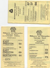
... ... Route 41...Melbourne. .1 - Route 72, 32 and 73 - Camberwell City via Swanston St (72), via William St (32) and Camberwell Junction (73) printed on yellow paper, dated April 1981 .2 - Route 88, 14, 89 and 90 - East Preston via Bourke St (88), via Latrobe St (14), East Preston Bell St (89) and Northcote Dundas St (90) to the city, printed on yellow paper, dated September 1980. .3 - Route 67, 37 and 66 - Carnegie - City via Swanston St (67), via William St (37) and Glenhuntly Depot (66) - printed on yellow paper, dated Jan. 1984 -has the Metropolitan Transit Logo. .4 - Route 70, 71 and 76 - Wattle Park - Nov 1979 .5 - Route 77, 78 and 79 - Prahran - City, Prahran - North Richmond - Nov 1979 .6 - Route 82 and 223 - Footscray - Moonee Ponds - tram and bus - Jan 1981 .7 - Route 1, 2, 4 - South Melbourne Beach - Feb 1981 .8 - Route 5 and 35 - Malvern - April 1981 .9 - route 70, 71, 76 - Wattle Park - April 1981 .10 - Route 15, 16, 53 and 55 - St Kilda Beach - Feb 1981 .11 - Route 6, 36. 7 - Glen Iris - July 1981 .12 - Route 59, 49, 51, 52, 82 - Essendon Airport March 1982 .13 - Route 48, 24, 40, 41, 29 North Balwyn - March 1982...Trams tramways MMTB Timetables Melbourne Fares Route 1 Route 2 Route 4 Route 5 Route 6 Route 7 Route 14 Route 15 Route 16 Route 24 Route 29 Route 32 Route 35 Route 36 Route 37 Route 40 Route 41 Route 48 Route 49 Route 51 Route 52 Route 53 Route 55 Route 59 Route 66 Route 67 Route 70 Route 71 Route 72 Route 73 Route 76 Route 77 Route 78 Route 79 Route 81 Route 82 Route 88 Route 89 Route 90 Route 223 Set of 13 MMTB Tram timetables, folded sheets, 10 sections, providing timetables for specific routes, day of week giving information on tram times at specific time points, route map, sections and fares and organisation address - 616 Little Collins St. ...Set of 13 MMTB Tram timetables, folded sheets, 10 sections, providing timetables for specific routes, day of week giving information on tram times at specific time points, route map, sections and fares and organisation address - 616 Little Collins St. Melbourne. .1 - Route 72, 32 and 73 - Camberwell City via Swanston St (72), via William St (32) and Camberwell Junction (73) printed on yellow paper, dated April 1981 .2 - Route 88, 14, 89 and 90 - East Preston via Bourke St (88), via Latrobe St (14), East Preston Bell St (89) and Northcote Dundas St (90) to the city, printed on yellow paper, dated September 1980. .3 - Route 67, 37 and 66 - Carnegie - City via Swanston St (67), via William St (37) and Glenhuntly Depot (66) - printed on yellow paper, dated Jan. 1984 -has the Metropolitan Transit Logo. .4 - Route 70, 71 and 76 - Wattle Park - Nov 1979 .5 - Route 77, 78 and 79 - Prahran - City, Prahran - North Richmond - Nov 1979 .6 - Route 82 and 223 - Footscray - Moonee Ponds - tram and bus - Jan 1981 .7 - Route 1, 2, 4 - South Melbourne Beach - Feb 1981 .8 - Route 5 and 35 - Malvern - April 1981 .9 - route 70, 71, 76 - Wattle Park - April 1981 .10 - Route 15, 16, 53 and 55 - St Kilda Beach - Feb 1981 .11 - Route 6, 36. 7 - Glen Iris - July 1981 .12 - Route 59, 49, 51, 52, 82 - Essendon Airport March 1982 .13 - Route 48, 24, 40, 41, 29 North Balwyn - March 1982trams, tramways, mmtb, timetables, melbourne, fares, route 1, route 2, route 4, route 5, route 6, route 7, route 14, route 15, route 16, route 24, route 29, route 32, route 35, route 36, route 37, route 40, route 41, route 48, route 49, route 51, route 52, route 53, route 55, route 59, route 66, route 67, route 70, route 71, route 72, route 73, route 76, route 77, route 78, route 79, route 81, route 82, route 88, route 89, route 90, route 223 -
 Melbourne Tram Museum
Ephemera - Timetable/s, Melbourne & Metropolitan Tramways Board (MMTB), "MMTB Timetables set of 39", 1960
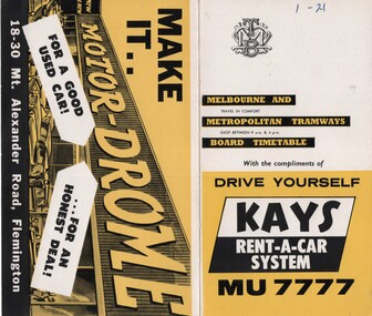
... ... Route 41...Not dated, based on fares - 1960 and possibly after Point Ormond had closed. .1 - Route 1, 21 - East Coburg - City .2 - Route 4, 4A, 4B - Carnegie - City .3 - Route 4D, 14 - East Malvern - City .4 - Route 5, 5A - Malvern Burke Road - City .5 - Route 6, 6A, 6B - Glen Iris - City .6 - Route 7, 7A, 7B, 7D - Camberwell - City .7 - Route 8, 8A - Toorak - City .8 - Route 9, 9A - Northcote via St Georges Road - City .9 - Route 9, 9B, 10, 12 - Sth Melbourne Beach, St Kilda Beach - City .10 - Route 10,11 - West Preston - City .11 - Route 15, 16 - St Kilda Beach - City .12 - Route 15, 22 - Moreland - City .13 - Route 18, 19, 20 - North Coburg - City .14 - Route 27, 28 - Hawthorn - Spencer St .15 - Route 42, 44, 45 - Mont Albert - City .16 - Route 48, 40, 41 - North Balwyn - Spencer St .17 - Route 49 - Essendon (Matthews Ave) - City .18 - Route 50, 54, 57, 58, 60 - West Maribyrnong - City .19 - Route 55, 56 - West Coburg - City .20 - Route 59 - Essendon Aerodrome - City .21 - Route 61, 62, 64, 65 - East Brighton - City .22 - Route 69 - Kew Cotham Road - St Kilda Beach .23 - Route 70, 71, 76 - Wattle Park - City .24 - Route 74, 75, 76 - Burwood - City .25 - Route 77, 80 - Prahran - City .26 - Route 78, 79 - North Richmond - Prahran .27 - Route 82 - Moonee Ponds - Footscray .28 - Williamstown Road - Footscray - Tram and bus .29 - Ballarat Road - Footscray - Tram and bus .30 - Russell St - - Footscray - Tram and bus .31 - East Brunswick - City .32 - Domain Road - City .33 - West Heidelberg - City .34 - Sunshine - City via Ballarat and Footscray Roads .35 - Sunshine - City via South and Dynon Roads .36 - Sunshine Park - City .37 - Garden City - City (Victoria St) .38 - Queens Bridge - Fisherman's Bend via Ingles St .39 - Queens Bridge - Fisherman's Bend via Lorimer St and Princes Bridge - Fisherman's Bend via Williamstown Rd....Trams tramways MMTB Timetables Melbourne Fares Route 1 Route 22 Route 4 Route 4A Route 4B Route 4D Route 14 Route 5 Route 5A Route 6 Route 6A Route 6B Route 7 Route 7A Route 7B Route 7D Route 8 Route 8A Route 9 Route 9A Route 9B Route 10 Route 11 Route 12 Route 15 Route 16 Route 22 Route 18 Route 19 Route 20 Route 27 Route 28 Route 42 Route 45 Route 44 Route 48 Route 40 Route 41 Route 49 Route 50 Route 54 Route 57 Route 58 Route 60 Route 52 Route 56 Route 59 Route 61 Route 62 Route 64 Route 65 Route 69 Route 70 Route 71 Route 76 Route 74 Route 75 Route 76 Route 77 Route 80 Route 78 Route 79 Route 82 Williamstown Rd Ballarat Rd Russell St Route 96 Domain Rd West Heidelberg Sunshine Garden City Queens Bridge Fishermen's Bend All have the route number in ink on the front cover - see image 5691i.jpg for standard cover. ...Set of 39 MMTB Tram timetables, 2 fold sheets, , providing timetables for specific routes, route numbers, day of week giving information on tram times at departure time points, sections and fares, where applicable all night bus services. All signed by B. H. Misson, Traffic Manager. All sponsored by Kays Rent a Car and Motor Drome, 18-30 Mount Alexander Road, Flemington. The only one missing is Point Ormond. Not dated, based on fares - 1960 and possibly after Point Ormond had closed. .1 - Route 1, 21 - East Coburg - City .2 - Route 4, 4A, 4B - Carnegie - City .3 - Route 4D, 14 - East Malvern - City .4 - Route 5, 5A - Malvern Burke Road - City .5 - Route 6, 6A, 6B - Glen Iris - City .6 - Route 7, 7A, 7B, 7D - Camberwell - City .7 - Route 8, 8A - Toorak - City .8 - Route 9, 9A - Northcote via St Georges Road - City .9 - Route 9, 9B, 10, 12 - Sth Melbourne Beach, St Kilda Beach - City .10 - Route 10,11 - West Preston - City .11 - Route 15, 16 - St Kilda Beach - City .12 - Route 15, 22 - Moreland - City .13 - Route 18, 19, 20 - North Coburg - City .14 - Route 27, 28 - Hawthorn - Spencer St .15 - Route 42, 44, 45 - Mont Albert - City .16 - Route 48, 40, 41 - North Balwyn - Spencer St .17 - Route 49 - Essendon (Matthews Ave) - City .18 - Route 50, 54, 57, 58, 60 - West Maribyrnong - City .19 - Route 55, 56 - West Coburg - City .20 - Route 59 - Essendon Aerodrome - City .21 - Route 61, 62, 64, 65 - East Brighton - City .22 - Route 69 - Kew Cotham Road - St Kilda Beach .23 - Route 70, 71, 76 - Wattle Park - City .24 - Route 74, 75, 76 - Burwood - City .25 - Route 77, 80 - Prahran - City .26 - Route 78, 79 - North Richmond - Prahran .27 - Route 82 - Moonee Ponds - Footscray .28 - Williamstown Road - Footscray - Tram and bus .29 - Ballarat Road - Footscray - Tram and bus .30 - Russell St - - Footscray - Tram and bus .31 - East Brunswick - City .32 - Domain Road - City .33 - West Heidelberg - City .34 - Sunshine - City via Ballarat and Footscray Roads .35 - Sunshine - City via South and Dynon Roads .36 - Sunshine Park - City .37 - Garden City - City (Victoria St) .38 - Queens Bridge - Fisherman's Bend via Ingles St .39 - Queens Bridge - Fisherman's Bend via Lorimer St and Princes Bridge - Fisherman's Bend via Williamstown Rd.All have the route number in ink on the front cover - see image 5691i.jpg for standard cover.trams, tramways, mmtb, timetables, melbourne, fares, route 1, route 22, route 4, route 4a, route 4b, route 4d, route 14, route 5, route 5a, route 6, route 6a, route 6b, route 7, route 7a, route 7b, route 7d, route 8, route 8a, route 9, route 9a, route 9b, route 10, route 11, route 12, route 15, route 16, route 22, route 18, route 19, route 20, route 27, route 28, route 42, route 45, route 44, route 48, route 40, route 41, route 49, route 50, route 54, route 57, route 58, route 60, route 52, route 56, route 59, route 61, route 62, route 64, route 65, route 69, route 70, route 71, route 76, route 74, route 75, route 76, route 77, route 80, route 78, route 79, route 82, williamstown rd, ballarat rd, russell st, route 96, domain rd, west heidelberg, sunshine, garden city, queens bridge, fishermen's bend -
 Melbourne Tram Museum
Map, Melbourne & Metropolitan Tramways Board (MMTB), Set of 15 tram route maps, 1977 to 1979
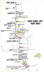
... ... Route 41...Copy 1 has "P14909" in pencil in the bottom right hand corner. .5 - Kew - St Kilda Beach - R1/79 - Route 69. .6 - Footscray - Moonee Ponds - R3/81 - Route 82 .7 - Flinders St tram routes - R5/78 - North Balwyn, East Burwood, routes 48, 40, 41, Hartwell, 28, 74 and 75 .8 - William St tram routes - Route 55, 56 and 63 - South Melbourne Depot and Domain. ...Trams tramways Maps Route Guide Route Numbers Routes Mont Albert Route 43 Route 47 Route 45 Route 44 Route 42 Malvern Burke Rd East Preston Carnegie East Brighton South Caulfield Route 5 Route 3 Route 67 Route 62 Route 64 Route 66 Glenhuntly Tram Depot Swanston St St Kilda Rd South Melbourne Beach St Kilda Beach Route 1 Route 2 Route 15 Route 16 Route 55 Kew- Cotham Road Route 69 Route 79 Route 82 Footscray Moonee Ponds Flinders St North Balwyn Kew East Burwood Burwood Hartwell Richmond Route 48 Route 40 Route 41 Route 28 Route 74 Route 75 Route 56 Route 63 William St West Coburg Toorak Camberwell Glen Iris Malvern Town Hall Route 72 Route 73 Route 7 Route 8 Bourke St Route 6 Route 95 Route 96 Route 97 Route 90 Route 89 Route 89 East Preston East Brunswick La Trobe University Clifton Hill Route 92 Route 87 Route 70 Route 71 Route 78 Route 79 North Richmond Prahran Wattle Park Essendon Airport West Maribyrnong North Coburg Route 50 Route 58 Route 60 Route 54 Route 57 Route 52 Route 49 Route 59 Route 18 Route 20 Route 19 Batman Ave Series of 15 colour route maps for various tram lines or groups of tram lines for the MMTB. ...Series of 15 colour route maps for various tram lines or groups of tram lines for the MMTB. Some have the Transport Information Centre telephone printed on them, others have a label stuck on. Some are finished with a plastic laminate finish on either one or both sides. Show the major cross streets, parks, schools, other tram routes, major stop numbers and railway lines. Two copies of each held unless noted otherwise. .1 - Mont - Albert City - R11/77, shows routes 43. 47. 45. 44 .2 - Malvern, East Malvern, Carnegie and East Brighton Tram Routes (from St Kilda Junction) - R1/79 - shows routes 5, 3, 67, 66, 61, 62 and 64. .3 - Swanston St tram guide - R1/79 - lists all routes and route numbers that branch or cross Swanston St between Grattan St and St Kilda Junction. .4 - St Kilda Rd Tram Routes R12/77 - details South Melbourne Beach, route 1 and route 2 and St Kilda Beach routes 15, 16 and 55 otherwise shows were the various routes branch off St Kilda Road. Copy 1 has "P14909" in pencil in the bottom right hand corner. .5 - Kew - St Kilda Beach - R1/79 - Route 69. .6 - Footscray - Moonee Ponds - R3/81 - Route 82 .7 - Flinders St tram routes - R5/78 - North Balwyn, East Burwood, routes 48, 40, 41, Hartwell, 28, 74 and 75 .8 - William St tram routes - Route 55, 56 and 63 - South Melbourne Depot and Domain. copy 2 has "P14913" in bottom right hand corner. .9 - Toorak Camberwell and Glen Iris tram routes with Camberwell Junction and Malvern Town Hall, R1/79, routes 8, 7, 6, 72 and 73 shown. .10 - Swanston St tram routes - R12/77 - shows all the Swanston St routes, including East Coburg and Moreland. .11 - Bourke St tram routes - R4/77 - East Brunswick Blyth St and East Preston Tyler St and intermediate routes, routes 95, 96, 97, 90, 89 and 88. .12 - as for .11, dated 1/85, showing extension to La Trobe University - has Metropolitan Transit logo. Only 1 copy held. Also shows route 92 and 87. .13 - Batman Ave tram routes - R9/77 - Wattle Park, North Richmond and Prahran - routes 70, 71, 78 and 79. .14 - City route guide - R9/77 - showing all route numbers and destinations that passed through the CBD. .15 - Elizabeth St tram routes - R12/77 - Essendon Airport, West Maribyrnong, North Coburg lines, routes 50, 58, 60, 54, 57, 52. 49, 59, 18, 20 and 19. Copy 1 has "P14905" in pencil in bottom left hand corner.trams, tramways, maps, route guide, route numbers, routes, mont albert, route 43, route 47, route 45, route 44, route 42, malvern burke rd, east preston, carnegie, east brighton, south caulfield, route 5, route 3, route 67, route 62, route 64, route 66, glenhuntly tram depot, swanston st, st kilda rd, south melbourne beach, st kilda beach, route 1, route 2, route 15, route 16, route 55, kew- cotham road, route 69, route 79, route 82, footscray, moonee ponds, flinders st, north balwyn, kew, east burwood, burwood, hartwell, richmond, route 48, route 40, route 41, route 28, route 74, route 75, route 56, route 63, william st, west coburg, toorak, camberwell, glen iris, malvern town hall, route 72, route 73, route 7, route 8, bourke st, route 6, route 95, route 96, route 97, route 90, route 89, route 89, east preston, east brunswick, la trobe university, clifton hill, route 92, route 87, route 70, route 71, route 78, route 79, north richmond, prahran, wattle park, essendon airport, west maribyrnong, north coburg, route 50, route 58, route 60, route 54, route 57, route 52, route 49, route 59, route 18, route 20, route 19, batman ave -
 Melbourne Tram Museum
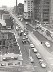
Photograph - MMTB Traffic Congestion Spencer St. - set of 2, Melbourne & Metropolitan Tramways Board (MMTB), c1978
... The photo is dated by the construction of the MMBW building on the corner of Little Collins and Spencer St which took place between 1976 and 1979 - see reference. 1 - Looking north from Victorian Railways building on the corner of Collins and Spencer Sts - showing two trams (routes 41 and 74) with heavy northbound traffic, light southbound traffic. ...The photo is dated by the construction of the MMBW building on the corner of Little Collins and Spencer St which took place between 1976 and 1979 - see reference. 1 - Looking north from Victorian Railways building on the corner of Collins and Spencer Sts - showing two trams (routes 41 and 74) with heavy northbound traffic, light southbound traffic. ...Set of 2 photos showing traffic congestion in Spencer St during the late 1970s. See also items 9169, 4519 & 4520. The photo is dated by the construction of the MMBW building on the corner of Little Collins and Spencer St which took place between 1976 and 1979 - see reference. 1 - Looking north from Victorian Railways building on the corner of Collins and Spencer Sts - showing two trams (routes 41 and 74) with heavy northbound traffic, light southbound traffic. A policeman is on point duty. On the left is the Railways Parcels office and the main station building. In the far distance, the Sands McDougal building. On the right is The Age, the City of Melbourne power station chimney, Mail Exchange, a vacant building block which became the Savoy Tavern, the Savoy Plaza Hotel, the MMBW building under construction, and a row of single-storey shops, including one advertising Cadbury's Chocolates. 2 - View from the Victorian Railways Head Office building looking south at the intersection of Flinders Lane and Spencer St. The building on the left is the Great Southern Hotel. Since this photo, Flinders Lane has been widened and the car park built on. The northbound traffic has drifted over the solid white line and blocked four trams (routes 76, 47, & 74)Demonstrates the work of the MMTB in understanding traffic that affected trams.Black and white print - with MMTB Stamp on the rear.in ink "P2571/1037" on both photos.tramways, spencer st, traffic control, traffic -
 Ballarat Tramway Museum
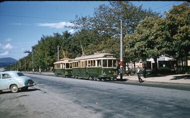
Slide - 35mm slide/s, Ben Parle, 5/04/1958 12:00:00 AM
... Photo of the No. 41 and 21 on an AETA tour, Sturt St. at Drummond St., facing the wrong way on the Sturt St track. Would appear the trip has terminated in Sturt St and about to reverse to another route. ...Photo of the No. 41 and 21 on an AETA tour, Sturt St. at Drummond St., facing the wrong way on the Sturt St track. Would appear the trip has terminated in Sturt St and about to reverse to another route. ...Kodachrome Transparency - 35mm slide - cardboard mount, with one side with red border and words "Kodachrome Transparency / Processed by Kodak" top and bottom. Photo taken by Ben Parle 5/4/1958. Has slide No. "14" stamped in red in top corner and date stamped on slide. Photo of the No. 41 and 21 on an AETA tour, Sturt St. at Drummond St., facing the wrong way on the Sturt St track. Would appear the trip has terminated in Sturt St and about to reverse to another route. Tram 41 has destination of Special and is carrying the AETA special car sign. For high resolution scan see btm2843h.tif"Sturt St / Drummond St" "-5 APR 1958"tramways, trams, sturt st, drummond st, aeta, tram 41, tram 21 -
 Melbourne Tram Museum
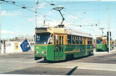
Photograph - Set of 6 colour prints of trams at Corner of Flinders and Swanston Streets, George Bishop, c1999
... Route 3...Flinders St...Swanston St...tram 41...In the background can be seen the construction of the Federation Square project which commenced in 1999. 1 - Z 96 (Route 3, University) at Flinders and Swanston Streets. 2 - Z 37 (University route 5) 3 - SW6 888, City Circle, westbound. 4 - Z3 140 (East Coburg Route 1) - would appear that the car is not doing their hook turn properly 5 - B2 2037 westbound (Route 70, City Flinders St) 6 - Z 41 (Route 72, University)...In the background can be seen the construction of the Federation Square project which commenced in 1999. 1 - Z 96 (Route 3, University) at Flinders and Swanston Streets. 2 - Z 37 (University route 5) 3 - SW6 888, City Circle, westbound. 4 - Z3 140 (East Coburg Route 1) - would appear that the car is not doing their hook turn properly 5 - B2 2037 westbound (Route 70, City Flinders St) 6 - Z 41 (Route 72, University) Yields information about the operation of Melbourne trams during the late 1990s. trams tramways Z3 class Z class tram 96 tram 37 City Circle tram 888 hook turns tram 140 B2 class tram 2037 SW6 class Route 1 Route 70 Route 72 Route 5 Route 3 Flinders St Swanston St tram 41 Details of the photograph and photographer on the rear in ink. ...Set of six colour photographs of trams at the corner of Swanston and Flinders Streets. In the background can be seen the construction of the Federation Square project which commenced in 1999. 1 - Z 96 (Route 3, University) at Flinders and Swanston Streets. 2 - Z 37 (University route 5) 3 - SW6 888, City Circle, westbound. 4 - Z3 140 (East Coburg Route 1) - would appear that the car is not doing their hook turn properly 5 - B2 2037 westbound (Route 70, City Flinders St) 6 - Z 41 (Route 72, University)Yields information about the operation of Melbourne trams during the late 1990s.Set of six Colour prints printed on Kodak paperDetails of the photograph and photographer on the rear in ink.trams, tramways, z3 class, z class, tram 96, tram 37, city circle, tram 888, hook turns, tram 140, b2 class, tram 2037, sw6 class, route 1, route 70, route 72, route 5, route 3, flinders st, swanston st, tram 41 -
 Melbourne Tram Museum
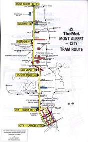
Map - Set of 11 The Met tram maps, The Met, mid to late 1980s
... May not be a complete set - see also item 3909 for a MMTB produced set. 1 - Mont Albert - City - shows routes 23, 12, 43, 47, 45, 44, & 42 2 - Elizabeth St tram guide - shows routes 50, 58, 60, 57, 82, 52, 49, 59, 18, 20 and 19. 3 - Flinders St tram guide - shows routes 24, 28, 41, 40, 48, 74 and 75 4 - Collins St tram guide - shows all linking routes 5 - East Brunswick, St Kilda Beach, Port Melbourne light rail routes - routes 96, 111 and 97 6 - St Kilda Road tram guide - shows all routes operating along St Kilda Road and connecting or linking routes 7 - Swanston St tram guide - shows all linking routes with route numbers. 8 - Toorak, Camberwell & Glen Iris tram guide - routes 72, 73, 6, 7, 8 9 - Batman Ave tram guide - routes 78, 79, 70 & 71 10 - William St tram guide - routes 55, 33, 63 11 - Bourke St tram guide - routes 96, 97, 95, 111, 92, 90, 89, 88, 87 & 86...May not be a complete set - see also item 3909 for a MMTB produced set. 1 - Mont Albert - City - shows routes 23, 12, 43, 47, 45, 44, & 42 2 - Elizabeth St tram guide - shows routes 50, 58, 60, 57, 82, 52, 49, 59, 18, 20 and 19. 3 - Flinders St tram guide - shows routes 24, 28, 41, 40, 48, 74 and 75 4 - Collins St tram guide - shows all linking routes 5 - East Brunswick, St Kilda Beach, Port Melbourne light rail routes - routes 96, 111 and 97 6 - St Kilda Road tram guide - shows all routes operating along St Kilda Road and connecting or linking routes 7 - Swanston St tram guide - shows all linking routes with route numbers. 8 - Toorak, Camberwell & Glen Iris tram guide - routes 72, 73, 6, 7, 8 9 - Batman Ave tram guide - routes 78, 79, 70 & 71 10 - William St tram guide - routes 55, 33, 63 11 - Bourke St tram guide - routes 96, 97, 95, 111, 92, 90, 89, 88, 87 & 86 Yields information about the various tram routes operated by The Met mid to late 1980s, including the light rail services. ...Set of 11 tram route guides or maps, produced by The Met - undated - mid to late 1980s. Shows the major cross streets, parks, schools, other tram routes, major stop numbers and railway lines. May not be a complete set - see also item 3909 for a MMTB produced set. 1 - Mont Albert - City - shows routes 23, 12, 43, 47, 45, 44, & 42 2 - Elizabeth St tram guide - shows routes 50, 58, 60, 57, 82, 52, 49, 59, 18, 20 and 19. 3 - Flinders St tram guide - shows routes 24, 28, 41, 40, 48, 74 and 75 4 - Collins St tram guide - shows all linking routes 5 - East Brunswick, St Kilda Beach, Port Melbourne light rail routes - routes 96, 111 and 97 6 - St Kilda Road tram guide - shows all routes operating along St Kilda Road and connecting or linking routes 7 - Swanston St tram guide - shows all linking routes with route numbers. 8 - Toorak, Camberwell & Glen Iris tram guide - routes 72, 73, 6, 7, 8 9 - Batman Ave tram guide - routes 78, 79, 70 & 71 10 - William St tram guide - routes 55, 33, 63 11 - Bourke St tram guide - routes 96, 97, 95, 111, 92, 90, 89, 88, 87 & 86Yields information about the various tram routes operated by The Met mid to late 1980s, including the light rail services. Series of 11 route maps printed in colour on mylar sheets.the met, trams, tramways, maps, route guide, route numbers, routes -
 Sunshine and District Historical Society Incorporated
Administrative record - City of Sunshine - Commissioner Mr Alexander Alex George Gillon Collection 1976 - 1982 - Minutes of the ordinary meeting of council held on 14th August 1979, City of Sunshine, 14th August 1979
... Albans Subdivision Annual Supply of Concrete Contract Station Road Widening Melbourne Metropolitan Planning Scheme Amendment No 81 Part 4 Traffic Engineer Report Old Sunshine Post Office Site, Intersection Mitchell Street / Hampstead Road and Glengala Road Truck Route Traffic Signals Ballarat Road / Hampshire Road Sunshine Route Numbering System Route 41 to be Re-routed along Graham Street Sunshine Proposed Intersection Signals Devonshire Road / Duke Street Sunshine Signing of Western Approaches West Gate Bridge Statcon Works Programme intersection Treatment East Esplanade / Main Road West / Main Road East St. ...Albans Subdivision Annual Supply of Concrete Contract Station Road Widening Melbourne Metropolitan Planning Scheme Amendment No 81 Part 4 Traffic Engineer Report Old Sunshine Post Office Site, Intersection Mitchell Street / Hampstead Road and Glengala Road Truck Route Traffic Signals Ballarat Road / Hampshire Road Sunshine Route Numbering System Route 41 to be Re-routed along Graham Street Sunshine Proposed Intersection Signals Devonshire Road / Duke Street Sunshine Signing of Western Approaches West Gate Bridge Statcon Works Programme intersection Treatment East Esplanade / Main Road West / Main Road East St. ...Minutes of the Ordinary Meeting of Council held on 14th August 1979 Report of the Town Clerk's Department Report of the Town Clerk Western Region Commission Trees and Shrubs for New Home Owners Scheme Site for Kindergarten for physical handicapped children Rogers Reserve Establishment of St. Albans South Progress Association Melbourne & Metropolitan Board of Works Proposed increase in Rates Offer to Sell Property at 1 Raleigh Road to Council Road Funding New Fuel Levy Municipal Association of Victoria Melbourne & Metropolitan Board of Works Representation Report of the Co-Ordinator of Welfare Services Charging Fees at Community Health Centres Diamond Avenue Pre-School Centre Multi-Purpose Room Caretaker Lions House of Sunshine Subsidy for the Installation of Heating Dobson Reserve Pre-School Centre Report of the Senior Health Officer Application for Transfer of Proprietorship of Premises Under the Health Act Health Act Registrations for 1979 Protean (Holdings) Ltd Corner of Boundary Road and Fitzgerald Road Laverton North Sunshine Underpass in Filthy and Odorous State and One Person Referred to it Smelling like a Public Urinal Builder's Sanitary Service Infant Welfare Refresher Course 30th July 1979 to 10th August 1979 Litter Noise By-Law Report of the Medical Officer of Health Report of the Superintendent Traffic & By-Laws Special Parking Area Corio Street for the Sunshine Elderly Citizens Welfare Committee Traffic & By-Laws Officers Association of Victoria Report of the City Librarian 1979/80 State Library Subsidy Melton Library Travelling Time of Sunshine Staff Report of the Interdepartmental Committee on Joint-Use Libraries 1979 Australian Library Week Second Pacific Rim Conference of Children's Literature 3rd - 7th September 1979 Children's Library Second Term Holiday Programme Reort of the Municipal Recreaction Officer Ground Rentals Summer Season 1978/79 Ground Rentals Winter Season 1979 Soccer Ground Development Fund Grant Applications Received From Ardeer Soccer Club, Dynamo Soccer Club & Sunshine Heights Junior Soccer Club Cricket Coaching Clinics Report of the City Engineer & Planner Report of the Building and Development Control System in Victoria (B.A.D.A.C.) Amendment No 9 Part 1A to the Melbourne Metropolitan Planning Scheme Rezoning Land Along Kororoit Creek Between Glengala Road and Derby Road Planning Permit Application Shop and Caretaker's Dwelling Lots 41 & 42 Watt Street Sunshine Planning Permit Application Service Premises (Chemist) and Consulting Room (Doctor) Addition to Existing Cluster Subdivision 104 Station Road Planning Permit Application Extensions to No 4 Mill of Existing Industrial Complex S.C.I. Meat & Paper Pty Ltd South Side of Somerville Road Opposite Alick Street Tottenham Planning Permit Application Extension to Existing Factory 2 Holmwood Road Tottenham Planning Permit Application Storage Shed Lot 50 Cromer Avenue Sunshine North Planning Permit Application Shed Lot 10 McIntyre Road Sunshine North Planning Permit Application Illuminated Sign 282 Ballarat Road North West Corner Errol Street Braybrook Planning Permit Subdivision and Detached Houses Lot 1001 Neale Road Deer Park Planning Permit Office & Extension of Amenities Building Lot 33 Railway Siding Fronting the North Side of Wright Street Planning Permit Application Petrol Filling Station Geelong Road South East Corner of Francis Street Brooklyn Planning Permit Application Six Chrysler Symbol Advertising Flags Lot 2 Ballarat Road South West Corner of Hampshire Road Sunshine Planning Permit Application Sky Sign 248 Hampshire Road Sunshine Planning Permit Application Factory Extension Lot 5 McIntyre Road Sunshine North Planning Permit Flats Lot 1 Phoenix Street Sunshine North Planning Permit Application Factory Extension Lot 92 Fourth Avenue Sunshine Plan of Subdivision Concord Circuit Albanvale Cancellation of Easement Neale Road Deer Park Cancellation of Easement Main Road West Albanvale Gillon Court and Ginifer Court St. Albans Subdivision Annual Supply of Concrete Contract Station Road Widening Melbourne Metropolitan Planning Scheme Amendment No 81 Part 4 Traffic Engineer Report Old Sunshine Post Office Site, Intersection Mitchell Street / Hampstead Road and Glengala Road Truck Route Traffic Signals Ballarat Road / Hampshire Road Sunshine Route Numbering System Route 41 to be Re-routed along Graham Street Sunshine Proposed Intersection Signals Devonshire Road / Duke Street Sunshine Signing of Western Approaches West Gate Bridge Statcon Works Programme intersection Treatment East Esplanade / Main Road West / Main Road East St. Albans Boring Operations Stony Creek in the Vicinity of Gilmour Road Sunshine North Half Cost Footpath St. Albans Road St. Albans Right of Way Wright Street to Sunshine West High School Half Cost Footpath Neale Road Deer Park Thomson Street Reconstruction Fencing Costs Between Council Properties and Adjoining Private Properties Report of the Building Surveyor Building Over Easement 54 Mawson Avenue Deer Park Building Over Easement 48 Salmond Street Deer Park Building Over Easement 36 Newbury Street Deer Park Siting of Building Lot 193 Nash Place Deer Park Report of the Director of Parks & Recreation Larisa Reserve Fencing P. McLarty Lectures Turf Research institute Orders of the Day Accounts Submitted for Payment as at 31st July 1979 Extraordinary Business Report of the Town Clerk Proposed amendment to plans for Italo-Australian Co-Operative Social Club Report of the City Engineer & Planner Planning Permit Application Extension to Place of Assembly Italo-Australian Co-Operative Social Club Furlong Road Pedestrian Operated Signals in Rosamond Road Between River Street and Fisher Street Deferred Payment Schemerogers reserve, maidstone, raleigh road, burton crescent, maribyrnong, burns street, st. albans south progress association, diamond avenue pre-school centre, diamond avenue, albanvale, lions house of sunshine, watt street, corio street, sunshine, dobson reserve pre-school centre, churchill avenue, protean, boundary road, fitzgerald road, laverton north, sunshine underpass, sunshine railway station underpass, sunshine elderly citizens welfare committee, ardeer soccer club, dynamo soccer club, sunshine heights junior soccer club, kororoit creek, glengala road, derby road, station road, deer park, s.c.i. meat & paper pty ltd, somerville road, alick street, tottenham, holmwood road, cromer avenue, sunshine north, mcintyre road, ballarat road, errol street, braybrook, neale road, wright street, geelong road, francis street, brooklyn, hampshire road, phoenix street, fourth avenue, concord circuit, main road west, gillon court, ginifer court, sunshine post office, mitchell street, hampstead road, sunshine west, graham street, devonshire road, duke street, west gate bridge, east esplanade, main road east, st. albans, stony creek, gilmour road, st. albans road, sunshine west high school, lachlan road, mawson avenue, salmond street, newbury street, nash place, larisa reserve, larisa road, italo-australian co-operative social club, rosamond road, river street, fisher street -
 Sunshine and District Historical Society Incorporated
Administrative record - City of Sunshine - Commissioner Mr Alexander Alex George Gillon Collection 1976 - 1982 - Notice of ordinary meeting of the council 14th August 1979, City of Sunshine, 8th August 1979
... Albans Subdivision Annual Supply of Concrete Contract Station Road Widening Melbourne Metropolitan Planning Scheme Amendment No 81 Part 4 Traffic Engineer Report Old Sunshine Post Office Site, Intersection Mitchell Street / Hampstead Road and Glengala Road Truck Route Traffic Signals Ballarat Road / Hampshire Road Sunshine Route Numbering System Route 41 to be Re-routed along Graham Street Sunshine Proposed Intersection Signals Devonshire Road / Duke Street Sunshine Signing of Western Approaches West Gate Bridge Statcon Works Programme intersection Treatment East Esplanade / Main Road West / Main Road East St. ...Albans Subdivision Annual Supply of Concrete Contract Station Road Widening Melbourne Metropolitan Planning Scheme Amendment No 81 Part 4 Traffic Engineer Report Old Sunshine Post Office Site, Intersection Mitchell Street / Hampstead Road and Glengala Road Truck Route Traffic Signals Ballarat Road / Hampshire Road Sunshine Route Numbering System Route 41 to be Re-routed along Graham Street Sunshine Proposed Intersection Signals Devonshire Road / Duke Street Sunshine Signing of Western Approaches West Gate Bridge Statcon Works Programme intersection Treatment East Esplanade / Main Road West / Main Road East St. ...Notice of Ordinary Meeting of the Council 14th August 1979 Report of the Town Clerk's Department Report of the Town Clerk Western Region Commission Trees and Shrubs for New Home Owners Scheme Site for Kindergarten for physical handicapped children Rogers Reserve Establishment of St. Albans South Progress Association Melbourne & Metropolitan Board of Works Proposed increase in Rates Offer to Sell Property at 1 Raleigh Road to Council Road Funding New Fuel Levy Municipal Association of Victoria Melbourne & Metropolitan Board of Works Representation Report of the Co-Ordinator of Welfare Services Charging Fees at Community Health Centres Diamond Avenue Pre-School Centre Multi-Purpose Room Caretaker Lions House of Sunshine Subsidy for the Installation of Heating Dobson Reserve Pre-School Centre Report of the Senior Health Officer Application for Transfer of Proprietorship of Premises Under the Health Act Health Act Registrations for 1979 Protean (Holdings) Ltd Corner of Boundary Road and Fitzgerald Road Laverton North Sunshine Underpass in Filthy and Odorous State and One Person Referred to it Smelling like a Public Urinal Builder's Sanitary Service Infant Welfare Refresher Course 30th July 1979 to 10th August 1979 Litter Noise By-Law Report of the Medical Officer of Health Report of the Superintendent Traffic & By-Laws Special Parking Area Corio Street for the Sunshine Elderly Citizens Welfare Committee Traffic & By-Laws Officers Association of Victoria Report of the City Librarian 1979/80 State Library Subsidy Melton Library Travelling Time of Sunshine Staff Report of the Interdepartmental Committee on Joint-Use Libraries 1979 Australian Library Week Second Pacific Rim Conference of Children's Literature 3rd - 7th September 1979 Children's Library Second Term Holiday Programme Reort of the Municipal Recreaction Officer Ground Rentals Summer Season 1978/79 Ground Rentals Winter Season 1979 Soccer Ground Development Fund Grant Applications Received From Ardeer Soccer Club, Dynamo Soccer Club & Sunshine Heights Junior Soccer Club Cricket Coaching Clinics Report of the City Engineer & Planner Report of the Building and Development Control System in Victoria (B.A.D.A.C.) Amendment No 9 Part 1A to the Melbourne Metropolitan Planning Scheme Rezoning Land Along Kororoit Creek Between Glengala Road and Derby Road Planning Permit Application Shop and Caretaker's Dwelling Lots 41 & 42 Watt Street Sunshine Planning Permit Application Service Premises (Chemist) and Consulting Room (Doctor) Addition to Existing Cluster Subdivision 104 Station Road Planning Permit Application Extensions to No 4 Mill of Existing Industrial Complex S.C.I. Meat & Paper Pty Ltd South Side of Somerville Road Opposite Alick Street Tottenham Planning Permit Application Extension to Existing Factory 2 Holmwood Road Tottenham Planning Permit Application Storage Shed Lot 50 Cromer Avenue Sunshine North Planning Permit Application Shed Lot 10 McIntyre Road Sunshine North Planning Permit Application Illuminated Sign 282 Ballarat Road North West Corner Errol Street Braybrook Planning Permit Subdivision and Detached Houses Lot 1001 Neale Road Deer Park Planning Permit Office & Extension of Amenities Building Lot 33 Railway Siding Fronting the North Side of Wright Street Planning Permit Application Petrol Filling Station Geelong Road South East Corner of Francis Street Brooklyn Planning Permit Application Six Chrysler Symbol Advertising Flags Lot 2 Ballarat Road South West Corner of Hampshire Road Sunshine Planning Permit Application Sky Sign 248 Hampshire Road Sunshine Planning Permit Application Factory Extension Lot 5 McIntyre Road Sunshine North Planning Permit Flats Lot 1 Phoenix Street Sunshine North Planning Permit Application Factory Extension Lot 92 Fourth Avenue Sunshine Plan of Subdivision Concord Circuit Albanvale Cancellation of Easement Neale Road Deer Park Cancellation of Easement Main Road West Albanvale Gillon Court and Ginifer Court St. Albans Subdivision Annual Supply of Concrete Contract Station Road Widening Melbourne Metropolitan Planning Scheme Amendment No 81 Part 4 Traffic Engineer Report Old Sunshine Post Office Site, Intersection Mitchell Street / Hampstead Road and Glengala Road Truck Route Traffic Signals Ballarat Road / Hampshire Road Sunshine Route Numbering System Route 41 to be Re-routed along Graham Street Sunshine Proposed Intersection Signals Devonshire Road / Duke Street Sunshine Signing of Western Approaches West Gate Bridge Statcon Works Programme intersection Treatment East Esplanade / Main Road West / Main Road East St. Albans Boring Operations Stony Creek in the Vicinity of Gilmour Road Sunshine North Half Cost Footpath St. Albans Road St. Albans Right of Way Wright Street to Sunshine West High School Half Cost Footpath Neale Road Deer Park Thomson Street Reconstruction Fencing Costs Between Council Properties and Adjoining Private Properties Report of the Building Surveyor Building Over Easement 54 Mawson Avenue Deer Park Building Over Easement 48 Salmond Street Deer Park Building Over Easement 36 Newbury Street Deer Park Siting of Building Lot 193 Nash Place Deer Park Report of the Director of Parks & Recreation Larisa Reserve Fencing P. McLarty Lectures Turf Research institute Orders of the Day Accounts Submitted for Payment as at 31st July 1979rogers reserve, maidstone, st. albans south progress association, raleigh road, burton crescent, maribyrnong, burns street, diamond avenue pre-school centre, diamond avenue, albanvale, lions house of sunshine, corio street, watt street, sunshine, dobson reserve pre-school centre, dobson reserve, churchill avenue, protean, boundary road, fitzgerald road, laverton north, sunshine underpass, sunshine railway station underpass, sunshine elderly citizens welfare committee, ardeer soccer club, dynamo soccer club, sunshine heights junior soccer club, kororoit creek, glengala road, derby road, station road, deer park, s.c.i. meat & paper pty ltd, somerville road, alick street, tottenham, holmwood road, cromer avenue, mcintyre road, sunshine north, ballarat road, errol street, braybrook, neale road, wright street, geelong road, francis street, brooklyn, hampshire road, phoenix street, fourth avenue, concord circuit, main road west, gillon court, ginifer court, sunshine post office, mitchell street, hampstead road, graham street, devonshire road, duke street, west gate bridge, east esplanade, main road east, stony creek, gilmour road, st. albans road, sunshine west high school, lachlan road, sunshine west, thomson street, mawson avenue, salmond street, newbury street, nash place, larisa reserve, larisa road -
 Melbourne Tram Museum
Map, Melbourne & Metropolitan Tramways Board (MMTB), MMTB Route Maps, 1979
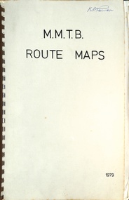
... Trams 1 - City route guide - R9/77 - showing all route numbers and destinations that passed through the CBD. 2 - Bourke St tram routes - R4/77 - East Brunswick Blyth St and East Preston Tyler St and intermediate routes, routes 95, 96, 97, 90, 89 and 88. 3 - Malvern, East Malvern, Carnegie, and East Brighton Tram Routes (from St Kilda Junction) - R1/79 - shows routes 5, 3, 67, 66, 61, 62, and 64. 4 - Elizabeth St tram routes - R12/77 - Essendon Airport, West Maribyrnong, North Coburg lines, routes 50, 58, 60, 54, 57, 52. 49, 59, 18, 20 and 19 5 - Flinders St tram routes - R5/78 - North Balwyn, East Burwood, routes 48, 40, 41, Hartwell, 28, 74 and 75 6 - Kew - St Kilda Beach - R1/79 - Route 69. 7 - Mont - Albert City - R11/77, shows routes 43. 47. 45. 44 8 - St Kilda Rd Tram Routes R12/77 - details South Melbourne Beach, route 1 and route 2 and St Kilda Beach routes 15, 16, and 55 otherwise shows where the various routes branch off St Kilda Road 9 - Batman Ave tram routes - R9/77 - Wattle Park, North Richmond and Prahran - routes 70, 71, 78 and 79. 10 - Footscray - Moonee Ponds - R3/81 - Route 82 11 - Swanston St tram guide - R1/79 - lists all routes and route numbers that branch or cross Swanston St between Grattan St and St Kilda Junction. 12 - Toorak Camberwell and Glen Iris tram route with Camberwell Junction and Malvern Town Hall, R1/79, routes 8, 7, 6, 72, and 73 shown. 13 - West Preston - Beach tram routes - R12/77 - routes 10, 11, 9 and 12, 14 - William St tram routes - R12/77 - Route 55, 56, and 63 - South Melbourne Depot and Domain. ...Trams 1 - City route guide - R9/77 - showing all route numbers and destinations that passed through the CBD. 2 - Bourke St tram routes - R4/77 - East Brunswick Blyth St and East Preston Tyler St and intermediate routes, routes 95, 96, 97, 90, 89 and 88. 3 - Malvern, East Malvern, Carnegie, and East Brighton Tram Routes (from St Kilda Junction) - R1/79 - shows routes 5, 3, 67, 66, 61, 62, and 64. 4 - Elizabeth St tram routes - R12/77 - Essendon Airport, West Maribyrnong, North Coburg lines, routes 50, 58, 60, 54, 57, 52. 49, 59, 18, 20 and 19 5 - Flinders St tram routes - R5/78 - North Balwyn, East Burwood, routes 48, 40, 41, Hartwell, 28, 74 and 75 6 - Kew - St Kilda Beach - R1/79 - Route 69. 7 - Mont - Albert City - R11/77, shows routes 43. 47. 45. 44 8 - St Kilda Rd Tram Routes R12/77 - details South Melbourne Beach, route 1 and route 2 and St Kilda Beach routes 15, 16, and 55 otherwise shows where the various routes branch off St Kilda Road 9 - Batman Ave tram routes - R9/77 - Wattle Park, North Richmond and Prahran - routes 70, 71, 78 and 79. 10 - Footscray - Moonee Ponds - R3/81 - Route 82 11 - Swanston St tram guide - R1/79 - lists all routes and route numbers that branch or cross Swanston St between Grattan St and St Kilda Junction. 12 - Toorak Camberwell and Glen Iris tram route with Camberwell Junction and Malvern Town Hall, R1/79, routes 8, 7, 6, 72, and 73 shown. 13 - West Preston - Beach tram routes - R12/77 - routes 10, 11, 9 and 12, 14 - William St tram routes - R12/77 - Route 55, 56, and 63 - South Melbourne Depot and Domain. ...Series of colour maps for various tram and bus routes, dated 1979. Also contained, not scanned are letters, reports, and specifications for printing these maps for use in shelters etc. Some have the Transport Information Centre telephone printed on them. Some are finished with a plastic laminate finish on either one or both sides. Show the major cross streets, parks, schools, other tram routes, major stop numbers, and railway lines. See also item 3909 for another example of these. Trams 1 - City route guide - R9/77 - showing all route numbers and destinations that passed through the CBD. 2 - Bourke St tram routes - R4/77 - East Brunswick Blyth St and East Preston Tyler St and intermediate routes, routes 95, 96, 97, 90, 89 and 88. 3 - Malvern, East Malvern, Carnegie, and East Brighton Tram Routes (from St Kilda Junction) - R1/79 - shows routes 5, 3, 67, 66, 61, 62, and 64. 4 - Elizabeth St tram routes - R12/77 - Essendon Airport, West Maribyrnong, North Coburg lines, routes 50, 58, 60, 54, 57, 52. 49, 59, 18, 20 and 19 5 - Flinders St tram routes - R5/78 - North Balwyn, East Burwood, routes 48, 40, 41, Hartwell, 28, 74 and 75 6 - Kew - St Kilda Beach - R1/79 - Route 69. 7 - Mont - Albert City - R11/77, shows routes 43. 47. 45. 44 8 - St Kilda Rd Tram Routes R12/77 - details South Melbourne Beach, route 1 and route 2 and St Kilda Beach routes 15, 16, and 55 otherwise shows where the various routes branch off St Kilda Road 9 - Batman Ave tram routes - R9/77 - Wattle Park, North Richmond and Prahran - routes 70, 71, 78 and 79. 10 - Footscray - Moonee Ponds - R3/81 - Route 82 11 - Swanston St tram guide - R1/79 - lists all routes and route numbers that branch or cross Swanston St between Grattan St and St Kilda Junction. 12 - Toorak Camberwell and Glen Iris tram route with Camberwell Junction and Malvern Town Hall, R1/79, routes 8, 7, 6, 72, and 73 shown. 13 - West Preston - Beach tram routes - R12/77 - routes 10, 11, 9 and 12, 14 - William St tram routes - R12/77 - Route 55, 56, and 63 - South Melbourne Depot and Domain. Buses 1 - Footscray, Sunshine, Deer Park, Nth Altona & Fishermans Bend - R2/79 2 - Box Hill bus routes to Templestowe, Heidelberg & East Kew - R6/78 - notes superseded by R3/82 3 - Plan of Russell St Melbourne bus departure bays. 4 - Box Hill, Mitcham & Ringwood bus routes to East Doncaster & Warrandyte - R3/82 5 - City - Warrandyte & East Doncaster bus routes - R3/82 & R6/78 6 - Bulleen - City - Port Melbourne - Garden City Bus route - R6/78 7 - North Altona - City bus route - 11/78 8 - Clifton Hill - Elsternwick - R2/79 9 - La Trobe - Northland - West Heidelberg - City Bus Service via East Freeway - 11/79 and R3/81 10 - Box Hill, Mitcham & Ringwood Bus Routes to East Doncaster & Warrandyte - R10/84 - with the Metropolitan Transit logo.Yields information about tram and bus routes in late 1970s early 1980s.Book - brown comb binding, card and clear plastic covers containing both bound and unbound maps and documents.K C Painter on front cover in ink.tramways, mmtb, tram routes, maps, bus routes, route numbers, routes, route guide -
 Ballarat Tramway Museum
Ephemera, Wal Jack, Wal Jack notebook, 1940's
... Crossed out 31 45 List of Ballarat Destination roll – Dec 1949 32, 33 46/47 Notes on Bendigo Bogie Trams – 1940’s 34 48 Bendigo Destination roll on a Birney tram Easter 1950, notes on tram tail lights and fares on the Bendigo system. 49 Blank – though headed “Bendigo Birney Trams” 50 Notes trams used on special days in Ballarat Crossed out 51 Ditto and No. 24 and 23 Crossed out 52 Ditto, 15, 11, 23 and Gold tram Crossed out 53 Notes on 34 caused delays, 5/1950, and use of 23 as gold tram Crossed out 54 Notes on repair to track at Sturt and Drummond 6/1951 Crossed out - see Reg Item 7720. 55 Notes on track work in Ballarat early 1950’s Crossed out 56/57 Notes on 33, 37, pay as you enter signs and 1953 special workings Crossed out 58/60 Notes trams used on special days in Ballarat Crossed out 61/64 Blank 35 65 “Salute to the Cable Tram” – transcription of text from Truck and Bus Transportation (July 1948) 36, 37 66/67 Continued from above and list cable tram routes, opening, closing, length and route colours. 38 68 List of photos in Truck and Bus Transportation, Anniversary Issue July 1948 of cable trams. 69 Blank 39 70 Notes on Brunswick TT, Fitzroy TT colours, Adelaide Service trams and MMTB route lengths. 40 71 Notes on HTT colours, tramcars, PMTT trams and colours and NMETL colours, trams and route destination signs 41 72 Notes on MMTB routes, cable and other Melbourne tram disposals, and sale of cable trams and storage at Brunswick. 42 73 Blank - page was headed Lugarno, Switzerland and Italian border 42 Handwritten sheet – photos to get – R. ...Crossed out 31 45 List of Ballarat Destination roll – Dec 1949 32, 33 46/47 Notes on Bendigo Bogie Trams – 1940’s 34 48 Bendigo Destination roll on a Birney tram Easter 1950, notes on tram tail lights and fares on the Bendigo system. 49 Blank – though headed “Bendigo Birney Trams” 50 Notes trams used on special days in Ballarat Crossed out 51 Ditto and No. 24 and 23 Crossed out 52 Ditto, 15, 11, 23 and Gold tram Crossed out 53 Notes on 34 caused delays, 5/1950, and use of 23 as gold tram Crossed out 54 Notes on repair to track at Sturt and Drummond 6/1951 Crossed out - see Reg Item 7720. 55 Notes on track work in Ballarat early 1950’s Crossed out 56/57 Notes on 33, 37, pay as you enter signs and 1953 special workings Crossed out 58/60 Notes trams used on special days in Ballarat Crossed out 61/64 Blank 35 65 “Salute to the Cable Tram” – transcription of text from Truck and Bus Transportation (July 1948) 36, 37 66/67 Continued from above and list cable tram routes, opening, closing, length and route colours. 38 68 List of photos in Truck and Bus Transportation, Anniversary Issue July 1948 of cable trams. 69 Blank 39 70 Notes on Brunswick TT, Fitzroy TT colours, Adelaide Service trams and MMTB route lengths. 40 71 Notes on HTT colours, tramcars, PMTT trams and colours and NMETL colours, trams and route destination signs 41 72 Notes on MMTB routes, cable and other Melbourne tram disposals, and sale of cable trams and storage at Brunswick. 42 73 Blank - page was headed Lugarno, Switzerland and Italian border 42 Handwritten sheet – photos to get – R. ...Demonstrates Wal Jack's records, hand written in a recycled notebook. Note - several sheets have been cut from the book - appear to be done before use by Wal. The crossed out sheets have not been imaged - these have been transferred by Wal to Reg Item 5507 and re-ordered. Image 30 shows a sample of a crossed out page. See related documents for a pdf file of the contents. Scan No. BTM5623iX Page No. Title or Subject Notes 1 Front 2 Inside Cover Addresses for Jack McLean, John Buckland Trooper Larsen Inside front cover. 3 1 Note re NSWT steam tram motor, MMTB PCC import issues, Peter Duckett seeking info and Photo of Julien’s battery tram on test in Melbourne 4 2 MMTB No. 8, 4, photos, Tyrell’s of Sydney photos, Perth 63 dimensions and MMTB plans for Domain Road & St Kilda Rd Jtn. 5 3 Notes re NSWGR P32, VR locos at Wodonga 13/10/1941, SAR V Class V143, SAR locos – W and Wx 6 4 NSW Private locos, Woy Woy quarry and AGL at Mortlake 5 Blank 6 Blank 7 7 First cable trams – links to photos T154, 29, 154 (Adelaide) 8 8 T156, Powelltown, Ray Pearson Negs 9 9 QR B18 ¼ locos, Ray Pearson’s scrap book, PMTT Zeppelin style trams, MMTB T class locations and 178/179 rebuilding. 10 10 Hawthorn horse tramway, VR Black Rock terminus sketch 11 11 NSW Tramways, Ryde, MMTB L class, Geelong tramway notes 12 12 Locomotive “Ballarat” in WA, Brisbane and various contacts. 13 13 Notes re VR News – 1943, H class, derailments, max speeds, Koondrook tramway and Geelong level crossing. Individual typed sheets pasted onto page – loose within book. 14 to 17 14/17 List of MMTB trams to 877 and work trams Some errors noted. 18 18 Newspaper cutting – Tram Record Day revenue (Brisbane 10/1943), Steam Trams at Journey’s end – Sydney – 6/1943 list of equipment being sold by Sydney Ferries, at Parramatta, 6/1943. MMTB Tram crossings in Melbourne, list of Sydney photos sent to Wal. Cuttings and Individual typed sheets pasted onto page. 19 19 Midland locos WA, VR open wagon stencils and a siding at Mt. Evelyn. Individual typed sheets pasted onto page. 20 20 Note re Sydney four wheel tourist trams and Hawthorn Max. Traction cars locations c1945. 21 to 23 21/23 Notes on Geelong Bogie trams and carrying flags for declaration of Newtown and Chilwell as a city – 1/10/1949 (See also Reg Item 5641) 24 to 26 24/26 Notes on Wellington Corporation Tramcars 37 27 Kelburn – Karoi cable line Wellington 28 to 29 28/29 Auckland Tramway Board tramcars notes 30/31 Blank 30 32/33 Notes on Ballarat tramcars – ESCo Crossed out 34/37 Ditto – SEC Crossed out 38 Music for the people notes Crossed out 39 Notes on Ballarat trams with tail lights Crossed out 40/43 Notes on Ballarat bogie trams Crossed out 44/45 Notes on SEC tram controllers, dead man and truck lengths. Crossed out 31 45 List of Ballarat Destination roll – Dec 1949 32, 33 46/47 Notes on Bendigo Bogie Trams – 1940’s 34 48 Bendigo Destination roll on a Birney tram Easter 1950, notes on tram tail lights and fares on the Bendigo system. 49 Blank – though headed “Bendigo Birney Trams” 50 Notes trams used on special days in Ballarat Crossed out 51 Ditto and No. 24 and 23 Crossed out 52 Ditto, 15, 11, 23 and Gold tram Crossed out 53 Notes on 34 caused delays, 5/1950, and use of 23 as gold tram Crossed out 54 Notes on repair to track at Sturt and Drummond 6/1951 Crossed out - see Reg Item 7720. 55 Notes on track work in Ballarat early 1950’s Crossed out 56/57 Notes on 33, 37, pay as you enter signs and 1953 special workings Crossed out 58/60 Notes trams used on special days in Ballarat Crossed out 61/64 Blank 35 65 “Salute to the Cable Tram” – transcription of text from Truck and Bus Transportation (July 1948) 36, 37 66/67 Continued from above and list cable tram routes, opening, closing, length and route colours. 38 68 List of photos in Truck and Bus Transportation, Anniversary Issue July 1948 of cable trams. 69 Blank 39 70 Notes on Brunswick TT, Fitzroy TT colours, Adelaide Service trams and MMTB route lengths. 40 71 Notes on HTT colours, tramcars, PMTT trams and colours and NMETL colours, trams and route destination signs 41 72 Notes on MMTB routes, cable and other Melbourne tram disposals, and sale of cable trams and storage at Brunswick. 42 73 Blank - page was headed Lugarno, Switzerland and Italian border 42 Handwritten sheet – photos to get – R. Field and Peter Duckett. 43, 44 74/75 Listing of trains on all lines leaving Ballarat and days run. 45 77 Listing of negatives sent to K. Rogers in 1944 and list of MMTB Max. Traction bogie trams 117 to 138 and disposal 46 77 Listing of MMTB trams, - appears to be something to do with photos or negs held. 47 78 Listing of Ray’s (Pearson) negs /photos of Brisbane trams and other railway photos. 79 Blank 48 80 Prices of pine timber in 4/1942, list of photos “I want”, notes re VR Train length, Ironbark Gully bridge, 3817 in Harden smash 7/1948 and 1948 Ballarat destination roll. Partly crossed out. Rear Cover. Has a strong association with Wal Jack, his work to collect and record both railway and tramway information. Yields information about tramways in Ballarat, Bendigo, Geelong and other cities tramways and railways.Grey covered book with black binding containing 40 lined sheets (80 pages) with handwritten notes with the front cover partly cut out and the words "Jewellery & Engraving" book written in. Contains some newspaper clippings and pasted typed notes as listed below. The image number of each sheet is given. See individual pdf files. trams, tramways, mmtb, ballarat, bendigo, sydney, brisbane, railways, geelong, new zealand, victorian railways, sec, esco -
 Marysville & District Historical Society
THE TRIANGLE NEWS-VOL 41 NO 6-FEBRUARY 21 2014
... marysville victoria australia made in marysville art craft and produce co op marysville central marysville and district lions welcome erin morrison to the triangle news team what's on when in february & march marsyville walks without hills marysville p.s. parents club agm marysville sub branch rsl agm the committee of management of the gallipoli park precinct marysville community market creative triangle marysville & district historical society resignation of mary kenealy buxton ridge vineyard wine tasting church notices the annual motorhome event at buxton world day of prayer national live theatre-warhorse mayor's chair murrindindi shire council advertise your regional tourism event for free adventurous cooks black spur caravan park advertisements chainsaw carving event marysville golf report daytime netball veterans football super 8's cricket at marysville alexandra district hospital display close the gap payment of rate instalment marysville real estate thank you from family picnic and fun day youth fundraiser australian government mobile service centre assistance temporary road closure darwin st fire prevention irrigation systems fallons bus service alexandra marysville route service position vacant parks & gardens officer marysville branch liberal party agm marysville skate park need for feed lions club of pakenham free disposal of greenwaste councillor comment intrepid triangle bushwalkers irish band saoirse el kanah marysville cultural community irish andrew sisters news from the gallipoli park precinct committee of management scarecrow competition buxton progress assocn rock 'n roll night at buxton hall marysville fire brigade news marysville region really long lunch the last of the yarra track stopping places book gallipoli park world's greatest shave THE TRIANGLE NEWS-VOL 41 NO 6-FEBRUARY 21 2014 ...marysville, victoria, australia, made in marysville art craft and produce co op, marysville central, marysville and district lions welcome erin morrison to the triangle news team, what's on when in february & march, marsyville walks without hills, marysville p.s. parents club agm, marysville sub branch rsl agm, the committee of management of the gallipoli park precinct, marysville community market, creative triangle, marysville & district historical society, resignation of mary kenealy, buxton ridge vineyard wine tasting, church notices, the annual motorhome event at buxton, world day of prayer, national live theatre-warhorse, mayor's chair, murrindindi shire council, advertise your regional tourism event for free, adventurous cooks, black spur caravan park, advertisements, chainsaw carving event, marysville golf report, daytime netball, veterans football, super 8's cricket at marysville, alexandra district hospital display, close the gap, payment of rate instalment, marysville real estate, thank you from family picnic and fun day youth fundraiser, australian government mobile service centre assistance, temporary road closure darwin st, fire prevention irrigation systems, fallons bus service alexandra marysville route service, position vacant parks & gardens officer, marysville branch liberal party agm, marysville skate park, need for feed, lions club of pakenham, free disposal of greenwaste, councillor comment, intrepid triangle bushwalkers, irish band saoirse, el kanah, marysville cultural community, irish andrew sisters, news from the gallipoli park precinct committee of management, scarecrow competition, buxton progress assocn, rock 'n roll night at buxton hall, marysville fire brigade news, marysville region really long lunch, the last of the yarra track stopping places book, gallipoli park, world's greatest shave -
Marysville & District Historical Society
THE TRIANGLE NEWS-VOL 41 NO 8-MARCH 7 2014
... marysville victoria australia marysville rsl president retires bob emblin triangle news new contact details what's on when in march marysville p.s. parents club agm the committee of management of the gallipoli park precinct marysville community market creative triangle upper room restaurant el kanah east meets west dinner buxton rise vineyard wine tasting world day of prayer church notices australian government mobile service centre cancelled mayor's chair temporary closure of yea & kinglake offices advertisements councillor comment murrindindi shire council advertise your regional tourism event for free marysville preschool tesselaar bulb fundraiser open house event alexandra bushfire memorials locations marysville real estate buxton park first bootcamp fire prevention irrigation systems fallons bus service alexandra marysville route service buxton hotel chinese night labour day office closures alexandra clearing sale marysville primary school cake stall marysville preschool long day care and kindergarten marysville beer & platter garden buxton memorial hall rock 'n roll night at buxton hall south cathedral landscape group trivia night grant street roadworks alexandra dinner and auction fundraiser marysville triangle youth marysville brownies guides open gardens marysville posh dinner story by nancy leslie regional victorian living expo expressions of interest triangle blackberry action group world's longest shave leukaemia foundation THE TRIANGLE NEWS-VOL 41 NO 8-MARCH 7 2014 ...marysville, victoria, australia, marysville rsl president retires, bob emblin, triangle news new contact details, what's on when in march, marysville p.s. parents club agm, the committee of management of the gallipoli park precinct, marysville community market, creative triangle, upper room restaurant, el kanah, east meets west dinner, buxton rise vineyard wine tasting, world day of prayer, church notices, australian government mobile service centre cancelled, mayor's chair, temporary closure of yea & kinglake offices, advertisements, councillor comment, murrindindi shire council, advertise your regional tourism event for free, marysville preschool tesselaar bulb fundraiser, open house event alexandra, bushfire memorials locations, marysville real estate, buxton park first bootcamp, fire prevention irrigation systems, fallons bus service alexandra marysville route service, buxton hotel chinese night, labour day office closures, alexandra clearing sale, marysville primary school cake stall, marysville preschool long day care and kindergarten, marysville beer & platter garden, buxton memorial hall, rock 'n roll night at buxton hall, south cathedral landscape group, trivia night, grant street roadworks alexandra, dinner and auction fundraiser, marysville triangle youth, marysville brownies guides, open gardens marysville, posh dinner story by nancy leslie, regional victorian living expo, expressions of interest, triangle blackberry action group, world's longest shave, leukaemia foundation -
Marysville & District Historical Society
THE TRIANGLE NEWS-VOL 41 NO 33-AUGUST 29 2014
... marysville victoria australia down to the wire for best & fairest 2014 marysville community golf & bowls club villains football club what's on when in september the committee of management of the gallipoli park precinct marysville community market creative triangle marysville triangle business & tourism church notices marysville golf report black spur inn open mic mayor's chair by cr margaret rae councillor comment by cr andrew derwent advertisments pans on fire update from france marysville & triangle community foundation residential & rural real estate marysville triangle real estate watch grand final at bunker restaurant narbethong community hall dinner & show marysville villains big raffle marysville preschool centre open day triangle community dinner father's day special marysville golf & bowls club el kanah jazz night-ultrafox curries are back at el kanah pans on fire in south of france craft market & indoor garage sale marysville preschool long day care and kindergarten the great divide mountain bike route adventurous cooks marysville community golf & bowls club opening hours THE TRIANGLE NEWS-VOL 41 NO 33-AUGUST 29 2014 ...marysville, victoria, australia, down to the wire for best & fairest 2014, marysville community golf & bowls club, villains football club, what's on when in september, the committee of management of the gallipoli park precinct, marysville community market, creative triangle, marysville triangle business & tourism, church notices, marysville golf report, black spur inn open mic, mayor's chair by cr margaret rae, councillor comment by cr andrew derwent, advertisments, pans on fire update from france, marysville & triangle community foundation, residential & rural real estate, marysville triangle real estate, watch grand final at bunker restaurant, narbethong community hall dinner & show, marysville villains big raffle, marysville preschool centre open day, triangle community dinner, father's day special marysville golf & bowls club, el kanah jazz night-ultrafox, curries are back at el kanah, pans on fire in south of france, craft market & indoor garage sale, marysville preschool long day care and kindergarten, the great divide mountain bike route, adventurous cooks, marysville community golf & bowls club opening hours -
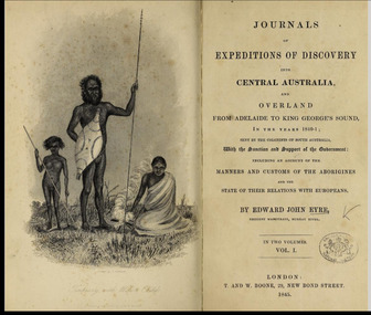 Flagstaff Hill Maritime Museum and Village
Book - Journal Reference Book/History, Edward John Eyre, Journals of Expeditions of Discovery into Central Australia and Overland From Adelaide to King George Sound. In the years 1840-1 Vol 1, 1845
... In the 1840–41 journey behind this book, he led a small party through difficult inland terrain, with the expedition aimed at opening and understanding Australia’s interior. The narrative emphasizes the severity of the landscape, often presenting central and southern inland regions as dry, difficult, and sparsely habitable. Because of this, it reads as both a route...In the 1840–41 journey behind this book, he led a small party through difficult inland terrain, with the expedition aimed at opening and understanding Australia’s interior. The narrative emphasizes the severity of the landscape, often presenting central and southern inland regions as dry, difficult, and sparsely habitable. Because of this, it reads as both a route ...Journals of Expeditions of Discovery into Central Australia was written by Edward John Eyre. It is Eyre’s 1845 account of his 1840–41 exploration journeys from Adelaide into central Australia and then overland to King George’s Sound. The book is published in two volumes and was first issued in 1845. It blends practical expedition reporting with reflection, so it is both a record of exploration and a statement about the colonial understanding of inland Australia.Journals of Expeditions of Discovery into Central Australia Vol 1 Author: Edward John Eyre Publisher: T and W Boone Date: 1845 non-fictionJournals of Expeditions of Discovery into Central Australia was written by Edward John Eyre. It is Eyre’s 1845 account of his 1840–41 exploration journeys from Adelaide into central Australia and then overland to King George’s Sound. The book is published in two volumes and was first issued in 1845. It blends practical expedition reporting with reflection, so it is both a record of exploration and a statement about the colonial understanding of inland Australia. flagstaff hill, warrnambool, shipwrecked coast, flagstaff hill maritime museum, maritime museum, flagstaff hill maritime village, great ocean road, book, warrnambool library, warrnambool mechanics’ institute, mechanics’ institute library, victorian library board, warrnambool books and records, journals of expeditions of discovery into central australia vol 1, edward john eyre -
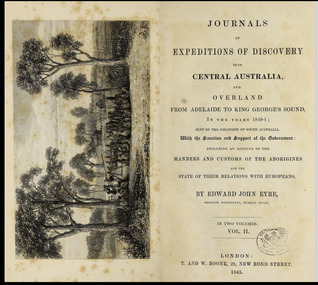 Flagstaff Hill Maritime Museum and Village
Book - Journal Reference Book/History, Edward John Eyre, Journals of Expeditions of Discovery into Central Australia and Overland From Adelaide to King George Sound. In the years 1840-1 Vol 2, 1845
... In the 1840–41 journey behind this book, he led a small party through difficult inland terrain, with the expedition aimed at opening and understanding Australia’s interior. The narrative emphasizes the severity of the landscape, often presenting central and southern inland regions as dry, difficult, and sparsely habitable. Because of this, it reads as both a route...In the 1840–41 journey behind this book, he led a small party through difficult inland terrain, with the expedition aimed at opening and understanding Australia’s interior. The narrative emphasizes the severity of the landscape, often presenting central and southern inland regions as dry, difficult, and sparsely habitable. Because of this, it reads as both a route ...Journals of Expeditions of Discovery into Central Australia was written by Edward John Eyre. It is Eyre’s 1845 account of his 1840–41 exploration journeys from Adelaide into central Australia and then overland to King George’s Sound. The book is published in two volumes and was first issued in 1845. It blends practical expedition reporting with reflection, so it is both a record of exploration and a statement about the colonial understanding of inland Australia.Journals of Expeditions of Discovery into Central Australia Vol 2 Author: Edward John Eyre Publisher: T and W Boone Date: 1845 non-fictionJournals of Expeditions of Discovery into Central Australia was written by Edward John Eyre. It is Eyre’s 1845 account of his 1840–41 exploration journeys from Adelaide into central Australia and then overland to King George’s Sound. The book is published in two volumes and was first issued in 1845. It blends practical expedition reporting with reflection, so it is both a record of exploration and a statement about the colonial understanding of inland Australia. flagstaff hill, warrnambool, shipwrecked coast, flagstaff hill maritime museum, maritime museum, flagstaff hill maritime village, great ocean road, book, warrnambool library, warrnambool mechanics’ institute, mechanics’ institute library, victorian library board, warrnambool books and records, journals of expeditions of discovery into central australia vol 1, edward john eyre -
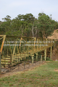 Eltham District Historical Society Inc
Photograph - Digital Photograph, Alan King, Maroondah Aqueduct Siphon Bridge over the Plenty River, 26 January 2008
... route. Named after the Aboriginal word for the area around the Maroondah Reservoir, the Maroondah Aqueduct was fully operational until the 1970s. Since the 1980s the land along parts of the aqueduct have been used for walking and bicycle riding, shaded in places by Monterey Pine trees planted to stabilise the surrounding ground. From 1857 the Yan Yean Reservoir supplied Melbourne’s water but the growing city needed additional catchments.1 In 1886 work began on a weir on the Watts River to enable the aqueduct to carry most of the river water 41...route. Named after the Aboriginal word for the area around the Maroondah Reservoir, the Maroondah Aqueduct was fully operational until the 1970s. Since the 1980s the land along parts of the aqueduct have been used for walking and bicycle riding, shaded in places by Monterey Pine trees planted to stabilise the surrounding ground. From 1857 the Yan Yean Reservoir supplied Melbourne’s water but the growing city needed additional catchments.1 In 1886 work began on a weir on the Watts River to enable the aqueduct to carry most of the river water 41 ...Opened in 1891, the bridge formed part of the Maroondah Aqueduct carrying water from Watts River near Healesville to the reservoir at Preston where it joined Melbourne's metropolitan water system. Covered under Heritage Overlay, Nillumbik Planning Scheme. Published: Nillumbik Now and Then / Marguerite Marshall 2008; photographs Alan King with Marguerite Marshall.; p99 Built to supply thirsty Melbourne in the late 19th century, the siphon bridge spanning the Plenty River off Leischa Court, Greensborough, was part of an engineering masterpiece. Opened in 1891, the bridge formed part of the Maroondah Aqueduct carrying water from the Watts River near Healesville to the reservoir at Preston where it joined the metropolitan distribution system. A major link in Melbourne’s water supply, it also had a huge impact on communities, which mushroomed along its route. Named after the Aboriginal word for the area around the Maroondah Reservoir, the Maroondah Aqueduct was fully operational until the 1970s. Since the 1980s the land along parts of the aqueduct have been used for walking and bicycle riding, shaded in places by Monterey Pine trees planted to stabilise the surrounding ground. From 1857 the Yan Yean Reservoir supplied Melbourne’s water but the growing city needed additional catchments.1 In 1886 work began on a weir on the Watts River to enable the aqueduct to carry most of the river water 41 miles (66km) to Melbourne. The aqueduct, built by the Board of Works, is the oldest remaining aqueduct near Melbourne and was probably the first built with concrete.2 Although the aqueduct is now only used between the Maroondah and Sugarloaf Reservoirs, it can still be traced across the Shire. It extends from the Maroondah Reservoir through Christmas Hills, Kangaroo Ground, Research, Eltham, St Helena and then previously wound west through Greensborough to Reservoir.3 Built by horse and manpower the aqueduct gravity fed 25 million gallons (113.6ML) of water a day to Melbourne along a gradient of one foot to the mile. It included 25 miles (41km) of open concrete and brick channel, six miles (10km) of tunnels, and nine miles (15km) of 14 inverted siphons of riveted wrought-iron across creeks. Bricks for the aqueduct were made from clay found near the sites and remains of several kilns can still be found between Kangaroo Ground and Christmas Hills. Building the aqueduct transformed local communities. An abattoir was established at Christmas Hills. Grog shanties and labourers’ camps sprang up and local courts dealt with cases of ‘petty pilfering and boisterous behaviour’.4 The Kangaroo Ground school population jumped to 91, crammed into a room with one teacher. Miners who built the tunnels camped just north of Churinga in Greensborough – then called Tunnel Hill Camp – and adjacent to the Evelyn Arms Hotel. The miners’ high spirits were sometimes quenched in horse troughs or by a ‘welt under the ear and kick on the behind’ as the local constable calmed them down rather than lock them up.5 But the growing city of Melbourne needed more water, so the O’Shannassy catchment, east of Warburton, was added to the system in 1914. In 1920 work began on the present concrete Maroondah Dam one mile (1.6km) from the weir on the Watts River. The aqueduct capacity was thus doubled to 50 million gallons (227ML) a day.6 Intense land development threatened to pollute the open water supply, so channel sections were replaced with large pipes. In the late 1960s a large water main was built from the tunnel outlet at Research and extended through St Helena and Greensborough, so this section of the aqueduct was taken out of use. Long sections of the unused open channels in Greensborough and Bundoora were destroyed, but the old channel in Research and Eltham North remained largely intact. In the 1970s, the Sugarloaf Reservoir was constructed, inundating 445 hectares of land in Christmas Hills. Sugarloaf was officially opened in 1980 and serves as a water storage and treatment plant supplying Melbourne. In the early 1980s pipes replaced the section from Sugarloaf Reservoir to the tunnel entrance at Kangaroo Ground. The Research-Kangaroo Ground tunnel operates as part of the pipeline system.This collection of almost 130 photos about places and people within the Shire of Nillumbik, an urban and rural municipality in Melbourne's north, contributes to an understanding of the history of the Shire. Published in 2008 immediately prior to the Black Saturday bushfires of February 7, 2009, it documents sites that were impacted, and in some cases destroyed by the fires. It includes photographs taken especially for the publication, creating a unique time capsule representing the Shire in the early 21st century. It remains the most recent comprehenesive publication devoted to the Shire's history connecting local residents to the past. nillumbik now and then (marshall-king) collection, maroondah aqueduct, pipe bridge, siphon bridge -
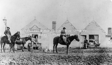 Eltham District Historical Society Inc
Photograph, William McLaughlin's Kangaroo Ground Hotel, General Store and Post Office, Eltham-Yarra Glen Road, Kangaroo Ground, c.1875
... (No. 41) The summer of 1863-4 may be re membered by many colonists as one of the most enjoyable as regards wet weather, and it was one made remarkable by the enterprise and activity apparent throughout Evelyn County. This spirit was fostered and encouraged by the prospect presented from the opening up of the new route...(No. 41) The summer of 1863-4 may be re membered by many colonists as one of the most enjoyable as regards wet weather, and it was one made remarkable by the enterprise and activity apparent throughout Evelyn County. This spirit was fostered and encouraged by the prospect presented from the opening up of the new route ...Initially known as the ‘Kangaroo Hotel,’ this photo shows the sign ‘Kangaroo Ground Hotel’ and William McLaughlin as the proprietor, which dates it between 1871 and 1882. The first hotel known as the Kangaroo Hotel was built at the top of the hill by Andrew Ross in 1864 commencing April; a license was obtained, and the bar opened by Edmund Pickett, the tenant, on 11th of July. The hotel was ready for public accommodation by September, 1864. On June 27, 1864, Edmund Pickett, residing at Kangaroo Ground, gave notice to the Bench of Magistrates at Eltham that it was his intention to apply on July 6th for a certificate authorising the issue of a Publican’s Licence for a house rented and occupied by himself, situated at Kangaroo Ground, containing two sitting rooms and five bedrooms exclusive of those required for the use of his family. On February 7, 1866, Edmund Pickett, publican, residing at Kangaroo Ground, applied at the Court of Petty Sessions held at Eltham for a Publican’s License for a house situated at the Kangaroo Ground, containing six bedrooms and two sitting rooms, rented and occupied by himself and licensed under the sign of the 'Kangaroo Hotel.' In 1866, with few boarders at the school and needing to reduce expenses, Ross had the bedroom house removed from the school and placed in contiguity to the hotel, the occupier to have the post office. The house was re-erected with a kitchen addition and was opened as the Post Office & General Store on April 1st. Throughout 1870 Andrew Ross found himself at odds with Pickett - he "felt much dissatisfaction at my having a hotel especially kept by a man of loose principals and low habits" and so served him notice to vacate by December 31st, occupying it himself on January 1, 1871, calling it Rossville House. William McLaughlin and his wife kept the store and post office. As a hotel was now wanted and McLaughlin was desirous to obtain a license, Ross set about making the Store building suitable which was achieved towards the end of 1871. Ross notes in his diary that the Store hotel was finished January 1, 1872. At the Court of Petty Sessions held at Eltham on 5 December 1871, William McLaughlin applied for a license for the Kangaroo Hotel, Kangaroo Ground. He had previously obtained a wine license, March 28. In June 1882, William McLaughlin of Madeline Street, Carlton, (late of Kangaroo Ground, hotelkeeper) was found insolvent due to losses in connection with the Kangaroo Ground Hotel. The license for the hotel was later transferred from Mr John Donaldson to Mrs Sophia Greenaway. It appears during McLaughlin’s tenure the hotel became known as the Kangaroo Ground Hotel. The hotel was replaced with a new wooden building in 1892, constructed by W.Holland and described as being "of a neat appearance, roomy, and fittled up with all modern requirements necessary in a business of this kind." This building was destroyed by fire in 1930. References: Ross, Andrew, 1814-1895 & Woiwod, Mick & Andrew Ross Museum. (2011). The diary of Andrew Ross 1828-1895 & the reminiscences of Andrew Ross 1851-1864 / edited, annotated and introduced by Mick Woiwod for the Andrew Ross Museum, Kangaroo Ground. Kangaroo Ground, [Vic.] : Tarcoola Press in association with the Andrew Ross Museum The Evelyn Observer, (1892, June 24). Evelyn Observer, and South and East Bourke Record (Vic. : 1882 - 1902), p. 2 (MORNING.). Retrieved May 13, 2025, from http://nla.gov.au/nla.news-article60667494 REMINISCENCES. (1893, April 21). Evelyn Observer, and South and East Bourke Record (Vic. : 1882 - 1902), p. 2 (MORNING.). Retrieved May 10, 2025, from http://nla.gov.au/nla.news-article60669116 REMINISCENCES COUNTY EVELYN. BY Andrew Ross. (No. 41) The summer of 1863-4 may be re membered by many colonists as one of the most enjoyable as regards wet weather, and it was one made remarkable by the enterprise and activity apparent throughout Evelyn County. This spirit was fostered and encouraged by the prospect presented from the opening up of the new route to the Jordan and Wood's Point, and the consequent occupation of lands and special localities along the main track. Accommodation for travellers were established at Yarra Flats, the future Healesville, Fernshaw, Marysville, while the beauties and difficulties of the Black Spur, together with the romantic region of the Stephenson Waterfalls mid the mountain forests attracted visitors other than the gold diggers. Before the end of this year 1863, the new route to Wood's Point by the Dividing Range had been so far improved that a track was laid off by the New Chum Creak, Paradise Plains, and the Springs to Emerald Hill, about half way between Jordan and Wood's Point, and the clearing of this track was looked forward to as enabling drays to be employed. The Government had so far yielded to the demands made upon it, that the work was proceeded with early in 1864. In March of that year the writer was favoured by a visit from Mr. Ligne, Surveyor-General, who was enroute to inspect the progress of the undertaking. He was accompanied by Mr. Collins Levey, his son-in-law, who had been a frequent visitor with his friend Mr. Franklin, of the Melbourne Herald newspaper, These parties, and not a few others, were glad to partake of the hospitality of residents on the Ground or, at Yarra Flats when as yet no public accommodation existed. Horsemen and pedestrians became numerous ere winter set in, and there was obviously the want of the hotel which was planned and commenced late in the autumn. The absence of any endeavour on that score by local proprietors induced the writer to undertake the erection of the Kangaroo Ground Hotel, which he did on his own responsibility. The spot best suited for the hotel being held by him on lease, he was permitted by the landlord to devote the required portion of land for the premises to be erected and occupied. Before this was accomplished the imported houses placed near the schoolhouse which had served for bedroom to boarded pupils were rebuilt near the hotel and served for a general store and post office also. Delay was experienced in procuring all the materials for the new building. After the break in the weather the roads on the Ground became very heavy and as timber had to come from town, it was under difficulties that the supply was procured. Bricks for chimneys were made in a small kiln, and hardwood for joists, &c., provided by sawyers employed for the purpose in the bush. The hotel, in consequence, was not ready for public accommodation until the spring, although a license was obtained, and the bar opened by Mr. Pickett, the tenant, on 11th of July. It may be remarked that the house was rather late in being established; a year earlier it would have secured the benefit of the rush to the new diggings, but in another sense it was rather premature for as yet no steps had been taken by the authorities to stop or even discourage the sale of liquor by unlicensed parties, and the holder of a license had to compete with the class in question. As the season (1864) advanced there were parties anxious to be the pioneers in traversing the whole of the route to Wood’s Point, but it was nigh to summer again before the track was available to vehicular traffic. I believe one of the first to effect the whole passage in this way was Mr. Gillies, some time settled at Mortlake. He drove a buggy and called at the Ground on 9th September, stating his intention to drive through to the Point, and we were subsequently informed that he had accomplished the task. (End of Reminiscences No 41)This photo forms part of a collection of photographs gathered by the Shire of Eltham for their centenary project book,"Pioneers and Painters: 100 years of the Shire of Eltham" by Alan Marshall (1971). The collection of over 500 images is held in partnership between Eltham District Historical Society and Yarra Plenty Regional Library (Eltham Library) and is now formally known as the 'The Shire of Eltham Pioneers Photograph Collection.' It is significant in being the first community sourced collection representing the places and people of the Shire's first one hundred years.Digital image (neg copy missing) Print 21 x 26.5 cmeltham-yarra glen road, kangaroo ground, kangaroo ground hotel, post office, shire of eltham pioneers photograph collection, gas lamp, hotels, kangaroo hotel, william mclaughlin, andrew ross, edmund pickett -
 Eltham District Historical Society Inc
Slide, Maroondah Aqueduct, Research, Victoria, 22 Mar. 1981
... Of this length, 41 km were open channel, 10 km, tunnel through hills and 15 km in 14 inverted siphons across stream valleys. The route...Of this length, 41 km were open channel, 10 km, tunnel through hills and 15 km in 14 inverted siphons across stream valleys. The route ...An inspection tour of the Maroondah Aqueduct was undertaken by the Shire of Eltham Historical Society on Sunday, March 22nd, 1981, commening where the aqueduct crosses Main Rd., Research, just below Eltham College. The Maroondah Aqueduct was part of Melbourne’s water supply system. It carried water over the 66 km from the Maroondah Reservoir on the Watts River at Healesville to the Preston Reservoir. Of this length, 41 km were open channel, 10 km, tunnel through hills and 15 km in 14 inverted siphons across stream valleys. The route of the aqueduct is north of Tarrawarra and Yarra Glen, along the Yarra escarpment south of Christmas Hills and crossing Watsons Creek into the present Shire of Eltham near Henley Rd. The eastern part of the route lies entirely within the former boundaries of the shire. The aqueduct passes south of Kangaroo Ground to Research and crosses the Diamond Creek by siphon at Allendale Rd., Eltham North. It then extends to Reservoir via St. Helena, Greensborough North and Bundoora. Water first flowed through the aqueduct in February 1891 when it was fed by a diversion weir on the Watts River. Records of the building of the aqueduct indicate that it was a significant construction achievement. The present Maroondah Reservoir was completed in 1927 and the aqueduct was enlarged at that time to take increased flows. About 1971 the section of the aqueduct through and north of Research was replaced by a large pipe and that section of the channel is now unused. The channel has remained largely intact (unlike sections at Greensborough and Bundoora where long lengths of the disused aqueduct have been demolished or filled in). The M.M.B.W. relinquished control of the disused aqueduct reserve which is crown land and the Shire of Eltham took control of this section of the reserve as a linear park. The Maroondah Aqueduct is considered to be an important historic structure, not just to the local area but to the metropolitan area generally. It is considered important to preserve substantially intact long lengths of the disused aqueduct, together with its bridges and other associated structures. 35 mm colour positive transparency (1 of 5) Mount - Agfachrome Agfa CS System black 8 dotsactivities, heritage excursion, maroondah aqueduct, research (vic.), shire of eltham historical society -
 Eltham District Historical Society Inc
Slide, Maroondah Aqueduct, Research, Victoria, 22 Mar. 1981
... Of this length, 41 km were open channel, 10 km, tunnel through hills and 15 km in 14 inverted siphons across stream valleys. The route...Of this length, 41 km were open channel, 10 km, tunnel through hills and 15 km in 14 inverted siphons across stream valleys. The route ...An inspection tour of the Maroondah Aqueduct was undertaken by the Shire of Eltham Historical Society on Sunday, March 22nd, 1981, commening where the aqueduct crosses Main Rd., Research, just below Eltham College. The Maroondah Aqueduct was part of Melbourne’s water supply system. It carried water over the 66 km from the Maroondah Reservoir on the Watts River at Healesville to the Preston Reservoir. Of this length, 41 km were open channel, 10 km, tunnel through hills and 15 km in 14 inverted siphons across stream valleys. The route of the aqueduct is north of Tarrawarra and Yarra Glen, along the Yarra escarpment south of Christmas Hills and crossing Watsons Creek into the present Shire of Eltham near Henley Rd. The eastern part of the route lies entirely within the former boundaries of the shire. The aqueduct passes south of Kangaroo Ground to Research and crosses the Diamond Creek by siphon at Allendale Rd., Eltham North. It then extends to Reservoir via St. Helena, Greensborough North and Bundoora. Water first flowed through the aqueduct in February 1891 when it was fed by a diversion weir on the Watts River. Records of the building of the aqueduct indicate that it was a significant construction achievement. The present Maroondah Reservoir was completed in 1927 and the aqueduct was enlarged at that time to take increased flows. About 1971 the section of the aqueduct through and north of Research was replaced by a large pipe and that section of the channel is now unused. The channel has remained largely intact (unlike sections at Greensborough and Bundoora where long lengths of the disused aqueduct have been demolished or filled in). The M.M.B.W. relinquished control of the disused aqueduct reserve which is crown land and the Shire of Eltham took control of this section of the reserve as a linear park. The Maroondah Aqueduct is considered to be an important historic structure, not just to the local area but to the metropolitan area generally. It is considered important to preserve substantially intact long lengths of the disused aqueduct, together with its bridges and other associated structures. 35 mm colour positive transparency (1 of 5) Mount - Agfachrome Agfa CS System black 8 dotsactivities, heritage excursion, maroondah aqueduct, research (vic.), shire of eltham historical society -
 Eltham District Historical Society Inc
Slide, Maroondah Aqueduct, Research, Victoria, 22 Mar. 1981
... Of this length, 41 km were open channel, 10 km, tunnel through hills and 15 km in 14 inverted siphons across stream valleys. The route...Of this length, 41 km were open channel, 10 km, tunnel through hills and 15 km in 14 inverted siphons across stream valleys. The route ...An inspection tour of the Maroondah Aqueduct was undertaken by the Shire of Eltham Historical Society on Sunday, March 22nd, 1981, commening where the aqueduct crosses Main Rd., Research, just below Eltham College. The Maroondah Aqueduct was part of Melbourne’s water supply system. It carried water over the 66 km from the Maroondah Reservoir on the Watts River at Healesville to the Preston Reservoir. Of this length, 41 km were open channel, 10 km, tunnel through hills and 15 km in 14 inverted siphons across stream valleys. The route of the aqueduct is north of Tarrawarra and Yarra Glen, along the Yarra escarpment south of Christmas Hills and crossing Watsons Creek into the present Shire of Eltham near Henley Rd. The eastern part of the route lies entirely within the former boundaries of the shire. The aqueduct passes south of Kangaroo Ground to Research and crosses the Diamond Creek by siphon at Allendale Rd., Eltham North. It then extends to Reservoir via St. Helena, Greensborough North and Bundoora. Water first flowed through the aqueduct in February 1891 when it was fed by a diversion weir on the Watts River. Records of the building of the aqueduct indicate that it was a significant construction achievement. The present Maroondah Reservoir was completed in 1927 and the aqueduct was enlarged at that time to take increased flows. About 1971 the section of the aqueduct through and north of Research was replaced by a large pipe and that section of the channel is now unused. The channel has remained largely intact (unlike sections at Greensborough and Bundoora where long lengths of the disused aqueduct have been demolished or filled in). The M.M.B.W. relinquished control of the disused aqueduct reserve which is crown land and the Shire of Eltham took control of this section of the reserve as a linear park. The Maroondah Aqueduct is considered to be an important historic structure, not just to the local area but to the metropolitan area generally. It is considered important to preserve substantially intact long lengths of the disused aqueduct, together with its bridges and other associated structures. 35 mm colour positive transparency (1 of 5) Mount - Agfachrome Agfa CS System black 8 dotsactivities, heritage excursion, maroondah aqueduct, research (vic.), shire of eltham historical society
