



Historical information
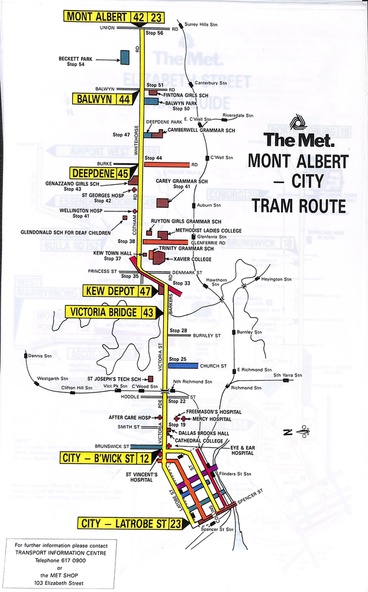
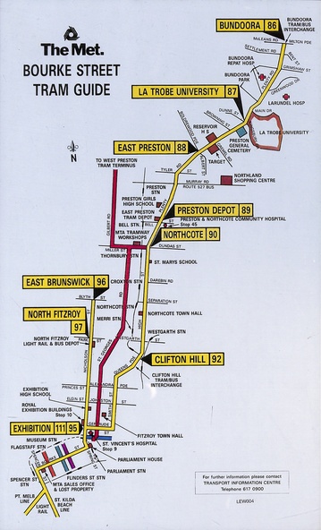
Set of 11 tram route guides or maps, produced by The Met - undated - mid to late 1980s. Shows the major cross streets, parks, schools, other tram routes, major stop numbers and railway lines. May not be a complete set - see also item 3909 for a MMTB produced set.
1 - Mont Albert - City - shows routes 23, 12, 43, 47, 45, 44, & 42
2 - Elizabeth St tram guide - shows routes 50, 58, 60, 57, 82, 52, 49, 59, 18, 20 and 19.
3 - Flinders St tram guide - shows routes 24, 28, 41, 40, 48, 74 and 75
4 - Collins St tram guide - shows all linking routes
5 - East Brunswick, St Kilda Beach, Port Melbourne light rail routes - routes 96, 111 and 97
6 - St Kilda Road tram guide - shows all routes operating along St Kilda Road and connecting or linking routes
7 - Swanston St tram guide - shows all linking routes with route numbers.
8 - Toorak, Camberwell & Glen Iris tram guide - routes 72, 73, 6, 7, 8
9 - Batman Ave tram guide - routes 78, 79, 70 & 71
10 - William St tram guide - routes 55, 33, 63
11 - Bourke St tram guide - routes 96, 97, 95, 111, 92, 90, 89, 88, 87 & 86
Significance
Yields information about the various tram routes operated by The Met mid to late 1980s, including the light rail services.
Physical description
Series of 11 route maps printed in colour on mylar sheets.
