
Showing 3 items matching " upper keilor"
-
 Sunshine and District Historical Society Incorporated
Mixed media - James Robertson of Upper Keilor
... James Robertson of Upper Keilor...... Upper Keilor...931.01 - Copy last will and testament of James Robertson Upper Keilor 1853 931.02 - Robertsons Homestead - Community Pitches Three Park Improvements To Council...Robertson Upper Keilor Keilor 931.01 - Copy last will and testament of James Robertson Upper Keilor 1853 931.02 - Robertsons Homestead - Community Pitches Three Park Improvements To Council Collection of letters & articles Mixed media James Robertson of Upper Keilor ...931.01 - Copy last will and testament of James Robertson Upper Keilor 1853 931.02 - Robertsons Homestead - Community Pitches Three Park Improvements To Councilrobertson, upper keilor, keilor -
 Sunshine and District Historical Society Incorporated
Archive - Places of Historic Interest in and around St Albans 2013, Missen Alie Compiler
... Places of Historic Interest in and around St Albans|The ABC Radio mast and transmitter station|The Blue stone Culvert bridge|Sydenham railway station|Robertsons Upper Keilor Homestead|A Sheep Dip|The Overnewton Venue|The Overnewton Gatehouse|Anderson Cottage|the Hume and Hovell Cairn| Keighlo|St Albans Railway Reserve Grasslands|The Anderson Farm House|The St George Fee Serbian Orthodox Church|The Agnes Stevens farmhouse|The Stensons Family Farm|The Errington Reserve Gates|The St Albans Community Youth Centre|St Albans Town Plan|St Albans Uniting Church...Albans Harrsion Places of Historic Interest in and around St Albans|The ABC Radio mast and transmitter station|The Blue stone Culvert bridge|Sydenham railway station|Robertsons Upper Keilor Homestead|A Sheep Dip|The Overnewton Venue|The Overnewton Gatehouse|Anderson Cottage|the Hume and Hovell Cairn| Keighlo|St Albans Railway Reserve Grasslands|The Anderson Farm House|The St George Fee Serbian Orthodox Church|The Agnes Stevens farmhouse|The Stensons Family Farm|The Errington Reserve Gates|The St Albans Community Youth Centre|St Albans Town Plan|St Albans Uniting Church Places of Historic Interest in and around St Albans 2013 Compiled by Alie Missen Archive Places of Historic Interest in and around St Albans 2013 Missen Alie Compiler ...Places of Historic Interest in and around St Albans|The ABC Radio mast and transmitter station|The Blue stone Culvert bridge|Sydenham railway station|Robertsons Upper Keilor Homestead|A Sheep Dip|The Overnewton Venue|The Overnewton Gatehouse|Anderson Cottage|the Hume and Hovell Cairn| Keighlo|St Albans Railway Reserve Grasslands|The Anderson Farm House|The St George Fee Serbian Orthodox Church|The Agnes Stevens farmhouse|The Stensons Family Farm|The Errington Reserve Gates|The St Albans Community Youth Centre|St Albans Town Plan|St Albans Uniting Churchst. albans, harrsion -
 Broadmeadows Historical Society & Museum
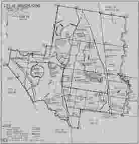
Map, City of Broadmeadows municipal map, February 1985, c. February 1985
... Keilor. The map provides evidence of municipal organisation and land use in Broadmeadows during the mid-1980s. This map is significant as a historical record of the City of Broadmeadows shortly before substantial local government and urban development changes in Melbourne's northern suburbs. It documents municipal boundaries, infrastructure, public reserves and administrative divisions in 1985, providing valuable evidence for researchers studying local government, urban planning and community development in the Broadmeadows district. Broadmeadows (Vic.) City of Broadmeadows Local government Municipal boundaries Urban planning Roads Parks and reserves Cartography Melbourne northern suburbs 1980s Victoria. Recto, upper ...The map documents the City of Broadmeadows municipal area as it existed in February 1985. It records local government ward boundaries, infrastructure, reserves and neighbouring municipalities including Bulla, Whittlesea, Preston, Coburg, Essendon and Keilor. The map provides evidence of municipal organisation and land use in Broadmeadows during the mid-1980s.This map is significant as a historical record of the City of Broadmeadows shortly before substantial local government and urban development changes in Melbourne's northern suburbs. It documents municipal boundaries, infrastructure, public reserves and administrative divisions in 1985, providing valuable evidence for researchers studying local government, urban planning and community development in the Broadmeadows district.Single-sheet monochrome printed map on grey paper. Recto contains a detailed municipal map of the City of Broadmeadows. Verso is blank apart from labels and annotations. Fold marks visible.Recto, upper left: "CITY OF BROADMEADOWS" / "Metric Scale 1:40000" / "DATE FEB 1985" Verso, upper centre: "WI-3206" Verso, upper right: Handwritten and partially obscured notation present.broadmeadows (vic.), city of broadmeadows, local government, municipal boundaries, urban planning, roads, parks and reserves, cartography, melbourne northern suburbs, 1980s victoria.
