


Historical information
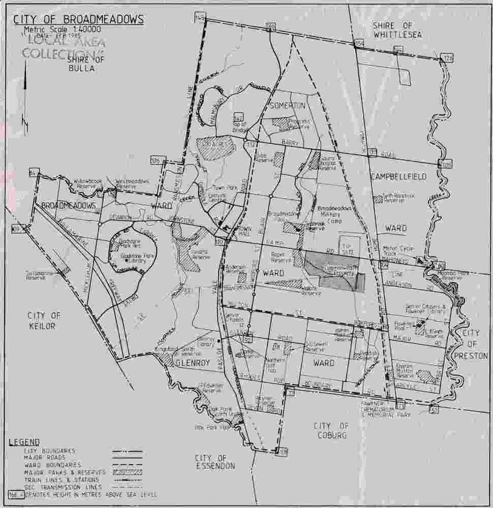
The map documents the City of Broadmeadows municipal area as it existed in February 1985. It records local government ward boundaries, infrastructure, reserves and neighbouring municipalities including Bulla, Whittlesea, Preston, Coburg, Essendon and Keilor. The map provides evidence of municipal organisation and land use in Broadmeadows during the mid-1980s.
Significance
This map is significant as a historical record of the City of Broadmeadows shortly before substantial local government and urban development changes in Melbourne's northern suburbs. It documents municipal boundaries, infrastructure, public reserves and administrative divisions in 1985, providing valuable evidence for researchers studying local government, urban planning and community development in the Broadmeadows district.
Physical description
Single-sheet monochrome printed map on grey paper. Recto contains a detailed municipal map of the City of Broadmeadows. Verso is blank apart from labels and annotations. Fold marks visible.
Inscriptions & markings
Recto, upper left: "CITY OF BROADMEADOWS" / "Metric Scale 1:40000" / "DATE FEB 1985"
Verso, upper centre: "WI-3206"
Verso, upper right: Handwritten and partially obscured notation present.