
Showing 48 items matching "1939 black friday bushfires"
-
 Marysville & District Historical Society
Ephemera (item) - Calendar page, Unknown
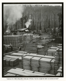
... ...1939 black friday bushfires...The mill was rebuilt after the 1939 Black Friday bushfires....The mill was rebuilt after the 1939 Black Friday bushfires....The mill was rebuilt after the 1939 Black Friday bushfires. A page from a calendar with a black and white photograph taken at the Anderson No. 2 Mill at Marysville. marysville victoria australia 1939 black friday bushfires calendar photograph andersons no. 1 mill andersons no. 2 mill "Anderson No 2 Mill at Marysville, rebuilt after 1939 fires. ...A page from a calendar with a black and white photograph taken at the Anderson No. 2 Mill at Marysville. The mill was rebuilt after the 1939 Black Friday bushfires.A page from a calendar with a black and white photograph taken at the Anderson No. 2 Mill at Marysville."Anderson No 2 Mill at Marysville, rebuilt after 1939 fires. Note how straight the timber was stacked, by hand!"marysville, victoria, australia, 1939 black friday bushfires, calendar, photograph, andersons no. 1 mill, andersons no. 2 mill -
 Marysville & District Historical Society
Newspaper (item) - Newspaper photograph, The Sun News-Pictorial, MILL WORKERS CUT OFF BY FLAMES SURVIVE NIGHT OF TERROR, 1939
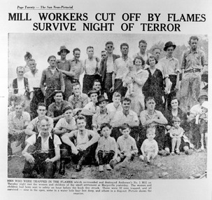
... ...1939 black friday bushfires...A photocopy of a newspaper photograph taken after the 1939 Black Friday bushfires destroyed the Anderson's No. 1 Mill near Marysville. ...A photocopy of a newspaper photograph taken after the 1939 Black Friday bushfires destroyed the Anderson's No. 1 Mill near Marysville. ...A photocopy of a newspaper photograph taken after the 1939 Black Friday bushfires destroyed the Anderson's No. 1 Mill near Marysville. ...A photocopy of a newspaper photograph taken after the 1939 Black Friday bushfires destroyed the Anderson's No. 1 Mill near Marysville. The women and children were sent to Marysville for safety and 32 men were trapped at the mine. All survived and this photograph is of the reunion.A photocopy of a newspaper photograph taken after the 1939 Black Friday bushfires destroyed the Anderson's No. 1 Mill near Marysville.marysville, victoria, australia, anderson's no. 1 mill, 1939 black friday bushfires, newspaper photograph, sun news-pictorial -
 Marysville & District Historical Society
Photograph (item) - Black and white photograph, Original photogaph taken, possibly, in the early 1940s
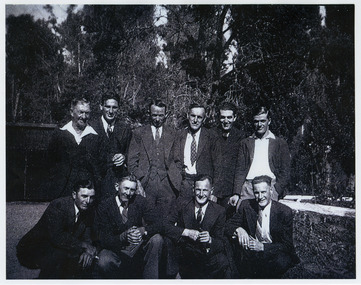
... ...1939 black friday bushfires...Anderson's No. 1 Mill was first established in the mid 1930s but was destroyed in the 1939 Black Friday bushfires. It was then rebuilt and named the Anderson's No. 2 Mill. ...Anderson's No. 1 Mill was first established in the mid 1930s but was destroyed in the 1939 Black Friday bushfires. It was then rebuilt and named the Anderson's No. 2 Mill. ...A copy of a black and white photograph of Anderson's No. 2 Mill employees. Anderson's No. 1 Mill was first established in the mid 1930s but was destroyed in the 1939 Black Friday bushfires. It was then rebuilt and named the Anderson's No. 2 Mill. The original photograph was taken, possibly, in the early 1940s.A copy of a black and white photograph of Anderson's No. 2 Mill employees.ANDERSON Mill Employees/ Early 40's??marysville, victoria, australia, anderson no. 1 sawmill, anderson no. 2 sawmill, photograph, 1939 black friday bushfires -
 Marysville & District Historical Society
Photograph (item) - Black and white photograph, Unknown
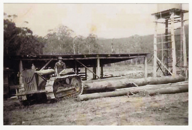
... ...1939 black friday bushfires...Following the devastating 1939 Black Friday bushfires, sawmill owners expanded into the region to salvage dead timber. ...Following the devastating 1939 Black Friday bushfires, sawmill owners expanded into the region to salvage dead timber. ...A copy of a black and white photograph taken at Feiglin's Sawmill near Marysville in Victoria. Feiglin's Sawmill (later the Narbethong Timber & Trading Co.) was a cornerstone of the regional timber industry on the Acheron Way in Narbethong, just outside Marysville. Following the devastating 1939 Black Friday bushfires, sawmill owners expanded into the region to salvage dead timber. Feiglin's was established in the Acheron Valley, employing local mill workers who lived in a small settlement of four-room cottages on Withers Lane.A copy of a black and white photograph taken at Feiglin's Sawmill near Marysville in Victoria.marysville, victoria, australia, narbethong, feiglin's sawmill, archeron way, 1939 black friday bushfires, acheron valley, narbethong timber & trading co., 2009 black saturday bushfires, mr. j. feiglin, photograph -
 Marysville & District Historical Society
Document (item) - Magazine article, Mr. J. Feiglin, FEIGLIN'S SAWMILL, Original was written for the Mansfield Historical Society Magazine-November 1985
... ...1939 black friday bushfires...Following the devastating 1939 Black Friday bushfires, sawmill owners expanded into the region to salvage dead timber. ...Following the devastating 1939 Black Friday bushfires, sawmill owners expanded into the region to salvage dead timber. ...A transcription of a magazine article outlining the history of Feiglin's Sawmill near Marysville in Victoria. The article was originally published in the Mansfield Historical Society Magazine in November 1985. Feiglin's Sawmill (later the Narbethong Timber & Trading Co.) was a cornerstone of the regional timber industry on the Acheron Way in Narbethong, just outside Marysville. Following the devastating 1939 Black Friday bushfires, sawmill owners expanded into the region to salvage dead timber. Feiglin's was established in the Acheron Valley, employing local mill workers who lived in a small settlement of four-room cottages on Withers Lane. By 1956, the broader Marysville area was a bustling timber hub with numerous mills, including Feiglin's, processing over 56,000 cubic metres of timber annually and supporting livelihoods for roughly 1,000 people.Black Saturday: The 2009 fires decimated the forest and completely destroyed the Narbethong Timber & Trading Co. (formerly Feiglins).A transcription of a magazine article outlining the history of Feiglin's Sawmill near Marysville in Victoria.marysville, victoria, australia, narbethong, feiglin's sawmill, archeron way, 1939 black friday bushfires, acheron valley, narbethong timber & trading co., 2009 black saturday bushfires, mansfield historical society magazine november 1985, mr. j. feiglin -
 Kiewa Valley Historical Society
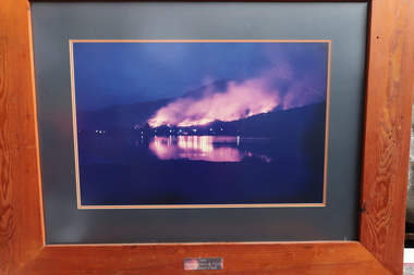
Photos: 2003 Fires at Bogong and Scientific Research at Bogong
... The 2003 bushfires caused by a lightning strikes on 8th January 2003. 87 fires were ignited 8 of which would join to form the largest fire in Victoria since the 1939 Black Friday bushfires, burning through 60% of the Alpine National Park. ...The 2003 bushfires caused by a lightning strikes on 8th January 2003. 87 fires were ignited 8 of which would join to form the largest fire in Victoria since the 1939 Black Friday bushfires, burning through 60% of the Alpine National Park. ...The 2003 bushfires caused by a lightning strikes on 8th January 2003. 87 fires were ignited 8 of which would join to form the largest fire in Victoria since the 1939 Black Friday bushfires, burning through 60% of the Alpine National Park. Ref. The Mountain Journal. Scientific research was used to test new methods during construction.These fires were close to Bogong village and Mt Beauty. The photos were displayed in the Mountain Monk Hotel, Mt Beauty which was the original SEC Working Mens Club during the construction of the Kiewa Hydro Electric Scheme. Scientific research was used to create new improved methods during construction. Framed photos (1-3) of the 2003 bushfires at Bogong village and Photos (4-11) with titles involving scientific work by the SECV. 1-3 2003 Bogong Complex Fires at Moncrieffs Gap 4. Phasmid Eggs 5. Insect cages 6. Spraying Bitumen 7. Grass grown after spray 8. "Finn" method 9. Erosion raceline bank 10. "Finn" treatment 11. Machine spraying grass seed2003 bushfires, moncrieffs gap -
 Department of Energy, Environment and Climate Action
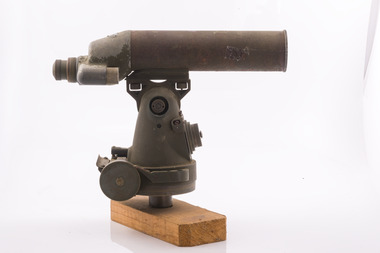
Telescope used in FCV fire towers - ex military, c 1940s
... Many were established by the Forests Commission Victoria (FCV) in the 1920s, but the network was expanded rapidly in response to recommendations of the Stretton Royal Commission after the 1939 Black Friday bushfires. When a fire or smoke was spotted from the tower a bearing was taken with the alidade and radioed or telephoned into the district office. ...Many were established by the Forests Commission Victoria (FCV) in the 1920s, but the network was expanded rapidly in response to recommendations of the Stretton Royal Commission after the 1939 Black Friday bushfires. When a fire or smoke was spotted from the tower a bearing was taken with the alidade and radioed or telephoned into the district office. ...Victoria once had well over one hundred fire lookouts and firetowers. Fire lookouts, or observation posts, were often just a clearing on a hill or a vantage point, whereas firetowers were definite structures. Many were established by the Forests Commission Victoria (FCV) in the 1920s, but the network was expanded rapidly in response to recommendations of the Stretton Royal Commission after the 1939 Black Friday bushfires. When a fire or smoke was spotted from the tower a bearing was taken with the alidade and radioed or telephoned into the district office. It was then cross referenced with bearings from other towers on a large wall map to give a "fix" on the fire location Alidades and telescopes were used in the post war period but were replaced with a much simpler map table and reference string suspended from the centre of the tower cabin.Uncommon usageTelescope used in fire towers Ex military Kern Company NY Argus made in USA Adjustment lens, dials and focus ring Small spirit levelbushfire, forests commission victoria (fcv) -
 Department of Energy, Environment and Climate Action
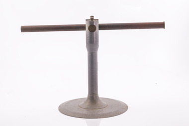
Alidade - sight tube used in FCV fire towers, c 1940s
... Many were established by the Forests Commission Victoria (FCV) in the 1920s, but the network was expanded rapidly in response to recommendations of the Stretton Royal Commission after the 1939 Black Friday bushfires. When a fire or smoke was spotted from the tower a bearing was taken with the alidade and radioed or telephoned into the district office. ...Many were established by the Forests Commission Victoria (FCV) in the 1920s, but the network was expanded rapidly in response to recommendations of the Stretton Royal Commission after the 1939 Black Friday bushfires. When a fire or smoke was spotted from the tower a bearing was taken with the alidade and radioed or telephoned into the district office. ...Victoria once had well over one hundred fire lookouts and firetowers. Fire lookouts, or observation posts, were often just a clearing on a hill or a vantage point, whereas firetowers were definite structures. Many were established by the Forests Commission Victoria (FCV) in the 1920s, but the network was expanded rapidly in response to recommendations of the Stretton Royal Commission after the 1939 Black Friday bushfires. When a fire or smoke was spotted from the tower a bearing was taken with the alidade and radioed or telephoned into the district office. It was then cross referenced with bearings from other towers on a large wall map to give a "fix" on the fire location Alidades and telescopes were used in the post war period but were replaced with a much simpler map table and reference string suspended from the centre of the tower cabin.Uncommon usageAlidade Sight TubeFCV and bearing markers on the alloy base. Very simple design. bushfire, forests commission victoria (fcv) -
 Wooragee Landcare Group
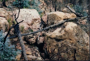
Photograph, circa April 2003
... This bushfire started by lightning and quickly became the largest fire in Victoria since the 1939 Black Friday bushfires. The Alpine bushfires destroyed 1.3 million hectares and burnt for 59 days before it could be controlled. ...This bushfire started by lightning and quickly became the largest fire in Victoria since the 1939 Black Friday bushfires. The Alpine bushfires destroyed 1.3 million hectares and burnt for 59 days before it could be controlled. ...This is a photograph taken in the Chiltern - Mount Pilot National Park near Chiltern in Victoria. On this day, the Wooragee Landcare Group was in the national park looking for signs of the tiger quoll. Tiger quolls can be found in few places with the Chiltern - Mount Pilot National Park being one of them. This photograph is of a tiger quoll nesting site as tiger quolls often nest between large rocks. This image also shows the damage caused by the 2003 bushfires. These bushfires happened at the same time as the 2003 Alpine bushfires. This bushfire started by lightning and quickly became the largest fire in Victoria since the 1939 Black Friday bushfires. The Alpine bushfires destroyed 1.3 million hectares and burnt for 59 days before it could be controlled. The 2003 bushfires severely damaged the environment and concern was raised about the safety of tiger quoll. This photograph displays how the nesting site was damaged by the fire. This meant that the quoll itself could have also been impacted by the fire. Hence why the Wooragee Landcare group went for a search for signs of the quoll.This photograph is significant because it shows a tiger quoll nesting site. Tiger quolls are a highly valuable species because they live in very few places. This, in turn, makes their nesting site valuable. This photograph also signifies the impact of the 2003 bushfires on the Chiltern - Mount Pilot National Park. The image displays burnt trees which makes it clear that the fire was deeply damaging. The fallen log over the nesting site demonstrates how the bushfire must of put the tiger quolls at risk because of how the fire damaged their nesting site. Landscape coloured photograph printed on gloss paperReverse: WAN NA 0ANA0N0 NNN+ 1 1636 / [PRINTED] (No.9) / 923bushfires, mount pilot chiltern national park, mount pilot, chiltern, victoria, wooragee landcare group, wooragee landcare, wooragee, national park, tiger quoll, 2003 bushfires, beechworth, rocks, nesting site, photograph, 2003 alpine bushfires, 1939 black friday, 2003, hectares, fire, damage, burnt, burn -
 Department of Energy, Environment and Climate Action
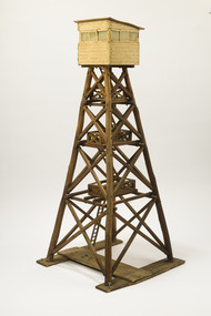
Wooden Model Fire Tower, Tom Coish, Model of Reef Hills fire tower, (5 km south of Benalla), 1957
... Many were established by the Forests Commission Victoria (FCV) in the 1920s, but the network was expanded rapidly in response to recommendations of the Stretton Royal Commission after the 1939 Black Friday bushfires. The wooden towers were often built by bush craftsmen like legendary FCV overseer Clem Heather from Orbost. ...Many were established by the Forests Commission Victoria (FCV) in the 1920s, but the network was expanded rapidly in response to recommendations of the Stretton Royal Commission after the 1939 Black Friday bushfires. The wooden towers were often built by bush craftsmen like legendary FCV overseer Clem Heather from Orbost. ...Victoria once had well over one hundred fire lookouts and firetowers. Fire lookouts, or observation posts, were often just a clearing on a hill or a vantage point, whereas firetowers were definite structures. There are at least three categories of firetowers… (1) tree perches, (2) four-legged towers made of either wood or steel, as well as (3) hilltop cabins and observatories. Many were established by the Forests Commission Victoria (FCV) in the 1920s, but the network was expanded rapidly in response to recommendations of the Stretton Royal Commission after the 1939 Black Friday bushfires. The wooden towers were often built by bush craftsmen like legendary FCV overseer Clem Heather from Orbost. But advances in aerial reconnaissance and radio technology led to the gradual reduction in the number of fixed towers. FFMV now operates 72 firetowers. The CFA, Melbourne Water, Hancock Victorian Plantations (HVP) also operate some, the Army has one at Puckapunyal overlooking the live-firing range. Only two remaining fire towers of this design remain in Victoria (Mt Little Dick and Big Tower in the Mullungdung State Forest). Mt Nowa Nowa and Stringers Knob burnt down in the 2019/20 bushfiresLarge model of an Reef Hills fire tower. Presumably used for instructional purposes. Traditional FCV four legged design with three landings and closed cabin.bushfire, forests commission victoria (fcv) -
 Department of Energy, Environment and Climate Action
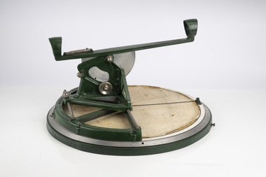
Fire Finder
... Many were established by the Forests Commission Victoria (FCV) in the 1920s, but the network was expanded rapidly in response to recommendations of the Stretton Royal Commission after the 1939 Black Friday bushfires. When a fire or smoke was spotted from the tower a bearing was taken with the alidade and radioed or telephoned into the district office. ...Many were established by the Forests Commission Victoria (FCV) in the 1920s, but the network was expanded rapidly in response to recommendations of the Stretton Royal Commission after the 1939 Black Friday bushfires. When a fire or smoke was spotted from the tower a bearing was taken with the alidade and radioed or telephoned into the district office. ...Victoria once had well over one hundred fire lookouts and firetowers. Fire lookouts, or observation posts, were often just a clearing on a hill or a vantage point, whereas firetowers were definite structures. Many were established by the Forests Commission Victoria (FCV) in the 1920s, but the network was expanded rapidly in response to recommendations of the Stretton Royal Commission after the 1939 Black Friday bushfires. When a fire or smoke was spotted from the tower a bearing was taken with the alidade and radioed or telephoned into the district office. It was then cross referenced with bearings from other towers on a large wall map to give a "fix" on the fire location. Alidades and telescopes were used in the post war period but were replaced with a much simpler map table and reference string suspended from the centre of the tower cabin. This "Fire Finder" was used in Canadian fire towers to identify the location of wildfires. The unique design was first developed by the British Columbia Forest Service (BCFS) in the early 1950s. Close examination of the map indicates that this particular Fire Finder may have been once used at Bluejoint Mountain lookout in Granby Provincial Park. This Fire Finder was a gift to Barry (Rocky) Marsden from the British Columbia Forest Service in the late 1980s in recognition of the close relationships that had been forged with the staff at the Altona Workshops over many decades. Fire Finders were originally painted black but this one was repainted green after it arrived at Altona. The BC Forest Service had a large facility where they manufactured Fire Finders and many other items of equipment, but in the 1980s it was shut down. Heavy cast iron circular object with a paper topographic map mounted on it. The metal dial and ruler works similar to a compass. The sight tube is used to determine the bearing and elevation of the fire on the map. This Fire Finder also sometimes known as an Alidade. Its a different design from the Osborne Fire Finder widely used in North American fire lookouts from the 1920s. British Columbia Forest Service. Model 62A. Serial Number 6308.bushfire -
 Department of Energy, Environment and Climate Action
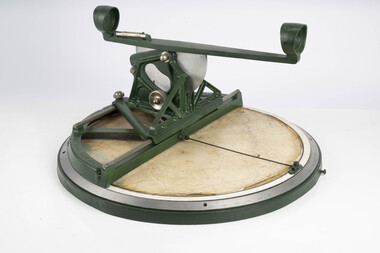
Fire Finder
... Many were established by the Forests Commission Victoria (FCV) in the 1920s, but the network was expanded rapidly in response to recommendations of the Stretton Royal Commission after the 1939 Black Friday bushfires. When a fire or smoke was spotted from the tower a bearing was taken with the alidade and radioed or telephoned into the district office. ...Many were established by the Forests Commission Victoria (FCV) in the 1920s, but the network was expanded rapidly in response to recommendations of the Stretton Royal Commission after the 1939 Black Friday bushfires. When a fire or smoke was spotted from the tower a bearing was taken with the alidade and radioed or telephoned into the district office. ...Victoria once had well over one hundred fire lookouts and firetowers. Fire lookouts, or observation posts, were often just a clearing on a hill or a vantage point, whereas firetowers were definite structures. Many were established by the Forests Commission Victoria (FCV) in the 1920s, but the network was expanded rapidly in response to recommendations of the Stretton Royal Commission after the 1939 Black Friday bushfires. When a fire or smoke was spotted from the tower a bearing was taken with the alidade and radioed or telephoned into the district office. It was then cross referenced with bearings from other towers on a large wall map to give a "fix" on the fire location. Alidades and telescopes were used in the post war period but were replaced with a much simpler map table and reference string suspended from the centre of the tower cabin. This "Fire Finder" was used in Canadian fire towers to identify the location of wildfires. The unique design was first developed by the British Columbia Forest Service (BCFS) in the early 1950s. Close examination of the map indicates that this particular Fire Finder may have been once used at Bluejoint Mountain lookout in Granby Provincial Park. This Fire Finder was a gift to Barry (Rocky) Marsden from the British Columbia Forest Service in the late 1980s in recognition of the close relationships that had been forged with the staff at the Altona Workshops over many decades. Fire Finders were originally painted black but this one was repainted green after it arrived at Altona. The BC Forest Service had a large facility where they manufactured Fire Finders and many other items of equipment, but in the 1980s it was shut down. Heavy cast iron circular object with a paper topographic map mounted on it. The metal dial and ruler works similar to a compass. The sight tube is used to determine the bearing and elevation of the fire on the map. This Fire Finder also sometimes known as an Alidade. Its a different design from the Osborne Fire Finder widely used in North American fire lookouts from the 1920s. British Columbia Forest Service. Model 62A. Serial Number 6308.bushfire -
 Marysville & District Historical Society
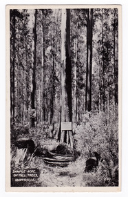
Postcard (item) - Black and white postcard, Valentine Publishing Co. Pty. Ltd, Sample Acre of Tall Trees, Marysville. V. 40, 1923-1963
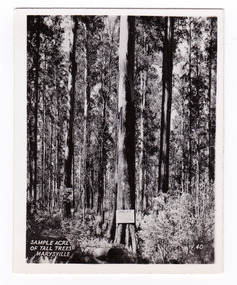
... After the devastating 1939 ‘Black Friday’ bushfires, Victoria’s tallest known trees were to be found in the Cumberland scenic reserve, 20 km north-east of Marysville. ...An early black and white photograph of a sample acre of tall trees near Marysville in Victoria.An early black and white photograph of a sample acre of tall trees near Marysville in Victoria. After the devastating 1939 ‘Black Friday’ bushfires, Victoria’s tallest known trees were to be found in the Cumberland scenic reserve, 20 km north-east of Marysville. This stand of trees was set aside in the 1920s to preserve a ‘sample acre’ of tall trees. It originally contained 27 trees, the tallest of which was said to be 92 m, whilst the average height was 81 m. A severe wind storm in 1959 blew down 13 trees and left the ‘tall tree’ at a reduced 84 m (Munro 1992). An examination of the crown of this tree by arborist Tom Greenwood (Tom Greenwood pers. comm. 2001) suggested that it was unlikely that it ever reached the original figure of 92 m; the current height is 81.5 m, a figure used as the starting point for this search for Victoria’s tallest trees. This postcard was published by the Valentine Publishing Co. Pty. Ltd. as a souvenir of Marysville.VALENTINE'S/ POST CARD/ A GENUINE PHOTOGRAPHsample acre, tall trees, marysville, victoria, cumberland valley, postcard, valentine publishing co, souvenir, 1939 bushfires, cumberland scenic reserve -
 Marysville & District Historical Society
Photograph (item) - Black and white photograph, Valentine Publishing Co. Pty. Ltd, Sample Acre of Tall Trees, Marysville. V. 40, 1923-1963
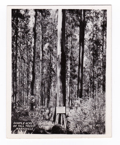
... After the devastating 1939 ‘Black Friday’ bushfires, Victoria’s tallest known trees were to be found in the Cumberland scenic reserve, 20 km north-east of Marysville. ...An early black and white photograph of a sample acre of tall trees near Marysville in Victoria.An early black and white photograph of a sample acre of tall trees near Marysville in Victoria. After the devastating 1939 ‘Black Friday’ bushfires, Victoria’s tallest known trees were to be found in the Cumberland scenic reserve, 20 km north-east of Marysville. This stand of trees was set aside in the 1920s to preserve a ‘sample acre’ of tall trees. It originally contained 27 trees, the tallest of which was said to be 92 m, whilst the average height was 81 m. A severe wind storm in 1959 blew down 13 trees and left the ‘tall tree’ at a reduced 84 m (Munro 1992). An examination of the crown of this tree by arborist Tom Greenwood (Tom Greenwood pers. comm. 2001) suggested that it was unlikely that it ever reached the original figure of 92 m; the current height is 81.5 m, a figure used as the starting point for this search for Victoria’s tallest trees. This photograph was published by the Valentine Publishing Co. Pty. Ltd. as a souvenir of Marysville.sample acre, tall trees, marysville, victoria, cumberland valley, valentine publishing co, photograph, souvenir, 1939 bushfires, cumberland scenic reserve -
 Marysville & District Historical Society
Photograph (item) - Black and white photograph, Valentine Publishing Co. Pty. Ltd, Sample Acre of Tall Trees, Marysville. V. 40, 1923-1963
... After the devastating 1939 ‘Black Friday’ bushfires, Victoria’s tallest known trees were to be found in the Cumberland scenic reserve, 20 km north-east of Marysville. ...An early black and white photograph of a sample acre of tall trees near Marysville in Victoria.An early black and white photograph of a sample acre of tall trees near Marysville in Victoria. After the devastating 1939 ‘Black Friday’ bushfires, Victoria’s tallest known trees were to be found in the Cumberland scenic reserve, 20 km north-east of Marysville. This stand of trees was set aside in the 1920s to preserve a ‘sample acre’ of tall trees. It originally contained 27 trees, the tallest of which was said to be 92 m, whilst the average height was 81 m. A severe wind storm in 1959 blew down 13 trees and left the ‘tall tree’ at a reduced 84 m (Munro 1992). An examination of the crown of this tree by arborist Tom Greenwood (Tom Greenwood pers. comm. 2001) suggested that it was unlikely that it ever reached the original figure of 92 m; the current height is 81.5 m, a figure used as the starting point for this search for Victoria’s tallest trees. This photograph was published by the Valentine Publishing Co. Pty. Ltd. as a souvenir of Marysville.sample acre, tall trees, marysville, victoria, cumberland valley, valentine publishing co, photograph, souvenir, 1939 bushfires, cumberland scenic reserve -
 Marysville & District Historical Society
Postcard (item) - Black and white postcard, Valentine Publishing Co. Pty. Ltd, Sample Acre of Tall Trees, Marysville. V. 40, 1923-1963
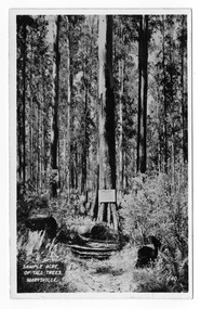
... After the devastating 1939 ‘Black Friday’ bushfires, Victoria’s tallest known trees were to be found in the Cumberland scenic reserve, 20 km north-east of Marysville. ...An early black and white photograph of a sample acre of tall trees near Marysville in Victoria.An early black and white photograph of a sample acre of tall trees near Marysville in Victoria. After the devastating 1939 ‘Black Friday’ bushfires, Victoria’s tallest known trees were to be found in the Cumberland scenic reserve, 20 km north-east of Marysville. This stand of trees was set aside in the 1920s to preserve a ‘sample acre’ of tall trees. It originally contained 27 trees, the tallest of which was said to be 92 m, whilst the average height was 81 m. A severe wind storm in 1959 blew down 13 trees and left the ‘tall tree’ at a reduced 84 m (Munro 1992). An examination of the crown of this tree by arborist Tom Greenwood (Tom Greenwood pers. comm. 2001) suggested that it was unlikely that it ever reached the original figure of 92 m; the current height is 81.5 m, a figure used as the starting point for this search for Victoria’s tallest trees. This postcard was published by the Valentine Publishing Co. Pty. Ltd. as a souvenir of Marysville.VALENTINE'S POST CARD A GENUINE PHOTOGRAPHsample acre, tall trees, marysville, victoria, cumberland valley, postcard, valentine publishing co, souvenir, 1939 bushfires, cumberland scenic reserve -
 Marysville & District Historical Society
Photograph (item) - Black and white photograph, Unknown
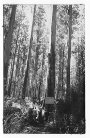
... After the devastating 1939 ‘Black Friday’ bushfires, Victoria’s tallest known trees were to be found in the Cumberland scenic reserve, 20 km north-east of Marysville. ...An early black and white photograph of a sample acre of tall trees near Marysville in Victoria.An early black and white photograph of a sample acre of tall trees near Marysville in Victoria. After the devastating 1939 ‘Black Friday’ bushfires, Victoria’s tallest known trees were to be found in the Cumberland scenic reserve, 20 km north-east of Marysville. This stand of trees was set aside in the 1920s to preserve a ‘sample acre’ of tall trees. It originally contained 27 trees, the tallest of which was said to be 92 m, whilst the average height was 81 m. A severe wind storm in 1959 blew down 13 trees and left the ‘tall tree’ at a reduced 84 m (Munro 1992). An examination of the crown of this tree by arborist Tom Greenwood (Tom Greenwood pers. comm. 2001) suggested that it was unlikely that it ever reached the original figure of 92 m; the current height is 81.5 m, a figure used as the starting point for this search for Victoria’s tallest trees.Big Trees Cumberland (illegible)sample acre, tall trees, marysville, victoria, cumberland valley, 1939 bushfires, cumberland scenic reserve, photograph -
 Marysville & District Historical Society
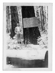
Photograph (item) - Black and white photograph, 10-1947
... After the devastating 1939 ‘Black Friday’ bushfires, Victoria’s tallest known trees were to be found in the Cumberland scenic reserve, 20 km north-east of Marysville. ...An early black and white photograph of a sample acre of tall trees near Marysville in Victoria.An early black and white photograph of a sample acre of tall trees near Marysville in Victoria. After the devastating 1939 ‘Black Friday’ bushfires, Victoria’s tallest known trees were to be found in the Cumberland scenic reserve, 20 km north-east of Marysville. This stand of trees was set aside in the 1920s to preserve a ‘sample acre’ of tall trees. It originally contained 27 trees, the tallest of which was said to be 92 m, whilst the average height was 81 m. A severe wind storm in 1959 blew down 13 trees and left the ‘tall tree’ at a reduced 84 m (Munro 1992). An examination of the crown of this tree by arborist Tom Greenwood (Tom Greenwood pers. comm. 2001) suggested that it was unlikely that it ever reached the original figure of 92 m; the current height is 81.5 m, a figure used as the starting point for this search for Victoria’s tallest trees. This postcard was published by the Valentine Publishing Co. Pty. Ltd. as a souvenir of Marysville.Tall Timber at Cumberland/ Valley. Oct. 47. 39sample acre, tall trees, marysville, victoria, cumberland valley, postcard, valentine publishing co, souvenir, 1939 bushfires, cumberland scenic reserve -
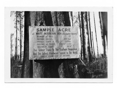 Marysville & District Historical Society
Photograph (item) - Black and white photograph, 1952
... After the devastating 1939 ‘Black Friday’ bushfires, Victoria’s tallest known trees were to be found in the Cumberland scenic reserve, 20 km north-east of Marysville. ...An early black and white photograph of a sample acre of tall trees near Marysville in Victoria.An early black and white photograph of a sample acre of tall trees near Marysville in Victoria. After the devastating 1939 ‘Black Friday’ bushfires, Victoria’s tallest known trees were to be found in the Cumberland scenic reserve, 20 km north-east of Marysville. This stand of trees was set aside in the 1920s to preserve a ‘sample acre’ of tall trees. It originally contained 27 trees, the tallest of which was said to be 92 m, whilst the average height was 81 m. A severe wind storm in 1959 blew down 13 trees and left the ‘tall tree’ at a reduced 84 m (Munro 1992). An examination of the crown of this tree by arborist Tom Greenwood (Tom Greenwood pers. comm. 2001) suggested that it was unlikely that it ever reached the original figure of 92 m; the current height is 81.5 m, a figure used as the starting point for this search for Victoria’s tallest trees. This postcard was published by the Valentine Publishing Co. Pty. Ltd. as a souvenir of Marysville.Cumberland 1952sample acre, tall trees, marysville, victoria, cumberland valley, postcard, valentine publishing co, souvenir, 1939 bushfires, cumberland scenic reserve -
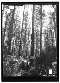 Marysville & District Historical Society
Photograph (item) - Black and white photograph, Unknown
... After the devastating 1939 ‘Black Friday’ bushfires, Victoria’s tallest known trees were to be found in the Cumberland scenic reserve, 20 km north-east of Marysville. ...An early black and white photograph of a sample acre of tall trees near Marysville in Victoria.An early black and white photograph of a sample acre of tall trees near Marysville in Victoria. After the devastating 1939 ‘Black Friday’ bushfires, Victoria’s tallest known trees were to be found in the Cumberland scenic reserve, 20 km north-east of Marysville. This stand of trees was set aside in the 1920s to preserve a ‘sample acre’ of tall trees. It originally contained 27 trees, the tallest of which was said to be 92 m, whilst the average height was 81 m. A severe wind storm in 1959 blew down 13 trees and left the ‘tall tree’ at a reduced 84 m (Munro 1992). An examination of the crown of this tree by arborist Tom Greenwood (Tom Greenwood pers. comm. 2001) suggested that it was unlikely that it ever reached the original figure of 92 m; the current height is 81.5 m, a figure used as the starting point for this search for Victoria’s tallest trees.H-illegible SPsample acre, tall trees, marysville, victoria, cumberland valley, 1939 bushfires, cumberland scenic reserve, photograph -
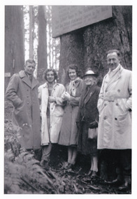 Marysville & District Historical Society
Photograph (item) - Black and white photograph, Unknown
... After the devastating 1939 ‘Black Friday’ bushfires, Victoria’s tallest known trees were to be found in the Cumberland scenic reserve, 20 km north-east of Marysville. ...An early black and white photograph of a sample acre of tall trees near Marysville in Victoria.An early black and white photograph of a sample acre of tall trees near Marysville in Victoria. After the devastating 1939 ‘Black Friday’ bushfires, Victoria’s tallest known trees were to be found in the Cumberland scenic reserve, 20 km north-east of Marysville. This stand of trees was set aside in the 1920s to preserve a ‘sample acre’ of tall trees. It originally contained 27 trees, the tallest of which was said to be 92 m, whilst the average height was 81 m. A severe wind storm in 1959 blew down 13 trees and left the ‘tall tree’ at a reduced 84 m (Munro 1992). An examination of the crown of this tree by arborist Tom Greenwood (Tom Greenwood pers. comm. 2001) suggested that it was unlikely that it ever reached the original figure of 92 m; the current height is 81.5 m, a figure used as the starting point for this search for Victoria’s tallest trees.8 A group from/ Kooringa./ 1948sample acre, tall trees, marysville, victoria, cumberland valley, 1939 bushfires, cumberland scenic reserve, photograph -
 Marysville & District Historical Society
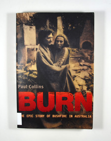
Book, Paul Collins, Burn-The Epic Story of Bushfire in Australia, 2006
... From the 1851 Black Thursday fire and the 1939 Black Friday fires to the Canberra inferno of 2003 this book tells the epic story of bushfire in Australia....From the 1851 Black Thursday fire and the 1939 Black Friday fires to the Canberra inferno of 2003 this book tells the epic story of bushfire in Australia. forest fires bush fires australia history The story of bushfires in Australia Stamp of Marysville & District / Historical Society Inc / P.O. ...The story of bushfires in AustraliaFront cover has a photograph of Sharon Guest and her daughter Patricia in the ruins of their Mt Macedon home, Ash Wednesday.non-fictionThe story of bushfires in Australiaforest fires, bush fires, australia, history -
 Marysville & District Historical Society
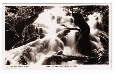
Postcard (item) - Black and white postcard, Rose Stereograph Company, Cora Lynn Falls, Marysville, Victoria, 1913-1967
... black saturday bushfires mountain ash mining timber mills 1939 bushfires POST CARD The "Rose" Series/ De Luxe A Real Photograph/ Produced in Australia Published by the Rose Stereograph Co.,/ Armadale, Victoria. Kitchener House,/ Marysville/ Monday Dear Gwen,/ Just a line now/ as it's nearly dinnertime./ We went to these falls/ last week & also to the/ Cumberland falls. I took/ some photos but it was/ too dark with all the/ ferns in the gullies./ We went to the Eildon/ Weir on Friday ...A postcard in a series produced by the Rose Stereograph Company in Victoria, Australia as a souvenir of Marysville.A black and white photograph of the Cora Lynn Falls which are in Cambarville. These falls are located on the Marysville-Wood's Point Road. Cambarville is notable for its giant mountain ash (Eucalyptus regnans) trees within the Cumberland Memorial Scenic Reserve, and relics from former sawmills and gold mining. The Big Culvert is located nearby on the Marysville - Woods Point Road, which was historically part of the Yarra Track. Cambarville was established as a timber mill town in the 1940s. Timber mill owners A Cameron and FJ Barton named Cambarville. They established the mill to salvage timber from trees destroyed in the 1939 bushfires. Cambarville was impacted by the 2009 Black Saturday bushfires and any remaining structures were destroyed. POST CARD The "Rose" Series/ De Luxe A Real Photograph/ Produced in Australia Published by the Rose Stereograph Co.,/ Armadale, Victoria. Kitchener House,/ Marysville/ Monday Dear Gwen,/ Just a line now/ as it's nearly dinnertime./ We went to these falls/ last week & also to the/ Cumberland falls. I took/ some photos but it was/ too dark with all the/ ferns in the gullies./ We went to the Eildon/ Weir on Friday - do you/ remember what part that is/ in? We also went to the/ Rubicon Power Station & to/ 2 of the big timber mills that/ were burnt out 2 yrs ago./ Well I must stop/ now & write to Bub/ Love from Joan Love from Auntie Mimacora lynn falls, cambarville, marysville, victoria, waterfalls, p. 2327, rose series postcard, postcard, souvenir, a cameron, fj barton, black saturday bushfires, mountain ash, mining, timber mills, 1939 bushfires -
 Marysville & District Historical Society
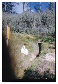
Photograph (item) - Colour photograph, 04-1960
... ...black friday 1939...bushfire...Few dugouts were built in other forest regions of Australia, but those that did exist in these Victorian ranges saved dozens of lives in the fires of Black Friday 1939. mount margaret marysville victoria fire dugout sawmilling industry black friday 1939 bushfire 27 'Fire Dug out' Mt Margaret April 1960 A colour photograph of the entrance to a fire dugout on Mount Margaret near Marysville in Victoria. ...A colour photograph of the entrance to a fire dugout on Mount Margaret near Marysville in Victoria.A colour photograph of the entrance to a fire dugout on Mount Margaret near Marysville in Victoria. The fire refuge dugout, which developed in the era of bush sawmilling in the early twentieth century, was a distinctive cultural response to the history of fire in the tall Victorian forests. Few dugouts were built in other forest regions of Australia, but those that did exist in these Victorian ranges saved dozens of lives in the fires of Black Friday 1939.27 'Fire Dug out' Mt Margaret April 1960mount margaret, marysville, victoria, fire dugout, sawmilling industry, black friday 1939, bushfire -
 Eltham District Historical Society Inc
Audio - Audio Recording, Katherine Sheedy, Interview: Doug Orford, 19 March 2024
... Doug recalled his family’s connection to the area, starting with his grandfather in 1853, getting to school, growing up on an 18-acre block, working on the orchard, his father’s horse and cart, shops, deliveries, the war and rationing, Black Friday bushfires in 1939, and a little bit about establishing the Shire of Eltham Historical Society, later Eltham District Historical Society, of which he was a life member. ...Doug recalled his family’s connection to the area, starting with his grandfather in 1853, getting to school, growing up on an 18-acre block, working on the orchard, his father’s horse and cart, shops, deliveries, the war and rationing, Black Friday bushfires in 1939, and a little bit about establishing the Shire of Eltham Historical Society, later Eltham District Historical Society, of which he was a life member. ...NILLUMBIK SHIRE COUNCIL ORAL HISTORY PROJECT Interview: Doug Orford Date: Tuesday 19 March 2024 Place of Interview: Aurrum Aged Care in Plenty Interviewer: Katherine Sheedy; Way Back When Consulting Historians In 2023 Nillumbik Shire Council agreed to support two Oral History projects associated with local history groups within the shire. One project was training sessions for group members on undertaking oral history recordings, which occurred in November 2023. The other project involved a professional historian recording two selected history group members, which occurred in March 2024. The interviews were undertaken by Katherine Sheedy of Way Back When Consulting Historians. Doug Orford, whose family first came to Eltham in about 1853, was born in Eltham in August 1929. Doug recalled his family’s connection to the area, starting with his grandfather in 1853, getting to school, growing up on an 18-acre block, working on the orchard, his father’s horse and cart, shops, deliveries, the war and rationing, Black Friday bushfires in 1939, and a little bit about establishing the Shire of Eltham Historical Society, later Eltham District Historical Society, of which he was a life member. Sadly Doug passed away just four months after his interview, in July 2024.audio recording, doug orford, eltham, eltham district historical society, oral history -
 Eltham District Historical Society Inc
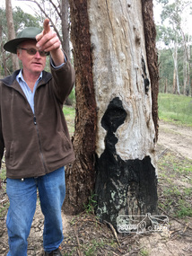
Photograph, Peter Pidgeon, Killeavey, Laughing Waters Road, Eltham 5 Nov 2016, 5 Nov 2016
... 1939, 1967 and 1969 fires. This tree bares evidence from the 1939 bushfire which raged through the area. Heriitage Excursion - Kileavey Walk and Talk activities eltham district historical society heritage excursion kileavey parks victoria laughing waters road eltham wurundjeri Black Friday 1939 Born Digital Killeavey, Laughing Waters Road, Eltham 5 Nov 2016 Photograph Peter Pidgeon ...Cam pointing out the ravages on various trees from the 1939, 1967 and 1969 fires. This tree bares evidence from the 1939 bushfire which raged through the area. Heriitage Excursion - Kileavey Walk and TalkBorn Digitalactivities, eltham district historical society, heritage excursion, kileavey, parks victoria, laughing waters road, eltham, wurundjeri, black friday 1939 -
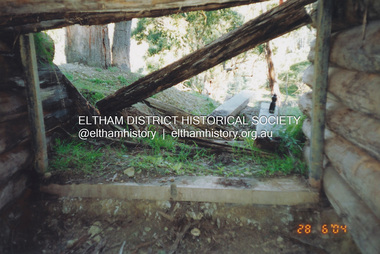 Eltham District Historical Society Inc
Photograph, Fay Bridge, Former Morrison property, Killeavey, Laughing Waters Road, Eltham, 28 June 2004
... The house was totally destroyed in the Black Friday bushfires in 1939, but was rebuilt. Beatrice continued to live at Killeavey and became well regarded as a botanist and naturalist. ...The house was totally destroyed in the Black Friday bushfires in 1939, but was rebuilt. Beatrice continued to live at Killeavey and became well regarded as a botanist and naturalist. ...Beatrice Wanliss Irvine was the daughter of former Victorian Premier Sir William Irvine. From age 13 she lived at “Killeavey” off Laughing Waters Road (later accessed from Reynolds Road). In 1923 she married James Morrison and the couple received Killeavey as a wedding gift. The property supported fruit and vegetable growing as well as an impressive botanical garden. But James died in 1936 after a period of ill health, leaving Beatrice to support their six children. The Killeavey house was built atop a cliff, 40 metres above the Yarra River. The garden was designed in 1910 by William Guilfoyle who was the second director of the Royal Botanical Gardens. The house was totally destroyed in the Black Friday bushfires in 1939, but was rebuilt. Beatrice continued to live at Killeavey and became well regarded as a botanist and naturalist. She died in 1989 and is buried in Eltham Cemetery with her husband and one of their sons. The (rebuilt) house was demolished by Parks Victoria. It contains significant garden remnants. The surrounding bushland is valued for its significant plant communities.fay bridge collection, 2004-06-28, beatrice wanliss morrison (nee irvine), eltham, james morrison, killeavey, laughing waters road, william irvine -
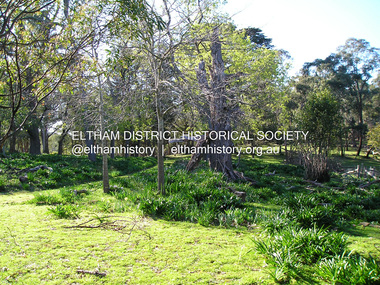 Eltham District Historical Society Inc
Photograph, Fay Bridge, Former Morrison property, Killeavey, Laughing Waters Road, Eltham, 30 August 2019
... The house was totally destroyed in the Black Friday bushfires in 1939, but was rebuilt. Beatrice continued to live at Killeavey and became well regarded as a botanist and naturalist. ...The house was totally destroyed in the Black Friday bushfires in 1939, but was rebuilt. Beatrice continued to live at Killeavey and became well regarded as a botanist and naturalist. ...Beatrice Wanliss Irvine was the daughter of former Victorian Premier Sir William Irvine. From age 13 she lived at “Killeavey” off Laughing Waters Road (later accessed from Reynolds Road). In 1923 she married James Morrison and the couple received Killeavey as a wedding gift. The property supported fruit and vegetable growing as well as an impressive botanical garden. But James died in 1936 after a period of ill health, leaving Beatrice to support their six children. The Killeavey house was built atop a cliff, 40 metres above the Yarra River. The garden was designed in 1910 by William Guilfoyle who was the second director of the Royal Botanical Gardens. The house was totally destroyed in the Black Friday bushfires in 1939, but was rebuilt. Beatrice continued to live at Killeavey and became well regarded as a botanist and naturalist. She died in 1989 and is buried in Eltham Cemetery with her husband and one of their sons. The (rebuilt) house was demolished by Parks Victoria. It contains significant garden remnants. The surrounding bushland is valued for its significant plant communities.fay bridge collection, beatrice wanliss morrison (nee irvine), eltham, james morrison, killeavey, laughing waters road, william irvine, 2019-08-30 -
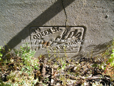 Eltham District Historical Society Inc
Photograph, Fay Bridge, Former Morrison property, Killeavey, Laughing Waters Road, Eltham, 27 October 2019
... The house was totally destroyed in the Black Friday bushfires in 1939, but was rebuilt. Beatrice continued to live at Killeavey and became well regarded as a botanist and naturalist. ...The house was totally destroyed in the Black Friday bushfires in 1939, but was rebuilt. Beatrice continued to live at Killeavey and became well regarded as a botanist and naturalist. ...Beatrice Wanliss Irvine was the daughter of former Victorian Premier Sir William Irvine. From age 13 she lived at “Killeavey” off Laughing Waters Road (later accessed from Reynolds Road). In 1923 she married James Morrison and the couple received Killeavey as a wedding gift. The property supported fruit and vegetable growing as well as an impressive botanical garden. But James died in 1936 after a period of ill health, leaving Beatrice to support their six children. The Killeavey house was built atop a cliff, 40 metres above the Yarra River. The garden was designed in 1910 by William Guilfoyle who was the second director of the Royal Botanical Gardens. The house was totally destroyed in the Black Friday bushfires in 1939, but was rebuilt. Beatrice continued to live at Killeavey and became well regarded as a botanist and naturalist. She died in 1989 and is buried in Eltham Cemetery with her husband and one of their sons. The (rebuilt) house was demolished by Parks Victoria. It contains significant garden remnants. The surrounding bushland is valued for its significant plant communities.fay bridge collection, beatrice wanliss morrison (nee irvine), eltham, james morrison, killeavey, laughing waters road, william irvine, 2019-10-27 -
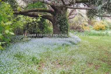 Eltham District Historical Society Inc
Photograph, Fay Bridge, New Zealand Oak at former Morrison property, Killeavey, Laughing Waters Road, Eltham, n.d
... The house was totally destroyed in the Black Friday bushfires in 1939, but was rebuilt. Beatrice continued to live at Killeavey and became well regarded as a botanist and naturalist. ...The house was totally destroyed in the Black Friday bushfires in 1939, but was rebuilt. Beatrice continued to live at Killeavey and became well regarded as a botanist and naturalist. ...Beatrice Wanliss Irvine was the daughter of former Victorian Premier Sir William Irvine. From age 13 she lived at “Killeavey” off Laughing Waters Road (later accessed from Reynolds Road). In 1923 she married James Morrison and the couple received Killeavey as a wedding gift. The property supported fruit and vegetable growing as well as an impressive botanical garden. But James died in 1936 after a period of ill health, leaving Beatrice to support their six children. The Killeavey house was built atop a cliff, 40 metres above the Yarra River. The garden was designed in 1910 by William Guilfoyle who was the second director of the Royal Botanical Gardens. The house was totally destroyed in the Black Friday bushfires in 1939, but was rebuilt. Beatrice continued to live at Killeavey and became well regarded as a botanist and naturalist. She died in 1989 and is buried in Eltham Cemetery with her husband and one of their sons. The (rebuilt) house was demolished by Parks Victoria. It contains significant garden remnants. The surrounding bushland is valued for its significant plant communities.fay bridge collection, beatrice wanliss morrison (nee irvine), eltham, james morrison, killeavey, laughing waters road, william irvine, new zealand oak
