Showing 45 items matching "aqueduct greensborough"
-
 Eltham District Historical Society Inc
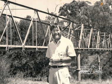
Photograph, Christine Fleming, Russell Yeoman near the Maroondah Aqueduct, Greensborough
... Russell Yeoman near the Maroondah Aqueduct, Greensborough...aqueduct...greensborough...Black and white photograph of Russell Yeoman, of Eltham District Historical Society near the Maroondah Aqueduct, Greensborough. Photograph was published in the Diamond Valley News, unknown date...ME34DV712 Reduction: 88.7% Caption: Man beside aqueduct Photographers' Caption Sheet Date:13-2 Publication: DV Operator's Name: Christine Fleming Assignemnt: Maroondah Aqueduct Greensborough Names and Initials: Russell Yeomans (sic)...Eltham District Historical Society Inc 728 Main Rd Eltham melbourne russell yeoman maroondah aqueduct greensborough Two paper labels stuck to rear Publication: DV (Diamond Valley News) Page No: 4 ID No. ...Black and white photograph of Russell Yeoman, of Eltham District Historical Society near the Maroondah Aqueduct, Greensborough. Photograph was published in the Diamond Valley News, unknown dateTwo paper labels stuck to rear Publication: DV (Diamond Valley News) Page No: 4 ID No. ME34DV712 Reduction: 88.7% Caption: Man beside aqueduct Photographers' Caption Sheet Date:13-2 Publication: DV Operator's Name: Christine Fleming Assignemnt: Maroondah Aqueduct Greensborough Names and Initials: Russell Yeomans (sic)russell yeoman, maroondah aqueduct, greensborough -
 Greensborough Historical Society
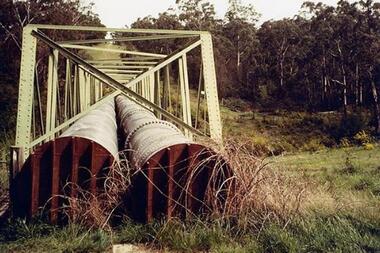
Photograph - Digital Image, Dual pipes: Aqueduct Greensborough, 2000c
... Dual pipes: Aqueduct Greensborough......aqueduct greensborough...Photograph of section of the Maroondah aqueduct over the Plenty River at Greensborough....Dual pipes: Aqueduct Greensborough Photograph - Digital Image ...Photograph of section of the Maroondah aqueduct over the Plenty River at Greensborough.Digital copy of colour photograph.maroondah aqueduct, aqueduct greensborough -
 Greensborough Historical Society
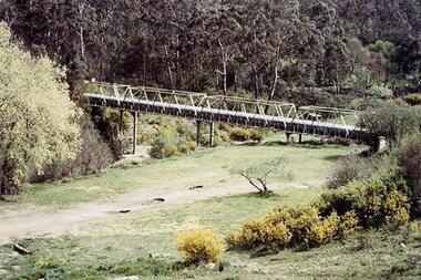
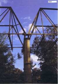
Photograph - Digital Image, Aqueduct Greensborough, 1960c
... Aqueduct Greensborough......aqueduct pipe bridge greensborough...Photograph of the Maroondah Aqueduct pipe bridge at Greensborough. The Pipe Bridge is 210 feet long, divided into 4 spans. ...Aqueduct Greensborough Photograph - Digital Image ...The Pipe Bridge at Greensborough is a significant and highly visible part of the system. It was constructed to carry the wrought iron aqueduct pipes over the Plenty River. The use of wrought iron meant the pipes were 75% lighter than cast iron, with the bridge construction reflecting this innovation. Photograph of the Maroondah Aqueduct pipe bridge at Greensborough. The Pipe Bridge is 210 feet long, divided into 4 spans. The main girders are light lattice 11 feet deep and 11 ft 4 inches apart. The bridge carried two wrought iron tubular mains, 53 inches in diameter, supported at intervals by cross girders and chairs, placed between the main girders. The bridge is carried on braced cast-iron columns, 18 inches in diameter, set on concrete foundations, with a clear headway of 20 feet above the Plenty River. The eastern side of the bridge is reinforced with a bluestone abutment at the river bank.Digital copy of colour photograph.maroondah aqueduct, aqueduct pipe bridge greensborough -
 Greensborough Historical Society
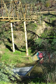
Photograph - Digital Image, Marilyn Smith, Plenty River at the aqueduct crossing Greensborough 2019, 02/07/2019
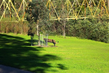
... Plenty River at the aqueduct crossing Greensborough 2019...Originally part of the Maroondah Aqueduct pipeline, all that remains is the bridge that once carried the pipe over the Plenty River. This photograph was taken from the Plenty River Trail in Greensborough. ...Originally part of the Maroondah Aqueduct pipeline, all that remains is the bridge that once carried the pipe over the Plenty River. This photograph was taken from the Plenty River Trail in Greensborough. plenty river trail maroondah pipetrack maroondah aqueduct plenty river graffiti 2 colour digital photographs Plenty River at the aqueduct crossing Greensborough 2019 Photograph - Digital Image Marilyn Smith ...The Plenty River at the aqueduct crossing, 2019, showing graffiti on the river bank rocks. Originally part of the Maroondah Aqueduct pipeline, all that remains is the bridge that once carried the pipe over the Plenty River. This photograph was taken from the Plenty River Trail in Greensborough. 2 colour digital photographsplenty river trail, maroondah pipetrack, maroondah aqueduct, plenty river, graffiti -
 Greensborough Historical Society
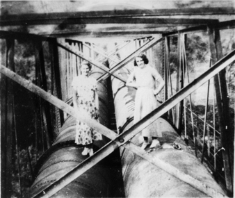
Photograph - Digital image, Ladies on aqueduct, 1950c
... aqueduct pipe bridge greensborough...Photograph of two ladies standing on the aqueduct pipes in Greensborough....Greensborough Historical Society 34A Glenauburn Road Lower Plenty Lower Plenty melbourne Photograph of two ladies standing on the aqueduct pipes in Greensborough. aqueduct pipe bridge greensborough Digital copy of black and white photograph. ...Photograph of two ladies standing on the aqueduct pipes in Greensborough.Digital copy of black and white photograph.aqueduct pipe bridge greensborough -
 Greensborough Historical Society
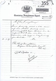
Report, Examining Draughtsman's Report - Watts River Aqueduct, 20/07/1897
... aqueduct...bridge...greensborough...This Field Survey was commissioned by the Melbourne Board of Works and was used to position the Maroondah Aqueduct bridge north of Greensborough at its crossing point on the Plenty River. ...It features a traverse of the Plenty River The Maroondah Aqueduct bridge is a significant example of late 19th century engineering. maroondah aqueduct watts river aqueduct bridge greensborough office of titles 1897 wrought iron water pipes plenty river melbourne board of works Copy of handwritten report includes maps. ...This Field Survey was commissioned by the Melbourne Board of Works and was used to position the Maroondah Aqueduct bridge north of Greensborough at its crossing point on the Plenty River. It incorporated the use of wrought iron water pipes and therefore is of lighter construction than other similar bridges in the district. It features a traverse of the Plenty RiverThe Maroondah Aqueduct bridge is a significant example of late 19th century engineering. A 4 page reproduction of an Office of Titles document. Copy of handwritten report includes maps.maroondah aqueduct, watts river aqueduct, bridge, greensborough, office of titles, 1897, wrought iron water pipes, plenty river, melbourne board of works -
 Eltham District Historical Society Inc
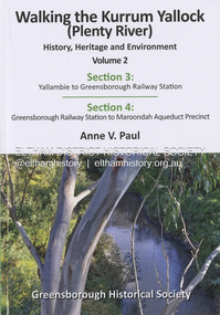
Book, Anne Paul, Walking the Kurrum Yallock (Plenty River; History), Heritage and Environment; Volume 2, 2026
... Aqueduct...greensborough...Greensborough Historical Society Kurrum Yallock Plenty River yallambie Greensborough Railway Station Maroondah Aqueduct greensborough "To Eltham District Historical Society Enjoy the journey & thanks for your wondeful photos Anne Paul June 2026" Paperback; 146 pages; 24.4 x 17 x 0.5 cm Walking the Kurrum Yallock (Plenty River; History), Heritage and Environment; Volume 2 Book Book Anne Paul Greensborough Historical Society ...Kurrum Yallock - the Plenty River is Melbourne's third river and a significant feature of the north eastern suburbs. It has well servd the Plenty Valley's occupants from First Nations people to its current day residents and wildlife. The Plenty River was central to the establishment of Greesnsborough in the 1850s, as a pioneer township and community of small farmers. The valley's extesnive parklands now provide an important wildlife corridor and recreational resource, along with connection to our pre and early Euroopean heritage. The Kurrum Yallock walk pivots around Greensborough, guiding people along the Plenty River Trrail, while interpreting specific heritage sites and exploring the broader history and enviroment of the Plenty River Valley."To Eltham District Historical Society Enjoy the journey & thanks for your wondeful photos Anne Paul June 2026"greensborough historical society, kurrum yallock, plenty river, yallambie, greensborough railway station, maroondah aqueduct, greensborough -
 Greensborough Historical Society
Photograph, Maroondah aqueduct pipe bridge 2011, 2011_
... aqueduct pipe bridge greensborough...Parts of the aqueduct structure remain. aqueduct pipe bridge greensborough maroondah aqueduct Copy of colour photograph Maroondah aqueduct pipe bridge 2011 Photograph ...in 1891 the Watts River (near Healesville) was tapped. It supplied water to Melbourne, via the Maroondah aqueduct. The Maroondah Reservoir, northeast of Melbourne, was completed in 1927 and water was piped via the Maroondah aqueduct to the northern suburbs. It was replaced by large pipes in the 1980s. Parts of the aqueduct structure remain.Copy of colour photographaqueduct pipe bridge greensborough, maroondah aqueduct -
 Greensborough Historical Society
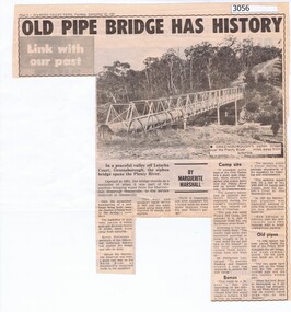
Newspaper Clipping, Diamond Valley News, Old pipe bridge has history, by Marguerite Marshall, 1891o
... aqueduct pipe bridge greensborough...Greensborough Historical Society 34A Glenauburn Road Lower Plenty Lower Plenty melbourne The aqueduct siphon bridge over the Plenty River, opened in 1891, was part of the pipeline bringing water from the service reservoir at Healesville, prior to the construction of the Maroondah Reservoir. aqueduct pipe bridge greensborough News article, black and white text and photograph. ...The aqueduct siphon bridge over the Plenty River, opened in 1891, was part of the pipeline bringing water from the service reservoir at Healesville, prior to the construction of the Maroondah Reservoir.News article, black and white text and photograph.aqueduct pipe bridge greensborough -
 Greensborough Historical Society
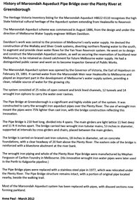
Article, Anne Paul, History of Maroondah Aqueduct Pipe Bridge over the Plenty River at Greensborough, by Anne Paul, 2012_03
... History of Maroondah Aqueduct Pipe Bridge over the Plenty River at Greensborough, by Anne Paul...aqueduct pipe bridge greensborough...The Maroondah Aqueduct pipe bridge, opened in 1891, was an important part of the system carrying water from the Maroondah Reservoir near Healesville to Melbourne. Most of the original system has been replaced by stainless steel pipes, the Greensborough section now running under the Plenty River since 1977. ...The original pipe bridge can still be seen over the Plenty River at Greensborough. aqueduct pipe bridge greensborough maroondah aqueduct melbourne water supply anne paul 2 p. typescript History of Maroondah Aqueduct Pipe Bridge over the Plenty River at Greensborough, by Anne Paul Article Article Anne Paul ...The Maroondah Aqueduct pipe bridge, opened in 1891, was an important part of the system carrying water from the Maroondah Reservoir near Healesville to Melbourne. Most of the original system has been replaced by stainless steel pipes, the Greensborough section now running under the Plenty River since 1977. The original pipe bridge can still be seen over the Plenty River at Greensborough.2 p. typescriptaqueduct pipe bridge greensborough, maroondah aqueduct, melbourne water supply, anne paul -
 Greensborough Historical Society
Photograph - Digital Image, Marilyn Smith, The Separation Tree Greensborough 2019, 02/07/2019
... ...aqueduct pipe bridge greensborough...Saplings of the original were planted around Melbourne in 2014, including this one along the Plenty River Trail in Greensborough. The old aqueduct bridge can be seen in background....Saplings of the original were planted around Melbourne in 2014, including this one along the Plenty River Trail in Greensborough. The old aqueduct bridge can be seen in background. separation tree plenty river trail aqueduct pipe bridge greensborough 2 colour digital photographs The Separation Tree Greensborough 2019 Photograph - Digital Image Marilyn Smith ...The original Separation Tree was one of two red river gums that pre-dated European occupation, and was the site where colonists congregated to celebrate the announcement of Victoria's separation from New South Wales on 15 November 1850. It died as the result of vandalism in 2010 and 2013. Saplings of the original were planted around Melbourne in 2014, including this one along the Plenty River Trail in Greensborough. The old aqueduct bridge can be seen in background.2 colour digital photographsseparation tree, plenty river trail, aqueduct pipe bridge greensborough -
 Greensborough Historical Society
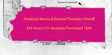
Folder of documents, Flintoff - various documents, 1844_
... ...greensborough...aqueduct...Greensborough area. Includes a survey plan for acquisition of land for the aqueduct 1897....Greensborough area. Includes a survey plan for acquisition of land for the aqueduct 1897. flintoff family land titles greensborough aqueduct Mainly handwritten documents dating from early 20th century. ...Records the Flintoff family's ownership of parcels of land in the Greensborough area. Includes a survey plan for acquisition of land for the aqueduct 1897.Various photocopies of title documents relating to land owned by the Flintoff family in Greensborough.Mainly handwritten documents dating from early 20th century.flintoff family, land titles, greensborough, aqueduct -
 Greensborough Historical Society
Folder, Aerial Imaging - Plenty River: by Ian Bryant, 2011_11
... Investigates early land use along the Plenty River from north of the main aqueduct crossing in Greensborough to south of the golf course in Lower Plenty...Greensborough Historical Society 34A Glenauburn Road Lower Plenty Lower Plenty melbourne Investigates early land use along the Plenty River from north of the main aqueduct crossing in Greensborough to south of the golf course in Lower Plenty Historical features seen from aerial and satellite images of the modern landscape may indicate earlier agricultural land usage. plenty river ian bryant lower plenty greensborough yallambie park aerial photography 9 x A4 pages of text and colour annotated maps downloaded from nearmap.com. ...Investigates early land use along the Plenty River from north of the main aqueduct crossing in Greensborough to south of the golf course in Lower PlentyHistorical features seen from aerial and satellite images of the modern landscape may indicate earlier agricultural land usage.9 x A4 pages of text and colour annotated maps downloaded from nearmap.com.plenty river, ian bryant, lower plenty, greensborough, yallambie park, aerial photography -
 Eltham District Historical Society Inc
Film - Video (VHS), Nillumbik Shire Council, The Nillumbik Story, 1996
... Greensborough...Heritage Trail...Hurstbridge Railway Line...jazz festival...Jock Ryan...Kangaroo Ground...kangaroo ground tower...Kinglake...Maroondah Aqueduct...CREDITS Music by John Greenfield from the CD Sweet Rain “The Snow Tree”, Uncle Music UNC 2001 Cameras - David Mirabella and Peter Farragher Editor – Olwyn Jones Written and Produced by Jason Cameron A Jason Cameron Proction for Nillumbik Shire Provides a record of the relatively newly created Shire of Nillumbik at the time and the features and attactions of the shire in its people arts, culture and environment video recording Arthurs Creek Arthurs Creek Landcare group Artists artists in residence Arts Arts Festival Authors BlackBerry Brock family Bulldozer Bulleen bushland sanctuary Caledonian gold rush Charles Reddington Clifton Pugh cottlesbridge Cypress rows developer Diamond Creek Diamond Creek Mine Diamond Reef Diamond Valley miniature railway Doncaster dunmoochin Education program EEPS Eltham Eltham East Primary School Eltham East Primary School Band Eltham Library Community Gallery Eltham Lower Park Environment fishing flour mill fruit growing fruiterer Garden Hill Gold mining Green Wedge Greensborough Heritage Trail Hurstbridge Railway Line jazz festival Jock Ryan Kangaroo Ground kangaroo ground tower Kinglake Maroondah Aqueduct Matcham Skipper Memorial Park Ming Mackay (1918-2009) Montsalvat Mudbrick houses Music musicians nesting area Nillumbik Historical Society Nillumbik Shire North Warrandyte Old timer Orchards Peter Brock Plenty River poets Population Recreation recreational activities revegetation Robert Hoddle Sandy Brock Shillinglaw Cottage Shire of Eltham War Memorial Sigmund Jorgensen St Andrews Hotel St Andrews Market Sugarloaf Reservoir Templestowe The Hill tourism Viewing platform Warrandyte water catchment area Watsons Creek Wedgetail eagle Whittlesea Wiregrass Gallery Wurundjeri Yarra River Jack Powell VHS Cassette (five copies) DVD (one copy) Converted to MP4 file format 0:22:00, 1.60GB The Nillumbik Story Film Video (VHS) Nillumbik Shire Council Jason Cameron David Mirabella Peter Farragher Olwyn Jones ...PART 1 – NILLUMBIK (00:00-07:17) Opening features various scenes around Nillumbik Shire. For 40,000 years Nillumbik was the home of the Wurundjeri people. Robert Hoddle gave the district its name. Jock Ryan, then president of Nillumbik Historical Society discusses the names Nillumbik and Diamond Creek. In the late 1830s white occupation began with gold found in Warrandyte in 1851 and 12 years later at Diamond Creek -the Diamond Reef which led to the Caledonian gold rush. Jock Ryan discusses the Diamond Creek mine, which was thriving until it burnt out in 1915. Large numbers of workmen moved into area in late 1870s to construct the Maroondah Aqueduct. With growing population of Melbourne, the nearby Yan Yean system had severely disrupted the flow of the Plenty River, forcing the closure of three flour mills there. The aqueduct came to the rescue carrying water 66km from Healesville to Preston. When the Diamond Creek gold mine burnt down the local economy suffered but fruit growing industry had already been established and Diamond Creek became a thriving fruit growing centre. Interview with Jack Powell, a long-time fruiterer at St Andrews market, his family had lived in the area for a hundred years, 3 to 4 generations, “a lot of hard work”. By the time the railway arrived fruit growing was no longer competitive. The railway brought the city closer and day trippers. The Green Wedge separates the shire from the more densely developed neighbours such as Whittlesea, Doncaster, Templestowe, Bulleen and Greensborough. Population at the time (1996) was 19,000 but links to the past remain strong. Mudbrick houses along the Heritage Trail The saving of Shillinglaw Cottage from demolition in 1963 and relocation brick by brick. PART 2 – ENVIRONMENT (07:18-14:44) Peter Brock (with Bev Brock in background) at St Andrews market discusses his childhood growing up in the district and the environment and the values it instilled upon him and his own family. The Brocks have been in the district since the 1860s. Nillumbik Shire responsible for managing three catchment areas; Diamond Creek, Arthurs Creek and Watsons Creek. Follows the course of the Diamond Creek commencing in Kinglake through the district to its confluence with the Yarra River at Eltham at Eltham Lower Park. Highlights Eltham Lower Park community revegetation program and the newly constructed (1996) viewing platform built of new and recycled timbers at the confluence of the Diamond Creek and Yarra River. Also featured are outdoor recreation on the river and at Eltham Lower Park including the Diamond Valley miniature railway. Sugarloaf reservoir and recreational activities and fishing. Aerial view of Memorial Park and Shire of Eltham War Memorial tower at Garden Hill, Kangaroo Ground. Significant tourism opportunities for the shire with 3 million potential day-trippers in metropolitan Melbourne. Council and community working together to find a way to promote the shires natural and artistic assets. At Arthurs Creek, the Brock family and neighbours working together to take care of their waterway. Peter Brock’s uncle, Sandy Brock talks about environmental management and the Arthurs Creek Landcare group and actions to eradicate blackberry problem. Having previously planted Cypress rows they are replacing them with indigenous species to improve the water supply, keeping cattle out of the creek bed to improve the quality downstream flowing into the Yarra. Eltham East Primary School Band playing “All things bright and beautiful” merges into scenes of the bushland sanctuary set aside by the school in 1980 with unidentified teacher discusses the sanctuary and their education program and school children’s comments. Plight of a family of Wedgetail eagles nesting in the path of a developer’s bulldozer at North Warrandyte and actions to save their nesting areas. PART 3 – ARTS (14:45-22:00) Arts and Jazz festival at Montsalvat featuring interviews with Sigmund Jorgensen discussing Montsalvat and its principles. Also Matcham Skipper. Clifton Pugh’s funeral at Montsalvat and his legacy at Dunmoochin near Cottlesbridge with artists in residence, at the time, Chicago artist Charles Reddington who discusses the benefits of the experience. An unidentified female artist also talks about the program and why people are drawn to the area. Unidentified man on street talking about the amount of talent in the area, artists, poets, musicians, authors. Artist Ming Mackay (1918-2009) interviewed talking about the people she mixes with on “the Hill”. Works of local artists are displayed Eltham Library Community Gallery and Wiregrass gallery with a new coffee shop at the Wiregrass making it an even more popular destination. Music at St Andrews Hotel (may be a little bit country) and the Saturday market where likely to hear anything. Sellers and patrons at the market asked about what attracts them to the market and where they came from. Scenes of poets/authors giving readings. CREDITS Music by John Greenfield from the CD Sweet Rain “The Snow Tree”, Uncle Music UNC 2001 Cameras - David Mirabella and Peter Farragher Editor – Olwyn Jones Written and Produced by Jason Cameron A Jason Cameron Proction for Nillumbik ShireProvides a record of the relatively newly created Shire of Nillumbik at the time and the features and attactions of the shire in its people arts, culture and environmentVHS Cassette (five copies) DVD (one copy) Converted to MP4 file format 0:22:00, 1.60GBvideo recording, arthurs creek, arthurs creek landcare group, artists, artists in residence, arts, arts festival, authors, blackberry, brock family, bulldozer, bulleen, bushland sanctuary, caledonian gold rush, charles reddington, clifton pugh, cottlesbridge, cypress rows, developer, diamond creek, diamond creek mine, diamond reef, diamond valley miniature railway, doncaster, dunmoochin, education program, eeps, eltham, eltham east primary school, eltham east primary school band, eltham library community gallery, eltham lower park, environment, fishing, flour mill, fruit growing, fruiterer, garden hill, gold mining, green wedge, greensborough, heritage trail, hurstbridge railway line, jazz festival, jock ryan, kangaroo ground, kangaroo ground tower, kinglake, maroondah aqueduct, matcham skipper, memorial park, ming mackay (1918-2009), montsalvat, mudbrick houses, music, musicians, nesting area, nillumbik historical society, nillumbik shire, north warrandyte, old timer, orchards, peter brock, plenty river, poets, population, recreation, recreational activities, revegetation, robert hoddle, sandy brock, shillinglaw cottage, shire of eltham war memorial, sigmund jorgensen, st andrews hotel, st andrews market, sugarloaf reservoir, templestowe, the hill, tourism, viewing platform, warrandyte, water catchment area, watsons creek, wedgetail eagle, whittlesea, wiregrass gallery, wurundjeri, yarra river, jack powell -
 Eltham District Historical Society Inc
Photograph - Digital Photograph, Alan King, Maroondah Aqueduct Siphon Bridge over the Plenty River, 26 January 2008
... The aqueduct capacity was thus doubled to 50 million gallons (227ML) a day.6 Intense land development threatened to pollute the open water supply, so channel sections were replaced with large pipes. In the late 1960s a large water main was built from the tunnel outlet at Research and extended through St Helena and Greensborough, so this section of the aqueduct was taken out of use. ...The aqueduct capacity was thus doubled to 50 million gallons (227ML) a day.6 Intense land development threatened to pollute the open water supply, so channel sections were replaced with large pipes. In the late 1960s a large water main was built from the tunnel outlet at Research and extended through St Helena and Greensborough, so this section of the aqueduct was taken out of use. ...Opened in 1891, the bridge formed part of the Maroondah Aqueduct carrying water from Watts River near Healesville to the reservoir at Preston where it joined Melbourne's metropolitan water system. Covered under Heritage Overlay, Nillumbik Planning Scheme. Published: Nillumbik Now and Then / Marguerite Marshall 2008; photographs Alan King with Marguerite Marshall.; p99 Built to supply thirsty Melbourne in the late 19th century, the siphon bridge spanning the Plenty River off Leischa Court, Greensborough, was part of an engineering masterpiece. Opened in 1891, the bridge formed part of the Maroondah Aqueduct carrying water from the Watts River near Healesville to the reservoir at Preston where it joined the metropolitan distribution system. A major link in Melbourne’s water supply, it also had a huge impact on communities, which mushroomed along its route. Named after the Aboriginal word for the area around the Maroondah Reservoir, the Maroondah Aqueduct was fully operational until the 1970s. Since the 1980s the land along parts of the aqueduct have been used for walking and bicycle riding, shaded in places by Monterey Pine trees planted to stabilise the surrounding ground. From 1857 the Yan Yean Reservoir supplied Melbourne’s water but the growing city needed additional catchments.1 In 1886 work began on a weir on the Watts River to enable the aqueduct to carry most of the river water 41 miles (66km) to Melbourne. The aqueduct, built by the Board of Works, is the oldest remaining aqueduct near Melbourne and was probably the first built with concrete.2 Although the aqueduct is now only used between the Maroondah and Sugarloaf Reservoirs, it can still be traced across the Shire. It extends from the Maroondah Reservoir through Christmas Hills, Kangaroo Ground, Research, Eltham, St Helena and then previously wound west through Greensborough to Reservoir.3 Built by horse and manpower the aqueduct gravity fed 25 million gallons (113.6ML) of water a day to Melbourne along a gradient of one foot to the mile. It included 25 miles (41km) of open concrete and brick channel, six miles (10km) of tunnels, and nine miles (15km) of 14 inverted siphons of riveted wrought-iron across creeks. Bricks for the aqueduct were made from clay found near the sites and remains of several kilns can still be found between Kangaroo Ground and Christmas Hills. Building the aqueduct transformed local communities. An abattoir was established at Christmas Hills. Grog shanties and labourers’ camps sprang up and local courts dealt with cases of ‘petty pilfering and boisterous behaviour’.4 The Kangaroo Ground school population jumped to 91, crammed into a room with one teacher. Miners who built the tunnels camped just north of Churinga in Greensborough – then called Tunnel Hill Camp – and adjacent to the Evelyn Arms Hotel. The miners’ high spirits were sometimes quenched in horse troughs or by a ‘welt under the ear and kick on the behind’ as the local constable calmed them down rather than lock them up.5 But the growing city of Melbourne needed more water, so the O’Shannassy catchment, east of Warburton, was added to the system in 1914. In 1920 work began on the present concrete Maroondah Dam one mile (1.6km) from the weir on the Watts River. The aqueduct capacity was thus doubled to 50 million gallons (227ML) a day.6 Intense land development threatened to pollute the open water supply, so channel sections were replaced with large pipes. In the late 1960s a large water main was built from the tunnel outlet at Research and extended through St Helena and Greensborough, so this section of the aqueduct was taken out of use. Long sections of the unused open channels in Greensborough and Bundoora were destroyed, but the old channel in Research and Eltham North remained largely intact. In the 1970s, the Sugarloaf Reservoir was constructed, inundating 445 hectares of land in Christmas Hills. Sugarloaf was officially opened in 1980 and serves as a water storage and treatment plant supplying Melbourne. In the early 1980s pipes replaced the section from Sugarloaf Reservoir to the tunnel entrance at Kangaroo Ground. The Research-Kangaroo Ground tunnel operates as part of the pipeline system.This collection of almost 130 photos about places and people within the Shire of Nillumbik, an urban and rural municipality in Melbourne's north, contributes to an understanding of the history of the Shire. Published in 2008 immediately prior to the Black Saturday bushfires of February 7, 2009, it documents sites that were impacted, and in some cases destroyed by the fires. It includes photographs taken especially for the publication, creating a unique time capsule representing the Shire in the early 21st century. It remains the most recent comprehenesive publication devoted to the Shire's history connecting local residents to the past. nillumbik now and then (marshall-king) collection, maroondah aqueduct, pipe bridge, siphon bridge -
 Greensborough Historical Society
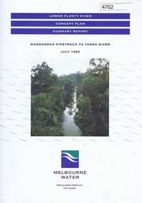
Pamphlet, Lower Plenty River concept plan, summary report: Maroondah Pipetrack to Yarra River, 1992_07
... Greensborough to where the Plenty meets the Yarra. Melbourne Water was the lead agency, assisted by the Shires of Eltham and Diamond Valley, City of Heidelberg, the EPA and Department of Planning and Housing. plenty river maroondah aqueduct melbourne water Coloured pamphlet, photograph and plans 12 pages. 2 copies. ...This draft concept plan covers the lower Plenty River from the Maroondah Pipe track in Greensborough to where the Plenty meets the Yarra. Melbourne Water was the lead agency, assisted by the Shires of Eltham and Diamond Valley, City of Heidelberg, the EPA and Department of Planning and Housing.Coloured pamphlet, photograph and plans 12 pages. 2 copies.plenty river, maroondah aqueduct, melbourne water -
 Greensborough Historical Society
Photograph - Digital image, Frank Solomon, The Snug Cafe St Helena 1, 1990c
... Greensborough Historical Society 34A Glenauburn Road Lower Plenty Lower Plenty melbourne St Helena Marketplace was the site of "The Snug". These photographs were taken by Frank Solomon and depict a cafe called The Snug, which is no longer operating. [Location information: Shop 10 St Helena Market Place Aqueduct ...St Helena Marketplace was the site of "The Snug". These photographs were taken by Frank Solomon and depict a cafe called The Snug, which is no longer operating. [Location information: Shop 10 St Helena Market Place Aqueduct Road Diamond Creek Vic 3089] Digital copy of colour photographthe snug, st helena marketplace, st helena -
 Greensborough Historical Society
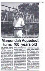
Newspaper clipping, Diamond Valley Leader, Maroondah Aqueduct turns 100 years old, 1991c
... Greensborough Historical Society 34A Glenauburn Road Lower Plenty Lower Plenty melbourne Aqueduct of 66 km built between 1886 and 1891 between Watts River near Healesville and Preston Reservoir. ...Aqueduct of 66 km built between 1886 and 1891 between Watts River near Healesville and Preston Reservoir. Parts have been replaced by pipes.The aqueduct formed a major link in Melbourne's water distribution system after supplies from Yan Yean Reservoir were considered insufficient in the 1870s.Photographic copy, text with photo of Russell Yeomansmaroondah aqueduct, russell yeomans -
![Photograph - Digital image, Kelly Garden Supplies [Greensborough], 02/05/2013](/media/collectors/4f729f5697f83e03086015b8/items/5729bced2162f108e8de6b52/item-media/5729bd212162f108e8de74aa/item-fit-380x285.jpg?cb=6) Greensborough Historical Society
Greensborough Historical SocietyPhotograph - Digital image, Kelly Garden Supplies [Greensborough], 02/05/2013
... Greensborough By-pass. Civic Drive was associated with the building of Diamond Valley Council Offices opened by Governor Rohan Delacombe on 26/2/1972. Previously it was known as Kelly's Track which wound its way around to a house that overlooked the aqueduct bridge. ...Greensborough By-pass. Civic Drive was associated with the building of Diamond Valley Council Offices opened by Governor Rohan Delacombe on 26/2/1972. Previously it was known as Kelly's Track which wound its way around to a house that overlooked the aqueduct bridge. ...This photograph of the former site of Kelly Garden Supplies was taken in 2013 to show changes over 40 years, based on Ron Reynold’s sketches in the 1973 publication “Greensborough and Greenhills” published by Cypress Books. The site is now part of the Civic roundabout at the top of the Greensborough By-pass. Civic Drive was associated with the building of Diamond Valley Council Offices opened by Governor Rohan Delacombe on 26/2/1972. Previously it was known as Kelly's Track which wound its way around to a house that overlooked the aqueduct bridge. Kelly's Sandpit (quarry) was the local go to place to obtain road, driveway fill and red sand for local construction. For 80 years previous Kelly's quarry supplied sand to the greater Melbourne area for the surfacing of school grounds, parks etc. Digital copy of colour photograph.greensborough and greenhills, civic drive greensborough, kelly garden supplies, ron reynolds -
 Greensborough Historical Society
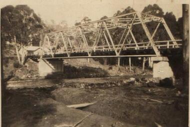
Photograph (copy), Aqueduct over the Plenty River / photographer unknown, 1920c
... View of the Maroondah Aqueduct where it crosses the Plenty River in Greensborough....Greensborough Historical Society 34A Glenauburn Road Lower Plenty Lower Plenty melbourne View of the Maroondah Aqueduct where it crosses the Plenty River in Greensborough. maroondah aqueduct plenty river Black and white photograph, enlarged and laminated. ...View of the Maroondah Aqueduct where it crosses the Plenty River in Greensborough.Black and white photograph, enlarged and laminated.maroondah aqueduct, plenty river -
 Greensborough Historical Society
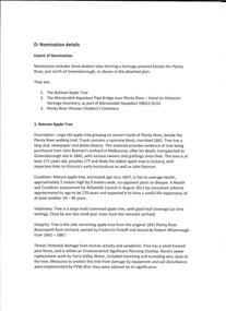
Folder of Documents, Anne Paul, Plenty River Heritage sites / Anne Paul, 1937_
... Greensborough Historical Society 34A Glenauburn Road Lower Plenty Lower Plenty melbourne This collection of correspondence, articles and photographs was collected by GHS member Anne Paul in support of Heritage overlays for the Pioneer Children's Graves, Batman Apple Tree and Maroondah Aqueduct. anne paul pioneer childrens cemetery batman apple tree maroondah aqueduct Blue plastic folder containing a large number of documents and images. ...This collection of correspondence, articles and photographs was collected by GHS member Anne Paul in support of Heritage overlays for the Pioneer Children's Graves, Batman Apple Tree and Maroondah Aqueduct.Blue plastic folder containing a large number of documents and images.anne paul, pioneer childrens cemetery, batman apple tree, maroondah aqueduct -
 Greensborough Historical Society
Photograph - Digital Image, Pipes over the Plenty River, 1950c
... Greensborough Historical Society 34A Glenauburn Road Lower Plenty Lower Plenty melbourne An early photograph of the Maroondah Aqueduct pipes crossing the Plenty River. maroondah aqueduct plenty river Digital copy of black and white photograph. ...An early photograph of the Maroondah Aqueduct pipes crossing the Plenty River.Digital copy of black and white photograph.maroondah aqueduct, plenty river -
 Greensborough Historical Society
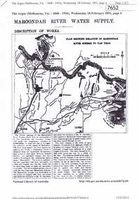
Article - Newspaper Clipping (copy), The Argus, Maroondah River water supply 1891, 18/02/1891
... aqueduct...yan yean reservoir...greensborough...Greensborough Historical Society 34A Glenauburn Road Lower Plenty Lower Plenty melbourne An historical account of the development of Melbourne's Maroondah River water supply, including a description of works undertaken in the 1890s. melbourne water mmbw maroondah aqueduct yan yean reservoir greensborough plenty river 3 p., photocopy of article, downloaded from Trove. ...An historical account of the development of Melbourne's Maroondah River water supply, including a description of works undertaken in the 1890s.3 p., photocopy of article, downloaded from Trove. Includes transcript in Word document.melbourne water, mmbw, maroondah aqueduct, yan yean reservoir, greensborough, plenty river -
 Greensborough Historical Society
Article - Journal - Excerpt, Victorian Government Gazette, Melbourne water supply 1879, 25/04/1879
... Greensborough Historical Society 34A Glenauburn Road Lower Plenty Lower Plenty melbourne An historical account from the Victorian Government Gazette 25/04/1879: Contract accepted - Melbourne Water Supply - B. Barnes & Co. Masonry abutments and piers, also construction and erection of wrought iron aqueduct ...An historical account from the Victorian Government Gazette 25/04/1879: Contract accepted - Melbourne Water Supply - B. Barnes & Co. Masonry abutments and piers, also construction and erection of wrought iron aqueduct over Plenty River at Morang. 5250 pounds.History of the Maroondah aqueduct1 p., photocopy of article, downloaded from State Library of Victoriamelbourne water, mmbw, maroondah aqueduct, plenty river -
 Greensborough Historical Society
Article - Journal - Excerpt, Victorian Government Gazette, Melbourne water supply 1890, 15/08/1890
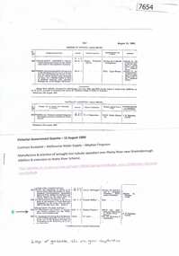
... Manufacture and erection of wrought iron tubular aqueduct over Plenty River near Greensborough. Addition and extension to Watts River Scheme....Greensborough Historical Society 34A Glenauburn Road Lower Plenty Lower Plenty melbourne An historical account from the Victorian Government Gazette 15/08/1890: Contract accepted - Melbourne Water Supply - Mephan Ferguson. Manufacture and erection of wrought iron tubular aqueduct ...An historical account from the Victorian Government Gazette 15/08/1890: Contract accepted - Melbourne Water Supply - Mephan Ferguson. Manufacture and erection of wrought iron tubular aqueduct over Plenty River near Greensborough. Addition and extension to Watts River Scheme.History of the Maroondah aqueduct1 p., photocopy of article, downloaded from State Library of Victoriamelbourne water, mmbw, maroondah aqueduct, plenty river, watts river -
 Greensborough Historical Society
Article - Article - Website, Wallaby Creek Weir, Aqueduct and associated sites, Kinglake, 2007
... Greensborough Historical Society 34A Glenauburn Road Lower Plenty Lower Plenty melbourne A short history of Kinglake's Wallaby Creek Weir and aqueduct in relation to Melbourne's water supply. melbourne water supply kinglake wallaby creek weir aqueducts Paper copy of website article, 7 p. text. ...A short history of Kinglake's Wallaby Creek Weir and aqueduct in relation to Melbourne's water supply. Paper copy of website article, 7 p. text.melbourne water supply, kinglake, wallaby creek weir, aqueducts -
 Greensborough Historical Society
Slide - Photograph, John Ramsdale, Aqueduct from Yan Yean Reservoir: Slide 37, 1990s
... Greensborough Historical Society 34A Glenauburn Road Lower Plenty Lower Plenty melbourne Photograph shows the aqueduct from Yan Yean Reservoir Part of the John Ramsdale collection of slides and audio visual material. aqueducts yan yean reservoir No maker's marks. ...Photograph shows the aqueduct from Yan Yean ReservoirPart of the John Ramsdale collection of slides and audio visual material.Colour photograph scanned from slide.No maker's marks. No caption on slide.aqueducts, yan yean reservoir -
 Greensborough Historical Society
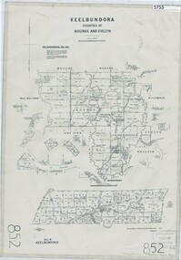
Map, Keelbundora. Counties of Bourke and Evelyn, 1950_11
... Greensborough Historical Society 34A Glenauburn Road Lower Plenty Lower Plenty melbourne Covers area bounded by Merri Creek, Yarra River, Plenty River and Crown Portions 24 to 28, with section including Maroondah Aqueduct and Darebin Creek. keelbundora (parish) Photocopy of digitised map Keelbundora. ...Covers area bounded by Merri Creek, Yarra River, Plenty River and Crown Portions 24 to 28, with section including Maroondah Aqueduct and Darebin Creek.Photocopy of digitised mapkeelbundora (parish) -
 Greensborough Historical Society
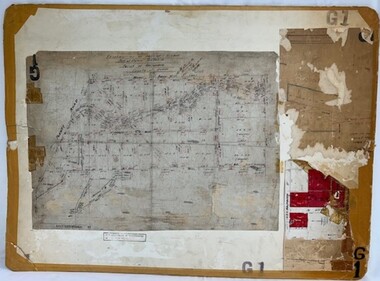
Poster - Planning Document, Shire of Diamond Valley, Subdivision Plan # G 1, Watsonia, 1962 and 1976
... Plan of Subdivisions in Shire of Diamond Valley: Side 1: subdivision of LP5406 bounded by Plenty Road, Greensborough Road, Meakin Avenue, Watsonia and includes Aqueduct Road, 1976. ...Greensborough Historical Society 34A Glenauburn Road Lower Plenty Lower Plenty melbourne Plan of Subdivisions in Shire of Diamond Valley: Side 1: subdivision of LP5406 bounded by Plenty Road, Greensborough Road, Meakin Avenue, Watsonia and includes Aqueduct Road, 1976. ...Plan of Subdivisions in Shire of Diamond Valley: Side 1: subdivision of LP5406 bounded by Plenty Road, Greensborough Road, Meakin Avenue, Watsonia and includes Aqueduct Road, 1976. Side 2: 2 plans - Keelbundoora: Morwell Avenue and Grace Street; Nillumbik: Inglis Street and Chute Street Diamond Creek, 1962An example of hard copy subdivision plans from the Greensborough area. Mainly from the Shire of Diamond Valley era (1964-1994).Plan (2 sided) mounted on heavy card. Contains 2 sheets pasted together.Stamped and handwritten Council permissions, dates and other details. subdivision plans, diamond creek, shire of diamond valley -
 Greensborough Historical Society
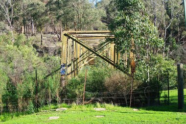
Photograph - Photograph - Digital Image, Marilyn Smith, Aqueduct crossing the Plenty River, Greensborough 2019, 02/07/2019
... Aqueduct crossing the Plenty River, Greensborough 2019...Originally part of the Maroondah Aqueduct pipeline, all that remains is the bridge that once carried the pipe over the Plenty River. This photograph was taken from the Plenty River Trail in Greensborough. ...Originally part of the Maroondah Aqueduct pipeline, all that remains is the bridge that once carried the pipe over the Plenty River. This photograph was taken from the Plenty River Trail in Greensborough. plenty river trail maroondah pipetrack maroondah aqueduct plenty river graffiti 3 colour digital photographs Aqueduct crossing the Plenty River, Greensborough 2019 Photograph Photograph - Digital Image Marilyn Smith ...The aqueduct crossing the Plenty River, 2019, overgrown with vegetation. Originally part of the Maroondah Aqueduct pipeline, all that remains is the bridge that once carried the pipe over the Plenty River. This photograph was taken from the Plenty River Trail in Greensborough. 3 colour digital photographsplenty river trail, maroondah pipetrack, maroondah aqueduct, plenty river, graffiti