Showing 3880 items matching "areas of victoria "
-
 Marysville & District Historical Society
Map (item), Taungurung Land and Waters Council Aboriginal Corporation, Unknown
... A map of the area in Victoria which is the land of the Taungurung Clan....A map of the area in Victoria which is the land of the Taungurung Clan....A map of the area in Victoria which is the land of the Taungurung Clan. ...A map of the area in Victoria which is the land of the Taungurung Clan.A map of the area in Victoria which is the land of the Taungurung Clan. Taungurung Land and Waters Council (TLaWC) was registered 16 July 2009 as the Registered Aboriginal Party that represents the interests of the Taungurung people. TLaWC is the corporate representative and ‘face’ of the Taungurung people and serves to uphold their interests with respect to culture and country. The Taungurung people occupy much of central Victoria. Their country encompasses the area between the upper reaches of the Goulburn River and its tributaries north of the Dividing Range. From the Campaspe River to Kilmore in the West, eastwards to Mount Beauty, from Benalla in the north down to the top of the Great Dividing Range, their boundaries with other Aboriginal tribes are respected in accordance with traditional laws.taungurung clan, taungurung land and waters council aboriginal corporation, victoria -
 Federation University Historical Collection
Map - Map and Information, Department of Mines: Map and Suggestions to Prospectors, 1891
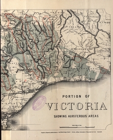
... areas...department of mines...victoria...The map outlines the auriferous (gold bearing) areas in Victoria. The information for prospectors was prepared by the Department of Mines in 1894...Document: 4 page type written Map: Portion of Victoria divided into Counties of 1891. Auriferous areas with red....Barker Library (top floor) Mount Helen goldfields The map outlines the auriferous (gold bearing) areas in Victoria. The information for prospectors was prepared by the Department of Mines in 1894 gold auriferous areas department of mines victoria map of victoria prospectors commissioner of crown lands hon a mclean alexander black surveyor general a mclean Reference section on map Document: 4 page type written Map: Portion of Victoria divided into Counties of 1891. ...The map outlines the auriferous (gold bearing) areas in Victoria. The information for prospectors was prepared by the Department of Mines in 1894Document: 4 page type written Map: Portion of Victoria divided into Counties of 1891. Auriferous areas with red.Reference section on mapgold, auriferous areas, department of mines, victoria, map of victoria, prospectors, commissioner of crown lands, hon a mclean, alexander black, surveyor general, a mclean -
Dandenong & District Historical Society
Book - A History of the Colony of Victoria from Discovery to its Absorption into the Commonwealth of Australia, Henry Gyles Turner, A History of the Colony of Victoria A.D 1854-1900, 1904
... ...Areas of Victoria & Indigenous information...Dandenong & District Historical Society 1st Floor, 39 Clow Street Dandenong melbourne Historic Information of Victoria & Commonwealth of Australia People - Explorers Famous people of the time. Areas of Victoria & Indigenous information A History of the Colony of Victoria A.D 1854-1900 Book A History of the Colony of Victoria from Discovery to its Absorption into the Commonwealth of Australia Henry Gyles Turner ...non-fictionpeople - explorers, famous people of the time., areas of victoria & indigenous information -
Federation University Historical Collection
Book, George Brown, Prospectors' Guide (Victoria), 1936, 1936
... Brown soft covered book with pullout map showing auriferous areas of Victoria. ...Barker Library (top floor) Mount Helen goldfields prospecting gold geology quartz reefs indicators ballarat indicators miners' rights mining leases forest regulations equipment gold cradle puddling machine sluice box whim whip california pump cradle mining tools mining laws Brown soft covered book with pullout map showing auriferous areas of Victoria. Prospectors' Guide (Victoria), 1936 Book Book George Brown H.J. ...Brown soft covered book with pullout map showing auriferous areas of Victoria. prospecting, gold, geology, quartz reefs, indicators, ballarat indicators, miners' rights, mining leases, forest regulations, equipment, gold cradle, puddling machine, sluice box, whim, whip, california pump, cradle, mining, tools, mining laws -
 Lakes Entrance Historical Society
Postcard - farmland Bruthen-Tambo Upper c1900
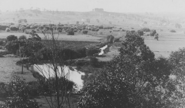
... Sepia toned postcard showing farmland in Bruthen Tambo Upper area Bruthen Victoria...Settlement Agriculture CGR Sepia toned postcard showing farmland in Bruthen Tambo Upper area Bruthen Victoria Postcard farmland Bruthen-Tambo Upper c1900 ...Sepia toned postcard showing farmland in Bruthen Tambo Upper area Bruthen VictoriaCGRsettlement, agriculture -
 Creswick Campus Historical Collection - University of Melbourne
Decorative object - Wallpaper samples
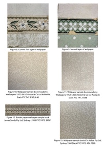
... They reflect changing tastes and fashions throughout the twentieth century and serve as evidence of wallpapers that were available and in use in a regional area of Victoria from the 1920s to the 1970s....They reflect changing tastes and fashions throughout the twentieth century and serve as evidence of wallpapers that were available and in use in a regional area of Victoria from the 1920s to the 1970s....They reflect changing tastes and fashions throughout the twentieth century and serve as evidence of wallpapers that were available and in use in a regional area of Victoria from the 1920s to the 1970s. Wallpaper samples Decorative object Wallpaper samples ...Overall, the wallpapers in the building are a rare surviving example of interior decorations used in educational institutions in Australia. They reflect changing tastes and fashions throughout the twentieth century and serve as evidence of wallpapers that were available and in use in a regional area of Victoria from the 1920s to the 1970s.The wallpapers present in Rooms 143 and 148 hold historic significance as a rare surviving example of interior decoration within Victoria during this period within an educational institution in Australia. They reflect changing tastes and fashions throughout the twentieth century. Additionally, these wallpapers serve as evidence of the styles that were available and used in a regional area of Victoria from the 1920s to the 1970s. Of particular importance are the four layers of wallpaper remaining on the south wall of Room 148, as they represent the most complete sequence of wallpapers used during these fifty years. The wallpapers in Room 143 are also significant; they not only provide further examples, including frieze papers, borders, and wall body papers, but they also contextualise the assortment of wallpapers used in both rooms. To a lesser extent, the wallpapers found in Rooms 144 and 146 offer additional context for the collection of significant wallpapers utilised across this suite of rooms.Wallpaper samples found in the upper six rooms of the front wing of the Creswick Campus Library. The upper-level rooms of the library comprise six spaces, including a WC, a stair landing, and a short hall. Overall, the wallpapers in the building are a rare surviving example of interior decorations used in educational institutions in Australia. They reflect changing tastes and fashions throughout the twentieth century and serve as evidence of wallpapers that were available and in use in a regional area of Victoria from the 1920s to the 1970s. -
 Ringwood and District Historical Society
Book, Coburg Historical Society, Recognising House Styles 1880s-1990s - Laurie Burchell, 1991
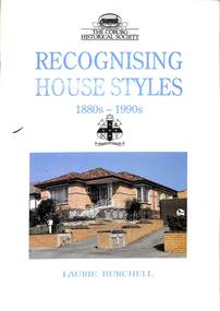
... Architectural references aimed at assisting researchers in describing, understanding, dting and comparing individual buildings in the Coburg area in Victoria....Ringwood and District Historical Society 125A Warrandyte Road Ringwood North melbourne Foreword by Miles Lewis Architectural references aimed at assisting researchers in describing, understanding, dting and comparing individual buildings in the Coburg area in Victoria. Recognising House Styles 1880s-1990s - Laurie Burchell Book Coburg Historical Society Coburg City Council Emen Printing Pty Ltd Challenge Typesetting Lawrence Burchell Robin Underwood ...Architectural references aimed at assisting researchers in describing, understanding, dting and comparing individual buildings in the Coburg area in Victoria.Foreword by Miles Lewis -
Lakes Entrance Historical Society
Book, Rogers L C, My Journey from the Snowy River, 1982
... Reminiscences of life in remote areas of Victoria at the turn of the Century by a son of a pioneering family of the Black Mountain in East Gippsland....Lakes Entrance Historical Society 4 Marine Parade Lakes Entrance gippsland Settlers Reminiscences of life in remote areas of Victoria at the turn of the Century by a son of a pioneering family of the Black Mountain in East Gippsland. ...Reminiscences of life in remote areas of Victoria at the turn of the Century by a son of a pioneering family of the Black Mountain in East Gippsland.settlers -
 Ringwood and District Historical Society
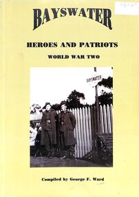
Book, Heroes and Patriots Publications, Bayswater Heroes and Patriots World War Two (Bayswater, Victoria) Compiled by George F. Ward, 1997
... Aspects of World War Two including stories and photographs of soldiers from the Bayswater area of Victoria, compiled by George F. Ward in 1997. ...Aspects of World War Two including stories and photographs of soldiers from the Bayswater area of Victoria, compiled by George F. Ward in 1997. ...Aspects of World War Two including stories and photographs of soldiers from the Bayswater area of Victoria, compiled by George F. Ward in 1997. Pictured on the front cover: Norman Pearce and Angus Gerlach on Bayswater Railway Station Circa 1942. -
 Victorian Aboriginal Corporation for Languages
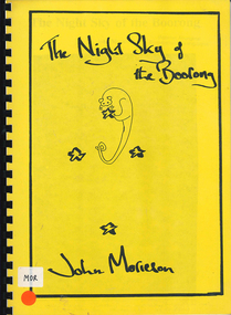
Book, John Morieson, The night sky of the Boorong
... Based on historical notes of a variety of people, it explains the Night Skies of the Lake Tyrell area of Victoria and the mythology of the people regarding the legends of the skies....Victorian Aboriginal Corporation for Languages 33 Saxon Street Brunswick melbourne Boorong astronomy ecological zodiac William Stanbridge Lake Tyrell Maps, b&w illustrations, b&w photographs Based on historical notes of a variety of people, it explains the Night Skies of the Lake Tyrell area of Victoria and the mythology of the people regarding the legends of the skies. ...Based on historical notes of a variety of people, it explains the Night Skies of the Lake Tyrell area of Victoria and the mythology of the people regarding the legends of the skies.Maps, b&w illustrations, b&w photographsboorong, astronomy, ecological zodiac, william stanbridge, lake tyrell -
Lakes Entrance Historical Society
Book, Meridith Fletcher, Gippsland Heritage Journal, 1996
... Life in various areas around Gippsland Victoria...Lakes Entrance Historical Society 4 Marine Parade Lakes Entrance gippsland Agriculture Land Settlement Migrants Life in various areas around Gippsland Victoria Gippsland Heritage Journal Book Meridith Fletcher ...Life in various areas around Gippsland Victoriaagriculture, land settlement, migrants -
 Bendigo Historical Society Inc.
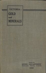
Book - BOOK - VICTORIA: GOLD AND . . MINERALS
... This book gives in great detail about promising mining areas in Victoria along with detailed maps of them....This book gives in great detail about promising mining areas in Victoria along with detailed maps of them. ...A copy of the 1935 guide book Victoria: GOLD and MINERALS . This book gives in great detail about promising mining areas in Victoria along with detailed maps of them.book, bendigo, mining -
Lakes Entrance Historical Society
Book, Bird E C F, The Silt Jetties at the Mitchell River, 1972
... The formation of the Mitchell River Silt Jetties is explained, and schemes for protecting this unique and fragile area of Victoria ...The formation of the Mitchell River Silt Jetties is explained, and schemes for protecting this unique and fragile area of Victoria The Silt Jetties at the Mitchell River Book Bird E C F ...The first of a series of scientific and historical studies of Gippsland to be published by the Bairnsdale Advertiser. The formation of the Mitchell River Silt Jetties is explained, and schemes for protecting this unique and fragile area of Victoria Ruth Clarkgenealogy, waterways, topography -
Glenelg Shire Council Cultural Collection
Photograph, n.d
... Black and white photograph of a section of residential area of Casterton Victoria....Glenelg Shire Council Cultural Collection History House Cliff Street Portland great-ocean-road Sourced from Casterton Town Hall (former Shire of Glenelg) Back: Black stamp - 001520 Black and white photograph of a section of residential area of Casterton Victoria. Photograph Photograph ...Sourced from Casterton Town Hall (former Shire of Glenelg)Black and white photograph of a section of residential area of Casterton Victoria.Back: Black stamp - 001520 -
Lakes Entrance Historical Society
Book, Land Conservation Council Victoria Alpine Area, 1977
... Land Conservation Council Victoria Alpine Area...Report containing information from various sources relevant to the future use of public land in the alpine area of Victoria. History, climate, landform, vegetation, land use, are some of the aspects presented....Lakes Entrance Historical Society 4 Marine Parade Lakes Entrance gippsland Topography Vegetation Ruth Clark Report containing information from various sources relevant to the future use of public land in the alpine area of Victoria. History, climate, landform, vegetation, land use, are some of the aspects presented. ...Report containing information from various sources relevant to the future use of public land in the alpine area of Victoria. History, climate, landform, vegetation, land use, are some of the aspects presented.Ruth Clarktopography, vegetation -
 Ringwood and District Historical Society
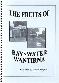
Book, The Fruits of Bayswater/Wantirna - Compiled by Evelyn Hodgkin - Volume Two, 2002
... Compilation of recollections, detailed stories and photographs of residents of Bayswater/Wantirna area, Victoria. ...Compilation of recollections, detailed stories and photographs of residents of Bayswater/Wantirna area, Victoria. The Fruits of Bayswater/Wantirna - Compiled by Evelyn Hodgkin - Volume Two Book Evelyn Hodgkin ...Compilation of recollections, detailed stories and photographs of residents of Bayswater/Wantirna area, Victoria. Front Cover - (left) Kleinert's Timber Yard, Station Street, Bayswater, 1940s (Photo courtesy Knox Historifcal Society); (right) Mountain Highway - outside Bayswater State School, looking towards township, 1940s. This photo courtesy of Marj Crisp. -
 Flagstaff Hill Maritime Museum and Village
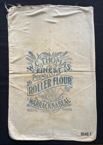
Textile - Flour bag - W.C.Thomas, Warracknabeal
... Thomas in Warracknabeal, a large wheat growing area in Victoria. The stencil on the front of the bag includes an image of wheat overlaid with the written information in scroll format....Thomas in Warracknabeal, a large wheat growing area in Victoria. The stencil on the front of the bag includes an image of wheat overlaid with the written information in scroll format. ...This flour bag came from the W.C. Thomas Flour Mill at Warracknabeal, Victoria. W.C. Thomas ran a number of flour mills throughout the Victorian wheat belt, with the Warracknabeal Mill operating from 1884 to 1964. After their use for flour storage, flour bags were able to be reused for bulk storage of other dry goods or sewn into domestic objects such as tea towels, pillowcases or waggas.This is a good example of a flour bag from a prominent Victorian flourmill, operating from the late 19th century to the mid-20th century.Calico flour bag for 'Roller Flour' from the flour mill of W.C. Thomas in Warracknabeal, a large wheat growing area in Victoria. The stencil on the front of the bag includes an image of wheat overlaid with the written information in scroll format.W.C. Thomas, Finest, Patent, Roller Flour, Warracknabeal, Victoria, Australia. Wheat image.flagstaff hill maritime museum and village, great ocean road, shipwreck coast, flour bags, calico, domestic object, textile, food storage, w.c. thomas, warracknabeal, flour mill -
 Ringwood and District Historical Society
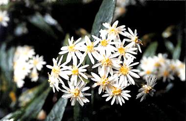
Photograph, Olearia lirata (Snowy Daisy Bush), c. 2000
... Photograph of Olearia lirata (Snowy Daisy Bush) indigenous to the Ringwood area, Victoria, Australia...area. Photograph of Olearia lirata (Snowy Daisy Bush) indigenous to the Ringwood area, Victoria, Australia Olearia lirata (Snowy Daisy Bush) Photograph Photograph ...Common native plant in the Ringwood area.Photograph of Olearia lirata (Snowy Daisy Bush) indigenous to the Ringwood area, Victoria, Australia -
Lakes Entrance Historical Society
Book, Porteus, Stanley D, Providence Ponds - A Novel of Early Australia, 1950
... A fictional account of the settling of the Providence Ponds area of Gippsland, Victoria, based on factual events....Lakes Entrance Historical Society 4 Marine Parade Lakes Entrance gippsland Settlers History A fictional account of the settling of the Providence Ponds area of Gippsland, Victoria, based on factual events. ...A fictional account of the settling of the Providence Ponds area of Gippsland, Victoria, based on factual events.settlers, history -
 Lakes Entrance Historical Society
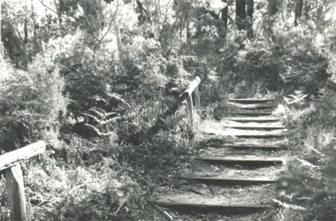
Photograph - Steps at Blackfellows Arm Lake Tyers area Victoria, Lakes Post Newspaper, 1994
... Steps at Blackfellows Arm Lake Tyers area Victoria...Black and white photograph of steps leading down to Blackfellows Arm Lake Tyers area Victoria...Lakes Entrance Historical Society 4 Marine Parade Lakes Entrance gippsland Houses Settlers Black and white photograph of steps leading down to Blackfellows Arm Lake Tyers area Victoria Photograph Steps at Blackfellows Arm Lake Tyers area Victoria Lakes Post Newspaper ...Black and white photograph of steps leading down to Blackfellows Arm Lake Tyers area Victoriahouses, settlers -
 Bendigo Historical Society Inc.
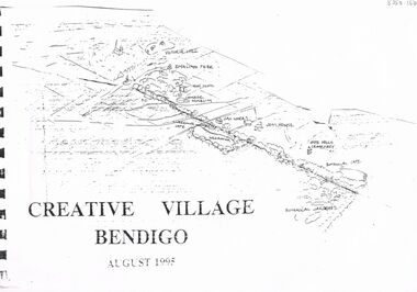
Document - MERLE HALL COLLECTION: DOCUMENTS RELATING TO CREATIIVE VILLAGE BENDIGO
... to bound printed material entitled ''Creative Village Bendigo - August 1995'' (with ink sketch of area from Victoria Hill to Botanical Gardens); Page 2 with sections describing Introduction; The Design Team and Acknowledgements....to bound printed material entitled ''Creative Village Bendigo - August 1995'' (with ink sketch of area from Victoria Hill to Botanical Gardens); Page 2 with sections describing Introduction; The Design Team and Acknowledgements. ...Documents relating to Creative Village Bendigo - Cover? to bound printed material entitled ''Creative Village Bendigo - August 1995'' (with ink sketch of area from Victoria Hill to Botanical Gardens); Page 2 with sections describing Introduction; The Design Team and Acknowledgements.creative village bendigo, merle hall collection -
 Lakes Entrance Historical Society
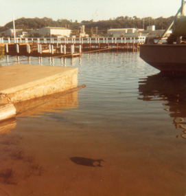
Photograph - New Works Jetty Lakes Entrance, Victoria. c1983, Fraser, Nancy
... Colour photograph showing new jetty under construction at New Works area, Lakes Entrance, Victoria....from Nan Fraser's album Boats and Boating Jetties Ocean Colour photograph showing new jetty under construction at New Works area, Lakes Entrance, Victoria. Photograph New Works Jetty Lakes Entrance, Victoria. c1983 Fraser, Nancy ...from Nan Fraser's albumColour photograph showing new jetty under construction at New Works area, Lakes Entrance, Victoria. boats and boating, jetties, ocean -
 Bendigo Historical Society Inc.
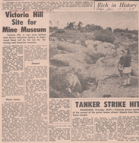
Newspaper - VICTORIA HILL - SITE FOR MINE MUSEUM
... Photo shows two visitors looking at the open cut area of Victoria Hill....Photo shows two visitors looking at the open cut area of Victoria Hill. Newspaper VICTORIA HILL - SITE FOR MINE MUSEUM ...Newspaper article and photo from the Bendigo Advertiser dated 12/7/68. Article mentions Victoria Hill, behind John Brown Industries Factory, will be the site for the mining and historical museum. Photo shows two visitors looking at the open cut area of Victoria Hill.newspaper, bendigo advertiser, victoria hill, site for mine museum, john brown industries, bendigo city council, bendigo and district association, cr t r flood, victoria quartz gold mine, lansell's 180 mine, theodore ballerstedt, mr george lansell, heather champness, shirley leersen -
 Marysville & District Historical Society
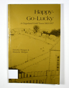
Book - Paperback book, Happy-Go-Lucky-A Gippsland Gold Town 1863-1917, 1987
... A history of a gold mining town in the Gippsland area of Victoria ...Marysville & District Historical Society 39 Darwin Street Marysville yarra-valley-and-the-dandenong-ranges A history of a gold mining town in the Gippsland area of Victoria gold gold mining gold town gippsland victoria australia history gold miner morgan, dorothy morgan, marjorie Stamp of the Marysville & District Historical Society Inc / P.O. ...A history of a gold mining town in the Gippsland area of Victoria Paperback. Gold cover. Cover has a pencil sketch of a gold mining town as well as a large gum tree on the back cover. Cover illustration runs across the whole cover.Stamp of the Marysville & District Historical Society Inc / P.O. Box 22 / Marysville 3779. Sticker - DISTRIBUTED BY: / Paoletti's (Adventurer) Maps P/L / 15 Nirvana Close, / Langwarrin. 3910 / Tel: 03 9789 6985 / Fax: 03 9776 6798 / Email: [email protected] / Other products & information Website: http://users.netlink.com.au/~maptrapgold, gold mining, gold town, gippsland, victoria, australia, history, gold miner, morgan, dorothy, morgan, marjorie -
 Lakes Entrance Historical Society
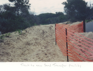
Photograph, Judy Davies, sand transfer system at New Works Lakes Entrance Victoria, 1998 c
... Colour photograph of sand track to new sand transfer system at New Works area Lakes Entrance Victoria...Lakes Entrance Historical Society 4 Marine Parade Lakes Entrance gippsland Environment Gippsland Ports Topography Colour photograph of sand track to new sand transfer system at New Works area Lakes Entrance Victoria sand transfer system at New Works Lakes Entrance Victoria Photograph Judy Davies ...Colour photograph of sand track to new sand transfer system at New Works area Lakes Entrance Victoriaenvironment, gippsland ports, topography -
Lakes Entrance Historical Society
Book, Andrew Claridge, Survey of Crown Lands 1989, 1989
... A Preliminary Survey of Crown Lands between Lake Bunga and Mill Piont, Lake Tyers Beach Area Victoria....Surveying A Preliminary Survey of Crown Lands between Lake Bunga and Mill Piont, Lake Tyers Beach Area Victoria. Survey of Crown Lands 1989 Book Andrew Claridge ...A Preliminary Survey of Crown Lands between Lake Bunga and Mill Piont, Lake Tyers Beach Area Victoria.surveying -
 Lakes Entrance Historical Society
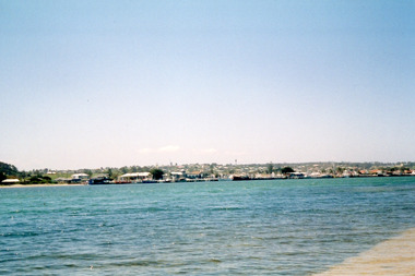
Photograph - Lakes Entrance viewed from the New Works area. c2005, Davies, Judy
... Colour photograph of the township viewed across the Cunninghame Arm from the New Works area. Lakes Entrance Victoria...Waterways Township Colour photograph of the township viewed across the Cunninghame Arm from the New Works area. Lakes Entrance Victoria Photograph Lakes Entrance viewed from the New Works area. c2005 Davies, Judy ...Colour photograph of the township viewed across the Cunninghame Arm from the New Works area. Lakes Entrance Victoriawaterways, township -
 Marysville & District Historical Society
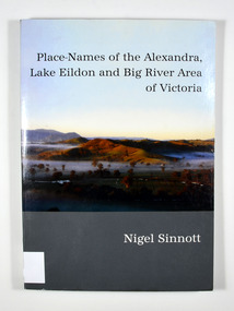
Book, Place-Names of the Alexandra, Lake Eildon and Big River Area of Victoria, 2003
... Place-Names of the Alexandra, Lake Eildon and Big River Area of Victoria...Place names of the Alexandra, Lake Eildon and Big River areas in Victoria...Place-Names of the Alexandra, Lake Eildon and Big River Area of Victoria Book Book Nigel Sinnott Friends of the Library - Alexandra District Inc ...Place names of the Alexandra, Lake Eildon and Big River areas in VictoriaPaperback. Front cover has a colour photograph named: 'Sunrise, Brooks Cutting near Alexandra', by Robert Douglas (2002). Back cover has a colour photograph of the author, Nigel Sinnott at McKenzie's Pinch, Alexandra (Mount Torbreck in background) by Robert Douglas (2002).To George Edwards / with best wishes, / Nigel Sinnott / 15 March 2003 To the memory of / Gordon BEATON (1911-88) / of Eildon / mycologist and engineer Stamp of Marysville & District / Historical Society Inc / P.O. Box 22 / Marysville 3779 geographical, victoria, big river region, eildon region, alexandra region, alexandra library, friends -
 Ballarat Tramway Museum
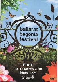
Programme, Begonia Festival, Begonia Festival program, 1940s
... Also shows the Park & Ride area in Victoria Park and notes the bus service from the railway (train station). ...Also shows the Park & Ride area in Victoria Park and notes the bus service from the railway (train station). ...Full colour, 16 page, full colour centre stapled Begonia Festival program, for the 2018 Begonia Festival. Has a map with Wendouree Parade in the gardens area and shows the tram track and depot. Also shows the Park & Ride area in Victoria Park and notes the bus service from the railway (train station). trams, tramways, begonia festival, festival program -
 Ballarat Tramway Museum
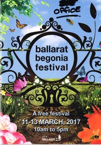
Programme, Begonia Festival, Begonia Festival program, Feb. 2017
... Also shows the Park & Ride area in Victoria Park and notes the bus service from the railway (train station). ...Also shows the Park & Ride area in Victoria Park and notes the bus service from the railway (train station). ...Full colour, 16 page, full colour centre stapled Begonia Festival program, for the 2017 Begonia Festival. Has a map with Wendouree Parade in the gardens area and shows the tram track and depot. Also shows the Park & Ride area in Victoria Park and notes the bus service from the railway (train station). has "office" written in black felt pen on the front cover in the top right hand corner.trams, tramways, begonia festival, festival program