
Showing 89 items matching "arthur's creek road"
-
 Eltham District Historical Society Inc
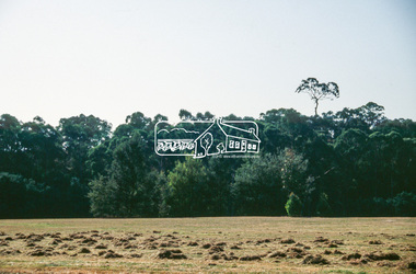
Slide - Photograph, Jasper's Park, Arthur's Creek Road, Hurstbridge, c.1992
... Jasper's Park, Arthur's Creek Road, Hurstbridge......Arthur's Creek Road...significant tree Arthur's Creek Road Hurstbridge Jasper's Park 35mm colour positive transparency Mount - Black and White Jasper's Park, Arthur's Creek Road, Hurstbridge Slide Photograph ...35mm colour positive transparency Mount - Black and Whitesignificant tree, arthur's creek road, hurstbridge, jasper's park -
 Eltham District Historical Society Inc
Document - Folder, Smith, Sydney and Rebecca
... Arthur's Creek...Arthur's Creek Road...Sydney Smith William Smith Elizabeth Smith Henty family Rebecca Lee William Lee Elizabeth Lee John Matthews Mary Ann Lee ship Maitland William Henny Rebecca Matthews Mary Ann Matthews Scale family of Epping Emma Smith Thomas Smith Robert Smith James Smith Rebecca Smith Reuben Smith Sarah Sussannah Smith Emma Jane Smith Midhurst at Arthur's Creek Arthur's Creek Road Frank Kurnell Elizabeth Smith nee Johnson William Johnson Sarah Johnson St John's Church Diamond Creek Arthur J Pickering Charlotte Harrison Sarah Janes Laura Smith William Sydney Smith Rebecca Edith Maud Smith Thomas James Leslie Smith Elizabeth Mary Mabel Smith Florence Ellen Isobel Smith Albert Percival Smith Evelyn Hazel Walher Smith Elsie May Smith Jack's Creek Waterworks Toorourrong Reservoir Doctors Gully Road Harold Bassett Hazel Glen State School Wesleyan Sunday School Hazel Glen Middle Station Creek Glenburn Glenburn School Allan Ferguson Diamond Creek State School Haley's Gully Road Arthur's Creek Newspaper clippings, A4 photocopies, etc Smith, Sydney and Rebecca Document Folder ...Sydney Smith (1821-1886) came to Australia as a young man. After marrying and some years in Epping, he moved to the Diamond Creek area. Contents Photocopy typed notes, undated, on Sydney Smith, family and descendants. Newspaper clippings, A4 photocopies, etcsydney smith, william smith, elizabeth smith, henty family, rebecca lee, william lee, elizabeth lee, john matthews, mary ann lee, ship maitland, william henny, rebecca matthews, mary ann matthews, scale family of epping, emma smith, thomas smith, robert smith, james smith, rebecca smith, reuben smith, sarah sussannah smith, emma jane smith, midhurst at arthur's creek, arthur's creek road, frank kurnell, elizabeth smith nee johnson, william johnson, sarah johnson, st john's church diamond creek, arthur j pickering, charlotte harrison, sarah janes laura smith, william sydney smith, rebecca edith maud smith, thomas james leslie smith, elizabeth mary mabel smith, florence ellen isobel smith, albert percival smith, evelyn hazel walher smith, elsie may smith, jack's creek waterworks, toorourrong reservoir, doctors gully road, harold bassett, hazel glen state school, wesleyan sunday school hazel glen, middle station creek glenburn, glenburn school, allan ferguson, diamond creek state school, haley's gully road arthur's creek -
Eltham District Historical Society Inc
Document - Sharp family
... ...Arthur's Creek Road...Gwen Sharp Sharp's Flat Hurstbridge Sharps Road Hurstbridge Arthurs Creek Hurstbridge Hurst Private Memorial Grave site Robert Hurst Frances Hurst Hurst's Bridge Ellen Hurst Keith Sharp Sheila Ferguson Henry Facey Hurst Charles Botterell Hawkins Fanny Hawkins nee Hurst Caroline Frances Maria Sharp nee Hawkins Robert Nehemiah Sharp "The Oaks" Kinglake William Sharp Edgar Sharp Harry Sharp Stan Sharp Daisy Sharp "Homeleigh" Hurstbridge Roy Sharp Jean Sharp Lilian Sharp Allwood House Hurstbridge Ferguson's Paddock Hurstbridge Arthur's Creek Road Carrie Sharp Sharps house Hurstbridge Dorset house Hurstbridge Ryans butcher Hurstbdirge Hortons bakery Hurstbridge Bootmaker Hurstbridge D G Graham blacksmith Hurstbridge Noella Macperson nee Sharp Richard Sharp Robert Sharp Muriel Sharp edna Sharp Lyn Sharp Muriel Sharp nee Limmer Muriel Willson Henry Willson Country Fire Authority Hurstbridge Newspaper clippings, A4 photocopies, etc Document Sharp family ...Keith Sharp was a descendant of the Hurst family, and lived in Hurstbridge, being active in the Hurstbridge Country Fire Authority. His family's farm gave its name to Sharps road, Hurstbridge. Contents Gwen Sharp, no date: Photocopy of collection of material on Sharp family of Hurstbridge and naming of Sharps Road containing: Photograph Fergusen's paddock, Hurstbridge, 1987. Notes on renaming of Sharp's Flat to Sharps Road. Notes on the Hurst family and how Keith Sharp is descended from Ellen Hurst, with details of each generation. Photographs of Sharp family and of Hurstbridge. Photograph of Allwood House, 1899, including W G Gray, Carrie Sharp and Robert Sharp. Newspaper clippings, A4 photocopies, etcgwen sharp, sharp's flat hurstbridge, sharps road hurstbridge, arthurs creek, hurstbridge, hurst private memorial grave site, robert hurst, frances hurst, hurst's bridge, ellen hurst, keith sharp, sheila ferguson, henry facey hurst, charles botterell hawkins, fanny hawkins nee hurst, caroline frances maria sharp nee hawkins, robert nehemiah sharp, "the oaks" kinglake, william sharp, edgar sharp, harry sharp, stan sharp, daisy sharp, "homeleigh" hurstbridge, roy sharp, jean sharp, lilian sharp, allwood house hurstbridge, ferguson's paddock hurstbridge, arthur's creek road, carrie sharp, sharps house hurstbridge, dorset house hurstbridge, ryans butcher hurstbdirge, hortons bakery hurstbridge, bootmaker hurstbridge, d g graham blacksmith hurstbridge, noella macperson nee sharp, richard sharp, robert sharp, muriel sharp, edna sharp, lyn sharp, muriel sharp nee limmer, muriel willson, henry willson, country fire authority hurstbridge -
 Eltham District Historical Society Inc
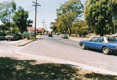
Photograph, Heidelberg-Kinglake Road, Hurstbridge; looking north east towards Kinglake
... Two colour photographs taken near the location of the present roundabout intersection of Anzac Road (on right) and Arthurs Creek Road (on left) with the Heidelberg-Kinglake Road at Hurstbridge. [37�38'14.8"S 145�11'39.6"E -37.637459, 145.194322]...main street kinglake road heidelberg/kinglake road hurstbridge Two colour photographs taken near the location of the present roundabout intersection of Anzac Road (on right) and Arthurs Creek Road (on left) with the Heidelberg-Kinglake Road at Hurstbridge. [37�38'14.8"S 145�11'39.6"E -37.637459, 145.194322] Heidelberg-Kinglake Road, Hurstbridge; looking north east towards Kinglake Photograph ...Two colour photographs taken near the location of the present roundabout intersection of Anzac Road (on right) and Arthurs Creek Road (on left) with the Heidelberg-Kinglake Road at Hurstbridge. [37�38'14.8"S 145�11'39.6"E -37.637459, 145.194322]main street, kinglake road, heidelberg/kinglake road, hurstbridge -
 Greensborough Historical Society
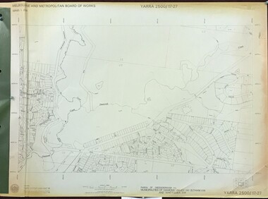
Map, Melbourne and Metropolitan Board of Works. Survey Division, MMBW, Yarra 2500 / 17.27. Central Hurstbridge, 1978_02
... Prominent streets include: Anzac Avenue and Hurstbridge-Arthurs Creek Road. ...Prominent streets include: Anzac Avenue and Hurstbridge-Arthurs Creek Road. mmbw melbourne and metropolitan board of works shire of diamond valley hurstbridge - maps MMBW Map in 1:2500 [scale] series. ...Melbourne and Metropolitan Board of Works. Yarra 2500 [base map] 17-27. Central Hurstbridge. Parish of Greensborough 2724, Municipalities of Diamond Valley 257, Eltham 238 and Whittlesea 239. Prominent streets include: Anzac Avenue and Hurstbridge-Arthurs Creek Road. MMBW Map in 1:2500 [scale] series. Cream parchment with green tape reinforcing on edges and punched holes on left edge.mmbw, melbourne and metropolitan board of works, shire of diamond valley, hurstbridge - maps -
 Eltham District Historical Society Inc
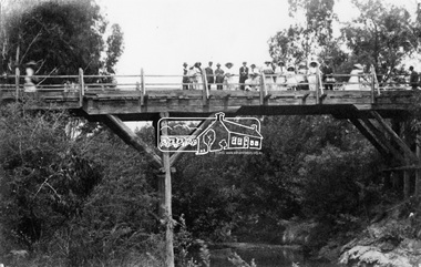
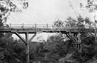
Negative - Photograph, Hurst's Bridge, c.1912
... A large group of people can be seen strolling across the timber bridge over the Diamond Creek on Hurstbridge-Arthurs Creek Road, Hurstbridge. It was built by John McDonald, of Arthur's Creek and was demolished and replaced in 1917 by a reinforced concrete arch bridge designed by John Monash....A large group of people can be seen strolling across the timber bridge over the Diamond Creek on Hurstbridge-Arthurs Creek Road, Hurstbridge. It was built by John McDonald, of Arthur's Creek and was demolished and replaced in 1917 by a reinforced concrete arch bridge designed by John Monash. ...The area of Hurstbridge was originally known as Hurst’s-bridge after the timber bridge built over the Diamond Creek near Hurst’s station in late 1881/early 1882. A large group of people can be seen strolling across the timber bridge over the Diamond Creek on Hurstbridge-Arthurs Creek Road, Hurstbridge. It was built by John McDonald, of Arthur's Creek and was demolished and replaced in 1917 by a reinforced concrete arch bridge designed by John Monash.This photo forms part of a collection of photographs gathered by the Shire of Eltham for their centenary project book, "Pioneers and Painters: 100 years of the Shire of Eltham" by Alan Marshall (1971). The collection of over 500 images is held in partnership between Eltham District Historical Society and Yarra Plenty Regional Library (Eltham Library) and is now formally known as 'The Shire of Eltham Pioneers Photograph Collection.' It is significant in being the first community sourced collection representing the places and people of the Shire's first one hundred years.Digital image 4 x 5 inch B&W Negshire of eltham pioneers photograph collection, 1912, bridge, diamond creek (creek), hurstbridge, hurst's bridge -
 Eltham District Historical Society Inc
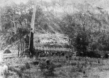
Negative - Photograph, Hurst's Bridge, 1885
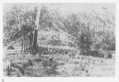
... The area of Hurstbridge was originally known as Hurst’s-bridge after the timber bridge built over the Diamond Creek near Hurst’s station in late 1881/early 1882 on the Hurstbridge-Arthurs Creek Road, Hurstbridge. It was built by John McDonald, of Arthur's Creek and was demolished and replaced in 1917 by a reinforced concrete arch bridge designed by John Monash. ...The area of Hurstbridge was originally known as Hurst’s-bridge after the timber bridge built over the Diamond Creek near Hurst’s station in late 1881/early 1882 on the Hurstbridge-Arthurs Creek Road, Hurstbridge. It was built by John McDonald, of Arthur's Creek and was demolished and replaced in 1917 by a reinforced concrete arch bridge designed by John Monash. ...Looking northwest onto the first bridge at Hurstbridge, 1885. The area of Hurstbridge was originally known as Hurst’s-bridge after the timber bridge built over the Diamond Creek near Hurst’s station in late 1881/early 1882 on the Hurstbridge-Arthurs Creek Road, Hurstbridge. It was built by John McDonald, of Arthur's Creek and was demolished and replaced in 1917 by a reinforced concrete arch bridge designed by John Monash. Cross Reference Photo No.(s): 1012/1013This photo forms part of a collection of photographs gathered by the Shire of Eltham for their centenary project book,"Pioneers and Painters: 100 years of the Shire of Eltham" by Alan Marshall (1971). The collection of over 500 images is held in partnership between Eltham District Historical Society and Yarra Plenty Regional Library (Eltham Library) and is now formally known as the 'The Shire of Eltham Pioneers Photograph Collection.' It is significant in being the first community sourced collection representing the places and people of the Shire's first one hundred years.Digital image 4 x 5 inch B&W Negshire of eltham pioneers photograph collection, hurstbridge, bridge, diamond creek (creek), hurst's bridge -
 Eltham District Historical Society Inc
Photograph, Hurst's Bridge, c.1912
... The area of Hurstbridge was originally known as Hurst’s-bridge after the timber bridge built over the Diamond Creek near Hurst’s station in late 1881/early 1882 on Hurstbridge-Arthurs Creek Road, Hurstbridge. It was built by John McDonald, of Arthur's Creek and was demolished and replaced in 1917 by a reinforced concrete arch bridge designed by John Monash. ...The area of Hurstbridge was originally known as Hurst’s-bridge after the timber bridge built over the Diamond Creek near Hurst’s station in late 1881/early 1882 on Hurstbridge-Arthurs Creek Road, Hurstbridge. It was built by John McDonald, of Arthur's Creek and was demolished and replaced in 1917 by a reinforced concrete arch bridge designed by John Monash. ...The area of Hurstbridge was originally known as Hurst’s-bridge after the timber bridge built over the Diamond Creek near Hurst’s station in late 1881/early 1882 on Hurstbridge-Arthurs Creek Road, Hurstbridge. It was built by John McDonald, of Arthur's Creek and was demolished and replaced in 1917 by a reinforced concrete arch bridge designed by John Monash. Part of a slide show presentation "Bridges & Waterways of the Shire" by Russell Yeoman to the 13 September 1989 Society meeting. The presentation included slides of historic photos from the Shire of Eltham Pioneers collections as well as several recent views. This photo forms part of a collection of photographs gathered by the Shire of Eltham for their centenary project book, Pioneers and Painters: 100 years of the Shire of Eltham" by Alan Marshall (1971). The collection of over 500 images is held in partnership between Eltham District Historical Society and Yarra Plenty Regional Library (Eltham Library) and is now formally known as 'The Shire of Eltham Pioneers Photograph Collection.' It is significant in being the first community sourced collection representing the places and people of the Shire's first one hundred years.Digital imageshire of eltham pioneers photograph collection, 1912, bridge, diamond creek (creek), hurstbridge, hurst's bridge -
 Eltham District Historical Society Inc
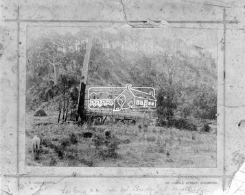
Negative - Photograph, J. P. Lind, Hurst's Bridge, 1885
... The area of Hurstbridge was originally known as Hurst’s-bridge after the timber bridge built over the Diamond Creek near Hurst’s station in late 1881/early 1882 on the Hurstbridge-Arthurs Creek Road, Hurstbridge. It was built by John McDonald, of Arthur's Creek and was demolished and replaced in 1917 by a reinforced concrete arch bridge designed by John Monash. ...The area of Hurstbridge was originally known as Hurst’s-bridge after the timber bridge built over the Diamond Creek near Hurst’s station in late 1881/early 1882 on the Hurstbridge-Arthurs Creek Road, Hurstbridge. It was built by John McDonald, of Arthur's Creek and was demolished and replaced in 1917 by a reinforced concrete arch bridge designed by John Monash. ...Looking northwest onto the first bridge at Hurstbridge, 1885. Timber bridge amid rural setting. Two horses graze in an open paddock in the foreground. A house is situated on a rise behind the bridge on a tree lined hill. The area of Hurstbridge was originally known as Hurst’s-bridge after the timber bridge built over the Diamond Creek near Hurst’s station in late 1881/early 1882 on the Hurstbridge-Arthurs Creek Road, Hurstbridge. It was built by John McDonald, of Arthur's Creek and was demolished and replaced in 1917 by a reinforced concrete arch bridge designed by John Monash. Cross Reference Photo No.(s): 1012/1013This photo forms part of a collection of photographs gathered by the Shire of Eltham for their centenary project book, "Pioneers and Painters: 100 years of the Shire of Eltham" by Alan Marshall (1971). The collection of over 500 images is held in partnership between Eltham District Historical Society and Yarra Plenty Regional Library (Eltham Library) and is now formally known as 'The Shire of Eltham Pioneers Photograph Collection.' It is significant in being the first community sourced collection representing the places and people of the Shire's first one hundred years.Digital image 4 x 5 inch B&W Negshire of eltham pioneers photograph collection, hurstbridge, bridge, diamond creek (river), diamond creek (creek), hurst's bridge -
 Eltham District Historical Society Inc
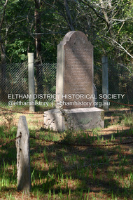
Photograph - Digital Photograph, Alan King, Henry Hurst grave, 1 February 2008
... His tragic end is recounted on his tombstone at the Hurst family cemetery, by Greysharps Road off Arthurs Creek Road erected ‘by a grateful public as a memorial to his heroic self-sacrifice.’ ...His tragic end is recounted on his tombstone at the Hurst family cemetery, by Greysharps Road off Arthurs Creek Road erected ‘by a grateful public as a memorial to his heroic self-sacrifice.’ ...Henry Hurst, after whom Hurstbridge was named, had a hard and adventurous life in the raw colony of the mid 1800s. His tragic end is recounted on his tombstone at the Hurst family cemetery, by Greysharps Road off Arthurs Creek Road erected ‘by a grateful public as a memorial to his heroic self-sacrifice.’ The memorial reads, ‘Sacred to the memory of Henry Facey Hurst (formerly of Hanford Dorset) who while defending his home fell near this spot by a ball fired by the bushranger Burke on October 4 1866 aged 34 years’. Published: Nillumbik Now and Then / Marguerite Marshall 2008; photographs Alan King with Marguerite Marshall.; p15This collection of almost 130 photos about places and people within the Shire of Nillumbik, an urban and rural municipality in Melbourne's north, contributes to an understanding of the history of the Shire. Published in 2008 immediately prior to the Black Saturday bushfires of February 7, 2009, it documents sites that were impacted, and in some cases destroyed by the fires. It includes photographs taken especially for the publication, creating a unique time capsule representing the Shire in the early 21st century. It remains the most recent comprehenesive publication devoted to the Shire's history connecting local residents to the past. nillumbik now and then (marshall-king) collection, hurst family cemetery, hurstbridge, gravestones, henry hurst, memorial -
 Eltham District Historical Society Inc
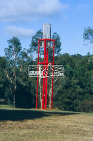
Slide - Photograph, Sensory Integration Invention A, Cathy Smith (1999), Fergusons Paddock, Arthurs Creek Road, Hurstbridge, c.Nov. 2001
... Sensory Integration Invention A, by Cathy Smith public art sculpture, commissioned by Nillumbik Shire Council, in Fergusons Paddock,12 Arthurs Creek Road Hurstbridge was officially unveiled in 1999. ...Sensory Integration Invention A, by Cathy Smith public art sculpture, commissioned by Nillumbik Shire Council, in Fergusons Paddock,12 Arthurs Creek Road Hurstbridge was officially unveiled in 1999. ...Sensory Integration Invention A, by Cathy Smith public art sculpture, commissioned by Nillumbik Shire Council, in Fergusons Paddock,12 Arthurs Creek Road Hurstbridge was officially unveiled in 1999. Councillors Penny Mullinar and Margaret Jennings in attendance. "Smith's work has strong references to humans' sensory and practical relationship with the land through the built environment. Wind entering the structure's tubing operates like a flute, generating sounds such as bird calls that resonate into the surrounding wetland areas." Source: Highlights from the Nillumbik Public Art Collection, NSC, n.d. Part of a slide show presentation "A Trip Down the Diamond Creek" by Russell Yeoman to the Eltham District Historical Society meeting of 14 Nov. 200135mm colour positive transparency Mount - Black and Whiteart in public places, arthurs creek road, cathy smith, ferguson's paddock, hurstbridge, public art, sensory integration invention a -
 Eltham District Historical Society Inc
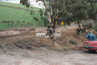
Slide, Culvert construction: Greens Road, Arthurs Creek, 19 Jun. 1981
... Culvert construction / drainage operations undertaken throughout the Shire of Eltham - Greens Road near intersection of Cottlesbridge-Strathewen Road, Arthurs Creek...Culvert construction / drainage operations undertaken throughout the Shire of Eltham - Greens Road near intersection of Cottlesbridge-Strathewen Road, Arthurs Creek culvert infrastructure roadworks Arthurs Creek Cottles Bridge-Strathewen Road Greens Road 35 mm colour positive transparency (1 of 4) Mount - Kodak Kodachrome Card Culvert construction: Greens Road, Arthurs Creek Slide Slide ...Culvert construction / drainage operations undertaken throughout the Shire of Eltham - Greens Road near intersection of Cottlesbridge-Strathewen Road, Arthurs Creek35 mm colour positive transparency (1 of 4) Mount - Kodak Kodachrome Cardculvert, infrastructure, roadworks, arthurs creek, cottles bridge-strathewen road, greens road -
 Eltham District Historical Society Inc
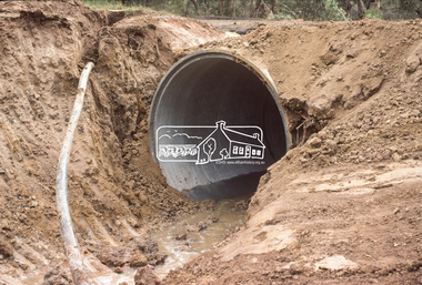
Slide, Culvert construction: Greens Road, Arthurs Creek, 19 Jun. 1981
... Culvert construction / drainage operations undertaken throughout the Shire of Eltham - Greens Road near intersection of Cottlesbridge-Strathewen Road, Arthurs Creek...Culvert construction / drainage operations undertaken throughout the Shire of Eltham - Greens Road near intersection of Cottlesbridge-Strathewen Road, Arthurs Creek culvert infrastructure roadworks arthurs creek cottles bridge-strathewen road greens road 35 mm colour positive transparency (1 of 4) Mount - Kodak Kodachrome Card Culvert construction: Greens Road, Arthurs Creek Slide Slide ...Culvert construction / drainage operations undertaken throughout the Shire of Eltham - Greens Road near intersection of Cottlesbridge-Strathewen Road, Arthurs Creek35 mm colour positive transparency (1 of 4) Mount - Kodak Kodachrome Cardculvert, infrastructure, roadworks, arthurs creek, cottles bridge-strathewen road, greens road -
 Eltham District Historical Society Inc
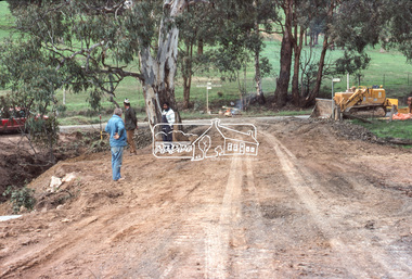
Slide, Culvert construction: Greens Road, Arthurs Creek, 19 Jun. 1981
... Culvert construction / drainage operations undertaken throughout the Shire of Eltham - Greens Road near intersection of Cottlesbridge-Strathewen Road, Arthurs Creek...Culvert construction / drainage operations undertaken throughout the Shire of Eltham - Greens Road near intersection of Cottlesbridge-Strathewen Road, Arthurs Creek culvert infrastructure roadworks arthurs creek cottles bridge-strathewen road greens road 35 mm colour positive transparency (1 of 4) Mount - Kodak Kodachrome Card Culvert construction: Greens Road, Arthurs Creek Slide Slide ...Culvert construction / drainage operations undertaken throughout the Shire of Eltham - Greens Road near intersection of Cottlesbridge-Strathewen Road, Arthurs Creek35 mm colour positive transparency (1 of 4) Mount - Kodak Kodachrome Cardculvert, infrastructure, roadworks, arthurs creek, cottles bridge-strathewen road, greens road -
 Eltham District Historical Society Inc
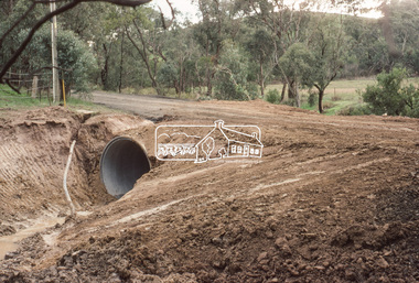
Slide, Culvert construction: Greens Road, Arthurs Creek, 19 Jun. 1981
... Culvert construction / drainage operations undertaken throughout the Shire of Eltham - Greens Road near intersection of Cottlesbridge-Strathewen Road, Arthurs Creek...Culvert construction / drainage operations undertaken throughout the Shire of Eltham - Greens Road near intersection of Cottlesbridge-Strathewen Road, Arthurs Creek culvert infrastructure roadworks arthurs creek cottles bridge-strathewen road greens road 35 mm colour positive transparency (1 of 4) Mount - Kodak Kodachrome Card Culvert construction: Greens Road, Arthurs Creek Slide Slide ...Culvert construction / drainage operations undertaken throughout the Shire of Eltham - Greens Road near intersection of Cottlesbridge-Strathewen Road, Arthurs Creek35 mm colour positive transparency (1 of 4) Mount - Kodak Kodachrome Cardculvert, infrastructure, roadworks, arthurs creek, cottles bridge-strathewen road, greens road -
Eltham District Historical Society Inc
Document - Folder, Phillips, Dr
... Dr Phillips had land on Aitken's Creek, near Arthur's Creek by the Greensborough Road where gold had been found in 1864. ...Dr Phillips had land on Aitken's Creek, near Arthur's Creek by the Greensborough Road where gold had been found in 1864. ...Dr Phillips had land on Aitken's Creek, near Arthur's Creek by the Greensborough Road where gold had been found in 1864. Contents Photocopies: Victorian Parliamentary Papers, 1864-1865, Vol, 3, No. 22, "Reports of Collectors of Agricultural Statistics", pp95-96.Newspaper clippings, A4 photocopies, etcdr phillips, greensborough road, kangaroo ground, tarrawarra, arthur's creek, county of evelyn, warrandyte -
 Eltham District Historical Society Inc
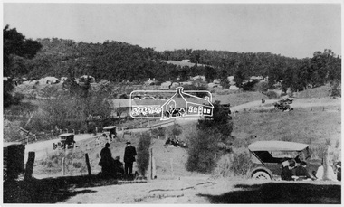
Negative - Photograph, Popular Picnicing at Hurstbridge, c.1925
... It is believed the picture is taken at the northwest corner of the intersection of Wattletree Road and Hurstbridge-Arthurs Creek Road looking southeast towards the township (most likely where the house is located on the property of what is today No. 2 Wattletree Road)- https://goo.gl/maps/VDorwCe1rJJUapjE6 According to a comment by Jean Verso (via @nillumbikcouncil FB page 3 Jan 2020) - "This view is from Wattle Tree Road with Haleys Gully Road to the right and across the creek to William Gray's nursery at Allwood. ...It is significant in being the first community sourced collection representing the places and people of the Shire's first one hundred years. 1925 dorset house fawkner crescent haleys gully road hurstbridge hurstbridge-arthurs creek road picnic postcards shire of eltham pioneers photograph collection valley view road wattle valley estate wattletree road exhibition yprl 2019-12 Digital image 4 x 5 inch B&W Neg Popular Picnicing at Hurstbridge Negative Photograph ...Picnickers enjoying a Sunday outing near the Wattle Valley Estate at Hurstbridge. Copied from brochure "Wattle Valley Estate". It is believed the picture is taken at the northwest corner of the intersection of Wattletree Road and Hurstbridge-Arthurs Creek Road looking southeast towards the township (most likely where the house is located on the property of what is today No. 2 Wattletree Road)- https://goo.gl/maps/VDorwCe1rJJUapjE6 According to a comment by Jean Verso (via @nillumbikcouncil FB page 3 Jan 2020) - "This view is from Wattle Tree Road with Haleys Gully Road to the right and across the creek to William Gray's nursery at Allwood. The building to the far left looks like Dorset House. The building on the left in the middle distance is still there today and has been used for storage and as a stable/tack room for a number of years." The Wattle Valley Estate was first advertised in August 1925 as weekend building allotments by the Greater Melbourne Land and Development Company. Advertised from £28.10.0 or £60 per block. In August 1926, 30 picked allotments of 60x150 feet were put up for auction Saturday August 14, 1926 with frontages to Valley View Road and Fawkner Crescent advertised in the “Heart of the Glorious Wattle Country” and “Within 15 Minutes of the Newly Electrified Railway Station”. The Advertiser on August 13, 1926 in an article promoting the auction stated “the estate is regarded as one of the best in the district, and will be sold practically without reserve.” It is noted that an advertisement running in The Argus February 22, 1951 offered the remaining 16 blocks for sale at £12.10.0 or £200 the lot. By March 7, the remaining blocks were advertised at £17.10.0 The Wattle Valley Estate took over 20 years to sell and then people could not build on them Cross Ref EDHS_02665 Rose Series Postcard P. 4341, "View at Hurstbridge, Vic." Also, other images from sales brochure SEPP_1055 / 1056This photo forms part of a collection of photographs gathered by the Shire of Eltham for their centenary project book,"Pioneers and Painters: 100 years of the Shire of Eltham" by Alan Marshall (1971). The collection of over 500 images is held in partnership between Eltham District Historical Society and Yarra Plenty Regional Library (Eltham Library) and is now formally known as the 'The Shire of Eltham Pioneers Photograph Collection.' It is significant in being the first community sourced collection representing the places and people of the Shire's first one hundred years.Digital image 4 x 5 inch B&W Neg1925, dorset house, fawkner crescent, haleys gully road, hurstbridge, hurstbridge-arthurs creek road, picnic, postcards, shire of eltham pioneers photograph collection, valley view road, wattle valley estate, wattletree road, exhibition yprl 2019-12 -
 Eltham District Historical Society Inc
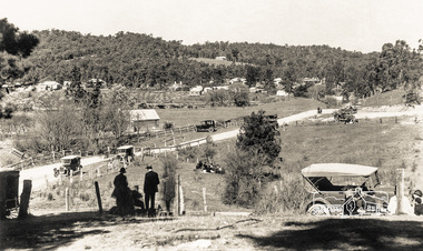
Photograph - Postcard, Rose Stereograph Company, View at Hurstbridge, Vic, c.1925
... It is believed the picture is taken at the northwest corner of the intersection of Wattletree Road and Hurstbridge-Arthurs Creek Road looking southeast towards the township (most likely where the house is located on the property of what is today No. 2 Wattletree Road)- https://goo.gl/maps/VDorwCe1rJJUapjE6 According to a comment by Jean Verso (via @nillumbikcouncil FB page 3 Jan 2020) - "This view is from Wattle Tree Road with Haleys Gully Road to the right and across the creek to William Gray's nursery at Allwood. ...It is believed the picture is taken at the northwest corner of the intersection of Wattletree Road and Hurstbridge-Arthurs Creek Road looking southeast towards the township (most likely where the house is located on the property of what is today No. 2 Wattletree Road)- https://goo.gl/maps/VDorwCe1rJJUapjE6 According to a comment by Jean Verso (via @nillumbikcouncil FB page 3 Jan 2020) - "This view is from Wattle Tree Road with Haleys Gully Road to the right and across the creek to William Gray's nursery at Allwood. ...Rose Series Postcard P. 4341 “View at Hurstbridge, Vic.” Picnickers enjoying a Sunday outing near the Wattle Valley Estate at Hurstbridge. Copied from brochure "Wattle Valley Estate". It is believed the picture is taken at the northwest corner of the intersection of Wattletree Road and Hurstbridge-Arthurs Creek Road looking southeast towards the township (most likely where the house is located on the property of what is today No. 2 Wattletree Road)- https://goo.gl/maps/VDorwCe1rJJUapjE6 According to a comment by Jean Verso (via @nillumbikcouncil FB page 3 Jan 2020) - "This view is from Wattle Tree Road with Haleys Gully Road to the right and across the creek to William Gray's nursery at Allwood. The building to the far left looks like Dorset House. The building on the left in the middle distance is still there today and has been used for storage and as a stable/tack room for a number of years." The Wattle Valley Estate was first advertised in August 1925 as weekend building allotments by the Greater Melbourne Land and Development Company. Advertised from £28.10.0 or £60 per block. In August 1926, 30 picked allotments of 60x150 feet were put up for auction Saturday August 14, 1926 with frontages to Valley View Road and Fawkner Crescent advertised in the “Heart of the Glorious Wattle Country” and “Within 15 Minutes of the Newly Electrified Railway Station”. The Advertiser on August 13, 1926 in an article promoting the auction stated “the estate is regarded as one of the best in the district, and will be sold practically without reserve.” It is noted that an advertisement running in The Argus February 22, 1951 offered the remaining 16 blocks for sale at £12.10.0 or £200 the lot. By March 7, the remaining blocks were advertised at £17.10.0 The Wattle Valley Estate took over 20 years to sell and then people could not build on them Cross Ref SEPP_1057, “Popular Picnicing at Hurstbridge” rcopied from Wattle Valley estate sales brochure.Digital file only Postcards scanned from the collection of Michael Aitken on loan to EDHS, 13 Feb 20181925, dorset house, exhibition yprl 2019-12, fawkner crescent, haleys gully road, hurstbridge, hurstbridge-arthurs creek road, michael aitken collection, picnic, postcards, rose stereograph company, shire of eltham pioneers photograph collection, valley view road, wattle valley estate, wattletree road -
 Eltham District Historical Society Inc
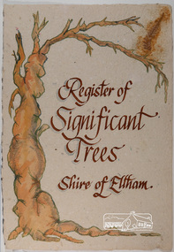
Work on paper - Folio, Register of Significant Trees, Shire of Eltham, c.1993
... Eucalyptus melliadora (Yellow box) . a) An outstanding mature specimen 42 metres high in Laughing Waters Road, Eltham. b) Another mature specimen in Arthurs Creek road, Hurstbridge is reported to be the tree under which the bushranger Robert Bourke was tied after he shot and killed Henry Hurst in 1866 . 2. ...Eucalyptus melliadora (Yellow box) . a) An outstanding mature specimen 42 metres high in Laughing Waters Road, Eltham. b) Another mature specimen in Arthurs Creek road, Hurstbridge is reported to be the tree under which the bushranger Robert Bourke was tied after he shot and killed Henry Hurst in 1866 . 2. ...In 1983, the National Trust advised the Shire of Eltham that it was investigating a number of trees within the shire which had been nominated for recording the Register of Significant Trees of Victoria. The trees involved were described in the Shire of Eltham Historical Society Newsletter No. 29, March 1983 as follows:- 1. Eucalyptus melliadora (Yellow box) . a) An outstanding mature specimen 42 metres high in Laughing Waters Road, Eltham. b) Another mature specimen in Arthurs Creek road, Hurstbridge is reported to be the tree under which the bushranger Robert Bourke was tied after he shot and killed Henry Hurst in 1866 . 2. Quercus robur (English Oak). a) "Donaldson's Oak", Donaldsons Road, Kangaroo Ground was planted by John Donaldson from seed collected from Windsor Great Park in 1878. b) "Wippells Oak". This now misshapen tree is located on the St. Andrews Road near the Kangaroo Ground Fire Station. Its origins may have been similar to Donaldson's Oak, and as a young tree it apparently slipped from higher up the hill during wet weather. Both oaks are of local historical importance. 3. Eucalyptus globulus (Blue Gum). A large mature specimen at the corner of the Kangaroo Ground-St. Andrews Road and Bakehouse Road, Panton Hill. 4. Plantanas acerifolia (Plane tree) A number of trees forming the Avenue of Honour to Eltham's First World War soldiers along Main Road between Dalton and Pitt Streets, Eltham. 5. Pinus canariensis (Canary Island Pine), Pinus pinea, (Stone pine) and Cedras altlantica, (Cedar) These trees are located at the Hurst family graves in the grounds of the Hurstbridge Pre-school Centre. In 1991 the Shire of Eltham introduced controls into its planning scheme to protect sites of architectural, historic or conservation interest and significant trees. The controls were approved by the Minister for Planning and Housing. As advised in the Shire of Eltham Historical Society Newsletter No. 78, May 1991, a planning permit is required to demolish or alter any listed building or to destroy, lop or remove any listed tree. Provision is made for comments to be obtained from the National Trust or Historic Buildings Council in considering any applications. The buildings and trees listed were: Buildings: 250 Bolton Street Eltham (former Walter Withers home) "Rosehill" - Bonds Road Lower Plenty St Andrews Church of England - St Andrews "Montsalvat" - Hillcrest Avenue Eltham St Margarets Church and former vicarage - Pitt Street Eltham Presbyterian Church - Kangaroo Ground Parks and Environment Office (former police quarters) Main Road Eltham Former Court House - Main Road Eltham "Shillinglaw Cottage" - Main Road Eltham "The Robins" - Kangaroo Ground Road Warrandyte Trees: "Donaldsons Oak" - Donaldsons Road Kangaroo Ground Yellow Box - Laughing Waters Road Eltham Yellow Box - Arthurs Creek Road Hurstbridge Wippells Oak - St Andrews Road Kanqaroo Road Pines and Cedar - Hurst family cemetery Greysharps Road Hurstbridge Yellow Box - Parsons Road Eltham A large Blue Gum at Panton Hill has been listed but has recently died (1991). In 1993 work by Council Parks and Environment staff and volunteers resulted in the preparation of a Significant Tree Register listing forty-one trees or groups of trees. According to Shire of Eltham Historical Society Newsletter No. 91, March 1993, a similar number remained to be assessed for inclusion in the register. There is a wide range of indigenous and planted trees on private and public land and extending through the Shire of Eltham from Lower Plenty to Kinglake. Most can be viewed from publicly accessible locations. The Significant Tree Register lists 41 trees or groups of trees throughout the Shire. It contains a wide range of naturally occurring and planted trees. They have been assessed according to eleven criteria including size, age, rarity, historical value and the like. The list includes large old Red Gums at Lower Plenty, historic Oaks at Kangaroo Ground and Mountain Ash at Kinglake. The register includes a set of slides showing each tree. Garry Bartlett of the Council's Parks and Environment Section and Faye Shepherd were extensively involved in establishment of the register (Newsletter No. 93, November 1993). In 1999 Niliumbik planners prepared an amendment to the Planning Scheme to provide protection for approximately 200 of the places listed in the heritage studies and also in the Significant Tree Register commenced by the Eltham Council (Eltham District Historical Society Newsletter No. 127, July 1999. In 2004, The Register of Significant Trees was presented to the Eltham District Historical Society by Nillumbik Shire Council as part of a wider collection of of its memorabilia of the former Eltham Shire Council (EDHS Newsletter No. 159, July 2004. Album of loose handmade paper sheets contained within a handmade slip cover constructed of handcrafted card with encapsulated flora material (flowers, vines, ferns) and tinted. Each page also contains an embedded/adhered fern leaf also tinted with lacqueur or similar, text as appropriate in ink by hand calligraphy. Each page also has a white protective sheet cut to size and adhered to back surface with sticky tape and folded over face of page. Pages variously have photographs and coloured masks adhered with a gum resin. Over time much of this resin has let go and photos/masks have been reattached using acid free archival safe adhesive. 15 pages 41 x 29 cm inclusive of 3 blank pages. Slip case 42 x 30 x 1 cm; face cover of slip case has broken off at left hand margin as insufficient depth/flexibility for contents.arthurs creek road, blue gum (eucalyptus globulus), canary island pine (pinus canariensis), couties road, donaldsons oak, donaldsons road, eltham, english oak (quercus robur), eucalyptus melliodora, graysharps road, hurst tree, hurstbridge, ironbark (eucalyptus tricarpa), ironbark hill, kangaroo ground, kangaroo ground-kinglake road, laughing waters road, panton hill hotel, panton hill, parsons road, significant trees register, sonia van bodegraven, sonjart, stone pine (pinus pinea). atlantic cedar (cedrus atlantica), wippells oak, yellow box gum (eucalyptus melliodora), yellow box gum -
 Eltham District Historical Society Inc
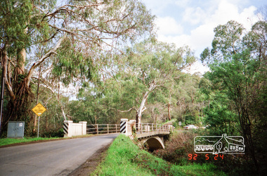
Photograph, Monash Bridge, Arthurs Creek Road, Hurstbridge, Eltham Heritage Tour, 24 May 1992, 24/05/1992
... Highlights of the tour included: - 10 am Leave from Shire Offices - 3 Important Trees - A Physical Link to Eltham's First Settlers - Toorak Mansion Gates - A Surviving Farm House - An Intact Circa 1900 Main Street - First Settlers - Gold Miners, and Timber-getters - An Early Hotel - A Pioneering Homestead - Changing Eltham Shire - 20th Century - 4 pm Afternoon Tea and Finish Tour Extract from ELTHAM CULTURAL HERITAGE TOUR (Newsletter No. 85, July 1992, by Bettina Woodburn) "On the Arthurs Creek Road is a bridge designed by Monash, which we admired before walking across the little park with a mud-brick and timber shelter, to the Hurst family graveyard. ...Road through 'Aussie' bush of towering gums, with bracken and scrubby understorey, the Kinglake National Park, before more open country with deciduous trees planted in line, and a creek lined with willows." Record of the Society's history and activities and highlighting various aspects of the Heritage Study undertaken by David Bick used to create the future heritage overlay for the Shire of Eltham and later Nillumbik Shire. shire of eltham historical society activities heritage tour hurstbridge monash bridge arthurs creek road Kodak Gold 100 5095 Roll of 35mm colour negative film, 4 strips Monash Bridge, Arthurs Creek Road, Hurstbridge, Eltham Heritage Tour, 24 May 1992 Photograph ...ELTHAM HERITAGE TOUR The Society excursion on 24th May 1992 was arranged by David Bick, leader of the team carrying out the Shire's heritage study. David selected a number of sites or buildings identified in the study, some of them lesser known components of the Shire's heritage. The tour commenced at the Eltham Shire Office at 10.00 am. Travel was by private car and mini-bus with stops at about twelve locations for commentary by David.It included a short walk in Hurstbridge and lunch at Kinglake. Highlights of the tour included: - 10 am Leave from Shire Offices - 3 Important Trees - A Physical Link to Eltham's First Settlers - Toorak Mansion Gates - A Surviving Farm House - An Intact Circa 1900 Main Street - First Settlers - Gold Miners, and Timber-getters - An Early Hotel - A Pioneering Homestead - Changing Eltham Shire - 20th Century - 4 pm Afternoon Tea and Finish Tour Extract from ELTHAM CULTURAL HERITAGE TOUR (Newsletter No. 85, July 1992, by Bettina Woodburn) "On the Arthurs Creek Road is a bridge designed by Monash, which we admired before walking across the little park with a mud-brick and timber shelter, to the Hurst family graveyard. There are two marked graves, one, Henry who was shot by Burke the bushranger and a cairn has a plaque listing others buried here from 1866 onwards. Burke was captured and tied to the wheel of a dray under the eucalypt near the waterhose/standpipe. Close by the kindergarten, at this place are three trees on the National Trust Register, a Canary Island pine, a Canadian cedar and probably a spruce. Radiata pines and a thick bolled peppercorn surround the little cemetery. Continuing along Main Street we notice elm trees planted as a war memorial, then on the left a 1930 timber house, a 1910 store and residence, resplendent with wrought iron trim, a double fronted Hardware Store and cypresses on the back alignment of a new vacant block. On the right side of the street is a less interesting attempt at an 'in character' shop. Further on are more early homes, one tucked away at the rear with two tall palms by the front steps. Another curiosity is a rounded veranda corner and there are more galvanised iron sheds or garages, before a mud-brick Dentist's Surgery. Beyond the round-a-about is St Peters Church, of mud-brick construction shared by Catholic and Anglican parishioners, overlooking the river flood plain. Leaving Hurstbridge on the Kinglake Road, we ate our picnic lunch beside the communication tower and enjoyed views of Melbourne, Yan Yean Reservoir and the distant Dandenongs beyond the spreading suburbs. Next we drove to the North West boundary of the Shire at Masons Falls Road towards Whittlesea. On the way to the North East Boundary we passed St Peters, a yellow wooden Church with a Tudor Archway; built in the early 1920's in the style of the 1860's. From the Healesville-Kinglake road the rolling hills had European aspects, the hedged fields and chestnut trees. Then it was back down the Hurstbridge Road through 'Aussie' bush of towering gums, with bracken and scrubby understorey, the Kinglake National Park, before more open country with deciduous trees planted in line, and a creek lined with willows."Record of the Society's history and activities and highlighting various aspects of the Heritage Study undertaken by David Bick used to create the future heritage overlay for the Shire of Eltham and later Nillumbik Shire.Roll of 35mm colour negative film, 4 stripsKodak Gold 100 5095shire of eltham historical society, activities, heritage tour, hurstbridge, monash bridge, arthurs creek road -
 Eltham District Historical Society Inc
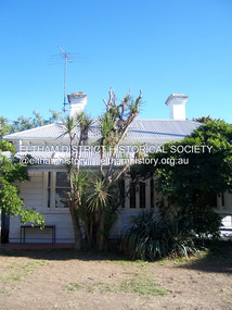
Photograph - Digital Photograph, Alan King, Allwood House, Hurstbridge, 16 April 2008
... The building, one of the district's oldest is situated back from the corner of Arthurs Creek Road and Main Road. Covered under Heritage Overlay, Nillumbik Planning Scheme Published: Nillumbik Now and Then / Marguerite Marshall 2008; photographs Alan King with Marguerite Marshall.; p17 Hurst, who was a surveyor, came to Melbourne in 1852 by default, as on the way to Sydney he contracted typhoid and was off-loaded in Melbourne. ...The building, one of the district's oldest is situated back from the corner of Arthurs Creek Road and Main Road. Covered under Heritage Overlay, Nillumbik Planning Scheme Published: Nillumbik Now and Then / Marguerite Marshall 2008; photographs Alan King with Marguerite Marshall.; p17 Hurst, who was a surveyor, came to Melbourne in 1852 by default, as on the way to Sydney he contracted typhoid and was off-loaded in Melbourne. ...Allwood - built in 1894 by Henry Hurst’s relatives, stands near the site of his house, which was demolisherd in the 1940s. Until 1924 Hurstbridge was known as Allwood. The building, one of the district's oldest is situated back from the corner of Arthurs Creek Road and Main Road. Covered under Heritage Overlay, Nillumbik Planning Scheme Published: Nillumbik Now and Then / Marguerite Marshall 2008; photographs Alan King with Marguerite Marshall.; p17 Hurst, who was a surveyor, came to Melbourne in 1852 by default, as on the way to Sydney he contracted typhoid and was off-loaded in Melbourne. Deciding to settle near Melbourne, he selected some land near the present Eltham railway station and was one of the first to grow crops there.2 But disaster struck again, when his shack was looted and burned, while he was carting goods for sale to nearby goldfields. It was then that Hurstbridge’s first settler, Cornelius Haley, asked Hurst to manage his 160 acres (65ha) grazing property and 9000 acres (3443ha) of leased land where the present Hurstbridge stands. Hurst proved equal to the tough conditions and he and his brother, Fred, cut a track with a bullock team from the property to Romsey, where Haley had selected some land. Hurst also put up a bridge across the creek near his house, after which Hurstbridge was named. He ran the property helped by two ticket-of-leave men and others, several of whom were sailors who had abandoned ship in search of gold, and were working there temporarily. In 1866, only 14 years after coming to Australia, Hurst met an early tragic death. One day a bushranger named Burke came to the house and demanded a horse. Hurst thought the bushranger might be an officer in search of runaway sailors3 and anyway, did not like the look of him, so he refused. A tussle followed and apparently Hurst shot first.4 He was shot and died five hours later from loss of blood. Later, troopers found Burke, who was subsequently hanged. The event is recorded in the Old Melbourne Gaol. The government offered the family £500 but the family refused it as ‘blood money’. Hurst’s father, Robert, even signed a petition against the bushranger’s death, claiming one life did not replace another. Hurst’s family continued to live in the district and saw a rise in their fortunes. They bought Haley’s cattle station and built the present Allwood House, using the original home as an orchard packing shed. The present Victorian style timber house had several outbuildings including a blacksmith’s shop. The property passed on to William Gray, an orchardist and nurseryman, who married Hurst’s grandniece, Frances. The business boomed from the early 1900s when it supplied most of the orchards in the area. Gray was Eltham Shire’s President for two terms and was asked to stand for parliament, but his wife’s illness and other family commitments prevented him from doing so. Then several calamities drove the family to bankruptcy. During World War One, Gray lost more than one million pounds on trees shipped overseas, which the Lloyd’s company had refused to insure. Other factors, including the Great Depression, ruined the family’s fortunes. The land was reduced from more than 640 acres (256ha) to 50 acres (20ha) and the older members married and left. After Mr Gray died, the house was leased, until his daughter Sheila Ferguson and her husband Gordon settled there in 1951, after buying it from other family members. However in 1975 the Shire designated the property as a passive recreation reserve. The Ferguson family sold most of the land, leaving the house on 0.6 hectares.This collection of almost 130 photos about places and people within the Shire of Nillumbik, an urban and rural municipality in Melbourne's north, contributes to an understanding of the history of the Shire. Published in 2008 immediately prior to the Black Saturday bushfires of February 7, 2009, it documents sites that were impacted, and in some cases destroyed by the fires. It includes photographs taken especially for the publication, creating a unique time capsule representing the Shire in the early 21st century. It remains the most recent comprehenesive publication devoted to the Shire's history connecting local residents to the past. nillumbik now and then (marshall-king) collection, hurstbridge, henry hurst, allwood house -
 Eltham District Historical Society Inc
Photograph - Digital Photograph, Alan King, Monash Bridge, Hurstbridge, 23 January 2008
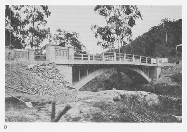
... .; p117 Monash Bridge is considered the Shire’s finest engineered bridge and was constructed by the engineering company of that great Australian, Sir John Monash.1 The bridge spans Diamond Creek on the Hurstbridge-Arthurs Creek Road, linking Hurstbridge with Yarrambat and Arthurs Creek. ....; p117 Monash Bridge is considered the Shire’s finest engineered bridge and was constructed by the engineering company of that great Australian, Sir John Monash.1 The bridge spans Diamond Creek on the Hurstbridge-Arthurs Creek Road, linking Hurstbridge with Yarrambat and Arthurs Creek. ...Monash Bridge spans the Diamond Creek at Hurstbridge. It was built in 1917 for the Shires of Heidelberg, Eltham and Whittlesea. It is considered Nillumbik Shire's finest engineered bridge and was construced by the engineering company of Sir John Monash. Covered under Heritage Overlay, Nillumbik Planning Scheme. Published: Nillumbik Now and Then / Marguerite Marshall 2008; photographs Alan King with Marguerite Marshall.; p117 Monash Bridge is considered the Shire’s finest engineered bridge and was constructed by the engineering company of that great Australian, Sir John Monash.1 The bridge spans Diamond Creek on the Hurstbridge-Arthurs Creek Road, linking Hurstbridge with Yarrambat and Arthurs Creek. Monash Bridge, also called Hurst’s Bridge, was built in 1917, by the Reinforced Concrete and Monier Pipe Construction Company Pty Ltd, for the Shires of Heidelberg, Eltham and Whittlesea. Although Monash was probably in action overseas during World War One when the bridge was designed and constructed, he evolved the basic design in the 1900s and it was a standard design for the firm. However J A Laing, a designer at the firm, was probably the designer, as his initials are on bridge drawings held by the Eltham District Historical Society.2 The bridge is an excellent early Australian example of an open spandrel reinforced concrete arch bridge and has a single span of 29 metres. It is unusual in Victoria, but similar to many reinforced concrete arch bridges in Europe and America, built from the late 19th century. In Victoria, Monash pioneered the use of reinforced concrete – then a revolutionary construction material. His company, Monash & Anderson, had the exclusive licence for the Monier patent for the system of reinforced concrete construction for Victoria and New South Wales. A well-known example of the Monier arch bridge is the Morell Bridge in South Yarra. The sweeping arch of the Monash Bridge combines grace and utility and blends with the surrounding rural landscape. Its design and construction have allowed it to carry increasing volumes of heavy traffic, but in modern times the one lane is considered by some to prevent easy passage through Hurstbridge. However others consider this an asset to deter too much more traffic, which would diminish Hurstbridge’s charming rural character.3 This is the third bridge across the Diamond Creek at this site. The original bridge was a log bridge upstream, constructed in the 1850s by early settler, Henry Hurst, after whom Hurstbridge was named. The bridge spanned the creek, where it divided his family’s property. In the 1880s a timber bridge replaced it, known as Hurst’s Bridge. However a more permanent bridge was considered necessary when the new railway arrived in 1912, bringing with it expectations of growth in the town and the surrounding fruit-growing district. Monash Bridge’s official opening on November 3, 1917 was a gala occasion, which took place before about 1000 spectators. Two who attended the opening had a particularly sound knowledge of the locality. One was Fred Hurst, Henry’s brother, who used to ford the creek at or near the bridge’s site more than 50 years before. The other was John McDonald of Arthurs Creek, who had built the old wooden bridge over the creek about 40 years earlier.4 Although John Monash was a fine engineer, his fame came from his brilliant war career, rather than from his engineering or his many other achievements. Monash was Corps Commander of the Australian Forces. His brilliance was recognised with his awards: Knight Grand Cross of the Order of St. Michael and St. George, and Knight Commander of the Bath. Monash was also decorated by the French, Belgian, and American Governments.5 After the war, Monash worked in many prominent civilian positions, the most notable as head of the Victorian State Electricity Commission. He was a leading and loved public figure, involved in many public and private organisations. He was president of the Australian Zionist Federation and involved in the Boy Scouts. Monash University is named after him. By the 1920s Monash was probably regarded as the greatest living Australian.6 Despite most of his life working as an administrator and leader, rather than a fighting soldier, he became integral to the ANZAC legend. Monash died in 1931.This collection of almost 130 photos about places and people within the Shire of Nillumbik, an urban and rural municipality in Melbourne's north, contributes to an understanding of the history of the Shire. Published in 2008 immediately prior to the Black Saturday bushfires of February 7, 2009, it documents sites that were impacted, and in some cases destroyed by the fires. It includes photographs taken especially for the publication, creating a unique time capsule representing the Shire in the early 21st century. It remains the most recent comprehenesive publication devoted to the Shire's history connecting local residents to the past. nillumbik now and then (marshall-king) collection, hurstbridge, monash bridge -
 Eltham District Historical Society Inc
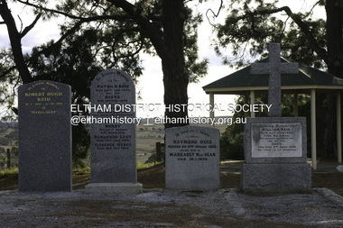
Photograph - Digital Photograph, Alan King, Reid family graves, Arthurs Creek Cemetery, 30 March 2008
... Arthurs Creek Cemetery was originally the private cemetery of pioneers Agnes and Patrick Reid. Published: Nillumbik Now and Then / Marguerite Marshall 2008; photographs Alan King with Marguerite Marshall.; p11 The Hazel Glen property, at Middle Hut Road, Arthurs Creek, which includes one of Victoria’s earliest pioneer buildings, was the forerunner to the Arthurs Creek and Doreen townships. ...Arthurs Creek Cemetery was originally the private cemetery of pioneers Agnes and Patrick Reid. Published: Nillumbik Now and Then / Marguerite Marshall 2008; photographs Alan King with Marguerite Marshall.; p11 The Hazel Glen property, at Middle Hut Road, Arthurs Creek, which includes one of Victoria’s earliest pioneer buildings, was the forerunner to the Arthurs Creek and Doreen townships. ...The Arthurs Creek Cemetery was originally the private cemetery of pioneers Agnes and Patrick Reid. Published: Nillumbik Now and Then / Marguerite Marshall 2008; photographs Alan King with Marguerite Marshall.; p11 The Hazel Glen property, at Middle Hut Road, Arthurs Creek, which includes one of Victoria’s earliest pioneer buildings, was the forerunner to the Arthurs Creek and Doreen townships. At one time the Doreen Post Office and school were called Hazel Glen. The Hazel Glen State School No 945, before it was moved to its present site, stood on land to the south of Chapel Lane, which had been donated by Hazel Glen owner, William Reid. In May 1895 the post office was renamed Doreen to avoid confusion with the Reid’s address. The Arthurs Creek Cemetery was originally the private cemetery of Hazel Glen pioneers Agnes and Patrick Reid. The Reids with their eight children, arrived in Melbourne in April 1839. In 1844 Patrick Reid took over the licence to the Stewart Ponds run of 5120 acres (2072ha). Reid renamed it Hazel Glen, after Hazelden, the name of the Reid estate at Mearns in Renfrewshire, Scotland. Reid built a small cottage from local stone and hand-made bricks, with walls one yard (91 cm) thick, a flagstone floor and a shingle roof. Today two rooms and a store room survive as part of a larger house. Agnes died in 1847 aged 49, and was buried on a hill overlooking Hazel Glen, where it is said she had asked to be buried as it had been a favourite picnic spot.2 In 1858 Patrick died aged 74, and was buried near her. Their son William was to become Whittlesea Shire’s first president. From 1868 he was a Whittlesea Roads Board member, then a shire councillor until shortly before his death in 1923 aged 88. In 1865 the Reid’s burial area was no longer on their property, so it was declared a cemetery site. In 1867 it became the Linton Public Cemetery, being in the Linton Parish. However, to avoid confusion with Linton near Ballarat, the cemetery was renamed the Arthurs Creek Public Cemetery in 1926. Arthurs Creek was named after Henry Arthur, a pastoralist and public servant, who ran 1000 sheep lower down the Creek, from 1836 to 1841. It is believed he built his home at the end of today’s Challenger Street in Diamond Creek.This collection of almost 130 photos about places and people within the Shire of Nillumbik, an urban and rural municipality in Melbourne's north, contributes to an understanding of the history of the Shire. Published in 2008 immediately prior to the Black Saturday bushfires of February 7, 2009, it documents sites that were impacted, and in some cases destroyed by the fires. It includes photographs taken especially for the publication, creating a unique time capsule representing the Shire in the early 21st century. It remains the most recent comprehenesive publication devoted to the Shire's history connecting local residents to the past. agnes reid, arthurs creek cemetery, nillumbik now and then (marshall-king) collection, patrick reid, reid family -
 Upper Yarra Museum
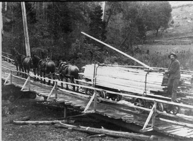
Negative Photographic Reproduction, Arthur Witnish's horse team hauling timber across bridge over Black Sands Creek, 14.2.1983
... bridge timber arthur witnish horse team tramway black sands creek timber truck gladysdale Black and white negative of Arthur Witnish's horse team hauling timber across bridge on Black Sands Road. ...Black and white negative of Arthur Witnish's horse team hauling timber across bridge on Black Sands Road. Negative Black white. Scanned at 600 dpibridge, timber, arthur witnish, horse team, tramway, black sands creek, timber truck, gladysdale -
 Ringwood and District Historical Society
Photographs, Collection of Pollard Photographs, Ringwood (Undated -probably early 1900's). Also Woods Point 1900, circa 1900
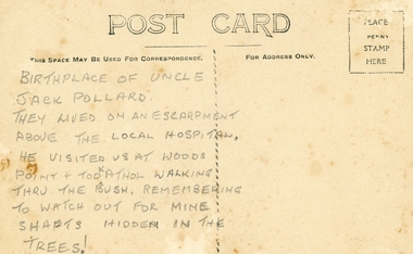
... Creek Road Road, and now Warrandyte Road).; 2. One bushel net apples, J Pollard, Victoria, Australia.; 3. Joseph and Emma Pollard and Family. Emma is nursing baby Ethyl.; 4. Ringwood PS photograph. Jack Pollard is second from the RHS in the back row.; 5. Woods Point with arrow indicating mine manager's house: that of Joseph Pollard. Circa 1900. The Pollard family had a 20 acre orcharding property between Mullum Mullum Road and Wonga Road. Given on 4th September 2010 by Arthur...Creek Road Road, and now Warrandyte Road).; 2. One bushel net apples, J Pollard, Victoria, Australia.; 3. Joseph and Emma Pollard and Family. Emma is nursing baby Ethyl.; 4. Ringwood PS photograph. Jack Pollard is second from the RHS in the back row.; 5. Woods Point with arrow indicating mine manager's house: that of Joseph Pollard. Circa 1900. The Pollard family had a 20 acre orcharding property between Mullum Mullum Road and Wonga Road. Given on 4th September 2010 by Arthur ...Pollard Photographs:; 1. Back of postcard of the Pollard home in Wonga Road (also called Anderson Creek Road Road, and now Warrandyte Road).; 2. One bushel net apples, J Pollard, Victoria, Australia.; 3. Joseph and Emma Pollard and Family. Emma is nursing baby Ethyl.; 4. Ringwood PS photograph. Jack Pollard is second from the RHS in the back row.; 5. Woods Point with arrow indicating mine manager's house: that of Joseph Pollard. Circa 1900. The Pollard family had a 20 acre orcharding property between Mullum Mullum Road and Wonga Road. Given on 4th September 2010 by Arthur Lunt from his cousin. The Pollard family. School photo at Ringwood State School. Jack�s father was Joseph � land (orchard) between Mullum and Wonga Roads +Additional Keywords: Pollard -
 Greensborough Historical Society
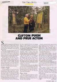
Newspaper Clipping, Jane Freeman, Clifton Pugh and Prue Acton, by Jane Freeman, 20/08/1989
... Clifton Pugh lived at 'Dunmoochin' on the Cottles Bridge-Strathewen Road between Hurstbridge and Arthur's Creek....Clifton Pugh lived at 'Dunmoochin' on the Cottles Bridge-Strathewen Road between Hurstbridge and Arthur's Creek. clifton pugh prue acton painters hurstbridge Text and col. photograph Clifton Pugh and Prue Acton, by Jane Freeman Newspaper Clipping Jane Freeman Sun Herald ...Relationship between Clifton Pugh and Prue Acton based on their common interest in painting. Clifton Pugh lived at 'Dunmoochin' on the Cottles Bridge-Strathewen Road between Hurstbridge and Arthur's Creek.Text and col. photographclifton pugh, prue acton, painters, hurstbridge -
 Greensborough Historical Society
Photograph - Photograph (Framed), St Helena and Diamond Creek Roads Greensborough 1889, 1889
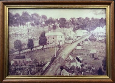
... Creek Roads. This copy has been cropped from the original to show lower Main Street and Marble hall. The original of this painting is owned by Greensborough Primary School. From the John Mackey collection. this item was displayed at the offices of Ryan, Mackey and Kelly, solicitors, Main Street Greensborough. greensborough main street greensborough marble hall greensborough arthur elliott John Mackey Small timber-framed photograph of road and houses, sepia. ...A view of Greensborough township 1889, painted from the corner of St Helena Road and Diamond Creek Roads. This copy has been cropped from the original to show lower Main Street and Marble hall. The original of this painting is owned by Greensborough Primary School.From the John Mackey collection. this item was displayed at the offices of Ryan, Mackey and Kelly, solicitors, Main Street Greensborough.Small timber-framed photograph of road and houses, sepia.greensborough, main street greensborough, marble hall greensborough, arthur elliott, john mackey -
 Eltham District Historical Society Inc
Journal - Newsletter, Shire of Eltham, Shire of Eltham newsletter, 1979
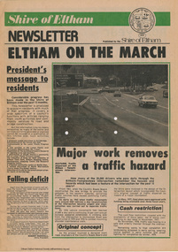
... arthur's creek...fitzsimons lane...main road...Subjects include President's message, Eltham-templestowe intersection, indoor recreational centre, Bridge over Watsons Creek, town square, list of councillors, forward planning, recreational faciliaites including Eltham town park, Hurstbridge hall, roads, community welfare services, eltham Community and reception centre opening, amenities for youth, concrete bridge at Arthurs creek and Mitton's Bridge at St Andrew's ...Subjects include President's message, Eltham-templestowe intersection, indoor recreational centre, Bridge over Watsons Creek, town square, list of councillors, forward planning, recreational faciliaites including Eltham town park, Hurstbridge hall, roads, community welfare services, eltham Community and reception centre opening, amenities for youth, concrete bridge at Arthurs creek and Mitton's Bridge at St Andrew's harry gilham collection intersection round-about recreation recreational centre watsons creek town square councilors newsletter planning parks hurstbridge hall community welfare service roads eltham community and reception centre youth skateboard track mitton's bridge arthur's creek fitzsimons lane main road road construction rondabout Newsprint, 4 pages Shire of Eltham newsletter Journal Newsletter Shire of Eltham ...Articles, some with photos. Subjects include President's message, Eltham-templestowe intersection, indoor recreational centre, Bridge over Watsons Creek, town square, list of councillors, forward planning, recreational faciliaites including Eltham town park, Hurstbridge hall, roads, community welfare services, eltham Community and reception centre opening, amenities for youth, concrete bridge at Arthurs creek and Mitton's Bridge at St Andrew's Newsprint, 4 pages harry gilham collection, intersection, round-about, recreation, recreational centre, watsons creek, town square, councilors, newsletter, planning, parks, hurstbridge hall, community welfare service, roads, eltham community and reception centre, youth, skateboard track, mitton's bridge, arthur's creek, fitzsimons lane, main road, road construction, rondabout -
 Eltham District Historical Society Inc
Work on paper (Sub-Item) - Photograph, Arthurs Creek Road Bridge, Hurstbridge, 1885
... Black and white photograph. bridge Hurstbridge Image printed on A4 page from 04997 Diamond Creek Basin Study, 1980 Arthurs Creek Road Bridge, Hurstbridge, 1885 Work on paper Photograph ...Black and white photograph.bridge, hurstbridge -
 Eltham District Historical Society Inc
Work on paper (Sub-Item) - Photograph, Monash Bridge, Arthurs Creek Road, Hurstbridge, 1917
... Black and white photograph of the new bridge opened in 1917. bridge hurstbridge Image printed on A4 page from 04997 Diamond Creek Basin Study, 1980 Monash Bridge, Arthurs Creek Road, Hurstbridge, 1917 Work on paper Photograph ...Black and white photograph of the new bridge opened in 1917.bridge, hurstbridge
