Showing 13 items matching "beechwoth"
-
 Rutherglen Historical Society
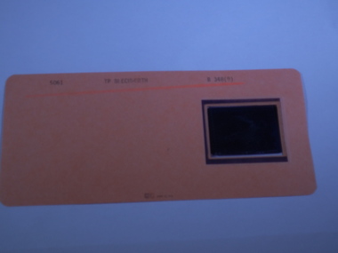
Aperture Card microfilm, Victorian Land Tiltes Office, Town Plan Beechwoth
... Town Plan Beechwoth...Rutherglen Historical Society Murray Street Rutherglen high-country Town layout of Beechworth plan town boundries lots roads card with a single microfilm insert Town Plan Beechwoth Aperture Card microfilm Victorian Land Tiltes Office ...Town layout of Beechworthcard with a single microfilm insertplan, town, boundries, lots, roads -
 Rutherglen Historical Society
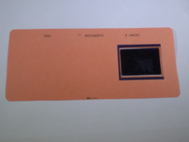
Aperture Card microfilm, Victorian Land Tiltes Office, Town Plan Beechwoth
... Town Plan Beechwoth...Rutherglen Historical Society Murray Street Rutherglen high-country Town layout of Beechworth plan town boundries lots roads card with a single microfilm insert Town Plan Beechwoth Aperture Card microfilm Victorian Land Tiltes Office ...Town layout of Beechworthcard with a single microfilm insertplan, town, boundries, lots, roads -
 Rutherglen Historical Society
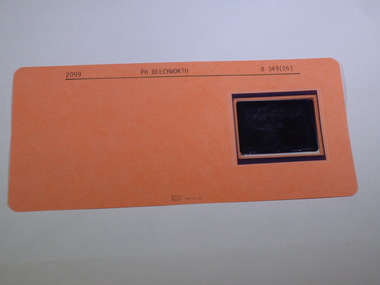
Aperture Card microfilm, Victorian Land Tiltes Office, Parish Plan Beechwoth
... Parish Plan Beechwoth...Rutherglen Historical Society Murray Street Rutherglen high-country Town layout of Beechworth plan town boundries lots roads card with a single microfilm insert Parish Plan Beechwoth Aperture Card microfilm Victorian Land Tiltes Office ...Town layout of Beechworthcard with a single microfilm insertplan, town, boundries, lots, roads -
 Rutherglen Historical Society
Aperture Card microfilm, Victorian Land Tiltes Office, Town Plan Beechwoth
... Town Plan Beechwoth...Rutherglen Historical Society Murray Street Rutherglen high-country Town layout of Beechworth plan town boundries lots roads card with a single microfilm insert Town Plan Beechwoth Aperture Card microfilm Victorian Land Tiltes Office ...Town layout of Beechworthcard with a single microfilm insertplan, town, boundries, lots, roads -
 Rutherglen Historical Society
Aperture Card microfilm, Victorian Land Tiltes Office, Parish Plan Beechwoth
... Parish Plan Beechwoth...Rutherglen Historical Society Murray Street Rutherglen high-country Town layout of Beechworth plan town boundries lots roads card with a single microfilm insert Parish Plan Beechwoth Aperture Card microfilm Victorian Land Tiltes Office ...Town layout of Beechworthcard with a single microfilm insertplan, town, boundries, lots, roads -
 Rutherglen Historical Society
Aperture Card microfilm, Victorian Land Tiltes Office, Parish Plan Beechwoth
... Parish Plan Beechwoth...Rutherglen Historical Society Murray Street Rutherglen high-country Town layout of Beechworth plan town boundries lots roads card with a single microfilm insert Parish Plan Beechwoth Aperture Card microfilm Victorian Land Tiltes Office ...Town layout of Beechworthcard with a single microfilm insertplan, town, boundries, lots, roads -
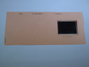 Rutherglen Historical Society
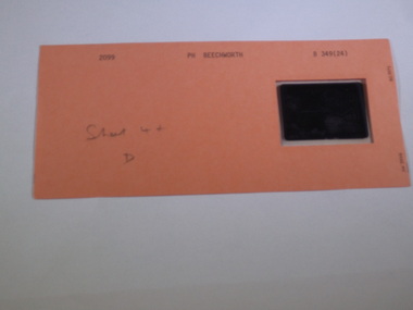
Aperture Card microfilm, Victorian Land Tiltes Office, Parish Plan Beechwoth, 5/06/1990
... Parish Plan Beechwoth...Rutherglen Historical Society Murray Street Rutherglen high-country Town layout of Beechworth plan town boundries lots roads card with a single microfilm insert Parish Plan Beechwoth Aperture Card microfilm Victorian Land Tiltes Office ...Town layout of Beechworthcard with a single microfilm insertplan, town, boundries, lots, roads -
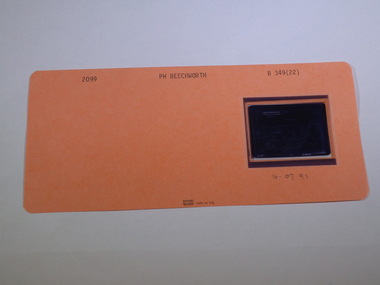 Rutherglen Historical Society
Aperture Card microfilm, Victorian Land Tiltes Office, Parish Plan Beechwoth, 4/07/1991
... Parish Plan Beechwoth...Rutherglen Historical Society Murray Street Rutherglen high-country Town layout of Beechworth plan town boundries lots roads card with a single microfilm insert Parish Plan Beechwoth Aperture Card microfilm Victorian Land Tiltes Office ...Town layout of Beechworthcard with a single microfilm insertplan, town, boundries, lots, roads -
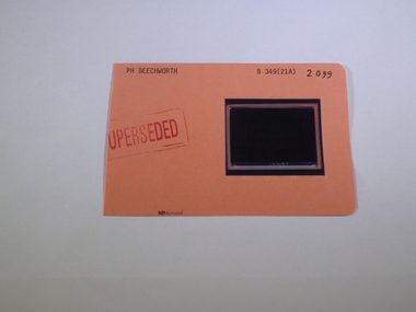 Rutherglen Historical Society
Aperture Card microfilm, Victorian Land Tiltes Office, Parish Plan Beechwoth (Superseded)
... Parish Plan Beechwoth (Superseded)...Rutherglen Historical Society Murray Street Rutherglen high-country Town layout of Beechworth plan town boundries lots roads card with a single microfilm insert Parish Plan Beechwoth (Superseded) Aperture Card microfilm Victorian Land Tiltes Office ...Town layout of Beechworthcard with a single microfilm insertplan, town, boundries, lots, roads -
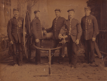 The Beechworth Burke Museum
Photograph, 1886
... Lloyd / Reverse: 97.22 / 84-253-1 / BMMA3123 Members of Beechwoth Fire Brigade 1886...Lloyd / Reverse: 97.22 / 84-253-1 / BMMA3123 Members of Beechwoth Fire Brigade 1886 Sepia rectangular photograph printed on photographic paper and mounted on card Photograph Photograph ...Photograph of the winners of the six-men hose and reel event in Sandhurst on the 10th March 1886. There are 5 men pictured in the photograph all wearing dress uniforms and medals posing with a hand-drawn hose reel and stand pipe. Pictured from left to right: J. Scott / G. Duncan / C. Ellen / J. Anderson / F. Lloyd /. This photograph was take by James E. Bray (1832-1891).Sepia rectangular photograph printed on photographic paper and mounted on cardObverse: Winners of the six-men hose and reel event, Sandhurst, March 10th 1986 / Prize: Fifty Guinea Hose Reel/ J.E Bray Photo / J.Payne (absent) , J. Scott / G. Duncan / C. Ellen / J. Anderson / F. Lloyd / Reverse: 97.22 / 84-253-1 / BMMA3123 Members of Beechwoth Fire Brigade 1886emergency services, beechworth, sandhurst, burke museum, photograph, fire brigade, fire -
 The Beechworth Burke Museum
Geological specimen - Coorongite
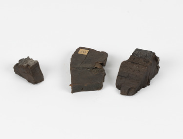
... ...beechwoth...Many of these specimens were sent to research and collecting organisations across Australia, including the Burke Museum, to educate and encourage further study. burke museum beechwoth indigo shire beechworth museum geological geological specimen mineraology coorong coorong river kurangk ngarrindjeri south australia coorongite coorongite specimen Specimen 245 page 69 / in Descriptive Register / "Elcestic Bitumen, / Coorangite" South of / Coorung River, South Australia . / C. ...Coorongite is a dark, rubber-like, highly resilient structureless algal deposit. In the Coorong district of South Australia it occurs in moderate quantities associated with the coastal swamps and sand dunes which extend for a considerable distance east of the mouth of the Murray. This particular specimen was recovered from the south of the Coorong River, South Australia. A type of sediment rich in organic matter, Coorongite is the unlithified end-member of the sapropelic coal series. The members of the sapropelic coal series can be ranked in order as sapropel (the unlithified form), sapropelic-lignite, and sapropelic-coal (the lithified forms) based on increasing carbon content and decreasing volatile content. Sapropel (Coorongite) is an unlithified dark, pulpy, fine organic mud containing concentrations of algae and miospores that are more or less identifiable. Coorongite is typically found as an algae like substance, that can be found in irregular size pieces. Coorongite was believed to be dried up oil due to its rubber-like texture. The Coorongite is also soft to the point where it can be cut into with a knife or it can be broken and torn by hand. Otherwise known as 'Kurangk', the Coorong River is home to the Ngarrindjeri people, which acts as both a place for gathering food and a spiritual place. In 1852 the first sight of Coorongite was found along the Coorong River. The finders mistook the Coorongite for dried up oil, which lead to the belief that there were oil reserves under the Coorong River. Between the 1860s and the 1930s the Coorong River became a place where mining oil and Coorongite became precedent. Nowadays, the local council and the South Australian Government are working together with the Ngarrindjeri people to sustain and preserve the Coorong River and the culture that is with it. Soon after gold was discovered in 1851, Victoria’s Governor La Trobe wrote to the Colonial Office in London, urging ‘the propriety of selecting and appointing as Mineral Surveyor for this Colony a gentleman possessed of the requisite qualifications and acquaintance with geological science and phenomena’. Alfred Selwyn was appointed geological surveyor in Australia in 1852 which began the Geological Survey of Victoria. Selwyn went on to collect geological samples and catalogue thousands of specimens around Australia. In 1853-69 the Geological Survey issued under Selwyn's direction sixty-one geological maps and numerous reports; they were of such high standard that a writer in the Quarterly Journal of the Geological Society of London bracketed the survey with that of the United States of America as the best in the world. During his years spent in Australia, Selwyn collected numerous significant geological specimens, examples of which are held in collections such as the Burke Museum.Coorongite is considered to be a mineral with a unique texture, where it can be both hard and soft. Coorongite can also be considered to be a rare mineral, as it is only located along the Coorong River and due to the mining of it, has left very few sources. It was believed at one point that Coorongite could be used to replace oil. This specimen is part of a larger collection of geological and mineral specimens collected from around Australia (and some parts of the world) and donated to the Burke Museum between 1868-1880. A large percentage of these specimens were collected in Victoria as part of the Geological Survey of Victoria that begun in 1852 (in response to the Gold Rush) to study and map the geology of Victoria. Collecting geological specimens was an important part of mapping and understanding the scientific makeup of the earth. Many of these specimens were sent to research and collecting organisations across Australia, including the Burke Museum, to educate and encourage further study.Three solid varyingly hand-sized pieces of wooden appearing organic matter derived from the river in the Coorong District in South Australia. A rubber-like, highly resilient structureless algal deposit.Specimen 245 page 69 / in Descriptive Register / "Elcestic Bitumen, / Coorangite" South of / Coorung River, South Australia . / C. WIllman / 15/4/21burke museum, beechwoth, indigo shire, beechworth museum, geological, geological specimen, mineraology, coorong, coorong river, kurangk, ngarrindjeri, south australia, coorongite, coorongite specimen -
 Wooragee Landcare Group
Photograph, 2004
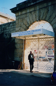
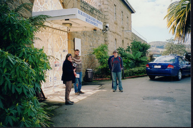
... Wooragee Wooragee Landcare Wooragee Landcare Group beechworth prison h.m beechworth prison beechwoth gaol ned kelly greg johnson agriculture victoria Department of Primary Industries DPI Reverse: WAN NA E0NA0N2. ...This photo was taken in 2004 and pictures Greg Johnson, who worked at Agriculture Victoria (formerly known as the Department of Primary Industries, DPI), outside Beechworth Prison. This was the last year Wooragee Landcare Group met with Beechworth Prison Farm and Industry Managers at the prison itself, where they discussed weed and rabbit control on the prison's 'Rockery' block. The weed and rabbit controls that were explored in this event aimed to educate people on how to manage common pests in the Wooragee landscape and improve the appearance of the Beechworth Prison. The Beechworth prison itself is significant as it was built between 1859 and 1864 and is designed using a radiating 'panopticon' method which had proved an efficient, cost-effective design for easy surveillance of prisoners by allowing guards to watch over a large area from a central observation point. The prison is historically significant for its association with the early development of Beechworth as the government administrative centre of north-eastern Victoria. It is part of a major precinct of public buildings and has links to numerous other places in Beechworth which used granite quarried and broken at the prison by male inmates. It is also significant for its associations with the bushranger Ned Kelly and the Kelly storyThe photo holds significance due to the social and educational context the image holds in representing the events Wooragee Landcare Group held in order to educate the public. The photograph also exemplifies the historic significance of the area due to the Beechworth Prison's relation to important historical eras and events.Portrait coloured photograph printed on gloss paperReverse: WAN NA E0NA0N2. NNN- 3 2906 / [PRINTED] (No.13) / 868wooragee, wooragee landcare, wooragee landcare group, beechworth prison, h.m beechworth prison, beechwoth gaol, ned kelly, greg johnson, agriculture victoria, department of primary industries, dpi -
 Wooragee Landcare Group
Photograph, 2004
... Wooragee Wooragee Landcare Wooragee Landcare Group beechworth prison h.m beechworth prison beechwoth gaol ned kelly greg johnson agriculture victoria Department of Primary Industries DPI Reverse: WAN NA E0NA0N2. ...This photo was taken in 2004 and pictures Luke Bailey and Glen Scholfield, the Wooragee Landcare Group coordinator, outside Beechworth Prison. This was the last year Wooragee Landcare Group met with Beechworth Prison Farm and Industry Managers at the prison itself, where they discussed weed and rabbit control on the prison's 'Rockery' block. The weed and rabbit controls that were explored in this event aimed to educate people on how to manage common pests in the Wooragee landscape and improve the appearance of the Beechworth Prison. The Beechworth prison itself is significant as it was built between 1859 and 1864 and is designed using a radiating 'panopticon' method which had proved an efficient, cost-effective design for easy surveillance of prisoners by allowing guards to watch over a large area from a central observation point. The prison is historically significant for its association with the early development of Beechworth as the government administrative centre of north-eastern Victoria. It is part of a major precinct of public buildings and has links to numerous other places in Beechworth which used granite quarried and broken at the prison by male inmates. It is also significant for its associations with the bushranger Ned Kelly and the Kelly storyThe photo holds significance due to the social and educational context the image holds in representing the events Wooragee Landcare Group held in order to educate the public. The photograph also exemplifies the historic significance of the area due to the Beechworth Prison's relation to important historical eras and events.Landscape coloured photograph printed on gloss paperReverse: WAN NA E0NA0N2. NN1- 1 2906 / [PRINTED] (No.15) / 870wooragee, wooragee landcare, wooragee landcare group, beechworth prison, h.m beechworth prison, beechwoth gaol, ned kelly, greg johnson, agriculture victoria, department of primary industries, dpi