
Showing 149 items matching "black river group"
-
 Marysville & District Historical Society
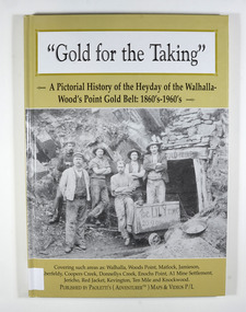
Book - Hardcover book, Gold for the Taking-A Pictorial History of the Heyday of the Walhalla-Wood's Point Gold Belt: 1860's-1960's, 2007
... ...black river group...A pictorial history of the heyday of the Walhalla-Wood's Point gold belt in the 1860's-1960's gold gold fields gold mining a1 mine settlement aberfeldy beardmore black river group coopers creek donnellys creek enochs point fulton creek gaffneys creek gooleys creek jamieson jordan valley kevington knockwood matlock ten mile walhalla wood's point history victoria Stamp of the Marysville & District Historical Society Inc / P.O. ...A pictorial history of the heyday of the Walhalla-Wood's Point gold belt in the 1860's-1960'sHardcover. The cover is a gold colour. The front cover has a photograph of a group of miners in front of the entry to a mine. On the top entry timber piece is a sign saying "Old Mine". The beginning of the wording is obscured by one of the miners standing in front of the entry. There is also an old mining trolley standing on tracks which lead into the mine.There is also an old gold mining dish sitting on a rock to the left of the entry into the mine.On the back cover is a photograph of Walhalla in modern times as well as a photograph of the publisher of this book. There is also a blurb about the publisher.Stamp of the Marysville & District Historical Society Inc / P.O. Box 22 / Marysville 3779gold, gold fields, gold mining, a1 mine settlement, aberfeldy, beardmore, black river group, coopers creek, donnellys creek, enochs point, fulton creek, gaffneys creek, gooleys creek, jamieson, jordan valley, kevington, knockwood, matlock, ten mile, walhalla, wood's point, history, victoria -
 Federation University Historical Collection
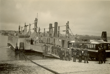
Photograph - Photograph - Black and White, St. Hilda's Bus and band members boarding the Torpoint Ferry, on the River Tamar, 1934
... Black and white photograph of an early 1930's bus boarding a vehicle and passenger chain ferry. A group on men dressed in a band uniform are standing and watching the bus's progress. Land can be seen on both sides of the Tamar River...Black and white photograph of an early 1930's bus boarding a vehicle and passenger chain ferry. A group on men dressed in a band uniform are standing and watching the bus's progress. Land can be seen on both sides of the Tamar River ...Frank Wright was a renown resident of Smeaton, where he was born on 2 August 1901. He lived at Laura Villa, and attended Smeaton State School. His father William was a gold miner and his mother's name was Sarah. Their family won many singing and instrumental awards. Frank was tutored by Percy Code and was awarded a gold medal for the highest marks in the ALCM examinations in the British Colonies at the age of seventeen years. He became the Australian Open Cornet Champion by the age of eighteen. A year later, Frank conducted the City of Ballarat Band, and later the Ballarat Soldiers’ Memorial Band. He formed the Frank Wright Frisco Band and Frank Wright and his Coliseum Orchestra. These bands won many South Street awards, and Frank as conductor won many awards in the Australian Band Championship contest. In 1933 Frank Wright sailed to England to conduct the famous St Hilda’s Band and was later appointed Musical Director of the London County Council, where he organized many amazing concerts in parks, in and around the London district. He was made Professor of Brass and Military Band Scoring and conducted at the Guildhall of Music and Drama. Frank was often invited to adjudicate Brass Band Championships around Europe, in Australia, including South Street and in New Zealand. The Frank Wright Medal at the Royal South Street competition is awarded to an individual recognized as making an outstanding contribution to brass music in Australia.Black and white photograph of an early 1930's bus boarding a vehicle and passenger chain ferry. A group on men dressed in a band uniform are standing and watching the bus's progress. Land can be seen on both sides of the Tamar River. It is the Torpoint Ferry between Devonport in Plymouth and Torpoint in Cornwall. The men are the St. Hilda's Band, including Frank Wright, the conductor.Written in pencil on back - St Hilda's Bus on Torpoint Ferry between Devon and Cornwall, 1934frank wright, st hilda's band, st hilda's bus, brass band, torpoint ferry -
 Mission to Seafarers Victoria
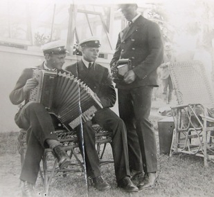
Photograph - Photograph, Black and white, Group of Swedes - Boxing Day 1920, 26 December 1920
... river excursion. A record of just one group of international sailors a long way from their home an country attending a Mission event. camera uniforms accordeon accordion picnic seamen swedish 1920 boxing day riversdale edward duckett Pencil inscription on verso in pencil handwritten :" Boxing day 1920 / Group of Swedes" ; at right angles a number "893" Black and white photograph of a trio of sailors in dress uniform – 2 seated on cane garden chairs one with piano-accordion being played. ...Supporters of the Mission often made their homes and gardens available as venue for Christmas Boxing day and Cup day events or picnics. On Boxing Day 1920 around 100 men were welcomed by Mr and Mrs Duckett on the grounds of the home Riversdale. They went there on a river excursion.A record of just one group of international sailors a long way from their home an country attending a Mission event. Black and white photograph of a trio of sailors in dress uniform – 2 seated on cane garden chairs one with piano-accordion being played. The standing sailor holds a cameraPencil inscription on verso in pencil handwritten :" Boxing day 1920 / Group of Swedes" ; at right angles a number "893"camera, uniforms, accordeon, accordion, picnic, seamen, swedish, 1920, boxing day, riversdale, edward duckett -
 Marysville & District Historical Society
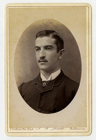
Photograph (Item) - Black and white portrait, John William Lindt, 1870s
... grouped informally on the lawns in front of their mansions, with servants at the rails of the upstairs balconies. He continued with landscape, producing folios Fernshaw and Watt River Scenery, Victoria ( c.1878-82), Scenery on the Ovens and Buckland Rivers, Victoria (c.1878–82) and Lorne, Louttit Bay and Cape Otway Ranges (1883). Sales of his Black ...A black and white portrait of an unknown man taken by John William Lindt.A black and white portrait of an unknown man taken by John William Lindt. John William Lindt was born in Germany in 1845. At 17 he took a working passage to Australia on a Dutch sailing ship. Taking up work as an itinerant piano-tuner, he traveled amongst towns in Victoria and New South Wales before settling in Grafton in 1863 where he became assistant and apprentice to photographer Conrad Wagner. After a brief return to Germany in 1867 Lindt took over management of Wagner’s studio in 1869. He married Wagner’s daughter, Anna on 13 January 1872. Over 1873-1874, using the slow and laborious wet-plate collodion process, John Lindt produced photographs of the local indigenous people both in their environment conducting actual traditional ceremonies in the Clarence River district, and in his studio. Twelve of this series is included in his 1874 album Australian Aboriginals. John Lindt moved to Melbourne in 1876 where he worked for Batchelder & Co. before opening his own opulent studios at number 7 at the top of Collins Street opposite the Treasury, in 1877. John Lindt's business of this period was wide-ranging, and included portraits, records of Melbourne public buildings and streetscapes, the Botanical Gardens, and Port Melbourne. He was a welcome photographer of members of parliament and other Melbourne personalities, their society and cultural life including the theatre, and was known as a ‘rich man’s photographer’ for those whose families he grouped informally on the lawns in front of their mansions, with servants at the rails of the upstairs balconies. He continued with landscape, producing folios Fernshaw and Watt River Scenery, Victoria ( c.1878-82), Scenery on the Ovens and Buckland Rivers, Victoria (c.1878–82) and Lorne, Louttit Bay and Cape Otway Ranges (1883). Sales of his Black Spur scenery amounted to approximately 25,000 copies printed from the original negatives between 1882 and 1892. John Lindt, in collaboration with Nicholas John Caire, produced a tourist booklet on the area around "The Hermitage" in 1913.7 Collins Str. East/ J.W. Lindt/ Melbournejohn william lindt, conrad wagner, australian aboriginals, batchelder & co, nicholas john caire, anna lindt -
 Marysville & District Historical Society
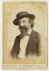
Photograph (Item) - Black and white portrait, John William Lindt, 1870s
... grouped informally on the lawns in front of their mansions, with servants at the rails of the upstairs balconies. He continued with landscape, producing folios Fernshaw and Watt River Scenery, Victoria ( c.1878-82), Scenery on the Ovens and Buckland Rivers, Victoria (c.1878–82) and Lorne, Louttit Bay and Cape Otway Ranges (1883). Sales of his Black ...A black and white portrait of an unknown man taken by John William Lindt.A black and white portrait of an unknown man taken by John William Lindt. John William Lindt was born in Germany in 1845. At 17 he took a working passage to Australia on a Dutch sailing ship. Taking up work as an itinerant piano-tuner, he traveled amongst towns in Victoria and New South Wales before settling in Grafton in 1863 where he became assistant and apprentice to photographer Conrad Wagner. After a brief return to Germany in 1867 Lindt took over management of Wagner’s studio in 1869. He married Wagner’s daughter, Anna on 13 January 1872. Over 1873-1874, using the slow and laborious wet-plate collodion process, John Lindt produced photographs of the local indigenous people both in their environment conducting actual traditional ceremonies in the Clarence River district, and in his studio. Twelve of this series is included in his 1874 album Australian Aboriginals. John Lindt moved to Melbourne in 1876 where he worked for Batchelder & Co. before opening his own opulent studios at number 7 at the top of Collins Street opposite the Treasury, in 1877. John Lindt's business of this period was wide-ranging, and included portraits, records of Melbourne public buildings and streetscapes, the Botanical Gardens, and Port Melbourne. He was a welcome photographer of members of parliament and other Melbourne personalities, their society and cultural life including the theatre, and was known as a ‘rich man’s photographer’ for those whose families he grouped informally on the lawns in front of their mansions, with servants at the rails of the upstairs balconies. He continued with landscape, producing folios Fernshaw and Watt River Scenery, Victoria ( c.1878-82), Scenery on the Ovens and Buckland Rivers, Victoria (c.1878–82) and Lorne, Louttit Bay and Cape Otway Ranges (1883). Sales of his Black Spur scenery amounted to approximately 25,000 copies printed from the original negatives between 1882 and 1892. John Lindt, in collaboration with Nicholas John Caire, produced a tourist booklet on the area around "The Hermitage" in 1913.7 Collins Str. East/ J.W. Lindt/ Melbournejohn william lindt, conrad wagner, australian aboriginals, batchelder & co, nicholas john caire, anna lindt -
 Marysville & District Historical Society
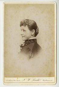
Photograph (Item) - Black and white portrait, John William Lindt, 1870s
... grouped informally on the lawns in front of their mansions, with servants at the rails of the upstairs balconies. He continued with landscape, producing folios Fernshaw and Watt River Scenery, Victoria ( c.1878-82), Scenery on the Ovens and Buckland Rivers, Victoria (c.1878–82) and Lorne, Louttit Bay and Cape Otway Ranges (1883). Sales of his Black ...A black and white portrait of an unknown woman taken by John William Lindt.A black and white portrait of an unknown woman taken by John William Lindt. John William Lindt was born in Germany in 1845. At 17 he took a working passage to Australia on a Dutch sailing ship. Taking up work as an itinerant piano-tuner, he traveled amongst towns in Victoria and New South Wales before settling in Grafton in 1863 where he became assistant and apprentice to photographer Conrad Wagner. After a brief return to Germany in 1867 Lindt took over management of Wagner’s studio in 1869. He married Wagner’s daughter, Anna on 13 January 1872. Over 1873-1874, using the slow and laborious wet-plate collodion process, John Lindt produced photographs of the local indigenous people both in their environment conducting actual traditional ceremonies in the Clarence River district, and in his studio. Twelve of this series is included in his 1874 album Australian Aboriginals. John Lindt moved to Melbourne in 1876 where he worked for Batchelder & Co. before opening his own opulent studios at number 7 at the top of Collins Street opposite the Treasury, in 1877. John Lindt's business of this period was wide-ranging, and included portraits, records of Melbourne public buildings and streetscapes, the Botanical Gardens, and Port Melbourne. He was a welcome photographer of members of parliament and other Melbourne personalities, their society and cultural life including the theatre, and was known as a ‘rich man’s photographer’ for those whose families he grouped informally on the lawns in front of their mansions, with servants at the rails of the upstairs balconies. He continued with landscape, producing folios Fernshaw and Watt River Scenery, Victoria ( c.1878-82), Scenery on the Ovens and Buckland Rivers, Victoria (c.1878–82) and Lorne, Louttit Bay and Cape Otway Ranges (1883). Sales of his Black Spur scenery amounted to approximately 25,000 copies printed from the original negatives between 1882 and 1892. John Lindt, in collaboration with Nicholas John Caire, produced a tourist booklet on the area around "The Hermitage" in 1913.7 Collins Str. East/ J.W. Lindt/ Melbournejohn william lindt, conrad wagner, australian aboriginals, batchelder & co, nicholas john caire, anna lindt -
 Marysville & District Historical Society
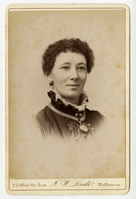
Photograph (Item) - Black and white portrait, John William Lindt, 1870s
... grouped informally on the lawns in front of their mansions, with servants at the rails of the upstairs balconies. He continued with landscape, producing folios Fernshaw and Watt River Scenery, Victoria ( c.1878-82), Scenery on the Ovens and Buckland Rivers, Victoria (c.1878–82) and Lorne, Louttit Bay and Cape Otway Ranges (1883). Sales of his Black ...A black and white portrait of an unknown woman taken by John William Lindt.A black and white portrait of an unknown woman taken by John William Lindt. John William Lindt was born in Germany in 1845. At 17 he took a working passage to Australia on a Dutch sailing ship. Taking up work as an itinerant piano-tuner, he traveled amongst towns in Victoria and New South Wales before settling in Grafton in 1863 where he became assistant and apprentice to photographer Conrad Wagner. After a brief return to Germany in 1867 Lindt took over management of Wagner’s studio in 1869. He married Wagner’s daughter, Anna on 13 January 1872. Over 1873-1874, using the slow and laborious wet-plate collodion process, John Lindt produced photographs of the local indigenous people both in their environment conducting actual traditional ceremonies in the Clarence River district, and in his studio. Twelve of this series is included in his 1874 album Australian Aboriginals. John Lindt moved to Melbourne in 1876 where he worked for Batchelder & Co. before opening his own opulent studios at number 7 at the top of Collins Street opposite the Treasury, in 1877. John Lindt's business of this period was wide-ranging, and included portraits, records of Melbourne public buildings and streetscapes, the Botanical Gardens, and Port Melbourne. He was a welcome photographer of members of parliament and other Melbourne personalities, their society and cultural life including the theatre, and was known as a ‘rich man’s photographer’ for those whose families he grouped informally on the lawns in front of their mansions, with servants at the rails of the upstairs balconies. He continued with landscape, producing folios Fernshaw and Watt River Scenery, Victoria ( c.1878-82), Scenery on the Ovens and Buckland Rivers, Victoria (c.1878–82) and Lorne, Louttit Bay and Cape Otway Ranges (1883). Sales of his Black Spur scenery amounted to approximately 25,000 copies printed from the original negatives between 1882 and 1892. John Lindt, in collaboration with Nicholas John Caire, produced a tourist booklet on the area around "The Hermitage" in 1913.7 Collins Str. East/ J.W. Lindt/ Melbournejohn william lindt, conrad wagner, australian aboriginals, batchelder & co, nicholas john caire, anna lindt -
 Marysville & District Historical Society
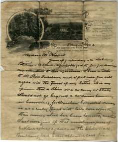
Letter (Item) - Hand written letter, John William Lindt, 1903
... grouped informally on the lawns in front of their mansions, with servants at the rails of the upstairs balconies. He continued with landscape, producing folios Fernshaw and Watt River Scenery, Victoria ( c.1878-82), Scenery on the Ovens and Buckland Rivers, Victoria (c.1878–82) and Lorne, Louttit Bay and Cape Otway Ranges (1883). Sales of his Black ...A letter written to Maurice Keppel by John William Lindt in 1903.A letter written to Maurice Keppel by John William Lindt in 1903. John William Lindt was born in Germany in 1845. At 17 he took a working passage to Australia on a Dutch sailing ship. Taking up work as an itinerant piano-tuner, he traveled amongst towns in Victoria and New South Wales before settling in Grafton in 1863 where he became assistant and apprentice to photographer Conrad Wagner. After a brief return to Germany in 1867 Lindt took over management of Wagner’s studio in 1869. He married Wagner’s daughter, Anna on 13 January 1872. Over 1873-1874, using the slow and laborious wet-plate collodion process, John Lindt produced photographs of the local indigenous people both in their environment conducting actual traditional ceremonies in the Clarence River district, and in his studio. Twelve of this series is included in his 1874 album Australian Aboriginals. John Lindt moved to Melbourne in 1876 where he worked for Batchelder & Co. before opening his own opulent studios at number 7 at the top of Collins Street opposite the Treasury, in 1877. John Lindt's business of this period was wide-ranging, and included portraits, records of Melbourne public buildings and streetscapes, the Botanical Gardens, and Port Melbourne. He was a welcome photographer of members of parliament and other Melbourne personalities, their society and cultural life including the theatre, and was known as a ‘rich man’s photographer’ for those whose families he grouped informally on the lawns in front of their mansions, with servants at the rails of the upstairs balconies. He continued with landscape, producing folios Fernshaw and Watt River Scenery, Victoria ( c.1878-82), Scenery on the Ovens and Buckland Rivers, Victoria (c.1878–82) and Lorne, Louttit Bay and Cape Otway Ranges (1883). Sales of his Black Spur scenery amounted to approximately 25,000 copies printed from the original negatives between 1882 and 1892. John Lindt, in collaboration with Nicholas John Caire, produced a tourist booklet on the area around "The Hermitage" in 1913. Maurice Keppel, from Ireland, was one of the first landholders in the newly surveyed town of Marysville in 1864. He and his wife ran the successful Keppel’s Australian Hotel. Two of their sons, John and Jerry, established a farm and opened up the surrounding high country. The Keppel lease was one of the longest held in the high country and the Keppel Family were amongst Marysville's pioneering families.maurice keppel, keppel family, keppel's australian hotel, marysville, victoria, john william lindt, conrad wagner, australian aboriginals, batchelder & co, nicholas john caire, anna lindt -
 Federation University Historical Collection
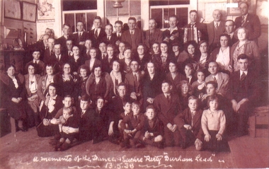
Photograph, A memento of the dance and euchre party Durham Lead 13.5.38
... It was one of several mining centres along the main mining lead running south of Ballarat, generally along the valley formed by the Yarowee or Leigh River durham lead leigh river garibaldi gold A memento of the dance and euchre party Durham Lead 13.5.38 Copy of a sepia tone black and white photograph of a large group of men, women and children taken at the dance and euchre party Durham Lead 13 April 1938. ...Durham Lead (also known as Durham, 1870s) was a mining township 15 km south of Ballarat. It was one of several mining centres along the main mining lead running south of Ballarat, generally along the valley formed by the Yarowee or Leigh RiverCopy of a sepia tone black and white photograph of a large group of men, women and children taken at the dance and euchre party Durham Lead 13 April 1938. Front row sitting on the seat (not the floor):- 4th from left, Mrs. Minnie Scott (nee Kinsey); 5th from left, Miss Lucy Kinsey; 1st right, Mr Thomas Scott Jnr. (dark suit & tie) 2nd back row:- 7th lady from right, wearing glasses, slightly behind, Miss Catherine (Kit) Scott A memento of the dance and euchre party Durham Lead 13.5.38durham lead, leigh river, garibaldi, gold -
 Marysville & District Historical Society
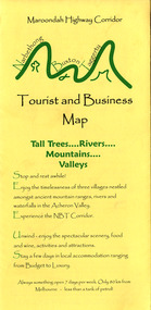
Map (Item) - Tourist and business map, Narbethong Community and Tourism Group, Narbethong Buxton Taggerty Tourist and Business Map, 04-2008
... A tourist and business map of Narbethong, Buxton and Taggerty. narbethong buxton taggerty victoria australia tourist and business map narbethong community and tourism group acheron valley yarra track wood's point black spur mystic mountains the meeting of the waters cathedral range danico design counted cross stitch things of sand & stone buxton zoo nursery & oddz & enz willowbank at taggerty safe trek 4wd services pnl 4wdriving buxton trout and salmon farm mystic mountains ski hire & outdoors narbethong ski hire highwood health centre cathedral view natural therapies narby cabinets plants by shelian gb timber executive signs rb automotive repairs buxton car care marysville towing & equipment hire martyn slade building design cathedral peak framing black spur roadhouse & ski hire tudor lodge roadhouse & ski hire buxton roadhouse & persian bazzar buxton post office general store & niche bar igloo roadhouse taggerty store narby eggs marapana agistment park mantirri blueberry farm carmyle farm hazelwood hazelnuts south cathedral lavender farm cathedral cherries black spur motel & caravan park woodlands rainforest retreat chestnut glade black spur inn wombat cottage abbey lake luxury b & b spa cottages blue views holiday cottages camp narbethong marapana farm stay b & b mantirri blueberry farm b & b little dene garden cottages silverstream b & b cottages nareen cabins moondai farm b & b south cathedral farm luxury b & b cottages yarrolyn caravan park sarsens rest lomah retreat pinjarra gardens kingbilli country estate henry viii manor house buxton hotel butters cafe of buxton wagtail wines little river wines lanterns at willowbank wirrawilla rainforest walk wilhemina falls the cascades This publication has been produced by the Narbethong Community and Tourism/ Group (NCTG) to promote the natural attractions, adventure activities and food/ trail from the Black Spur, through Narbethong, Buxton and Taggerty./ the information provided in this publication has been supplied by the individual/ members. ...A tourist and business map of Narbethong, Buxton and Taggerty. This map was produced by the Narbethong Community and Tourism Group in April 2008. It was produced to promote the natural attractions, adventure activities and food trail from the Black Spur, through Narbethong, Buxton and Taggerty.A tourist and business map of Narbethong, Buxton and Taggerty.This publication has been produced by the Narbethong Community and Tourism/ Group (NCTG) to promote the natural attractions, adventure activities and food/ trail from the Black Spur, through Narbethong, Buxton and Taggerty./ the information provided in this publication has been supplied by the individual/ members. NCTG takes no responsibility for its accuracy./ April 2008narbethong, buxton, taggerty, victoria, australia, tourist and business map, narbethong community and tourism group, acheron valley, yarra track, wood's point, black spur, mystic mountains, the meeting of the waters, cathedral range, danico design counted cross stitch, things of sand & stone, buxton zoo nursery & oddz & enz, willowbank at taggerty, safe trek 4wd services, pnl 4wdriving, buxton trout and salmon farm, mystic mountains ski hire & outdoors, narbethong ski hire, highwood health centre, cathedral view natural therapies, narby cabinets, plants by shelian, gb timber, executive signs, rb automotive repairs, buxton car care, marysville towing & equipment hire, martyn slade building design, cathedral peak framing, black spur roadhouse & ski hire, tudor lodge roadhouse & ski hire, buxton roadhouse & persian bazzar, buxton post office general store & niche bar, igloo roadhouse, taggerty store, narby eggs, marapana agistment park, mantirri blueberry farm, carmyle farm, hazelwood hazelnuts, south cathedral lavender farm, cathedral cherries, black spur motel & caravan park, woodlands rainforest retreat, chestnut glade, black spur inn, wombat cottage, abbey lake luxury b & b spa cottages, blue views holiday cottages, camp narbethong, marapana farm stay b & b, mantirri blueberry farm b & b, little dene garden cottages, silverstream b & b cottages, nareen cabins, moondai farm b & b, south cathedral farm luxury b & b cottages, yarrolyn caravan park, sarsens rest, lomah retreat, pinjarra gardens, kingbilli country estate, henry viii manor house, buxton hotel, butters cafe of buxton, wagtail wines, little river wines, lanterns at willowbank, wirrawilla rainforest walk, wilhemina falls, the cascades -
 Marysville & District Historical Society
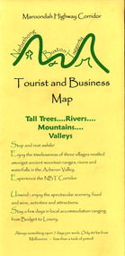
Map (Item) - Tourist and business map, Narbethong Community and Tourism Group, Narbethong Buxton Taggerty Tourist and Business Map, 04-2008
... A tourist and business map of Narbethong, Buxton and Taggerty. narbethong buxton taggerty victoria australia tourist and business map narbethong community and tourism group acheron valley yarra track wood's point black spur mystic mountains the meeting of the waters cathedral range danico design counted cross stitch things of sand & stone buxton zoo nursery & oddz & enz willowbank at taggerty safe trek 4wd services pnl 4wdriving buxton trout and salmon farm mystic mountains ski hire & outdoors narbethong ski hire highwood health centre cathedral view natural therapies narby cabinets plants by shelian gb timber executive signs rb automotive repairs buxton car care marysville towing & equipment hire martyn slade building design cathedral peak framing black spur roadhouse & ski hire tudor lodge roadhouse & ski hire buxton roadhouse & persian bazzar buxton post office general store & niche bar igloo roadhouse taggerty store narby eggs marapana agistment park mantirri blueberry farm carmyle farm hazelwood hazelnuts south cathedral lavender farm cathedral cherries black spur motel & caravan park woodlands rainforest retreat chestnut glade black spur inn wombat cottage abbey lake luxury b & b spa cottages blue views holiday cottages camp narbethong marapana farm stay b & b mantirri blueberry farm b & b little dene garden cottages silverstream b & b cottages nareen cabins moondai farm b & b south cathedral farm luxury b & b cottages yarrolyn caravan park sarsens rest lomah retreat pinjarra gardens kingbilli country estate henry viii manor house buxton hotel butters cafe of buxton wagtail wines little river wines lanterns at willowbank wirrawilla rainforest walk wilhemina falls the cascades This publication has been produced by the Narbethong Community and Tourism/ Group (NCTG) to promote the natural attractions, adventure activities and food/ trail from the Black Spur, through Narbethong, Buxton and Taggerty./ the information provided in this publication has been supplied by the individual/ members. ...A tourist and business map of Narbethong, Buxton and Taggerty. This map was produced by the Narbethong Community and Tourism Group in April 2008. It was produced to promote the natural attractions, adventure activities and food trail from the Black Spur, through Narbethong, Buxton and Taggerty.A tourist and business map of Narbethong, Buxton and Taggerty.This publication has been produced by the Narbethong Community and Tourism/ Group (NCTG) to promote the natural attractions, adventure activities and food/ trail from the Black Spur, through Narbethong, Buxton and Taggerty./ the information provided in this publication has been supplied by the individual/ members. NCTG takes no responsibility for its accuracy./ April 2008narbethong, buxton, taggerty, victoria, australia, tourist and business map, narbethong community and tourism group, acheron valley, yarra track, wood's point, black spur, mystic mountains, the meeting of the waters, cathedral range, danico design counted cross stitch, things of sand & stone, buxton zoo nursery & oddz & enz, willowbank at taggerty, safe trek 4wd services, pnl 4wdriving, buxton trout and salmon farm, mystic mountains ski hire & outdoors, narbethong ski hire, highwood health centre, cathedral view natural therapies, narby cabinets, plants by shelian, gb timber, executive signs, rb automotive repairs, buxton car care, marysville towing & equipment hire, martyn slade building design, cathedral peak framing, black spur roadhouse & ski hire, tudor lodge roadhouse & ski hire, buxton roadhouse & persian bazzar, buxton post office general store & niche bar, igloo roadhouse, taggerty store, narby eggs, marapana agistment park, mantirri blueberry farm, carmyle farm, hazelwood hazelnuts, south cathedral lavender farm, cathedral cherries, black spur motel & caravan park, woodlands rainforest retreat, chestnut glade, black spur inn, wombat cottage, abbey lake luxury b & b spa cottages, blue views holiday cottages, camp narbethong, marapana farm stay b & b, mantirri blueberry farm b & b, little dene garden cottages, silverstream b & b cottages, nareen cabins, moondai farm b & b, south cathedral farm luxury b & b cottages, yarrolyn caravan park, sarsens rest, lomah retreat, pinjarra gardens, kingbilli country estate, henry viii manor house, buxton hotel, butters cafe of buxton, wagtail wines, little river wines, lanterns at willowbank, wirrawilla rainforest walk, wilhemina falls, the cascades -
 Marysville & District Historical Society
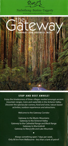
Map (Item) - Tourist and business map, Narbethong Community and Tourism Group, the Gateway TOURIST AND BUSINESS MAP, 08-2009
... A tourist and business map of Narbethong, Buxton and Taggerty. narbethong buxton taggerty victoria australia tourist and business map the gateway tourist and business map black spur motel & caravan park woodlands rainforest retreat chestnut glade black spur inn wombat cottage abbey lake luxury b&b spa cottages camp narbethong marapana farm stay b&b mantirri b&b little dene garden cottages nareen cabins silverstream b&b cottages buxton hotel motel south cathedral farm luxury b&b cottages cathedral view b&b retreat kingbilli country estate cathedral valley farm pinjarra gardens willowbank at taggerty sarsens rest yarrolyn caravan park danico design counted cross stitch things of sand & stone buxton zoo nursery safetrek 4wd services mystic mountains ski hire & outdoors pnl 4wdriving buxton trout and salmon farm buxton bait and tackle black spur roadhouse tudor lodge service station roadhouse & ski hire buxton roadhouse buxton p.o. general store igloo roadhouse henry v111 manor house buxton hotel butters cafe wagtail wines little river wines narby eggs marapana agistment park carmyle farm hazelwood hazelnuts cathedral view naturall therapies cre8ing growth linda hailey naby cabinets gb timber narbethong timber & trading rb automotive repairs buxton car care martyn slade building design taggerty vet clinic This publication has been produced by the Narbethong Community and Tourism Group Inc./ (NCTG) The information provided in this publication has been supplied by the individual/ members. ...A tourist and business map of Narbethong, Buxton, and Taggerty. This map was produced by the Narbethong Community and Tourism Group Inc in August 2009. It was produced to promote the natural attractions, adventure activities, and food trail from the Black Spur, through Narbethong, Buxton, and Taggerty.A tourist and business map of Narbethong, Buxton and Taggerty.This publication has been produced by the Narbethong Community and Tourism Group Inc./ (NCTG) The information provided in this publication has been supplied by the individual/ members. NCTG takes no responsibility for its accuracy./ August 2009narbethong, buxton, taggerty, victoria, australia, tourist and business map, the gateway tourist and business map, black spur motel & caravan park, woodlands rainforest retreat, chestnut glade, black spur inn, wombat cottage, abbey lake luxury b&b spa cottages, camp narbethong, marapana farm stay b&b, mantirri b&b, little dene garden cottages, nareen cabins, silverstream b&b cottages, buxton hotel motel, south cathedral farm luxury b&b cottages, cathedral view b&b retreat, kingbilli country estate, cathedral valley farm, pinjarra gardens, willowbank at taggerty, sarsens rest, yarrolyn caravan park, danico design counted cross stitch, things of sand & stone, buxton zoo nursery, safetrek 4wd services, mystic mountains ski hire & outdoors, pnl 4wdriving, buxton trout and salmon farm, buxton bait and tackle, black spur roadhouse, tudor lodge service station roadhouse & ski hire, buxton roadhouse, buxton p.o. general store, igloo roadhouse, henry v111 manor house, buxton hotel, butters cafe, wagtail wines, little river wines, narby eggs, marapana agistment park, carmyle farm, hazelwood hazelnuts, cathedral view naturall therapies, cre8ing growth, linda hailey, naby cabinets, gb timber, narbethong timber & trading, rb automotive repairs, buxton car care, martyn slade building design, taggerty vet clinic -
 Marysville & District Historical Society
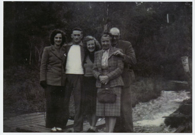
Photograph (item) - Black and white photograph, Original photograph-1947
... A copy of a black and white photograph of an unknown group of guests staying at Kooringa Guest House in Marysville standing by a river. ...A copy of a black and white photograph of an unknown group of guests staying at Kooringa Guest House in Marysville standing by a river. ...A copy of a black and white photograph of an unknown group of guests staying at Kooringa Guest House in Marysville standing by a river. ...A copy of a black and white photograph of an unknown group of guests staying at Kooringa Guest House in Marysville standing by a river. The original photograph was taken in 1947.A copy of a black and white photograph of an unknown group of guests staying at Kooringa Guest House in Marysville standing by a river.marysville, victoria, australia, kooringa, frederick webb, cuzens brothers, betha wilhelmina christina unmack, minnie webb, t.e. foster, edgar charles webb, clarence thomas pitman, jacob pitman, sir isaac pitman, caroline anna blood newenham, henry newenham pitman, carrie rosalind persse pitman, reginald william stringer, alice burton pitman, clarence edward pitman, newenham mueller pitman, olive birch, constance may pitman, olive dora blakeney pitman, gwendoline de burch pitman, kooringa guesthouse, lilian may shelton, thomas henry branchflower, wilbur anderson, peter mackey, caroline anna pitman, joyce anderson, photograph -
 Marysville & District Historical Society
THE TRIANGLE NEWS-VOL 40 NO 28-JULY 26 2013
... marysville victoria australia international delegates look to murrindindi leadership what's on when in august intrepid triangle bushwalkers the committee of management of the gallipoli park precinct creative triangle marysville community market captive bred regent honeyeaters put on a show at chiltern department of environment & primary industries marysville & district lions club water diving course (scuba) church notices new beginnings my hope for australia paster charles & marjorie lazaro from india councillor comment narbethong community hall free movie night marysville preschool hosts annual fundraiser footy-pie night taggerty community dinner pioneer reserve gets a minor makeover stolen wood piece of history to take root in shire murrindindi shire council the hovell tree school crossing safely the marysville historical society sharing community stories for historical archives real estate marysville football club reunion premiers 1973 black spur inn ugfm presents a taste of tamworth snags survey to guide work on victorian rivers mayor's chair australian grief and bereavement centre buxton fire brigade bushdance at buxton hall triangle community dance group lions-wood raffle have your say on new national parks regulations municipal public health and wellbeing plan 2013-2017 buxton recreation reserve notice of agm alexandra tennis club committee of management notice of agm THE TRIANGLE NEWS-VOL 40 NO 28-JULY 26 2013 ...marysville, victoria, australia, international delegates look to murrindindi leadership, what's on when in august, intrepid triangle bushwalkers, the committee of management of the gallipoli park precinct, creative triangle, marysville community market, captive bred regent honeyeaters put on a show at chiltern, department of environment & primary industries, marysville & district lions club, water diving course (scuba), church notices, new beginnings my hope for australia, paster charles & marjorie lazaro from india, councillor comment, narbethong community hall, free movie night, marysville preschool hosts annual fundraiser footy-pie night, taggerty community dinner, pioneer reserve gets a minor makeover, stolen wood, piece of history to take root in shire, murrindindi shire council, the hovell tree, school crossing safely, the marysville historical society, sharing community stories for historical archives, real estate, marysville football club reunion premiers 1973, black spur inn, ugfm presents a taste of tamworth, snags survey to guide work on victorian rivers, mayor's chair, australian grief and bereavement centre, buxton fire brigade, bushdance at buxton hall, triangle community dance group, lions-wood raffle, have your say on new national parks regulations, municipal public health and wellbeing plan 2013-2017, buxton recreation reserve notice of agm, alexandra tennis club committee of management notice of agm -
 Marysville & District Historical Society
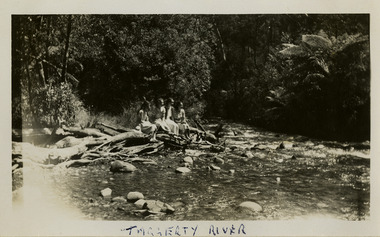
Photograph (item) - Black and white photograph, 1954
... A black and white photograph of an unknown group of people at the Taggerty River in Marysville. ...A black and white photograph of an unknown group of people at the Taggerty River in Marysville. ...A black and white photograph of an unknown group of people at the Taggerty River in Marysville. ...A black and white photograph of an unknown group of people at the Taggerty River in Marysville. The photograph was taken in 1954 whilst the group was staying at Roseleigh in Marysville.A black and white photograph of an unknown group of people at the Taggerty River in Marysville. The photograph was taken in 1954 whilst the group was staying at Roseleigh in Marysville.TAGGERTY RIVERmarysville, victoria, australia, roseleigh guest house, grieve family, thomas charles grieve, john arthur grieve, rose grieve, ackerman family, mary moyne, elise ackerman, ken mcleod, george peters, rose emily pullum, beltana, rose lillian smith, ivy may grieve, alexander james ficinus, raymond charles smith, accommodation, photograph, taggerty river -
 Federation University Historical Collection
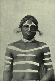
Image - black and white, Barwon River Man (New South Wales)
... Black and white Image of an Aboriginal man from Barwon River, New South Wales. Aboriginal people from six language groups originally occupied the area of the Barwon River wetlands. ...The confluence of the Barwon and Culgoa rivers, between Brewarrina and Bourke, marks the start of the Darling River. aborigine aboriginal barwon river Black and white Image of an Aboriginal man from Barwon River, New South Wales. Aboriginal people from six language groups originally occupied the area of the Barwon River wetlands. ...Digitised directly from 'The Native Races of the British Empire: Victoria' The Barwon River in New South Wales is formed through the confluence of the Macintyre River and Weir River (part of the Border Rivers system), north of Mungindi, in the Southern Downs region of Queensland. The Barwon River generally flows south and west, joined by 36 tributaries, including major inflows from the Boomi, Moonie, Gwydir, Mehi, Namoi, Macquarie, Bokhara and Bogan rivers. During major flooding, overflow from the Narran Lakes and the Narran River also flows into the Barwon. The confluence of the Barwon and Culgoa rivers, between Brewarrina and Bourke, marks the start of the Darling River.Black and white Image of an Aboriginal man from Barwon River, New South Wales. Aboriginal people from six language groups originally occupied the area of the Barwon River wetlands. These were the Ngemba, the Baranbinja, the Murrawari, the Ualayai, the Weilwan, and the Kamilaroi peoples. The Aboriginal people generally used the wetlands for hunting, fishing, and gathering uses, and for cultural association.(Wikipedia) The name "barwon" is derived from the Australian Aboriginal words of barwum or bawon, meaning great, wide, awful river of muddy water; and also baawan, a Ngiyambaa name for both the Barwon and Darling rivers. The history, culture and livelihoods of the local Aboriginal people are closely intertwined with the Barwon River and its associated tributaries and downstream flows. (Wikipedia)aborigine, aboriginal, barwon river -
 Federation University Historical Collection
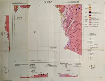
Map - Geological, Tallangatta, New South Wales: 1:250,000 Geological Series, SJ 55-3, 1966, 1966
... There are 13 formation sections grouped into 9 - Quaternary, Tertiary, Middle Devonian, Lower to Middle Devonian, Lower Devonian, Upper Silurian, Silurian, Upper Ordovician and Ordovician. tallangatta new south wales geological survey topographical base snowy mountains hydro electrical authority department of lands snowy lease map department of mines quaternary tertiary middle devonian lower to middle devonian lower devonian uper siluran silurian upper ordovician ordovician Scale of map, longitude and latitude, river names. "Tallangatta 1:250,00" written in black ...Compiled by the Geological Survey of N.S.W., Division of Regional Geology. Topographical base compiled from Snowy Mountains Hydro Electrical Authority, Department of Lands, County maps and Snowy Lease Map. Other sheet adjoin this map. There are 13 formation sections grouped into 9 - Quaternary, Tertiary, Middle Devonian, Lower to Middle Devonian, Lower Devonian, Upper Silurian, Silurian, Upper Ordovician and Ordovician.Large coloured map showing geological features, faults, bores, rivers and mineral deposits.Scale of map, longitude and latitude, river names. "Tallangatta 1:250,00" written in black pen.tallangatta, new south wales, geological survey, topographical base, snowy mountains hydro electrical authority, department of lands, snowy lease map, department of mines, quaternary, tertiary, middle devonian, lower to middle devonian, lower devonian, uper siluran, silurian, upper ordovician, ordovician -
 Greensborough Historical Society
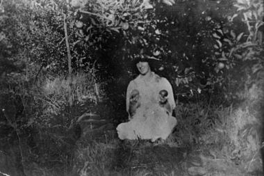
Photograph - Digital Image, Mrs Greenwood with two apples; and, older Gladys Greenwood: group of photographs, 1927c
... The area of Greensborough along the Plenty River was known for its orchards, which might explain why Mrs Greenwood is photographed holding the apples. greenwood gladys greenwood Digital copy of one black and white photograph and one colour photograph. Mrs Greenwood with two apples; and, older Gladys Greenwood: group ...A young Mrs Greenwood is seen posing with two apples; an older Miss Gladys Greenwood (daughter of Mrs Greenwood) is seen at a celebration. The Greenwood family share farmed with the Bosch family.The area of Greensborough along the Plenty River was known for its orchards, which might explain why Mrs Greenwood is photographed holding the apples.Digital copy of one black and white photograph and one colour photograph.greenwood, gladys greenwood -
 Greensborough Historical Society
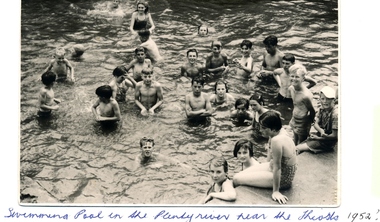
Photograph - Digital image, Swimming pool, Plenty River 1952, 1952_
... group of children enjoy a swim in the Plenty River pool Greensborough in 1952. Opened in 1937, the remnants of this pool can be seen today. (Gary Partington is the boy in the centre). The remnants of this concrete pool can still be seen today. greensborough swimming pool plenty river swimming pool Digital copy of black and white photograph. ...A group of children enjoy a swim in the Plenty River pool Greensborough in 1952. Opened in 1937, the remnants of this pool can be seen today. (Gary Partington is the boy in the centre).The remnants of this concrete pool can still be seen today.Digital copy of black and white photograph.greensborough swimming pool, plenty river swimming pool -
 Greensborough Historical Society
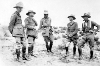
Photograph - Digital image, Leslie Cecil Maygar and group of soldiers, 1900c
... River. Leslie Cecil Maygar VC, DSO, VD was an Australian recipient of the Victoria Cross. In 1901 Lieutenant Maygar was awarded the Victoria Cross for rescuing a fellow Victorian whose horse had been shot. He died at Beersheeba in Palestine in 1917. leslie cecil maygar maygar family Digital copy of black and white photograph. Leslie Cecil Maygar and group ...The Maygar family came to Greensborough circa 1841 from Somerset England. They were of Hungarian descent. They farmed along the Plenty River. Leslie Cecil Maygar VC, DSO, VD was an Australian recipient of the Victoria Cross. In 1901 Lieutenant Maygar was awarded the Victoria Cross for rescuing a fellow Victorian whose horse had been shot. He died at Beersheeba in Palestine in 1917.Digital copy of black and white photograph.leslie cecil maygar, maygar family -
 Greensborough Historical Society
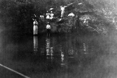
Photograph - Digital image, Untitled 1937, 1937_
... group of people on the banks of the river. Part of a collection of photographs owned by Dorris McLaughlin who was born in Greensborough, in 1899 to John McLaughlin and Rosalie Ellen Whatmough. The collection contains photographs of friends and relatives from the Greensborough and Eltham areas. dorris mclaughlin Digital copy of black and white photograph. ...Photograph of a group of people on the banks of the river. Part of a collection of photographs owned by Dorris McLaughlin who was born in Greensborough, in 1899 to John McLaughlin and Rosalie Ellen Whatmough. The collection contains photographs of friends and relatives from the Greensborough and Eltham areas.Digital copy of black and white photograph.dorris mclaughlin -
 Greensborough Historical Society
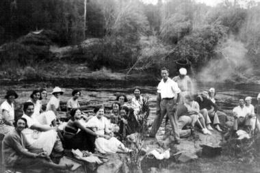
Photograph - Digital image, Outing at Laughing Waters on The Yarra River, 1935, 1935_
... This photograph shows a large group of people sitting beside the river. dorris mclaughlin laughing water Digital copy of black and white photograph. ...Part of a collection of photographs owned by Dorris McLaughlin who was born in Greensborough, in 1899 to John McLaughlin and Rosalie Ellen Whatmough. The collection contains photographs of friends and relatives from the Greensborough and Eltham areas. This photograph shows a large group of people sitting beside the river.Digital copy of black and white photograph.dorris mclaughlin, laughing water -
Glenelg Shire Council Cultural Collection
Negative - Negative - Glenelg River near Nelson, Victoria, c. 1936
... black and white photograph. Image shows Glenelg River near Nelson, Victoria. Dinghy pulled up on river bank, jetty bottom left, group of people on bank beneath trees....black and white photograph. Image shows Glenelg River near Nelson, Victoria. Dinghy pulled up on river bank, jetty bottom left, group of people on bank beneath trees. ...Negative for a black and white photograph. Image shows Glenelg River near Nelson, Victoria. Dinghy pulled up on river bank, jetty bottom left, group of people on bank beneath trees. -
Glenelg Shire Council Cultural Collection
Negative - Negative -Donovan's Landing Nelson, Victoria, c. 1936
... black and white photograph. Image shows Donovan's landing, Nelson Victoria. Group of 7 people standing on a small landing, river, boat sheds in background....black and white photograph. Image shows Donovan's landing, Nelson Victoria. Group of 7 people standing on a small landing, river, boat sheds in background. ...Negative for a black and white photograph. Image shows Donovan's landing, Nelson Victoria. Group of 7 people standing on a small landing, river, boat sheds in background. -
 Orbost & District Historical Society
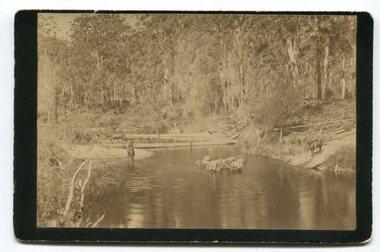
black and white photograph, late 19th - early 20th century
... black buff card. It is of a group of pack horses being guided across a waterway with a man on horseback on either side of the river....black buff card. It is of a group of pack horses being guided across a waterway with a man on horseback on either side of the river. black and white photograph ...In the late 1800's early 1900's transporting goods by road was difficult and at times impossible because roads as thoroughfares did not exist.The means of travelling along the roads in the 1800's was by bullock wagon, horse pulled dray, pack horse or simply by foot. This is a pictorial record of transport in the mid 18th - early 19th century. Pack horses were vital for the delivery of goods, responding to emergencies as they could travel in country inaccessible to larger horse - drawn carts or wagons.A black / white photograph on a black buff card. It is of a group of pack horses being guided across a waterway with a man on horseback on either side of the river.transport pack-horses -
 Orbost & District Historical Society
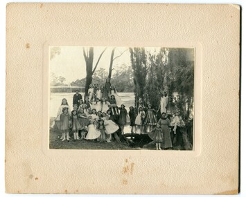
black and white photograph, 1920s
... A black / white photograph of a group of young girls dressed up and posing on the banks of a river. ...This photograph is a contemporary record of rural life in Orbost in the early 20th century. orbost snowy-river A black / white photograph of a group of young girls dressed up and posing on the banks of a river. ...The bridge shown in the background was built in the 1920s as a road and rail bridge, and was partly washed away by flood waters in 1934. There is no known history of this item.This photograph is a contemporary record of rural life in Orbost in the early 20th century.A black / white photograph of a group of young girls dressed up and posing on the banks of a river. On the left hand side of the photograph is an older man and on the right is an older lady. In the background is a bridge - the first Snowy River bridge. The photograph is on a cream coloured buff card. orbost snowy-river -
 Orbost & District Historical Society
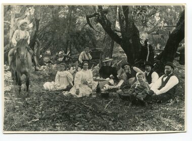
black and white photograph, 1901
... River as a cattle run. About 1888 he became Secretary of the new Tambo Shire. This is a contemporary pictorial record of rural family life in Orbost in the early 20th century. old-station-orbost family-life on back - "Old Station" A black / white photograph of a group of people sitting in a clearing under some trees having a picnic. ...This photograph was taken at the "old station" at Corringle near Orbost. It was a popular picnic spot. Late in 1857 Mr Thomas T. Stirling took over Corringle Run ("Corringle" means "shallow water"). Mr Stirling and his family came from the wester district - Winchelsea. He settled at the Old Station. A few people were employed at the Orbost Stationb and there was settlement on the Orbost flats, Mr T. T. Stirling held the land from Lake Tyrers to Bemm River as a cattle run. About 1888 he became Secretary of the new Tambo Shire.This is a contemporary pictorial record of rural family life in Orbost in the early 20th century.A black / white photograph of a group of people sitting in a clearing under some trees having a picnic. On the left - hand side is a young boy on a horse.on back - "Old Station"old-station-orbost family-life -
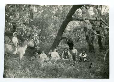 Orbost & District Historical Society
black and white photograph, 1901
... River as a cattle run. About 1888 he became Secretary of the new Tambo Shire. This is a contemporary pictorial record of rural family life in Orbost in the early 20th century. family-rural-life-orbost old-station-corringle on back - "Picnic at the Old Station" A black / white photograph of a group of early settlers (it appears to be a family group) having a picnic underneath trees. ...The Old Station at Corringle was a popular picnic spot in 1901. Late in 1857 Mr Thomas T. Stirling took over Corringle Run ("Corringle" means "shallow water"). Mr Stirling and his family came from the wester district - Winchelsea. He settled at the Old Station. A few people were employed at the Orbost Stationb and there was settlement on the Orbost flats, Mr T. T. Stirling held the land from Lake Tyrers to Bemm River as a cattle run. About 1888 he became Secretary of the new Tambo Shire.This is a contemporary pictorial record of rural family life in Orbost in the early 20th century.A black / white photograph of a group of early settlers (it appears to be a family group) having a picnic underneath trees. There is a young boy on a horse on the left hand side.on back - "Picnic at the Old Station"family-rural-life-orbost old-station-corringle -
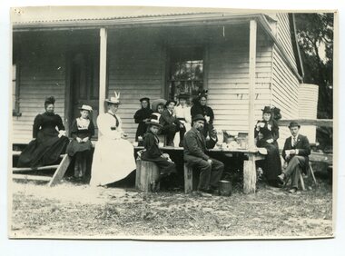 Orbost & District Historical Society
black and white photograph, Green, O. S, April 1897
... river. Captain McNeil with tug went out through the entrance and brought in the schooners. This item is associated with the Richardson family, early settlers of the Orbost district. richardson-family-orbost-marlo mcneil-captain on back - " The Richardson family picnic at Marlo" A black / white photograph of a group of people having afternoon tea on the end of a verandah of a wooden house. ...This photograph shows the Richardson family having a picnic on the verandah of Captain McNeil' house at Marlo - April 1897. Snowy River Shipping Company formed in 1880. They were soon shipping produce (mainly vegetables) from the area to Melbourne. The Snowy River Shipping Company was formed by Mr Henry James during the 1880s, with Captain McNeil as master. Captain Hegarty was the shipping agent at Marlo. Towing a line of small barges these paddle steamers plied their trade between the port of Marlo, and the farms along the river banks, churning their way almost twenty miles upstream to a landing beside what is now Frank Richardson’s property. On these trips, the barges carried mail and supplies to the townspeople and farmers, loading their produce, mostly maize, on the return trip to the coast. The coming of the railway in 1915 spelt the end for the little river boats. ( ref. F. W. RODWELL in the “Snowy Review”) Frank Richardson 1877-1950 was a sawmiller at Tabbara and helped build and run paddle steamer "Curlip"as engineer. Captain McNeil was an always cheerful Marlo identity and local children had many times sailing with him on the river. Captain McNeil with tug went out through the entrance and brought in the schooners.This item is associated with the Richardson family, early settlers of the Orbost district.A black / white photograph of a group of people having afternoon tea on the end of a verandah of a wooden house. All are seated.on back - " The Richardson family picnic at Marlo"richardson-family-orbost-marlo mcneil-captain -
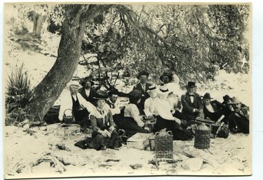 Orbost & District Historical Society
black and white photograph, January 1, 1897
... River as a cattle run. About 1888 he became Secretary of the new Tambo Shire. This photograph is a portrait of rural life in the late 19th century. It is an insight into the dress, manners and activities of the first settlers of Orbost. old-station-orbost rural-family-life on back - "Beach Paddock - Old Station -1897" with a list of names Two copies of a black / white photograph of a group of men and women picnicking on the sand under tall trees. black and white photograph ...This photograph shows Mr John Bird ( 3rd from left) ; Mr John Gilbert and Mr Lance Herbert among others having a picnic at the popular beach paddock at Old Station, Corringle, on January 1, 1897. Late in 1857 Mr Thomas T. Stirling took over Corringle Run ("Corringle" means "shallow water"). Mr Stirling and his family came from the wester district - Winchelsea. He settled at the Old Station. A few people were employed at the Orbost Stationb and there was settlement on the Orbost flats, Mr T. T. Stirling held the land from Lake Tyrers to Bemm River as a cattle run. About 1888 he became Secretary of the new Tambo Shire.This photograph is a portrait of rural life in the late 19th century. It is an insight into the dress, manners and activities of the first settlers of Orbost.Two copies of a black / white photograph of a group of men and women picnicking on the sand under tall trees.on back - "Beach Paddock - Old Station -1897" with a list of namesold-station-orbost rural-family-life
