Showing 11 items matching "boroondara planning scheme"
-
 Surrey Hills Historical Society Collection
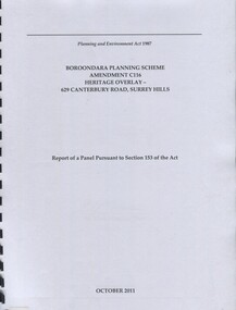
Book, Boroondara Planning Scheme Amendment C116 Heritage Overlay - 629 Canterbury Road, Surrey Hills, Oct-11
... Boroondara Planning Scheme Amendment C116 Heritage Overlay - 629 Canterbury Road, Surrey Hills...Surrey Hills Historical Society Collection 190A Canterbury Road Canterbury melbourne Report of a panel pursuant to Section 153 of the Planning and Environment Act regarding the property at 629 Canterbury Road, Surrey Hills - an Edwardian two story red-brick butchers' shop built in 1897 for the Tacey family. abermore pty ltd heritage studies tacey family butchers surrey hills canterbury road (ms) natica schmeder sherry james jo james (mr) mark marsden (mr) bryce raworth 2011 1897 Report of a panel pursuant to Section 153 of the Planning and Environment Act regarding the property at 629 Canterbury Road, Surrey Hills - an Edwardian two story red-brick butchers' shop built in 1897 for the Tacey family. Boroondara Planning Scheme Amendment C116 Heritage Overlay - 629 Canterbury Road, Surrey Hills Book ...Report of a panel pursuant to Section 153 of the Planning and Environment Act regarding the property at 629 Canterbury Road, Surrey Hills - an Edwardian two story red-brick butchers' shop built in 1897 for the Tacey family.Report of a panel pursuant to Section 153 of the Planning and Environment Act regarding the property at 629 Canterbury Road, Surrey Hills - an Edwardian two story red-brick butchers' shop built in 1897 for the Tacey family.abermore pty ltd, heritage studies, tacey family butchers, surrey hills, canterbury road, (ms) natica schmeder, sherry james, jo james, (mr) mark marsden, (mr) bryce raworth, 2011, 1897 -
 Kew Historical Society Inc
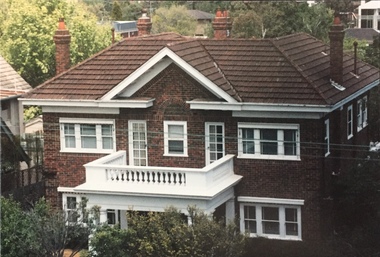
Photograph - 264 Cotham Road, 1988
... (Criteria D and E) (Boroondara Planning Scheme)...The residence was constructed in 1931 for the Howitt family. 264 Cotham Road, Kew (HO813) is an individually listed building of significance under Amendment C294 of the Boroondara Planning Scheme. ...(Criteria D and E) (Boroondara Planning Scheme) 264 cotham road -- kew (vic.) ...The dwelling is representative of the development of the Georgian Revival style in the 1920s and 30s and its popularity amongst the upper-middle classes as a result of the work of William Hardy Wilson and Professor Leslie Wilkinson. It is of importance as a fine and largely intact designer/builder example of the Georgian Revival style, with American Georgian Revival influences. The dwelling embodies the principal characteristics of the style. American Georgian Revival influences are noted in the deep eaves with modillions, central broken pediment, brick quoins and presentation of the central porch. The garden wall, with arched opening, in the side setback appears to be an early or original landscape feature, based on the comparable brick work detail construction with that of the house. Considering this, it is the only early landscape feature extant which assists in providing some understanding of the original landscape layout of the property. (Criteria D and E) (Boroondara Planning Scheme)Colour photographic positive of 264 Cotham Road, Kew. The residence was constructed in 1931 for the Howitt family. 264 Cotham Road, Kew (HO813) is an individually listed building of significance under Amendment C294 of the Boroondara Planning Scheme. 264 cotham road -- kew (vic.) -
 Canterbury History Group
Document - Maling Road Shopping Centre and Residential Environs, 1997
... ...Boroondara Planning Scheme...1997 Review of Urban Conservation from Camberwell Conservation Study 1991 Maling Roadshopping Centre and Residential Environs Canterbury Streets Canterbury Map of the Postcode 3126 Boroondara Planning Scheme 5 double-sided typed pages with one map Document Maling Road Shopping Centre and Residential Environs Camberwell Council - Conservation Study ...1997 Review of Urban Conservation from Camberwell Conservation Study 19915 double-sided typed pages with one mapmaling roadshopping centre and residential environs, canterbury streets, canterbury map of the postcode 3126, boroondara planning scheme -
Canterbury History Group
Article - Plan to rebuild heritage listed home after arson attack, May 2024
... ...Boroondara Planning Scheme...Canterbury Boroondara Bulletin Shenley Croft Mangarra Road Merle James Boroondara Planning Scheme Arson Boroondara Heritage Overlay Demolition by neglect 1x typed sheet in black and white with 1 x coloured photograph Article Plan to rebuild heritage listed home after arson attack ...Article from the Boroondara Bulletin - It is believed that a fire was deliberately lit to destroy the house in order for rebuilding. Council demanded that this be rebuilt in the former original style.1x typed sheet in black and white with 1 x coloured photographcanterbury, boroondara bulletin, shenley croft, mangarra road, merle james, boroondara planning scheme, arson, boroondara heritage overlay, demolition by neglect -
Canterbury History Group
Article - Maling Precinct Protection Group, David Tink, 09/02/1998
... Boroondara Planning Scheme proposals and the MPPG response...Boroondara Planning Scheme proposals and the MPPG response Maling Precinct Protection Group Lorrie Buttner Geoff Reid David Tink Typed page in black and white Article Maling Precinct Protection Group David Tink ...Boroondara Planning Scheme proposals and the MPPG responseTyped page in black and whitemaling precinct protection group, lorrie buttner, geoff reid, david tink -
Canterbury History Group
Document, Context Pty Ltd, City of Boroondara, Municipal-Wide Heritage Gap Study: Volume 1 - Canterbury: Final report 23 January 2017, 2017
... This report is part of the Council's heritage studies and form part of the Boroondara Planning Scheme....Canterbury History Group 190A Canterbury Road Canterbury melbourne This report is part of the Council's heritage studies and form part of the Boroondara Planning Scheme. Heritage studies Matlock Street Mangarra Road Chaucer Crescent Rochester Road Canterbury Road This report is an assessment for Canterbury's heritage assets (including Victorian, Federation, interwar and post-war dwellings, commercial buildings and precincts). ...This report is an assessment for Canterbury's heritage assets (including Victorian, Federation, interwar and post-war dwellings, commercial buildings and precincts). It includes an overview of the methodology, findings and recommendations as well as citations for nominated individual properties and precincts. Appendix D is a detailed study of the places studied.405 pages, A4 in ring binder; includes colour photos, mapsnon-fictionThis report is an assessment for Canterbury's heritage assets (including Victorian, Federation, interwar and post-war dwellings, commercial buildings and precincts). It includes an overview of the methodology, findings and recommendations as well as citations for nominated individual properties and precincts. Appendix D is a detailed study of the places studied.heritage studies, matlock street, mangarra road, chaucer crescent, rochester road, canterbury road -
 Kew Historical Society Inc
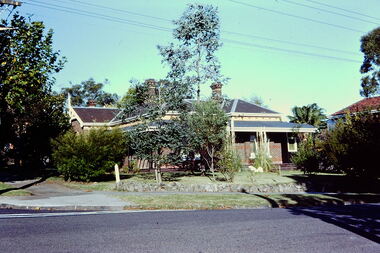
Slide - Villa, 16 Redmond Street, 1979
... The 2014 report recommended that the house be included in the Schedule to the Heritage Overlay of the Boroondara Planning Scheme as an individually Significant place....The 2014 report recommended that the house be included in the Schedule to the Heritage Overlay of the Boroondara Planning Scheme as an individually Significant place. ...One of a group of slides taken by members of the Society of built heritage in Kew in 1979-80. The selection of subject matter reflects the priorities of the period. The colour of some slides has degraded.The slides represent a snapshot in time of built architecture in Kew, much of which has changed in the forty-plus period since they were created.Colour positive transparency (slide) of a single-storey Victorian tuck-pointed polychrome villa (formerly known as 'Roylands', 'Myrambeek') on the corner of Redmond and Fellows Streets, Kew. Research by Lovell Chen established that the house was built in 1892-3 and that owners have included Charles Bennett, Zilpah Bennett, Catherine Bucknall, Frederick Umber, George Darby etc. The 2014 report recommended that the house be included in the Schedule to the Heritage Overlay of the Boroondara Planning Scheme as an individually Significant place."Cnr Redmond and Fellows Streets"historic houses -- kew (vic.), victorian villas -- kew (vic.), 16 redmond street -- kew (vic.), roylands, myrambeek -
Canterbury History Group
Document - Lowell Chen, Urban Planning Special Committee - City of Boroondara, 1/12/2011 12:00:00 AM
... Individual Heritage Overlays: Authorisation and Exhibition of Planning Scheme Amendment. Summary Report Prepared for the City of Boroondara. ...Individual Heritage Overlays: Authorisation and Exhibition of Planning Scheme Amendment. Summary Report Prepared for the City of Boroondara. ...Kew and Hawthorn. Further Heritage Investigations. Attachments for item: UPC3. Individual Heritage Overlays: Authorisation and Exhibition of Planning Scheme Amendment. Summary Report Prepared for the City of Boroondara. Item 3 Emulation Hall, Canterbury. pages 174-177. Includes black and white photographscanterbury, rochester road, dunstan reynolds & partners, egyptian revival style, emulation hall, historic buildings, masonic lodges -
Canterbury History Group
Article, Glidden, Greg, Zone changes rebutted, 6/05/2014 12:00:00 AM
... Canterbury History Group 190A Canterbury Road Canterbury melbourne Boroondara High-Rise Buildings Victorian Government C190 Amendment Local Laws City of Boroondara Report on a meeting at the Camberwell Civic Centre where more than 600 residents attended to hear the council reject a state government planning scheme that would result in a greater proportion of high-rise apartments being built in residential areas. ...Report on a meeting at the Camberwell Civic Centre where more than 600 residents attended to hear the council reject a state government planning scheme that would result in a greater proportion of high-rise apartments being built in residential areas.Report on a meeting at the Camberwell Civic Centre where more than 600 residents attended to hear the council reject a state government planning scheme that would result in a greater proportion of high-rise apartments being built in residential areas.boroondara, high-rise buildings, victorian government, c190 amendment, local laws, city of boroondara -
Kew Historical Society Inc
Journal, Kewriosity : August 1990
... Planning Scheme [Willsmere] / p5. Backyard burning banned / p5. Kew Community House [courses] / p6. Clean up for Studley Park [Boroondara Bushwalkers] / p6. ...Council assistance available to maintain homes / p1. Rates reminder / p1. No elections / p1. Dates for August / p2. Breast information session / p2. One act plays [Track Players] / p2. Strategies for success / p2. Rotary changeover [Kew Rotary Club] / p2. Kew's kindergartens to open doors / p3. Budget to take care of basics / p3. Urban women have a taste for country life [Kew/Balwyn Country Women's Association CWA] / p3. Your community bus needs you / p3. Recruiting drive [Meals on Wheels] / p3. Notices / p4. Major donation to St George's [Hospital] [Kew Rotary Club] / p4. Carey's new head / p4. Library corner / p4. Update on traffic / p4. Family day care / p5. Centenary celebrations for Kew East [Primary School] / p5. Courses, coffee and a chat [ Kew Community House] / p5. Govt amends Kew Planning Scheme [Willsmere] / p5. Backyard burning banned / p5. Kew Community House [courses] / p6. Clean up for Studley Park [Boroondara Bushwalkers] / p6. Council re-assesses proposal [skateboard bowl at Victoria Park] / p6. Meetings promote care giver act / p7. Council seeks community reps / p7. Kew Primary promotes its assets / p7. Recipe for success [Children's International Summer Villages] / p8. Special paper collection / p8. "Kew is for Living" [Kew Festival] / p8.Kewriosity was a local newsletter combining Kew Council and community news. It was published between November 1983 and June 1994, replacing an earlier Kewriosity [broad] Sheet (1979-84). In producing Kewriosity, Council aimed to provide a range of interesting and informative articles covering its deliberations and decision making, together with items of general interest and importance to the Kew community and information not generally available through daily media outlets.non-fictionCouncil assistance available to maintain homes / p1. Rates reminder / p1. No elections / p1. Dates for August / p2. Breast information session / p2. One act plays [Track Players] / p2. Strategies for success / p2. Rotary changeover [Kew Rotary Club] / p2. Kew's kindergartens to open doors / p3. Budget to take care of basics / p3. Urban women have a taste for country life [Kew/Balwyn Country Women's Association CWA] / p3. Your community bus needs you / p3. Recruiting drive [Meals on Wheels] / p3. Notices / p4. Major donation to St George's [Hospital] [Kew Rotary Club] / p4. Carey's new head / p4. Library corner / p4. Update on traffic / p4. Family day care / p5. Centenary celebrations for Kew East [Primary School] / p5. Courses, coffee and a chat [ Kew Community House] / p5. Govt amends Kew Planning Scheme [Willsmere] / p5. Backyard burning banned / p5. Kew Community House [courses] / p6. Clean up for Studley Park [Boroondara Bushwalkers] / p6. Council re-assesses proposal [skateboard bowl at Victoria Park] / p6. Meetings promote care giver act / p7. Council seeks community reps / p7. Kew Primary promotes its assets / p7. Recipe for success [Children's International Summer Villages] / p8. Special paper collection / p8. "Kew is for Living" [Kew Festival] / p8. publications -- city of kew (vic.), kewriosity, council newsletters, community newsletters -
 Kew Historical Society Inc
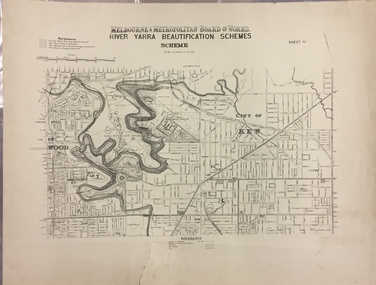
Map, MMBW, River Yarra Beautification Schemes, c.1913
... Boroondara and to the history of the development of state utilities in Victoria. A number of the Kew maps have additional details added by former municipal officers, including the levels reached by various floods. As these were working documents, information was added to them long after the period of their initial production and distribution. melbourne & metropolitan board of works mmbw maps mmbw plans city of kew flood levels -- kew (vic.) cartography MELBOURNE AND METROPOLITAN BOARD OF WORKS / RIVER YARRA BEAUTIFICATION SCHEMES / SCHEME / SCALE 10 CHAINS TO AN INCH Map of the City of Kew showing part of the River Yarra Beautification Schemes. ...The Melbourne and Metropolitan Board of Works (MMBW) was established by an act of the Victorian Parliament in 1890 to prepare for and to implement a sewerage and water reticulation system across what was then inner Melbourne, its surrounding and middle distance suburbs, including Kew. The MMBW was disbanded in 1991.The map collection of the Kew Historical Society has at its core the historic maps assembled and originally stored in the City Engineer's Department of the City of Kew. These include maps in a number of scales. The vast majority of maps were produced by the MMBW in the first two decades of the twentieth century, and are solid working maps, backed by linen for durability. These maps are historically significant to Kew, the City of Boroondara and to the history of the development of state utilities in Victoria. A number of the Kew maps have additional details added by former municipal officers, including the levels reached by various floods. As these were working documents, information was added to them long after the period of their initial production and distribution.Map of the City of Kew showing part of the River Yarra Beautification Schemes. The map shows development to date and the flood levels reached in 1923 and 1924. This map may have been adapted from an earlier map, as most development in central Kew and Studley Park had occurred by this date yet numerous streets are not represented. Public buildings and institutions are clearly represented and named on the map as are significant public transport infrastructure (eg the Outer Circle railway).MELBOURNE AND METROPOLITAN BOARD OF WORKS / RIVER YARRA BEAUTIFICATION SCHEMES / SCHEME / SCALE 10 CHAINS TO AN INCHmelbourne & metropolitan board of works, mmbw maps, mmbw plans, city of kew, flood levels -- kew (vic.), cartography