
Showing 111 items matching "bridge - sale"
-
 Lakes Entrance Historical Society
Postcard - SS Omeo passing Swing bridge, Sale Victoria, Carpenter
... SS Omeo passing Swing bridge, Sale Victoria....Omeo passing Sale bridge, Sale Victoria....Postcard SS Omeo passing Swing bridge, Sale Victoria. Carpenter ...Omeo passing Sale bridge, Sale Victoria.This is some of Bernard's photography, One penny stamp on reverse.bridges, waterways -
 Lakes Entrance Historical Society
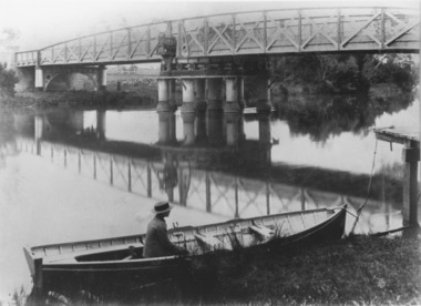
Photograph - Swing Bridge Sale Victoria c1905, Caire, Nicholas John, c1905
... Swing Bridge Sale Victoria c1905...Latrobe Bridge Sale Victoria in closed position . The operating machinery is still visible...Bridge in its closed position. The operating machinery is visible, plus the unique pier structure of the central span. In the rowing boat moored along side the river bank a person wearing a boater hat is seated. Sale...Latrobe Bridge Sale Victoria in closed position . The operating machinery is still visible Waterways Bridges Civil Engineering Black and white photograph of the Latrobe Bridge in its closed position. ...Latrobe Bridge Sale Victoria in closed position . The operating machinery is still visibleBlack and white photograph of the Latrobe Bridge in its closed position. The operating machinery is visible, plus the unique pier structure of the central span. In the rowing boat moored along side the river bank a person wearing a boater hat is seated. Sale Victoria. Plus 1 other photos including the building of the swing bridgewaterways, bridges, civil engineering -
Lakes Entrance Historical Society
Photograph - Swing Bridge Sale Victoria 1905c, Caire, Nicholas John
... Swing Bridge Sale Victoria 1905c...Latrobe Wharf on the left bank is seen through bridge. Sale Victoria...Latrobe Wharf on the left bank is seen through bridge. Sale Victoria Bridges Waterways Civil Engineering Jetties Black and white photograph of the Latrobe Bridge. ...turning on a central axis to allow the passage of river vessels. Image shows machinery for operation and the bridge closed to river traffic. Latrobe Wharf on the left bank is seen through bridge. Sale VictoriaBlack and white photograph of the Latrobe Bridge. This was a swing bridge over the Latrobe Riverbridges, waterways, civil engineering, jetties -
 Lakes Entrance Historical Society
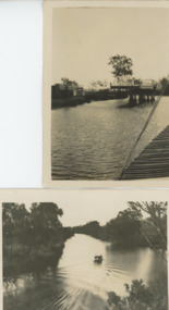
Photograph - Swing Bridge Sale Victoria
... Swing Bridge Sale Victoria...Black and white photograph of Sale Swing bridge which is open on Thompson River south of Sale Victoria...Also another black and white photograph of Thompson River 05222.1 9 x 6 cm Waterways Bridges Black and white photograph of Sale Swing bridge which is open on Thompson River south of Sale Victoria Photograph Swing Bridge Sale Victoria ...Also another black and white photograph of Thompson River 05222.1 9 x 6 cmBlack and white photograph of Sale Swing bridge which is open on Thompson River south of Sale Victoriawaterways, bridges -
Clunes Museum
Document - DOCUMENT SALE OF BRIDGE, 5/4/1877
... DOCUMENT SALE OF BRIDGE......BRIDGE - SALE...AN OFFICIAL DOCUMENT- INDENTURE BETWEEN NATIONAL BANK OF AUSTRALIA AND EVANS THOMAS OF CLUNES AND MAYOR AND COUNCILLORS AND BURGEYES OF BOROUGH OF CLUNES FOR THE ABSOLUTE SALE OF BRIDGE OVER BULLAROOK CREEK IN THE BOROUGH KNOWN AS GRUNDERMANNS BRIDGE IN 1877. ...DATED 23 MARCH 1877 DOCUMENT BRIDGE - SALE BULLAROOK CREEK EVAN THOMAS GRUNDEMANNS BRIDGE NELSONS BRIDGE AN OFFICIAL DOCUMENT- INDENTURE BETWEEN NATIONAL BANK OF AUSTRALIA AND EVANS THOMAS OF CLUNES AND MAYOR AND COUNCILLORS AND BURGEYES OF BOROUGH OF CLUNES FOR THE ABSOLUTE SALE OF BRIDGE OVER BULLAROOK CREEK IN THE BOROUGH KNOWN AS GRUNDERMANNS BRIDGE IN 1877. ...DOCUMENT - TRANSFER OF GRUNDEMANNS BRIDGE (NOW CALLED NELSONS BRIDGE FROM NATIONAL BANK AND MR. EVANS THOMAS TO BOROUGH OF CLUNES. DATED 23 MARCH 1877AN OFFICIAL DOCUMENT- INDENTURE BETWEEN NATIONAL BANK OF AUSTRALIA AND EVANS THOMAS OF CLUNES AND MAYOR AND COUNCILLORS AND BURGEYES OF BOROUGH OF CLUNES FOR THE ABSOLUTE SALE OF BRIDGE OVER BULLAROOK CREEK IN THE BOROUGH KNOWN AS GRUNDERMANNS BRIDGE IN 1877. FOR 100 POUNDS, TO CLUNES BOROUGH AND COUNCILdocument, bridge - sale, bullarook creek, evan thomas, grundemanns bridge, nelsons bridge -
 Lakes Entrance Historical Society
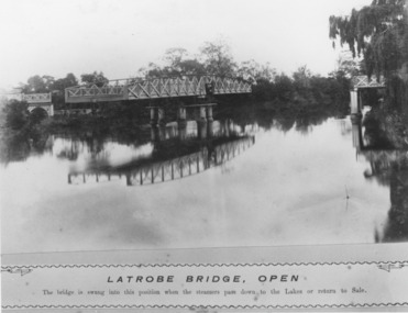
Photograph - Swing Bridge Sale Victoria c1905, Caire, Nicholas John, c1905
... Swing Bridge Sale Victoria c1905...The bridge is swung into this position when the steamers pass down to the Lakes or return to Sale....Black and white photograph of the Latrobe River Bridge over the Latrobe River, shows the bridge open to river traffic with a good view of the supporting structure. Sale Victoria...The bridge is swung into this position when the steamers pass down to the Lakes or return to Sale. ...Latrobe Bridge - Open. The bridge is swung into this position when the steamers pass down to the Lakes or return to Sale.Black and white photograph of the Latrobe River Bridge over the Latrobe River, shows the bridge open to river traffic with a good view of the supporting structure. Sale Victoriawaterways, bridges, civil engineering -
 Lakes Entrance Historical Society
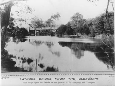
Photograph - Swing Bridge Sale Victoria c1905, Caire, Nicholas John, c1905
... Swing Bridge Sale Victoria c1905...Black and white photograph of the Latrobe Bridge,in the closed position, taken from the bank of the Glengarry Latrobe River. Sale Victoria...Waterways Bridges Civil Engineering Black and white photograph of the Latrobe Bridge,in the closed position, taken from the bank of the Glengarry Latrobe River. Sale Victoria Photograph Swing Bridge Sale Victoria c1905 Caire, Nicholas John ...Latrobe Bridge from the Glengarry. This bridge spans the Latrobe at the junction of the Glengarry and the Thompson.Black and white photograph of the Latrobe Bridge,in the closed position, taken from the bank of the Glengarry Latrobe River. Sale Victoriawaterways, bridges, civil engineering -
Lakes Entrance Historical Society
Photograph - Latrobe River Swing bridge Sale 1935
... Latrobe River Swing bridge Sale 1935...Black and white photograph showing closed swing bridge over Latrobe River, corner of jetty lower right hand corner. Sale, Victoria....Photograph Latrobe River Swing bridge Sale 1935 ...Also second photograph of swing bridge closed with lady in the foreground 6 x 8.5Black and white photograph showing closed swing bridge over Latrobe River, corner of jetty lower right hand corner. Sale, Victoria.bridges, waterways, jetties -
Lakes Entrance Historical Society
Book, Miller Greg, Sale Swing Bridge, 2003
... Sale Swing Bridge...Research interpretation and management recommendations for the Sale Swing Bridge Victoria by a forestec student...Bridges Transport Waterways Research interpretation and management recommendations for the Sale Swing Bridge Victoria by a forestec student Sale Swing Bridge Book Miller Greg ...Research interpretation and management recommendations for the Sale Swing Bridge Victoria by a forestec studentbridges, transport, waterways -
Lakes Entrance Historical Society
Postcard - Latrobe River swing bridge Longford Victoria.1925
... Sepia postcard showing steamer Omeo passing through opened swing bridge on Latrobe River at Longford near Sale, Victoria....Swing Bridge, Latrobe River, Sale...Note on back dated Christmas 1926 Boats and Boating Bridges Swing Bridge, Latrobe River, Sale Sepia postcard showing steamer Omeo passing through opened swing bridge on Latrobe River at Longford near Sale, Victoria. ...Note on back dated Christmas 1926Sepia postcard showing steamer Omeo passing through opened swing bridge on Latrobe River at Longford near Sale, Victoria.Swing Bridge, Latrobe River, Saleboats and boating, bridges -
 Eltham District Historical Society Inc
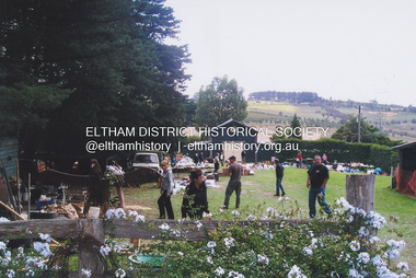
Photograph, Fay Bridge, Garage Sale, Pigeon Bank, Kangaroo Ground, n.d
... Fay Bridge Collection...Garage Sale...Fay Bridge Collection Garage Sale Pigeon Bank Kangaroo Ground 1 image - scanned from colour prints on loan Garage Sale, Pigeon Bank, Kangaroo Ground Photograph Photograph Fay Bridge ...fay bridge collection, garage sale, pigeon bank, kangaroo ground -
 Lakes Entrance Historical Society
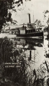
Postcard - S.S. Omeo, prior to 1915
... Black and white postcard showing SS Omeo passing the swing bridge at Sale Victoria. Plus a second photo...Letter on back to Henry McMeeken from his sister Violet who was at Sale High School 8 November 1915 Ships and Shipping Correspondence N W Morrwey Stationer Sale Black and white postcard showing SS Omeo passing the swing bridge at Sale Victoria. ...Letter on back to Henry McMeeken from his sister Violet who was at Sale High School 8 November 1915Black and white postcard showing SS Omeo passing the swing bridge at Sale Victoria. Plus a second photoN W Morrwey Stationer Saleships and shipping, correspondence -
 Lakes Entrance Historical Society
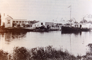
Photograph - P.S. Tanjil, Cornell F, 1880 c
... This scene is immediately downstream of present swing bridge on Latrobe River. Sale Victoria...This scene is immediately downstream of present swing bridge on Latrobe River. Sale Victoria Photograph P.S. ...Also new sepia print 10 x 15 cm. See also Peter Synan's book 'Highways of Water'Sepia photograph showing paddle steamer Tanjil at Latrobe Wharf. Swan Hotel on left and Victoria Hotel on right. Timber stacked on wharf. People on wharf and in small boats on river on left, taken from opposite side of Latrobe River. This scene is immediately downstream of present swing bridge on Latrobe River. Sale Victoriaboats and boating, jetties, hotels -
 Bendigo Historical Society Inc.
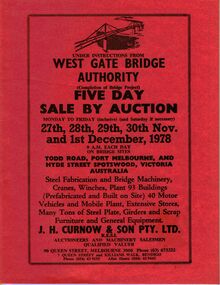
Document - IAN DYETT COLLECTION: AUCTION CATALOGUE - WEST GATE BRIDGE AUTHORITY
... Three orange covered auction catalogues with black printing for a sale on 27th, 28th, 29th, 30th Nov. and 1st December, 1978 under instructions from West Gate Bridge Authority. ...Bridge Authority J H Curnow & Son Pty. Ltd F C Dyett I M Dyett Bolton Bros Print Three orange covered auction catalogues with black printing for a sale on 27th, 28th, 29th, 30th Nov. and 1st December, 1978 under instructions from West Gate Bridge Authority. ...Three orange covered auction catalogues with black printing for a sale on 27th, 28th, 29th, 30th Nov. and 1st December, 1978 under instructions from West Gate Bridge Authority. For sale was steel fabrication and bridge machinery, cranes, winches, plant 93 buildings (prefabricated and built on site) 40 motor vehicles and mobile plant, extensive stores, many tons of steel plate, girders and scrap, furniture and general equipment. J. H. Curnow & Son Pty. Ltd. Were the auctioneers.business, auctioneers, j h curnow & son pty ltd, ian dyett collection - auction catalogue - west gate bridge authority, j h curnow & son pty. ltd, f c dyett, i m dyett, bolton bros print -
Port Melbourne Historical & Preservation Society
Photograph - Bridge Street, Port Melbourne, 1970 - 2005
... Image may have been taken by a PMHPS member or scanned from a past resident or taken for real estate sale purposes. Bridge Street: Numbers - 22; 44; 46; 48; 49; 51; 52; 53; 55; 57; 59; 63; 75; 81; 92; 94; 219; 221; 223; 225; 227; 229; 231; 233; 234; 235; 236; 237; 239; 241; 243; 245; 247; 249; 251; 253; 255; 257; 259; 261; 263; 265; 267; 269; 271; 273 Also several roundabout views...built environment - domestic bridge street woodruff terrace Photographic images of properties in Port Melbourne. Image may have been taken by a PMHPS member or scanned from a past resident or taken for real estate sale purposes. ...Photographic images of properties in Port Melbourne. Image may have been taken by a PMHPS member or scanned from a past resident or taken for real estate sale purposes. Bridge Street: Numbers - 22; 44; 46; 48; 49; 51; 52; 53; 55; 57; 59; 63; 75; 81; 92; 94; 219; 221; 223; 225; 227; 229; 231; 233; 234; 235; 236; 237; 239; 241; 243; 245; 247; 249; 251; 253; 255; 257; 259; 261; 263; 265; 267; 269; 271; 273 Also several roundabout viewsbuilt environment - domestic, bridge street, woodruff terrace -
 Flagstaff Hill Maritime Museum and Village
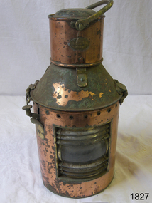
Functional object - Marine Lamp, R C Murray & Co Ltd, 1900 -1930
... Bridge St Glasgow. An additional address is at 37 Cavendish St Glasgow listed for 1910, and also at Pollokshaws Road. The writer assumes the company must have moved sometime between 1886 & 1910 to these addresses. The writer at this time cannot ascertain any more historical information regarding the company or its founder, however, lamps made by RC Murray are now collector's items commanding significant sale prices on many auction websites....Bridge St Glasgow. An additional address is at 37 Cavendish St Glasgow listed for 1910, and also at Pollokshaws Road. The writer assumes the company must have moved sometime between 1886 & 1910 to these addresses. The writer at this time cannot ascertain any more historical information regarding the company or its founder, however, lamps made by RC Murray are now collector's items commanding significant sale prices on many auction websites. ...The item is a kerosene marine ships lamp used onboard ships and smaller vessels for general lighting and navigation the subject lamp was made by a very well known maker R C Murray of Glasgow Scotland. During the research several different addresses were found but nothing on the founder or company history. It appears RC Murray made not only marine lamps but lamps for the railways as well. The company is listed in the Scottish Post Office Directories for 1885 to 1886 as manufacturing tinsmiths, lamp makers, coppersmiths, gas fitters, bell hangers and workers in sheet iron, zinc and brass at street numbers 7, 9 and 11 Carlton Court, Bridge St Glasgow. An additional address is at 37 Cavendish St Glasgow listed for 1910, and also at Pollokshaws Road. The writer assumes the company must have moved sometime between 1886 & 1910 to these addresses. The writer at this time cannot ascertain any more historical information regarding the company or its founder, however, lamps made by RC Murray are now collector's items commanding significant sale prices on many auction websites.A significant item used in the marine industry on many ships, the company made kerosene lamps for other industries as well and was a well-known company in the early part of the 20th century.Marine kerosene ships lamp, round copper handle on top and side top is hinged with catch and lever, protruding near top.Inscribed "RC Murray and Co Limited" "Pollokshaws Road Glasgow S.1." flagstaff hill, warrnambool, shipwrecked-coast, flagstaff-hill, flagstaff-hill-maritime-museum, maritime-museum, shipwreck-coast, flagstaff-hill-maritime-village, lamp, lantern, brass lamp, nautical object -
Marysville & District Historical Society
THE TRIANGLE NEWS-VOL 39 NO 44-NOVEMBER 16 2012
... bridge takes shape at yellow creek taggerty...vicforests help gardens rise from black saturday...murrindindi shire pools...taggerty xmas party...request for tender...marysville & triangle tourism interpretive product...murrindindi climate network...new vibe hotel and conference centre...cfa sunday...buxton fire station...buxton home for private sale...marysville victoria australia marysville art show winners what's on when in november friends of the marysville walkers agm narbethong community hall agm marysville & district kindergarten assocn preschool centre creative triangle marysville community market licola camps black spur roadhouse melbourne concert orchestra comes to narbethong narbethong progress assocn new rose garden for lions park lions of marysville & district church notices carols by candlelight gallipoli park marysville golf report triangle garden club tennis at buxton marysville cricket club training australia day nominations extended australia day awards marysville district football & netball club camp marysville vicforests help children outdoor education group advertisements mayor's chair snakes fight for mating rights department of sustainability and environment swimming pool entry & season tickets triangle community dancers movember at marysville golf club prepare of australia day real estate shortlist of bushfire memorial sites intrepid triangle bushwalkers key community projects in toolangi and castella bridge takes shape at yellow creek taggerty vicforests help gardens rise from black saturday murrindindi shire pools taggerty xmas party request for tender marysville & triangle tourism interpretive product murrindindi climate network new vibe hotel and conference centre cfa sunday buxton fire station buxton home for private sale THE TRIANGLE NEWS-VOL 39 NO 44-NOVEMBER 16 2012 ...marysville, victoria, australia, marysville art show winners, what's on when in november, friends of the marysville walkers agm, narbethong community hall agm, marysville & district kindergarten assocn preschool centre, creative triangle, marysville community market, licola camps, black spur roadhouse, melbourne concert orchestra comes to narbethong, narbethong progress assocn, new rose garden for lions park, lions of marysville & district, church notices, carols by candlelight, gallipoli park, marysville golf report, triangle garden club, tennis at buxton, marysville cricket club training, australia day nominations extended, australia day awards, marysville district football & netball club, camp marysville, vicforests help children, outdoor education group, advertisements, mayor's chair, snakes fight for mating rights, department of sustainability and environment, swimming pool entry & season tickets, triangle community dancers, movember at marysville golf club, prepare of australia day, real estate, shortlist of bushfire memorial sites, intrepid triangle bushwalkers, key community projects in toolangi and castella, bridge takes shape at yellow creek taggerty, vicforests help gardens rise from black saturday, murrindindi shire pools, taggerty xmas party, request for tender, marysville & triangle tourism interpretive product, murrindindi climate network, new vibe hotel and conference centre, cfa sunday, buxton fire station, buxton home for private sale -
Marysville & District Historical Society
THE TRIANGLE NEWS-VOL 40 NO 31-AUGUST 31 2013
... sale...high tea at st john's alexandra...real estate...ugfm presents a taste of tamworth...alexandra townhall...marysville preschool needs help...the upper goulburn winegrowers assocn...alexandra railway precinct...the alexandra timber tramway and museum committee...taggerty community projects...expressions of interest called for project reference group...marysville golf report...zumba buxton hall...fauna safety takes top priority in bridge...marysville victoria australia villains into grand final marysville football club veterans what's on when in august tag agm the committee of management of the gallipoli park precinct marysville community market creative triangle ceremony celebrates our early explorer links the hovell tree celebrates hume and hovell expedition marysville & district lions club church notices upper goulburn food wine and culture group grants coordinator permanent p/t position exhibition tells story of recovery and resilience marysville lake mountain visitor information centre advertisements mayor's chair gallipoli park community agm mystic mountain tourism agm mops sale high tea at st john's alexandra real estate ugfm presents a taste of tamworth alexandra townhall marysville preschool needs help the upper goulburn winegrowers assocn alexandra railway precinct the alexandra timber tramway and museum committee taggerty community projects expressions of interest called for project reference group marysville golf report zumba buxton hall fauna safety takes top priority in bridge works eildon jamieson road bridge department of environment & primary industries ugfm extends broadcast from marysville studio seasonal road closures are enforceable parks victoria councillor comment australian centre for grief & bereavement intrepid triangle bushwalkers triangle community dance group bushdance buxton hall marysville cultural community irwell street string band THE TRIANGLE NEWS-VOL 40 NO 31-AUGUST 31 2013 ...marysville, victoria, australia, villains into grand final, marysville football club veterans, what's on when in august, tag agm, the committee of management of the gallipoli park precinct, marysville community market, creative triangle, ceremony celebrates our early explorer links, the hovell tree celebrates hume and hovell expedition, marysville & district lions club, church notices, upper goulburn food wine and culture group, grants coordinator permanent p/t position, exhibition tells story of recovery and resilience, marysville lake mountain visitor information centre, advertisements, mayor's chair, gallipoli park community agm, mystic mountain tourism agm, mops sale, high tea at st john's alexandra, real estate, ugfm presents a taste of tamworth, alexandra townhall, marysville preschool needs help, the upper goulburn winegrowers assocn, alexandra railway precinct, the alexandra timber tramway and museum committee, taggerty community projects, expressions of interest called for project reference group, marysville golf report, zumba buxton hall, fauna safety takes top priority in bridge works, eildon jamieson road bridge, department of environment & primary industries, ugfm extends broadcast from marysville studio, seasonal road closures are enforceable, parks victoria, councillor comment, australian centre for grief & bereavement, intrepid triangle bushwalkers, triangle community dance group, bushdance buxton hall, marysville cultural community, irwell street string band -
 Flagstaff Hill Maritime Museum and Village
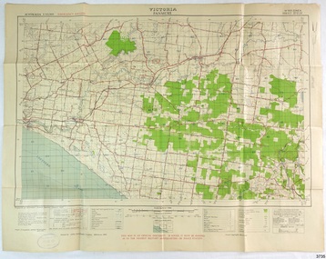
Document - Map, Department of Lands & Survey, Victoria / Panmure, 1942
... SALE / PRICE 2/- / - - - - - OF THE ARMY”) Military map of Panmure, Victoria, Australia; part of the W.R. Angus Collection. Rectangular coloured map on cream paper for the Australian Army. Details include sea, waterways and land, contour lines, grid lines, names of districts, towns and roads, bridges, swamps, rail lines, cuttings, tracks, buildings (including blacksmiths), pumps, lighthouses, telegraph, telephones and electric transmission lines, and fire stations. ...This Emergency Edition of the map of Panmure, Victoria, is part of the W.R. Angus Collection. It was printed in 1942 during World War II. It is one of two maps donated to Flagstaff Hill Maritime Village by the family of Doctor William Roy Angus, who served as Surgeon Captain in the Australian Defence Department. The map was compiled for the Dept. of Army by the Dept. of Lands and Survey in Melbourne, prepared by the Australian Section of the Imperial General Staff, which was a British Government body created in 1907 to co-ordinate the defence of Britain and its Empire. It was printed by A.H.Q. Cartographic Company, Survey Corps, which was formed in 1941. The Corp changed its name to L.H.Q. Cartographic Company of Bendigo. In 1947 the name reverted back to the A.H.Q. Cartographic Company until 1955 when it became the A.H.Q. Survey Regiment. The W.R. Angus Collection includes historical medical equipment, surgical instruments and material once belonging to Dr Edward Ryan and Dr Thomas Francis Ryan, (both of Nhill, Victoria) as well as Dr Angus’ own belongings. The Collection’s history spans the medical practices of the two Doctors Ryan, from 1885-1926 plus that of Dr Angus who began practice in 1924. Dr. Angus served with the Australian Department of Defence as a Surgeon Captain during the Second World Was from 1942 to 1945. He served in Ballarat, Victoria, and in Bonegilla, N.S.W. until he suffering from a heart attack just before the war ended. ABOUT THE “W.R.ANGUS COLLECTION” - Doctor William Roy Angus M.B., B.S., Adel., 1923, F.R.C.S. Edin.,1928, was generally known as Dr Roy Angus. His working life included a position as a doctor with the Flying Doctor Service in Australia’s rural and remote areas. After many varied experiences Dr Angus and his family moved to Warrnambool in 1939 where he purchased “Birchwood,” the 1852 home and medical practice of Dr John Hunter Henderson. He was appointed on a part-time basis as Port Medical Officer in Warrnambool and held this position until the 1940’s when the government no longer required the service of a Port Medical Officer. Dr Angus was a surgeon at the Warrnambool Base Hospital 1939-1942. After further studies he commenced practice as an ophthalmologist in Warrnambool, pioneering in artificial eye improvements. He was Honorary Consultant Ophthalmologist to Warrnambool Base Hospital for 31 years and made monthly visits to Portland to perform eye surgery. Dr Angus and his wife Gladys were very involved in Warrnambool’s community with a strong interest in civic affairs. They were both involved in the creation of Flagstaff Hill Maritime Village, including the layout of the gardens. After his death on 28th March 1970 his family requested his practitioner’s plate, medical instruments and some personal belongings be displayed in the Port Medical Office surgery at Flagstaff Hill Maritime Village, and be called the “W. R. Angus Collection”. This Emergency Edition of the Map of Panmure is significant as an example of the documents prepared for the defence of Australia in World War 2. The Map is also significant for its connection between the Australian Army and the involvement of Dr WR Angus as a Surgeon in the Medical Services during World War II. The W.R. Angus Collection is significant for still being located at the site it is connected with, Doctor Angus being the last Port Medical Officer in Warrnambool. The collection of medical instruments and other equipment is culturally significant, being an historical example of medicine, administration, household equipment and clothing from late 19th to mid-20th century. Dr Angus assisted Dr Tom Ryan, a pioneer in the use of X-rays and in ocular surgery. The collection includes Dr Angus’s Army objects and is significant as an example of items issued to Doctors and Surgeons in the Medical Services of the Australian Army in World War IIMilitary map of Panmure, Victoria, Australia; part of the W.R. Angus Collection. Rectangular coloured map on cream paper for the Australian Army. Details include sea, waterways and land, contour lines, grid lines, names of districts, towns and roads, bridges, swamps, rail lines, cuttings, tracks, buildings (including blacksmiths), pumps, lighthouses, telegraph, telephones and electric transmission lines, and fire stations. The map has margin notes that include distances in miles to nearby towns. The map was compiled for the Dept. of Army by the Dept. of Lands and Survey in Melbourne, prepared by the Australian Section, Imperial General Staff and printed by A.H.Q. Cartographic Company, Melbourne in 1942. Crown Copyright Reserved. Inscriptions in red print state that it is and Emergency Edition and an Official document. An oval purple stamp includes the price.Printed in black; 'Victoria / Panmure", "No. 930 / Zone 6" Printed in red; “EMERGENCY EDITION”, “THIS MAP IS AN OFFICIAL DOCUMENT. IF FOUND, IT MUST BE HANDED / IN TO THE NEAREST MILITARY HEADQUARTERS OR POLICE STATION” Stamped: within concentric ovals (“- - - FOR SALE / PRICE 2/- / - - - - - OF THE ARMY”)flagstaff hill, warrnambool, flagstaff hill maritime museum, maritime museum, shipwreck coast, flagstaff hill maritime village, great ocean road, dr w r angus, dr ryan, warrnambool base hospital, flying doctor, surgeon captain, australian department of defence, royal australian army, world war 2, map panmure 1942, roy angus, port medical officer, nhill base hospital, military map, emergency map, military service australian army, department of army, department of lands and survey, a.h.q. cartographic company melbourne, panmure 1942, australian section, imperial general staff -
 Flagstaff Hill Maritime Museum and Village
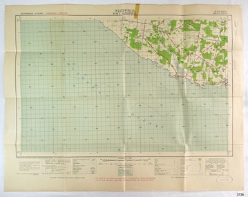
Document - Map, Department of Lands & Survey, Victoria / Port Campbell, 1942
... SALE / PRICE 2/- / - - - - - OF THE ARMY”) Military map of Port Campbell, Victoria, Australia; part of the W.R. Angus Collection. Rectangular coloured map on cream paper for the Australian Army. Details include sea, waterways and land, contour lines, grid lines, names of districts, towns and roads, bridges ...This Emergency Edition of the map of Port Campbell, Victoria, is part of the W.R. Angus Collection. It was printed in 1942 during World War II. It is one of two maps donated to Flagstaff Hill Maritime Village by the family of Doctor William Roy Angus, who served as Surgeon Captain in the Australian Defence Department. The map was compiled for the Dept. of Army by the Dept. of Lands and Survey in Melbourne, prepared by the Australian Section of the Imperial General Staff, which was a British Government body created in 1907 to co-ordinate the defence of Britain and its Empire. It was printed by A.H.Q. Cartographic Company, Survey Corps, which was formed in 1941. The Corp changed its name to L.H.Q. Cartographic Company of Bendigo. In 1947 the name reverted back to the A.H.Q. Cartographic Company until 1955 when it became the A.H.Q. Survey Regiment. The W.R. Angus Collection includes historical medical equipment, surgical instruments and material once belonging to Dr Edward Ryan and Dr Thomas Francis Ryan, (both of Nhill, Victoria) as well as Dr Angus’ own belongings. The Collection’s history spans the medical practices of the two Doctors Ryan, from 1885-1926 plus that of Dr Angus who began practice in 1924. Dr Angus served with the Australian Department of Defence as a Surgeon Captain during the Second World Was from 1942 to 1945. He served in Ballarat, Victoria, and in Bonegilla, N.S.W. until he suffering from a heart attack just before the war ended. ABOUT THE “W.R.ANGUS COLLECTION” - Doctor William Roy Angus M.B., B.S., Adel., 1923, F.R.C.S. Edin.,1928, was generally known as Dr Roy Angus. His working life included a position as a doctor with the Flying Doctor Service in Australia’s rural and remote areas. After many varied experiences Dr Angus and his family moved to Warrnambool in 1939 where he purchased “Birchwood,” the 1852 home and medical practice of Dr John Hunter Henderson. He was appointed on a part-time basis as Port Medical Officer in Warrnambool and held this position until the 1940’s when the government no longer required the service of a Port Medical Officer. Dr Angus was a surgeon at the Warrnambool Base Hospital 1939-1942. After further studies he commenced practice as an ophthalmologist in Warrnambool, pioneering in artificial eye improvements. He was Honorary Consultant Ophthalmologist to Warrnambool Base Hospital for 31 years and made monthly visits to Portland to perform eye surgery. Dr Angus and his wife Gladys were very involved in Warrnambool’s community with a strong interest in civic affairs. They were both involved in the creation of Flagstaff Hill Maritime Village, including the layout of the gardens. After his death on 28th March 1970 his family requested his practitioner’s plate, medical instruments and some personal belongings be displayed in the Port Medical Office surgery at Flagstaff Hill Maritime Village, and be called the “W. R. Angus Collection”. This Emergency Edition of the Map of Port Campbell is significant as an example of the documents prepared for the defence of Australia in World War 2. The Map is also significant for its connection between the Australian Army and the involvement of Dr WR Angus as a Surgeon in the Medical Services during World War II. The W.R. Angus Collection is significant for still being located at the site it is connected with, Doctor Angus being the last Port Medical Officer in Warrnambool. The collection of medical instruments and other equipment is culturally significant, being an historical example of medicine, administration, household equipment and clothing from late 19th to mid-20th century. Dr Angus assisted Dr Tom Ryan, a pioneer in the use of X-rays and in ocular surgery. The collection includes Dr Angus’s Army objects and is significant as an example of items issued to Doctors and Surgeons in the Medical Services of the Australian Army in World War IIMilitary map of Port Campbell, Victoria, Australia; part of the W.R. Angus Collection. Rectangular coloured map on cream paper for the Australian Army. Details include sea, waterways and land, contour lines, grid lines, names of districts, towns and roads, bridges, swamps, rail lines, cuttings, tracks, buildings (including blacksmiths), pumps, lighthouses, telegraph, telephones and electric transmission lines, and fire stations. The map has margin notes that include distances in miles to nearby towns. The map was compiled for the Dept. of Army by the Dept. of Lands and Survey in Melbourne, prepared by the Australian Section, Imperial General Staff and printed by A.H.Q. Cartographic Company, Melbourne in 1942. Crown Copyright Reserved. Inscriptions in red print state that it is and Emergency Edition and an Official document. An oval purple stamp includes the price.Printed in black; 'Victoria / Port Campbell", "No. 932 / Zone 6" Printed in red; “EMERGENCY EDITION”, “THIS MAP IS AN OFFICIAL DOCUMENT. IF FOUND, IT MUST BE HANDED / IN TO THE NEAREST MILITARY HEADQUARTERS OR POLICE STATION” Stamped: within concentric ovals (“- - - FOR SALE / PRICE 2/- / - - - - - OF THE ARMY”)flagstaff hill, warrnambool, flagstaff hill maritime museum, maritime museum, shipwreck coast, flagstaff hill maritime village, great ocean road, dr w r angus, dr ryan, warrnambool base hospital, nhill base hospital, flying doctor, surgeon captain, map port campbell 1942, roy angus, port medical officer, military map, emergency map, australian department of defence, royal australian army, military service australian army, department of army, department of lands and survey, world war 2, a.h.q. cartographic company melbourne, australian section, imperial general staff, port campbell 1942 -
 Greensborough Historical Society
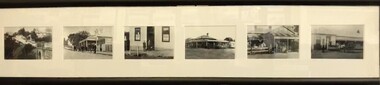
Postcards (framed), Greensborough Historical Society, Greensborough Historical Society Postcards. Series One, 2011_08
... Set of 6 postcards produced for sale by Greensborough Historical Society. Postcards Left to right: Plenty River Bridge; Quirk's Tea Rooms; Commercial Bank; Farmer's Arms Hotel, all Main Street; Medhurst Fruit Store, and, Greensborough Hotel, Grimshaw Street....Set of 6 postcards produced for sale by Greensborough Historical Society. Postcards Left to right: Plenty River Bridge; Quirk's Tea Rooms; Commercial Bank; Farmer's Arms Hotel, all Main Street; Medhurst Fruit Store, and, Greensborough Hotel, Grimshaw Street. greensborough historical society main street greensborough grimshaw street greensborough 6 black and white postcards in black timber frame, under glass. ...Set of 6 postcards produced for sale by Greensborough Historical Society. Postcards Left to right: Plenty River Bridge; Quirk's Tea Rooms; Commercial Bank; Farmer's Arms Hotel, all Main Street; Medhurst Fruit Store, and, Greensborough Hotel, Grimshaw Street.6 black and white postcards in black timber frame, under glass.greensborough historical society, main street greensborough, grimshaw street greensborough -
 Orbost & District Historical Society
display book, 2001-2002
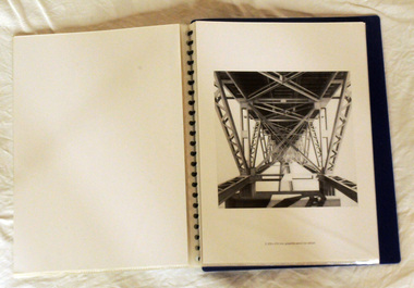
... In 2001 -2002 he began working on series of drawings about Mc Killops Bridge and environs for exhibition at Gippsland Art Gallery, Sale Victoria (Oct 2003). ...In 2001 -2002 he began working on series of drawings about Mc Killops Bridge and environs for exhibition at Gippsland Art Gallery, Sale Victoria (Oct 2003). ...Kevin Parker was born in 1942 in Melbourne and studied Architecture at RMIT and from 1965-1990 worked as a freelance architectural illustrator. He continued this when he moved to Deddick in East Gippsland in 1991. In 2001 -2002 he began working on series of drawings about Mc Killops Bridge and environs for exhibition at Gippsland Art Gallery, Sale Victoria (Oct 2003). These drawings and prints feature McKillop's Bridge an the item is a compilation from a folder usually sold in the Slab Hut (Orbost Visitor Information Centre). A loose-leaf display book of copies of architectural style pencil drawings by Deddick artist, Kevin Parker. There is an introduction by Valerie Auer of Tubbut. The drawings are of McKillop's Bridge.parker-kevin drawings mckillop's-bridge display-book -
 Ringwood and District Historical Society
Map - Public Land Sale by Thomas Ham, 2000 Acres for Sale - Crown Sections 20, 23, 24 - Ringwood, Victoria - 1855
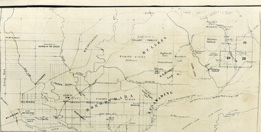
... Bridge, at Hawthorne, then take the left-hand road to KEW. When at the "Woodman Inn", take the Cotham Road to the right, bearing due east, keep this Road, passing Trainor's "White Horse" Inn, and before you leave the fences, you will see calico bills (see margin) nailed to the Trees on the bush track leading to the Upper Yarra country, follow the Bills till you come to the SOUTH boundary line of the Property, which bears East and West (see Plan) where you will see Bills nailed up "THIS PROPERTY FOR SALE, etc." ...Bridge, at Hawthorne, then take the left-hand road to KEW. When at the "Woodman Inn", take the Cotham Road to the right, bearing due east, keep this Road, passing Trainor's "White Horse" Inn, and before you leave the fences, you will see calico bills (see margin) nailed to the Trees on the bush track leading to the Upper Yarra country, follow the Bills till you come to the SOUTH boundary line of the Property, which bears East and West (see Plan) where you will see Bills nailed up "THIS PROPERTY FOR SALE, etc." ...Two 1850s surveyor's maps on cardboard backing showing area from Melbourne extending East beyond Bulleen and Nunawading. Detailed description of lots for sale and navigational directions to the property from Richmond by Thomas Ham, Victorian public servant, map maker, publisher, lithographer and original Ringwood land owner. Inset map enlarging area between Yarra River and Dandenong Creek, with southern boundary of allotments later forming part of Oban Road, North Ringwood.TRANSCRIPT: "This really valuable Property is now offered to the public for sale, in lots to suit purchasers at the Iow rate of £1 per Acre for 80 acres and upwards, and £1.10s per Acre for any smaller portion. Terms of payment Half Cash, Balance in 6 and 12 months, bearing 8 per cent interest. The Estate is well wooded with Gum, Cherry Tree and Stringy Bark, with Wattle in the valleys of the several creeks. Every lot is Staked and Trenched at the corners marked on the Plan thus - The Surveyor has carefully sub-divided the Property, in order to give every Farm a Creek for Water, Valley for Cultivation, and Hills for House and Grass Paddock. The ROADS have been very carefully laid out so as to give a firm, well drained, and nearly level road to each Homestead. Intending purchasers can readily find the property by the following directions, viz: Start from Richmond Bridge, at Hawthorne, then take the left-hand road to KEW. When at the "Woodman Inn", take the Cotham Road to the right, bearing due east, keep this Road, passing Trainor's "White Horse" Inn, and before you leave the fences, you will see calico bills (see margin) nailed to the Trees on the bush track leading to the Upper Yarra country, follow the Bills till you come to the SOUTH boundary line of the Property, which bears East and West (see Plan) where you will see Bills nailed up "THIS PROPERTY FOR SALE, etc." The Bills from Town lead direct to where Mr. Jull is erecting his Store, and arrangements have been made with him to show the lots to intending purchasers free of charge. At the respective corners of the lots the Bills are nailed up double, with numbers to denote the lot, and that the corner stake is adjacent. Any parties wishing to proceed to the property by way of BULLEEN will find Bills nailed on the Trees, commencing at the NEW INN, at "Wilson's Slip Rail." Keep this Track till you come to the Log Bridge, over the Deep Creek at Bloxhome's Paddock; go through the land now being cleared; keep the track over the hill till you come to an Iron House, you will then be on the property, which Iies to the North and East as per Plan. Follow the Bills till you come to Mr. Jull's Store, etc. etc. Further particulars can be had from the Agent for the Property. THOMAS HAM. " -
 Orbost & District Historical Society
maps, early 1900s
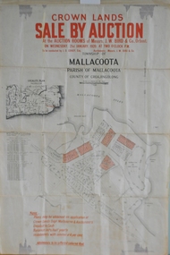
... Shire of Orbost Cunninghame Road - signed by the shire engineer. 796.9 - This is a hand drawn map of Orbost Cunninghame Road, November 1896. 796.10 - This is a hand drawn cross-section of a culvert on the Orbost Cunninghame Road. 796.11 - This is a plan of a culvert on Tabbara Road, 13th January 1899 796.12 - This is a poster for an "Important Subdivisional Sale' for land near Orbost Bridge, on Wednesday 16th March 1921 at the rooms of H. ...Shire of Orbost Cunninghame Road - signed by the shire engineer. 796.9 - This is a hand drawn map of Orbost Cunninghame Road, November 1896. 796.10 - This is a hand drawn cross-section of a culvert on the Orbost Cunninghame Road. 796.11 - This is a plan of a culvert on Tabbara Road, 13th January 1899 796.12 - This is a poster for an "Important Subdivisional Sale' for land near Orbost Bridge, on Wednesday 16th March 1921 at the rooms of H. ...796.1 - Crown Land Sale by auction in the township of Mallacoota on Wednesday January 1920 at 2pm. 796.2 - Snowy River farms , 630 acres of river flat land at Orbost on Wednesday April 28, 1909 at 2.30pm. 796.3 - Famous Orbost Flats - "Important Sale of Snowy River Land" , 900 acres subdivided into 13 choice farms on Wednesday 1st December 1920 at 2.30pm. 796.4 - "Second Great Sale in James' Subdivision", adjoining town of Orbost on 16th May, 1919 at 2pm. 796.5 - "Subdivisional Sale Brooklands Estate", 5 rich Snowy River farms on Wednesday 23rd February at 2.30 at Orbost on account of James Hossack Esq. 796.6 - "Subdivisional sale of Splendid Residence Sites and Handy Small Paddocks" adjoining the progressive town of Orbost on 5th March 1915 at 11am at the rooms of H.James & Co. 796.7 - This is a contract drawing on waxed paper. Crossing near Harbecks Cunninghame Signed and traced N. Anderson 17/11/00. 796.8 - A plan and specification on waxed paper. Shire of Orbost Cunninghame Road - signed by the shire engineer. 796.9 - This is a hand drawn map of Orbost Cunninghame Road, November 1896. 796.10 - This is a hand drawn cross-section of a culvert on the Orbost Cunninghame Road. 796.11 - This is a plan of a culvert on Tabbara Road, 13th January 1899 796.12 - This is a poster for an "Important Subdivisional Sale' for land near Orbost Bridge, on Wednesday 16th March 1921 at the rooms of H. James & Co. These documents are an important part of Orbost history in that they show how the town and surrounding areas were subdivided for farming and residential settlement.A set of twelve maps, plans and land sale posters .orbost-land-1900s maps posters h.james -
 Ringwood and District Historical Society
Pamphlet, G.A. Green, Auction Sale Brochure - Garden Farms Estate, Ringwood, Victoria - 1919, 1919
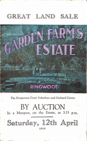
... Bridge over Dandenong Creek. (Image) On one of the timbered lots adjoining railway. (Image) This Dandenong Creek traveres the Estate. (Image) Main Fern Tree Gully Line bisects the Estate. Multi-fold brochure advertising public auction of one-acre, 2-acre, 5-acre and 8-acre allotments in Ringwood and Bayswater on Saturday 12th April, 1919. Brochure includes terms of sale ...Multi-fold brochure advertising public auction of one-acre, 2-acre, 5-acre and 8-acre allotments in Ringwood and Bayswater on Saturday 12th April, 1919. Brochure includes terms of sale, description of subdivision features and local facilities, and photographic images of the area.Subdivison includes Canterbury Road Heathmont, Armstrong Road Heathmont, Armstrong Road Bayswater, Bungalook Road Heathmont, Bungalook Road Bayswater, and Orchard Road Bayswater. Road shown as Bayswater Road to Bayswater became Mountain Highway Bayswater. Vendor: H.E.B.Armstrong, Auctioneers: Coghill & Haughton, 79 Swanston Street Melbourne, Telephone Central 2793, in conjunction with J.B. McAlpin, Ringwood, Opposite Station, Telephone Ringwood 7. (Map) Woodcock & McCormack, Civil Engineers Architects & Surveyors, 430 Little Collins Street, Melbourne, Phone 3241 Central. MOST OF THE MONEY COMES OUT OF THE LAND. And more money can be obtained from anb acre of fruit than from an acre of any other produce. But you do not have to grow fruit on Garden Farms Estate. You can go in for - Outer Suburban Home - Market Garden - Orchard - Pig Raising - Poultry Farm - Small Dairy Farm - Small Fruits - Floral Culture - Scent and Bee Farm - Or just for a Week-end Home. RINGWOOD - THE PLACE TO LIVE. The Beautiful Ringwood District has so many natural attractions, that half a Land Agent's work is done in just showing a prospective buyer round and about. Ringwood has a pull of its own that attracts folk, proved beyond doubt by its rapid development within the last decade (spite the war). First, it is high and healthy, picturesque and undulating, convenient of access, sufficiently close to the Metropolis for City and Business folk to live at Ringwood. Its development is solid, because most of its people are industrious husbandmen, real producers, who have turned idle hills into smiling gardens. These are the kind of real people to live amongst; ones who wear out their spades. The rapidly-developing town has excellent Stores, Trade and Repair Shops Churches, Banks, Telephone Exchange, Weekly General Market, Cool Stores, and good Private and State Schools, etc.; is Electrically lit, has Metropolitan Water Supply, and generally provides so that practically all shopping can be done locally. WHY RINGWOOD MUST GROW. Ringwood is a great centre and must be a greater. Two rapidly-developing railways junction here. The passengers from Ringwood Station cityward, in one year, number 250,000. Ringwood will be the terminus of the Outer Suburban Electric Eastern Railway. Its natural boundaries are the River Yarra on the North, Dandenong Creek on the South, the popular town of Croydon on the East, and the suburb of Mitcham on the West. This is a large territory that is steadily being converted from intense culture, and then it might be called (as regards its gardens) "The Devon Territory of Victoria." ARMSTRONG ROAD. This new road traverses Garden Farms Estate from its northern boundary on the main Canterbury Road, across Dandenong Creek, to its southern boundary on the main Bayswater Road, and will provide a long-desired additional link of communication between Bayswater and Ringwood. The 1-acre building sites on Bayswater Road are within 8 minutes' walk of the Bayswater Railway Station, and the Canterbury Road frontages are only 1-1/2 miles from Ringwood Station, and 1/2 mile from the Railway Station site of Canterbury Road; therefore, the whole Estate is easy of access and there should be a large demand for land so favourably placed. (Image) Cultivation Field - Potatoes on Lot 28 (Image) Picture of Bayswater Creek Flats. (Image) View from "Korumbeen" where Mr. Armstrong lived on Garden Farms Estate. Estate outlined in white ring. (Image) Site of New Bridge over Dandenong Creek. (Image) On one of the timbered lots adjoining railway. (Image) This Dandenong Creek traveres the Estate. (Image) Main Fern Tree Gully Line bisects the Estate. -
 Ringwood and District Historical Society
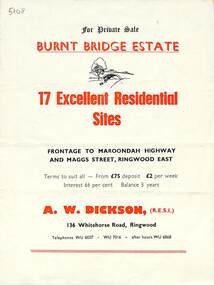
Flyer, Land Sale Brochure, Burnt Bridge Estate, Ringwood East/Croydon, Vic. - circa 1959
... Land Sale Brochure, Burnt Bridge Estate, Ringwood East/Croydon, Vic. - circa 1959...Bi-folded single sheet with black and red print both sides including subdivision features and local facilities Land Sale Brochure, Burnt Bridge Estate, Ringwood East/Croydon, Vic. - circa 1959 Flyer ...Bi-folded single sheet with black and red print both sides including subdivision features and local facilitiesSubdivision layout includes Marcus Road, Maggs Street and Maroondah Highway Croydon/Ringwood East. (Agent) A.W. Dickson, 136 Whitehorse Road, Ringwood, Telephones WU 6007, WU 7016, after hours WU 6868. -
 Ringwood and District Historical Society
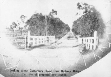
Photograph, Canterbury Road, Heathmont, looking from bridge towards Bedford Road. 1923
... Sale 15/12/1923 by Public Auction." Black and white photograph (2 copies) Canterbury Road, Heathmont, looking from bridge towards Bedford Road. 1923 Photograph ...Black and white photograph (2 copies)Written on rear of one photograph: "Coleman's Heathmont Estate looking towards Bedford Rd. Sale 15/12/1923 by Public Auction." -
 Ringwood and District Historical Society
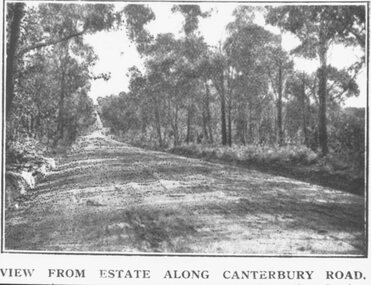
Photograph, Coleman's Heathmont Estate Sale, 15/12/1923. Looking west along Canterbury Road Heathmont. Railway bridge is situated at foot of hill
... Sale, 15/12/1923. Looking west along Canterbury Road Heathmont. Railway bridge is situated at foot of hill....bridge at foot of hill. Area in foreground now shopping centre both sides of road. Copy of black and white photograph Coleman's Heathmont Estate Sale, 15/12/1923. ...Copy of black and white photographImage shows a view from Estate along Canterbury Road looking towards city. Railway bridge at foot of hill. Area in foreground now shopping centre both sides of road. -
 Ringwood and District Historical Society
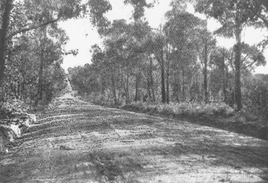
Photograph, View from Coleman's Estate, Heathmont, looking west along Canterbury Road. 1923
... Written on rear of backing sheet: "Coleman's Heathmont Estate. Sale 15/12/23. Railway bridge is seen at foot of hill where new station site has been surveyed." ...Written on rear of backing sheet: "Coleman's Heathmont Estate. Sale 15/12/23. Railway bridge is seen at foot of hill where new station site has been surveyed." ...Black and white photographWritten on rear of backing sheet: "Coleman's Heathmont Estate. Sale 15/12/23. Railway bridge is seen at foot of hill where new station site has been surveyed." (Now shops along this part of road). -
 Eltham District Historical Society Inc
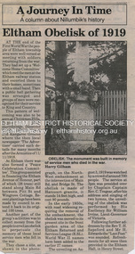
Folder, Eltham Obelisk (later Cenotaph), 1918-2018
... Bridge Street at Main Road was revised necessitating the relocation of the Eltham Obelisk. It was ‘temporarily’ relocated to the front garden of the Eltham RSL Sub-Branch on Main Road for safe keeping. In 2007, a suggestion was proposed by Harry Gilham (President, EDHS) to John Cohen (ERSL) to claim a special site along with the historic Shillinglaw trees on the now vacant former Eltham Shire Office site adjacent to the Eltham War Memorial precinct for relocation of the obelisk. In 2010 following the financial collapse and sale...Bridge Street at Main Road was revised necessitating the relocation of the Eltham Obelisk. It was ‘temporarily’ relocated to the front garden of the Eltham RSL Sub-Branch on Main Road for safe keeping. In 2007, a suggestion was proposed by Harry Gilham (President, EDHS) to John Cohen (ERSL) to claim a special site along with the historic Shillinglaw trees on the now vacant former Eltham Shire Office site adjacent to the Eltham War Memorial precinct for relocation of the obelisk. In 2010 following the financial collapse and sale ...The Eltham Obelisk was originally located at the corner of Bridge and Main Roads in 1919. It commemorated the memory of the Eltham Soldiers who fell in the First World War and complemented the Eltham Avenue of Honour established in 1917 to those that served. In 1943 (WW2) the local community commenced plans to establish the Eltham War Memorial, a living memorial to benefit the children as opposed to a one in stone as per the obelisk. The Eltham War Memorial Trust was established in 1945. In 1947 the Trust intended for the Obelisk to be relocated from Bridge Street and Main Road to the Garden of Remembrance which was planned as part of the Baby Health Centre which was to be the first of three buildings of the Eltham War Memorial to be built in 1951. In 1951 the Eltham RSL was invited to be represented on the Eltham War Memorial Trust. During the period of June through October 1956 the original wooden bridge over the Diamond Creek in Bridge Street was replaced with a new concrete structure. At the same time the intersection of Bridge Street at Main Road was revised necessitating the relocation of the Eltham Obelisk. It was ‘temporarily’ relocated to the front garden of the Eltham RSL Sub-Branch on Main Road for safe keeping. In 2007, a suggestion was proposed by Harry Gilham (President, EDHS) to John Cohen (ERSL) to claim a special site along with the historic Shillinglaw trees on the now vacant former Eltham Shire Office site adjacent to the Eltham War Memorial precinct for relocation of the obelisk. In 2010 following the financial collapse and sale of the Eltham RSL Sub-Branch property and amalgamation with the Montmorency Eltham RSL sub-branch, the location of the obelisk was again in immediate jeopardy and in conjunction with Nillumbik Shire Council, supported by the RSL, the obelisk was relocated in front of the Eltham War Memorial buildings in preparation for the Dawn Service on Anzac Day 2012. The new location resulted in significant impact upon the Eltham War Memorial Garden. Council’s preferred location was near the Eltham Library however that would have cost $39,000. The Eltham War Memorial Garden was subjected to further intrusion in 2014 with a proposed expansion of the War Memorial Terrace. Contents: 1. Newspaper article: Eltham, The Advertiser, 15 Nov 1918 2. Newspaper article: Eltham, The Advertiser, 18 Nov 1918 3. Newspaper article: An Obelisk at Eltham, The Advertiser, 11 Jul 1919 4. Newspaper advertisement: Unveiling of Obelisk at Eltham, The Advertiser, 1 Aug 1919 5. Newspaper article: Eltham Soldiers’ Memorial; Unveiled by Sir William Irvine, The Argus, Monday, 4 Aug 1919, p8 6. Newspaper article: Memorial to the Fallen; Unveiled at Eltham, The Age, Monday, 4th August 1919 7. Newspaper article: Eltham Memorial to Fallen Soldiers, Diamond Creek Valley Advocate, 8 Aug 1919 8. Newspaper article: Programme - Presentation of German Machine Gun at the Obelisk, Eltham on Sunday, 8th August 1920, at 3.30 P.M. 9. Newspaper article: article about presentation of a war trophy, a heavy machine gun placed beside obelisk, The Advertiser, 13 Aug 1920 10. Newspaper article: Eltham: ANZAC Services, The Advertiser, Friday, May 2, 1924 11. Newspaper article: Eltham War Memorial, The Advertiser, Oct 26, 1928 12. Newspaper article: Obelisk honors their memory, Diamond Valley News, March 30, 1971, p11 13. Newspaper article: Eltham Obelisk of 1919, Harry Gilham, August 2000 as well as draft submitted dated 22 Aug 2000 14. Newspaper article: Names renewal, thanks to Barry, Diamond Valley Leader, 18 Apr 2007, p3 with picture featuring Eltham RSL president John Haines and Gwen Rosewall 15. Handwritten note from Harry Gilham (President EDHS) to John Cohen (ERSL) regarding history of Eltham RSL site and 1947 newspaper article "Eltham War Memorial Trust "Garden of Remembrance" referencing relocation of Obelisk to the proposed Garden of Remembrance at the Baby Health Centre (Eltham War Memorial), 24 December 2000. 16. Minutes of Eltham RSL and Community Meeting held at 29 Nyora Road, Eltham, 23 June 2010 (Community meeting re closure of Eltham RSL sub-branch and relocation of the WW1 Obelisk) 17. Newspaper article: RSL branch has a fight on its hands by Alana Schetzer, Heidelberg & Valley Weekly, 3 August 2010, p7 18. Newspaper article: Locals battle state RSL over building, Diamond Valley Leader, 4 August 2010, p7 19. Newspaper article: Move war memorial: RSL, c. Dec. 2010 20. Officers' reports, 11.113/10 Relocation of Eltham RSL Cenotaph, Nillumbik Shire Council Ordinary Meeting, 21 December 2010 21. Newspaper article: New home for cenotaph; Councillors support proposal for relocation to Eltham's War Memorial Hall, Diamond Valley Leader, 12 January 2011 22. Newspaper article: CFA hot for RSL site; MP presses for 'fast-track' purchase, Diamond Valley Leader, 23 February 2011, p1 23. Email Correspondence: EDHS President to NSC General Manager Community and Leisure re RSL Obelisk (Cenotaph) proposed relocation, 24 May 2011 24. Officers' reports, OCM.091/11 Interim Relocation site for the Eltham Cenotaph, Nillumbik Shire Council Ordinary Meeting, 23 August 2011 25. Newspaper article: New home for cenotaph delights war veterans, Diamond Valley Leader, 31 August 2011, p9 26. Newsletter Extract: Eltham RSL and War Memorial, EDHS Newsletter 14 Sep 2011 27. Officers' reports, OCM.004/121 Interim Relocation of the Eltham Cenotaph, Nillumbik Shire Council Ordinary Meeting, 31 January 2012 (includes Funding agreement between NSC and Montmorency-Eltham RSL Sub-branch Inc) 28. Newspaper article: Memorial move lags, Diamond Valley Leader, 1 February 2012 29. Site history of Obelisk and Wall Memorial Hall, Montmorency-Eltham RSL, March 2012 draft 30. Open Letter to the Residents of ELTHAM and MONTMORENCY [And their Surrounding Districts]; Montmorency-Eltham RSL, 19 March 2012 (including drafts) 31. Newspaper advertisement: Open letter to the residents of Eltham and Montmorency, Montmorency Eltham RSL, Diamond Valley News, 21 March 2012 32. Newspaper advertisement: Open letter to the residents of Eltham and Montmorency, Montmorency Eltham RSL, Banyule & Nillumbik Weekly, 27 March 2012, p7 33. Newspaper article: New dawn for tribute, Diamond Valley Leader ca April 2012 34. Email (Copy): Alex Smith (MERSL Ast. Sec.) advising that contractor (Malcorp) will relocate obelisk Monday, April 2, 2012 35. Newspaper article: Memorial Moved, Banyule/Nillumbik Weekly, 10 April 2012 36. Newspaper article: Eltham cenotaph move goes 'like clockwork', Diamond Valley Leader, 11 April 2012 37. Newspaper photo: Veterans (l-r) Alan Field, Max Lowerson and John Cohen will join piper David Cretney to commemorate fallen Diggers, 2012 (standing beside relocated obelisk in front of the Eltham War Memorial complex), c. 11 April 2012 38. Advertisement, Program for Eltham Dawn Service, Diamond Valley Leader, April 2012 39. Program for Montmorency Anzac Day March 2012 (incomplete, some pages duplicated, some pages upside down). 40. Newspaper article: RSL site nets $1.8m, Diamond Valley Leader, 9 May 2012 41. OCM.076/13 Amendment C84 Eltham Cenotaph; 11. Officer's reports, Ordinary Meeting of Council Agenda, 25 June 2013, pp42-44 and Attachment; Amendment C84 Eltham Cenotaph; Citation - Eltham War Memorial (4 pages) 42. Newspaper article: Council seeks to protect cenotaph, Diamond Valley Leader, Wednesday, July 3, 2013, p5 43. Newspaper article: Future safe for war memorial, Diamond Valley Leader, Wednesday, November 13, 2013, p5 44. Handwritten notes in pencil (2 pages) by Harry Gilham, Items form the Eltham and Whittlesea Shires The Advertiser newspaper 7 June 1918 - 1919 providing a summary of the formation of the Peace Celebration Committee leading to the establishment of the Avenue of Honour and the Eltham Obelisk and seeking information in lead up to WW1 Centenary, 2013 45. Newspaper article: Memories of our heroes, Diamond Valley Leader, 25 Apr 2018 – also Veteran saluted, featuring article on Army veteran, Glen Ferrarotto. Contents: Newspaper article: Eltham Obelisk of 1919, Harry Gilham, August 2000 as well as draft submitted dated 22 Aug 2000 Newspaper article: Eltham, The Advertiser 15 Nov 1918 and 18 Nov 1918 Newspaper article: An Obelisk at Eltham, The Advertiser, 11 Jul 1919 Newspaper advertisement: Unveiling of Obelisk at Eltham, The Advertiser, 1 Aug 1919 Newspaper article: Eltham Soldiers’ Memorial; Unveiled by Sir William Irvine, The Argus, Monday, 4 Aug 1919, p8 Newspaper article: Eltham Memorial to Fallen Soldiers, Diamond Creek Valley Advocate, 8 Aug 1919 Newspaper article: Memorial to the Fallen; Unveiled at Eltham, The Age, Monday, 4th August 1919 Newspaper article: Programme - Presentation of German Machine Gun at the Obelisk, Eltham on Sunday, 8th August, 1920, at 3.30 P.M. Newspaper article: article about presentation of a war trophy, a heavy machine gun placed beside obelisk, The Advertiser, 13 Aug 1920 Newspaper article: Eltham: ANZAC Services, The Advertiser, Friday, May 2, 1924 Newspaper article: Eltham War Memorial, The Advertiser, Oct 26, 1928 Handwritten note from Harry Gilham (President EDHS) to John Cohen (ERSL) regarding history of Eltham RSL site and 1947 newspaper article "Eltham War Memorial Trust "Garden of Remembrance" referencing relocation of Obelisk to the proposed Garden of Remembrance at the Baby Health Centre (Eltham War Memorial). Officers' reports, 11.113/10 Relocation of Eltham RSL Cenotaph, Nillumbik Shire Council Ordinary Meeting, 21 December 2010 Email Correspondence: EDHS President to NSC General Manager Community and Leisure re RSL Obelisk (Cenotaph) proposed relocation, 24 May 2011 Newsletter Extract: Eltham RSL and War Memorial, EDHS Newsletter 14 Sep 2011 Officers' reports, OCM.091/11 Interim Relocation site for the Eltham Cenotaph, Nillumbik Shire Council Ordinary Meeting, 23 August 2011 Officers' reports, OCM.004/121 Interim Relocation of the Eltham Cenotaph, Nillumbik Shire Council Ordinary Meeting, 31 January 2012 (includes Funding agreement between NSC and Montmorency-Eltham RSL Sub-branch Inc) Newspaper article: Move war memorial: RSL, c.2011 Newspaper article: Memorial move lags, Diamond Valley Leader, 1 February 2012 Newspaper article: New dawn for tribute, Diamond Valley Leader ca April 2012 Open letter to the residents of Eltham and Montmorency and copies of drafts by the Montmorency Eltham RSL, no date and final version published in Diamond Valley New 21 March 2012 and Banyule & Nillumbik Weekly, 27 March, 2012 Newspaper article: RSL site nets $1.8m, Diamond Valley Leader, 9 May 2012 Newspaper article: Memorial Moved, Banyule/Nillumbik Weekly, 10 April 2012 Newspaper article: Eltham cenotaph move goes 'like clockwork', Diamond Valley Leader, 11 April 2012 Advertisement, Program for Eltham Dawn Service, Diamond Valley Leader, April 2012 Newspaper photo: Veterans (l-r) Alan Field, Max Lowerson and John Cohen will join piper David Cretney to commemorate fallen Diggers, 2012 (standing beside relocated obelisk in front of the Eltham War Memorial complex) Program for Montmorency Anzac Day March 2012 (incomplete, some pages duplicated, some pages upside down). Newspaper article: Plan to expand memorial, Diamond Valley Leader, Sep. 2004, p5 Newspaper article: Names renewal, thanks to Barry, Diamond Valley Leader, 18 Apr 2007, p3 with picture featuring Eltham RSL president John Haines and Gwen Rosewall Letter: EDHS President to Manager Community Participation, Learning and Culture, Nillumbik Shire Council regarding a proposal by the Montmorency-Eltham RSL Sub-branch to expand the area occupied by the relocated obelisk further into the Eltham War Memorial Garden of Remembrance, 18 Aug 2014 Notices of Motion, NOM.001/14 pertaining to memorials Advisory Committee and Montmorency-Eltham RSL to upgrade the Eltham War Memorial site in time for ANZAC Day 2015, Nillumbik Shire Council Ordinary Meeting, 26 August 2014 Agenda: User Groups and Stakeholders Meeting, Proposed Extension to Memorial Terrace, 11 September 2014 EDHS presentation to NSC Policy and Services meeting 9 September 2014 regarding the Montmorency-Eltham RSL proposal to expand/upgrade the Eltham War Memorial Policy and Services reports, PSD.034/14 Eltham War Memorial Building Precinct - Proposed Extension to Memorial Terrace, Nillumbik Shire Council Ordinary Meeting, 9 September 2014 Email (copy): President EDHS re Eltham War Memorial Complex, Main Road, Eltham, 15 Sep 2014 requesting Nillumbik Shire Council place a Heritage Overlay upon the Eltham War Memorial Complex Media Release: Support for cenotaph expansion, Nillumbik Shire Council, Sep 2014 Newspaper article: Council defers RSL war memorial upgrade to see consultation, Diamond Valley News, 17 Sep 2014 Letter (copy): Harry Gilham, Eltham to local press and others, 20 Sep 2014 protesting attempts by the RSL to further expand upon the area already ceded from the Eltham War Memorial for the relocated WW1 obelisk and alter the original vision for an Eltham War Memorial complex. Letter: Alan Field, President, The Eltham Veterans War Memorial Preservation Society Inc. to CEO and Councillors, Nillumbik Shire Council protesting at perceived injustices and ‘veteran bashing’ regarding their previous efforts to relocate ‘their Obelisk and Cenotaph’ to the Eltham War Memorial complex and their frustration in their attempts to further expand upon the Memorial Terrace. Areas of letter are highlighted with handwritten markups and notes. Also notes on loose card and paper with definitions of Memorial, Obelisk, Cenotaph, commentary on establishment of Eltham War Memorial, The Eltham War Memorial Trust and RSL involvement and current actions by RSL in respect to claims in the letter (written by Harry Gilham ?). Policy and Services reports, PS.038/14 Eltham War Memorial Building Precinct - proposed extension to the Eltham Cenotaph Terrace, Nillumbik Shire Council Policy and Services Committee Meeting, 14 October 2014 Newspaper article: Centenary dawn service moves to Petrie Park, Diamond Valley Leader, 22 Oct 2014 Newspaper article: Upset over upgrade; war memorial revamp plans get culled, Diamond Valley Leader, 29 Oct 2014 Newspaper article: Memories of our heroes, Diamond Valley Leader, 25 Apr 2018 – also Veteran saluted, featuring article on Army veteran, Glen Ferrarotto. Handwritten notes in pencil (2 pages) by Harry Gilham, Items form the Eltham and Whittlesea Shires The Advertiser newspaper 7 June 1918 - 1919 providing a summary of the formation of the Peace Celebration Committee leading to the establishment of the Avenue of Honour and the Eltham Obelisk Newspaper article: Obelisk honors their memory, Diamond Valley News, March 30, 1971, p11eltham cenotaph, nillumbik shire council, eltham war memorial, montmorency eltham rsl sub-branch, dawn service, cenotaph, eltham rsl sub-branch, eltham war memorial trust, garden of remembrance, harry gilham collection, john cohen, obelisk, remembrance garden, shillinglaw trees, german machine gun, war memorial, war trophy
