Showing 157 items matching broughton
-
 Surrey Hills Historical Society Collection
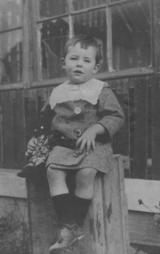
Digital photo, Alan Holt as an infant, c1914
Alan Judge Holt as an infant. He was born 16 June 1912, one of 3 sons of Edmund Holt and his wife Ruby Ellen Sutton. His brothers were Frederick Sutton Holt (1914-1992) and Raymond James Holt (1918-2000). The family home was 9 Beatrice Avenue, Surrey Hills and the family were active members of the Surrey Hills Methodist Church. Alan married Edna Jean Pallot in 1937 and they too had 3 sons - Barry, Neville and Max. Alan and Edna and family lived at 62 Broughton Road, Surrey Hills; later Alan and Edna lived at 2 Earle Street, Mont Albert and finally 13 Berry Street, Box Hill. Alan became Secretary of the Victorian Lands Department. He was passionate about local history and was responsible for much of the backbone research and records of the Surrey Hills local history collection. He died in 1993.A young Alan Judge Holt sitting on a box. Estimated age is 2 years.alan holt, alan judge holt, infants -
 Surrey Hills Historical Society Collection
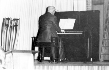
Photograph, Alan Judge Holt at the piano
His dates: 1913-1993. ‘Kenilworth’, 9 Beatrice Avenue was home of Edmund Holt, his wife and 3 sons Ray, Fred and Alan who attended Surrey Hills State School in their primary years. The family were very involved with the Methodist (Uniting) Church. Alan became organist and for some years also played at the Canterbury Presbyterian Church. He was well-liked from his days as a newspaper delivery boy, and after marriage lived at 62 Broughton Road and then 2 Earle Street taking part in various local activities with his wife Edna and three boys. After completing his secondary education at University High Alan joined the Public Service and after a time in the Premier’s Department moved to the Lands Department. He became Secretary of that department and after retirement moved to 13 Berry Street, Box Hill. He keenly researched the history of Surrey Hills. He left his collection of Surrey Hills history to the people of Surrey Hills. A black and white photograph of a man playing at a piono. He is dressed in a suit and has his back to us. There is a planter stand to the left of the photo.kenilworth, beatrice avenue, surrey hills, mr alan judge holt, lands department, organist, surrey hills methodist church, canterbury presbyterian church, mrs edna holt, broughton road, earle street, pianist -
 Tatura Irrigation & Wartime Camps Museum
Folio, Photographs of Army Garrison Members
Material collected and donated. Photographs of Army Garrison members; POW Camps including Graytown. Records E.J. Martin; T.J. Bowen; K. Liston; Photograph of water colour sketch by Pow. H. Hartmann. Dinner menus. 2/2nd. Pioneer march through Tatura. Photograph of Sgt. Johan Thomsen and five others at Graytown. Service Record White, Cyril Leyshon (2). Report of sale of paintings - Mrs. Ethel Jones, Bendigo. Service Record - Broughton Edward Renata Muhunga. Copy of AWM record 17th Garrison Battalion. Copy of AWM record 17th Garrison Battalion No. 1 Camp WW1. Copy of drawing by Leyshon-White, Cyril. Photocopy of group including N.J. Thomsen. Photocopied AWM photos including W. Ruthven. Photocopied AWM photo of delayed action rifle firing device invented by W.C. Scurry. Photo and appointment of Lieut. Tackaberry. Six photos of camps and sketch of Dhurringile donated by W. Severino.Black two ring folder with printed material and photos in plastic sleeves.army garrison members, pow camp graytown, e j martin, t j bowen, k liston, h hartmann, dinner menus, pioneer march, sergeant johan thomsen, greytown pow camp, cyril leyshon white, mrs ethel jones, edward renate muhunga broughton, 17th garrison battalion, n j thomse, w ruthven, delayed action rifle firing device, w c scurry, lieutenant tackaberry, w severino -
 Surrey Hills Historical Society Collection
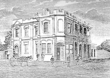
Photograph, Humberstone's Royal Hotel Surrey Hills
Humberstone's Royal Hotel was a substantial 2-storey building on the corner of Canterbury and Broughton Road. The hotel was built in 1887 to replace an older hotel (Delany's Hotel) built further east in 1856. It was de-licensed in 1921 after a "Local Option Poll" and became Tower House Day & Boarding School under Miss Marion Beetson from 1922 until 1932. It was demolished in 1932. There were 25 students in the 1920's, mostly boarders from outside Surrey Hills and all primary school students. The school room was detached from the main building and there was 6 acres of playing area. The old bar was the business office, the girls' dormitory the old dining room. Marion Beetson was the teacher, Mary Beetson managed the household. Their father was an Indian Army officer. The younger children wore a school blazer with the T.H.C. badge on the pocket. Miss Susan Kelsall visited to give piano lessons and Prof. Kelsall taught French. Miss Marion Beetson died in Castlemaine on 8 February 1952. Information courtesy of Mrs Louise Bell, Castlemaine, ex-student. See SHP0867a and SHP0867b, photos of Louisa in T.H.C. uniform. Photograph of line sketch of Humberstone's Royal Hotel, Surrey Hills. In the foreground is a horse and cart with 5 men standing in front of the hotel. Main entrance is on the corner of the intersection with large windows. There are 8 on one side and 3 on the other with 4 arches on both upper and ground floors. Turret style edging hides the rooftop with two chimneys visible. Pencilled on back "Spare - have in/ our photo files"delany's hotel, miss marion beetson, humberstone's royalhotel, surrey hills, canterbury road, broughton road, hotels, accommodation, royal hotel, tower house day and boarding school, 1880-1890, mary beetson -
 Federation University Historical Collection
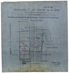
Plan, Plan applied for a Lease, Parishes of Glenmora and Rothcar, 27/05/1913
Plan on linen showing mining leases around the township of Lower Homebush, District of Maryborough. Scale: 20 chains to in inch (1:15840) WGS 84 Centroid Lat: 37 degrees 01 feet 35 inches S Long: 143 degrees 30 feet 35 inches S NS: 3.2km EW: 2.8km glenmona, rathcar, gladstone, maryborough, mining, clarence smith, homebush, clarence smith, w d thompson, peter leyden, b elliot, c horne, a field, john leydon, g jolly, r e jolly, d garner, s j barry, m harris, a harris, w j mcconnell, ellen harris, r j harris, j barry, t curtain, s garner, e barry, m j barry, l e squires, wilkins jnr, e c grace, e j field, mary field, m broughton, b l lusby, m j lusby, j e field, f broughton, j gillock, m simmons, glenmona, rathscar, parish of avoca, maryborough district, albert field, g grose, j harris -
 Surrey Hills Historical Society Collection
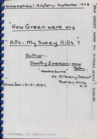
Book, Dorothy Selby (nee Emerson), How green were my hills - my Surrey Hills, September 1979
A biographical history by Dorothy Selby (nee Emerson) recollecting the people she came into contact with during her time in Surrey Hills from 1915-1937.A4, comb binding, 9 pageshouse names, kookaburra, albany crescent, surrey hills, (miss) dorothy emerson, (mrs) dorothy emerson, warrigal road, boundary road, st stephen's presbyterian church, (mrs) - gillies, (mr) tom ward, dentist, (mrs) - bowen, edwardian style, royal hotel, broughton road, (mrs) - brogan, (mr) - brogan, (mr) - tuckett, tacey's butcher, (mr) james tait, draper, (mr) alfred rose, state savings bank, surrey college, tower house college, balmoral crescent, (mr) - clewett, (mr) percy blood, stenning and holyoak, grocers, (mr) - pell, greengrocer, confectioner, fishmonger, (mr) tommy everon, (miss) beatrice bligh, (mr) - lyons, (mr) - ray, surrey hills station, transport, (ms) kitty mcewan, golfer, taxis, (mr) - collins, surrey hills primary school, (dr) (mr) - forsythe, (dr) (mr) - gandever, windsor crescent, valonia avenue, victoria avenue, (mr) john blogg, progress association, rechabite hall, (mr) claude wardle, (miss) beatrice oakley, empire day, (mr) robert gordon menzies, girl guides, (ms) nancy steele, (ms) hattie steele, (dr) (mr) - blaikie, (mr) - richards, stationmaster, crime, (mr) - cockerill, (mr) horrie breedon, first enlistment, (mr) (rev) brazier, (mr) (rev) - oakes, (mr) (rev) - gillies, (mr) (rev) - mudford, (mr) (rev) - millikan, (mr) (rev) - cockett, (mr) (rev) alfred gifford, (mr) (fr) david gleeson -
 Surrey Hills Historical Society Collection
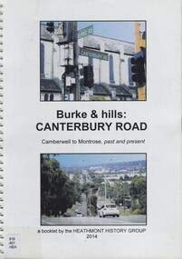
Book, Burke & hills: Canterbury Road, Camberwell to Montrose, past and present, 2014
Co-author Gerry Robinson was a speaker at a Surrey Hills Historical Society (SHHS) meeting. Lyndel Walker, member of SHHS, purchased the book for the collection. This book examines the changing landscape of Canterbury Road from the early days of settlement until today (2015)This book examines the changing landscape of Canterbury Road from the early days of settlement until today (2015)burke, surrey hills, canterbury, broughton park, vegetation, (mr) denis delaney, geology, (mr) john mcclare, geography, (mrs) mary mcclare, churches -
 Surrey Hills Historical Society Collection
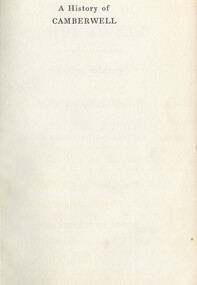
Book, A History of Camberwell, 1964
Includes description including photographs of Camberwell Junction and Burke Road, pre 1950's era. Electric transport 1916-1925, tools and waterways. Published [Brisbane] : Jacaranda Press in association with the Camberwell City Council, 1964 From estate of Ken Hall; Cheryl Poustie was Ken's daughter. Records in detail history and development of the Melbourne suburb of Camberwell. A city covering thirteen square miles. Begins with first European settlement in 1835 by John Gardiner - ending at 1960.Records in detail history and development of the Melbourne suburb of Camberwell. A city covering thirteen square miles. Begins with first European settlement in 1835 by John Gardiner - ending at 1960.Title Page: Kenneth T.Hall / 89-4418camberwell - history, (mr) john gardiner, outer circle railway, camberwell (vic) - history, broughton hall -
Surrey Hills Historical Society Collection
Folder of real estate advertisements, Folders of real estate advertisements (Streets beginning with B), Various
A4 folders with individual pockets for each property in streets beginning with B located in Surrey Hills and Mont Albert. Folders are ordered by street name and then chronologically by property number. Each property has its own pocket. This may include multiple real estate advertisements collected from sales over time. It may also include copies of any research undertaken by Alan Holt and / or members of the SHNCHC team. These are augmented by cards in the Alan Holt index file and by his property registers of Surrey Hills and Mont Albert.balmoral crescent, banool road, barloa road, barton street, beatrice avenue, beatty street, bedford avenue, beech street, belmont street, benson street, bentley street, benwerrin street, black street, blackburn street, blenheim street, boisdale street, bona vista avenue, bonner street, boronia street, bristol street, broughton road, bundoran parade -
 Surrey Hills Historical Society Collection
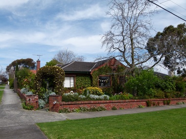
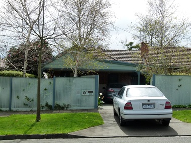
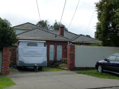
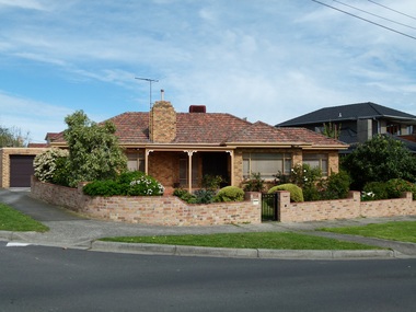
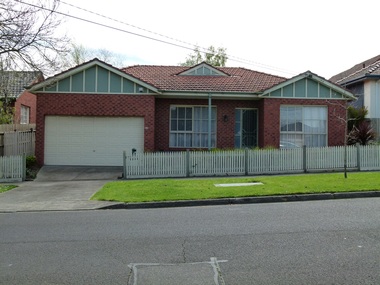
Photograph - 110 Broughton Road, Surrey Hills, The Street Where You Live Project
Photos documenting this address as part of a photographic series undertaken by volunteer photographers during 2013 and 2014 for The Street Where You Live Project. This was organised through the Surrey Hills Neighbourhood Centre and covered the postcode 3127 in the cities of Boroondara and Whitehorse.These photos provide a snapshot of real estate in the suburbs of Mont Albert and Surrey Hills during a period of rapid change with many properties on large blocks demolished to create higher density residential development or renewal of single dwellings. At particular risk were properties not covered by heritage overlays, especially interwar housing and post 1950's housing. -
 Surrey Hills Historical Society Collection
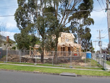
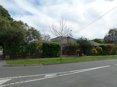
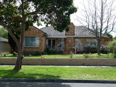
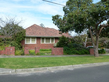
Photograph - 111 Broughton Road, Surrey Hills, The Street Where You Live Project
Photos documenting this address as part of a photographic series undertaken by volunteer photographers during 2013 and 2014 for The Street Where You Live Project. This was organised through the Surrey Hills Neighbourhood Centre and covered the postcode 3127 in the cities of Boroondara and Whitehorse.These photos provide a snapshot of real estate in the suburbs of Mont Albert and Surrey Hills during a period of rapid change with many properties on large blocks demolished to create higher density residential development or renewal of single dwellings. At particular risk were properties not covered by heritage overlays, especially interwar housing and post 1950's housing. -
 Surrey Hills Historical Society Collection
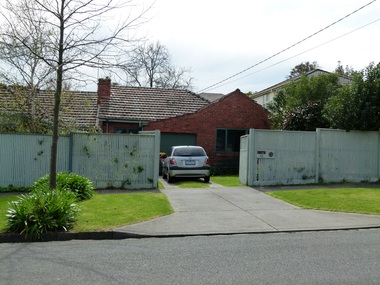
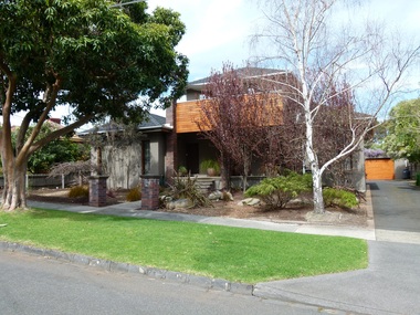
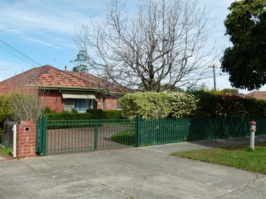
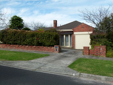
Photograph - 112 Broughton Road, Surrey Hills, The Street Where You Live Project
Photos documenting this address as part of a photographic series undertaken by volunteer photographers during 2013 and 2014 for The Street Where You Live Project. This was organised through the Surrey Hills Neighbourhood Centre and covered the postcode 3127 in the cities of Boroondara and Whitehorse.These photos provide a snapshot of real estate in the suburbs of Mont Albert and Surrey Hills during a period of rapid change with many properties on large blocks demolished to create higher density residential development or renewal of single dwellings. At particular risk were properties not covered by heritage overlays, especially interwar housing and post 1950's housing. -
 Surrey Hills Historical Society Collection
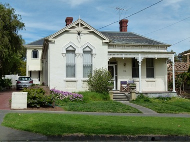
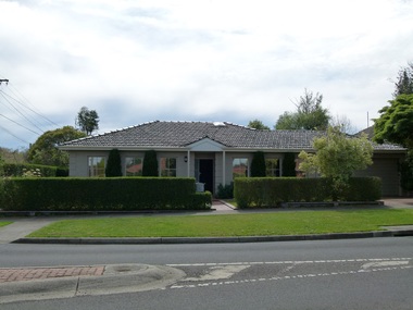
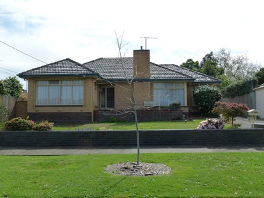
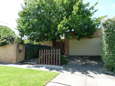
Photograph - 113 Broughton Road, Surrey Hills, The Street Where You Live Project
Photos documenting this address as part of a photographic series undertaken by volunteer photographers during 2013 and 2014 for The Street Where You Live Project. This was organised through the Surrey Hills Neighbourhood Centre and covered the postcode 3127 in the cities of Boroondara and Whitehorse.These photos provide a snapshot of real estate in the suburbs of Mont Albert and Surrey Hills during a period of rapid change with many properties on large blocks demolished to create higher density residential development or renewal of single dwellings. At particular risk were properties not covered by heritage overlays, especially interwar housing and post 1950's housing. -
 Surrey Hills Historical Society Collection
Photograph - 114 Broughton Road, Surrey Hills, The Street Where You Live Project
Photos documenting this address as part of a photographic series undertaken by volunteer photographers during 2013 and 2014 for The Street Where You Live Project. This was organised through the Surrey Hills Neighbourhood Centre and covered the postcode 3127 in the cities of Boroondara and Whitehorse.These photos provide a snapshot of real estate in the suburbs of Mont Albert and Surrey Hills during a period of rapid change with many properties on large blocks demolished to create higher density residential development or renewal of single dwellings. At particular risk were properties not covered by heritage overlays, especially interwar housing and post 1950's housing. -
 Surrey Hills Historical Society Collection
Photograph - 115 Broughton Road, Surrey Hills, The Street Where You Live Project
Photos documenting this address as part of a photographic series undertaken by volunteer photographers during 2013 and 2014 for The Street Where You Live Project. This was organised through the Surrey Hills Neighbourhood Centre and covered the postcode 3127 in the cities of Boroondara and Whitehorse.These photos provide a snapshot of real estate in the suburbs of Mont Albert and Surrey Hills during a period of rapid change with many properties on large blocks demolished to create higher density residential development or renewal of single dwellings. At particular risk were properties not covered by heritage overlays, especially interwar housing and post 1950's housing. -
 Surrey Hills Historical Society Collection
Photograph - 115A Broughton Road, Surrey Hills, The Street Where You Live Project
Photos documenting this address as part of a photographic series undertaken by volunteer photographers during 2013 and 2014 for The Street Where You Live Project. This was organised through the Surrey Hills Neighbourhood Centre and covered the postcode 3127 in the cities of Boroondara and Whitehorse.These photos provide a snapshot of real estate in the suburbs of Mont Albert and Surrey Hills during a period of rapid change with many properties on large blocks demolished to create higher density residential development or renewal of single dwellings. At particular risk were properties not covered by heritage overlays, especially interwar housing and post 1950's housing. -
 Surrey Hills Historical Society Collection
Photograph - 116 Broughton Road, Surrey Hills, The Street Where You Live Project
Photos documenting this address as part of a photographic series undertaken by volunteer photographers during 2013 and 2014 for The Street Where You Live Project. This was organised through the Surrey Hills Neighbourhood Centre and covered the postcode 3127 in the cities of Boroondara and Whitehorse.These photos provide a snapshot of real estate in the suburbs of Mont Albert and Surrey Hills during a period of rapid change with many properties on large blocks demolished to create higher density residential development or renewal of single dwellings. At particular risk were properties not covered by heritage overlays, especially interwar housing and post 1950's housing. -
 Surrey Hills Historical Society Collection
Photograph - 117 Broughton Road, Surrey Hills, The Street Where You Live Project
Photos documenting this address as part of a photographic series undertaken by volunteer photographers during 2013 and 2014 for The Street Where You Live Project. This was organised through the Surrey Hills Neighbourhood Centre and covered the postcode 3127 in the cities of Boroondara and Whitehorse.These photos provide a snapshot of real estate in the suburbs of Mont Albert and Surrey Hills during a period of rapid change with many properties on large blocks demolished to create higher density residential development or renewal of single dwellings. At particular risk were properties not covered by heritage overlays, especially interwar housing and post 1950's housing. -
 Surrey Hills Historical Society Collection
Photograph - 118 Broughton Road, Surrey Hills, The Street Where You Live Project
Photos documenting this address as part of a photographic series undertaken by volunteer photographers during 2013 and 2014 for The Street Where You Live Project. This was organised through the Surrey Hills Neighbourhood Centre and covered the postcode 3127 in the cities of Boroondara and Whitehorse.These photos provide a snapshot of real estate in the suburbs of Mont Albert and Surrey Hills during a period of rapid change with many properties on large blocks demolished to create higher density residential development or renewal of single dwellings. At particular risk were properties not covered by heritage overlays, especially interwar housing and post 1950's housing. -
 Surrey Hills Historical Society Collection
Photograph - 119 Broughton Road, Surrey Hills, The Street Where You Live Project
Photos documenting this address as part of a photographic series undertaken by volunteer photographers during 2013 and 2014 for The Street Where You Live Project. This was organised through the Surrey Hills Neighbourhood Centre and covered the postcode 3127 in the cities of Boroondara and Whitehorse.These photos provide a snapshot of real estate in the suburbs of Mont Albert and Surrey Hills during a period of rapid change with many properties on large blocks demolished to create higher density residential development or renewal of single dwellings. At particular risk were properties not covered by heritage overlays, especially interwar housing and post 1950's housing. -
 Surrey Hills Historical Society Collection
Photograph - 120 Broughton Road, Surrey Hills, The Street Where You Live Project
Photos documenting this address as part of a photographic series undertaken by volunteer photographers during 2013 and 2014 for The Street Where You Live Project. This was organised through the Surrey Hills Neighbourhood Centre and covered the postcode 3127 in the cities of Boroondara and Whitehorse.These photos provide a snapshot of real estate in the suburbs of Mont Albert and Surrey Hills during a period of rapid change with many properties on large blocks demolished to create higher density residential development or renewal of single dwellings. At particular risk were properties not covered by heritage overlays, especially interwar housing and post 1950's housing. -
 Surrey Hills Historical Society Collection
Photograph - 121 Broughton Road, Surrey Hills, The Street Where You Live Project
Photos documenting this address as part of a photographic series undertaken by volunteer photographers during 2013 and 2014 for The Street Where You Live Project. This was organised through the Surrey Hills Neighbourhood Centre and covered the postcode 3127 in the cities of Boroondara and Whitehorse.These photos provide a snapshot of real estate in the suburbs of Mont Albert and Surrey Hills during a period of rapid change with many properties on large blocks demolished to create higher density residential development or renewal of single dwellings. At particular risk were properties not covered by heritage overlays, especially interwar housing and post 1950's housing. -
 Surrey Hills Historical Society Collection
Photograph - 123 Broughton Road, Surrey Hills, The Street Where You Live Project
Photos documenting this address as part of a photographic series undertaken by volunteer photographers during 2013 and 2014 for The Street Where You Live Project. This was organised through the Surrey Hills Neighbourhood Centre and covered the postcode 3127 in the cities of Boroondara and Whitehorse.These photos provide a snapshot of real estate in the suburbs of Mont Albert and Surrey Hills during a period of rapid change with many properties on large blocks demolished to create higher density residential development or renewal of single dwellings. At particular risk were properties not covered by heritage overlays, especially interwar housing and post 1950's housing. -
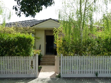
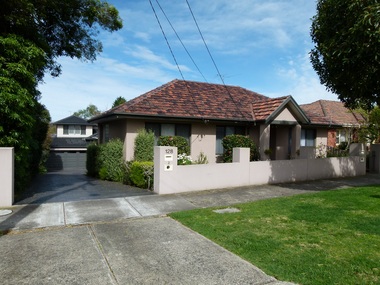
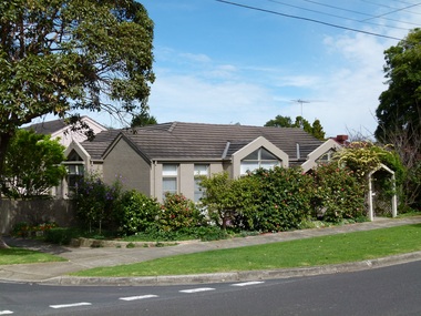
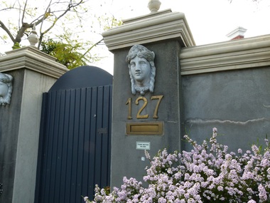 Surrey Hills Historical Society Collection
Photograph - 127 Broughton Road, Surrey Hills, The Street Where You Live Project
Photos documenting this address as part of a photographic series undertaken by volunteer photographers during 2013 and 2014 for The Street Where You Live Project. This was organised through the Surrey Hills Neighbourhood Centre and covered the postcode 3127 in the cities of Boroondara and Whitehorse.These photos provide a snapshot of real estate in the suburbs of Mont Albert and Surrey Hills during a period of rapid change with many properties on large blocks demolished to create higher density residential development or renewal of single dwellings. At particular risk were properties not covered by heritage overlays, especially interwar housing and post 1950's housing. -
 Surrey Hills Historical Society Collection
Photograph - 128 Broughton Road, Surrey Hills, The Street Where You Live Project
Photos documenting this address as part of a photographic series undertaken by volunteer photographers during 2013 and 2014 for The Street Where You Live Project. This was organised through the Surrey Hills Neighbourhood Centre and covered the postcode 3127 in the cities of Boroondara and Whitehorse.These photos provide a snapshot of real estate in the suburbs of Mont Albert and Surrey Hills during a period of rapid change with many properties on large blocks demolished to create higher density residential development or renewal of single dwellings. At particular risk were properties not covered by heritage overlays, especially interwar housing and post 1950's housing. -
 Surrey Hills Historical Society Collection
Photograph - 130 Broughton Road, Surrey Hills, The Street Where You Live Project
Photos documenting this address as part of a photographic series undertaken by volunteer photographers during 2013 and 2014 for The Street Where You Live Project. This was organised through the Surrey Hills Neighbourhood Centre and covered the postcode 3127 in the cities of Boroondara and Whitehorse.These photos provide a snapshot of real estate in the suburbs of Mont Albert and Surrey Hills during a period of rapid change with many properties on large blocks demolished to create higher density residential development or renewal of single dwellings. At particular risk were properties not covered by heritage overlays, especially interwar housing and post 1950's housing. -
 Surrey Hills Historical Society Collection
Photograph - 131 Broughton Road, Surrey Hills, The Street Where You Live Project
Photos documenting this address as part of a photographic series undertaken by volunteer photographers during 2013 and 2014 for The Street Where You Live Project. This was organised through the Surrey Hills Neighbourhood Centre and covered the postcode 3127 in the cities of Boroondara and Whitehorse.These photos provide a snapshot of real estate in the suburbs of Mont Albert and Surrey Hills during a period of rapid change with many properties on large blocks demolished to create higher density residential development or renewal of single dwellings. At particular risk were properties not covered by heritage overlays, especially interwar housing and post 1950's housing. -
 Surrey Hills Historical Society Collection
Photograph - 134 Broughton Road, Surrey Hills, The Street Where You Live Project
Photos documenting this address as part of a photographic series undertaken by volunteer photographers during 2013 and 2014 for The Street Where You Live Project. This was organised through the Surrey Hills Neighbourhood Centre and covered the postcode 3127 in the cities of Boroondara and Whitehorse.These photos provide a snapshot of real estate in the suburbs of Mont Albert and Surrey Hills during a period of rapid change with many properties on large blocks demolished to create higher density residential development or renewal of single dwellings. At particular risk were properties not covered by heritage overlays, especially interwar housing and post 1950's housing. -
 Surrey Hills Historical Society Collection
Photograph - 136 Broughton Road, Surrey Hills, The Street Where You Live Project
Photos documenting this address as part of a photographic series undertaken by volunteer photographers during 2013 and 2014 for The Street Where You Live Project. This was organised through the Surrey Hills Neighbourhood Centre and covered the postcode 3127 in the cities of Boroondara and Whitehorse.These photos provide a snapshot of real estate in the suburbs of Mont Albert and Surrey Hills during a period of rapid change with many properties on large blocks demolished to create higher density residential development or renewal of single dwellings. At particular risk were properties not covered by heritage overlays, especially interwar housing and post 1950's housing. -
 Surrey Hills Historical Society Collection
Photograph - 1A Broughton Road, Surrey Hills, The Street Where You Live Project
Photos documenting this address as part of a photographic series undertaken by volunteer photographers during 2013 and 2014 for The Street Where You Live Project. This was organised through the Surrey Hills Neighbourhood Centre and covered the postcode 3127 in the cities of Boroondara and Whitehorse.These photos provide a snapshot of real estate in the suburbs of Mont Albert and Surrey Hills during a period of rapid change with many properties on large blocks demolished to create higher density residential development or renewal of single dwellings. At particular risk were properties not covered by heritage overlays, especially interwar housing and post 1950's housing.