
Showing 96 items matching "canterbury hill estate"
-
 Surrey Hills Historical Society Collection
Work on paper - Vertical File, Heritage Overlay 1
... ...Canterbury Hill Estate...Surrey Hills and Canterbury Hill Estate Heritage Study – workshop notes 28.3.2011 (3 pages) C150 6. ...City of Boroondara Surrey Hills Overlay Canterbury Hill Estate Lovell Chenn Urban Planning Committee C150 Heritage Overlays 1 1. ...Heritage Overlays 1 1. Map showing Surrey Hills overlays 1991’s City of Boroondara (1 page) 2. Letter from City of Boroondara ‘Strategic Planning’ Dept 2.6.2014 with fact sheet and map regarding draft Heritage Overlays, South Residential Precinct, Surrey Hills and Canterbury Hill Estate (3 pages) C150 3. Map showing heritage overlays in 3127 in City of Whitehorse Dec 2015 (1 page) 4. Project brief for Surrey Hills and Canterbury Hill Estate Heritage study c. 2010 undated (7 pages) C150 5. Surrey Hills and Canterbury Hill Estate Heritage Study – workshop notes 28.3.2011 (3 pages) C150 6. Notice Amendment C150 from P Storer c. June 2012 (1 x double sided page) 7. The Lovell – Chen draft study of Surrey Hills and Canterbury Hill Estate dated 2011. 25 pages and 14 pages of schedule of properties C150 8. As above with response to submissions and alternations to the draft 2011, 87 pages 9. Urban Planning Committee Agenda, 18.2.2013 Post Exhibition update regarding Amendment C150. 6 pages 10. Urban Planning Committee, City of Boroondara 3.10.2011, agenda and authorisation and exhibition of Amendment C150, 93 pages. city of boroondara, surrey hills overlay, canterbury hill estate, lovell chenn, urban planning committee, c150 -
Surrey Hills Historical Society Collection
Work on paper - Vertical File, Heritage Overlay 3
... Surrey Hills and Canterbury Hill Estate Heritage Study...Includes letter to from Boroondara City Council re: Surrey Hills and Canterbury Hill Estate Heritage Study – Workshop Notes, dated 28 March 2011 and A3 colour aerial map. 4. ...Heritage Overlay Precinct 40 Urban Planning Special Committee Surrey Hills and Canterbury Hill Estate Heritage Study Camberwell Conservation Study 1991 Heritage Overlays 3 1. ...Heritage Overlays 3 1. Map of Precinct 40, Union and Canterbury Roads, Surrey Hills Shopping Centre. City of Camberwell Urban Conservation Study, 1986 & 1991 (8 pages single sided) 2. Urban Planning Special Committee, Monday, 18 October 2010. UPC2 Proposed inclusion of 629 Canterbury Road, Surrey Hills in the schedule to the Heritage Overlay Attachments. (9 pages single sided). 3. Surrey Hills and Canterbury Hill Estate Heritage Study Workshop Notes – 24 March 2011. (4 pages double sided). Includes letter to from Boroondara City Council re: Surrey Hills and Canterbury Hill Estate Heritage Study – Workshop Notes, dated 28 March 2011 and A3 colour aerial map. 4. Mont Albert Residential Precinct, Mont Albert, HO. 102. Alterations and Additions to Dwellings in the Mont Albert Residential Precinct. Whitehorse City Council. (17 pages single sided) 5. Camberwell Conservation Study Environmental History draft report – volume 1. (2 pages) 6. Camberwell Conservation Study 1991 Volume 1 extract Recommendation Summary (22 pages single sided) 7. “Heritage protection ‘cost owner $460k’”, The Age newspaper article, by Tom Cowie, dated 21.8.2024 8. “Heritage public nomination plan slammed”, The Age newspaper article by Tom Cowie, dated 7.8.2024 heritage overlay, precinct 40, urban planning special committee, surrey hills and canterbury hill estate heritage study, camberwell conservation study 1991 -
Surrey Hills Historical Society Collection
Work on paper - Vertical File, Heritage Overlays 2
... Surrey Hills and Canterbury Hill Estate Heritage Study...Surrey Hills and Canterbury Hill Estate Heritage Study Union Road Commercial Precinct Citation. ...Surrey Hills and Canterbury Hill Estate Heritage Study Union Road Commercial Precinct Citation. ...Heritage Overlays 2 1. Extract from McConville’s Camberwell Conservation Plan advice 1989 (3 pages single sided) 2. Surrey Hills and Canterbury Hill Estate Heritage Study Union Road Commercial Precinct Citation. Lovell Chen. June 2011 (14 pages) 3. Notice of Preparation of an Amendment C177 City of Boroondara (3 pages double sided) 4. Heritage Overlay Fact Sheet from Boroondara City Council 5. Letter to Surrey Hills Neighbourhood Centre Heritage Collection from Boroondara City Council re: Boroondara Planning Scheme Amendment C177 dated 2.10.2015 6. Letter to Surrey Hills Neighbourhood Centre Heritage Collection from Boroondara City Council re: Boroondara Planning Scheme Amendment C263 (part 1) Notice of Approval, dated 16.7.2018 7. Boroondara Planning Scheme Amendment C150 Surrey Hills Residential Precincts Consideration of Panel report (164 pages double sided) dated 16.12.2013 mcconville's camberwell conservation plan, surrey hills and canterbury hill estate heritage study, heritage overlay, boroondara planning scheme amendment c150 -
Surrey Hills Historical Society Collection
Work on paper - Vertical File, Heritage Study - C148 Union Road Shops
... Surrey Hills and Canterbury Hill Estate Heritage Study...Surrey Hills and Canterbury Hill Estate Heritage Study Union Road Commercial Precinct Citation. ...Surrey Hills and Canterbury Hill Estate Heritage Study Union Road Commercial Precinct Citation. ...Heritage Study C148 1. Surrey Hills and Canterbury Hill Estate Heritage Study Union Road Commercial Precinct Citation. Lovell Chen. June 2011 (30 pages) 2. Urban Planning Special Committee Monday, 16 April 2012, Attachments. Agenda attachments to the report: UPC2 Amendment C148 – Union Road Commercial Heritage Precinct – Post Exhibition Update. (38 pages). 3. Urban Planning Special Committee Agenda open to the public, Monday, 16 April 2012 Council Chamber, 8 Inglesby Road, Camberwell. Boroondara City Council. (29 pages). 4. Letter from the Department of Planning and Community Development, Planning Panels Victoria re: Amendment C148 to the Boroondara Planning Scheme dated 6 June 2012. (8 pages single sided) 5. Statement of Evidence and Report to Planning Panel, Boroondara Planning Scheme Amendment C148 Union Road Commercial Heritage Precinct Surrey Hills. Prepared for City of Boroondara by Lovell Chen, July 2012. (8 pages double sided). 6. Appeal to Officers Comments to our initial submission ref. Item #3 page 2 of 38 Attachment to UPC Agenda for 16 April 2012 letter to Urban Planning Special Committee UPC2 Amendment C148 Union Road Commercial Heritage Precinct – Post Exhibition Update (4 pages single sided). 7. Submission to the Panel Hearing Thursday, 26 July 2012 re: Boroondara Planning Scheme – Amendment C148 by Coordinator of the Surrey Hills Neighbourhood Heritage Collection and member of Surrey Hills Historical Collection. (3 pages single sided). 8. Union Road Commercial Heritage Precinct Panel Hearing Submission on behalf of Boroondara City Council, Amendment C148, 26 July 2012. (38 pages double sided). 9. Memorandum to Michelle Wyatt from Lovell Chen dated 7 August 2012 re: Supplementary Information to C148 Panel. 10. Planning and Environment Act 1987 Report Panel Boroondara Planning Scheme Amendment C148, 29 August 2012. (12 pages double sided). surrey hills and canterbury hill estate heritage study, urban planning special committee, boroondara planning scheme amendment c148, union road commercial heritage precinct panel -
Canterbury History Group
Document - A Victorian Gem - Heritage Report "Arklow"
... Heritage Report for "Arklow", 40 Bryson Street, Canterbury - part of Arklow Hill Estate. Report includes information on submission and previous owner Title information...Heritage Report for "Arklow", 40 Bryson Street, Canterbury - part of Arklow Hill Estate. Report includes information on submission and previous owner Title information Arklow Hill Estate Heritage Studies Bryson Street Victorian Style 11 pages, spinal bound, A4, includes maps Document A Victorian Gem - Heritage Report "Arklow" ...Heritage Report for "Arklow", 40 Bryson Street, Canterbury - part of Arklow Hill Estate. Report includes information on submission and previous owner Title information11 pages, spinal bound, A4, includes mapsarklow hill estate, heritage studies, bryson street, victorian style -
 Ringwood and District Historical Society
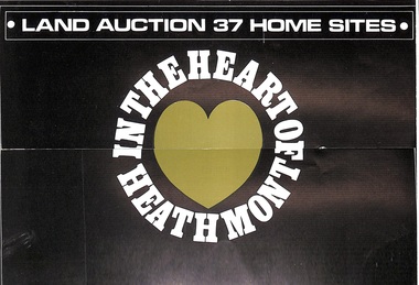
Pamphlet, Land Auction Brochure - Heathmont Hills Estate, Heathmont, Vic
... McLean Pty Ltd., 166 Canterbury Road, Heathmont, 87 7808 A.H. 842 2708. Land Auction Brochure - Heathmont Hills Estate, Heathmont, Vic. ...Multi-fold brochure advertising auction of 37 home sites on Saturday May 6th, (1967?). Brochure includes terms of sale, description of subdivision features and local facilities, with locality map. Subdivision includes Canterbury Road, Cuthbert Street, and Craig Court, off Balfour Avenue, Heathmont. Agent - N.R. Reid & Co Pty Ltd., 173 Coleman Parade, Glen Waverley, (phone) 560 0355 A.H. 28 3185, in conjunction with H.G. McLean Pty Ltd., 166 Canterbury Road, Heathmont, 87 7808 A.H. 842 2708. -
 Ringwood and District Historical Society
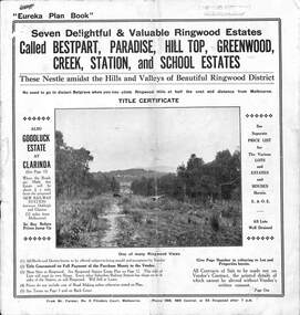
Pamphlet, Land Sale Brochure Titled Eureka Plan Book - Seven Delightful & Valuable Ringwood Estates - circa 1925
... Plan of Paradise Estate, Ringwood, includes Canterbury Road, Dandenong Road (Wantirna Road), Luck Street and Paradise Road. Plan of Creek Estate, Ringwood, includes Dandenong Creek, Wantirna Road and Gordon Crescent. Plan of Hill...Plan of Paradise Estate, Ringwood, includes Canterbury Road, Dandenong Road (Wantirna Road), Luck Street and Paradise Road. Plan of Creek Estate, Ringwood, includes Dandenong Creek, Wantirna Road and Gordon Crescent. Plan of Hill ...Twenty page land sale brochure including photographs, subdivision features and local facilities. Additional flyer with conditions of sale and prices for estate blocks.Seven delightful and valuable Ringwood Estates called Bestpart, Paradise, Hill Top, Greenwood, Creek, Station, and School Estates. These nestle amidst the hills and valleys of beautiful Ringwood district. Also Goodluck Estate at Clarinda. Pamphlet marked as being From Mr. Farmer, No. 5 Flinders Court, Melbourne. Phone 988, 989 Central, or 55 Ringwood after 7 p.m. Plan of Ringwood School Estate includes William Street (later Kendall Street), Greenwood Avenue, Alton Street and Locke Street. Plan of Bestpart Estate, Ringwood, includes Bedford Road, Wilana Street, Greenwood Avenue, Caroline Street, Henry Street and Haig Street. Plan of Ringwood Station Estate includes Pitt Street, Bedford Road, Greenwood Avenue, Station Street, William Street (later Kendall Street, James Street, Wantirna Road, Caroline Street, Henry Street, Ellison Street and Haig Street. Plan of Geenwood Estate, Ringwood, includes Prussian Road (later Geenwood Avenue). Plan of Paradise Estate, Ringwood, includes Canterbury Road, Dandenong Road (Wantirna Road), Luck Street and Paradise Road. Plan of Creek Estate, Ringwood, includes Dandenong Creek, Wantirna Road and Gordon Crescent. Plan of Hill Top Estate, Ringwood (later Heathmont area), includes Heathmont Railway Station, Heathmont Road, Balfour Avenue, Lilian Street, Edith Street, Edna Street and Great Ryrie Street. Plan of Goodluck Estate, Clarinda, includes Talbot Avenue, Good Street, Luck Street, and Centre Road in locality plan between Oakleigh and Clayton Railway Stations. -
 Ringwood and District Historical Society
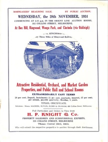
Flyer, Stillwell & Stephens Pty. Ltd, Brochure - Multiple Properties for Public Auction at Box Hill, Ringwood, Wonga Park and Clarinda - 28th November, 1934
... Wonga Park via Ringwood - "Holme Bush" off Warrandyte Road, Part of Lots 14 and 15, Ringwood Orchard Estate, approximatgely three miles (north) of Ringwood Railway Station - 64 Acres. 2. 17 Bishop Street, Box Hill - timber residence. 3. Greenwood Avenue, Ringwood - On East Side, 150 feet 3 inches South of Bedford Road - timber attic residence. 4. Ringwood - Wantirna Road, South-east corner of Canterbury...Wonga Park via Ringwood - "Holme Bush" off Warrandyte Road, Part of Lots 14 and 15, Ringwood Orchard Estate, approximatgely three miles (north) of Ringwood Railway Station - 64 Acres. 2. 17 Bishop Street, Box Hill - timber residence. 3. Greenwood Avenue, Ringwood - On East Side, 150 feet 3 inches South of Bedford Road - timber attic residence. 4. Ringwood - Wantirna Road, South-east corner of Canterbury ...Seven-page brochure advertising Mortgagees' Realising Sale by Public Auction on Wednesday, 28th November, 1934 for properties at Box Hill, Ringwood, Wonga Park, and Clarinda (via Oakleigh), including photographs, property descriptions, and terms of sale.Auction Commencing at 2.15 p.m. in the Orient Line Auction Rooms, 352 Collins Street, Melbourne. Solicitors: Messrs. Madden, Butler, Elder & Graham, 406 Collins Street, Melbourne. (Agents) H.P. Knight & Co. Property Salesmen and Subidivisional Experts, 315 Collins Street, Melbourne, 'Phones: Central 10615, 10616. Attractive Residential, Orchard, and Market Garden Properties, and Public Hall and School Rooms. 1. Wonga Park via Ringwood - "Holme Bush" off Warrandyte Road, Part of Lots 14 and 15, Ringwood Orchard Estate, approximatgely three miles (north) of Ringwood Railway Station - 64 Acres. 2. 17 Bishop Street, Box Hill - timber residence. 3. Greenwood Avenue, Ringwood - On East Side, 150 feet 3 inches South of Bedford Road - timber attic residence. 4. Ringwood - Wantirna Road, South-east corner of Canterbury Road - Orchard Property of approx. 11-1/2 Acres. 5. Box Hill - Whitehorse Road, South-east corner of Linsley Street - Timber building utilised as a Public Hall and Private School. 6. Clarinda vic Oakleigh, Talbot Crescent, off Centre Road - Home on 10 acres of land. -
 Ringwood and District Historical Society
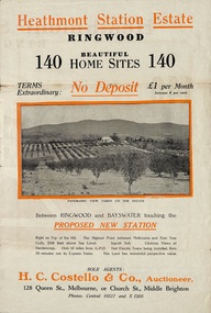
Flyer, Land Sale Brochure, Heathmont Station Estate, Ringwood, Vic. - circa 1925
... Hill and Gembrook. Subdivision includes Canterbury Road, Station Street (later Wainui Avenue), Lisgoold Street, Viviani Crescent, and Balfour Avenue. Agent - H.C. Costello & Co., Auctioneer, 128 Queen Street, Melbourne, or Church Street, Middle Brighton. Phones: Central 10517 and X1205. Bi-fold advertisement for sale of retail and residential sites, including panoramic and other photographs, map, and summary of subdivision features and local facilities. Land Sale Brochure, Heathmont Station Estate ...Extract of "Herald" 2/2/22: The intention of the Railway Commissioners is to electrify the line to the Gully as soon as convenient, and with greater frequency of service many persons settled, and settling, in the district will be benefited. There is a scheme which may be launched that will allow for an express service of fast trains to the Gully. The commissioners are alive to the necessity for assisting to settle the picturesque districts between Box Hill and Gembrook.Bi-fold advertisement for sale of retail and residential sites, including panoramic and other photographs, map, and summary of subdivision features and local facilities. Subdivision includes Canterbury Road, Station Street (later Wainui Avenue), Lisgoold Street, Viviani Crescent, and Balfour Avenue. Agent - H.C. Costello & Co., Auctioneer, 128 Queen Street, Melbourne, or Church Street, Middle Brighton. Phones: Central 10517 and X1205. -
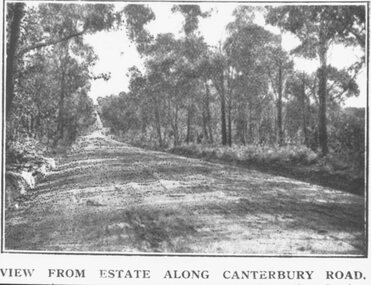 Ringwood and District Historical Society
Photograph, Coleman's Heathmont Estate Sale, 15/12/1923. Looking west along Canterbury Road Heathmont. Railway bridge is situated at foot of hill
... Estate Sale, 15/12/1923. Looking west along Canterbury Road Heathmont. Railway bridge is situated at foot of hill....Image shows a view from Estate along Canterbury Road looking towards city. Railway bridge at foot of hill. ...Image shows a view from Estate along Canterbury Road looking towards city. Railway bridge at foot of hill. ...Copy of black and white photographImage shows a view from Estate along Canterbury Road looking towards city. Railway bridge at foot of hill. Area in foreground now shopping centre both sides of road. -
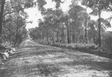 Ringwood and District Historical Society
Photograph, View from Coleman's Estate, Heathmont, looking west along Canterbury Road. 1923
... Estate. Sale 15/12/23. Railway bridge is seen at foot of hill where new station site has been surveyed." (Now shops along this part of road). Black and white photograph View from Coleman's Estate, Heathmont, looking west along Canterbury Road. 1923. ...Black and white photographWritten on rear of backing sheet: "Coleman's Heathmont Estate. Sale 15/12/23. Railway bridge is seen at foot of hill where new station site has been surveyed." (Now shops along this part of road). -
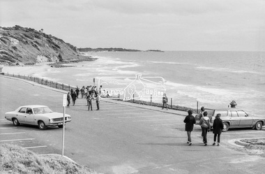 Eltham District Historical Society Inc
Photograph, George Coop, Sunnyside Beach, Mount Eliza, c.August 1983, 1983
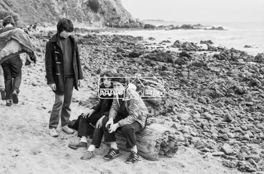
... Canterbury Road (near Mahoneys Road) in 1955. Enrolments grew rapidly and by 1969 there were over 1,100 students, making it one of the largest schools in the state. In 1989 it was merged with Burwood Heights High and Blackburn South High to become a junior campus of Forest Hills Secondary College. However, the junior campuses were closed in 1997, and the former Nunawading High was bulldozed to make way for a housing estate...Canterbury Road (near Mahoneys Road) in 1955. Enrolments grew rapidly and by 1969 there were over 1,100 students, making it one of the largest schools in the state. In 1989 it was merged with Burwood Heights High and Blackburn South High to become a junior campus of Forest Hills Secondary College. However, the junior campuses were closed in 1997, and the former Nunawading High was bulldozed to make way for a housing estate ...Possibly an excursion or school camp for Year 8 or 9 students from Nunawading High School to the seaside at Mount Eliza. Nunawading High School opened on Canterbury Road (near Mahoneys Road) in 1955. Enrolments grew rapidly and by 1969 there were over 1,100 students, making it one of the largest schools in the state. In 1989 it was merged with Burwood Heights High and Blackburn South High to become a junior campus of Forest Hills Secondary College. However, the junior campuses were closed in 1997, and the former Nunawading High was bulldozed to make way for a housing estate. "Lost Schools of the 1990s", Learning from the Past, http://learningfromthepast.com.au/lost-schools-of-the-1990s/ George Coop was a teacher of art, craft, wood working and graphics at Nunawading High School until it merged into Forest Hills Secondary College at which point he retired.Digital TIFF file Scan of 35mm Kodak Safety 5062 black and white transparencymount eliza, nunawading high school, sunnyside beach -
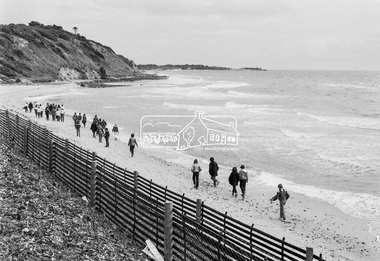 Eltham District Historical Society Inc
Photograph, George Coop, Sunnyside Beach, Mount Eliza, c.August 1983, 1983
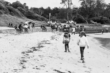
... Canterbury Road (near Mahoneys Road) in 1955. Enrolments grew rapidly and by 1969 there were over 1,100 students, making it one of the largest schools in the state. In 1989 it was merged with Burwood Heights High and Blackburn South High to become a junior campus of Forest Hills Secondary College. However, the junior campuses were closed in 1997, and the former Nunawading High was bulldozed to make way for a housing estate...Canterbury Road (near Mahoneys Road) in 1955. Enrolments grew rapidly and by 1969 there were over 1,100 students, making it one of the largest schools in the state. In 1989 it was merged with Burwood Heights High and Blackburn South High to become a junior campus of Forest Hills Secondary College. However, the junior campuses were closed in 1997, and the former Nunawading High was bulldozed to make way for a housing estate ...Possibly an excursion or school camp for Year 8 or 9 students from Nunawading High School to the seaside at Mount Eliza Nunawading High School opened on Canterbury Road (near Mahoneys Road) in 1955. Enrolments grew rapidly and by 1969 there were over 1,100 students, making it one of the largest schools in the state. In 1989 it was merged with Burwood Heights High and Blackburn South High to become a junior campus of Forest Hills Secondary College. However, the junior campuses were closed in 1997, and the former Nunawading High was bulldozed to make way for a housing estate. "Lost Schools of the 1990s", Learning from the Past, http://learningfromthepast.com.au/lost-schools-of-the-1990s/ George Coop was a teacher of art, craft, wood working and graphics at Nunawading High School until it merged into Forest Hills Secondary College at which point he retired.Digital TIFF file Scan of 35mm Kodak Safety 5062 black and white transparencymount eliza, nunawading high school, sunnyside beach -
 Eltham District Historical Society Inc
Photograph, George Coop, Sunnyside Beach, Mount Eliza, c.August 1983, 1983
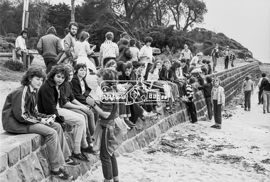
... Canterbury Road (near Mahoneys Road) in 1955. Enrolments grew rapidly and by 1969 there were over 1,100 students, making it one of the largest schools in the state. In 1989 it was merged with Burwood Heights High and Blackburn South High to become a junior campus of Forest Hills Secondary College. However, the junior campuses were closed in 1997, and the former Nunawading High was bulldozed to make way for a housing estate...Canterbury Road (near Mahoneys Road) in 1955. Enrolments grew rapidly and by 1969 there were over 1,100 students, making it one of the largest schools in the state. In 1989 it was merged with Burwood Heights High and Blackburn South High to become a junior campus of Forest Hills Secondary College. However, the junior campuses were closed in 1997, and the former Nunawading High was bulldozed to make way for a housing estate ...Possibly an excursion or school camp for Year 8 or 9 students from Nunawading High School to the seaside at Mount Eliza Nunawading High School opened on Canterbury Road (near Mahoneys Road) in 1955. Enrolments grew rapidly and by 1969 there were over 1,100 students, making it one of the largest schools in the state. In 1989 it was merged with Burwood Heights High and Blackburn South High to become a junior campus of Forest Hills Secondary College. However, the junior campuses were closed in 1997, and the former Nunawading High was bulldozed to make way for a housing estate. "Lost Schools of the 1990s", Learning from the Past, http://learningfromthepast.com.au/lost-schools-of-the-1990s/ George Coop was a teacher of art, craft, wood working and graphics at Nunawading High School until it merged into Forest Hills Secondary College at which point he retired.Digital TIFF file Scan of 35mm Kodak Safety 5062 black and white transparencymount eliza, nunawading high school, sunnyside beach -
 Eltham District Historical Society Inc
Photograph, George Coop, Sunnyside Beach, Mount Eliza, c.August 1983, 1983
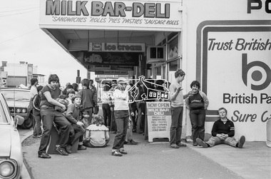
... Canterbury Road (near Mahoneys Road) in 1955. Enrolments grew rapidly and by 1969 there were over 1,100 students, making it one of the largest schools in the state. In 1989 it was merged with Burwood Heights High and Blackburn South High to become a junior campus of Forest Hills Secondary College. However, the junior campuses were closed in 1997, and the former Nunawading High was bulldozed to make way for a housing estate...Canterbury Road (near Mahoneys Road) in 1955. Enrolments grew rapidly and by 1969 there were over 1,100 students, making it one of the largest schools in the state. In 1989 it was merged with Burwood Heights High and Blackburn South High to become a junior campus of Forest Hills Secondary College. However, the junior campuses were closed in 1997, and the former Nunawading High was bulldozed to make way for a housing estate ...Possibly an excursion or school camp for Year 8 or 9 students from Nunawading High School to the seaside at Mount Eliza Nunawading High School opened on Canterbury Road (near Mahoneys Road) in 1955. Enrolments grew rapidly and by 1969 there were over 1,100 students, making it one of the largest schools in the state. In 1989 it was merged with Burwood Heights High and Blackburn South High to become a junior campus of Forest Hills Secondary College. However, the junior campuses were closed in 1997, and the former Nunawading High was bulldozed to make way for a housing estate. "Lost Schools of the 1990s", Learning from the Past, http://learningfromthepast.com.au/lost-schools-of-the-1990s/ George Coop was a teacher of art, craft, wood working and graphics at Nunawading High School until it merged into Forest Hills Secondary College at which point he retired.Digital TIFF file Scan of 35mm Kodak Safety 5062 black and white transparencymount eliza, nunawading high school -
 Eltham District Historical Society Inc
Photograph, George Coop, Sunnyside Beach, Mount Eliza, c.August 1983, 1983
... Canterbury Road (near Mahoneys Road) in 1955. Enrolments grew rapidly and by 1969 there were over 1,100 students, making it one of the largest schools in the state. In 1989 it was merged with Burwood Heights High and Blackburn South High to become a junior campus of Forest Hills Secondary College. However, the junior campuses were closed in 1997, and the former Nunawading High was bulldozed to make way for a housing estate...Canterbury Road (near Mahoneys Road) in 1955. Enrolments grew rapidly and by 1969 there were over 1,100 students, making it one of the largest schools in the state. In 1989 it was merged with Burwood Heights High and Blackburn South High to become a junior campus of Forest Hills Secondary College. However, the junior campuses were closed in 1997, and the former Nunawading High was bulldozed to make way for a housing estate ...Possibly an excursion or school camp for Year 8 or 9 students from Nunawading High School to the seaside at Mount Eliza Nunawading High School opened on Canterbury Road (near Mahoneys Road) in 1955. Enrolments grew rapidly and by 1969 there were over 1,100 students, making it one of the largest schools in the state. In 1989 it was merged with Burwood Heights High and Blackburn South High to become a junior campus of Forest Hills Secondary College. However, the junior campuses were closed in 1997, and the former Nunawading High was bulldozed to make way for a housing estate. "Lost Schools of the 1990s", Learning from the Past, http://learningfromthepast.com.au/lost-schools-of-the-1990s/ George Coop was a teacher of art, craft, wood working and graphics at Nunawading High School until it merged into Forest Hills Secondary College at which point he retired.Digital TIFF file Scan of 35mm Kodak Safety 5062 black and white transparencymount eliza, nunawading high school -
 Eltham District Historical Society Inc
Photograph, George Coop, Sunnyside Beach, Mount Eliza, c.August 1983, 1983
... Canterbury Road (near Mahoneys Road) in 1955. Enrolments grew rapidly and by 1969 there were over 1,100 students, making it one of the largest schools in the state. In 1989 it was merged with Burwood Heights High and Blackburn South High to become a junior campus of Forest Hills Secondary College. However, the junior campuses were closed in 1997, and the former Nunawading High was bulldozed to make way for a housing estate...Canterbury Road (near Mahoneys Road) in 1955. Enrolments grew rapidly and by 1969 there were over 1,100 students, making it one of the largest schools in the state. In 1989 it was merged with Burwood Heights High and Blackburn South High to become a junior campus of Forest Hills Secondary College. However, the junior campuses were closed in 1997, and the former Nunawading High was bulldozed to make way for a housing estate ...Possibly an excursion or school camp for Year 8 or 9 students from Nunawading High School to the seaside at Mount Eliza Nunawading High School opened on Canterbury Road (near Mahoneys Road) in 1955. Enrolments grew rapidly and by 1969 there were over 1,100 students, making it one of the largest schools in the state. In 1989 it was merged with Burwood Heights High and Blackburn South High to become a junior campus of Forest Hills Secondary College. However, the junior campuses were closed in 1997, and the former Nunawading High was bulldozed to make way for a housing estate. "Lost Schools of the 1990s", Learning from the Past, http://learningfromthepast.com.au/lost-schools-of-the-1990s/ George Coop was a teacher of art, craft, wood working and graphics at Nunawading High School until it merged into Forest Hills Secondary College at which point he retired.Digital TIFF file Scan of 35mm Kodak Safety 5062 black and white transparencymount eliza, nunawading high school -
 Eltham District Historical Society Inc
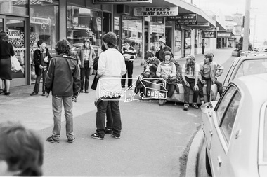
Photograph, George Coop, Sunnyside Beach, Mount Eliza, c.August 1983, 1983
... Canterbury Road (near Mahoneys Road) in 1955. Enrolments grew rapidly and by 1969 there were over 1,100 students, making it one of the largest schools in the state. In 1989 it was merged with Burwood Heights High and Blackburn South High to become a junior campus of Forest Hills Secondary College. However, the junior campuses were closed in 1997, and the former Nunawading High was bulldozed to make way for a housing estate...Canterbury Road (near Mahoneys Road) in 1955. Enrolments grew rapidly and by 1969 there were over 1,100 students, making it one of the largest schools in the state. In 1989 it was merged with Burwood Heights High and Blackburn South High to become a junior campus of Forest Hills Secondary College. However, the junior campuses were closed in 1997, and the former Nunawading High was bulldozed to make way for a housing estate ...Possibly an excursion or school camp for Year 8 or 9 students from Nunawading High School to the seaside at Mount Eliza Nunawading High School opened on Canterbury Road (near Mahoneys Road) in 1955. Enrolments grew rapidly and by 1969 there were over 1,100 students, making it one of the largest schools in the state. In 1989 it was merged with Burwood Heights High and Blackburn South High to become a junior campus of Forest Hills Secondary College. However, the junior campuses were closed in 1997, and the former Nunawading High was bulldozed to make way for a housing estate. "Lost Schools of the 1990s", Learning from the Past, http://learningfromthepast.com.au/lost-schools-of-the-1990s/ George Coop was a teacher of art, craft, wood working and graphics at Nunawading High School until it merged into Forest Hills Secondary College at which point he retired.Digital TIFF file Scan of 35mm Kodak Safety 5062 black and white transparencymount eliza, nunawading high school -
 Eltham District Historical Society Inc
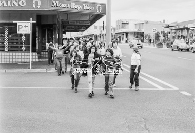
Photograph, George Coop, Sunnyside Beach, Mount Eliza, c.August 1983, 1983
... Canterbury Road (near Mahoneys Road) in 1955. Enrolments grew rapidly and by 1969 there were over 1,100 students, making it one of the largest schools in the state. In 1989 it was merged with Burwood Heights High and Blackburn South High to become a junior campus of Forest Hills Secondary College. However, the junior campuses were closed in 1997, and the former Nunawading High was bulldozed to make way for a housing estate...Canterbury Road (near Mahoneys Road) in 1955. Enrolments grew rapidly and by 1969 there were over 1,100 students, making it one of the largest schools in the state. In 1989 it was merged with Burwood Heights High and Blackburn South High to become a junior campus of Forest Hills Secondary College. However, the junior campuses were closed in 1997, and the former Nunawading High was bulldozed to make way for a housing estate ...Possibly an excursion or school camp for Year 8 or 9 students from Nunawading High School to the seaside at Mount Eliza Nunawading High School opened on Canterbury Road (near Mahoneys Road) in 1955. Enrolments grew rapidly and by 1969 there were over 1,100 students, making it one of the largest schools in the state. In 1989 it was merged with Burwood Heights High and Blackburn South High to become a junior campus of Forest Hills Secondary College. However, the junior campuses were closed in 1997, and the former Nunawading High was bulldozed to make way for a housing estate. "Lost Schools of the 1990s", Learning from the Past, http://learningfromthepast.com.au/lost-schools-of-the-1990s/ George Coop was a teacher of art, craft, wood working and graphics at Nunawading High School until it merged into Forest Hills Secondary College at which point he retired.Digital TIFF file Scan of 35mm Kodak Safety 5062 black and white transparencymount eliza, nunawading high school -
 Eltham District Historical Society Inc
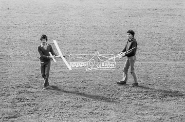
Photograph, George Coop, Balsa wood model airplane construction class, Nunawading High School, Canterbury Road, c.August 1983, 1983
... Canterbury Road (near Mahoneys Road) in 1955. Enrolments grew rapidly and by 1969 there were over 1,100 students, making it one of the largest schools in the state. In 1989 it was merged with Burwood Heights High and Blackburn South High to become a junior campus of Forest Hills Secondary College. However, the junior campuses were closed in 1997, and the former Nunawading High was bulldozed to make way for a housing estate...Canterbury Road (near Mahoneys Road) in 1955. Enrolments grew rapidly and by 1969 there were over 1,100 students, making it one of the largest schools in the state. In 1989 it was merged with Burwood Heights High and Blackburn South High to become a junior campus of Forest Hills Secondary College. However, the junior campuses were closed in 1997, and the former Nunawading High was bulldozed to make way for a housing estate ...Teachers at Nunawading High School were required to hold one afternoon a week with students undertaking some form of activity. There were various clubs such as gardening, chess, etc. Given George's background with art, craft and woodwork, he organised an activity for students to assemble balsa wood airplane kits which were test flown on the school grounds; Canternury Road in the background. Nunawading High School opened on Canterbury Road (near Mahoneys Road) in 1955. Enrolments grew rapidly and by 1969 there were over 1,100 students, making it one of the largest schools in the state. In 1989 it was merged with Burwood Heights High and Blackburn South High to become a junior campus of Forest Hills Secondary College. However, the junior campuses were closed in 1997, and the former Nunawading High was bulldozed to make way for a housing estate. "Lost Schools of the 1990s", Learning from the Past, http://learningfromthepast.com.au/lost-schools-of-the-1990s/ George Coop was a teacher of art, craft, wood working and graphics at Nunawading High School until it merged into Forest Hills Secondary College at which point he retired.Digital TIFF file Scan of 35mm Kodak Safety 5062 black and white transparencycanterbury road,model airplane, nunawading high school -
 Eltham District Historical Society Inc
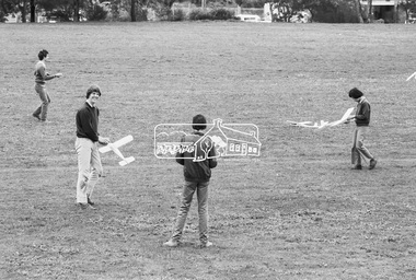
Photograph, George Coop, Balsa wood model airplane construction class, Nunawading High School, Canterbury Road, c.August 1983, 1983
... Canterbury Road (near Mahoneys Road) in 1955. Enrolments grew rapidly and by 1969 there were over 1,100 students, making it one of the largest schools in the state. In 1989 it was merged with Burwood Heights High and Blackburn South High to become a junior campus of Forest Hills Secondary College. However, the junior campuses were closed in 1997, and the former Nunawading High was bulldozed to make way for a housing estate...Canterbury Road (near Mahoneys Road) in 1955. Enrolments grew rapidly and by 1969 there were over 1,100 students, making it one of the largest schools in the state. In 1989 it was merged with Burwood Heights High and Blackburn South High to become a junior campus of Forest Hills Secondary College. However, the junior campuses were closed in 1997, and the former Nunawading High was bulldozed to make way for a housing estate ...Teachers at Nunawading High School were required to hold one afternoon a week with students undertaking some form of activity. There were various clubs such as gardening, chess, etc. Given George's background with art, craft and woodwork, he organised an activity for students to assemble balsa wood airplane kits which were test flown on the school grounds; Canternury Road in the background. Nunawading High School opened on Canterbury Road (near Mahoneys Road) in 1955. Enrolments grew rapidly and by 1969 there were over 1,100 students, making it one of the largest schools in the state. In 1989 it was merged with Burwood Heights High and Blackburn South High to become a junior campus of Forest Hills Secondary College. However, the junior campuses were closed in 1997, and the former Nunawading High was bulldozed to make way for a housing estate. "Lost Schools of the 1990s", Learning from the Past, http://learningfromthepast.com.au/lost-schools-of-the-1990s/ George Coop was a teacher of art, craft, wood working and graphics at Nunawading High School until it merged into Forest Hills Secondary College at which point he retired.Digital TIFF file Scan of 35mm Kodak Safety 5062 black and white transparencycanterbury road,model airplane, nunawading high school -
 Eltham District Historical Society Inc
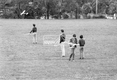
Photograph, George Coop, Balsa wood model airplane construction class, Nunawading High School, Canterbury Road, c.August 1983, 1983
... Canterbury Road (near Mahoneys Road) in 1955. Enrolments grew rapidly and by 1969 there were over 1,100 students, making it one of the largest schools in the state. In 1989 it was merged with Burwood Heights High and Blackburn South High to become a junior campus of Forest Hills Secondary College. However, the junior campuses were closed in 1997, and the former Nunawading High was bulldozed to make way for a housing estate...Canterbury Road (near Mahoneys Road) in 1955. Enrolments grew rapidly and by 1969 there were over 1,100 students, making it one of the largest schools in the state. In 1989 it was merged with Burwood Heights High and Blackburn South High to become a junior campus of Forest Hills Secondary College. However, the junior campuses were closed in 1997, and the former Nunawading High was bulldozed to make way for a housing estate ...Teachers at Nunawading High School were required to hold one afternoon a week with students undertaking some form of activity. There were various clubs such as gardening, chess, etc. Given George's background with art, craft and woodwork, he organised an activity for students to assemble balsa wood airplane kits which were test flown on the school grounds; Canternury Road in the background. Nunawading High School opened on Canterbury Road (near Mahoneys Road) in 1955. Enrolments grew rapidly and by 1969 there were over 1,100 students, making it one of the largest schools in the state. In 1989 it was merged with Burwood Heights High and Blackburn South High to become a junior campus of Forest Hills Secondary College. However, the junior campuses were closed in 1997, and the former Nunawading High was bulldozed to make way for a housing estate. "Lost Schools of the 1990s", Learning from the Past, http://learningfromthepast.com.au/lost-schools-of-the-1990s/ George Coop was a teacher of art, craft, wood working and graphics at Nunawading High School until it merged into Forest Hills Secondary College at which point he retired.Digital TIFF file Scan of 35mm Kodak Safety 5062 black and white transparencycanterbury road,model airplane, nunawading high school -
 Eltham District Historical Society Inc
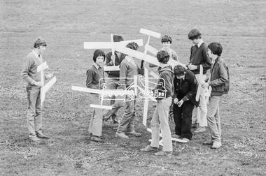
Photograph, George Coop, Balsa wood model airplane construction class, Nunawading High School, Canterbury Road, c.August 1983, 1983
... Canterbury Road (near Mahoneys Road) in 1955. Enrolments grew rapidly and by 1969 there were over 1,100 students, making it one of the largest schools in the state. In 1989 it was merged with Burwood Heights High and Blackburn South High to become a junior campus of Forest Hills Secondary College. However, the junior campuses were closed in 1997, and the former Nunawading High was bulldozed to make way for a housing estate...Canterbury Road (near Mahoneys Road) in 1955. Enrolments grew rapidly and by 1969 there were over 1,100 students, making it one of the largest schools in the state. In 1989 it was merged with Burwood Heights High and Blackburn South High to become a junior campus of Forest Hills Secondary College. However, the junior campuses were closed in 1997, and the former Nunawading High was bulldozed to make way for a housing estate ...Teachers at Nunawading High School were required to hold one afternoon a week with students undertaking some form of activity. There were various clubs such as gardening, chess, etc. Given George's background with art, craft and woodwork, he organised an activity for students to assemble balsa wood airplane kits which were test flown on the school grounds; Canternury Road in the background. Nunawading High School opened on Canterbury Road (near Mahoneys Road) in 1955. Enrolments grew rapidly and by 1969 there were over 1,100 students, making it one of the largest schools in the state. In 1989 it was merged with Burwood Heights High and Blackburn South High to become a junior campus of Forest Hills Secondary College. However, the junior campuses were closed in 1997, and the former Nunawading High was bulldozed to make way for a housing estate. "Lost Schools of the 1990s", Learning from the Past, http://learningfromthepast.com.au/lost-schools-of-the-1990s/ George Coop was a teacher of art, craft, wood working and graphics at Nunawading High School until it merged into Forest Hills Secondary College at which point he retired.Digital TIFF file Scan of 35mm Kodak Safety 5062 black and white transparencycanterbury road,model airplane, nunawading high school -
 Eltham District Historical Society Inc
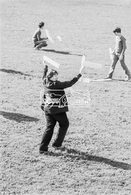
Photograph, George Coop, Balsa wood model airplane construction class, Nunawading High School, Canterbury Road, c.August 1983, 1983
... Canterbury Road (near Mahoneys Road) in 1955. Enrolments grew rapidly and by 1969 there were over 1,100 students, making it one of the largest schools in the state. In 1989 it was merged with Burwood Heights High and Blackburn South High to become a junior campus of Forest Hills Secondary College. However, the junior campuses were closed in 1997, and the former Nunawading High was bulldozed to make way for a housing estate...Canterbury Road (near Mahoneys Road) in 1955. Enrolments grew rapidly and by 1969 there were over 1,100 students, making it one of the largest schools in the state. In 1989 it was merged with Burwood Heights High and Blackburn South High to become a junior campus of Forest Hills Secondary College. However, the junior campuses were closed in 1997, and the former Nunawading High was bulldozed to make way for a housing estate ...Teachers at Nunawading High School were required to hold one afternoon a week with students undertaking some form of activity. There were various clubs such as gardening, chess, etc. Given George's background with art, craft and woodwork, he organised an activity for students to assemble balsa wood airplane kits which were test flown on the school grounds; Canternury Road in the background. Nunawading High School opened on Canterbury Road (near Mahoneys Road) in 1955. Enrolments grew rapidly and by 1969 there were over 1,100 students, making it one of the largest schools in the state. In 1989 it was merged with Burwood Heights High and Blackburn South High to become a junior campus of Forest Hills Secondary College. However, the junior campuses were closed in 1997, and the former Nunawading High was bulldozed to make way for a housing estate. "Lost Schools of the 1990s", Learning from the Past, http://learningfromthepast.com.au/lost-schools-of-the-1990s/ George Coop was a teacher of art, craft, wood working and graphics at Nunawading High School until it merged into Forest Hills Secondary College at which point he retired.Digital TIFF file Scan of 35mm Kodak Safety 5062 black and white transparencycanterbury road,model airplane, nunawading high school -
 Eltham District Historical Society Inc
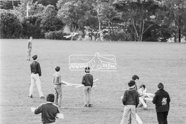
Photograph, George Coop, Balsa wood model airplane construction class, Nunawading High School, Canterbury Road, c.August 1983, 1983
... Canterbury Road (near Mahoneys Road) in 1955. Enrolments grew rapidly and by 1969 there were over 1,100 students, making it one of the largest schools in the state. In 1989 it was merged with Burwood Heights High and Blackburn South High to become a junior campus of Forest Hills Secondary College. However, the junior campuses were closed in 1997, and the former Nunawading High was bulldozed to make way for a housing estate...Canterbury Road (near Mahoneys Road) in 1955. Enrolments grew rapidly and by 1969 there were over 1,100 students, making it one of the largest schools in the state. In 1989 it was merged with Burwood Heights High and Blackburn South High to become a junior campus of Forest Hills Secondary College. However, the junior campuses were closed in 1997, and the former Nunawading High was bulldozed to make way for a housing estate ...Teachers at Nunawading High School were required to hold one afternoon a week with students undertaking some form of activity. There were various clubs such as gardening, chess, etc. Given George's background with art, craft and woodwork, he organised an activity for students to assemble balsa wood airplane kits which were test flown on the school grounds; Canternury Road in the background. Nunawading High School opened on Canterbury Road (near Mahoneys Road) in 1955. Enrolments grew rapidly and by 1969 there were over 1,100 students, making it one of the largest schools in the state. In 1989 it was merged with Burwood Heights High and Blackburn South High to become a junior campus of Forest Hills Secondary College. However, the junior campuses were closed in 1997, and the former Nunawading High was bulldozed to make way for a housing estate. "Lost Schools of the 1990s", Learning from the Past, http://learningfromthepast.com.au/lost-schools-of-the-1990s/ George Coop was a teacher of art, craft, wood working and graphics at Nunawading High School until it merged into Forest Hills Secondary College at which point he retired.Digital TIFF file Scan of 35mm Kodak Safety 5062 black and white transparencycanterbury road,model airplane, nunawading high school -
 Eltham District Historical Society Inc
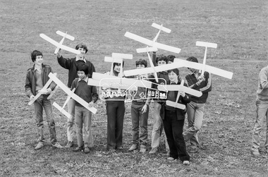
Photograph, George Coop, Balsa wood model airplane construction class, Nunawading High School, Canterbury Road, c.August 1983, 1983
... Canterbury Road (near Mahoneys Road) in 1955. Enrolments grew rapidly and by 1969 there were over 1,100 students, making it one of the largest schools in the state. In 1989 it was merged with Burwood Heights High and Blackburn South High to become a junior campus of Forest Hills Secondary College. However, the junior campuses were closed in 1997, and the former Nunawading High was bulldozed to make way for a housing estate...Canterbury Road (near Mahoneys Road) in 1955. Enrolments grew rapidly and by 1969 there were over 1,100 students, making it one of the largest schools in the state. In 1989 it was merged with Burwood Heights High and Blackburn South High to become a junior campus of Forest Hills Secondary College. However, the junior campuses were closed in 1997, and the former Nunawading High was bulldozed to make way for a housing estate ...Teachers at Nunawading High School were required to hold one afternoon a week with students undertaking some form of activity. There were various clubs such as gardening, chess, etc. Given George's background with art, craft and woodwork, he organised an activity for students to assemble balsa wood airplane kits which were test flown on the school grounds; Canternury Road in the background. Nunawading High School opened on Canterbury Road (near Mahoneys Road) in 1955. Enrolments grew rapidly and by 1969 there were over 1,100 students, making it one of the largest schools in the state. In 1989 it was merged with Burwood Heights High and Blackburn South High to become a junior campus of Forest Hills Secondary College. However, the junior campuses were closed in 1997, and the former Nunawading High was bulldozed to make way for a housing estate. "Lost Schools of the 1990s", Learning from the Past, http://learningfromthepast.com.au/lost-schools-of-the-1990s/ George Coop was a teacher of art, craft, wood working and graphics at Nunawading High School until it merged into Forest Hills Secondary College at which point he retired.Digital TIFF file Scan of 35mm Kodak Safety 5062 black and white transparencycanterbury road,model airplane, nunawading high school -
 Eltham District Historical Society Inc
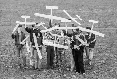
Photograph, George Coop, Balsa wood model airplane construction class, Nunawading High School, Canterbury Road, c.August 1983, 1983
... Canterbury Road (near Mahoneys Road) in 1955. Enrolments grew rapidly and by 1969 there were over 1,100 students, making it one of the largest schools in the state. In 1989 it was merged with Burwood Heights High and Blackburn South High to become a junior campus of Forest Hills Secondary College. However, the junior campuses were closed in 1997, and the former Nunawading High was bulldozed to make way for a housing estate...Canterbury Road (near Mahoneys Road) in 1955. Enrolments grew rapidly and by 1969 there were over 1,100 students, making it one of the largest schools in the state. In 1989 it was merged with Burwood Heights High and Blackburn South High to become a junior campus of Forest Hills Secondary College. However, the junior campuses were closed in 1997, and the former Nunawading High was bulldozed to make way for a housing estate ...Teachers at Nunawading High School were required to hold one afternoon a week with students undertaking some form of activity. There were various clubs such as gardening, chess, etc. Given George's background with art, craft and woodwork, he organised an activity for students to assemble balsa wood airplane kits which were test flown on the school grounds; Canternury Road in the background. Nunawading High School opened on Canterbury Road (near Mahoneys Road) in 1955. Enrolments grew rapidly and by 1969 there were over 1,100 students, making it one of the largest schools in the state. In 1989 it was merged with Burwood Heights High and Blackburn South High to become a junior campus of Forest Hills Secondary College. However, the junior campuses were closed in 1997, and the former Nunawading High was bulldozed to make way for a housing estate. "Lost Schools of the 1990s", Learning from the Past, http://learningfromthepast.com.au/lost-schools-of-the-1990s/ George Coop was a teacher of art, craft, wood working and graphics at Nunawading High School until it merged into Forest Hills Secondary College at which point he retired.Digital TIFF file Scan of 35mm Kodak Safety 5062 black and white transparencycanterbury road,model airplane, nunawading high school -
Surrey Hills Historical Society Collection
Folder of real estate advertisements, Folders of real estate advertisements (Streets beginning with C), Various
... canterbury road carlyle crescent carson avenue charles street chertsey street chester street chestnut street churchill street clyde street como avenue croydon road curlewis street A4 folders with individual pockets for each property in streets beginning with C located in Surrey Hills and Mont Albert. Folders are ordered by street name and then chronologically by property number. Each property has its own pocket. This may include multiple real estate ...A4 folders with individual pockets for each property in streets beginning with C located in Surrey Hills and Mont Albert. Folders are ordered by street name and then chronologically by property number. Each property has its own pocket. This may include multiple real estate advertisements collected from sales over time. It may also include copies of any research undertaken by Alan Holt and / or members of the SHNCHC team. These are augmented by cards in the Alan Holt index file and by his property registers of Surrey Hills and Mont Albert.canterbury road, carlyle crescent, carson avenue, charles street, chertsey street, chester street, chestnut street, churchill street, clyde street, como avenue, croydon road, curlewis street -
 Surrey Hills Historical Society Collection
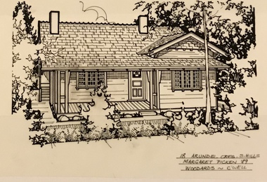
Drawing - Architectural drawing, 18 Arundel Crescent, Surrey Hills by Margaret Picken, 1989, 1989
... estate agents in Melbourne between c.1983 and 2005. Each work is signed and dated. Margaret Picken approached a number of historical societies in July 2020 with a view to donating her work. Sketches for post code 3127 are held by this collection. Others for suburbs including Ashburton, Balwyn, Camberwell, Canterbury, Blackburn, Box Hill...estate agents in Melbourne between c.1983 and 2005. Each work is signed and dated. Margaret Picken approached a number of historical societies in July 2020 with a view to donating her work. Sketches for post code 3127 are held by this collection. Others for suburbs including Ashburton, Balwyn, Camberwell, Canterbury, Blackburn, Box Hill ...Margaret Picken (1950-) trained and worked as a cartographic draftsman from 1968-1975 within the mining industry. These skills were readily transferable to work as a property illustrator for the real estate industry. Process: “Sketches were ordered by phone initially as there were no mobile phones or computers then. I would take our 2 year-old son with me to the houses when the other 2 boys were at school. I photographed houses with a Polaroid camera and made a ‘thumbnail’ sketch while there. The photos were used to scale off a sketch in pencil and then that sketch was overlaid with drafting film and the ‘pen and ink’ was completed. This process was the only one I used the entire time. Polaroid photos gave an instant usable photo. I then delivered the sketches by hand to the offices. There were deadlines each week on a Tuesday.” “… about 2003 coloured photos began to take over the sketches and mainstream companies replaced sole traders like myself providing a one-stop shop for all advertising. I produced my last Real Estate sketches in late 2005.” Margaret Picken (1950-) trained and worked as a cartographic draftsman from 1968-1975 within the mining industry. These skills were readily transferable to work as a property illustrator for the real estate industry. This architectural drawing is one of a series created by Margaret Picken for a range of real estate agents in Melbourne between c.1983 and 2005. Each work is signed and dated. Margaret Picken approached a number of historical societies in July 2020 with a view to donating her work. Sketches for post code 3127 are held by this collection. Others for suburbs including Ashburton, Balwyn, Camberwell, Canterbury, Blackburn, Box Hill, Burwood, Glen Iris, Hawthorn, Kew, Mont Albert North and Nunawading have been donated to the relevant historical group in those suburbs. (See Balwyn Historical Society, Box Hill Historical Society, Camberwell Historical Society, Hawthorn Historical Society, Kew Historical Society, Whitehorse Historical Society). In some cases, this collection also has a copy of the matching newspaper advertisement. Pen and ink architectural drawing on drafting film of 18 Arundel Crescent, Surrey Hills (VIC) by Margaret Picken. The drawing, dated 1989 , was commissioned by the Woodards real estate company.18 ARUNDEL CRES. S. HILLS / MARGARET PICKEN '89 / WOODARDS ~ C'WELLarchitectural drawing, houses, surrey hills / mont albert (vic.), artists, margaret picken 1950-, californian bungalow, arundel crescent -
 Surrey Hills Historical Society Collection
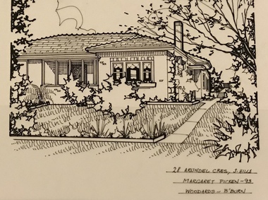
Drawing - Architectural drawing, 28 Arundel Crescent, Surrey Hills by Margaret Picken, 1993, 1989
... estate agents in Melbourne between c.1983 and 2005. Each work is signed and dated. Margaret Picken approached a number of historical societies in July 2020 with a view to donating her work. Sketches for post code 3127 are held by this collection. Others for suburbs including Ashburton, Balwyn, Camberwell, Canterbury, Blackburn, Box Hill...estate agents in Melbourne between c.1983 and 2005. Each work is signed and dated. Margaret Picken approached a number of historical societies in July 2020 with a view to donating her work. Sketches for post code 3127 are held by this collection. Others for suburbs including Ashburton, Balwyn, Camberwell, Canterbury, Blackburn, Box Hill ...Margaret Picken (1950-) trained and worked as a cartographic draftsman from 1968-1975 within the mining industry. These skills were readily transferable to work as a property illustrator for the real estate industry. Process: “Sketches were ordered by phone initially as there were no mobile phones or computers then. I would take our 2 year-old son with me to the houses when the other 2 boys were at school. I photographed houses with a Polaroid camera and made a ‘thumbnail’ sketch while there. The photos were used to scale off a sketch in pencil and then that sketch was overlaid with drafting film and the ‘pen and ink’ was completed. This process was the only one I used the entire time. Polaroid photos gave an instant usable photo. I then delivered the sketches by hand to the offices. There were deadlines each week on a Tuesday.” “… about 2003 coloured photos began to take over the sketches and mainstream companies replaced sole traders like myself providing a one-stop shop for all advertising. I produced my last Real Estate sketches in late 2005.” Margaret Picken (1950-) trained and worked as a cartographic draftsman from 1968-1975 within the mining industry. These skills were readily transferable to work as a property illustrator for the real estate industry. This architectural drawing is one of a series created by Margaret Picken for a range of real estate agents in Melbourne between c.1983 and 2005. Each work is signed and dated. Margaret Picken approached a number of historical societies in July 2020 with a view to donating her work. Sketches for post code 3127 are held by this collection. Others for suburbs including Ashburton, Balwyn, Camberwell, Canterbury, Blackburn, Box Hill, Burwood, Glen Iris, Hawthorn, Kew, Mont Albert North and Nunawading have been donated to the relevant historical group in those suburbs. (See Balwyn Historical Society, Box Hill Historical Society, Camberwell Historical Society, Hawthorn Historical Society, Kew Historical Society, Whitehorse Historical Society). In some cases, this collection also has a copy of the matching newspaper advertisement. Pen and ink architectural drawing on drafting film of 28 Arundel Crescent, Surrey Hills (VIC) by Margaret Picken. The drawing, dated 1993, was commissioned by the Woodards real estate company.28 ARUNDEL CRES, S. HILLS / MARGARET PICKEN ~ 93 / WOODARDSarchitectural drawing, houses, surrey hills / mont albert (vic.), artists, margaret picken 1950-, arundel crescent, 1940
