
Showing 15 items matching "census data"
-
 Wonga Park Community Cottage History Group
Flyer - 1981 Census data, for Wonga Park Postcode 3115
... 1981 Census data ...1981 Census data for Wonga Park Postcode 3115...1981 Census data for Wonga Park Postcode 3115 for Wonga Park Postcode 3115 Flyer 1981 Census data ...1981 Census data for Wonga Park Postcode 3115 -
 Eltham District Historical Society Inc
Book, Community Services Victoria, Social Profile: North Eastern Suburbs Region, May 1990
... ...census data...statistics population demographics social profile census data Local Government summaries for Diamond Valley, Eltham, Heidelberg, Northcote, Preston, Whittlesea. ...Local Government summaries for Diamond Valley, Eltham, Heidelberg, Northcote, Preston, Whittlesea. Provides census data and comparisons between years with summaries on topics including: Population, Age Distribution, Marital Status, Single Parents, Family Annual Income, Personal Annual Income, Social Security Income, Psychiatric Hospitla Admissions and departures, Aboriginal and Torres Strait Islanders, Persons born Overseas and country of origin, Langauges, English competence of overseas born persons, Occupancy of dwellings, Structure of occupied dwellings, type of occupanncy, private rents, monthly mortgages, households with no vehicle, level of qualifications, occupational status, employment, industry groups, unemployment, school attendance.119 pagesnon-fictionLocal Government summaries for Diamond Valley, Eltham, Heidelberg, Northcote, Preston, Whittlesea. Provides census data and comparisons between years with summaries on topics including: Population, Age Distribution, Marital Status, Single Parents, Family Annual Income, Personal Annual Income, Social Security Income, Psychiatric Hospitla Admissions and departures, Aboriginal and Torres Strait Islanders, Persons born Overseas and country of origin, Langauges, English competence of overseas born persons, Occupancy of dwellings, Structure of occupied dwellings, type of occupanncy, private rents, monthly mortgages, households with no vehicle, level of qualifications, occupational status, employment, industry groups, unemployment, school attendance.statistics, population, demographics, social profile, census data -
 Port Fairy Historical Society Museum and Archives
Book, Richard Osburne, The history of Warrnambool, capital of the western ports of Victoria, from 1847 (when the first government land sales took place) up to the end of 1886, 1980
... ...demography - census data....) -- history. framlingham / purnim (w vic sj54-11) demography - census data Book The history of Warrnambool, capital of the western ports of Victoria, from 1847 (when the first government land sales took place) up to the end of 1886 / by Richard Osburne Other Authors, Fraser, Malcolm, 1930-2015, (author of introduction, etc.) ...The history of Warrnambool, capital of the western ports of Victoria, from 1847 (when the first government land sales took place) up to the end of 1886 / by Richard Osburne Other Authors, Fraser, Malcolm, 1930-2015, (author of introduction, etc.) Tylee Memorial Collection368 pages, unnumbered and folded leaves of plates : illustrations (some colour), maps, portraits, plans ; 19 cmnon-fictionThe history of Warrnambool, capital of the western ports of Victoria, from 1847 (when the first government land sales took place) up to the end of 1886 / by Richard Osburne Other Authors, Fraser, Malcolm, 1930-2015, (author of introduction, etc.) Tylee Memorial Collectionvictoria. warrnambool, 1847-1886. facsimiles, government policy - initial period and protectionism., settlement and contacts - 19th century., mining industry - gold., race relations - violent - massacres, religions - christianity - missions., warrnambool (vic.) -- history., framlingham / purnim (w vic sj54-11), demography - census data, book -
 Broadmeadows Historical Society & Museum
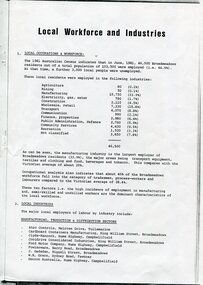
Document - Report, City of Broadmeadows Statistics (1980s), c.1985-1986
... ...Census Data...City of Broadmeadows Local Government Demography Population Statistics Workforce Employment Manufacturing Industry Housing Public Housing Immigration Ethnic Communities Historic Sites Education Transport Municipal History Community Development Census Data Melbourne Northern Suburbs Campbellfield Broadmeadows Glenroy Fawkner Tullamarine Coolaroo Two old catalogue labels on back page: "WI-2424" (highlighted with yellow) “WI-2222” 11-page black-and-white stapled photocopied report comprising typed text, tables and statistical summaries on A4 paper. ...The document reflects the social, economic and demographic characteristics of the City of Broadmeadows during a period of significant industrial activity and population growth. Manufacturing remained the dominant employment sector, with major employers including Ford Motor Company, W.R. Grace, Clyde-Hancock and numerous transport and food production enterprises. The report also documents migration patterns, public housing development and community infrastructure during a period when Broadmeadows was one of Melbourne's principal industrial municipalities.This report is significant for its documentation of the demographic, social and economic characteristics of the City of Broadmeadows during the early to mid-1980s. It provides a contemporary snapshot of one of Australia's major manufacturing municipalities and records information on population growth, migration, housing and employment patterns during a period of substantial change. The report has research significance because it consolidates data drawn from multiple sources into a single reference document and records information about major local industries, employers and community characteristics that may no longer exist in the same form. It provides valuable evidence of the municipality's industrial base, settlement patterns and community development priorities. The report has social significance through its documentation of the diverse communities living within Broadmeadows and the role of public housing, migration and industrial employment in shaping the municipality's identity.11-page black-and-white stapled photocopied report comprising typed text, tables and statistical summaries on A4 paper.Two old catalogue labels on back page: "WI-2424" (highlighted with yellow) “WI-2222”city of broadmeadows, local government, demography, population statistics, workforce, employment, manufacturing industry, housing, public housing, immigration, ethnic communities, historic sites, education, transport, municipal history, community development, census data, melbourne northern suburbs, campbellfield, broadmeadows, glenroy, fawkner, tullamarine, coolaroo -
 Sunshine and District Historical Society Incorporated
Pamphlet - Know your neighbourhood, Brimbank City Council Dept of Planning and Development, 2011
... Brochure Know your neighbourhood The Sunshine District|Brochure Know your neighbourhood The Deer Park District|Brochure Know your neighbourhood The St Albans District|Brochure Know your neighbourhood The Keilor District|Brochure Know your neighbourhood The Sydenham District|Data Source Profile & Forcast ID using ABS Census data|Data Source City West Water|Data Source Australian Conservation Consumption Atlas|Data Source Victorian Commission of Gambling regulation|Brochure City West Water Be Water Wise Target 155 in 2018|Brochure City West Water 231 litres per day 2014|Brochure City West Water Be Water Wise Target 155 in 2017|Brochure city West Water Be Water Wise Target 155 in 2016|Albion Neighbourhood Plan 27 Octobe 2012|Explanatory Brochure Albion Neighbourhood Study...Sunshine Brochure Know your neighbourhood The Sunshine District|Brochure Know your neighbourhood The Deer Park District|Brochure Know your neighbourhood The St Albans District|Brochure Know your neighbourhood The Keilor District|Brochure Know your neighbourhood The Sydenham District|Data Source Profile & Forcast ID using ABS Census data|Data Source City West Water|Data Source Australian Conservation Consumption Atlas|Data Source Victorian Commission of Gambling regulation|Brochure City West Water Be Water Wise Target 155 in 2018|Brochure City West Water 231 litres per day 2014|Brochure City West Water Be Water Wise Target 155 in 2017|Brochure city West Water Be Water Wise Target 155 in 2016|Albion Neighbourhood Plan 27 Octobe 2012|Explanatory Brochure Albion Neighbourhood Study Demographic data on the following topics Community population and people Local economy and life long learning Sustainable action and environment 5 four page leaflets Illustrated Each leaflet has a map of the district named Pamphlet Know your neighbourhood Brimbank City Council Dept of Planning and Development Community Planning City of Brimbank. ...Brochure Know your neighbourhood The Sunshine District|Brochure Know your neighbourhood The Deer Park District|Brochure Know your neighbourhood The St Albans District|Brochure Know your neighbourhood The Keilor District|Brochure Know your neighbourhood The Sydenham District|Data Source Profile & Forcast ID using ABS Census data|Data Source City West Water|Data Source Australian Conservation Consumption Atlas|Data Source Victorian Commission of Gambling regulation|Brochure City West Water Be Water Wise Target 155 in 2018|Brochure City West Water 231 litres per day 2014|Brochure City West Water Be Water Wise Target 155 in 2017|Brochure city West Water Be Water Wise Target 155 in 2016|Albion Neighbourhood Plan 27 Octobe 2012|Explanatory Brochure Albion Neighbourhood Studysunshine -
 Ringwood and District Historical Society
Newspaper - Clippings, Local Newspaper Mergers and Readership Demographics in Ringwood/Maroondah - 1995-1998
... This snapshot of Maroondah's population was revealed in Victoria in Fact, a Department of Infrasctructure report on the first release of 1996 Census data." ... 6. The Mail 21 April 1998 - How Maroondah Fits Into The Picture. "... a report based on 1996 Census data ... of 31 metropolitan Melbourne municipalities, including Maroondah." ... 7. ...This snapshot of Maroondah's population was revealed in Victoria in Fact, a Department of Infrasctructure report on the first release of 1996 Census data." ... 6. The Mail 21 April 1998 - How Maroondah Fits Into The Picture. "... a report based on 1996 Census data ... of 31 metropolitan Melbourne municipalities, including Maroondah." ... 7. ...Collection of seven newspaper articles glued to paper backing.1. The Mail 30 May 1995 - The Mail kept them informed - "The impact of the war (WWII) on the Ringwood and Croydon communities is reflected in the war-time editions of the Mail." ... 2. The Mail 3 October 1995 - Award - "Former Ringwood/Croydon Mail photographer Michelle Kelcey received a third place in the cadet section of the 1995 Hurley Awards." (The Hurley Awards acknowledge the work of suburban and regional newspaper photographers throughout Australia.) 3. The Mail 21 May 1996 - We're Maroondah now. "... Ringwood-Croydon Mail has changed names ... your Leader newspaper is now called the Maroondah Mail." ... 4. The Mail 22 July 1997 - The typical resident by Patrick Carlyon. "... some of the conclusions from the 1996 census released last week by the Australian Bureau of Statistics." ... 5. The Mail 2 December 1997 - Snapshot of Maroondah by Lynne Kinsey. "... This snapshot of Maroondah's population was revealed in Victoria in Fact, a Department of Infrasctructure report on the first release of 1996 Census data." ... 6. The Mail 21 April 1998 - How Maroondah Fits Into The Picture. "... a report based on 1996 Census data ... of 31 metropolitan Melbourne municipalities, including Maroondah." ... 7. Maroondah Post 25 January 1995 - Maroondah Post - a new name. "... From today the Maroondah Post will service all of the new City of Maroondah ..." (following merge of Croydon Post and Ringwood Post). -
Federation University Historical Collection
Document, Zelda Martin, Central Victorian Goldmining towns - Boom Towns or Ghost Towns?, c1996
... data from "Reports of Mining Surveyors Talbot (Back Creek) Brief History Taradale: Post office Directory 1869 - Name/Occupation/Street. Also list in alphabetical order by Occupation Taradale *Chronological Reference to Taradale Mines *Water - The Coliban System of Waterworks *Joseph Brady *The Syphon Tarnagulla (Sandy Creek) *Brief History *Tarnagulla Businessmen Cameos to give depth to advertisments in 'The Tarnagulla Courier' various issues 1864-1871 *Directory - Name/Occupation /Address *List - Name/Business/Trade Wedderburn (Koorong) *Brief History *List - Name/Occupation The Golden Triangle: *The Early Rushes - Wedderburn / Moliagul / Sandy Creek - Tarnagulla / Jones Creek - Waanyarra / Kingower / Dunolly - Goldsborough / Inglweood *Census of 1857 - Population / Occupations *1858-1871 - A Time of Consolidation- Wedderburn / Moliagul / Sandy Creek- Tarnagulla / Arnold *Census 1871 - Population *Information gleaned from the census data - Demographics / Population / Occupations / marital / Birthplace / Religion / Literacy/ Occupation and Housing Cameos *Graphs - Birthplace of settlers /Male-Female Ratio / Married males / Children under 15 as Percentage of Population / Religion *Census 1857 - Statistical data *Maps *Bibliography [.13] Resource No. 6 - Black Display Book Information and Research in Central Victoria including: *Banking - Research from ANZ Bank Archives *Institutions - also includes articles listed from the Ballarat Times Newspaper *Australian mining History Association - A.M.H.A. ...data from "Reports of Mining Surveyors Talbot (Back Creek) Brief History Taradale: Post office Directory 1869 - Name/Occupation/Street. Also list in alphabetical order by Occupation Taradale *Chronological Reference to Taradale Mines *Water - The Coliban System of Waterworks *Joseph Brady *The Syphon Tarnagulla (Sandy Creek) *Brief History *Tarnagulla Businessmen Cameos to give depth to advertisments in 'The Tarnagulla Courier' various issues 1864-1871 *Directory - Name/Occupation /Address *List - Name/Business/Trade Wedderburn (Koorong) *Brief History *List - Name/Occupation The Golden Triangle: *The Early Rushes - Wedderburn / Moliagul / Sandy Creek - Tarnagulla / Jones Creek - Waanyarra / Kingower / Dunolly - Goldsborough / Inglweood *Census of 1857 - Population / Occupations *1858-1871 - A Time of Consolidation- Wedderburn / Moliagul / Sandy Creek- Tarnagulla / Arnold *Census 1871 - Population *Information gleaned from the census data - Demographics / Population / Occupations / marital / Birthplace / Religion / Literacy/ Occupation and Housing Cameos *Graphs - Birthplace of settlers /Male-Female Ratio / Married males / Children under 15 as Percentage of Population / Religion *Census 1857 - Statistical data *Maps *Bibliography [.13] Resource No. 6 - Black Display Book Information and Research in Central Victoria including: *Banking - Research from ANZ Bank Archives *Institutions - also includes articles listed from the Ballarat Times Newspaper *Australian mining History Association - A.M.H.A. ...Zelda Martin was a PhD candidate at the University of Melbourne.[.1] 4th item in light blue display book titled Research Approach/Overview of Chapters/Confirmation of Canditure/Chapters1,2,3&4 of proposed thesis. *Twenty-seven page article on Victorian goldfields towns titled: Central Victorian Goldmining Towns - Boom Towns or Ghost Towns. The article was written during the author's PhD study. It outlines the context methodology, and resources and the chapters of the proposed thesis: (1) Central Victorian Goldmining Towns - The Context (2) Contemporary Views of the Factors Necessary for Town Growth (3) Outward Manifestations of Town Growth (4) The Trappings of Government (5-9) The Main Towns and Their Hinterland. [.2] 5th item in Light Blue display book as above item. *Chapter 1 of proposed thesis titled 'Pick, Shovel and Tin Dish Mining.' Covers in Section A: Central Victoria - Pre 1851: Aborigines in Central Victoria, Squatters, and Government. Section B: The years 1851-1854: The Early Gold Rushes, Government Reaction, Township Surveys, Legislation, Town Development, Local Government and Early Settlement. [.3] 6th item in Light Blue display book as above item. *2A of proposed thesis titled 'Contemporary Views of the Factors Necessary for Town Growth'. Similar information to Chapter 1 plus extra re towns and maps. Sections: Introduction, Context of Place - Geographical Towns Listed, The Context of Time - Pre1851 Aborigines, Governance of Port Phillip, The Squatters, The Villages of Central Victorian Highlands, Conclusion, Condensed Version of Chapter2B. [.4] 7th item in Light Blue display book as above item. *Chapter2B of proposed thesis. Sections: Area of Research, Schools, Banks, Newspapers, Progress Association, Town Development - Sandhurst (Bendigo), Ballarat, Castlemaine,, Maryborough, Ararat and Stawell. [.5] 8th item in Light Blue display book as above item. *Chapter 3 of proposed thesis titled 'Outward Manifestations of Town Growth'. Sections: Introduction, Contemporary Writing, Educationalists, The Bankers, The Townsfolk, Current Theory, General Theories of Urban Development, and Conclusion. [.6] 9th item in Light Blue display book as above item. *Chapter 4 of proposed thesis titled 'Trappings of Government' Sections: Introduction, Early Government Attitudes to Mining and Town Development, Law and Order, Township Surveys, Legislation, Local Government, Transport and Communication, The People and Lobbyists. [.7] 10th item in Light Blue display book as above item. *'The Rise and Fall of Central Victorian Goldmining Towns'. Includes a map showing main Goldfields, a table showing towns and villages at two points in time - 1857 and 1871; a Bibliography of Primary and Secondary Sources. [.8] Resource No1. Black display book titled Local Towns 1 : Alma: *Brief history *Directory *Maps Amphitheatre / Mountain Hut: *Brief History Post Office Directory Ararat: *Brief History *Post Office Directory 1869 - Alphabetical Listing by Occupation *Ararat - Prominent Citizens of 1858 *Langi-Morgala Museum Avoca: *Brief History *Excerpts from 'Avoca The Early Years', Margery and Betty Beavis; pg1 - Beginnings; pg11 - The Midas Touch; pg25 - Local Gold Escorts; pg27 - A Town is Born; pg51- The Administration of Justice; pg53 - The Ways of the Law; pg61 - News of the Day; pg65 - A Time to Play; pg72 - Land Ownership *Post Office Directory (Bailliere's) 1869 *Tourism Map and Information of area *Historic Avoca - A 5.5km Tour *Avoca & the Pyrenees Region - information pamphlet Ballarat: *Early History of Ballarat - Ballarat Historical Society, Publication No.1: origin of the name; Ballaarat - the Beginning; Fabulous Yields from the Ballaarat Goldfield; *Streetscape Lydiard Street. *Hand drawn map showing Leigh River, Old Portland Bay Road, plaque on road to Colac; etc. *Newspaper article re 'The Theatre Royal' ( which stood in the vicinity of the current Owen Williams store) - 'The News'15/04/1998 *Article - 'Ballarat's Mechanics' Institute Lives On' Ballarat Courier, 14/09/1985 *Article - Standing the Test of Time' The News 17/11/1993 re The Mechanics Institute & picture of the Reading Room *'Ballarat a Study of a City, Phyllis Reichl, pub. Nelson, 1968; no.3 place, time and people field studies series *Investigator Vol.33 No.2, 1998 Geelong Historical Society. Article on pg75 describes Ballarat in 1861 *Folded poster - 'Ballarat 100' a history of telegraph communication, pub. Telecom. Beaufort (Fiery Creek): *Brief history *Post Office Directory [.9] Resource No.2 Black Folder Titled Towns cont.No2 Bendigo (Sandhurst): *'Family & Local History at the Bendigo Library - 1851-2001 150 years of gold'. *Bendigo Government Camp in 1853 illustration; key to sketch and names of Government officers stationed there *Excerpts from 'Bendigo and Vicinity' Adolph Haman *The Bendigo Goldfield Registry - pgs 1-7 Introduction *Excerpt: 'Breaking the Grip' *Excerpt: The Most Go-Ahead Place *Excerpts from 'History of Bendigo' - anti license agitation; laying out of town; proposed railway; gold calls and dividends; the Sandhurst Municipality; journalism *Bibliography Blackwood: *Excerpts from 'Aspects of Early Blackwood - The Goldfield, the Landmarks, the Pioneers' Alan J Buckingham and Margaret F Hitchcock, JG Publishing,1980 Buninyong: *A Brief History *Investigator Vol1 No.2 Feb 1966 Geelong Historical Society. Pg3 - Article re gold escort route - Mt Alexander to Adelaide - (see a simple monument on the Western Highway a few miles out of Horsham. Pg 15 - Ballarat Excursion - re the finding of gold. *Three articles published by Buninyong and District Historical Society Inc: (Magpie Exploration; Finding Gold In The Green Hills; Magpie Exploration; Burnt Bridge to Cargarie to Mt Mercer) *Copies of newspaper articles/items *Buninyong Street Directory Carisbrook: *In the Beginning There Was Carisbrook *The History of the Carisbrook Racecourse Carngham / Snake Valley: *Brief History *Directory Castlemaine: *Directory 1865-1866 - Alphabetical and Street *Poster - Castlemaine A Contemporary Guide "The Great Centre" 1866 - A Contemporary Guide to the Fascinating Past *Pamphlet - Castlemaine District Community Hospital *Map - Castlemaine, Maldon & Surrounding Districts *Map and Information - The Dry Diggings Track - a 55kl walk among historic goldfields relics ( Castlemaine Fryerstown Vaughan Mt Franklin Hepburn Daylesford) *Postcard - Former Court House *Directory 1867 - Alphabetical, Trade [.10] Resource No.3 Grey folder Titled Towns 3 Creswick to Maryborough Creswick: *Brief History *Booklet - "Creswick Cemetery Walk" *Booklet - The Buried Rivers of Gold Heritage Trail Creswick *Creswick Historical Museum Information Sheet *Chronological History of Creswick *Alphabetical Directory of the Borough of Creswick *Creswick's Creek Directory 1856 *Historic Creswick Walking Tour *A Brief Account of the Schools of Creswick - Past and Present *100 Years of Railway Travel in Creswick *The Berry Deep Leads *The Spence Home at Jackass Gully in the Creswick State Forest ( William Guthrie Spence - Pioneer) *The New Australian Mine and the 1882 Disaster *Creswick District News, Issue 7, July August 1999 *The Creswick Miners Walk - Information and Map *Maps Chewton: *Brief History *Directory Clunes: *Brief History *Clunes Street Directory Daylesford: *Brief History *Notable Bushfires in Daylesford District Over More Than a Century - "Black Thursday" 1851; 1862; 1899; the Disastrous Hepburn Fire of 1906; 1939; 1944; 1969. *Post Office Directory -Daylesford and Hepburn Dunolly / Inkerman: *Brief History *Directory *Pamphlet - Goldfields Historical Museum *Pamphlet - Historic Dunolly - Victoria's Best Kept Secret *Map of Gold Workings at Dunolly Area - showing where the main gold rushes occurred *Brief History - Inglewood *Directory - Inglewood - Name Occupation, Dwelling Kingower: *Brief History *Directory - Name / Ocupation / Dwelling Linton / Happy Valley / Piggoreet: *Brief History *Directory - Lintons McIvor: *"A History of the Shire and the Township of Heathcote" by J.O. Randell Majorca: *Brief History *Official Post Office Directory 1869 - Name / Occupation/ Address Maldon (Tarrangower): *Brief History Part 1 *Brief History Part 2 *Post Office Directory *List - Alphabetical Order by Names plus Business and Trade (Tarrangower Times Oct/1858) *List - Alphabetical Order by Trade plus Name and Business *Directory - Name / Occupation / Dwelling Maryborough: *Worsley Cottage - built by Arthur Worsley, a contractor in stonework in 1894 [.11] Resource No. 4 Blue Display Book titled Towns 4 Moliagul to Stawell Moliagul: *Brief History *Moligul Legislative Assembly (Voting?) List - Names and Occupations *Moliagul Victorian Post Office Directory 1868 - Name / Ocupation / Address / Comments *"The Welcome Stranger" gold nugget *The Sunday School *The Welcome Stranger Discovery Walk - information and map Moonambel (Mountain Creek) Redbank *Brief History *List of names extracted from advertisments of the Pioneer and Mountain Creek Advertiser 16/02/1861. *Bailliere's Directory 1869 - Alphabetical List of Name / Occupation / Place St Arnaud: *Brief History Sebastapol: *Brief History *Directory 1869 - Alphabetical by Name; plus occupation and address. Browns and Scarsdale: *Brief History *Browns Street Directory - Name and Occupation Smythesdale: *Brief Description *Smythesdale Street Directory -Name and Occupation Stawell (Pleasant Creek) *Brief History *Victorian Official Post Office Directory - Name /Occupation / Dwelling *Chronology - 1841-1920 *Production of gold statistics - 1879 - 1900 *Big Hill *Extracts from "The Golden Years of Stawell". Chapt 1 - Stawell's Coming Out. Capt. 2 - The Gold Rush. Caapt.3 - Cradle of Democracy. Chapt.4 - The Reefs Becomes Stawell. Chapt. 5 - Rushing In. Chapt.6 - The Pioneers. Chapt 7 - The Decade of Optimism. [.12] Resource No. 5: Blue Display Book titled 'Towns Steiglitz to the The Golden Triangle. Steiglitz: Brief History Victorian Post Office Directory 1869 *Map of Steiglitz *List of maps relevant to Steiglitz history *Information 6 tables of data from "Reports of Mining Surveyors Talbot (Back Creek) Brief History Taradale: Post office Directory 1869 - Name/Occupation/Street. Also list in alphabetical order by Occupation Taradale *Chronological Reference to Taradale Mines *Water - The Coliban System of Waterworks *Joseph Brady *The Syphon Tarnagulla (Sandy Creek) *Brief History *Tarnagulla Businessmen Cameos to give depth to advertisments in 'The Tarnagulla Courier' various issues 1864-1871 *Directory - Name/Occupation /Address *List - Name/Business/Trade Wedderburn (Koorong) *Brief History *List - Name/Occupation The Golden Triangle: *The Early Rushes - Wedderburn / Moliagul / Sandy Creek - Tarnagulla / Jones Creek - Waanyarra / Kingower / Dunolly - Goldsborough / Inglweood *Census of 1857 - Population / Occupations *1858-1871 - A Time of Consolidation- Wedderburn / Moliagul / Sandy Creek- Tarnagulla / Arnold *Census 1871 - Population *Information gleaned from the census data - Demographics / Population / Occupations / marital / Birthplace / Religion / Literacy/ Occupation and Housing Cameos *Graphs - Birthplace of settlers /Male-Female Ratio / Married males / Children under 15 as Percentage of Population / Religion *Census 1857 - Statistical data *Maps *Bibliography [.13] Resource No. 6 - Black Display Book Information and Research in Central Victoria including: *Banking - Research from ANZ Bank Archives *Institutions - also includes articles listed from the Ballarat Times Newspaper *Australian mining History Association - A.M.H.A. Bibliography *Australia's Mining History * Bibliography - Land Surveys Victoria - *1853 Administration (Statistics and Other) includes: schools / ministers of religion / police / military / local administration / licences for sale of spirits / distances between various Victorian gold fields. * Victoria Government Gazette (Copy) - N0. 116, 12/12/1854 includes: Gold Felds Commission of Enquiry & No. 85, 15/09/1854 - Addresses presented to the Lieutenant Governor (Sir Charles Hotham) during his tour through the Gold Fields of Victoria,1854. Addresses on behalf of : the people of Bendigo; Members of the Church of England, Bendigo; Members of the Wesleyan Church on the Bendigo Gold Fields; Bendigo Gold District General Hospital; the Bendigo Prospecting Association; Committee of the Bendigo Local Exhibition; Bendigo District Medical Association; Coloured Americans Resident at Bendigo; German Inhabitants of Bendigo; Landowners, Inhabitants, and Miners of Castlemaine; Inhabitants of Forest Creek; Inhabitants of Heathcote and Gold Miners of McIvor; Residents and landholders of the District of Bacchus Marsh; Inhabitants of Kilmore and Vicinity. *Gold Fields Correspondence 1853: letter from Lieutenant Colonel Valiant, (Officer commanding the Troops in Victoria) to the Lieutenant Governor re threatened disturbance at Sandhurst (Bendigo) regarding the Gold License Fee. * Extracts from a book "Victoria" re Gold Fields Commission of Enquiry involving mainly Ballarat and Castlemaine and a chapter titled 'A Tour to the Victorian Gold-Fields' *Lists of central Victorian newspapers - listed by date published 1851to 1874; by first date available to State Library. *A list of cities and towns showing County, population in 1861 &1871, and municipal status. [.14] Resource no.7. Black display book. *Reference: Papers presented to Parliament Victoria - 1859-1860 4 volumes - relevant sections copied. Contains information on Branches of Government. General / Finance / Gold / Gazette / Commission and Warrant / Statistic. *Gold Fields Act. In accordance with the Act the gold fields are divided into six districts - Ballaarat, Castlemaine , Sandhurst, Avoca, Ararat, and Beechworth.. Official staff in each gold district consists of a Resident Warden, Wardens, Wardens' Clerks, Bailiffs, Chinese Protectors, Chinese Interpreters, and Mining Surveyors. *Gold Receiver *Gaols *Police magistrates and Clerks of Petty Sessions, etc. *Field Branch *Immigration and Emigration Overland - Chinese - 1859 *Population on the Goldfields *The Geological Survey - The Government Geologist is assisited by staff from four branches - the office Branch; the Publishing Branch; the Field Branch and the Museum Branch. *Commission to Enquire Into Sludge dated 10/02/1859 (Some sections copied) - Report to the Honorable Chief Commissioner of Public Works, Melbourne re the mode of carrying the sludge from the puddling mills in Sandhurst without interfering with the drainage of the town and the roads in the neighbourhood. [.15] Resource No.8: Camel display book titled Resource No. 8. Aborigines *Lists of book titles - +"Readings in Victorian prehistory" +"The Aborigines of Port Phillip" +Aboriginal languages and clans" +"A History of the Port Phillip District" +"Langi Ghiran 1: Aboriginal Rock...." +"Koorie History: sources for aboriginal studies in the State Library of Victoria", ed. Tom Griffiths, Melb. Friends of the State Library, 1989 +"The Public Lands of Australia Felix"; settlement and land appraisal in Victoria1834-91 with special reference to the Western Plains", J.M.Powell, Melb. Oxford University Press 1970 +*Bibliography of the Victorian Aborigines' from the earliest manuscripts to 31st December 1970, Massoa, Aldo, Melb. Hawthorn Press, 1971 +"Aborigines in Colonial Victoria, 1836-1886", M.F. Christie, Sydney University Press, 1979 +"Urban and Industrial Australia: readings in Human Geography" ed J.M. Powell, Melb. Sorrett Pub. 1974 *Extracts: -Processes of Pioneer Settlement - The Squatting Occupation of Victoria, 1834-60. J.M. Powell -Areal Variations in the Class Structure of the Central-Place Hierarchy. P. Scott - Volume1 and Volume 2: Notes Relating to the Habits of the Natives of Other Parts of Australia and Tasmania. Compiled from various sources for the Government of Victoria by R Brough Smyth. John Curry, O'Neil, Melb. 1st pub. Melb. 1876. p31-45 - Numbers and Distribution of the Aborigines in Victoria -Victorian Aborigines 1835-1901 - A Resource Guide to the Holdings of the Public Record Office, Victoria; published by the Government Information Centre 1984. *History of the Aboriginal Artefacts Displayed in the Daylesford Museum. F. G. Powell (4 page pamphlet) *Letter to Zelda Martin from Peter Lovett, Cultural Officer, Ballarat & District Aboriginal Co- Operative, 05/02/1997 *Map: Ian Clarke Victorian Tribunal Boundary Map - Clans of Central Victoria. *Victorian Rock Art and Mythology - Article about Mount Langhi Ghiran and myths of the Tjapwarong people. *Two Aboriginal myths relating to the Grampians - 'The Monster Emu' / 'The Aquisition of Fire', by the Aborigines in the Grampians Areas *Article titled (chapter 8) Ballarat - information re camping sites in the region. Lake Wendouree / Lake Burrumbeet (includes a myth) / Mt Bunninyong / Lal Lal / Pitfield / Mount Elephant / Mount Egerton / Meredith / Lake Goldsmith / Lake Learmonth / Ercildoune *Notes on the Aborigines of the Wider Ballarat Region plus European names=Aboriginal names. John Morris 26/07/1995 *Role of Aborigines in Town Development in Central Victoria. Mentions Native Police Force est. in Port Phillip 1842 and Central Board for Aborigines est. 1860 *The Grave of King Billy. (Frank Wilson) Pamphlet. *Camping Places in Central and Northern Victoria. Article re Lake Burrumbeet site. *Programme for the Unveiling of Memorial Cairn for Edward Stone Parker 1802-1865. Note portrait not accurate. Accurate portrait is available in the book "A Successful Failure A Trilogy The Aborigines and Early Settlers", Edgar Morrison, Graffiti Publications, 2002. * Large envelope addressed to Mr G Netherway containing newspaper cuttings regarding the life of Edward Stone Parker, the unveiling of the Memorial Cairn as mentioned above, articles titled 'Episodes from Our Early Days' (Edgar Morrison, Yandoit)- The Black's School, A School At Last and The Final years. Also a typed page titled 'Historical Background to E.S.Parker's Career. Includes an interesting tale titled 'When the cat lay doggo' re laying power leads for the unveiling ceremony at the memorial site. [.16] green display folder titled 'Research Aids' *List of references to Commissioners' & W'ardens' Reports (formerly held at La Trobe Library Archives, now at Public Records Office [PRO]). Indicates town referred to / date of report / name of camp if different to town. * Archive information re Anglican Records *Movement around the Goldfields - Miners and Storekeepers - usefulness of newspapers in providing information - areas covered - Castlemaine, Maldon, Ararat, Stawell, Tarnagulla, Dunolly. *Port Phillip /Victoria Directories 1839/1867 - Chronological list of Directories included in this series. *"Notes on the History of Local Government in Victoria" A.W. Greig Melb. University Press 1925 - Photo-copied extract p5-p40. (Source - Deakin University Library) - Introduction by W.Harrison Moore. Section 1 - Development in New South Wales Before Separation. Section 2 - Development in Victoria After Its Separation from New South Wales. Hand written notations: 'roads, markets, and local government 1855 on' ;'opportunity of squatters in parliament' and 'opportunities of matters in parliament p33' * Notes on the Establishment of Surveyor General's Department 1851and Commissioner of Crown Lands and Survey. * Newspaper articles from The Argus, 1849, re the discovery of gold in the Pyrenees region. * Excerpt - a report on schools - A.B.Orlebar, Inspector; re the need for permanent school buildings rather than tents. *Excerpt from - 'Approaches to Urban History', Sean Glynn: The Case for Caution * Except from - 'The Urban Sprinkle', Weston Bate: Country Towns and Australian Regional History *Reference- 'The History of Land Tenure in the Colony of Victoria', John Quick. References the Haines Land Bill, land tenure and Land Leagues. [.17] Light blue envelope folder titled 'Birtchnell's Ballarat, etc. Directory 1862 *Contains various directories for Smythesdale, Buninyong, Clunes, Brown's and Creswick. [.18] Red envelope folder no.2 titled Victorian Gazetteer *Selected pages from 1869 Victorian Gazetteer on A4 paper (with a handwritten note questioning if some pages are from 1868 Victorian Gazetteer as appears to be different sizes - A3 pages.) Information includes locations and descriptions of towns, hotels, banks, communications and populations. (Does not include names, residences and occupations) [.19] Red Envelope folder titled Bailliere's Official Post Office Directory 1868 (or1869 or a mixture of both?) *Preface *Contains a selection of pages of towns highlighted in yellow in the the index *Work on this directory was commenced in 1867. *Information includes: Municipalities - mayors and councilors; lists of towns naming male inhabitants and their occupations. [.20]Yellow manila folder titled Post Grad Seminar Presentation 1996 *Gives some background to Zelda Martin's proposed thesis and why she chose the topic Gold Mining Towns Boom or Bust [.21] A3 display book - No. 1A * A list of 'Relevant Newspapers collected: The Tarrangower Times and Maldon Advertiser (first published 1858) Includes dates 1858-1867. The Mount Alexander Mail. Includes dates 1854-1866 The Tarnagulla Courier. Includes dates from1864-1871 Dunolly and Burnt Creek Express. Includes dates from 1862-1871 * Selection of newspaper pages from The Mount Alexander Mail 1854 to 1856, mostly showing advertisements for businesses and services provided to that community. [.22] A3 display book - No. 1B * Selection of newspaper pages from The Mount Alexander Mail 1857 to 1866, mostly showing advertisements for businesses and services provided to that community. [.23] A3 display book -No. 2 * Selection of newspaper pages from The Tarnagulla Courier 1864 to 1871, mostly showing advertisements for businesses and services provided to that community. [.24] A3 display book - No. 3 *Selection of newspaper pages from The Tarrangower Times (and Maldon and Newstead) Advertiser 1858 to1867, mostly showing advertisements for businesses and services provided to that community. [.25] A3 display book - No.4 * Selection of newspaper pages from The Dunolly and Burnt Creek Express; and The Dunolly and Betbetshire Express 1862 to 1871, mostly showing advertisements for businesses and services provided for that community. [.26] A3 display book - No.5 Includes: * Bryce Ross's Diggings Directory. Includes instructions for using this directory. This directory was used by "all persons having connexion or desiring to communicate with 'working parties, private friends, or Stores at the Diggings." As a directory for each area wwas completed it was published in each month's issue of Bonwick's "Digger's Magazine." Years c1852/1853. This Directory commences first at the head of Forest Creek. Includes a directory for Bendigo and Ballarat. Of interest at the end of the Bendigo and Ballarat directory is a list of the number of storekeepers, butchers, doctors, smiths, eating houses, lemonade sellers and chapels. * The Castlemaine Directory and Book of General Information Comprehending Glass's Model Calendar for the Two Years 1862 and1863. "zelda martin, victorian goldfield towns, bendigo, castlemaine, ballarat, maldon, stawell, ararat, maryborough, creswick, avoca, heathcote, banks, bank of australasia, union bank of australia, government camp, sandhurst, water supply, tarnagulla, talbot, back creek, mountain creek, police court, carisbrook, dunolly, thompson's foundry, charles clacy, anthony trollope, robert cecil, mount alexander, urbanisation, national schools, education, govenrment, industry, railway, transport, settlement, land settlement in central victoria, steiglitz, joseph brady, the new australian mine, berry deep leads, william guthrie spence, creswick state forest, arthur worsley, worsley cottage, the welcome stranger, moliagul, moonambel, redbank, st arnaud, sebastapol, brown's, scarsdale, clunes, chewton, daylesford, bushfires, inkerman, inglewood, kingower, lintons, happy valley, piggoreet, mcivor, majorca, tarrangower, taradale, the coliban system, the syphon, sandy creek, wedderburn, koorong, arnold, jones creek, waanyarra, the golden triangle, census 1857, blackwood, buninyong, durham lead, magpie, carngham, snake valley, alma, amherst, daisy hill, amphitheatre, mountain hut, beaufort, fiery creek, counties, population, gold fields commission of enquiry1854, william westgarth, gold license fee, lieutenant colonel valiant, administration of the victorian gold fields, commission to enquire into sludge 1859, e.s. parker, edward stone parker, edgar morrison, mount franklin protectorate, dja dja wurrung, memorial cairn, franklinford, mt franklin memorial cairn, jajowurrong, dja dja wurung, tjaowarong, wothowurong, assistant protectors, daylesford museum, buluk, rock art - grampians, aboriginal mythology - grampians, aborigines, first nations people, mount franklin, aboriginal artifacts, lake burrumbeet, native police force, central board of aborigines, yandoit, commissioners' reports, wardens' reports, port phillip/victoria directories 1839-1867, local government - victoria 1853/1854, surveyor general's department - 1850's, victorian schools 1850's, a.b.orlebar, haines land bill, william charles haines, wilson gray, land tenure, land leagues, victorian gazetteer, the tarrangower times and maldon advertiser - 1858-1867, the mount alexander mail 1854-1866, the tarnagulla courier 1864, dunolly and burnt creek express 1862-1871, bryce rose's diggings directory, the castlemaine directory 1862-1863 -
 Flagstaff Hill Maritime Museum and Village
Book - Atlas, F.E. Hiscocks and Co, New Victorian Counties Atlas, 1874
... In addition, it includes economic and agricultural production data, along with geological and mining details gathered directly from the Department of the Secretary for Mines, showing exactly where resources were being extracted. Because the maps explicitly detail the names of pastoral occupiers and the boundaries of their "runs," the atlas serves as a vital historical census of who controlled Victorian wealth in 1874. ...Published in Melbourne in 1874 by the prominent bookseller and publisher George Robertson, F.E. Hiscocks & Co.’s New Victorian Counties Atlas is a monumental 19th-century cartographic and statistical record of the colony of Victoria. While George Robertson was the publisher responsible for production, marketing, and distribution, the detailed compiling and surveying were executed by F.E. Hiscocks & Co., with the striking colour lithography handled by the renowned Melbourne firm Hamel & Ferguson.Hard cover book, New Victorian Counties Atlas Author: F.E. Hiscocks and Co, Publisher: George Robertson, Melbourne Vic. Date: 1874 Morocco Olive hardcover with a damaged black spine, reinforced corners to hardcover gold edging to where spine meets hardcover. Title in a lozenge on front cover edged with a decorative panel. non-fictionPublished in Melbourne in 1874 by the prominent bookseller and publisher George Robertson, F.E. Hiscocks & Co.’s New Victorian Counties Atlas is a monumental 19th-century cartographic and statistical record of the colony of Victoria. While George Robertson was the publisher responsible for production, marketing, and distribution, the detailed compiling and surveying were executed by F.E. Hiscocks & Co., with the striking colour lithography handled by the renowned Melbourne firm Hamel & Ferguson.flagstaff hill, warrnambool, maritime village, maritime museum, shipwreck coast, great ocean road, new victorian counties atlas, hiscocks and co, atlas, maps -
Greensborough Historical Society
CD-ROM, Church of Jesus Christ of Latter-Day Saints, 1881 Census for Great Britain by region, with National Index and Resource File Viewer disc, 1881_
... Covers data for England, Scotland, Wales, Channel Islands, Isle of Man by Regions and the Royal Navy. Ring binder containing 24 CDs 1881 Census for Great Britain by region, with National Index and Resource File Viewer disc. ...Covers data for England, Scotland, Wales, Channel Islands, Isle of Man by Regions and the Royal Navy.Ring binder containing 24 CDs -
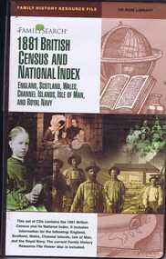 Greensborough Historical Society
CD-ROM, Church of Jesus Christ of Latter-Day Saints, 1881 British Census and National Index, 1881_
... Comprises data for England, Scotland, wales, Channel Islands, Isle of Man by Regions, and the Royal Navy, with Family History resource File Viewer disc. family history Ring binder containing 24 CD-Roms 1881 British Census and National Index CD-ROM Church of Jesus Christ of Latter-Day Saints ...Comprises data for England, Scotland, wales, Channel Islands, Isle of Man by Regions, and the Royal Navy, with Family History resource File Viewer disc.Ring binder containing 24 CD-Romsfamily history -
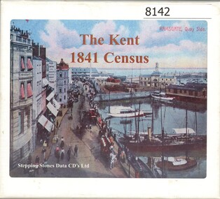 Greensborough Historical Society
CD-ROM, Stepping Stones Data CDs Limited, The Kent 1841 census, 1841
... May assist in family history research. censuses great britain Kent England family history 3 x CD-ROMs , contents note and instructions for use in box The Kent 1841 census CD-ROM Stepping Stones Data CDs Limited ...CD set contains the 1841 census for Kent in Great Britain. It is searchable by Parish, township and hamlet. May assist in family history research.3 x CD-ROMs , contents note and instructions for use in boxcensuses great britain, kent england, family history -
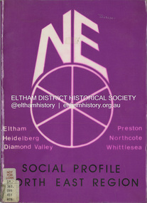 Eltham District Historical Society Inc
Book, North Eastern Suburbs Family and Community Services Regional Consultative Council, Social Profile North East Region, January 1985
... The profile draws on census data for 1976 and 1981. Local Government summaries for the local government areas of Diamond Valley, Eltham, Heidelberg, Northcote, Preston and Whittlesea. ...Comprehensive statistical overview of Melbourne's north east region. The profile draws on census data for 1976 and 1981. Local Government summaries for the local government areas of Diamond Valley, Eltham, Heidelberg, Northcote, Preston and Whittlesea. Sections include demographic profiles (including family type and migrant populations), workforce, housing, education, support services, children's services, transport, recreation and leisure facilities, local government authorities, and local government area profile summaries.non-fictionComprehensive statistical overview of Melbourne's north east region. The profile draws on census data for 1976 and 1981. Local Government summaries for the local government areas of Diamond Valley, Eltham, Heidelberg, Northcote, Preston and Whittlesea. Sections include demographic profiles (including family type and migrant populations), workforce, housing, education, support services, children's services, transport, recreation and leisure facilities, local government authorities, and local government area profile summaries.population, social profile, social service, demographics -
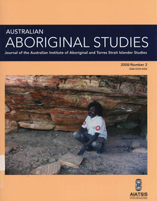 Victorian Aboriginal Corporation for Languages
Periodical, Australian Institute of Aboriginal and Torres Strait Islander Studies, Australian Aboriginal studies : journal of the Australian Institute of Aboriginal and Torres Strait Islander Studies, 2008
... Indigenous population data for evaluation and performance measurement: A cautionary note Gaminiratne Wijesekere (Dept. of Families, Housing, Community Services and Indigenous Affairs, Canberra) I outline the status of population census counts for Indigenous peoples, identifying information on Indigenous births and deaths, and internal migration estimates. ...Indigenous population data for evaluation and performance measurement: A cautionary note Gaminiratne Wijesekere (Dept. of Families, Housing, Community Services and Indigenous Affairs, Canberra) I outline the status of population census counts for Indigenous peoples, identifying information on Indigenous births and deaths, and internal migration estimates. ...Mawul Rom Project: Openness, obligation and reconciliation Morgan Brigg (Universtiy of Queensland) and Anke Tonnaer (University of Aarhus, Denmark) Aboriginal Australian initiatives to restore balanced relationships with White Australians have recently become part of reconciliation efforts. This paper provides a contextualised report on one such initiative, the Mawul Rom crosscultural mediation project. Viewing Mawul Rom as a diplomatic venture in the lineage of adjustment and earlier Rom rituals raises questions about receptiveness, individual responsibility and the role of Indigenous ceremony in reconciliation efforts. Yolngu ceremonial leaders successfully draw participants into relationship and personally commit them to the tasks of cross-cultural advocacy and reconciliation. But Mawul Rom must also negotiate a paradox because emphasis on the cultural difference of ceremony risks increasing the very social distance that the ritual attempts to confront. Managing this tension will be a key challenge if Mawul Rom is to become an effective diplomatic mechanism for cross-cultural conflict resolution and reconciliation. Living in two camps: the strategies Goldfields Aboriginal people use to manage in the customary economy and the mainstream economy at the same time Howard Sercombe (Strathclyde University, Glasgow) The economic sustainability of Aboriginal households has been a matter of public concern across a range of contexts. This research, conducted in the Eastern Goldfields of Western Australia, shows how economically successful Aboriginal persons manage ?dual economic engagement?, or involvement in the customary economy and the mainstream economy at the same time. The two economies sometimes reinforce each other but are more often in conflict, and management of conflicting obligations requires high degrees of skill and innovation. As well as creating financially sustainable households, the participants contributed significantly to the health of their extended families and communities. The research also shows that many Aboriginal people, no matter what their material and personal resources, are conscious of how fragile and unpredictable their economic lives can be, and that involvement in the customary economy is a kind of mutual insurance to guarantee survival if times get tough. Indigenous population data for evaluation and performance measurement: A cautionary note Gaminiratne Wijesekere (Dept. of Families, Housing, Community Services and Indigenous Affairs, Canberra) I outline the status of population census counts for Indigenous peoples, identifying information on Indigenous births and deaths, and internal migration estimates. I comment on the ?experimental? Indigenous population projections and question the rationale for having two sets of projections. Program managers and evaluators need to be mindful of limitations of the data when using these projections for monitoring, evaluating and measuring Indigenous programs. Reaching out to a younger generation using a 3D computer game for storytelling: Vincent Serico?s legacy Theodor G Wyeld (Flinders University, Adeliade) and Brett Leavy (CyberDreaming Australia) Sadly, Vincent Serico (1949?2008), artist, activist and humanist, recently passed away. Born in southern Queensland in Wakka Wakka/Kabi Kabi Country (Carnarvon Gorge region) in 1949, Vincent was a member of the Stolen Generations. He was separated from his family by White administration at four years of age. He grew up on the Cherbourg Aboriginal Reserve in the 1950s, when the policies of segregation and assimilation were at their peak. Only returning to his Country in his early forties, Vincent started painting his stories and the stories that had been passed on to him about the region. These paintings manifest Vincent?s sanctity for tradition, storytelling, language, spirit and beliefs. A team of researchers was honoured and fortunate to have worked closely with Vincent to develop a 3D simulation of his Country using a 3D computer game toolkit. Embedded in this simulation of his Country, in the locations that their stories speak to, are some of Vincent?s important contemporary art works. They are accompanied by a narration of Vincent?s oral history about the places, people and events depicted. Vincent was deeply concerned about members of the younger generation around him ?losing their way? in modern times. In a similar vein, Brett Leavy (Kooma) sees the 3D game engine as an opportunity to engage the younger generation in its own cultural heritage in an activity that capitalises on a common pastime. Vincent was an enthusiastic advocate of this approach. Working in consultation with Vincent and the research team, CyberDreaming developed a simulation of Vincent?s Country for young Aboriginal and non-Aboriginal persons from the Carnarvon Gorge region to explore Vincent?s life stories of the region. The use of Vincent?s contemporary paintings as storyboards provides a traditional medium for the local people to interactively re-engage with traditional values. Called Serico?s World, it represents a legacy to his life?s works, joys and regrets. Here we discuss the background to this project and Vincent?s contribution. A singular beeswax representation of Namarrkon, the Lightning Man, from western Arnhem Land RG Gunn (La Trobe University) and RL Whear (Jawoyn Association) Samples from a beeswax representation of Namarrkon, the Lightning Man, from western Arnhem Land were analysed for radiocarbon and dated to be about 150 years old. An underlying beeswax figure was found to be approximately 1100 years old. The Dreaming Being Namarrkon is well known throughout Arnhem Land, although his sphere of activity is concentrated around the northern half of the Arnhem Land plateau. Namarrkon is well represented in rock-paintings in this area and continues to be well represented in contemporary canvas-paintings by artists from the broader plateau region. We conclude that representations of Namarrkon in both painted and beeswax forms appear to be parallel manifestations of the late Holocene regionalisation of Arnhem Land. ?Missing the point? or ?what to believe ? the theory or the data?: Rationales for the production of Kimberley points Kim Akerman (Moonah) In a recent article, Rodney Harrison presented an interesting view on the role glass Kimberley points played in the lives of the Aborigines who made and used them. Harrison employed ethnographic and historical data to argue that glass Kimberley points were not part of the normal suite of post-contact artefacts used primarily for hunting and fighting or Indigenous exchange purposes, but primarily were created to service a non-Indigenous market for aesthetically pleasing artefacts. Harrison asserted that this market determined the form that these points took. A critical analysis of the data does not substantiate either of these claims. Here I do not deal with Harrison?s theoretical material or arguments; I focus on the ethnographic and historical material that he has either omitted or failed to appreciate in developing his thesis and which, in turn, renders it invalid. The intensity of raw material utilisation as an indication of occupational history in surface stone artefact assemblages from the Strathbogie Ranges, central Victoria Justin Ian Shiner (La Trobe University, Bundoora) Stone artefact assemblages are a major source of information on past human?landscape relationships throughout much of Australia. These relationships are not well understood in the Strathbogie Ranges of central Victoria, where few detailed analyses of stone artefact assemblages have been undertaken. The purpose of this paper is to redress this situation through the analysis of two surface stone artefact assemblages recorded in early 2000 during a wider investigation of the region?s potential for postgraduate archaeological fieldwork. Analysis of raw material utilisation is used to assess the characteristics of the occupational histories of two locations with similar landscape settings. The analysis indicates variability in the intensity of raw material use between the assemblages, which suggests subtle differences in the occupational history of each location. The results of this work provide a direction for future stone artefact studies within this poorly understood region.document reproductions, maps, b&w photographs, colour photographskimberley, mawul rom project, 3d computer game, storytelling, vincent serico, beeswax, namarrkon, artefact assemblages, strathbogie ranges, groote eylandt, budd billy ii -
 Sunshine and District Historical Society Incorporated
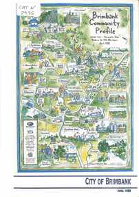
Archive - Brimbank Community Profile 1999, City of Brimbank, 36251
... Brimbank Community Profile 1999 Includes Social Demgraphic Data based on the 1996 ABS Census April 1999...Brimbank Brimbank Community Profile 1999 Includes Social Demgraphic Data based on the 1996 ABS Census April 1999 A plastic covered report Archive Brimbank Community Profile 1999 City of Brimbank ...Brimbank Community Profile 1999 Includes Social Demgraphic Data based on the 1996 ABS Census April 1999brimbank -
University of Melbourne, Burnley Campus Archives
Document, Burnley history Census, 1994?
... burnley history census List of trees, some with dates and historical data Burnley history Census Document ...List of trees, some with dates and historical databurnley, history census
