
Showing 44 items matching "civic infrastructure"
-
 Kew Historical Society Inc
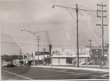
Photograph, Stuart Tompkins Studio, Electricity Supply Poles, Warrigal Road, Ashwood, 1965
... ...civic infrastructure -- 1960s...The photos originally formed part of the Engineering Department's files in the City of Kew before being donated to the kew Historical Society. electric light poles public works -- 1960s civic infrastructure -- 1960s Typed inscription on reverse: "Electricity Supply Poles. ...Research provided by Stuart Tompkins Studio, Box Hill, into alternatives for median strip street lighting to be used in Burke Road, Kew. The photographers identified variants in different suburbs appropriate to Kew's needs.The series from which the photograph is drawn provides a snapshot by a commercial photographic studio of each named vicinity in 1965 as well as providing examples of public works infrastructure being commissioned by local government in the 1960s. The photos originally formed part of the Engineering Department's files in the City of Kew before being donated to the kew Historical Society.Electricity Supply Poles, Warrigal Road, Ashwood, 1965. Stuart Tompkins Studio provided this photograph for the Kew City Council. The photograph, taken at the intersection of Warrigal Road and High Street South, Ashwood looks north along High Street Road. The intent of the photograph was to provide the Council with models of electricity supply poles. In the photo, wooden and steel poles can be seen in the median strip. The photograph also includes the shops bordering High Street Road during this period. [There are three copies of this photograph in the Collection.]. Typed inscription on reverse: "Electricity Supply Poles. Photographed for Kew City Council 8/2/65. No.4 Warrigal Road - Ashwood. South of High Street Road looking north. Wooden and steel poles with different brackets in median strip." Studio stamp: "Stuart Tompkins Studio. 547 Station Street, Box Hill. WX1439."electric light poles, public works -- 1960s, civic infrastructure -- 1960s -
 Kew Historical Society Inc
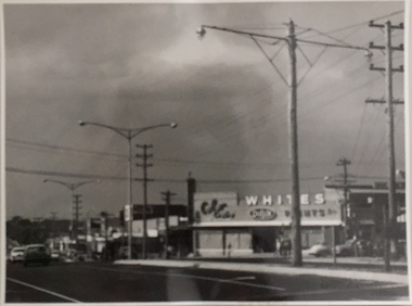
Photograph, Stuart Tompkins Studio, Electricity Supply Poles, Warrigal Road, Ashwood, 1965
... ...civic infrastructure - 1960s...The photos originally formed part of the Engineering Department's files in the City of Kew before being donated to the kew Historical Society. electric light poles civic infrastructure - 1960s public works -- 1960s Typed inscription on reverse: "Electricity Supply Poles. ...Research provided by Stuart Tompkins Studio, Box Hill, into alternatives for median strip street lighting to be used in Burke Road, Kew. The photographers identified variants in different suburbs appropriate to Kew's needs.The series from which the photograph is drawn provides a snapshot by a commercial photographic studio of each named vicinity in 1965 as well as providing examples of public works infrastructure being commissioned by local government in the 1960s. The photos originally formed part of the Engineering Department's files in the City of Kew before being donated to the kew Historical Society.Electricity Supply Poles, Warrigal Road, Ashwood, 1965. Stuart Tompkins Studio provided this photograph for the Kew City Council. The photograph, taken at the intersection of Warrigal Road and High Street South, Ashwood looks north along High Street Road. The intent of the photograph was to provide the Council with models of electricity supply poles. In the photo, wooden and steel poles can be seen in the median strip. The photograph also includes the shops bordering High Street Road during this period. [There are three copies of this photograph in the Collection.]. Typed inscription on reverse: "Electricity Supply Poles. Photographed for Kew City Council 8/2/65. No.4 Warrigal Road - Ashwood. South of High Street Road looking north. Wooden and steel poles with different brackets in median strip." Studio stamp: "Stuart Tompkins Studio. 547 Station Street, Box Hill. WX1439."electric light poles, civic infrastructure - 1960s, public works -- 1960s -
 Broadmeadows Historical Society & Museum
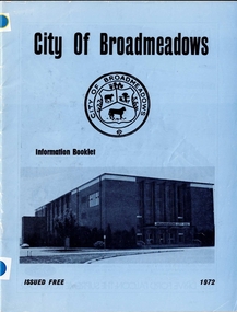
Booklet - Information Booklet, City of Broadmeadows Council, City of Broadmeadows Information Booklet 1972, 1972
... ...Civic Infrastructure...City of Broadmeadows Local Government Municipal Administration Community Services Urban Development Civic Infrastructure Broadmeadows City Hall Municipal History Melbourne Northern Suburbs Public Information Publications Victoria 1972. ...An official municipal information booklet issued free by the City of Broadmeadows in 1972. It provides residents with an overview of council operations, elected representatives, municipal facilities, services, infrastructure, planning initiatives and community resources. The publication serves as a contemporary record of the municipality during a significant period of population growth and urban development.34-page stapled paper booklet with printed colour cover and black-and-white internal pages. Front cover features the City of Broadmeadows municipal seal, a photograph of Broadmeadows City Hall, the words “Information Booklet”, and the date 1972. Booklet contains information relating to municipal administration, services, facilities, development, and local government activities within the City of Broadmeadows. non-fictionAn official municipal information booklet issued free by the City of Broadmeadows in 1972. It provides residents with an overview of council operations, elected representatives, municipal facilities, services, infrastructure, planning initiatives and community resources. The publication serves as a contemporary record of the municipality during a significant period of population growth and urban development.city of broadmeadows, local government, municipal administration, community services, urban development, civic infrastructure, broadmeadows city hall, municipal history, melbourne northern suburbs, public information publications, victoria, 1972. -
 Broadmeadows Historical Society & Museum
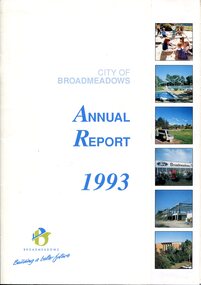
Book - Annual Report, Alex Simic et al, City of Broadmeadows Annual Report 1993, 1993
... Civic Governance...Community Services...Urban Development...Municipal Finance...Recreation Facilities...Infrastructure...Front cover features the title City of Broadmeadows Annual Report 1993, municipal logo and slogan "Building a Better Future", and a series of colour photographs depicting community facilities, recreation spaces, commercial development and civic infrastructure....Front cover features the title City of Broadmeadows Annual Report 1993, municipal logo and slogan "Building a Better Future", and a series of colour photographs depicting community facilities, recreation spaces, commercial development and civic infrastructure. City of Broadmeadows Annual Report 1993 Book Annual Report Alex Simic Phillip Shannihan City of Broadmeadows ...The annual report presents an overview of municipal operations and achievements for 1993. Content typically includes reports from the Mayor and Chief Executive Officer, financial statements, departmental reports, community services, engineering and works programs, planning activities, recreation services, economic development initiatives, staffing information and statistical data relating to municipal governance and service delivery.28 pages including covers; colour printed publication with card cover and stapled binding. Front cover features the title City of Broadmeadows Annual Report 1993, municipal logo and slogan "Building a Better Future", and a series of colour photographs depicting community facilities, recreation spaces, commercial development and civic infrastructure.non-fictionThe annual report presents an overview of municipal operations and achievements for 1993. Content typically includes reports from the Mayor and Chief Executive Officer, financial statements, departmental reports, community services, engineering and works programs, planning activities, recreation services, economic development initiatives, staffing information and statistical data relating to municipal governance and service delivery.city of broadmeadows, local government, municipal administration, annual reports, civic governance, community services, urban development, municipal finance, recreation facilities, infrastructure, broadmeadows, hume region, victoria, local history, municipal reform. -
 Broadmeadows Historical Society & Museum
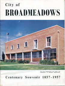
Booklet - Centenary Souvenir, City of Broadmeadows Council, City of Broadmeadows: Centenary Souvenir 1857-1957, 1957
... The publication documents the early settlement of the municipality, the development of local government, transport, agriculture, roads, civic infrastructure and community growth. It provides an important representation of municipal identity and historical understanding during the post-war period. ...The publication documents the early settlement of the municipality, the development of local government, transport, agriculture, roads, civic infrastructure and community growth. It provides an important representation of municipal identity and historical understanding during the post-war period. ...This commemorative souvenir booklet was produced by the City of Broadmeadows to mark one hundred years of municipal government from 1857 to 1957. It presents an overview of the municipality's history, including early European settlement, pastoral occupation, local government formation, infrastructure development and civic achievements. Historical photographs and reproduced archival documents provide visual and documentary evidence of Broadmeadows' transformation from a rural district to an expanding metropolitan municipality. The publication was intended to celebrate community achievements while promoting civic pride and preserving local history.A 36-page illustrated stapled booklet published by the City of Broadmeadows to commemorate the centenary of local government in the municipality, 1857-1957. Contains historical text, reproductions of government records, municipal information, and black-and-white photographs.non-fictionThis commemorative souvenir booklet was produced by the City of Broadmeadows to mark one hundred years of municipal government from 1857 to 1957. It presents an overview of the municipality's history, including early European settlement, pastoral occupation, local government formation, infrastructure development and civic achievements. Historical photographs and reproduced archival documents provide visual and documentary evidence of Broadmeadows' transformation from a rural district to an expanding metropolitan municipality. The publication was intended to celebrate community achievements while promoting civic pride and preserving local history.broadmeadows, city of broadmeadows, local government, municipal history, centenary celebrations, community history, urban development, early settlement, john pascoe fawkner, duncan cameron, victoria, historical publications, civic administration, municipal officers, roads, transport, campbellfield, pascoe vale, glenroy, heritage -
 Sunshine and District Historical Society Incorporated
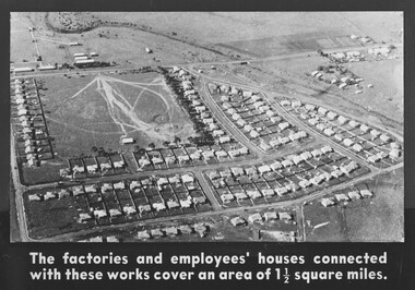
Photograph - Deer Park ICI Employee's Houses Photograph
... In December 1929, Sassella Park officially opened as a sports ground, thus Sassella Park predating the ICI housing estate expansion, the post‑war suburban development and the 1950s–60s civic infrastructure boom throughout Deer Park....In December 1929, Sassella Park officially opened as a sports ground, thus Sassella Park predating the ICI housing estate expansion, the post‑war suburban development and the 1950s–60s civic infrastructure boom throughout Deer Park. This photograph captures one of the few purpose‑built industrial housing estates in Victoria. ...The Deer Park ICI Employees Housing Estate was built in stages from the 1920s to the 1950s to house workers and managers of the Nobel/ICI explosives and chemical works. It is now recognised as a State‑significant company town precinct for its rare surviving examples of employer‑built housing in Victoria. When Nobel merged into ICIANZ (Imperial Chemical Industries of Australia and New Zealand) in 1928, the company expanded the housing program. Sassella Park, centre left was sold to the Shire of Braybrook by Mr. Antonio Sassella in 1925. In December 1929, Sassella Park officially opened as a sports ground, thus Sassella Park predating the ICI housing estate expansion, the post‑war suburban development and the 1950s–60s civic infrastructure boom throughout Deer Park.This photograph captures one of the few purpose‑built industrial housing estates in Victoria. ICI deliberately built a company‑town layout with , Recreation Reserve, Deer Park Hall, the Hunt Club Hotel was used as an ICI training Centre, Social Club and Community Facilities.The factories and Employee's houses connected with these works cover an area of 1 1/2 square milesdumfries street, station road, kynoch street, welwyn parade, downes way, irvine street, slough street, milbank drive, huddersfield road, sassella park, sassella park caretakers house, ici, kororoit creek, deer park -
 The Beechworth Burke Museum
Audio - Oral History, Jennifer Williams, Mrs Vanessa McDonald, 9 November 2000
... By the late 1850s, Stanley boasted schools, an athenaeum, a church, a weekly newspaper and several hotels and other civic infrastructure to cater for a growing population. ...By the late 1850s, Stanley boasted schools, an athenaeum, a church, a weekly newspaper and several hotels and other civic infrastructure to cater for a growing population. ...Mrs. Vanessa McDonald was born in Beechworth in 1917. Christened, Agnes Bertha Collins, Vanessa changed her name in 1960. Mrs. McDonald's family's connection with gold mining in the district reach back to the first of Beechworth's gold rushes, when her great grandfather, a Dutchman who adopted the name Charles Collins, arrived in 1851-1852. Mrs. McDonald spent her childhood in the isolated hamlet of Stanley, in the area known as 'Little Scotland', where she recalls helping her mother to raise younger siblings, picking apples and walnuts on the family farm, and roaming the hills for wildflowers. As a young woman Mrs. McDonald attended religious and social gatherings in the local community. In 1940 she went to Melbourne to work as a mothercraft nurse during the Second World War. She met her husband at a Beechworth football match and was married at the Stanley Methodist Church in 1941. The gold diggings known as the 'Nine Mile' became the hamlet of Stanley, after the British Prime Minister, Lord Stanley, in 1858. By the late 1850s, Stanley boasted schools, an athenaeum, a church, a weekly newspaper and several hotels and other civic infrastructure to cater for a growing population. The area attracted large numbers of Chinese miners, whose presence was frequently resisted. Like other early Victorian mining settlements, Stanley was a hotbed of political and racial tensions during the gold rush. One side of the Nine Mile Creek was known as 'Little Scotland’, the other, 'Little Ireland'. A number of Christian denominations built congregations and churches in Stanley, including the Church of England, Methodist Church, the Catholic Church, and Presbyterian Church. Stanley became part of the United Shire of Beechworth in 1871. By 1880 timber was being cut and two sawmills were established by 1887. River-dredged gold mining consumed vast amounts of timber from the forests in the area, and in 1931 the first of several softwood plantations began. This oral history recording was part of a project conducted by Jennifer Williams in the year 2000 to capture the everyday life and struggles in Beechworth during the twentieth century. This project involved recording seventy oral histories on cassette tapes of local Beechworth residents which were then published in a book titled: 'Listen to what they say: voices of twentieth century Beechworth'. These cassette tapes were digitised in July 2021 with funds made available by the Friends of the Burke.Following the decline in the mining and associated industries during the early-mid-twentieth century, the Beechworth district experienced a period of general economic decline. On the east side of the Dingle Range, Mrs. McDonald's father, William Henry Collins, felled timber and the family were pioneer apple orchardists. The establishment of apple orchards in Stanley reflects changes to how land was used and contributes to our understanding of the historical development of rural communities following the gold rush. Mrs. McDonald's recollections are significant for understanding family and social life in a small rural town in years leading up to the Great Depression and prior to the Second World War. This oral history recording may be compared with other oral histories and items in the Burke Museum's collection. This oral history account is socially and historically significant as it is a part of a broader collection of interviews conducted by Jennifer Williams which were published in the book 'Listen to what they say: voices of twentieth-century Beechworth.' While the township of Beechworth is known for its history as a gold rush town, these accounts provide a unique insight into the day-to-day life of the town's residents during the 20th century, many of which will have now been lost if they had not been preserved.This is a digital copy of a recording that was originally captured on a cassette tape. The cassette tape is black with a horizontal white strip and is currently stored in a clear flat plastic rectangular container. It holds up 40 minutes of recordings on each side.Mrs Vanessa McDonald /listen to what they say, beechworth, oral history, burke museum, emigration, gold rush immigration, victorian gold rush, mining families, apple orchard, forestry, forest plantation, little scotland, stanley, twentieth century history, regional australia, rural australia, farming, harvest festival, great depression, dingle range, the nine mile, australian wildflowers, high country wildflowers, mothercraft nurse, rural and regional women, social history, collins, mrs. vanessa mcdonald, building community life, shaping cultural and creative life, fruit growers, family history, changes to land use in regional victoria -
 Eltham District Historical Society Inc
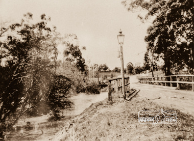
Photograph, Diamond Creek Bridge, Eltham North, c.1920
... Eltham was an outer-rural, heavily timbered farming and orchard district at the turn of the century, it faced unique civic infrastructure challenges. In rural Eltham, early streetlamps were exceptionally sparse. ...Eltham was an outer-rural, heavily timbered farming and orchard district at the turn of the century, it faced unique civic infrastructure challenges. In rural Eltham, early streetlamps were exceptionally sparse. ...View looking east across the Glen Park Bridge and the railway crossing towards Main Road circa 1920. The bridge was originally built as a replacement for an older private bridge built by a man named Foley around 1880. In 1911 Heidelberg and Eltham agreed to share the costs to build a new bridge (the Diamond Creek was the border between the two). Construction began in June 1915 and it was officially opened by Cr. Taylor on Cup Day, November 1915. This photo, dated around 1920, is of the Glen Park Bridge crossing over the Diamond Creek about 50 metres north of the present-day Wattletree tree Road Bridge. Glen Park Road intersected Main Rain Road along an alignment following present day Coleman Cresent. In this this picture we see the narrow wooden bridge over a high flowing Diamond Creek at Glen Park, now Eltham North. In the background is a railway crossing sign. There is a self-contained carbide streetlamp situated in front of the bridge. In the early 1900s, carbide (acetylene gas) streetlamps emerged as a lighting technology for regional towns across Victoria, Australia, before municipal electricity grids were widely established. During the late Victorian and early Edwardian eras, major hubs like Melbourne relied on centralized coal-gas infrastructure. However, small regional Victorian shires lacked the funds or population density to build large gasworks. When the commercial production of calcium carbide became viable around 1900, it offered a quantum leap in brightness over traditional kerosene streetlamps. Acetylene gas burned with an intense, crisp white flame—significantly brighter than oil or candles. Many rural towns used self-contained lampposts. A lamplighter had to climb each post daily to manually place calcium carbide pellets in a lower chamber and fill an upper chamber with water. The water dripped onto the carbide, producing acetylene gas to feed the burner. Lamplighters carefully measured the fuel amounts so the chemical reaction would naturally exhaust itself and "turn off" around midnight. While carbide streetlights provided unparalleled visibility for early motorists, cyclists, and pedestrians, they were incredibly labour-intensive and inherently volatile. The gas was highly explosive, prone to leaks, and left behind a pungent, sulphur-like odour. By the end of World War I, local Victorian councils rapidly phased out acetylene infrastructure in favour of safer, independent electric powerhouse generators. In the context of Eltham's local history, the Eltham Shire and surrounding Yarra Valley region actively relied on carbide streetlamps and kerosene lighting during the early 20th century before the expansion of the Melbourne electric grid. Eltham was an outer-rural, heavily timbered farming and orchard district at the turn of the century, it faced unique civic infrastructure challenges. In rural Eltham, early streetlamps were exceptionally sparse. The community relied heavily on "innkeeper laws" which dictated local hotels—such as the historic Eltham Hotel—were legally required to keep external oil, kerosene, or acetylene lamps burning through the night to illuminate the main roads for travellers and coaches. The volatile carbide and kerosene lamps on Eltham's main thoroughfares were progressively phased out during the 1920s. The district steadily transitioned to electricity, which allowed for developments like the installation of modern electrical wiring at the local fire station on Arthur Street by 1928. The Glen Park Bridge was a low structure and subject to flooding readily. In 1959 Eltham Council erected a new crossing over the Diamond Creek and realigned the road to the present-day Wattletree Road Bridge. Construction was not fully complete when on Sunday, 20 September 1959, heavy flooding occurred in the stream and at 3:53 pm the old bridge was washed away forever. - Research by Peter Pidgeon, EDHS, June 2026Photograph copy eltham north, wattletree road, coleman crescent, bridges, diamond creek (creek), bridge, carbide streetlamp, floodwater, glen park bridge, street lamp, glen park road, glen park estate -
 Flagstaff Hill Maritime Museum and Village
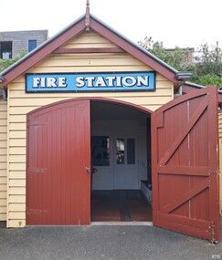
Memorabilia - Fire Brigade Collection, Warrnambool Fire Brigade, 1863-1950s
... infrastructure for accessible running water from pipes, as we know today. But after the expansion and growth of the township, it was time for action. The Warrnambool Fire Brigade was formed in 1863. The Brigade has served Warrnambool on a daily basis ever since. The volunteers of the Brigade were required to fill their water carts each evening from a spring on Cannon Hill and be on standby to deliver water to fire scenes. In 1889, the Warrnambool Council built a new Fire Station at 25 Liebig Street. Today, the Civic...infrastructure for accessible running water from pipes, as we know today. But after the expansion and growth of the township, it was time for action. The Warrnambool Fire Brigade was formed in 1863. The Brigade has served Warrnambool on a daily basis ever since. The volunteers of the Brigade were required to fill their water carts each evening from a spring on Cannon Hill and be on standby to deliver water to fire scenes. In 1889, the Warrnambool Council built a new Fire Station at 25 Liebig Street. Today, the Civic ...The original replica Fire Station at Flagstaff Hill was constructed in 2006 by members of the CVA Warrnambool Fire Brigade. It was rebuilt in 2015, ironically due to damage from fire in the adjacent building, and now includes a locked display. The fire station faithfully replicates the designs of the late 1800s fire stations found across Victoria. Every detail, including the type of nails used, adheres to period-correct specifications. The objects on display are on loan from the CFA. They provide a glimpse into the history and evolution of firefighting in Victoria, preserving the heritage and legacy of the brave men and women who have served their communities. Fire Brigade Collection highlights: . Hose reels and equipment: essential firefighting equipment used during the late 19th and early 20th centuries. . Brass helmets: symbolic headgear worn by firefighters for protection and identification. . Photographs: historical images capturing the evolution of firefighting in the region. . Certificates: awards highlighting the skill and dedication of firefighters. A BRIEF HISTORY OF THE WARRNAMBOOL FIRE BRIGADE - [Ref: Quarrell, A, 2013, The Warrnambool Fire Brigade: 1863-2013, Amazon Printing, Warrnambool]: “Since the township of Warrnambool was established in the 1840s, there were several attempts at forming a Fire Brigade. However, many issues hindered progress. Firstly, minimal fires were recorded. Secondly, the town had no money to purchase expensive equipment, including a fire engine, and thirdly and most importantly, there was no infrastructure for accessible running water from pipes, as we know today. But after the expansion and growth of the township, it was time for action. The Warrnambool Fire Brigade was formed in 1863. The Brigade has served Warrnambool on a daily basis ever since. The volunteers of the Brigade were required to fill their water carts each evening from a spring on Cannon Hill and be on standby to deliver water to fire scenes. In 1889, the Warrnambool Council built a new Fire Station at 25 Liebig Street. Today, the Civic Centre is located on this site.” The objects on loan from the Warrnambool Fire Brigade are significant to local history since its establishment in 1863. They tell the story of the Brigade’s history, which is part of Warrnambool and the district’s history.Warrnambool Fire Brigade Collection: a variety of historic objects and equipment used by the firemen of the brigade since 1863. The items are kindly on loan from the Warrnambool Fire Brigade in a building originally erected in the Village by the Fire Brigade to house their historic collection. The items include: EQUIPMENT: 2 fire reels, 3 leather buckets, 1 wooden ladder, 2 old pumps, 2 fire extinguishers, 1 foam nozzle, 2 hydrants, 1 red chest with breathing apparatus, 1 large grey chest, 1 red metal thread gauges box, 2 copper and brass extinguishers, 3 copper and brass branches, 1 canvas bucket, assorted reels of hose, assorted couplings and branches, PHOTOGRAPHS/CERTIFICATES: 3 Discipline Certificates dated 1894, 1893, 1911, Mounted photo of members of the Warrnambool Fire Brigade Football Club, Mounted photos of members of the Warrnambool Fire Brigade in uniform, framed photo of LC Marshall UNIFORMS: 1 Officer’s jacket, 1 blazer, 1 turnout jacket, 1 harness belt, 1 leather helmet, 1 pair of boots, 1 brass helmet, 1 axe belt with axe and plug spanner TROPHIES: 1 clock flagstaff hill maritime museum and village, great ocean road, shipwreck coast, flagstaff hill, warrnambool, maritime village, maritime museum, cfa, fire brigade, warrnambool fire brigade, fire reel, leather bucket, wooden ladder, pump, fire extinguisher, foam nozzle, fireman’s hydrant, breathing apparatus, copper and brass extinguishers, copper and brass branches, canvas bucket, discipline certificates, warrnambool fire brigade football club, l c marshall, officer’s jacket, blazer, turnout jacket, harness belt, leather helmet, pair of boots, brass helmet, axe belt with axe and plug spanner, clock, mantle clock -
 Ringwood and District Historical Society
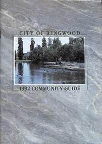
Book, City of Ringwood, City of Ringwood 1992 Community Guide, 1992
... CONTENTS: (page no.) 1991/92 COUNCIL REPRESENTATIVES 4 1992 CALENDAR 51 AQUATIC CENTRE 8 AQUATIC CENTRE VOUCHERS 49 CHIEF EXECUTIVE'S REPORT 6 CIVIC CENTRE TELEPHONE INDEX — DIRECT DIALLING 53 COMMUNITY DIRECTORY 35-47 COMMUNITY SERVICES 17-19 COUNCIL & COMMITTEE CYCLES 4 COUNCIL FINANCES & 1991/92 RATES 16 COUNCILLORS 3 FUNCTIONAL RESPONSIBILITIES 15 HISTORY OF RINGWOOD 5 HOUSING & RESIDENTIAL DEVELOPMENT 29-30 INFRASTRUCTURE 34 LOCAL, STATE & FEDERAL GOVERNMENT ELECTIONS 32 MANAGEMENT TEAM 14 MAYORAL MESSAGE – Cr. ...rinx CONTENTS: (page no.) 1991/92 COUNCIL REPRESENTATIVES 4 1992 CALENDAR 51 AQUATIC CENTRE 8 AQUATIC CENTRE VOUCHERS 49 CHIEF EXECUTIVE'S REPORT 6 CIVIC CENTRE TELEPHONE INDEX — DIRECT DIALLING 53 COMMUNITY DIRECTORY 35-47 COMMUNITY SERVICES 17-19 COUNCIL & COMMITTEE CYCLES 4 COUNCIL FINANCES & 1991/92 RATES 16 COUNCILLORS 3 FUNCTIONAL RESPONSIBILITIES 15 HISTORY OF RINGWOOD 5 HOUSING & RESIDENTIAL DEVELOPMENT 29-30 INFRASTRUCTURE 34 LOCAL, STATE & FEDERAL GOVERNMENT ELECTIONS 32 MANAGEMENT TEAM 14 MAYORAL MESSAGE – Cr. ...Community information book issued by City of Ringwood for 1992 - covering the facilities and activities of the Ringwood Council and other local organisations and associations. Includes two Aquatic Centre entry vouchers valid until June 30th, 1992.CONTENTS: (page no.) 1991/92 COUNCIL REPRESENTATIVES 4 1992 CALENDAR 51 AQUATIC CENTRE 8 AQUATIC CENTRE VOUCHERS 49 CHIEF EXECUTIVE'S REPORT 6 CIVIC CENTRE TELEPHONE INDEX — DIRECT DIALLING 53 COMMUNITY DIRECTORY 35-47 COMMUNITY SERVICES 17-19 COUNCIL & COMMITTEE CYCLES 4 COUNCIL FINANCES & 1991/92 RATES 16 COUNCILLORS 3 FUNCTIONAL RESPONSIBILITIES 15 HISTORY OF RINGWOOD 5 HOUSING & RESIDENTIAL DEVELOPMENT 29-30 INFRASTRUCTURE 34 LOCAL, STATE & FEDERAL GOVERNMENT ELECTIONS 32 MANAGEMENT TEAM 14 MAYORAL MESSAGE – Cr. Max Williams 1 NEIGHBOURHOOD MAP 26-27 NOTES 52 PAPER & CARDBOARD COLLECTION SERVICE 22 PARKS & RESERVES — PUBLIC FACILITIES 31 PROTECTING OUR COMMUNITY 23-24 PROTECTING THE ENVIRONMENT 20-21 RINGWOOD FESTIVAL & HIGHLAND CARNIVAL 13 RINGWOOD GOLF COURSE 7 STRATEGIC BIKE PLAN 11 STREET INDEX A-L 25 STREET INDEX L-Z 28 THE LIBRARY 12 THE RINGWOOD CONVENTION & PERFORMING ARTS CENTRE 10 TRAFFIC MANAGEMENT 33 YOUR PERSONAL DIRECTORY 50 rinx -
Bendigo Historical Society Inc.
Document - History Notes - Information on Mining, statistics and early development of Bendigo, 1840-1990 approx
... Key Events: Establishment of hospital, police court, churches, schools, and infrastructure like railways and water supply.Governance and Civic Structure. ...Key Events: Establishment of hospital, police court, churches, schools, and infrastructure like railways and water supply.Governance and Civic Structure. ...Saddle, Fault, and Spur reefs are the main types, found in Ordovician slates and sandstones folded into anticlines and synclines. Major Productive Reefs: Hustlers, Garden Gully, Paddy's Gully, Sheepshead, New Chum, Nell Gwynne, and Carshalton.Mining Process: Gold is found in quartz lodes, extracted, crushed, and separated using mercury amalgamation. From 1851–1949, over 21 million ounces of gold were produced, valued at approximately £323 million (1964 prices). Located Bendigo is in central Victoria, north of the Dividing Range, between Campaspe Valley and Loddon flats; 100 miles from Melbourne. The City area is 8,030 acres; population around 40,000 (city), 47,000 (district).Climate is temperate, with average rainfall of 20 inches, and 320 sunny days per year. Gold First discovered in 1851 at Golden Square. Bendigo Became a municipal district in 1855, a town in 1861, a city in 1871, and changed its name from Sandhurst to Bendigo in 1891. Key Events: Establishment of hospital, police court, churches, schools, and infrastructure like railways and water supply.Governance and Civic Structure. Council Structure: 3 wards, each with 3 councillors serving 3-year terms; mayor elected by councillors. Main revenue from rates and property; principal duties include public works, health, parks, and enforcement of by-laws. Major Projects: Olympic swimming pool, market extensions, park improvements, road and drainage works.Economy and IndustryCommerce: 730 retail shops, 260 factories, and a major livestock market.Principal Industries: Meat processing, manufacturing (including ordnance, textiles, engineering), fruit and food processing, and egg production. Bendigo is Noted for sheep, lamb, fruit (especially tomatoes and apples), and dairy. Major rail and road hub with connections across Victoria and to New South Wales; tram and bus services.Education: Institute of Technology, Teachers College, multiple secondary and primary schools, and special education facilities. Several hospitals, aged care homes, and health services. 486 acres of parks and gardens, extensive sports facilities, and Lake Eppalock for water sports. Wide range of community, cultural, and sporting organizations. Regional library, art gallery, music and drama societies. Notable Figures and HeritageGeorge Lansell: Known as the "Gold King," a key figure in Bendigo's mining history. Transformation: From a sheep run to a major goldfield and then to a modern city with significant infrastructure and cultural assets. Motto Coat of Arms: Features symbols representing gold mining, agriculture, pioneering, and fruit growing.Motto: "Progress" in gold on a purple ribbon.Bendigo's history is marked by rapid growth from gold discovery, strong civic development, and a diverse economy, making it a significant regional center in Victoria.History Notes - Information on Mining, statistics and early development of Bendigo - author unknown This item contains the following document: 11217.65a Twelve Foolscap typed pages with information on Bendigonon-fictionbendigo, fortuna, george lansell, development of bendigo -
 National Vietnam Veterans Museum (NVVM)
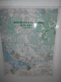
Map, Military Civic Action in Phuoc Tuy Province
... Details housing, schools, hospitals & infrastructure projects. Military Civic Action in Phuoc Tuy Province Map Map 29th Eng. ...Laminated map of civil action in Phuoc Tuy Province and Vung Tau Special Zone in the period of March 1970 to June 1971. Details housing, schools, hospitals & infrastructure projects.civil action, phuoc tuy, vung tau -
 Port Melbourne Historical & Preservation Society
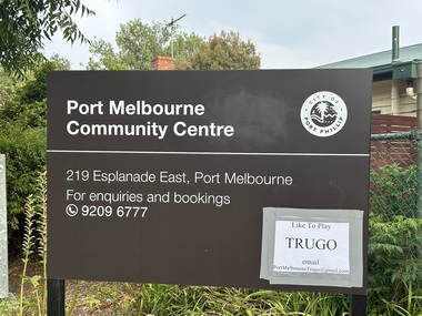
Photograph - Digital Photo Port Melbourne Community Centre, David RADCLIFFE, Mar 2026
... infrastructure. Trugo is a sport created by railway workers in the early days of Melbourne. Community Centre Port Melbourne Trugo Club Edwards Park Built Environment - Civic Image of Port Melbourne Community Centre signage in Edwards Park, 219 Esplanade East, Port Melbourne. ...Community service infrastructure. Trugo is a sport created by railway workers in the early days of Melbourne.Image of Port Melbourne Community Centre signage in Edwards Park, 219 Esplanade East, Port Melbourne. Also Trugo Club referenced.community centre, port melbourne trugo club, edwards park, built environment - civic -
Port Melbourne Historical & Preservation Society
Document - Reports, Department of Infrastructure, C5 amendment to Port Phillip Planning Scheme, Department of Infrastructure, 1999
... Heritage overlays to protect heritage areas were also under review. town planning built environment - civic heritage becton fox hay timber and hardware pty ltd Developer submissions to an independent Panel reviewing the C5 amendment to the Port Phillip Planning Scheme, 1999 Report from Department of Infrastructure Document Reports, Department of Infrastructure, C5 amendment to Port Phillip Planning Scheme Department of Infrastructure ...The C5 Amendment aimed to create a framework for built form and development controls in the Port Melbourne Mixed Use Area undergoing conversion to residential development. Heritage overlays to protect heritage areas were also under review.Developer submissions to an independent Panel reviewing the C5 amendment to the Port Phillip Planning Scheme, 1999 Report from Department of Infrastructuretown planning, built environment - civic, heritage, becton, fox hay timber and hardware pty ltd -
Port Melbourne Historical & Preservation Society
Document - Reports, Department of Infrastructure to panel reviewing C5 amendment to Port Phillip Planning Scheme, Graham Deacons et al, 1999
... Heritage overlays to protect heritage areas were also under review. town planning built environment - civic heritage becton fox hay timber and hardware pty ltd Developer submissions to an independent Panel reviewing the C5 amendment to the Port Phillip Planning Scheme, 1999 Report from Deacons, Graham and James for Becton Document Reports, Department of Infrastructure to panel reviewing C5 amendment to Port Phillip Planning Scheme Graham Deacons James Deacons ...The C5 Amendment aimed to create a framework for built form and development controls in the Port Melbourne Mixed Use Area undergoing conversion to residential development. Heritage overlays to protect heritage areas were also under review.Developer submissions to an independent Panel reviewing the C5 amendment to the Port Phillip Planning Scheme, 1999 Report from Deacons, Graham and James for Bectontown planning, built environment - civic, heritage, becton, fox hay timber and hardware pty ltd -
 Charlton Golden Grains Museum Inc
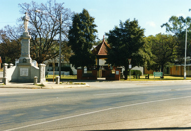
Photograph - Rotunda, c.1990
... During his 28 years in the community, he held leadership roles in many of the organizations that shaped the town’s infrastructure and social life. #### Professional and Civic Work Green was a key figure in establishing essential services for Charlton. ...During his 28 years in the community, he held leadership roles in many of the organizations that shaped the town’s infrastructure and social life. #### Professional and Civic Work Green was a key figure in establishing essential services for Charlton. ...Granite War monument to the left, Brick rotunda in the center within Elliot Garden, Sign reads Elliot Gardens. The War monument unveiled by Premier Sir William McPherson KCMG on June 23rd 1923. Elliot Gardens named to honor General Harold 'Pompey" Elliot, named in 1940. ### Benjamin Green and the Charlton Band Rotunda The **Ben Green Memorial Rotunda**, located in Elliott Gardens, stands as a tribute to one of Charlton’s most active citizens. **Benjamin Green** was a solicitor who practiced law in the town from 1895 until his death in 1923. During his 28 years in the community, he held leadership roles in many of the organizations that shaped the town’s infrastructure and social life. #### Professional and Civic Work Green was a key figure in establishing essential services for Charlton. He was one of the originators of the **Electric Light and Power Company** and served as the solicitor for the **Water Trust**. His commitment to education was shown through his work as a "prime mover" in the creation of the **Charlton Higher Elementary School**. His community involvement also included: * **Sport:** He introduced golf to Northern Victoria and founded the **Charlton Golf Club** in 1900, serving as its President until his death. He also founded the **Plumpton and Open Coursing Club**. * **Veterans:** He took a strong interest in the welfare of returned soldiers and donated **£100** toward the town's war memorial. * **Culture:** He was an active member of the **Mechanics Institute**. #### The Memorial Rotunda When Green passed away in 1923, a public fund was started to build a band rotunda for outdoor music recitals in his memory. The structure was designed and built by **Folliott Gilmore**, a local builder and timber merchant. It was officially dedicated by his friend **Frank Tate**, the Victorian Director of Education. #### Historical Celebrations The rotunda became a central point for major community events. During a "Back-to-School" celebration held during Show Week, the town was decorated with **12,000 handmade paper flowers** created by local women’s organisations. These flowers covered the rotunda, the bridge, and the town entrances. The event was a significant historical bridge for the town; it was attended by nine original students who had attended Charlton's first **"bark hut" school** in 1875, allowing them to see the modern developments Green had helped achieve. Colour photograph of the Granite War monument to the left, Brick rotunda in the center within Elliot Garden, Sign reads Elliot Gardens.war memorial, elliott gardens, charlton, halls, parks, reserves -
 Charlton Golden Grains Museum Inc
Photograph, c.1980
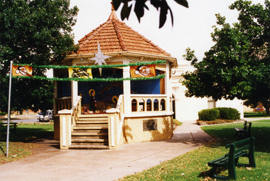
... During his 28 years in the community, he held leadership roles in many of the organizations that shaped the town’s infrastructure and social life. #### Professional and Civic Work Green was a key figure in establishing essential services for Charlton. ...During his 28 years in the community, he held leadership roles in many of the organizations that shaped the town’s infrastructure and social life. #### Professional and Civic Work Green was a key figure in establishing essential services for Charlton. ...Band Rotunda in gardens erected in 1926 in memory of Benjamin Green (Charlton benefactor and solicitor). Red tiled roof and brick base. Steps lead up to the base. ### Benjamin Green and the Charlton Band Rotunda The **Ben Green Memorial Rotunda**, located in Elliott Gardens, stands as a tribute to one of Charlton’s most active citizens. **Benjamin Green** was a solicitor who practiced law in the town from 1895 until his death in 1923. During his 28 years in the community, he held leadership roles in many of the organizations that shaped the town’s infrastructure and social life. #### Professional and Civic Work Green was a key figure in establishing essential services for Charlton. He was one of the originators of the **Electric Light and Power Company** and served as the solicitor for the **Water Trust**. His commitment to education was shown through his work as a "prime mover" in the creation of the **Charlton Higher Elementary School**. His community involvement also included: * **Sport:** He introduced golf to Northern Victoria and founded the **Charlton Golf Club** in 1900, serving as its President until his death. He also founded the **Plumpton and Open Coursing Club**. * **Veterans:** He took a strong interest in the welfare of returned soldiers and donated **£100** toward the town's war memorial. * **Culture:** He was an active member of the **Mechanics Institute**. #### The Memorial Rotunda When Green passed away in 1923, a public fund was started to build a band rotunda for outdoor music recitals in his memory. The structure was designed and built by **Folliott Gilmore**, a local builder and timber merchant. It was officially dedicated by his friend **Frank Tate**, the Victorian Director of Education. #### Historical Celebrations The rotunda became a central point for major community events. During a "Back-to-School" celebration held during Show Week, the town was decorated with **12,000 handmade paper flowers** created by local women’s organisations. These flowers covered the rotunda, the bridge, and the town entrances. The event was a significant historical bridge for the town; it was attended by nine original students who had attended Charlton's first **"bark hut" school** in 1875, allowing them to see the modern developments Green had helped achieve. Standard colour photo, not mounted.charlton, rotunda, elliott gardens, green b, mechanics institure -
 Charlton Golden Grains Museum Inc
Photograph, c.1987
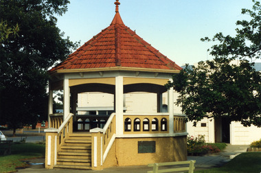
... During his 28 years in the community, he held leadership roles in many of the organizations that shaped the town’s infrastructure and social life. #### Professional and Civic Work Green was a key figure in establishing essential services for Charlton. ...During his 28 years in the community, he held leadership roles in many of the organizations that shaped the town’s infrastructure and social life. #### Professional and Civic Work Green was a key figure in establishing essential services for Charlton. ...Built in 1926 the Ben Green memorial Rotunda was named after a local citizen of Charlton. Ben Green was a solicitor and member who supported many school prizes for literature. Ben was also president of the Charlton Club and of the Charlton Coursing Club. Ben was a keen tennis player, winning Victorian Championships in 1892, 1893, and 1984. The garden in which the Rotunda stands also contains the Boer War, World war I and II memorial and a bust of Harold "Pompey" Elliott. ### Benjamin Green and the Charlton Band Rotunda The **Ben Green Memorial Rotunda**, located in Elliott Gardens, stands as a tribute to one of Charlton’s most active citizens. **Benjamin Green** was a solicitor who practiced law in the town from 1895 until his death in 1923. During his 28 years in the community, he held leadership roles in many of the organizations that shaped the town’s infrastructure and social life. #### Professional and Civic Work Green was a key figure in establishing essential services for Charlton. He was one of the originators of the **Electric Light and Power Company** and served as the solicitor for the **Water Trust**. His commitment to education was shown through his work as a "prime mover" in the creation of the **Charlton Higher Elementary School**. His community involvement also included: * **Sport:** He introduced golf to Northern Victoria and founded the **Charlton Golf Club** in 1900, serving as its President until his death. He also founded the **Plumpton and Open Coursing Club**. * **Veterans:** He took a strong interest in the welfare of returned soldiers and donated **£100** toward the town's war memorial. * **Culture:** He was an active member of the **Mechanics Institute**. #### The Memorial Rotunda When Green passed away in 1923, a public fund was started to build a band rotunda for outdoor music recitals in his memory. The structure was designed and built by **Folliott Gilmore**, a local builder and timber merchant. It was officially dedicated by his friend **Frank Tate**, the Victorian Director of Education. #### Historical Celebrations The rotunda became a central point for major community events. During a "Back-to-School" celebration held during Show Week, the town was decorated with **12,000 handmade paper flowers** created by local women’s organisations. These flowers covered the rotunda, the bridge, and the town entrances. The event was a significant historical bridge for the town; it was attended by nine original students who had attended Charlton's first **"bark hut" school** in 1875, allowing them to see the modern developments Green had helped achieve. Standard colour photograph.charlton, elliott gardens, rotunda, parks, green ben -
 Charlton Golden Grains Museum Inc
Photograph, c.1987
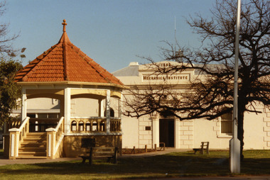
... During his 28 years in the community, he held leadership roles in many of the organizations that shaped the town’s infrastructure and social life. #### Professional and Civic Work Green was a key figure in establishing essential services for Charlton. ...During his 28 years in the community, he held leadership roles in many of the organizations that shaped the town’s infrastructure and social life. #### Professional and Civic Work Green was a key figure in establishing essential services for Charlton. ...Built in 1926 the Ben Green memorial Rotunda was named after a local citizen of Charlton. Ben Green was a solicitor and member who supported many school prizes for literature. Ben was also president of the Charlton Club and of the Charlton Coursing Club. Ben was a keen tennis player, winning Victorian Championships in 1892, 1893, and 1984. The garden in which the Rotunda stands also contains the Boer War, World war I and II memorial and a bust of Harold "Pompey" Elliott. ### Benjamin Green and the Charlton Band Rotunda The **Ben Green Memorial Rotunda**, located in Elliott Gardens, stands as a tribute to one of Charlton’s most active citizens. **Benjamin Green** was a solicitor who practiced law in the town from 1895 until his death in 1923. During his 28 years in the community, he held leadership roles in many of the organizations that shaped the town’s infrastructure and social life. #### Professional and Civic Work Green was a key figure in establishing essential services for Charlton. He was one of the originators of the **Electric Light and Power Company** and served as the solicitor for the **Water Trust**. His commitment to education was shown through his work as a "prime mover" in the creation of the **Charlton Higher Elementary School**. His community involvement also included: * **Sport:** He introduced golf to Northern Victoria and founded the **Charlton Golf Club** in 1900, serving as its President until his death. He also founded the **Plumpton and Open Coursing Club**. * **Veterans:** He took a strong interest in the welfare of returned soldiers and donated **£100** toward the town's war memorial. * **Culture:** He was an active member of the **Mechanics Institute**. #### The Memorial Rotunda When Green passed away in 1923, a public fund was started to build a band rotunda for outdoor music recitals in his memory. The structure was designed and built by **Folliott Gilmore**, a local builder and timber merchant. It was officially dedicated by his friend **Frank Tate**, the Victorian Director of Education. #### Historical Celebrations The rotunda became a central point for major community events. During a "Back-to-School" celebration held during Show Week, the town was decorated with **12,000 handmade paper flowers** created by local women’s organisations. These flowers covered the rotunda, the bridge, and the town entrances. The event was a significant historical bridge for the town; it was attended by nine original students who had attended Charlton's first **"bark hut" school** in 1875, allowing them to see the modern developments Green had helped achieve. Standard colour photographcharlton, elliott gardens, rotunda, parks, mechanics institure, golden grains museum, ben green -
 Charlton Golden Grains Museum Inc
Photograph, c.1990
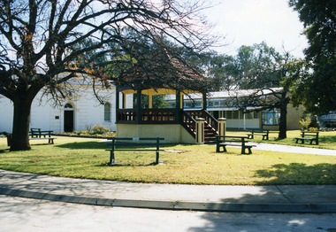
... During his 28 years in the community, he held leadership roles in many of the organizations that shaped the town’s infrastructure and social life. #### Professional and Civic Work Green was a key figure in establishing essential services for Charlton. ...During his 28 years in the community, he held leadership roles in many of the organizations that shaped the town’s infrastructure and social life. #### Professional and Civic Work Green was a key figure in establishing essential services for Charlton. ...### Benjamin Green and the Charlton Band Rotunda The **Ben Green Memorial Rotunda**, located in Elliott Gardens, stands as a tribute to one of Charlton’s most active citizens. **Benjamin Green** was a solicitor who practiced law in the town from 1895 until his death in 1923. During his 28 years in the community, he held leadership roles in many of the organizations that shaped the town’s infrastructure and social life. #### Professional and Civic Work Green was a key figure in establishing essential services for Charlton. He was one of the originators of the **Electric Light and Power Company** and served as the solicitor for the **Water Trust**. His commitment to education was shown through his work as a "prime mover" in the creation of the **Charlton Higher Elementary School**. His community involvement also included: * **Sport:** He introduced golf to Northern Victoria and founded the **Charlton Golf Club** in 1900, serving as its President until his death. He also founded the **Plumpton and Open Coursing Club**. * **Veterans:** He took a strong interest in the welfare of returned soldiers and donated **£100** toward the town's war memorial. * **Culture:** He was an active member of the **Mechanics Institute**. #### The Memorial Rotunda When Green passed away in 1923, a public fund was started to build a band rotunda for outdoor music recitals in his memory. The structure was designed and built by **Folliott Gilmore**, a local builder and timber merchant. It was officially dedicated by his friend **Frank Tate**, the Victorian Director of Education. #### Historical Celebrations The rotunda became a central point for major community events. During a "Back-to-School" celebration held during Show Week, the town was decorated with **12,000 handmade paper flowers** created by local women’s organisations. These flowers covered the rotunda, the bridge, and the town entrances. The event was a significant historical bridge for the town; it was attended by nine original students who had attended Charlton's first **"bark hut" school** in 1875, allowing them to see the modern developments Green had helped achieve. Standard colour photographcharlton, elliott gardens, rotunda, parks, mechanics institure, golden grains museum, green ben -
 Charlton Golden Grains Museum Inc
Photograph, c.1990
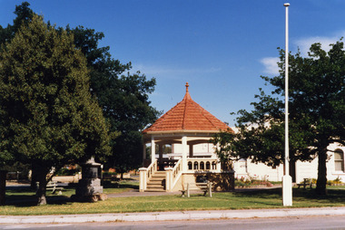
... During his 28 years in the community, he held leadership roles in many of the organizations that shaped the town’s infrastructure and social life. #### Professional and Civic Work Green was a key figure in establishing essential services for Charlton. ...During his 28 years in the community, he held leadership roles in many of the organizations that shaped the town’s infrastructure and social life. #### Professional and Civic Work Green was a key figure in establishing essential services for Charlton. ...Built in 1926 the Ben Green memorial Rotunda was named after a local citizen of Charlton. Ben Green was a solicitor and member who supported many school prizes for literature. Ben was also president of the Charlton Club and of the Charlton Coursing Club. Ben was a keen tennis player, winning Victorian Championships in 1892, 1893, and 1984. The garden in which the Rotunda stands also contains the Boer War, World war I and II memorial and a bust of Harold "Pompey" Elliott. ### Benjamin Green and the Charlton Band Rotunda The **Ben Green Memorial Rotunda**, located in Elliott Gardens, stands as a tribute to one of Charlton’s most active citizens. **Benjamin Green** was a solicitor who practiced law in the town from 1895 until his death in 1923. During his 28 years in the community, he held leadership roles in many of the organizations that shaped the town’s infrastructure and social life. #### Professional and Civic Work Green was a key figure in establishing essential services for Charlton. He was one of the originators of the **Electric Light and Power Company** and served as the solicitor for the **Water Trust**. His commitment to education was shown through his work as a "prime mover" in the creation of the **Charlton Higher Elementary School**. His community involvement also included: * **Sport:** He introduced golf to Northern Victoria and founded the **Charlton Golf Club** in 1900, serving as its President until his death. He also founded the **Plumpton and Open Coursing Club**. * **Veterans:** He took a strong interest in the welfare of returned soldiers and donated **£100** toward the town's war memorial. * **Culture:** He was an active member of the **Mechanics Institute**. #### The Memorial Rotunda When Green passed away in 1923, a public fund was started to build a band rotunda for outdoor music recitals in his memory. The structure was designed and built by **Folliott Gilmore**, a local builder and timber merchant. It was officially dedicated by his friend **Frank Tate**, the Victorian Director of Education. #### Historical Celebrations The rotunda became a central point for major community events. During a "Back-to-School" celebration held during Show Week, the town was decorated with **12,000 handmade paper flowers** created by local women’s organisations. These flowers covered the rotunda, the bridge, and the town entrances. The event was a significant historical bridge for the town; it was attended by nine original students who had attended Charlton's first **"bark hut" school** in 1875, allowing them to see the modern developments Green had helped achieve. Standard colour photograph.charlton, elliott gardens, rotunda, parks, green ben -
 Sunshine and District Historical Society Incorporated
Book - Joseph 'Joe' Wlodarczyk Collection - Morgan's Official Street Directory 1951, Val Morgan & Sons Pty Ltd, Morgan's Official Street Directory 1951, 1951
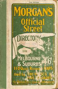
... infrastructure. - Track land use: They document residential, commercial, and industrial activity, helping researchers understand zoning and environmental changes over time. - Reveal social patterns: Listings of trades, professions, and businesses offer insight into the economic and cultural makeup of a community. Genealogy and Family Research - Locate ancestors: They often include names, occupations, and addresses, making them invaluable for tracing family movements and connections. - Fill gaps in records: When census or electoral rolls are missing or incomplete, directories can provide continuity. cademic and Community Research - Support civic projects: Community groups use them to document local stories, map historical events, or advocate for preservation. - Enable comparative studies: Researchers can analyze changes across decades by comparing editions. ...infrastructure. - Track land use: They document residential, commercial, and industrial activity, helping researchers understand zoning and environmental changes over time. - Reveal social patterns: Listings of trades, professions, and businesses offer insight into the economic and cultural makeup of a community. Genealogy and Family Research - Locate ancestors: They often include names, occupations, and addresses, making them invaluable for tracing family movements and connections. - Fill gaps in records: When census or electoral rolls are missing or incomplete, directories can provide continuity. cademic and Community Research - Support civic projects: Community groups use them to document local stories, map historical events, or advocate for preservation. - Enable comparative studies: Researchers can analyze changes across decades by comparing editions. ...Hard copy book that includes a set of maps that cover the streets of MelbourneSmall hard covered book with green & yellow text on front. Inside has maps, index of street names & advertisementsnon-fictionHard copy book that includes a set of maps that cover the streets of Melbournedirectory, joseph 'joe' wlodarczyk, street directory -
 Sunshine and District Historical Society Incorporated
Book - Victorian Municipal Directory Collection, Arnall & Jackson Pty Ltd, Victorian Municipal Directory
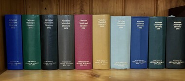
... Directory Victoria Thomas William "Bill" Deutschmann City of Sunshine The Victorian Municipal Directories were annual (or near‑annual) reference books published from the late 19th century through much of the 20th century that listed every municipality in Victoria, along with detailed information about councils, officers, rates, boundaries, services, infrastructure, and local institutions. They were the backbone of civic administration research before digitisation. 1/ Victorian Municipal Directory 1972 - State Guide and Water supply Record Incorporating Part of Southern N.S.W. 2/ Victorian Municipal Directory 1974 - State Guide and Water supply Record Incorporating Part of Southern N.S.W. 3/ Victorian Municipal Directory 1976 - State Guide and Water supply Record 4/ Victorian Municipal Directory 1978 - State Guide and Water supply Record 5/ Victorian Municipal Directory 1980 - State Guide and Water supply Record 6/ Victorian Municipal Directory 1982 - State Guide and Water supply Record 7/ Victorian Municipal Directory 1984 - State Guide and Water supply Record 8/ Victorian Municipal Directory 1986 - State Guide and Water supply Record 9/ Victorian Municipal Directory 1988 - State Guide and Water supply Record 10/ Victorian Municipal Directory 1990 - State Guide and Water supply Record Collection of 10 Victorian Municipal Directories Hard Covered Books Victorian Municipal Directory Book Victorian Municipal Directory Collection Arnall & Jackson Pty Ltd ...The Victorian Municipal Directories were annual (or near‑annual) reference books published from the late 19th century through much of the 20th century that listed every municipality in Victoria, along with detailed information about councils, officers, rates, boundaries, services, infrastructure, and local institutions. They were the backbone of civic administration research before digitisation.Collection of 10 Victorian Municipal Directories Hard Covered Booksnon-fictionThe Victorian Municipal Directories were annual (or near‑annual) reference books published from the late 19th century through much of the 20th century that listed every municipality in Victoria, along with detailed information about councils, officers, rates, boundaries, services, infrastructure, and local institutions. They were the backbone of civic administration research before digitisation.directory, victoria, thomas william "bill" deutschmann, city of sunshine -
 Sunshine and District Historical Society Incorporated
Photograph - Lieutenant Governor Of Victoria Samuel McCaughey Visit To Sunshine 1990 Photographs, Adam Ellwood, 29th June 1990
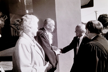
... Ceremonial duties include attending civic events, visiting suburbs, towns, schools, and community organisations, opening public buildings and infrastructure, presenting awards and honours, supporting charities and volunteer groups. ...Ceremonial duties include attending civic events, visiting suburbs, towns, schools, and community organisations, opening public buildings and infrastructure, presenting awards and honours, supporting charities and volunteer groups. ...Sir Samuel McCaughey was a state officeholder, specifically the Lieutenant‑Governor of Victoria. The Governor of Victoria is the Queen / King’s representative in the State of Victoria and is a state level constitutional and ceremonial role. Constitutional duties include giving Royal Assent to Victorian laws, appointing the Premier and Ministers, opening and dissolving Parliament, acting on the advice of the Victorian Government, and ensuring stable, lawful government in the state. Ceremonial duties include attending civic events, visiting suburbs, towns, schools, and community organisations, opening public buildings and infrastructure, presenting awards and honours, supporting charities and volunteer groups. These photographs taken by The Advocate in 1990, when Governor McCaughey and his wife made an official visit to Sunshine. They were welcomed to Sunshine by the Mayor Cr. Don McKay and mayoress Mrs. Isobel McKay. Also at the reception was scouts and guides from Sunshine and Deer Park. The Sunshine North Secondary College Band played in the foyer to welcome the Governor and his wife. After the reception, the party was then taken to The Hunt Club, where the Governor laid the foundation brick for new pottery kiln. They then moved to the Albion Explosive Factory where the new project plans were explained to them. They then moved to Cranwell Park to lay a memorial plaque before travelling to Marie Mill Community Hall and the Living Museum of the West.Governor and Lieutenant‑Governor visits to suburbs like Albion, Braybrook, Maribyrnong, St. Albans and Sunshine were important civic events because they connected local communities to the highest levels of Victoria’s constitutional and ceremonial leadership.Governor McCaughey at Sunshine 321.2samuel mccaughey, sunshine, don mckay, isobel mckay, the hunt club and community arts centre, albion explosive factory, ballarat road, deer park, cranwell park, cranwell street, braybrook, marie mill community centre, randall street, living museum of the west, maribyrnong -
 Broadmeadows Historical Society & Museum
Photograph - Area - Suburb, Fawkner Street Westmeadows Looking North
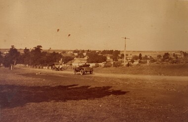
... infrastructure in the area. The scene reflects the semi-rural character of Westmeadows prior to its suburban expansion in the post-war period. The presence of unsealed roads and early 20th-century vehicles suggests a time when the township served as a quiet residential and agricultural community, before the development of the Broadmeadows Housing Commission estate in the late 1940s. Historically, Westmeadows was a key waypoint along the Old Sydney Road, and its built environment—including bluestone bridges and early civic...infrastructure in the area. The scene reflects the semi-rural character of Westmeadows prior to its suburban expansion in the post-war period. The presence of unsealed roads and early 20th-century vehicles suggests a time when the township served as a quiet residential and agricultural community, before the development of the Broadmeadows Housing Commission estate in the late 1940s. Historically, Westmeadows was a key waypoint along the Old Sydney Road, and its built environment—including bluestone bridges and early civic ...This photograph captures a historically significant streetscape in Westmeadows, formerly known as Broadmeadows Township, looking north from Fawkner Street. The image features a dirt road with a vintage automobile parked along its path, flanked by trees and modest residential buildings in the background. A tall utility or signpost stands prominently, indicative of early infrastructure in the area. The scene reflects the semi-rural character of Westmeadows prior to its suburban expansion in the post-war period. The presence of unsealed roads and early 20th-century vehicles suggests a time when the township served as a quiet residential and agricultural community, before the development of the Broadmeadows Housing Commission estate in the late 1940s. Historically, Westmeadows was a key waypoint along the Old Sydney Road, and its built environment—including bluestone bridges and early civic buildings—offers insight into Melbourne’s colonial and interwar development. This photograph contributes to the visual documentation of the City of Hume’s transformation from rural township to suburban district.This photograph holds historical and cultural significance as a visual record of Westmeadows, a township in Melbourne’s north-west, during the early 20th century. Captured from Fawkner Street looking north, the image depicts a dirt road flanked by modest residential buildings and mature trees, with a vintage automobile parked in the foreground. The presence of a tall utility or signpost adds to the authenticity of the streetscape. The image is emblematic of Westmeadows’ semi-rural character prior to its suburban transformation in the post-war era. It reflects the township’s role as a quiet residential and agricultural community, shaped by its proximity to the Old Sydney Road and its historical function as a waypoint for travelers. The architectural style and infrastructure visible in the photograph provide insight into the urban morphology and transport conditions of the time. As a primary source, the photograph contributes to the documentation of Melbourne’s suburban expansion, offering valuable context for researchers, historians, and urban planners studying the evolution of the City of Hume. It is significant for its ability to convey the lived experience, landscape, and development patterns of a community in transition.Sepia tone photo. Two cars on road. Trees, some buildings behind. Open land. Street view.'Looking north Fawkner Street Westmeadows'/'PH-0018' (old catalogue number)westmeadows, fawkner street, north, car -
Broadmeadows Historical Society & Museum
Photograph - Press Photograph, Tony Gouch, Broady Club Proposed Sporting Facility, 14 February 1990
... infrastructure for the benefit of local residents. Mr. Syranamural’s presence in the photograph represents the pivotal role of community leaders in advocating for inclusive and accessible sporting opportunities. The proposed development site would later become a cornerstone of the Club’s facilities, contributing to its legacy of fostering social cohesion, physical wellbeing, and civic pride. ...This photograph captures Mr. Arie Syranamural, then Secretary-Manager of the Broadmeadows Club, standing on the site earmarked for future sporting facilities in 1990. The image represents a pivotal moment in the Club’s history, reflecting its commitment to expanding recreational opportunities for the Broadmeadows community.This photograph of Mr. Arie Syranamural, Secretary-Manager of the Broadmeadows Club, taken in 1990, holds historical and cultural significance as a visual record of community development and leadership in Melbourne’s northern suburbs. Captured on land proposed for future sporting facilities, the image symbolises a transformative period in the Club’s history, reflecting its commitment to expanding recreational infrastructure for the benefit of local residents. Mr. Syranamural’s presence in the photograph represents the pivotal role of community leaders in advocating for inclusive and accessible sporting opportunities. The proposed development site would later become a cornerstone of the Club’s facilities, contributing to its legacy of fostering social cohesion, physical wellbeing, and civic pride. The photograph is significant for its association with the Broadmeadows Sporting Club’s broader mission, which since its founding in the 1970s, has been instrumental in supporting local sports and community initiatives. It also serves as a testament to the Club’s enduring impact, having reinvested over $1.1 million into community programs since 1993. As an archival item, this image provides valuable insight into the planning and vision that shaped the recreational landscape of Broadmeadows and stands as a tribute to the individuals who championed community progress during a formative era.Black and white photograph of a man standing in a vacant piece of land with a white border.Back of Photograph (white sheet): Photographer's Caption Sheet/Date 14.2.90/Publication OBS/Operator's name Tony Gouch/Assignment Broady Club Proposed Sporting Facility/Names and Initials: PUB 28/2/90 OBS/(in block letters/from left to right) Arie Syranamural/(be brief and to the point, be certain of spelling names) Green Sheet: The Leader Newspaper Group/Northern Division/Paper BO/Catchline 610/Percentage 70/Date 28/2/Page 6broadmeadows club, development, jacana basin, broadmeadows, february 1990 -
 Kew Historical Society Inc
Photograph, Stuart Tompkins Studio, Electricity Supply Poles, Warrigal Road, Ashwood, 1965
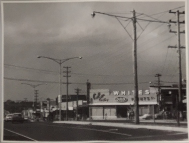
... public infrastructure -- 1960s...civic...The photos originally formed part of the Engineering Department's files in the City of Kew before being donated to the kew Historical Society. electric light poles public infrastructure -- 1960s civic works -- 1960s Typed inscription on reverse: "Electricity Supply Poles. ...Research provided by Stuart Tompkins Studio, Box Hill, into alternatives for median strip street lighting to be used in Burke Road, Kew. The photographers identified variants in different suburbs appropriate to Kew's needs.The series from which the photograph is drawn provides a snapshot by a commercial photographic studio of each named vicinity in 1965 as well as providing examples of public works infrastructure being commissioned by local government in the 1960s. The photos originally formed part of the Engineering Department's files in the City of Kew before being donated to the kew Historical Society.Electricity Supply Poles, Warrigal Road, Ashwood, 1965. Stuart Tompkins Studio provided this photograph for the Kew City Council. The photograph, taken at the intersection of Warrigal Road and High Street South, Ashwood looks north along High Street Road. The intent of the photograph was to provide the Council with models of electricity supply poles. In the photo, wooden and steel poles can be seen in the median strip. The photograph also includes the shops bordering High Street Road during this period. [There are three copies of this photograph in the Collection.]. Typed inscription on reverse: "Electricity Supply Poles. Photographed for Kew City Council 8/2/65. No.4 Warrigal Road - Ashwood. South of High Street Road looking north. Wooden and steel poles with different brackets in median strip." Studio stamp: "Stuart Tompkins Studio. 547 Station Street, Box Hill. WX1439."electric light poles, public infrastructure -- 1960s, civic works -- 1960s -
 Kew Historical Society Inc
Photograph - Kew City Hall, Ron Setford
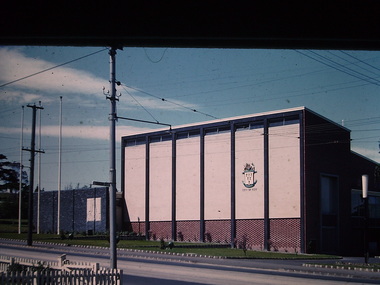
... infrastructure during the 1970s with the construction of the Eastern Freeway. The photographer also took care to annotate and date most of his slides which enable the researcher to pinpoint temporal and spatial locations. Ron Setford Photographs -- Kew (Vic.) -- 1960s Nil The Kew City Hall in Cotham Road, designed by Harold Bartlett, was intended as the initial phase in a scheme to develop an entire civic precinct. ...Ron Setford and his wife Grace Setford lived in Tanner Avenue, East Kew, from c.1946 to c.1995. A keen photographer, he recorded the changing face of Kew over a 20 year period. Apart from 30 photographs of built structures and places in Kew dating from 1960 and 1961, 145 of his 35mm colour slides chronicle the development of the Eastern Freeway through the Yarra Valley over a five year period from c.1972 to c.1977. This important collection was donated to the Society by his granddaughter in 2025.This collection of 175 35mm slides is of local and statewide significance, owing to its subject matter, particularly the major development of road transport infrastructure during the 1970s with the construction of the Eastern Freeway. The photographer also took care to annotate and date most of his slides which enable the researcher to pinpoint temporal and spatial locations.The Kew City Hall in Cotham Road, designed by Harold Bartlett, was intended as the initial phase in a scheme to develop an entire civic precinct. This was representative of a widely-held belief, of the immediate post-war era, that a district's civic centre should be precisely that – not just a single grand building for official use, but a dedicated precinct providing a range of community facilities as well as an administrative function. The Kew masterplan was later abandoned. The City Hall was designed to cater for public or official functions. Its interior had a small stage at one end for intimate theatrical productions, a larger stage at the other (with sunken orchestra pit) for musical performances, plus the most up-to-date equipment for live TV transmission.Nilron setford, photographs -- kew (vic.) -- 1960s -
 Kew Historical Society Inc
Photograph - Kew City Hall, Ron Setford, 1960
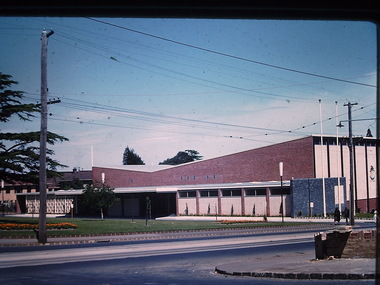
... infrastructure during the 1970s with the construction of the Eastern Freeway. The photographer also took care to annotate and date most of his slides which enable the researcher to pinpoint temporal and spatial locations. Ron Setford Photographs -- Kew (Vic.) -- 1960s Kew Town Hall "Kew Town Hall" The Kew City Hall in Cotham Road, designed by Harold Bartlett, was intended as the initial phase in a scheme to develop an entire civic precinct. ...Ron Setford and his wife Grace Setford lived in Tanner Avenue, East Kew, from c.1946 to c.1995. A keen photographer, he recorded the changing face of Kew over a 20 year period. Apart from 30 photographs of built structures and places in Kew dating from 1960 and 1961, 145 of his 35mm colour slides chronicle the development of the Eastern Freeway through the Yarra Valley over a five year period from c.1972 to c.1977. This important collection was donated to the Society by his granddaughter in 2025.This collection of 175 35mm slides is of local and statewide significance, owing to its subject matter, particularly the major development of road transport infrastructure during the 1970s with the construction of the Eastern Freeway. The photographer also took care to annotate and date most of his slides which enable the researcher to pinpoint temporal and spatial locations.The Kew City Hall in Cotham Road, designed by Harold Bartlett, was intended as the initial phase in a scheme to develop an entire civic precinct. This was representative of a widely-held belief, of the immediate post-war era, that a district's civic centre should be precisely that – not just a single grand building for official use, but a dedicated precinct providing a range of community facilities as well as an administrative function. The Kew masterplan was later abandoned. The City Hall was designed to cater for public or official functions. Its interior had a small stage at one end for intimate theatrical productions, a larger stage at the other (with sunken orchestra pit) for musical performances, plus the most up-to-date equipment for live TV transmission."Kew Town Hall"ron setford, photographs -- kew (vic.) -- 1960s, kew town hall -
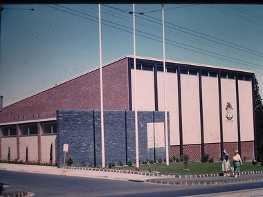 Kew Historical Society Inc
Photograph - Kew City Hall, Ron Setford, 1960
... infrastructure during the 1970s with the construction of the Eastern Freeway. The photographer also took care to annotate and date most of his slides which enable the researcher to pinpoint temporal and spatial locations. Ron Setford Photographs -- Kew (Vic.) -- 1960s Kew Town Hall Nil The Kew City Hall in Cotham Road, designed by Harold Bartlett, was intended as the initial phase in a scheme to develop an entire civic precinct. ...Ron Setford and his wife Grace Setford lived in Tanner Avenue, East Kew, from c.1946 to c.1995. A keen photographer, he recorded the changing face of Kew over a 20 year period. Apart from 30 photographs of built structures and places in Kew dating from 1960 and 1961, 145 of his 35mm colour slides chronicle the development of the Eastern Freeway through the Yarra Valley over a five year period from c.1972 to c.1977. This important collection was donated to the Society by his granddaughter in 2025.This collection of 175 35mm slides is of local and statewide significance, owing to its subject matter, particularly the major development of road transport infrastructure during the 1970s with the construction of the Eastern Freeway. The photographer also took care to annotate and date most of his slides which enable the researcher to pinpoint temporal and spatial locations.The Kew City Hall in Cotham Road, designed by Harold Bartlett, was intended as the initial phase in a scheme to develop an entire civic precinct. This was representative of a widely-held belief, of the immediate post-war era, that a district's civic centre should be precisely that – not just a single grand building for official use, but a dedicated precinct providing a range of community facilities as well as an administrative function. The Kew masterplan was later abandoned. The City Hall was designed to cater for public or official functions. Its interior had a small stage at one end for intimate theatrical productions, a larger stage at the other (with sunken orchestra pit) for musical performances, plus the most up-to-date equipment for live TV transmission.Nilron setford, photographs -- kew (vic.) -- 1960s, kew town hall
