
Showing 37 items matching "derelict land"
-
 Bendigo Historical Society Inc.
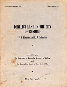
Book - "Derelict Land in the City of Bendigo", 1966
... "Derelict Land in the City of Bendigo"......Derelict land...The goldmining era has left behind a much altered landscape, so that a large proportion of the city was then classified as derelict land. This paper examines some of the problems left by the gold mining period and the possibilities and costs of rehabilitation. ..."Derelict land in the City of Bendigo" by P. J. ...Bendigo Derelict land land rehabilitation "Derelict land in the City of Bendigo" by P. ...After 103 years of continuous activity on the field the last gold mine in Bendigo was closed in 1954. The city of Bendigo had by this time outgrown its mining origins and it now functions as an important regional centre for much of north-west Victoria. The goldmining era has left behind a much altered landscape, so that a large proportion of the city was then classified as derelict land. This paper examines some of the problems left by the gold mining period and the possibilities and costs of rehabilitation. "Derelict land in the City of Bendigo" by P. J. Rimmer and R. J., Johnston. Research paper, dated November, 1966. Published jointly by The Department of Geography, University of Sydney and The Geographical Society of New South Wales. 17 pp. Contains diagrams and black and white photos. Soft cover of made of cardboard. Titles and publisher's details listed on front cover in black text. bendigo, derelict land, land rehabilitation -
 Bendigo Historical Society Inc.
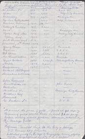
Document - ALBERT RICHARDSON COLLECTION: SHAFTS ALIENATED AND SITES RESERVED BY THE MINES DEPARTMENT
... ...derelict land reused...On top of page ' Ref. derelict land in the City of Bendigo copied 17.4.62. ...BENDIGO Mining derelict land reused Albert Richardson Handwritten one page table of information. ...Handwritten one page table of information. On top of page ' Ref. derelict land in the City of Bendigo copied 17.4.62. Shafts alienated and sites reserved by the Mines Dept' List of mines, dates, depth of shaft, receiving body. For example: Londonderry, 1957, 2900 feet, Kindergarten. Reference: 'Derelict Land in the City of Bendigo' P.J. Rimmer and R.J. Johnston. Published jointly by the Dept of Geography, University of Sydney and The Geographical Society of NSW.Albert Richardsonbendigo, mining, derelict land reused -
![Photograph - Digital image, Willis Vale [2], 1950c](/media/collectors/4f729f5697f83e03086015b8/items/54fd41442162f10d30bf885f/item-media/54fd41912162f10d30bf8caa/item-fit-380x285.jpg?cb=6) Greensborough Historical Society
Greensborough Historical SocietyPhotograph - Digital image, Willis Vale [2], 1950c
... land: House built by Edward Maygar, The flowering Hawthorne Bushes were planted by William Partington. Note the prominent house on upper right where Robert Whatmough lived in the mid 19th century and later sold to Partington family. It was located on the Plenty River across from Partington's Flat. The derelict...land: House built by Edward Maygar, The flowering Hawthorne Bushes were planted by William Partington. Note the prominent house on upper right where Robert Whatmough lived in the mid 19th century and later sold to Partington family. It was located on the Plenty River across from Partington's Flat. The derelict ...View of Greensborough in the distance from Willis Vale and surrounding land: House built by Edward Maygar, The flowering Hawthorne Bushes were planted by William Partington. Note the prominent house on upper right where Robert Whatmough lived in the mid 19th century and later sold to Partington family. It was located on the Plenty River across from Partington's Flat. The derelict Willis Vale house was destroyed in 1964 when a fire originating from North Plenty Gorge - Kurrak Road - was lit by two teenage boys and made its way several kilometres down to Partington's Flat Greensborough. In 1946, Alan Partington built the Alwyn Farmhouse in place of the original Robert Whatmough home seen in this photo which became Whatmough Park circa 1976.Home of the Partington familyDigital copy of black and white photograph.willis vale, partington family, maygar family, whatmough -
![Photograph - Digital image, Willis Vale [house from distance], 1932c](/media/collectors/4f729f5697f83e03086015b8/items/54fd54082162f10d30c05b8a/item-media/54fd54392162f10d30c05f8f/item-fit-380x285.jpg?cb=6) Greensborough Historical Society
Greensborough Historical SocietyPhotograph - Digital image, Willis Vale [house from distance], 1932c
... Land use included farming and orchards. The derelict Willis Vale house was destroyed in 1964 when a fire originating from North Plenty Gorge - Kurrak Road - was lit by two teenage boys and made its way several kilometres down to Partington's Flat Greensborough....Land use included farming and orchards. The derelict Willis Vale house was destroyed in 1964 when a fire originating from North Plenty Gorge - Kurrak Road - was lit by two teenage boys and made its way several kilometres down to Partington's Flat Greensborough. ...Willis Vale: House built by Edward Maygar, Robert Whatmough lived there mid 19th century and later sold to Partington family. It was located on the Plenty River at Partington's Flat Greensborough. Land use included farming and orchards. The derelict Willis Vale house was destroyed in 1964 when a fire originating from North Plenty Gorge - Kurrak Road - was lit by two teenage boys and made its way several kilometres down to Partington's Flat Greensborough.Home of the Partington familyDigital copy of black and white photograph.willis vale, partington family, whatmough, maygar -
![Photograph - Digital image, Willis Vale [3], 1878c](/media/collectors/4f729f5697f83e03086015b8/items/54fd5aeb2162f10d30c0aed5/item-media/54fd5b042162f10d30c0b12d/item-fit-380x285.jpg?cb=6) Greensborough Historical Society
Greensborough Historical SocietyPhotograph - Digital image, Willis Vale [3], 1878c
... Land use included farming and orchards. The derelict Willis Vale house was destroyed in 1964 when a fire originating from North Plenty Gorge - Kurrak Road - was lit by two teenage boys and made its way several kilometres down to Partington's Flat Greensborough....Land use included farming and orchards. The derelict Willis Vale house was destroyed in 1964 when a fire originating from North Plenty Gorge - Kurrak Road - was lit by two teenage boys and made its way several kilometres down to Partington's Flat Greensborough. ...Ellen and Charles Partington at Willis Vale: House built by Edward Maygar, Robert Whatmough lived there mid 19th century and later sold to Partington family. It was located on the Plenty River at Partington's Flat Greensborough. Land use included farming and orchards. The derelict Willis Vale house was destroyed in 1964 when a fire originating from North Plenty Gorge - Kurrak Road - was lit by two teenage boys and made its way several kilometres down to Partington's Flat Greensborough.Home of the Partington familyDigital copy of black and white photograph.charles partington, willis vale, ellen partington -
 Greensborough Historical Society
Photograph - Digital Image, Brickwork, Willis Vale, 1950c
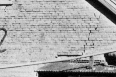
... Land use included farming and orchards. The derelict Willis Vale house was vandalized in 1964 and destroyed when a fire originating from North Plenty Gorge - Kurrak Road - was lit by two teenage boys and made its way several kilometres down to Partington's Flat Greensborough. ...Land use included farming and orchards. The derelict Willis Vale house was vandalized in 1964 and destroyed when a fire originating from North Plenty Gorge - Kurrak Road - was lit by two teenage boys and made its way several kilometres down to Partington's Flat Greensborough. ...Close up photograph of a section of brickwork at Willis Vale. This is the end wall under the roof. Willis Vale built by Edward Maygar, Robert Whatmough lived there mid 19th century and later sold to Partington family. It was located on the Plenty River at Partington's Flat Greensborough. Land use included farming and orchards. The derelict Willis Vale house was vandalized in 1964 and destroyed when a fire originating from North Plenty Gorge - Kurrak Road - was lit by two teenage boys and made its way several kilometres down to Partington's Flat Greensborough. This photo was taken after the Partington's moved house in 1947 across the river where Alan built their new Alwyn house that had access to electricity.Part of Willis Vale, a pioneer home in the Greensborough area.Digital copy of black and white photograph.willis vale -
 Greensborough Historical Society
Photograph - Digital Image, View of Greensborough from Willis Vale, 1906_
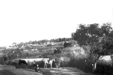
... Land use included farming and orchards. The derelict Willis Vale house was destroyed in 1964 when a fire originating from North Plenty Gorge - Kurrak Road - was lit by two teenage boys and made its way several kilometres down to Partington's Flat Greensborough. ...Land use included farming and orchards. The derelict Willis Vale house was destroyed in 1964 when a fire originating from North Plenty Gorge - Kurrak Road - was lit by two teenage boys and made its way several kilometres down to Partington's Flat Greensborough. ...View of Greensborough from Willis Vale. The people in the photograph were visitors and not identified. Willis Vale: House built by Edward Maygar, Robert Whatmough lived there mid 19th century and later sold to Partington family. It was located on the Plenty River at Partington's Flat Greensborough. Land use included farming and orchards. The derelict Willis Vale house was destroyed in 1964 when a fire originating from North Plenty Gorge - Kurrak Road - was lit by two teenage boys and made its way several kilometres down to Partington's Flat Greensborough. [Ellen died on 13/10/1903 - Some think this photo is thought to have been taken shortly after, at her funeral.]Digital copy of black and white photograph.willis vale, greensborough, partington family -
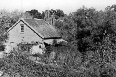 Greensborough Historical Society
Photograph - Digital Image, Willis Vale, 1950c
... Land use included farming and orchards. The derelict Willis Vale house was vandalized in 1964 and destroyed when a fire originating from North Plenty Gorge - Kurrak Road - was lit by two teenage boys and made its way several kilometres down to Partington's Flat Greensborough. ...Land use included farming and orchards. The derelict Willis Vale house was vandalized in 1964 and destroyed when a fire originating from North Plenty Gorge - Kurrak Road - was lit by two teenage boys and made its way several kilometres down to Partington's Flat Greensborough. ...Willis Vale: House built by Edward Maygar, Robert Whatmough lived there mid 19th century and later sold to Partington family. It was located on the Plenty River at Partington's Flat Greensborough. Land use included farming and orchards. The derelict Willis Vale house was vandalized in 1964 and destroyed when a fire originating from North Plenty Gorge - Kurrak Road - was lit by two teenage boys and made its way several kilometres down to Partington's Flat Greensborough. This photo was taken after the Partington's moved house in 1947 across the river where Alan built their new Alwyn house that had access to electricity.Home of the Partington familyDigital copy of black and white photograph.willis vale, partington family, whatmough, maygar family -
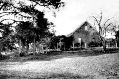 Greensborough Historical Society
Photograph - Digital Image, Willis Vale, 1920c
... Land use included farming and orchards. The derelict Willis Vale house was destroyed in 1964 when a fire originating from North Plenty Gorge - Kurrak Road - was lit by two teenage boys and made its way several kilometres down to Partington's Flat Greensborough....Land use included farming and orchards. The derelict Willis Vale house was destroyed in 1964 when a fire originating from North Plenty Gorge - Kurrak Road - was lit by two teenage boys and made its way several kilometres down to Partington's Flat Greensborough. ...Willis Vale: House built by Edward Maygar, Robert Whatmough lived there mid 19th century and later sold to Partington family. It was located on the Plenty River at Partington's Flat Greensborough. Land use included farming and orchards. The derelict Willis Vale house was destroyed in 1964 when a fire originating from North Plenty Gorge - Kurrak Road - was lit by two teenage boys and made its way several kilometres down to Partington's Flat Greensborough.Home of the Partington familyDigital copy of black and white photograph.willis vale, partington family, maygar, whatmough -
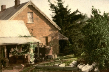 Greensborough Historical Society
Photograph - Digital image, Willis Vale in Colour, 1940c
... Land use included farming and orchards. The derelict Willis Vale house was destroyed in 1964 when a fire originating from North Plenty Gorge - Kurrak Road - was lit by two teenage boys and made its way several kilometres down to Partington's Flat Greensborough....Land use included farming and orchards. The derelict Willis Vale house was destroyed in 1964 when a fire originating from North Plenty Gorge - Kurrak Road - was lit by two teenage boys and made its way several kilometres down to Partington's Flat Greensborough. ...Willis Vale: House built by Edward Maygar, Robert Whatmough lived there mid 19th century and later sold to Partington family. It was located on the Plenty River at Partington's Flat Greensborough. Land use included farming and orchards. The derelict Willis Vale house was destroyed in 1964 when a fire originating from North Plenty Gorge - Kurrak Road - was lit by two teenage boys and made its way several kilometres down to Partington's Flat Greensborough.Home of the Partington familyDigital copy of colour photograph.willis vale, partington, whatmough, maygar -
![Photograph - Digital image, Willis Vale [front door], 1900c](/media/collectors/4f729f5697f83e03086015b8/items/55029fb42162f11024c2fdd5/item-media/55029fe62162f11024c300cd/item-fit-380x285.jpg?cb=6) Greensborough Historical Society
Greensborough Historical SocietyPhotograph - Digital image, Willis Vale [front door], 1900c
... Land use included farming and orchards. The derelict Willis Vale house was destroyed in 1964 when a fire originating from North Plenty Gorge - Kurrak Road - was lit by two teenage boys and made its way several kilometres down to Partington's Flat Greensborough....Land use included farming and orchards. The derelict Willis Vale house was destroyed in 1964 when a fire originating from North Plenty Gorge - Kurrak Road - was lit by two teenage boys and made its way several kilometres down to Partington's Flat Greensborough. ...Willis Vale: House built by Edward Maygar, Robert Whatmough lived there mid 19th century and later sold to Partington family. It was located on the Plenty River at Partington's Flat Greensborough. Land use included farming and orchards. The derelict Willis Vale house was destroyed in 1964 when a fire originating from North Plenty Gorge - Kurrak Road - was lit by two teenage boys and made its way several kilometres down to Partington's Flat Greensborough.Home of the Partington familyDigital copy of black and white photograph.willis vale, partington -
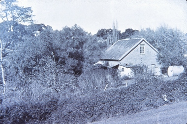 Greensborough Historical Society
Photograph - Digital Image, Willis Vale, 1950c
... Land use included farming and orchards. The derelict Willis Vale house was vandalized in 1964 and destroyed when a fire originating from North Plenty Gorge - Kurrak Road - was lit by two teenage boys and made its way several kilometres down to Partington's Flat Greensborough. ...Land use included farming and orchards. The derelict Willis Vale house was vandalized in 1964 and destroyed when a fire originating from North Plenty Gorge - Kurrak Road - was lit by two teenage boys and made its way several kilometres down to Partington's Flat Greensborough. ...Willis Vale: House built by Edward Maygar, Robert Whatmough lived there mid 19th century and later sold to Partington family. It was located on the Plenty River at Partington's Flat Greensborough. Land use included farming and orchards. The derelict Willis Vale house was vandalized in 1964 and destroyed when a fire originating from North Plenty Gorge - Kurrak Road - was lit by two teenage boys and made its way several kilometres down to Partington's Flat Greensborough. This photo was taken after the Partington's moved house in 1947; across the river where Alan built their new Alwyn house that had access to electricity.Home of the Partington familyDigital copy of black and white photograph.willis vale, partington, whatmough, maygar -
![Photograph - Digital image, Willis Vale [side view], 1950c](/media/collectors/4f729f5697f83e03086015b8/items/5502a2592162f11024c32328/item-media/5502a2852162f11024c3268d/item-fit-380x285.jpg?cb=6) Greensborough Historical Society
Greensborough Historical SocietyPhotograph - Digital image, Willis Vale [side view], 1950c
... Land use included farming and orchards. The derelict Willis Vale house was vandalized in 1964 and destroyed when a fire originating from North Plenty Gorge - Kurrak Road - was lit by two teenage boys and made its way several kilometres down to Partington's Flat Greensborough. ...Land use included farming and orchards. The derelict Willis Vale house was vandalized in 1964 and destroyed when a fire originating from North Plenty Gorge - Kurrak Road - was lit by two teenage boys and made its way several kilometres down to Partington's Flat Greensborough. ...Willis Vale: House built by Edward Maygar, Robert Whatmough lived there mid 19th century and later sold to Partington family. It was located on the Plenty River at Partington's Flat Greensborough. Land use included farming and orchards. The derelict Willis Vale house was vandalized in 1964 and destroyed when a fire originating from North Plenty Gorge - Kurrak Road - was lit by two teenage boys and made its way several kilometres down to Partington's Flat Greensborough. This photo was taken after the Partington's moved house in 1947. across the river where Alan built their new Alwyn house that had access to electricity. Home of the Partington family Home of the Partington familyDigital copy of black and white photograph.willis vale, partington, whatmough, maygar -
 Eltham District Historical Society Inc
Photograph, Liz Pidgeon, Hassall's Gallery Bazaar, 1215 Main Road, Eltham, 25 March 2014, 25 March 2014
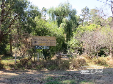
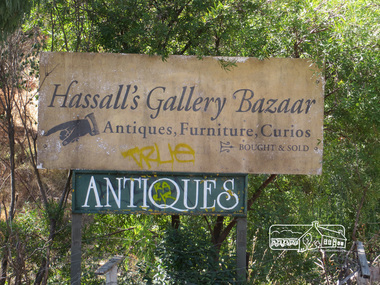
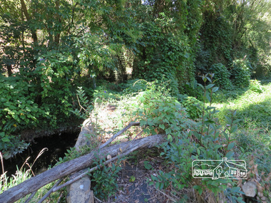
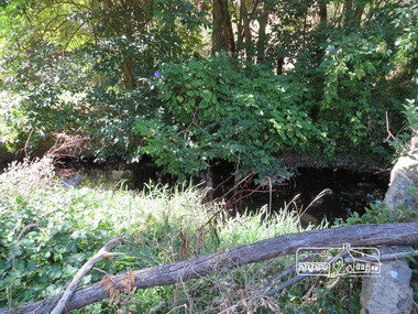
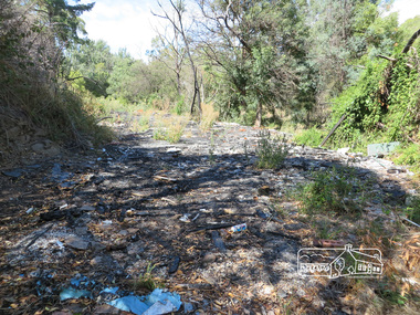
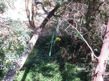
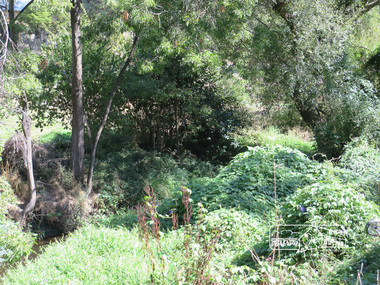
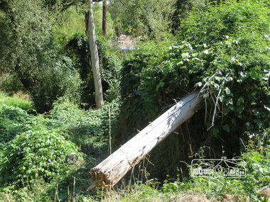
... derelict and neglected for some years. At one stage a shipping container sat near the entrance. This series of ten photographs illustrate the extent of the vegetation which has taken over the land, evidence of rubbish and a possible fire. ...derelict and neglected for some years. At one stage a shipping container sat near the entrance. This series of ten photographs illustrate the extent of the vegetation which has taken over the land, evidence of rubbish and a possible fire. ...This is the site of the first roadside art gallery - Hassall's Roadside Gallery created by the artist son of an artist. Ian Hassall was the son of John Hassall who was among and may have been the first of the British poster artists. The gallery opened Saturday July 14, 1962 at 1215 Main road, Eltham by the director of the National Gallery of Victoria, Eric Westbrook. Situated on the left hand side of the main road, about a mile and a half beyond Eltham, towards Research, near Coleman's Corner at the intersection of Wattletree Road. The property has remnants of a stone quarry, probably for the purpose of gaining stone for local road making. Paintings were hung on screens and removed at night for safety. Large pedestals displayed sculpture and jewellery. All types of hand made art work was displayed. Access to the exhibition and grounds was slightly lower than the level of the road. They were encircled by a narrow little moat formed by a small tributary of the Diamond Creek accessed by a small well built stone bridge built by Ian Hassall with local stone. The Gallery later became known as Hassall's Gallery Bazaar antiques, furniture, curios bought and sold. It operated through to the early 1990s. The property has been derelict and neglected for some years. At one stage a shipping container sat near the entrance. This series of ten photographs illustrate the extent of the vegetation which has taken over the land, evidence of rubbish and a possible fire. In July 2017, planning permission was sought from the Shire of Nillumbik for buildings and works to construct a dwelling and associated vegetation removal. (source planningalerts.org.au)Born Digitaleltham, main road, hassall's gallery bazaar -
 Eltham District Historical Society Inc
Photograph, Liz Pidgeon, Hassall's Gallery Bazaar, 1215 Main Road, Eltham, 25 March 2014, 25 March 2014
... derelict and neglected for some years. At one stage a shipping container sat near the entrance. This series of ten photographs illustrate the extent of the vegetation which has taken over the land, evidence of rubbish and a possible fire. ...derelict and neglected for some years. At one stage a shipping container sat near the entrance. This series of ten photographs illustrate the extent of the vegetation which has taken over the land, evidence of rubbish and a possible fire. ...This is the site of the first roadside art gallery - Hassall's Roadside Gallery created by the artist son of an artist. Ian Hassall was the son of John Hassall who was among and may have been the first of the British poster artists. The gallery opened Saturday July 14, 1962 at 1215 Main road, Eltham by the director of the National Gallery of Victoria, Eric Westbrook. Situated on the left hand side of the main road, about a mile and a half beyond Eltham, towards Research, near Coleman's Corner at the intersection of Wattletree Road. The property has remnants of a stone quarry, probably for the purpose of gaining stone for local road making. Paintings were hung on screens and removed at night for safety. Large pedestals displayed sculpture and jewellery. All types of hand made art work was displayed. Access to the exhibition and grounds was slightly lower than the level of the road. They were encircled by a narrow little moat formed by a small tributary of the Diamond Creek accessed by a small well built stone bridge built by Ian Hassall with local stone. The Gallery later became known as Hassall's Gallery Bazaar antiques, furniture, curios bought and sold. It operated through to the early 1990s. The property has been derelict and neglected for some years. At one stage a shipping container sat near the entrance. This series of ten photographs illustrate the extent of the vegetation which has taken over the land, evidence of rubbish and a possible fire. In July 2017, planning permission was sought from the Shire of Nillumbik for buildings and works to construct a dwelling and associated vegetation removal. (source planningalerts.org.au)Born Digitaleltham, main road, hassall's gallery bazaar -
 Eltham District Historical Society Inc
Photograph, Liz Pidgeon, Hassall's Gallery Bazaar, 1215 Main Road, Eltham, 25 March 2014, 25 March 2014
... derelict and neglected for some years. At one stage a shipping container sat near the entrance. This series of ten photographs illustrate the extent of the vegetation which has taken over the land, evidence of rubbish and a possible fire. ...derelict and neglected for some years. At one stage a shipping container sat near the entrance. This series of ten photographs illustrate the extent of the vegetation which has taken over the land, evidence of rubbish and a possible fire. ...This is the site of the first roadside art gallery - Hassall's Roadside Gallery created by the artist son of an artist. Ian Hassall was the son of John Hassall who was among and may have been the first of the British poster artists. The gallery opened Saturday July 14, 1962 at 1215 Main road, Eltham by the director of the National Gallery of Victoria, Eric Westbrook. Situated on the left hand side of the main road, about a mile and a half beyond Eltham, towards Research, near Coleman's Corner at the intersection of Wattletree Road. The property has remnants of a stone quarry, probably for the purpose of gaining stone for local road making. Paintings were hung on screens and removed at night for safety. Large pedestals displayed sculpture and jewellery. All types of hand made art work was displayed. Access to the exhibition and grounds was slightly lower than the level of the road. They were encircled by a narrow little moat formed by a small tributary of the Diamond Creek accessed by a small well built stone bridge built by Ian Hassall with local stone. The Gallery later became known as Hassall's Gallery Bazaar antiques, furniture, curios bought and sold. It operated through to the early 1990s. The property has been derelict and neglected for some years. At one stage a shipping container sat near the entrance. This series of ten photographs illustrate the extent of the vegetation which has taken over the land, evidence of rubbish and a possible fire. In July 2017, planning permission was sought from the Shire of Nillumbik for buildings and works to construct a dwelling and associated vegetation removal. (source planningalerts.org.au)Born Digitaleltham, main road, hassall's gallery bazaar -
 Eltham District Historical Society Inc
Photograph, Liz Pidgeon, Hassall's Gallery Bazaar, 1215 Main Road, Eltham, 25 March 2014, 25 March 2014
... derelict and neglected for some years. At one stage a shipping container sat near the entrance. This series of ten photographs illustrate the extent of the vegetation which has taken over the land, evidence of rubbish and a possible fire. ...derelict and neglected for some years. At one stage a shipping container sat near the entrance. This series of ten photographs illustrate the extent of the vegetation which has taken over the land, evidence of rubbish and a possible fire. ...This is the site of the first roadside art gallery - Hassall's Roadside Gallery created by the artist son of an artist. Ian Hassall was the son of John Hassall who was among and may have been the first of the British poster artists. The gallery opened Saturday July 14, 1962 at 1215 Main road, Eltham by the director of the National Gallery of Victoria, Eric Westbrook. Situated on the left hand side of the main road, about a mile and a half beyond Eltham, towards Research, near Coleman's Corner at the intersection of Wattletree Road. The property has remnants of a stone quarry, probably for the purpose of gaining stone for local road making. Paintings were hung on screens and removed at night for safety. Large pedestals displayed sculpture and jewellery. All types of hand made art work was displayed. Access to the exhibition and grounds was slightly lower than the level of the road. They were encircled by a narrow little moat formed by a small tributary of the Diamond Creek accessed by a small well built stone bridge built by Ian Hassall with local stone. The Gallery later became known as Hassall's Gallery Bazaar antiques, furniture, curios bought and sold. It operated through to the early 1990s. The property has been derelict and neglected for some years. At one stage a shipping container sat near the entrance. This series of ten photographs illustrate the extent of the vegetation which has taken over the land, evidence of rubbish and a possible fire. In July 2017, planning permission was sought from the Shire of Nillumbik for buildings and works to construct a dwelling and associated vegetation removal. (source planningalerts.org.au)Born Digitaleltham, main road, hassall's gallery bazaar -
 Eltham District Historical Society Inc
Photograph, Liz Pidgeon, Hassall's Gallery Bazaar, 1215 Main Road, Eltham, 25 March 2014, 25 March 2014
... derelict and neglected for some years. At one stage a shipping container sat near the entrance. This series of ten photographs illustrate the extent of the vegetation which has taken over the land, evidence of rubbish and a possible fire. ...derelict and neglected for some years. At one stage a shipping container sat near the entrance. This series of ten photographs illustrate the extent of the vegetation which has taken over the land, evidence of rubbish and a possible fire. ...This is the site of the first roadside art gallery - Hassall's Roadside Gallery created by the artist son of an artist. Ian Hassall was the son of John Hassall who was among and may have been the first of the British poster artists. The gallery opened Saturday July 14, 1962 at 1215 Main road, Eltham by the director of the National Gallery of Victoria, Eric Westbrook. Situated on the left hand side of the main road, about a mile and a half beyond Eltham, towards Research, near Coleman's Corner at the intersection of Wattletree Road. The property has remnants of a stone quarry, probably for the purpose of gaining stone for local road making. Paintings were hung on screens and removed at night for safety. Large pedestals displayed sculpture and jewellery. All types of hand made art work was displayed. Access to the exhibition and grounds was slightly lower than the level of the road. They were encircled by a narrow little moat formed by a small tributary of the Diamond Creek accessed by a small well built stone bridge built by Ian Hassall with local stone. The Gallery later became known as Hassall's Gallery Bazaar antiques, furniture, curios bought and sold. It operated through to the early 1990s. The property has been derelict and neglected for some years. At one stage a shipping container sat near the entrance. This series of ten photographs illustrate the extent of the vegetation which has taken over the land, evidence of rubbish and a possible fire. In July 2017, planning permission was sought from the Shire of Nillumbik for buildings and works to construct a dwelling and associated vegetation removal. (source planningalerts.org.au)Born Digitaleltham, main road, hassall's gallery bazaar -
 Eltham District Historical Society Inc
Photograph, Liz Pidgeon, Hassall's Gallery Bazaar, 1215 Main Road, Eltham, 25 March 2014, 25 March 2014
... derelict and neglected for some years. At one stage a shipping container sat near the entrance. This series of ten photographs illustrate the extent of the vegetation which has taken over the land, evidence of rubbish and a possible fire. ...derelict and neglected for some years. At one stage a shipping container sat near the entrance. This series of ten photographs illustrate the extent of the vegetation which has taken over the land, evidence of rubbish and a possible fire. ...This is the site of the first roadside art gallery - Hassall's Roadside Gallery created by the artist son of an artist. Ian Hassall was the son of John Hassall who was among and may have been the first of the British poster artists. The gallery opened Saturday July 14, 1962 at 1215 Main road, Eltham by the director of the National Gallery of Victoria, Eric Westbrook. Situated on the left hand side of the main road, about a mile and a half beyond Eltham, towards Research, near Coleman's Corner at the intersection of Wattletree Road. The property has remnants of a stone quarry, probably for the purpose of gaining stone for local road making. Paintings were hung on screens and removed at night for safety. Large pedestals displayed sculpture and jewellery. All types of hand made art work was displayed. Access to the exhibition and grounds was slightly lower than the level of the road. They were encircled by a narrow little moat formed by a small tributary of the Diamond Creek accessed by a small well built stone bridge built by Ian Hassall with local stone. The Gallery later became known as Hassall's Gallery Bazaar antiques, furniture, curios bought and sold. It operated through to the early 1990s. The property has been derelict and neglected for some years. At one stage a shipping container sat near the entrance. This series of ten photographs illustrate the extent of the vegetation which has taken over the land, evidence of rubbish and a possible fire. In July 2017, planning permission was sought from the Shire of Nillumbik for buildings and works to construct a dwelling and associated vegetation removal. (source planningalerts.org.au)Born Digitaleltham, main road, hassall's gallery bazaar -
 Eltham District Historical Society Inc
Photograph, Liz Pidgeon, Hassall's Gallery Bazaar, 1215 Main Road, Eltham, 25 March 2014, 25 March 2014
... derelict and neglected for some years. At one stage a shipping container sat near the entrance. This series of ten photographs illustrate the extent of the vegetation which has taken over the land, evidence of rubbish and a possible fire. ...derelict and neglected for some years. At one stage a shipping container sat near the entrance. This series of ten photographs illustrate the extent of the vegetation which has taken over the land, evidence of rubbish and a possible fire. ...This is the site of the first roadside art gallery - Hassall's Roadside Gallery created by the artist son of an artist. Ian Hassall was the son of John Hassall who was among and may have been the first of the British poster artists. The gallery opened Saturday July 14, 1962 at 1215 Main road, Eltham by the director of the National Gallery of Victoria, Eric Westbrook. Situated on the left hand side of the main road, about a mile and a half beyond Eltham, towards Research, near Coleman's Corner at the intersection of Wattletree Road. The property has remnants of a stone quarry, probably for the purpose of gaining stone for local road making. Paintings were hung on screens and removed at night for safety. Large pedestals displayed sculpture and jewellery. All types of hand made art work was displayed. Access to the exhibition and grounds was slightly lower than the level of the road. They were encircled by a narrow little moat formed by a small tributary of the Diamond Creek accessed by a small well built stone bridge built by Ian Hassall with local stone. The Gallery later became known as Hassall's Gallery Bazaar antiques, furniture, curios bought and sold. It operated through to the early 1990s. The property has been derelict and neglected for some years. At one stage a shipping container sat near the entrance. This series of ten photographs illustrate the extent of the vegetation which has taken over the land, evidence of rubbish and a possible fire. In July 2017, planning permission was sought from the Shire of Nillumbik for buildings and works to construct a dwelling and associated vegetation removal. (source planningalerts.org.au)Born Digitaleltham, main road, hassall's gallery bazaar -
 Eltham District Historical Society Inc
Photograph, Liz Pidgeon, Hassall's Gallery Bazaar, 1215 Main Road, Eltham, 25 March 2014, 25 March 2014
... derelict and neglected for some years. At one stage a shipping container sat near the entrance. This series of ten photographs illustrate the extent of the vegetation which has taken over the land, evidence of rubbish and a possible fire. ...derelict and neglected for some years. At one stage a shipping container sat near the entrance. This series of ten photographs illustrate the extent of the vegetation which has taken over the land, evidence of rubbish and a possible fire. ...This is the site of the first roadside art gallery - Hassall's Roadside Gallery created by the artist son of an artist. Ian Hassall was the son of John Hassall who was among and may have been the first of the British poster artists. The gallery opened Saturday July 14, 1962 at 1215 Main road, Eltham by the director of the National Gallery of Victoria, Eric Westbrook. Situated on the left hand side of the main road, about a mile and a half beyond Eltham, towards Research, near Coleman's Corner at the intersection of Wattletree Road. The property has remnants of a stone quarry, probably for the purpose of gaining stone for local road making. Paintings were hung on screens and removed at night for safety. Large pedestals displayed sculpture and jewellery. All types of hand made art work was displayed. Access to the exhibition and grounds was slightly lower than the level of the road. They were encircled by a narrow little moat formed by a small tributary of the Diamond Creek accessed by a small well built stone bridge built by Ian Hassall with local stone. The Gallery later became known as Hassall's Gallery Bazaar antiques, furniture, curios bought and sold. It operated through to the early 1990s. The property has been derelict and neglected for some years. At one stage a shipping container sat near the entrance. This series of ten photographs illustrate the extent of the vegetation which has taken over the land, evidence of rubbish and a possible fire. In July 2017, planning permission was sought from the Shire of Nillumbik for buildings and works to construct a dwelling and associated vegetation removal. (source planningalerts.org.au)Born Digitaleltham, main road, hassall's gallery bazaar -
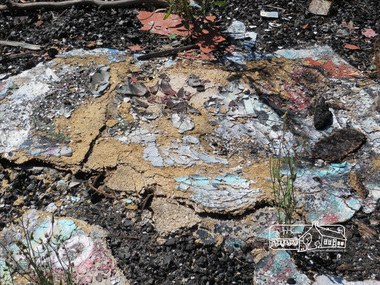 Eltham District Historical Society Inc
Photograph, Liz Pidgeon, Hassall's Gallery Bazaar, 1215 Main Road, Eltham, 25 March 2014, 25 March 2014
... derelict and neglected for some years. At one stage a shipping container sat near the entrance. This series of ten photographs illustrate the extent of the vegetation which has taken over the land, evidence of rubbish and a possible fire. ...derelict and neglected for some years. At one stage a shipping container sat near the entrance. This series of ten photographs illustrate the extent of the vegetation which has taken over the land, evidence of rubbish and a possible fire. ...This is the site of the first roadside art gallery - Hassall's Roadside Gallery created by the artist son of an artist. Ian Hassall was the son of John Hassall who was among and may have been the first of the British poster artists. The gallery opened Saturday July 14, 1962 at 1215 Main road, Eltham by the director of the National Gallery of Victoria, Eric Westbrook. Situated on the left hand side of the main road, about a mile and a half beyond Eltham, towards Research, near Coleman's Corner at the intersection of Wattletree Road. The property has remnants of a stone quarry, probably for the purpose of gaining stone for local road making. Paintings were hung on screens and removed at night for safety. Large pedestals displayed sculpture and jewellery. All types of hand made art work was displayed. Access to the exhibition and grounds was slightly lower than the level of the road. They were encircled by a narrow little moat formed by a small tributary of the Diamond Creek accessed by a small well built stone bridge built by Ian Hassall with local stone. The Gallery later became known as Hassall's Gallery Bazaar antiques, furniture, curios bought and sold. It operated through to the early 1990s. The property has been derelict and neglected for some years. At one stage a shipping container sat near the entrance. This series of ten photographs illustrate the extent of the vegetation which has taken over the land, evidence of rubbish and a possible fire. In July 2017, planning permission was sought from the Shire of Nillumbik for buildings and works to construct a dwelling and associated vegetation removal. (source planningalerts.org.au)Born Digitaleltham, main road, hassall's gallery bazaar -
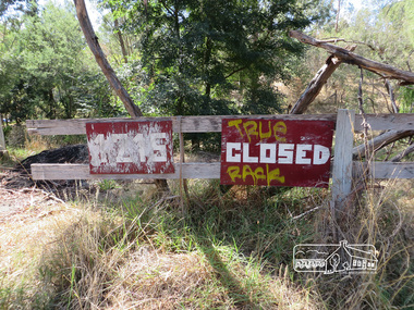 Eltham District Historical Society Inc
Photograph, Liz Pidgeon, Hassall's Gallery Bazaar, 1215 Main Road, Eltham, 25 March 2014, 25 March 2014
... derelict and neglected for some years. At one stage a shipping container sat near the entrance. This series of ten photographs illustrate the extent of the vegetation which has taken over the land, evidence of rubbish and a possible fire. ...derelict and neglected for some years. At one stage a shipping container sat near the entrance. This series of ten photographs illustrate the extent of the vegetation which has taken over the land, evidence of rubbish and a possible fire. ...This is the site of the first roadside art gallery - Hassall's Roadside Gallery created by the artist son of an artist. Ian Hassall was the son of John Hassall who was among and may have been the first of the British poster artists. The gallery opened Saturday July 14, 1962 at 1215 Main road, Eltham by the director of the National Gallery of Victoria, Eric Westbrook. Situated on the left hand side of the main road, about a mile and a half beyond Eltham, towards Research, near Coleman's Corner at the intersection of Wattletree Road. The property has remnants of a stone quarry, probably for the purpose of gaining stone for local road making. Paintings were hung on screens and removed at night for safety. Large pedestals displayed sculpture and jewellery. All types of hand made art work was displayed. Access to the exhibition and grounds was slightly lower than the level of the road. They were encircled by a narrow little moat formed by a small tributary of the Diamond Creek accessed by a small well built stone bridge built by Ian Hassall with local stone. The Gallery later became known as Hassall's Gallery Bazaar antiques, furniture, curios bought and sold. It operated through to the early 1990s. The property has been derelict and neglected for some years. At one stage a shipping container sat near the entrance. This series of ten photographs illustrate the extent of the vegetation which has taken over the land, evidence of rubbish and a possible fire. In July 2017, planning permission was sought from the Shire of Nillumbik for buildings and works to construct a dwelling and associated vegetation removal. (source planningalerts.org.au)Born Digitaleltham, main road, hassall's gallery bazaar -
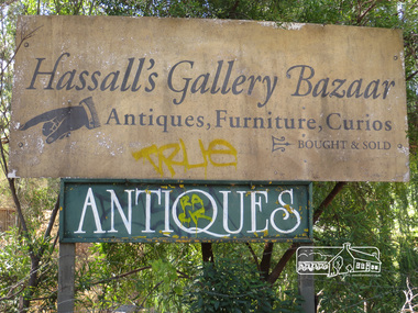 Eltham District Historical Society Inc
Photograph, Liz Pidgeon, Hassall's Gallery Bazaar, 1215 Main Road, Eltham, 25 March 2014, 25 March 2014
... derelict and neglected for some years. At one stage a shipping container sat near the entrance. This series of ten photographs illustrate the extent of the vegetation which has taken over the land, evidence of rubbish and a possible fire. ...derelict and neglected for some years. At one stage a shipping container sat near the entrance. This series of ten photographs illustrate the extent of the vegetation which has taken over the land, evidence of rubbish and a possible fire. ...This is the site of the first roadside art gallery - Hassall's Roadside Gallery created by the artist son of an artist. Ian Hassall was the son of John Hassall who was among and may have been the first of the British poster artists. The gallery opened Saturday July 14, 1962 at 1215 Main road, Eltham by the director of the National Gallery of Victoria, Eric Westbrook. Situated on the left hand side of the main road, about a mile and a half beyond Eltham, towards Research, near Coleman's Corner at the intersection of Wattletree Road. The property has remnants of a stone quarry, probably for the purpose of gaining stone for local road making. Paintings were hung on screens and removed at night for safety. Large pedestals displayed sculpture and jewellery. All types of hand made art work was displayed. Access to the exhibition and grounds was slightly lower than the level of the road. They were encircled by a narrow little moat formed by a small tributary of the Diamond Creek accessed by a small well built stone bridge built by Ian Hassall with local stone. The Gallery later became known as Hassall's Gallery Bazaar antiques, furniture, curios bought and sold. It operated through to the early 1990s. The property has been derelict and neglected for some years. At one stage a shipping container sat near the entrance. This series of ten photographs illustrate the extent of the vegetation which has taken over the land, evidence of rubbish and a possible fire. In July 2017, planning permission was sought from the Shire of Nillumbik for buildings and works to construct a dwelling and associated vegetation removal. (source planningalerts.org.au)Born Digitaleltham, main road, hassall's gallery bazaar -
 Eltham District Historical Society Inc
Photograph - Digital Photograph, Alan King, Rob Roy Hill Climb, 24 November 2007
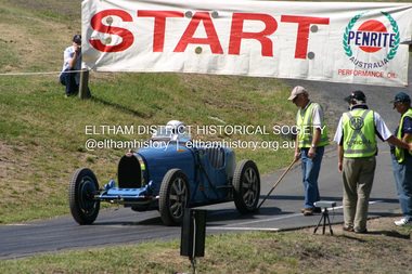
... land was to be sub-divided. In 1991 the MGCC approached the Shire of Nillumbik about using the derelict Rob Roy venue. ...land was to be sub-divided. In 1991 the MGCC approached the Shire of Nillumbik about using the derelict Rob Roy venue. ...The Rob Roy Hill Climb originated in 1935 on the property of former Heidelberg Mayor, William Clinton, where he reared the Rob Roy breed of miniature ponies. He established Pleasure Grounds on part of the property attracting groups of Sunday visitors from Melbourne's inner suburbs. Visitors enjoyed a picnic area, pony rides, a dance hall and a tap room. Young men would ride their BSA or Harley Davidson motorcycles to the property which led to regular club-organised hillclimb meetings between 1930 and 1936. In 1935 Clinton offered the use of his property to the Light Car Club of Australia for their hillclimbs. The track was sealed that same year and the hillclimb at Clintons Road was one of only three specially designed bitumen surface hillclimbs in the world, the others being Shelsey Walsh and Prescott Hillclimbs in the UK. The first Light Car Club of Australia hillclimb was held at Rob Roy in February 1937. Covered under Heritage Overlay, Nillumbik Planning Scheme. Published: Nillumbik Now and Then / Marguerite Marshall 2008; photographs Alan King with Marguerite Marshall.; p133 About six times a year the unlikely sound of car engines emerges from deep in the heart of Christmas Hills.* Usually a quiet retreat, the Hills are home to one of the world’s oldest purpose-built motor sport venues - the Rob Roy Hillclimb. When sealed in 1939, the hillclimb at Clintons Road was one of only three specially designed bitumen surface hillclimbs in the world, the others being Shelsley Walsh and Prescott Hillclimbs in the UK.1 The Rob Roy Hillclimb originated in 1935 on the property of former Heidelberg mayor, William Clinton, where he reared the Rob Roy breed of miniature ponies. Rob Roy was the Scottish folk hero and outlaw. On part of his property Clinton established Pleasure Grounds, attracting Sunday parties from Melbourne’s inner suburbs. Visitors enjoyed a picnic area, pony rides, a dance hall and a tap room.2 Young men riding on their BSA or Harley Davidson bikes led to club-organised regular hillclimb meetings, between 1930 and 1936. In 1935 Clinton offered his property to the Light Car Club of Australia for their hillclimbs. In February 1937, the first Light Car Club of Australia hillclimb meeting was held at Rob Roy. Jack Day achieved the fastest time that day for the 760 yard (695m) track at 36 seconds in a Ford V8 engined Bugatti Special. At first the climb was just a dusty gravel track, but in 1939 it was up-graded and bituminised. Today the 695 metre track begins on a slight incline, proceeds through a sharp right turn, which formerly passed a rusty iron shed, now remembered by the name Tin Shed Corner. The track continues down a slight incline to a level stretch along the top of an embankment holding back a half-acre (0.2ha) dam, then up to a one-in-three gradient. The track then winds uphill through several left turns to the finish line. In 1939 Frank Kleinig reduced the record to 29.72 seconds in an MG Hudson. Throughout World War Two the Rob Roy Hillclimbs were suspended, but were resumed in 1947. The hillclimbs consistently attracted crowds averaging 500 to 600 people, peaking at 2000, until the hillclimb was destroyed by the 1962 bushfires. The meetings included nine Australian Hillclimb Championships, with the first in 1938 won by Peter Whitehead in his ERA. Eight of the Outright and Class record holders were Australian Grand Prix winners including Jack Brabham, who became a triple F1 World Champion. The Light Car Club of Australia held 61 meetings at Rob Roy. Events usually included Touring, Gran Turismo, Production, Sports, Racing and Vintage cars and in the latter years Go-carts. These meets suddenly stopped after the 1962 bushfire destroyed the access bridge on the property leading to the track area, although fortunately Clinton saved his home. The club then established the Lakeland Hillclimb venue close to Lilydale.3 From 1979 to 1987 the MG Car Club ran hill climbs at the Templestowe Hillclimb until the land was to be sub-divided. In 1991 the MGCC approached the Shire of Nillumbik about using the derelict Rob Roy venue. In 1992, after much lobbying, the club signed a ten-year lease from Melbourne Water, which has been renewed. The original track was faithfully reconstructed. Access roads were improved and guard rails were installed on the causeway. Permanent structures were rebuilt and tonnes of rubbish removed. This was made possible by an immense amount of voluntary work by MGCC members and financial support from the newly formed Friends of Rob Roy. In February 1993 the first Return to Rob Roy Historic Meeting was run with a huge spectator attendance of around 1000 enthusiasts. In September 2007, the Nillumbik Shire Council gave the hillclimb heritage protection. This acknowledged the property’s significant contribution to early Australian motor sport with its social connection to William Clinton and the local community.4 *Christmas Hills was named after emancipated convict and shepherd David Christmas, lost in these hills.This collection of almost 130 photos about places and people within the Shire of Nillumbik, an urban and rural municipality in Melbourne's north, contributes to an understanding of the history of the Shire. Published in 2008 immediately prior to the Black Saturday bushfires of February 7, 2009, it documents sites that were impacted, and in some cases destroyed by the fires. It includes photographs taken especially for the publication, creating a unique time capsule representing the Shire in the early 21st century. It remains the most recent comprehenesive publication devoted to the Shire's history connecting local residents to the past. nillumbik now and then (marshall-king) collection, rob roy hill climb, clintons road, light car club of australia, william clinton -
 Bendigo Historical Society Inc.
Document - Fortuna Villa - The Past and the Future
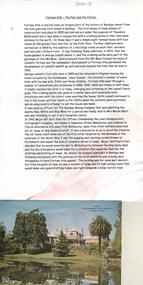
... land on which they built a quartz crushing mill and a two storied, 8 roomed home in 1855. In 1869 they added 2 large rooms to each floor. In 1870 they sold the property to George Lansell. Further additions and renovations too place in 1888' 1890, 1900 and 1907. In 1942 the largely derelict...land on which they built a quartz crushing mill and a two storied, 8 roomed home in 1855. In 1869 they added 2 large rooms to each floor. In 1870 they sold the property to George Lansell. Further additions and renovations too place in 1888' 1890, 1900 and 1907. In 1942 the largely derelict ...Theodore Batterstedt and his father bought five acres of land on which they built a quartz crushing mill and a two storied, 8 roomed home in 1855. In 1869 they added 2 large rooms to each floor. In 1870 they sold the property to George Lansell. Further additions and renovations too place in 1888' 1890, 1900 and 1907. In 1942 the largely derelict building was compulsorily acquired by the army to house the Land Headquarters Cartographic Company and later the Army Survey Regiment.A 2 page document detailing the history of George Lansell's 'Fortuna' estate.george lansell, fortuna, military -
 Bendigo Historical Society Inc.
Booklet - Griffith Collection: 'Golden Square Primary School No. 1189. CENTENARY 1873-1973, August 10th, 11th, 12th, 1973', 1973
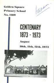
... Land was officially gazetted for the new school in 1873. Classes were held prior to the construction of the building in building on the corner of Laurel Street and High Street. This is the site of the former Methodist (Uniting) Church Hall. The Golden Square Primary School 1189 merged with the Maple Street Primary School, Golden Square, in 2010. The merged school was rebuilt and the Golden Square Primary School now is sited at the corner of Maple Street and Mackenzie Street West, Golden Sqaure. The Laurel Street campus was closed and presently the site is unused and semi-derelict...Land was officially gazetted for the new school in 1873. Classes were held prior to the construction of the building in building on the corner of Laurel Street and High Street. This is the site of the former Methodist (Uniting) Church Hall. The Golden Square Primary School 1189 merged with the Maple Street Primary School, Golden Square, in 2010. The merged school was rebuilt and the Golden Square Primary School now is sited at the corner of Maple Street and Mackenzie Street West, Golden Sqaure. The Laurel Street campus was closed and presently the site is unused and semi-derelict ...The Golden Square Primary School 1189 was entered on the roll of State Schools on 29th January 1875. Its forerunner was the Wesleyan Common School No. 279. Churches played an important part in education early on in Bendigo but later the government assumed control of primary education. Land was officially gazetted for the new school in 1873. Classes were held prior to the construction of the building in building on the corner of Laurel Street and High Street. This is the site of the former Methodist (Uniting) Church Hall. The Golden Square Primary School 1189 merged with the Maple Street Primary School, Golden Square, in 2010. The merged school was rebuilt and the Golden Square Primary School now is sited at the corner of Maple Street and Mackenzie Street West, Golden Sqaure. The Laurel Street campus was closed and presently the site is unused and semi-derelict. Booklet with white cardboard cover with black printing and black and white photograph on front cover. Pages white with black printing and black and white photographs. Fastened together with two staples. Printed by Cambridge Press, Bendigo. Editor was D. J. Munari who was a member of the organising committee for the centenary of the Golden Square Primary School.Front cover: Autograph in blue ink, writer unknown.centenary, golden square primary school, laurel street, maple street -
 Sunshine and District Historical Society Incorporated
Administrative record - City of Sunshine - Commissioner Mr Alexander Alex George Gillon Collection 1976 - 1982 - Reports of the Town Clerk's Department 10th August 1977, City of Sunshine, 10th August 1977
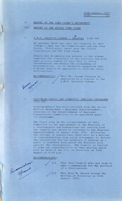
... Gratuity Scheme Trustees Victorian Family and Community Services Programmes Unemployment Station Road Drain Clean Air and Environment Council of Victoria Metropolitan Fire Brigade and the County Fire Authority Western Region Commission Representation Municipal Association of Victoria Award Matters The Hub Alterations and Additions Report of the Co-Ordinator of Welfare Services Needs of the Aged Migrant The Bailey Report Western Region Women's Refuge Emergency Accommodation Midway Hostel Report of the Senior Health Inspector Application for Septic Tank Application for Installation of Gas Fired Dry Septic Tank Units Melbourne & Metropolitan Board of Works Pollution Advice Contaminated Milk Powder Removal of a Dwelling Outside the Municipality 24 Hertford Road Sunshine to Smythes Creek Ballarat School Immunisation 1977 Report of the Medical Officer of Health Report of the By-Laws Officer Dog Act School Crossing Main Road West Disposal of Derelict Vehicles Report of the City Librarian Letter of Appreciation from Sunshine High School Extended Loan Period for Library Material Cost of Using Library Photocopying Machines Australian Library Week 16 to 24 September 1977 Report of the City Engineer Land Use Permit Application Factory Extensions Lot 293 Hawthorne Avenue Land Use Permit Application Advertising Hoarding South West Corner Furlong Road and St. ...Gratuity Scheme Trustees Victorian Family and Community Services Programmes Unemployment Station Road Drain Clean Air and Environment Council of Victoria Metropolitan Fire Brigade and the County Fire Authority Western Region Commission Representation Municipal Association of Victoria Award Matters The Hub Alterations and Additions Report of the Co-Ordinator of Welfare Services Needs of the Aged Migrant The Bailey Report Western Region Women's Refuge Emergency Accommodation Midway Hostel Report of the Senior Health Inspector Application for Septic Tank Application for Installation of Gas Fired Dry Septic Tank Units Melbourne & Metropolitan Board of Works Pollution Advice Contaminated Milk Powder Removal of a Dwelling Outside the Municipality 24 Hertford Road Sunshine to Smythes Creek Ballarat School Immunisation 1977 Report of the Medical Officer of Health Report of the By-Laws Officer Dog Act School Crossing Main Road West Disposal of Derelict Vehicles Report of the City Librarian Letter of Appreciation from Sunshine High School Extended Loan Period for Library Material Cost of Using Library Photocopying Machines Australian Library Week 16 to 24 September 1977 Report of the City Engineer Land Use Permit Application Factory Extensions Lot 293 Hawthorne Avenue Land Use Permit Application Advertising Hoarding South West Corner Furlong Road and St. ...Reports of the Town Clerk's Department 10th August 1977 Reports of the Town Clerk's Department Report of the Acting Town Clerk A.M.P. Gratuity Scheme Trustees Victorian Family and Community Services Programmes Unemployment Station Road Drain Clean Air and Environment Council of Victoria Metropolitan Fire Brigade and the County Fire Authority Western Region Commission Representation Municipal Association of Victoria Award Matters The Hub Alterations and Additions Report of the Co-Ordinator of Welfare Services Needs of the Aged Migrant The Bailey Report Western Region Women's Refuge Emergency Accommodation Midway Hostel Report of the Senior Health Inspector Application for Septic Tank Application for Installation of Gas Fired Dry Septic Tank Units Melbourne & Metropolitan Board of Works Pollution Advice Contaminated Milk Powder Removal of a Dwelling Outside the Municipality 24 Hertford Road Sunshine to Smythes Creek Ballarat School Immunisation 1977 Report of the Medical Officer of Health Report of the By-Laws Officer Dog Act School Crossing Main Road West Disposal of Derelict Vehicles Report of the City Librarian Letter of Appreciation from Sunshine High School Extended Loan Period for Library Material Cost of Using Library Photocopying Machines Australian Library Week 16 to 24 September 1977 Report of the City Engineer Land Use Permit Application Factory Extensions Lot 293 Hawthorne Avenue Land Use Permit Application Advertising Hoarding South West Corner Furlong Road and St. Albans Road Land Use Permit Application Two Factories with Office Each Lot 38 Reid Street Land Use Permit Application Subdivision and Attached House on Each Lot 1010 Robinsons Road Land Use Permit Application Storage of Quarry Products Lot 1 Somerville Road Extending from the Intersection of Market Road and Somerville Road West Towards Kororoit Creek Land Use Permit Application Trash and Treasure Lot 1 Boundary Road Corner Market Road Land Use Permit Application Extension to Existing Factory Lots 4 & 5 Tottenham Parade Land Use Permit Application Rebuilding of Service Premises 105 Anderson Road Croner of Fraser Street Land Use Permit Application Storage of Soil and Retail Plant Nursery North West Corner Fairbairn Road and Boundary Road Land Use Permit Application Flats Lot 472 Hendry Street Land Use Permit Application Light Industry 84 Station Road South East Corner of Glencairn Avenue Plan of Subdivision Geelong Road and Francis Street Plan of Subdivision Browne Avenue, Furlong Road and Epalock Crescent Strata Subdivison 31 - 33 Warrs Road Plan of Consolidation Hume Street Westerngate Estate Robinsons Road Subdivision Camperdown Avenue and Sandford Avenue Sunshine North Plan of Subdivision 10 Chicago Street Variation to Contract Furlong Road Construction Annual Supply Contract Signal Installation Programme 1977/78 Connection of Main Road East, St. Albans with Buckley Street, Niddrie Across Maribyrnong River Disposal of Mini Moke Highfield Quarry South West Side Bunting Road Possible New Tip Site When Sunshine Tip Operations Cease Conference with Associated Quarries Pty Ltd Boundary Road and Fitzgerald Road Intersection Treatment No Standing Bookmobile Excepted Duke Street Retention of Caterpillar D6 Dozer Harrison Street and Miles Street Private Street Scheme Report of the Building Surveyor Apprentice Building Inspectors Fencing Anley Place Installation of Underground Tank Mountainview Quarries McIntyre Road Sunshine North Sunshine Swimming Pool Solar Heating Highpoint West Complex Cleaning Municipal Offices Albion Pre-School Centre Maintenance Dobson Pre-School Centre Maintenance Fairbairn Pre-School Centre Maintenance Sewer Dempster Park Alterations to Pavilion Skinner Reserve Orders of the Day Accounts Submitted for Payment as at 31st July 1977 Plan of Subdivision Rita Street Fencing 83 Hall Street Sunshine West Swimming Pools Fees and Charges city of sunshine, alexander "alex" george gillon, station road, deer park, the hub, sun crescent, sunshine, midway hostel, williamson road, maribyrnong, hertford road, sunshine high school, ballarat road, sunshine north, hawthorne avenue, st. albans road, furlong road, st. albans, reid street, albion, robinsons road, somerville road, brooklyn, boundary road, market road, tottenham parade, footscray west, anderson road, fraser street, fairbairn road, sunshine west, hendry street, glencairn avenue, geelong road, francis street, epalock crescent, warrs road, hume street, camperdown avenue, sandford avenue, chicago street, main road east, buckley street, niddrie, maribyrnong river, highfield quarry, bunting road, sunshine tip, associated quarries, fitzgerald road, duke street, harrison street, miles street, anley place, mountainview quarries, mcintyre road, sunshine swimming pool, highpoint west, rosamond road, albion pre-school centre, dobson pre-school centre, fairbairn pre-school centre, dempster park, skinner reserve, churchill avenue, braybrook, phoenix street, derrimut street -
 Sunshine and District Historical Society Incorporated
Administrative record - City of Sunshine - Commissioner Mr Alexander Alex George Gillon Collection 1976 - 1982 - Minutes of the ordinary meeting of council held on 10th August 1977, City of Sunshine, 10th August 1977
... Gratuity Scheme Trustees Victorian Family and Community Services Programmes Unemployment Station Road Drain Clean Air and Environment Council of Victoria Metropolitan Fire Brigade and the County Fire Authority Western Region Commission Representation Municipal Association of Victoria Award Matters The Hub Alterations and Additions Report of the Co-Ordinator of Welfare Services Needs of the Aged Migrant The Bailey Report Western Region Women's Refuge Emergency Accommodation Midway Hostel Report of the Senior Health Inspector Application for Septic Tank Application for Installation of Gas Fired Dry Septic Tank Units Melbourne & Metropolitan Board of Works Pollution Advice Contaminated Milk Powder Removal of a Dwelling Outside the Municipality 24 Hertford Road Sunshine to Smythes Creek Ballarat School Immunisation 1977 Report of the Medical Officer of Health Report of the By-Laws Officer Dog Act School Crossing Main Road West Disposal of Derelict Vehicles Report of the City Librarian Letter of Appreciation from Sunshine High School Extended Loan Period for Library Material Cost of Using Library Photocopying Machines Australian Library Week 16 to 24 September 1977 Report of the City Engineer Land Use Permit Application Factory Extensions Lot 293 Hawthorne Avenue Land Use Permit Application Advertising Hoarding South West Corner Furlong Road and St. ...Gratuity Scheme Trustees Victorian Family and Community Services Programmes Unemployment Station Road Drain Clean Air and Environment Council of Victoria Metropolitan Fire Brigade and the County Fire Authority Western Region Commission Representation Municipal Association of Victoria Award Matters The Hub Alterations and Additions Report of the Co-Ordinator of Welfare Services Needs of the Aged Migrant The Bailey Report Western Region Women's Refuge Emergency Accommodation Midway Hostel Report of the Senior Health Inspector Application for Septic Tank Application for Installation of Gas Fired Dry Septic Tank Units Melbourne & Metropolitan Board of Works Pollution Advice Contaminated Milk Powder Removal of a Dwelling Outside the Municipality 24 Hertford Road Sunshine to Smythes Creek Ballarat School Immunisation 1977 Report of the Medical Officer of Health Report of the By-Laws Officer Dog Act School Crossing Main Road West Disposal of Derelict Vehicles Report of the City Librarian Letter of Appreciation from Sunshine High School Extended Loan Period for Library Material Cost of Using Library Photocopying Machines Australian Library Week 16 to 24 September 1977 Report of the City Engineer Land Use Permit Application Factory Extensions Lot 293 Hawthorne Avenue Land Use Permit Application Advertising Hoarding South West Corner Furlong Road and St. ...Minutes of the Ordinary Meeting of Council held on 10th August 1977 Reports of the Town Clerk's Department Report of the Acting Town Clerk A.M.P. Gratuity Scheme Trustees Victorian Family and Community Services Programmes Unemployment Station Road Drain Clean Air and Environment Council of Victoria Metropolitan Fire Brigade and the County Fire Authority Western Region Commission Representation Municipal Association of Victoria Award Matters The Hub Alterations and Additions Report of the Co-Ordinator of Welfare Services Needs of the Aged Migrant The Bailey Report Western Region Women's Refuge Emergency Accommodation Midway Hostel Report of the Senior Health Inspector Application for Septic Tank Application for Installation of Gas Fired Dry Septic Tank Units Melbourne & Metropolitan Board of Works Pollution Advice Contaminated Milk Powder Removal of a Dwelling Outside the Municipality 24 Hertford Road Sunshine to Smythes Creek Ballarat School Immunisation 1977 Report of the Medical Officer of Health Report of the By-Laws Officer Dog Act School Crossing Main Road West Disposal of Derelict Vehicles Report of the City Librarian Letter of Appreciation from Sunshine High School Extended Loan Period for Library Material Cost of Using Library Photocopying Machines Australian Library Week 16 to 24 September 1977 Report of the City Engineer Land Use Permit Application Factory Extensions Lot 293 Hawthorne Avenue Land Use Permit Application Advertising Hoarding South West Corner Furlong Road and St. Albans Road Land Use Permit Application Two Factories with Office Each Lot 38 Reid Street Land Use Permit Application Subdivision and Attached House on Each Lot 1010 Robinsons Road Land Use Permit Application Storage of Quarry Products Lot 1 Somerville Road Extending from the Intersection of Market Road and Somerville Road West Towards Kororoit Creek Land Use Permit Application Trash and Treasure Lot 1 Boundary Road Corner Market Road Land Use Permit Application Extension to Existing Factory Lots 4 & 5 Tottenham Parade Land Use Permit Application Rebuilding of Service Premises 105 Anderson Road Croner of Fraser Street Land Use Permit Application Storage of Soil and Retail Plant Nursery North West Corner Fairbairn Road and Boundary Road Land Use Permit Application Flats Lot 472 Hendry Street Land Use Permit Application Light Industry 84 Station Road South East Corner of Glencairn Avenue Plan of Subdivision Geelong Road and Francis Street Plan of Subdivision Browne Avenue, Furlong Road and Epalock Crescent Strata Subdivison 31 - 33 Warrs Road Plan of Consolidation Hume Street Westerngate Estate Robinsons Road Subdivision Camperdown Avenue and Sandford Avenue Sunshine North Plan of Subdivision 10 Chicago Street Variation to Contract Furlong Road Construction Annual Supply Contract Signal Installation Programme 1977/78 Connection of Main Road East, St. Albans with Buckley Street, Niddrie Across Maribyrnong River Disposal of Mini Moke Highfield Quarry South West Side Bunting Road Possible New Tip Site When Sunshine Tip Operations Cease Conference with Associated Quarries Pty Ltd Boundary Road and Fitzgerald Road Intersection Treatment No Standing Bookmobile Excepted Duke Street Retention of Caterpillar D6 Dozer Harrison Street and Miles Street Private Street Scheme Report of the Building Surveyor Apprentice Building Inspectors Fencing Anley Place Installation of Underground Tank Mountainview Quarries McIntyre Road Sunshine North Sunshine Swimming Pool Solar Heating Highpoint West Complex Cleaning Municipal Offices Albion Pre-School Centre Maintenance Dobson Pre-School Centre Maintenance Fairbairn Pre-School Centre Maintenance Sewer Dempster Park Alterations to Pavilion Skinner Reserve Orders of the Day Accounts Submitted for Payment as at 31st July 1977 Plan of Subdivision Rita Street Fencing 83 Hall Street Sunshine West Swimming Pools Fees and Charges Extraordinary Business Amendment to Seal Plan Westerngate North Estate Stage 1A Former Post Office Offer to Sell to Council Building Bon Thomas Reserve W.V. Black Hampshire Road Albion Pre-School and Infant Welfare Centre city of sunshine, alexander "alex" george gillon, station road, deer park, the hub, sun crescent, sunshine, hertford road, sunshine high school, ballarat road, sunshine north, hawthorne avenue, furlong road, st. albans road, st. albans, reid street, albion, robinsons road, market road, somerville road, brooklyn, boundary road, tottenham parade, footscray west, anderson road, fraser street, fairbairn road, hendry street, glencairn avenue, geelong road, francis street, epalock crescent, warrs road, maribyrnong, hume street, camperdown avenue, sandford avenue, chicago street, main road east, buckley street, niddrie, maribyrnong river, highfield quarry, bunting road, sunshine tip, associated quarries, fitzgerald road, duke street, harrison street, miles street, anley place, mountainview quarries, mcintyre road, sunshine swimming, highpoint west, rosamond road, albion pre-school centre, dobson pre-school centre, fairbairn pre-school, derrimut street, dempster park, phoenix street, skinner reserve, churchill avenue, braybrook, rita street, hall street, sunshine west, bon thomas reserve, quinn street, hampshire road -
 Sunshine and District Historical Society Incorporated
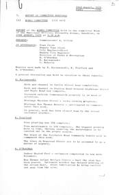
Administrative record - City of Sunshine - Commissioner Mr Alexander Alex George Gillon Collection 1976 - 1982 - Report of Committee Meetings 22nd August 1978, City of Sunshine, 22nd August 1978
... Report of Committee Meetings 22nd August 1978 Report of the Works Committee Kerb & Channel Curtin Street Near Completion Kerb & Channel Station Road Between Gladstone Street & Neale Road Completed Drainage Macedon Street Rock Slowing Process Drainage Bon Thomas Reserve to Commence Later This Week In General, All Work has been Slowed Down This Week by the Recent Inclement Weather Tree Planting 34% Complete Tree Maintenance 51% Complete Fairbairn Road Community Centre Drain will Commence This Week Newstead Street Trees to be Attended to Indoor Heated Pool Completion Estimated Mid November Bon Thomas Reserve Infant Welfare Centre Half Slab Poured Diamond Reserve Day Care Centre Delayed Orama Street Day Care Centre Funds Approved Highpoint West Day Care Centre Awaiting Approval Ralph Street Toilets Slab and Brick Work Completed Selwyn Park Toilet & Pavilion Objections Have Been Received Report of the Co-Ordinator of Welfare Services Toddler Group for Children At Risk Resource Centre / Toy Library Youth Counselling Service Report of the Municipal Recreation Officer Multiple Sclerosis Society of Victoria Request for Land Provision of Minibuses for Community Groups Sunshine West High School Community Use Agreement Report of the City Engineer Preferred Development Areas Newmarket Relocation Proposal Planning Permit Application Warehouse and Workshop Hawthorn Avenue Home Occupation Three Phase Power Connection 170 Wright Street Planning Permit Medical Consultation Room South East Corner Percy Street and Main Road East Plan of Subdivision Robinsons Road Provision of Footbridge Over Kororoit Creek Establishment of Recycling Depot at Sunshine Tip Derelict Cars and Domestic Ferrous Scrap Report of the Building Surveyor 28 - 30 Ridley Street Albion...City of Sunshine Alexander "Alex" George Gillon Curtin Street Maidstone Station Road Gladstone Street Neale Road Albanvale Macedon Street Bon Thomas Reserve Quinn Street Deer Park Fairbairn Road Sunshine West Newstead Street Maribyrnong Bon Thomas Reserve Infant Welfare Centre Diamond Reserve Day Care Centr Diamond Reserve Orama Street Day Care Centre Orama Street Highpoint West Day Care Centre Rosamond Road Ralph Street Selwyn Park Selwyn Street Albion Sunshine West High School Lachlan Road Hawthorn Avenue Sunshine North Wright Street Sunshine Percy Street Main Road East Kororoit Creek Sunshine Tip Ridley Street Report of Committee Meetings 22nd August 1978 Report of the Works Committee Kerb & Channel Curtin Street Near Completion Kerb & Channel Station Road Between Gladstone Street & Neale Road Completed Drainage Macedon Street Rock Slowing Process Drainage Bon Thomas Reserve to Commence Later This Week In General, All Work has been Slowed Down This Week by the Recent Inclement Weather Tree Planting 34% Complete Tree Maintenance 51% Complete Fairbairn Road Community Centre Drain will Commence This Week Newstead Street Trees to be Attended to Indoor Heated Pool Completion Estimated Mid November Bon Thomas Reserve Infant Welfare Centre Half Slab Poured Diamond Reserve Day Care Centre Delayed Orama Street Day Care Centre Funds Approved Highpoint West Day Care Centre Awaiting Approval Ralph Street Toilets Slab and Brick Work Completed Selwyn Park Toilet & Pavilion Objections Have Been Received Report of the Co-Ordinator of Welfare Services Toddler Group for Children At Risk Resource Centre / Toy Library Youth Counselling Service Report of the Municipal Recreation Officer Multiple Sclerosis Society of Victoria Request for Land Provision of Minibuses for Community Groups Sunshine West High School Community Use Agreement Report of the City Engineer Preferred Development Areas Newmarket Relocation Proposal Planning Permit Application Warehouse and Workshop Hawthorn Avenue Home Occupation Three Phase Power Connection 170 Wright Street Planning Permit Medical Consultation Room South East Corner Percy Street and Main Road East Plan of Subdivision Robinsons Road Provision of Footbridge Over Kororoit Creek Establishment of Recycling Depot at Sunshine Tip Derelict Cars and Domestic Ferrous Scrap Report of the Building Surveyor 28 - 30 Ridley Street Albion Foolscap sized document. ...Report of Committee Meetings 22nd August 1978 Report of the Works Committee Kerb & Channel Curtin Street Near Completion Kerb & Channel Station Road Between Gladstone Street & Neale Road Completed Drainage Macedon Street Rock Slowing Process Drainage Bon Thomas Reserve to Commence Later This Week In General, All Work has been Slowed Down This Week by the Recent Inclement Weather Tree Planting 34% Complete Tree Maintenance 51% Complete Fairbairn Road Community Centre Drain will Commence This Week Newstead Street Trees to be Attended to Indoor Heated Pool Completion Estimated Mid November Bon Thomas Reserve Infant Welfare Centre Half Slab Poured Diamond Reserve Day Care Centre Delayed Orama Street Day Care Centre Funds Approved Highpoint West Day Care Centre Awaiting Approval Ralph Street Toilets Slab and Brick Work Completed Selwyn Park Toilet & Pavilion Objections Have Been Received Report of the Co-Ordinator of Welfare Services Toddler Group for Children At Risk Resource Centre / Toy Library Youth Counselling Service Report of the Municipal Recreation Officer Multiple Sclerosis Society of Victoria Request for Land Provision of Minibuses for Community Groups Sunshine West High School Community Use Agreement Report of the City Engineer Preferred Development Areas Newmarket Relocation Proposal Planning Permit Application Warehouse and Workshop Hawthorn Avenue Home Occupation Three Phase Power Connection 170 Wright Street Planning Permit Medical Consultation Room South East Corner Percy Street and Main Road East Plan of Subdivision Robinsons Road Provision of Footbridge Over Kororoit Creek Establishment of Recycling Depot at Sunshine Tip Derelict Cars and Domestic Ferrous Scrap Report of the Building Surveyor 28 - 30 Ridley Street Albion city of sunshine, alexander "alex" george gillon, curtin street, maidstone, station road, gladstone street, neale road, albanvale, macedon street, bon thomas reserve, quinn street, deer park, fairbairn road, sunshine west, newstead street, maribyrnong, bon thomas reserve infant welfare centre, diamond reserve day care centr, diamond reserve, orama street day care centre, orama street, highpoint west day care centre, rosamond road, ralph street, selwyn park, selwyn street, albion, sunshine west high school, lachlan road, hawthorn avenue, sunshine north, wright street, sunshine, percy street, main road east, kororoit creek, sunshine tip, ridley street
