Showing 72 items matching "explorers -- australia -- maps"
-
 Wodonga & District Historical Society Inc
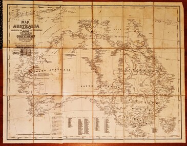
Map - Australia Shewing the Tracks of the Late Explorers
... Explorers -- Australia -- Maps...Map of Australia and part of Indonesia. Part coloured with tracks of 15 explorers including Eyre, Stuart, Leichhardt and Burke and Wills with notes and some details of latitude and longitude. ...Map of Australia shewing the tracks of late explorers into the interior and across the continent together with their discoveries map/ projected, compiled and drawn by O.W.O. ... Shewing the Tracks of the Late Explorers Map Australia Shewing the Tracks of the Late Explorers ...Charles George Eastland Platts arrived in South Australia on 22 March 1839, and soon after established his business in Adelaide. He became Adelaide’s first bookseller. It was known as Platts’ Library but was also a bookshop and stationer. His business was also used as a postal receiving house. Platts died on 14 November 1871. Boyle Travers Finniss (18 August 1807 – 24 December 1893) had an early career in the British Military before selling off his commission in 1835. He was appointed assistant surveyor to Colonel William Light in South Australia. He then had several roles in public service. Finniss was the first premier and Chief Secretary South Australia, serving from 24 October 1856 to 20 August 1857. In 1864 he was appointed as the Government Resident of the Northern Territory. He was filling this role at the time when the map was produced and is acknowledged on the map.This is a very early map documenting the exploration and opening up of Australia.Map of Australia and part of Indonesia. Part coloured with tracks of 15 explorers including Eyre, Stuart, Leichhardt and Burke and Wills with notes and some details of latitude and longitude. Relief relating to the major mountain ranges is indicated. At the bottom of the map is a key to the explorers and a list of the counties in the different states. Top left side of map has small sketch of the Platts (publisher) building at the corner of King William Street.Map of Australia shewing the tracks of late explorers into the interior and across the continent together with their discoveries map/ projected, compiled and drawn by O.W.O. Bennett Most Respectfully Dedicated to LIEUT. COL. BOYLE TRAVERS FINISS Government Resident of the Northern Territory of SOUTH AUSTRALIAexplorers -- australia -- maps, rare maps australia -
 Warrnambool and District Historical Society Inc.
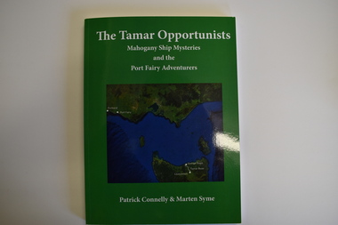
Book, The Tamar Opportunists - Mahogany Ship Mysteries and the Port Fairy Adventurers, 2022
... This book is of considerable interest Australia-wide because of its critical approach to the Mahogany Ship legend Port Fairy History The Tamar opportunists mahogany ship This book explores aspects of the Mahogany Ship wreck and aspects of early Port Fairy history. This is a book of 122 pages. The cover is green with a green and blue map ...This book explores aspects of the Mahogany Ship wreck and aspects of early Port Fairy history.This is a book of 122 pages. The cover is green with a green and blue map on the front and white printing on the front and back. It contains a Foreword and Acknowledgements, an Epilogue, Appendices, Bibliography, Index and printed material, maps, sketches, tables and black and white photographs.non-fictionThis book explores aspects of the Mahogany Ship wreck and aspects of early Port Fairy history.port fairy history, the tamar opportunists, mahogany ship -
 Bendigo Military Museum
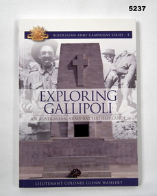
Book - BOOK, GUIDE to ANZAC BATTLEFIELDS, LIEUTENANT COLONEL GLENN WAHLERT, "Exploring Gallipoli", 2008
... EXPLORING/ GALLIPOLI - / AN AUSTRALIAN ARMY BATTLEFIELD GUIDE" Books WW1 Gallipoli History Soft cover book. Soft cover - cardboard, blue, grey and black print on front, spine, back and front and back flaps of cover. Front and back illustrations - montage of grey with black and white photographs of soldiers and War Memorial. Back flap - illustrations in colour - maps ...'EXPLORING/ GALLIPOLI - / AN AUSTRALIAN ARMY BATTLEFIELD GUIDE"Soft cover book. Soft cover - cardboard, blue, grey and black print on front, spine, back and front and back flaps of cover. Front and back illustrations - montage of grey with black and white photographs of soldiers and War Memorial. Back flap - illustrations in colour - maps. 136 pages, paper, cut, plain, semi gloss white, illustrated - colour and black and white photographs, diagrams, maps, illustrations.books, ww1, gallipoli, history -
 Orbost & District Historical Society
document, BALDWIN SPENCER TRAIL Project Brief 1988, February 1988
... explorer William Baldwin Spencer. Sir Walter Baldwin Spencer KCMG (23 June 1860 – 14 July 1929) was an English-Australian biologist and anthropologist. this booklet is a useful reference tool. Baldwin-Spencer A document of 10 pp with a cream cover, titled, Baldwin Spencer Trail Project Brief Feb 1988. It contains maps ...This document was produced by the Department of Conservation, Forests & Land Management, Orbost, to commemorate the visit by Baldwin-Spencer in 1989 as part of the Bicentennial Walking Tracks Project. The Baldwin Spencer Trail closely follows the route of scientist and explorer William Baldwin Spencer. Sir Walter Baldwin Spencer KCMG (23 June 1860 – 14 July 1929) was an English-Australian biologist and anthropologist. this booklet is a useful reference tool.A document of 10 pp with a cream cover, titled, Baldwin Spencer Trail Project Brief Feb 1988. It contains mapsbaldwin-spencer -
 Orbost & District Historical Society
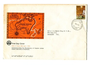
first day cover, April 1970
... explorer Lieutenant (later Captain) James Cook sailed and charted the East Coast of Australia in 1770, and claimed the eastern seaboard of the Continent for the British Crown. This was not considered the official bicentenary of Australia, but rather the mapping of the Eastern coastline. This item reflects the commemoration of a significant event in the history of Australia. first-day-cover cook-james-bicentenary philately addressed to - "M/s J.A. Spate Esq. B.V. Sc, P.O. Box 312 trbost Vic" An envelope with a first day issue stamp commemorating the 1970 voyages of James Cook. It has a large orange map ...The Bicentenary of James Cook in Australia was commemorated in Australia in 1970. The British explorer Lieutenant (later Captain) James Cook sailed and charted the East Coast of Australia in 1770, and claimed the eastern seaboard of the Continent for the British Crown. This was not considered the official bicentenary of Australia, but rather the mapping of the Eastern coastline.This item reflects the commemoration of a significant event in the history of Australia.An envelope with a first day issue stamp commemorating the 1970 voyages of James Cook. It has a large orange map of Australia - "Nouvelle Hollande" on the front.addressed to - "M/s J.A. Spate Esq. B.V. Sc, P.O. Box 312 trbost Vic"first-day-cover cook-james-bicentenary philately -
 Orbost & District Historical Society
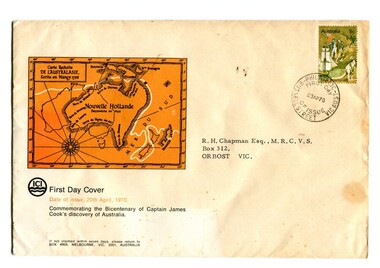
first day cover, April 1970
... Australia in 1970. The British explorer Lieutenant (later Captain) James Cook sailed and charted the East Coast of Australia in 1770, and claimed the eastern seaboard of the Continent for the British Crown. This was not considered the official bicentenary of Australia, but rather the mapping of the Eastern coastline. This item reflects the commemoration of a significant event in Australian history. first-day-cover bicentennial-james-cook philately addressed to "R.H. Chapman- esq" An envelope with a first day issue stamp of the bicentenary of the voyages of James Cook. On the envelope is a large orange map ...The Bicentenary of James Cook in Australia was commemorated in Australia in 1970. The British explorer Lieutenant (later Captain) James Cook sailed and charted the East Coast of Australia in 1770, and claimed the eastern seaboard of the Continent for the British Crown. This was not considered the official bicentenary of Australia, but rather the mapping of the Eastern coastline.This item reflects the commemoration of a significant event in Australian history.An envelope with a first day issue stamp of the bicentenary of the voyages of James Cook. On the envelope is a large orange map of Australia - "Nouvelle Hollande".addressed to "R.H. Chapman- esq"first-day-cover bicentennial-james-cook philately -
 Bendigo Historical Society Inc.
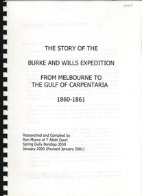
Book - THE STORY OF THE BURKE AND WILLS EXPEDITION, 2000
... History House 11 Mackenzie Street Bendigo goldfields AUSTRALIA History explorers Australia-History-Explorers Ron Munro The Story of the Burke and Wills expedition, from Melbourne to the Gulf of Carpentaria 1860-1861 189 pages with photographs and maps. ...The Story of the Burke and Wills expedition, from Melbourne to the Gulf of Carpentaria 1860-1861 189 pages with photographs and maps.Ron Munroaustralia, history, explorers, australia-history-explorers -
 The Beechworth Burke Museum
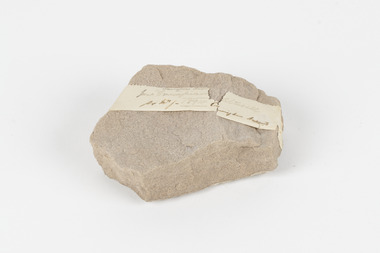
Geological specimen - Slice Dendrites on Sandstone, Unknown
... explore the geological and mineral resources and to record a detailed map of the state. It was headed by British geologist, Alfred Richard Cecil Selwyn (1824-1902), who was responsible for issuing over 60 geological maps during his 17 years as director. These maps were all hand-drawn and coloured and became the benchmark for accuracy for geological mapping. Collecting geological specimens was an important part of mapping and understanding the scientific makeup of the earth. Many of these specimens were sent to research and collecting organisations across Australia ...Dendrites are deposits of black minerals, typically manganese oxides that precipitated from water seeping through fractures in fine-grain rocks like a sandstone or limestone. Dendrites are much less regular than plant fossils and lacks vein structures. The manganese cryztallizes through the process called 'supercooling'. Some samples of dendrites occur in volcanic rocks in the Lilydale district, east of Melbourne. Sandstones are made of tiny sand grains that may have been deposited in the sea and later formed together. Most sandstones are made of quartz which are chemically-resistant minerals. This particular specimen was donated by Alfred Selwyn in 1868 as part of the Geological Survey of Victoria. It is connected to the original 1875 catalogue on Geological Specimen with number 189 'Quartz Crystals_Quartz Crystals (two are polished)'Dendrites on sandstones This specimen is an important contribution to the geological history of Victoria, as well as its links to the 1868 Geological Survey of Victoria. This specimen is part of larger collection of significant geological specimens in the Burke Museum that was collected from around the world between 1868-1880. A large percentage of these specimens were collection as part of the Geological Survey of Victoria 1852-1974. The Geological Survey of Victoria was an organisation founded in response to the Victorian gold rush to explore the geological and mineral resources and to record a detailed map of the state. It was headed by British geologist, Alfred Richard Cecil Selwyn (1824-1902), who was responsible for issuing over 60 geological maps during his 17 years as director. These maps were all hand-drawn and coloured and became the benchmark for accuracy for geological mapping. Collecting geological specimens was an important part of mapping and understanding the scientific makeup of the earth. Many of these specimens were sent to research and collecting organisations across Australia, including the Burke Museum, to educate and encourage further study. A hand-sized slice of light brown sandstone with dendrites formed from crystallized manganese oxide.Existing label: Not sure what / 'Slica dondrites' / means. / Sample is sandstone and original label / identifies it as from / the Grampians near Stawell. / C. Willman / 15/4/21 Other label: [illegible] / stone [ illegible] / from Grampians Stawell / 1894 /geological specimen, geology, geology collection, burke museum, beechworth, dendrites, sandstones, quartz, lilydale district, geological survey of victoria, grampians, victoria rocks, minerals, rocks, manganese oxides, alfred selwyn -
 Mission to Seafarers Victoria
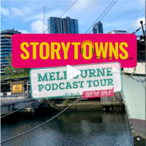
Document - Media release, Podcast reveals unique Melbourne experiences, April 2022
... explore Melbourne’s suburbs with with our fresh-out-the-oven “Railway Stories” audio guides! And if you’re feeling adventurous this weekend, take a road trip through regional Australia and let us jazz up your adventure, where the local folks are the true stars of the story. Sue Dight was interviewed to add to t The interview was a to way to put the Mission to Seafarers on the map ...In April 2022, the City of Melbourne partnering Storytown, with launched the "Melbourne Podcast Tour". Storytown, an application created by Jarrod Pickford offering audio guides. This self-guided tour takes you along the Yarra River, from Southbank to Docklands, taking around 1.5 hours to complete by bike or 2 hours by foot. From their website: "Told by locals Discover Australia through the voices of its locals! Storytowns collaborates with communities to craft immersive audio guides, offering authentic travel tales from the heart of each neighborhood. Simply grab your headphones, download our app and explore Melbourne’s suburbs with with our fresh-out-the-oven “Railway Stories” audio guides! And if you’re feeling adventurous this weekend, take a road trip through regional Australia and let us jazz up your adventure, where the local folks are the true stars of the story. Sue Dight was interviewed to add to tThe interview was a to way to put the Mission to Seafarers on the map and increase its visitation. Unfortunately the tour is not avalaible anymore (as from 2023).Digital copy of a media releasecom, city of melbourne, app, storytown, sue dight, on the map, marketing, audioguide, jarrod pickford, audio guides, self-guides tour, podcast, radio interview -
 Monbulk RSL Sub Branch
Book, Patrick Lindsay, The spirit of the digger: Then and now, 2003
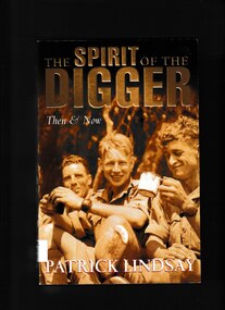
... explores what it is that sets Australian soldiers apart. It reveals the human side of the campaigns they have been involved in and provides an extraordinary insight into their lives, there thoughts and spirit australia - military history australia - social interaction A summary of the experiences of Australian soldiers in conflicts from Gallipoli to today Bibliography, index, notes, ill (b/w). maps, p.463 The spirit of the digger: Then and now Book Patrick Lindsay Pan McMillan Australia ...A summary of the experiences of Australian soldiers in conflicts from Gallipoli to todayBibliography, index, notes, ill (b/w). maps, p.463non-fictionA summary of the experiences of Australian soldiers in conflicts from Gallipoli to todayaustralia - military history, australia - social interaction -
 Monbulk RSL Sub Branch
Book, Robin Youl et al, From desk to dugout : the education of a Victorian ANZAC, 2015
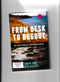
... Australia. From Desk to Dugout explores this particular moment in Australian literary and educational history and its intersections with the war at Gallipoli and the history of ANZAC. Ill, maps ...Come see my little dugout - way up on the hill it stands, Where I can get a lovely view of Anzac's golden sands.' The Anzac Book was the finest 'trench publication' produced during the Great War and was an instant bestseller when first released in 1916. Created by soldiers under enemy fire and in extreme hardship, the illustrations, stories, cartoons, and poems were intended as a Christmas and New Year diversion for soldiers facing a harsh winter in the trenches on Gallipoli. The way these young men powerfully captured their felt experiences and struggles in the trenches had a huge emotional effect on readers back home in Australia. From Desk to Dugout explores this particular moment in Australian literary and educational history and its intersections with the war at Gallipoli and the history of ANZAC.Ill, maps, p.127.non-fictionCome see my little dugout - way up on the hill it stands, Where I can get a lovely view of Anzac's golden sands.' The Anzac Book was the finest 'trench publication' produced during the Great War and was an instant bestseller when first released in 1916. Created by soldiers under enemy fire and in extreme hardship, the illustrations, stories, cartoons, and poems were intended as a Christmas and New Year diversion for soldiers facing a harsh winter in the trenches on Gallipoli. The way these young men powerfully captured their felt experiences and struggles in the trenches had a huge emotional effect on readers back home in Australia. From Desk to Dugout explores this particular moment in Australian literary and educational history and its intersections with the war at Gallipoli and the history of ANZAC.world war 1914-1918 - campaigns - gallipoli, gallipoli campaign - personal narratives -
 Monbulk RSL Sub Branch
Book, The History Press, Fromelles 1916, 2010
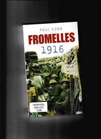
... australian participation This account explores this battle which for many epitomises the futility of the Great War. In the few hours in which it took place many heroic deeds were done but the battle caused a souring of Anglo-Australian relationships and truly was a baptism of fire for these British and Australian troops. Index, bib, ill, maps ...This account explores this battle which for many epitomises the futility of the Great War. In the few hours in which it took place many heroic deeds were done but the battle caused a souring of Anglo-Australian relationships and truly was a baptism of fire for these British and Australian troops.Index, bib, ill, maps, p.329.non-fictionThis account explores this battle which for many epitomises the futility of the Great War. In the few hours in which it took place many heroic deeds were done but the battle caused a souring of Anglo-Australian relationships and truly was a baptism of fire for these British and Australian troops.world war 1914- 1918 - campaigns - western front, western front 1914-1918 - australian participation -
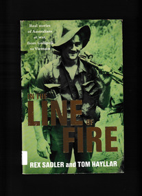 Monbulk RSL Sub Branch
Book, Pan McMillan et al, In the line of fire : real stories of Australians at war, from Gallipoli to Vietnam, 2005
... Australia Sustralia - History - Military In the line of fire' explores the nature of combat from the perspective of the men doing the actual fighting. From the heights of Gallipoli to the trenches of the Western Front, from the deserts of North Africa to the jungle POW camps of the Thai-Burma Railway, from the savage cold of a Korean winter to the steamy heat of Vietnam this book details what it's really like to be in the line of fire. Also it reveals the experiences of Australian women at war and the combat photographers. Index, bibliography, ill, maps ...In the line of fire' explores the nature of combat from the perspective of the men doing the actual fighting. From the heights of Gallipoli to the trenches of the Western Front, from the deserts of North Africa to the jungle POW camps of the Thai-Burma Railway, from the savage cold of a Korean winter to the steamy heat of Vietnam this book details what it's really like to be in the line of fire. Also it reveals the experiences of Australian women at war and the combat photographers.Index, bibliography, ill, maps, p.358.non-fictionIn the line of fire' explores the nature of combat from the perspective of the men doing the actual fighting. From the heights of Gallipoli to the trenches of the Western Front, from the deserts of North Africa to the jungle POW camps of the Thai-Burma Railway, from the savage cold of a Korean winter to the steamy heat of Vietnam this book details what it's really like to be in the line of fire. Also it reveals the experiences of Australian women at war and the combat photographers.military participation - australia, sustralia - history - military -
 Otway Districts Historical Society
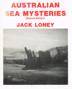
Book, Australian sea mysteries, 1988
... Otway Districts Historical Society Cliff Young Drive Beech Forest great-ocean-road Recalling ships that have explored, traded and plied the waters around the Australian coastline it tells of their changing fortunes, their shipwrecks and their incidents which have added to their sea mysteries. australia; sea; j.k. loney; shipwrecks; oceans; Australian sea mysteries. J.K. Loney. 2nd ed. nl; Marine History Publications; 1988. 116 p.; illus, maps ...Recalling ships that have explored, traded and plied the waters around the Australian coastline it tells of their changing fortunes, their shipwrecks and their incidents which have added to their sea mysteries.Australian sea mysteries. J.K. Loney. 2nd ed. nl; Marine History Publications; 1988. 116 p.; illus, maps, bibliography. Hard cover. ISBN 0 909191 28 Xaustralia; sea; j.k. loney; shipwrecks; oceans; -
 Otway Districts Historical Society
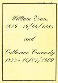
Book - Family History, Doris Robbins, William Evans 1929-19/06/1885 and Catherine Carmody 1833-14/01/1909, 1998
... Australia in 1857. He was appointed Assistant Lighthouse Keeper at Cape Otway Lighthouse in 1858, and married Catherine Carmody on the 14 May,1860. William and Catherine spent 22 years at Cape Otway. From this union, until August 1998, eight generations of children were recorded. The book explores the lives of these children. william evans catherine carmody cape otway lighthouse William Evans (1829-19 Jun 1885) and Catherine Carmody (1833- 14 Jan 1909), Doris Robbins. Self published; Colac (Vic); c.1998. 238 p.; illus, maps ...William Evans, being born in Anglesea, Wales, in 1829, migrated to Australia in 1857. He was appointed Assistant Lighthouse Keeper at Cape Otway Lighthouse in 1858, and married Catherine Carmody on the 14 May,1860. William and Catherine spent 22 years at Cape Otway. From this union, until August 1998, eight generations of children were recorded. The book explores the lives of these children.William Evans (1829-19 Jun 1885) and Catherine Carmody (1833- 14 Jan 1909), Doris Robbins. Self published; Colac (Vic); c.1998. 238 p.; illus, maps. Soft cover.william evans, catherine carmody, cape otway, lighthouse -
 Bendigo Historical Society Inc.
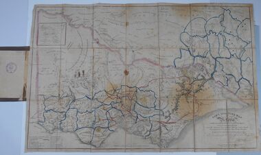
Document - HARRIS COLLECTION: HAMS SQUATTING MAP OF VICTORIA, PORT PHILLIP DISTRICT, NSW
... Australian Alps are still described as 'unsurveyed country'. (State Library Victoria https://www.slv.vic.gov.au/squatting-map-victoria) MAP Victoria squatting map Folding map enclosed in burgundy cover. Map backed by cloth and bound. Rare, early map of Victoria and neighbouring Port Phillip District of New South Wales. Written on bottom RH corner of map: Ham's Squatting Map of Victoria ( Port Phillip District, New South Wales ) carefully corrected to this date from the Colonial Government Surveys, Crown Lands, Commissioners & Explorers ...Thomas Ham was a cartographer, engraver, lithographer and publisher in Victoria and Queensland. He compiled and printed several editions of his squatting map, beginning with A map of Australia Felix in 1847 and changing its title to Ham's squatting map of Victoria in 1851. The 1851 edition was accompanied by a key listing the names of all the squatters within squatting districts and counties. Later editions show the existing counties, but some areas of Gippsland and the Australian Alps are still described as 'unsurveyed country'. (State Library Victoria https://www.slv.vic.gov.au/squatting-map-victoria)Folding map enclosed in burgundy cover. Map backed by cloth and bound. Rare, early map of Victoria and neighbouring Port Phillip District of New South Wales. Written on bottom RH corner of map: Ham's Squatting Map of Victoria ( Port Phillip District, New South Wales ) carefully corrected to this date from the Colonial Government Surveys, Crown Lands, Commissioners & Explorers Maps, Private Surveys & c. Respectfully inscribed (with permission ) to His Excellency Sir Chas A. Fitz-Roy Knt, Governor of New South Wales &c &c by his Obedient Servant, The Compiler, 1851. Compiled, engraved and published by Thomas Ham, Melbourne. Proposed and original boundary ( in legend) have been coloured in in blue and pink ink ( later addition ?) Number on map show 'reference to proprietor's Printed on back of map ' J.G. AD 1852, with two cross hatched decorations and two hearts entwined. On other back panel in pencil enclosed in a drawn frame ' G.S.H., 1889, Axedale' (George Harris, Axedale, belongs in Harris Collection) Stamped in purple ink 'Royal Historical Society of Victoria, Bendigo Branch. Written 1959, 53.map, victoria, squatting map -
 Bendigo Historical Society Inc.
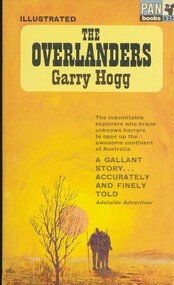
Book - THE OVERLANDERS
... explorers who brave unknown horrors to open up the awesome continent of Australia. Published by Pan books Ltd London, printed by Cox & Wyman Ltd London, softcover 192 pages with black and white illustrations & a map....explorers who brave unknown horrors to open up the awesome continent of Australia. Published by Pan books Ltd London, printed by Cox & Wyman Ltd London, softcover 192 pages with black and white illustrations & a map. ...The Overlanders by Garry Hogg, the indomitable explorers who brave unknown horrors to open up the awesome continent of Australia. Published by Pan books Ltd London, printed by Cox & Wyman Ltd London, softcover 192 pages with black and white illustrations & a map.Garry Hoggbooks, natural history, exploration -
 Bendigo Historical Society Inc.
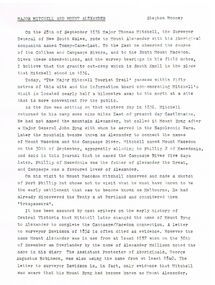
Document - MAJOR MITCHELL AND MOUNT ALEXANDER
... History House 11 Mackenzie Street Bendigo goldfields DOCUMENT Major Mitchell and Mount Alexander Tommy-Came-Last The Major Mitchell Tourist Trail Major General John Byng Phillip of Macedonia Alexander the Great Henty s Surveyor Davidson Alexander Mollison George Augustus Robinson William Morton Mr Charles Hotson Ebden John Randell Public Library of Melbourne Les Blake Governor Burke Phillip Parker King Crown Solicitor Henry Field Gurner Arthur Phillip Hume Australia Felix Expedition L Blake Place Names of Victoria G Brenmer Booklet for Secondary Schools M Cannon Historical Records of Victoria Vol 1 J H L Cumpston Thomas Mitchell Surveyor General and Explorer H F Gurner Chronicle of Port Phillip T L Mitchell Three Expeditions into the Interior of Eastern Australia A F Mollison An Overlanding Diary W L Morton Adventures of a Pioneer M S 5188 Itinerary from the Journal of the Exploring Expedition returning from Portland Bay M S 5189 Mitchell's 1837 Map J O Randell Pastoral Settlement in Northern Victoria Vol 1 Pastoral Settlement in Northern Victoria Vol 2 Records of the Victorian Archaeological Survey Number 5 Journals of George Augustus Robinson T C Sargent Some Peninsular Names in Australia Felix W H Wells A Geographical Dictionary or Gazetteer of the Australian Colonies Typed notes mentioning the naming of Mount Alexander, Coliban, Campaspe and who named them. ...Typed notes mentioning the naming of Mount Alexander, Coliban, Campaspe and who named them. Also the origins of the names.document, major mitchell and mount alexander, tommy-came-last, the major mitchell tourist trail, major general john byng, phillip of macedonia, alexander the great, henty s, surveyor davidson, alexander mollison, george augustus robinson, william morton, mr charles hotson ebden, john randell, public library of melbourne, les blake, governor burke, phillip parker king, crown solicitor henry field gurner, arthur phillip, hume, australia felix expedition, l blake, place names of victoria, g brenmer, booklet for secondary schools, m cannon, historical records of victoria vol 1, j h l cumpston, thomas mitchell surveyor general and explorer, h f gurner, chronicle of port phillip, t l mitchell, three expeditions into the interior of eastern australia, a f mollison, an overlanding diary, w l morton, adventures of a pioneer, m s 5188, itinerary from the journal of the exploring expedition returning from portland bay, m s 5189, mitchell's 1837 map, j o randell, pastoral settlement in northern victoria vol 1, pastoral settlement in northern victoria vol 2, records of the victorian archaeological survey number 5, journals of george augustus robinson, t c sargent, some peninsular names in australia felix, w h wells, a geographical dictionary or gazetteer of the australian colonies -
 Bendigo Historical Society Inc.
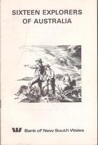
Book - SIXTEEN EXPLORERS OF AUSTRALIA, Feb. 1977
... Booklet. 17 page booklet giving one-page stories of exploration of Australia with drawings and maps. Explorers are Abel Tasman, James Cook, George Bass, Matthew Flinders, Gregory Blaxland, John Oxley, Phillip Parker King, Charles Sturt, Thomas Mitchell, Edward Eyre, Ludwig Leichhardt, Augustus Charles Gregory, Edmund Kennedy, Robert O'Hara Burke, John McDouall Stuart, John Forrest. ...Australian explorers history. Bank of NSW Booklet. 17 page booklet giving one-page stories of exploration of Australia with drawings and maps. ...Booklet. 17 page booklet giving one-page stories of exploration of Australia with drawings and maps. Explorers are Abel Tasman, James Cook, George Bass, Matthew Flinders, Gregory Blaxland, John Oxley, Phillip Parker King, Charles Sturt, Thomas Mitchell, Edward Eyre, Ludwig Leichhardt, Augustus Charles Gregory, Edmund Kennedy, Robert O'Hara Burke, John McDouall Stuart, John Forrest. Published by the Bank of NSW and printed by Sydney Allen Printers P/L, Rydalmere, NSW.Bank of NSWhistory, australian, australian explorers, history. -
 Flagstaff Hill Maritime Museum and Village
Map - World Map, Mappe Monde [Medieval Map of the World], 1910
... map is significant for its connection with early world explorers. A comparison of maps over the centuries shows the progression of navigational technology, the countries who claimed the land they explored. The naming of even some Australian ...This map from the mid-18th century doesn't include the finer details of land and sea masses that we know today. The map was produced by German cartographer and publisher, Johann Baptist Homann (1663-1724) and published in 1746, after his death. Earlier versions were published, such as 1707 and 1716. The date can be calculated from the Roman numerals on the top left text area. This print of a map is significant for its connection with early world explorers. A comparison of maps over the centuries shows the progression of navigational technology, the countries who claimed the land they explored. The naming of even some Australian locations shows who had already made their mark on Australia in the early 18th century. The print shows the fine details included by the cartographer and the beauty included that makes it attractive and interesting even today. The map is also significant for its connection with German cartographer, Johann Baptist Homann, whose Homann publishing company was renewed in Germany for producing high quality maps and atlases. Map behind glass in dark brown wooden frame on beige paper. The Coloured hand drawn line drawings show different hemispheres of the known world in the mid-18th century. Beautifully drawn figures and decorative embellishments enhance the map. The text on the top right has an explanation of the Figures I, II, III, and IV. This print of the 1746 map was produced in England by Leisure Arts Ltd. "PLANIGLOBIL TERRESTRIS" "MDCCXXXXVI" [1746] "MAPPE_MONDE" [Medieval Map of the World] "LEISURE ARTS LTD" "Printed in England"flagstaff hill, warrnambool, flagstaff hill maritime museum, flagstaff hill maritime village, flagstaff hill maritime museum and village, shipwreck coast, world map, french map, 18th century map, leisure arts ltd, cartography, early exploration, cartographer, johann homann (1663-1724), exploration, naviagtion, 1746 planiglobil terrestris -
 Orbost & District Historical Society
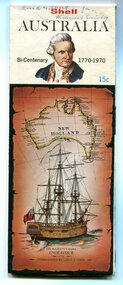
map, Shell Australia, 1970
... This Shell road map was made as part of the 200 year celebration of Captain James Cook's voyage on the HM Endeavour and the first sighting of Australia at Point Hicks in 1770. The Bicentenary of James Cook in Australia was commemorated in Australia in 1970. The British explorer...Orbost & District Historical Society Ruskin Street Orbost gippsland This Shell road map was made as part of the 200 year celebration of Captain James Cook's voyage on the HM Endeavour and the first sighting of Australia at Point Hicks in 1770. The Bicentenary of James Cook in Australia was commemorated in Australia in 1970. The British explorer ...This Shell road map was made as part of the 200 year celebration of Captain James Cook's voyage on the HM Endeavour and the first sighting of Australia at Point Hicks in 1770. The Bicentenary of James Cook in Australia was commemorated in Australia in 1970. The British explorer Lieutenant (later Captain) James Cook sailed and charted the East Coast of Australia in 1770, and claimed the eastern seaboard of the Continent for the British Crown. This was not considered the official bicentenary of Australia, but rather the mapping of the Eastern coastline. This item reflects the commemoration of a significant event in Australian history.A coloured foldout touring map of Australia with a picture of James Cook and the ship, Endeavour, on the front.map-australia bicentennial-cook-1970 -
 Orbost & District Historical Society
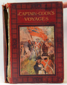
book, Cassell and Company Limited, Captain Cook's Voyages, 1908
... explorer, navigator, cartographer, and captain in the Royal Navy. Cook made detailed maps of Newfoundland prior to making three voyages to the Pacific Ocean, during which he achieved the first recorded European contact with the eastern coastline of Australia and the Hawaiian Islands, and the first recorded circumnavigation of New Zealand....explorer, navigator, cartographer, and captain in the Royal Navy. Cook made detailed maps of Newfoundland prior to making three voyages to the Pacific Ocean, during which he achieved the first recorded European contact with the eastern coastline of Australia and the Hawaiian Islands, and the first recorded circumnavigation of New Zealand. ...James Cook was a British explorer, navigator, cartographer, and captain in the Royal Navy. Cook made detailed maps of Newfoundland prior to making three voyages to the Pacific Ocean, during which he achieved the first recorded European contact with the eastern coastline of Australia and the Hawaiian Islands, and the first recorded circumnavigation of New Zealand.Cook's 12 years sailing around the Pacific Ocean contributed much to European knowledge of the area. This is a useful reference book.A 446pp hard back book titled, "Captain Cook's Voyages" in gold print. It has a black and red cover with a coloured illustration of the landing of James Cook, his crew and the planting of the British red ensign. It has coloured illustrations. Includes Aboriginal encounters with explorers. inside cover - :To Fred from his mother, mas 1910" -
 Flagstaff Hill Maritime Museum and Village
Document
... 1) Large map of Australia with information on explorers, navigators etc involved in its discovery. ...Flagstaff Hill Maritime Museum and Village 89 Merri Street Warrnambool great-ocean-road flagstaff hill warrnambool shipwrecked-coast flagstaff-hill flagstaff-hill-maritime-museum maritime-museum shipwreck-coast flagstaff-hill-maritime-village 1) Large map of Australia with information on explorers, navigators etc involved in its discovery. ...1) Large map of Australia with information on explorers, navigators etc involved in its discovery. Title "The Discovery of Australia by Western Man" 2) Poster which explains in full information formulated on .1 Also gives in great detail natural history information relevant to the formation of the Australian continent.flagstaff hill, warrnambool, shipwrecked-coast, flagstaff-hill, flagstaff-hill-maritime-museum, maritime-museum, shipwreck-coast, flagstaff-hill-maritime-village -
 Flagstaff Hill Maritime Museum and Village
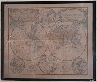
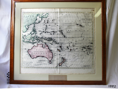
Map, Australien (Sudland) auch Polynesien oder Inselwelt, insgemein der funfte Welltheil, c.1990
... maps, many of which were reprinted after his death in 1816. This reprint of an 1802 is significant for its historical and geographical contant, showing the voyages of many early explorers to the southern regions of the world including Australia. ...This map is a reprint of Johann (Johannes) Walch’s “Australien (Sudland) auch Polynesien oder Inselwelt, insgemein der funfte Welltheil”, published in 1802. It shows Australia, New Zealand, South East Asia and the Pacific Islands shows a large number of places names, many of which have changed since the map was drawn. The map includes the routes and dates of the voyages of Tasman, Cook, Bougainville, Carteret, Byron, and others up to 1802. The shapes of the lands on this early map show that some of the areas had not yet been charted. The map was donated to Flagstaff Hill Maritime Village in April 1990 by the Group Study Exchange Team from Rotary District 233, Sweden. It was framed and presented by Rotary District 978 and presented by Barry Lange, the Governor of District 978 in 1989-90. (District 978, Geelong East, is now District 9780.) Johann (Johannes) Walch Johann Walch, painter and engraver, was born in 1757. He was well known for creating miniature portraits. He gained his training in Geneva, Venice and Rome. His publications include atlases and sheet maps, many of which were reprinted after his death in 1816. This reprint of an 1802 is significant for its historical and geographical contant, showing the voyages of many early explorers to the southern regions of the world including Australia. It also shows the early names used for countries and towns and is a valuable reference to historical interpretation. The map itself is a fine example of hand drawn and hand coloured maps of the early 19th century, the method of production, detail included, layout, symbols and so forth.Map, reprint of Johann (Johannes) Walch’s “Australien (Sudland) auch Polynesien oder Inselwelt, insgemein der funfte Welltheil “, first published by in Ausburg in 1802. The image on this Map No 5B, shows Australia and the south Pacific. The timber framed, glass covered, printed and coloured map was created in two sections and joined. Brass plaque at base of map states that the map was presented to Flagstaff Hill by Rotary International in April 1990. Feint lines used for aligning lettering can be seen on the map and there are large erased letters such as a “D” and “S” that are almost obscured.Plague “ROTARY INTERNATIONAL / THE MAP WAS DONATED BY THE GROUP STUDY EXCHANGE TEAM / FROM ROTARY DISTRICT 233 SWEDEN IN APRIL 1990 / AND WAS FRAMED AND PRESENTED BY ROTARY DISTRICT 978 / BARRY LANGE – GOVERNOR DISTRICT 978 1989/90” Stamped on back “ELLIMINOOK FRAMES / MRS. JILL FALKINER / ELLIMINOOK / BIRREGURRA, VIC. 3242 / PHONE: (052) 36 2080” flagstaff hill, warrnambool, shipwrecked coast, flagstaff hill maritime museum, maritime museum, shipwreck coast, flagstaff hill maritime village, great ocean road, australien (sudland) auch polynesien oder inselwelt, insgemein der funfte welltheil, johann (johannes) walch, cartographer johann (johannes) walch, ausburg publisher johann (johannes) walch, johann (johannes) walch map number 5b, 1802 map of australia and south pacific, rotary international group study exchange team, rotary district 233 sweden, elliminook frames, voyages of tasman, voyages of cook, voyages of bougainville, voyages of carteret, voyages of byron, barry lange, painter of miniature portraits johann (johannes) walch -
 Narre Warren and District Family History Group
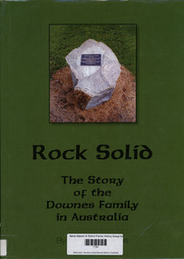
Book, Graham Downes, Rock solid : the story of the Downes family in Australia, 2013
... Australia. The book explores the life of Timothy Downes (1794–1894) and his descendants, detailing their experiences, challenges, and contributions to Australian society. It includes maps ...A genealogical and historical account of the Downes family, tracing their roots from Ireland to Australia. The book explores the life of Timothy Downes (1794–1894) and his descendants, detailing their experiences, challenges, and contributions to Australian society. It includes maps, portraits, and genealogical tables to provide a comprehensive view of the family's journey.144, 187 pages : illustrations, maps, portraits, genealogical tables ; 30 cmnon-fictionA genealogical and historical account of the Downes family, tracing their roots from Ireland to Australia. The book explores the life of Timothy Downes (1794–1894) and his descendants, detailing their experiences, challenges, and contributions to Australian society. It includes maps, portraits, and genealogical tables to provide a comprehensive view of the family's journey.timothy downes (c1794-1894), downes family, st. james (vic.), ellen goodwin -
 Narre Warren and District Family History Group
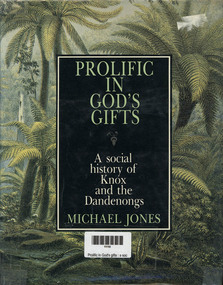
Book, MA Jones, Prolific in God's gifts : a social history of Knox and the Dandenongs, 1983
... Australia. The book explores the area's development from the arrival of the first pastoralists to its transformation into part of urban Melbourne. It highlights key figures such as James Clow, a clergyman and pastoralist, and John Wood Beilby, an explorer and speculator. The book also discusses the region's early agricultural struggles, the impact of the railway, and its emergence as one of Australia's first tourist destinations. Richly illustrated with photographs and maps ...a detailed historical account of the Knox and Dandenong regions in Victoria, Australia. The book explores the area's development from the arrival of the first pastoralists to its transformation into part of urban Melbourne. It highlights key figures such as James Clow, a clergyman and pastoralist, and John Wood Beilby, an explorer and speculator. The book also discusses the region's early agricultural struggles, the impact of the railway, and its emergence as one of Australia's first tourist destinations. Richly illustrated with photographs and maps, it provides a vivid picture of the area's history through original newspaper excerpts and documents. [AI generated text]328 p.; 24 cmnon-fictiona detailed historical account of the Knox and Dandenong regions in Victoria, Australia. The book explores the area's development from the arrival of the first pastoralists to its transformation into part of urban Melbourne. It highlights key figures such as James Clow, a clergyman and pastoralist, and John Wood Beilby, an explorer and speculator. The book also discusses the region's early agricultural struggles, the impact of the railway, and its emergence as one of Australia's first tourist destinations. Richly illustrated with photographs and maps, it provides a vivid picture of the area's history through original newspaper excerpts and documents. [AI generated text]knox (vic.), dandenongs -
 Victorian Railway History Library
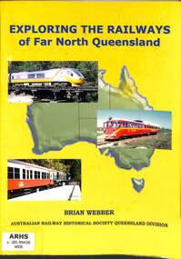
Book, Webber, Brian, Exploring The Railways of Far North Queensland, 2004
... maps, p.64. Exploring The Railways of Far North Queensland Book Webber, Brian Australian Railway Historical Society - Queensland Division ...A pictorial history of the railways around Cairns in Far North Queensland.ill, maps, p.64.non-fictionA pictorial history of the railways around Cairns in Far North Queensland.railroad construction - queensland - history, railroad operations - queensland - history -
 Victorian Railway History Library
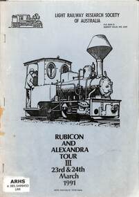
Booklet, Evans, Peter, Rubicon And Alexandra Tour III, 1991
... Victorian Railway History Library 39 St Edmonds Rd Prahran Prahran Timber tramways - Australia - history narrow gauge railroads - Australia - history A tour program for a trip to Rubicon and Alexandra areas of Victoria exploring narrow gauge tramways in the area on the 23 & 24-03-91. ill, maps, p.36. ...A tour program for a trip to Rubicon and Alexandra areas of Victoria exploring narrow gauge tramways in the area on the 23 & 24-03-91.ill, maps, p.36.non-fictionA tour program for a trip to Rubicon and Alexandra areas of Victoria exploring narrow gauge tramways in the area on the 23 & 24-03-91.timber tramways - australia - history, narrow gauge railroads - australia - history -
 Victorian Railway History Library
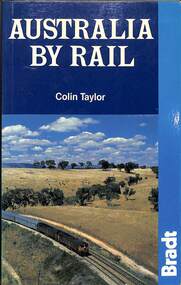
Book, Taylor, Colin, Australia By Rail, 1988
... Australia's railways offer a rich variety of contrasting experiences. Taking the train is an ideal way to explore the continent in comfort and style. Features include: fully revised fifth edition- updated and expanded: with seventy maps including the new Ghan extension to Darwin, rail travel for all budgets--from the five-star luxury of the Great South Pacific Express to economy sleeping berths for budget-conscious travellers, plus full details of the Austrailpass and other passes and ticket bargains, railway route guides with seventy rail maps--all main lines and branches, what to look out for when travelling, and where to stop, railway history--and the battle for the survival of rail in Australia, city guides and maps--the best sights, recommended hotels, and restaurants in many stops along the lines; with extensive sections on Sydney, Melbourne, Brisbane, Adelaide, Perth, Darwin, and Canberra. ill, maps, p.144. ...From the vast emptiness of the Nullarbor Plain, on the longest straight rail line in the world, to the twisting tracks of outback Queensland and the rainforests of the north, Australia's railways offer a rich variety of contrasting experiences. Taking the train is an ideal way to explore the continent in comfort and style. Features include: fully revised fifth edition- updated and expanded: with seventy maps including the new Ghan extension to Darwin, rail travel for all budgets--from the five-star luxury of the Great South Pacific Express to economy sleeping berths for budget-conscious travellers, plus full details of the Austrailpass and other passes and ticket bargains, railway route guides with seventy rail maps--all main lines and branches, what to look out for when travelling, and where to stop, railway history--and the battle for the survival of rail in Australia, city guides and maps--the best sights, recommended hotels, and restaurants in many stops along the lines; with extensive sections on Sydney, Melbourne, Brisbane, Adelaide, Perth, Darwin, and Canberra.ill, maps, p.144.non-fictionFrom the vast emptiness of the Nullarbor Plain, on the longest straight rail line in the world, to the twisting tracks of outback Queensland and the rainforests of the north, Australia's railways offer a rich variety of contrasting experiences. Taking the train is an ideal way to explore the continent in comfort and style. Features include: fully revised fifth edition- updated and expanded: with seventy maps including the new Ghan extension to Darwin, rail travel for all budgets--from the five-star luxury of the Great South Pacific Express to economy sleeping berths for budget-conscious travellers, plus full details of the Austrailpass and other passes and ticket bargains, railway route guides with seventy rail maps--all main lines and branches, what to look out for when travelling, and where to stop, railway history--and the battle for the survival of rail in Australia, city guides and maps--the best sights, recommended hotels, and restaurants in many stops along the lines; with extensive sections on Sydney, Melbourne, Brisbane, Adelaide, Perth, Darwin, and Canberra.railroad travel -- australia -- guidebooks, railroad travel -- australia -
 Victorian Railway History Library
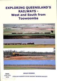
Book, Webber, Brian, Exploring Queensland's Railways - West and South from Toowoomba, 2015
... maps, p.160. Exploring Queensland's Railways - West and South from Toowoomba Book Webber, Brian The Australian Narrow Gauge Railway Museum Society ...A description of the railways west and south of the city of Toowoomba in Queensland in 2015.Ill, maps, p.160.non-fictionA description of the railways west and south of the city of Toowoomba in Queensland in 2015.railroads - queensland - history, railroad travel -- queensland, south west