Historical information
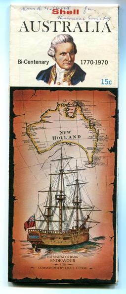
This Shell road map was made as part of the 200 year celebration of Captain James Cook's voyage on the HM Endeavour and the first sighting of Australia at Point Hicks in 1770.
The Bicentenary of James Cook in Australia was commemorated in Australia in 1970. The British explorer Lieutenant (later Captain) James Cook sailed and charted the East Coast of Australia in 1770, and claimed the eastern seaboard of the Continent for the British Crown. This was not considered the official bicentenary of Australia, but rather the mapping of the Eastern coastline.
Significance
This item reflects the commemoration of a significant event in Australian history.
Physical description
A coloured foldout touring map of Australia with a picture of James Cook and the ship, Endeavour, on the front.