Showing 44 items matching "gazetteer"
-
 Port Melbourne Historical & Preservation Society
Book, Louis L Holzer, Victorian Municipal Directory and Gazetteer, Jun 1951
... Victorian Municipal Directory and Gazetteer......gazetteer...Victorian Municipal Directory and Gazetteer, 1951. Gold cover, green spine binding. ...Victorian Municipal Directory and Gazetteer, 1951. Gold cover, green spine binding. ...Was originally owned by Mr W S Lang who was a city valuer of Port MelbourneVictorian Municipal Directory and Gazetteer, 1951. Gold cover, green spine binding. Spine and cover of book is fairly wornNames and writing on the front cover in pencil.waterworks, utilities - water, gazetteer -
 Kilmore Historical Society
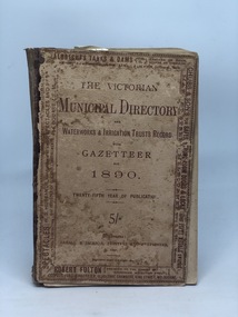
VICTORIAN MUNICIPAL DIRECTORY 1890, Victorian Municipal Directory and Waterworks & Irrigation Trusts Records with Gazetteer for 1890, 1890
... Victorian Municipal Directory and Waterworks & Irrigation Trusts Records with Gazetteer for 1890......Gazetteer...Faded cloth and cardboard cover, loose front cover With printed detailing on cover and spine 'The Victorian Municipal Directory & Gazetteer twenty fifth year of issue' xxiv; 770 pages ; 18cm...Kilmore Historical Society 4 Powlett Street Kilmore daylesford-and-the-macedon-ranges Municipal Directory Gazetteer 1890 Kilmore Mechanics Institute Library. ...Faded cloth and cardboard cover, loose front cover With printed detailing on cover and spine 'The Victorian Municipal Directory & Gazetteer twenty fifth year of issue' xxiv; 770 pages ; 18cmmunicipal directory, gazetteer, 1890, kilmore mechanics institute library. -
 Glenelg Shire Council Cultural Collection
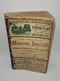
Book - Waterworks and irrigation trust record with Gazetteer 1891, Arnall & Jackson Printers and Stationers, The Victorian Municipal Directory waterworks and irrigation trust record with Gazetteer 1891, 1891
... The Victorian Municipal Directory waterworks and irrigation trust record with Gazetteer 1891......Gazetteer...Book detailing the Victorian Municipal Directory waterworks and irrigation trust record with Gazetteer 1891. The book is 575 pages long however this is multiple pre pages of the numbered pages featuring advertising of various enterprises and a prelude section numbered in roman numerals. ...Cover middle: The Victorian Municipal Directory waterworks and irrigation trust record with Gazetteer 1891 Twenty-sixth year of publication, registered under (missing texts) Arnall & Jackson, Printers & Station (text missing) Street, Melbourne. ...The Victorian Municipal Directory waterworks and irrigation trust record with Gazetteer 1891 Book Waterworks and irrigation trust record with Gazetteer 1891 Arnall & Jackson Printers and Stationers ...A reference text of Victorian waterworks and irrigation trusts in Victoria Australia 1891.Book detailing the Victorian Municipal Directory waterworks and irrigation trust record with Gazetteer 1891. The book is 575 pages long however this is multiple pre pages of the numbered pages featuring advertising of various enterprises and a prelude section numbered in roman numerals. The book has a dark brown binding, cream front and back with dark green and brown text. Front cover is divided into 3 sections the top portion is an ad for Tangyes Limited Pumping Plant, the middle is the books title and the bottom is an Tangyes Limited Steam engines.A reference text of Victorian waterworks and irrigation trusts in Victoria Australia 1891.victorian municipal directory, gazetteer, waterworks, irrigation, 1891 -
 Flagstaff Hill Maritime Museum and Village
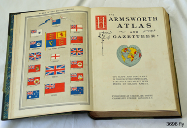
Book, Harmsworth Atlas and Gazetteer, 1908
... Harmsworth Atlas and Gazetteer...This Harmsworth Atlas and Gazetteer was inherited by one of the donors, a gift from her father who was Tasmanian....The cover is green linen with green leather, gilt trimmed corners and decorative spine, It includes 500 maps and diagrams in colour, with commercial statistics and gazetteer index of 105,000 names. Jan 1908. Also inserted between the pages of the book were 2 folded sheets of waxed paper, each with carefully placed flowers pressed between them; native orchids and wattle. ...Flagstaff Hill Maritime Museum and Village 89 Merri Street Warrnambool great-ocean-road This Harmsworth Atlas and Gazetteer was inherited by one of the donors, a gift from her father who was Tasmanian. flagstaff hill warrnambool shipwrecked coast flagstaff hill maritime museum maritime museum shipwreck coast flagstaff hill maritime village great ocean road harmsworth atlas and gazetteer atlas 1908 maps 1908 gazetteer 1908 book 1908 pressed australian native flowers pressed wattle pressed orchid Large hard covered book with maps, charts and tables. ...This Harmsworth Atlas and Gazetteer was inherited by one of the donors, a gift from her father who was Tasmanian.Large hard covered book with maps, charts and tables. The cover is green linen with green leather, gilt trimmed corners and decorative spine, It includes 500 maps and diagrams in colour, with commercial statistics and gazetteer index of 105,000 names. Jan 1908. Also inserted between the pages of the book were 2 folded sheets of waxed paper, each with carefully placed flowers pressed between them; native orchids and wattle. Published at Carmelite House, Carmelite Road, London flagstaff hill, warrnambool, shipwrecked coast, flagstaff hill maritime museum, maritime museum, shipwreck coast, flagstaff hill maritime village, great ocean road, harmsworth atlas and gazetteer, atlas 1908, maps 1908, gazetteer 1908, book 1908, pressed australian native flowers, pressed wattle, pressed orchid -
 Eltham District Historical Society Inc
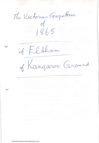
Folder, The Victorian Gazetteer of 1865. Entries for Eltham and Kangaroo Ground, 1999
... The Victorian Gazetteer of 1865. Entries for Eltham and Kangaroo Ground......gazetteer...The Gazetteer is a geographical dictionary or directory for place names in Victoria. ...Eltham District Historical Society Inc 728 Main Rd Eltham melbourne The Gazetteer is a geographical dictionary or directory for place names in Victoria. ...The Gazetteer is a geographical dictionary or directory for place names in Victoria. Entries for Eltham and Kangaroo Ground have been photocopied. These entries provide physical descriptions, some description of local industry and amenities and more at the time of publication in 1865.3 pages. Copies HG Booklet 118harry gilham collection, gazetteer, eltham, kangaroo ground, 1865 -
 Flagstaff Hill Maritime Museum and Village
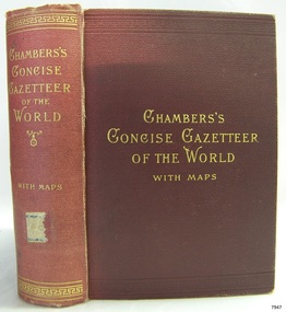
Book, Chambers Concise Gazetteer of The World
... Chambers Concise Gazetteer of The World...Chambers Concise Gazetteer of The World Topographical, Statistical, Historical Publisher: W & R Chambers Date: 1895...Pastedown front endpaper has sticker from Warrnambool Mechanics Institute and Free Library covered by a sticker from Corangamite Regional Library Service Fly paper has stamps from both Warrnambool Public Museum and Corangamite Regional Library Service Chambers Concise Gazetteer of The World Topographical, Statistical, Historical Publisher: W & R Chambers Date: 1895 Chambers Concise Gazetteer of The World Book ...This item is from the ‘Pattison Collection’, a collection of books and records that was originally owned by the Warrnambool Mechanics’ Institute, which was founded in Warrnambool in 1853. By 1886 the Warrnambool Mechanics’ Institute (WMI) had grown to have a Library, Museum and Fine Arts Gallery, with a collection of “… choice productions of art, and valuable specimens in almost every branch and many wonderful national curiosities are now to be seen there, including historic relics of the town and district.” It later included a School of Design. Although it was very well patronised, the lack of financial support led the WMI in 1911 to ask the City Council to take it over. In 1935 Ralph Pattison was appointed as City Librarian to establish and organise the Warrnambool Library as it was then called. When the WMI building was pulled down in 1963 a new civic building was erected on the site and the new Warrnambool Library, on behalf of the City Council, took over all the holdings of the WMI. At this time some of the items were separated and identified as the ‘Pattison Collection’, named after Ralph Pattison. Eventually the components of the WMI were distributed from the Warrnambool Library to various places, including the Art Gallery, Historical Society and Flagstaff Hill. Later some were even distributed to other regional branches of Corangamite Regional Library and passed to and fro. It is difficult now to trace just where all of the items have ended up. The books at Flagstaff Hill Maritime Village generally display stamps and markings from Pattison as well as a variety of other institutions including the Mechanics’ Institute itself. RALPH ERIC PATTISON Ralph Eric Pattison was born in Rockhampton, Queensland, in 1891. He married Maude Swan from Warrnambool in 1920 and they set up home in Warrnambool. In 1935 Pattison accepted a position as City Librarian for the Warrnambool City Council. His huge challenge was to make a functional library within two rooms of the Mechanics’ Institute. He tirelessly cleaned, cleared and sorted a disarrayed collection of old books, jars of preserved specimens and other items reserved for exhibition in the city’s museum. He developed and updated the library with a wide variety of books for all tastes, including reference books for students; a difficult task to fulfil during the years following the Depression. He converted all of the lower area of the building into a library, reference room and reading room for members and the public. The books were sorted and stored using a cataloguing and card index system that he had developed himself. He also prepared the upper floor of the building and established the Art Gallery and later the Museum, a place to exhibit the many old relics that had been stored for years for this purpose. One of the treasures he found was a beautiful ancient clock, which he repaired, restored and enjoyed using in his office during the years of his service there. Ralph Pattison was described as “a meticulous gentleman whose punctuality, floorless courtesy and distinctive neat dress were hallmarks of his character, and ‘his’ clock controlled his daily routine, and his opening and closing of the library’s large heavy doors to the minute.” Pattison took leave during 1942 to 1945 to serve in the Royal Australian Navy, Volunteer Reserve as Lieutenant. A few years later he converted one of the Museum’s rooms into a Children’s Library, stocking it with suitable books for the younger generation. This was an instant success. In the 1950’s he had the honour of being appointed to the Victorian Library Board and received more inspiration from the monthly conferences in Melbourne. He was sadly retired in 1959 after over 23 years of service, due to the fact that he had gone over the working age of council officers. However he continued to take a very keen interest in the continual development of the Library until his death in 1969. The Pattison Collection, along with other items at Flagstaff Hill Maritime Village, was originally part of the Warrnambool Mechanics' Institute’s collection. The Warrnambool Mechanics’ Institute Collection is primarily significant in its totality, rather than for the individual objects it contains. Its contents are highly representative of the development of Mechanics' Institute libraries across Australia, particularly Victoria. A diversity of publications and themes has been amassed, and these provide clues to our understanding of the nature of and changes in the reading habits of Victorians from the 1850s to the middle of the 20th century. The collection also highlights the Warrnambool community’s commitment to the Mechanics’ Institute, reading, literacy and learning in the regions, and proves that access to knowledge was not impeded by distance. These items help to provide a more complete picture of our community’s ideals and aspirations. The Warrnambool Mechanics Institute book collection has historical and social significance for its strong association with the Mechanics Institute movement and the important role it played in the intellectual, cultural and social development of people throughout the latter part of the nineteenth century and the early twentieth century. The collection of books is a rare example of an early lending library and its significance is enhanced by the survival of an original collection of many volumes. The Warrnambool Mechanics' Institute’s publication collection is of both local and state significance. Chambers Concise Gazetteer of The World Topographical, Statistical, Historical Publisher: W & R Chambers Date: 1895Label on spine cover with typed text PAT ? ? Pastedown front endpaper has sticker from Warrnambool Mechanics Institute and Free Library covered by a sticker from Corangamite Regional Library Service Fly paper has stamps from both Warrnambool Public Museum and Corangamite Regional Library Servicewarrnambool, shipwrecked-coast, flagstaff-hill, flagstaff-hill-maritime-museum, maritime-museum, shipwreck-coast, flagstaff-hill-maritime-village, shipwrecked-artefact, book, pattison collection, warrnambool library, warrnambool mechanics’ institute, ralph eric pattison, corangamite regional library service, warrnambool city librarian, mechanics’ institute library, victorian library board, warrnambool books and records, warrnambool children’s library, great ocean road, chambers concise gazetteer of the world -
 Federation University Historical Collection
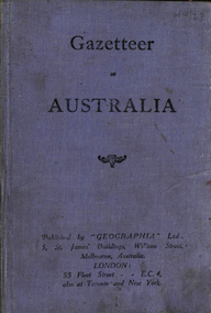
Book, Geographia Ltd, Gazetteer of Australia by Alexander Gross
... Gazetteer of Australia by Alexander Gross......gazetteer...Indicates the location of each place australia gazetteer alexander gross place names Hardcover book of 149 pages Gazetteer of Australia by Alexander Gross Book Geographia Ltd ...List of place names of Australia. Indicates the location of each place Hardcover book of 149 pagesaustralia, gazetteer, alexander gross, place names -
 Kew Historical Society Inc
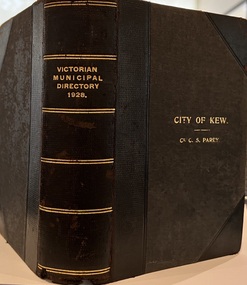
Journal, Arnall & Jackson: Printers & Stationers, Victorian Municipal Directory and Gazetteer : Also Commonwealth Guide and the Water Supply Record for 1928
... Victorian Municipal Directory and Gazetteer : Also Commonwealth Guide and the Water Supply Record for 1928...Bound copy of the Victorian Municipal Directory and Gazetteer: Also Commonwealth Guide and the Water Supply Record for 1928. ...Bound copy of the Victorian Municipal Directory and Gazetteer: Also Commonwealth Guide and the Water Supply Record for 1928. ...The Victorian Municipal Directory provided annual details, and later bi-annual details, of all councils. Published by Arnall & Jackson (Printers and Stationers), copies were published in 'cloth' for sixteen shillings and 'half roan' for eighteen shillings. This copy was owned by Cr C.S.Parry. Elected to the Kew City Council as a representative of North Ward, Cr Parry was elevated to the position of Mayor in 1931. It, together with five other editions, was presented to the Kew Historical Society in 1987 by his grandson.Bound copy of the Victorian Municipal Directory and Gazetteer: Also Commonwealth Guide and the Water Supply Record for 1928. The volume contains 846 pages and includes sections on: - Comparative table – Municipal Returns for Twenty-one Years. - Index to Townships, Parishes and Railway Stations. - Changes and appointments. - Commonwealth of Australia (Constitution, Parliament, Departments and Officers). - State of Victoria (Parliament, Departments and Officers / Boards, Institutions, Trusts and Loans). - Municipalities in Victoria (Cities and Towns, Boroughs, Shires). - Water Supply (State Rivers and Water Supply Commission).non-fictionThe Victorian Municipal Directory provided annual details, and later bi-annual details, of all councils. Published by Arnall & Jackson (Printers and Stationers), copies were published in 'cloth' for sixteen shillings and 'half roan' for eighteen shillings. This copy was owned by Cr C.S.Parry. Elected to the Kew City Council as a representative of North Ward, Cr Parry was elevated to the position of Mayor in 1931. It, together with five other editions, was presented to the Kew Historical Society in 1987 by his grandson. victoria -- registers -- periodicals., victoria -- directories., water-supply -- victoria -- directories., municipal government -- victoria -- periodicals., cities and towns -- victoria -- directories. -
Clunes Museum
Book - MUNICIPAL DIRECTORY 1888, ARNELL & JACKSON, 1888
... THIS GAZETTEER CONTAINS INFORMATION ON VICTORIAN CITIES, TOWNS, BOROUGHS, SHIRES & VILLAGES, IN 1888, THE COUNCILLORS AND OFFICE BEARERS AND HISTORY OF EACH TOWN, SHIRE & BOROUGHS. ...THE VICTORIAN MUNICIPAL DIRECTORY AND GAZETTEER FOR 1888....CLUNES BOROUGH PAGE 137 local history document municipal directory history shire THE VICTORIAN MUNICIPAL DIRECTORY AND GAZETTEER FOR 1888. Book MUNICIPAL DIRECTORY 1888 ARNELL & JACKSON ...THIS GAZETTEER CONTAINS INFORMATION ON VICTORIAN CITIES, TOWNS, BOROUGHS, SHIRES & VILLAGES, IN 1888, THE COUNCILLORS AND OFFICE BEARERS AND HISTORY OF EACH TOWN, SHIRE & BOROUGHS. POPULATION, AREA, ANNUAL RATES, TRANSPORT & REVENUE, ALSO MEDICAL & POSTAL NOTES, ETC. CLUNES BOROUGH PAGE 137THE VICTORIAN MUNICIPAL DIRECTORY AND GAZETTEER FOR 1888.local history, document, municipal directory, history, shire -
 Greensborough Historical Society
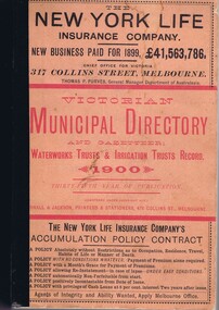
Book - Directory, Arnall and Jackson, Victorian Municipal Directory and Gazetteer 1900, 1900
... Victorian Municipal Directory and Gazetteer 1900...Victorian Municipal Directory and Gazetteer 1900 Book Directory Arnall and Jackson ...A compilation of facts and figures of the local government areas in Victoria in 1900.659 p., text.non-fictionA compilation of facts and figures of the local government areas in Victoria in 1900.municipal directories, gazetteers, local government, victoria history -
 Eltham District Historical Society Inc
Folder, Victorian Municipal Directory and Gazetteer: and also Commonwealth Guide and the water Supply records for 1936, 1936
... Victorian Municipal Directory and Gazetteer: and also Commonwealth Guide and the water Supply records for 1936...Victorian Municipal Directory and Gazetteer: and also Commonwealth Guide and the water Supply records for 1936 Folder ...Includes municipal information about the Shire including brief history, parishes, political boundaries and names of representatives, statistics, Councilors, Officers, names of places and descriptions. Also includes part one for Euroa Shire and last page for Shire of East Lodden.3 pages. Photocopy relating to Eltham Shire. Includes title page and pages 568-571.HG Booklet 25harry gilham collection, councilors, directory, towns, 1936, shire of eltham -
 Narre Warren and District Family History Group
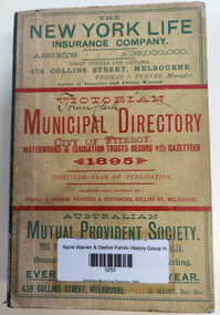
Book, Arnall & Jackson, Victorian municipal directory : and waterworks & irrigation trusts record with gazetteer for 1895, 1895
... Victorian municipal directory : and waterworks & irrigation trusts record with gazetteer for 1895....Victorian municipal directory : and waterworks & irrigation trusts record with gazetteer for 1895. Book Arnall & Jackson ...A guide to municipalities, waterworks and irrigation trusts throughout the state. Names of of councilors and council officers together with information about towns in the area.xvi, 672 pages ; 19 cm.non-fictionA guide to municipalities, waterworks and irrigation trusts throughout the state. Names of of councilors and council officers together with information about towns in the area. local government -- victoria -- directories, victoria -- directories -
Narre Warren and District Family History Group
Book, Arnall & Jackson, Victorian municipal directory : and waterworks & irrigation trusts record with gazetteer for 1919, 1895
... Victorian municipal directory : and waterworks & irrigation trusts record with gazetteer for 1919...Victorian municipal directory : and waterworks & irrigation trusts record with gazetteer for 1919 Book Arnall & Jackson ...A guide to municipalities, waterworks and irrigation trusts throughout the state. Names of of councilors and council officers together with information about towns in the area.xvi, 742 pages ; 19 cm.non-fictionA guide to municipalities, waterworks and irrigation trusts throughout the state. Names of of councilors and council officers together with information about towns in the area. local government -- victoria -- directories, victoria -- directories -
Narre Warren and District Family History Group
Book, Arnall & Jackson, Victorian municipal directory : and waterworks & irrigation trusts record with gazetteer for 1949, 1895
... Victorian municipal directory : and waterworks & irrigation trusts record with gazetteer for 1949...Victorian municipal directory : and waterworks & irrigation trusts record with gazetteer for 1949 Book Arnall & Jackson ...A guide to municipalities, waterworks and irrigation trusts throughout the state. Names of of councilors and council officers together with information about towns in the area.v,1082 pages ; 19 cm.non-fictionA guide to municipalities, waterworks and irrigation trusts throughout the state. Names of of councilors and council officers together with information about towns in the area. local government -- victoria -- directories, victoria -- directories -
 Victorian Railway History Library
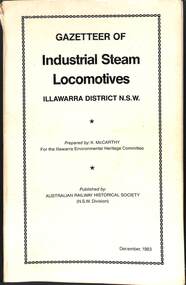
Book, McCarthy, Ken, Gazetteer of Industrial Steam Locomotives Illawarra District NSW, 1983
... Gazetteer of Industrial Steam Locomotives Illawarra District NSW...Victorian Railway History Library 39 St Edmonds Rd Prahran Prahran industrial railroads - Australia - history Steam locomotives - NSW – pictorial A listing of the industrial steam locomotives standard & narrow gauge that operated on the industrial railways of the Illawarra district in New South Wales. ill, maps, p.298. Gazetteer of Industrial Steam Locomotives Illawarra District NSW Book McCarthy, Ken Australian Railway Historical Society NSW Division ...A listing of the industrial steam locomotives standard & narrow gauge that operated on the industrial railways of the Illawarra district in New South Wales.ill, maps, p.298.non-fictionA listing of the industrial steam locomotives standard & narrow gauge that operated on the industrial railways of the Illawarra district in New South Wales.industrial railroads - australia - history, steam locomotives - nsw – pictorial -
 Kilmore Historical Society
VICTORIAN MUNICIPAL DIRECTORY 1914, Victorian Municipal Directory and Gazetteer: Commonwealth guide and the water supply record for 1914, 1914
... Victorian Municipal Directory and Gazetteer: Commonwealth guide and the water supply record for 1914...Black leather spine and corners with cloth hardboard cover, loose front cover With embossed detailing on cover and spine 'Victorian Municipal Directory 1914' xxiv; 746 pages ; 20cm; Victorian Municipal Directory and Gazetteer: Commonwealth guide and the water supply record for 1914 VICTORIAN MUNICIPAL DIRECTORY 1914 Arnall & Jackson, Printers and Stationers ...Black leather spine and corners with cloth hardboard cover, loose front cover With embossed detailing on cover and spine 'Victorian Municipal Directory 1914' xxiv; 746 pages ; 20cm;city of camberwell, henry rooks, 1913-14, municipal directory, water supply record, commonwealth guide, kilmore mechanics institute library. -
Clunes Museum
Book, The Victorian Municipal Directory and Gazetteer for 1888, 1888
... The Victorian Municipal Directory and Gazetteer for 1888...Depts., Postal Rates, Waterworks Trusts, Railways, Harbour Trust, Certificates of Service, etc., & Advertisements The Victorian Municipal Directory and Gazetteer for 1888 Book BOOK ARNELL & JACKSON ...Book contains information re; Municipal councils within Victoria, Arnall & Jacksons Almanac 1888, weather information, thirteenth Parliament of Vic., Ministries and Govt. Depts., Postal Rates, Waterworks Trusts, Railways, Harbour Trust, Certificates of Service, etc., & AdvertisementsBook contains information re; Municipal councils within Victoria, Arnall & Jacksons Almanac 1888, weather information, thirteenth Parliament of Vic., Ministries and Govt. Depts., Postal Rates, Waterworks Trusts, Railways, Harbour Trust, Certificates of Service, etc., & Advertisementsnon-fictionBook contains information re; Municipal councils within Victoria, Arnall & Jacksons Almanac 1888, weather information, thirteenth Parliament of Vic., Ministries and Govt. Depts., Postal Rates, Waterworks Trusts, Railways, Harbour Trust, Certificates of Service, etc., & Advertisementsdirectory, victorian municipalities, 1888, arnall & jackson -
 Victorian Railway History Library
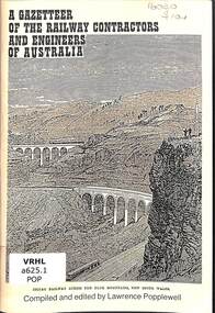
Book, Popplewell, Lawrence, A Gazetteer of the Railway Contractors and Engineers of Australia, 1992
... A Gazetteer of the Railway Contractors and Engineers of Australia...Volume 1 is for New South Wales, Victoria and Tasmania ill, maps, p.100. A Gazetteer of the Railway Contractors and Engineers of Australia Book Popplewell, Lawrence Melledgen Press ...A listing of all the contractors and engineers who have worked on major railway projects in Australia between 1854 & 1940. Volume 1 is for New South Wales, Victoria and Tasmaniaill, maps, p.100.non-fictionA listing of all the contractors and engineers who have worked on major railway projects in Australia between 1854 & 1940. Volume 1 is for New South Wales, Victoria and Tasmaniarailway construction - australia, railroad engineers - australia -
Moorabbin Air Museum
Book (Item) - Gazetteer of the World Diary of the Great War
... Gazetteer of the World Diary of the Great War...Moorabbin Air Museum Moorabbin Airport 12 First Street Moorabbin melbourne Geographia Ltd Gazetteer of the World Diary of the Great War Book Gazetteer of the World Diary of the Great War ...Geographia Ltd -
 Victorian Railway History Library
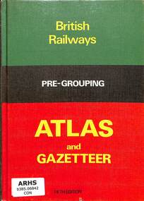
Book, Ian Allan Ltd, British Railways Pre-Grouping Atlas and Gazetteer, 1980
... British Railways Pre-Grouping Atlas and Gazetteer...Railroads - Great Britain - history Railroads -- Great Britain -- History -- Atlases Maps of the railways of England, Wales & Scotland prior to grouping into large railway companies in 1923. index, maps, p.84 British Railways Pre-Grouping Atlas and Gazetteer Book Ian Allan Ltd ...Maps of the railways of England, Wales & Scotland prior to grouping into large railway companies in 1923.index, maps, p.84non-fictionMaps of the railways of England, Wales & Scotland prior to grouping into large railway companies in 1923.railroads - great britain - history, railroads -- great britain -- history -- atlases -
 Victorian Railway History Library
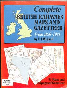
Book, Wignall, C.J, Complete British Railways Maps and Gazetteer from 1830-1981, 1980
... Complete British Railways Maps and Gazetteer from 1830-1981....Railroads - Great Britain - history Railroads -- Great Britain -- History -- Atlases Maps and Gazetteer of the railways of England, Wales & Scotland from 1830-1981. index, app, bib, maps, p.84 Complete British Railways Maps and Gazetteer from 1830-1981. ...Maps and Gazetteer of the railways of England, Wales & Scotland from 1830-1981.index, app, bib, maps, p.84non-fictionMaps and Gazetteer of the railways of England, Wales & Scotland from 1830-1981.railroads - great britain - history, railroads -- great britain -- history -- atlases -
 Bendigo Historical Society Inc.
Book - Geographical dictionary
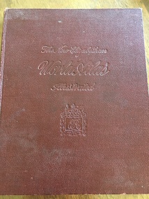
... The Gazetteer presents an extensive a to z list of Victorian towns and villages, lakes, rivers and creeks, islands, bays, hills and mountains, runs and other localities and features. ...Bailliere's Victorian Gazetteer and road guide containing the most recent and accurate information as to every place in the colony. ...Brown hardcover book, on the spine: Victorian Gazetteer with map 1865. The first and last pages are advertisements. ...The Gazetteer presents an extensive a to z list of Victorian towns and villages, lakes, rivers and creeks, islands, bays, hills and mountains, runs and other localities and features. Entries include latitude and longitude, populations, proximity to other towns, local industries, coach and mail runs, hotels, churches and schools.Bailliere's Victorian Gazetteer and road guide containing the most recent and accurate information as to every place in the colony. Brown hardcover book, on the spine: Victorian Gazetteer with map 1865. The first and last pages are advertisements. The book has 442 pages listing every place in the colony. The map is not included. Compiled by Robert P. Whitworth. Published by Bailliere, Regent Street Unreadable name on first page and the name of F. Houston in blue pen on first page geographic dictionary, colony of victoria -
 Rutherglen Historical Society
Microfiche, Bailliere's Victorian Directory 1871/2, 1871/72
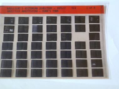
... SLV Gazetteer Abbottsford - Dunn's Town...Rutherglen Historical Society Murray Street Rutherglen high-country A directory of all Towns in Victoria in 1886 town names victoria SLV Gazetteer Abbottsford - Dunn's Town small sheet of film Bailliere's Victorian Directory 1871/2 Microfiche ...A directory of all Towns in Victoria in 1886small sheet of film SLV Gazetteer Abbottsford - Dunn's Towntown, names, victoria -
 Rutherglen Historical Society
Microfiche, Bailliere's Victorian Directory 1871/2, 1871/72
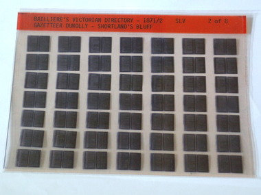
... SLV Gazetteer Dunolly - ShortLand's Reef...Rutherglen Historical Society Murray Street Rutherglen high-country A directory of all Towns in Victoria in 1886 town names victoria SLV Gazetteer Dunolly - ShortLand's Reef small sheet of film Bailliere's Victorian Directory 1871/2 Microfiche ...A directory of all Towns in Victoria in 1886small sheet of film SLV Gazetteer Dunolly - ShortLand's Reeftown, names, victoria -
Whitehorse Historical Society Inc.
Article, Ballyshanassy
... Paragraph about Ballyshanassy (County of Bourke) in the Victorian Gazetteer...Whitehorse Historical Society Inc. 2-10 Deep Creek Road Mitcham melbourne Ballyshanassy Shire of Nunawading Bourke Paragraph about Ballyshanassy (County of Bourke) in the Victorian Gazetteer Paragraph about Ballyshanassy (County of Bourke) in the Victorian Gazetteer Ballyshanassy Article Article ...Paragraph about Ballyshanassy (County of Bourke) in the Victorian GazetteerParagraph about Ballyshanassy (County of Bourke) in the Victorian GazetteerParagraph about Ballyshanassy (County of Bourke) in the Victorian Gazetteerballyshanassy shire of nunawading, bourke -
 Rutherglen Historical Society
Microfiche, Bailliere's Victorian Directory 1871/2, 1871/72
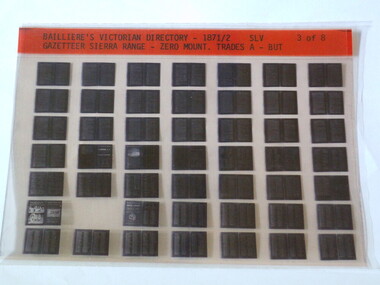
... SLV Gazetteer Sierra Rang - Zero Mount. Trades A - BUT...Rutherglen Historical Society Murray Street Rutherglen high-country A directory of all Towns in Victoria in 1886 town names victoria SLV Gazetteer Sierra Rang - Zero Mount. Trades A - BUT small sheet of film Bailliere's Victorian Directory 1871/2 Microfiche ...A directory of all Towns in Victoria in 1886small sheet of film SLV Gazetteer Sierra Rang - Zero Mount. Trades A - BUTtown, names, victoria -
 Orbost & District Historical Society
book, E-Gee Printers, Middleton & Manning's Gippsland Directory 1884-5, 1983
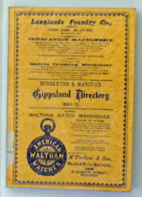
... Beginning with advertisements from local businesses of the time, this is followed by a short gazetteer of places around the region, as well as general information on the districts of Gippsland. ...It contains a short gazetteer of places in the region as well as general information on the districts of Gippsland. ...It contains a short gazetteer of places in the region as well as general information on the districts of Gippsland. ...The 1884-1885 Directory was the first year of publication for the Middleton and Manning's Gippsland Directory. It was first published by Ale Middleton and Francis Beresford Manning. Beginning with advertisements from local businesses of the time, this is followed by a short gazetteer of places around the region, as well as general information on the districts of Gippsland. The main part of the Directory consisting of about 100 pages, is the Alphabetical Directory. Listed alphabetically by surname under each region, this lists heads of household (mostly male but there are a few females mentioned), together with their occupation and address.The list includes farmers, labourers, coach painters, dairywoman, teacher, saddler, brickmaker, merchant, laundress, hotel keeper, minister of religion, dressmaker, grocer, grazier, gasfitter, seedsman, coachbuilder, engineer, auctioneer, upholsterer, fowler, journalist, surveyor, musician, traveller, watchmaker, solicitor, restaurant keeper, blacksmith and miner. It is not just "business owners" mentioned in this directory it is everyone. (ref Gen E Books)This is a useful reference tool.A 135 pp soft covered book with an orange/brown cover. On the front cover in black print is a range of advertisements or local businesses. It contains a short gazetteer of places in the region as well as general information on the districts of Gippsland. The main part of the directory is an alphabetical list of the household , with occupations and addresses. This is a reprint of the original.directory-gippsland book-middleton-manning-1884-5 -
Tarnagulla History Archive
Transcript: Victorian Gazetteer and Road Guide 1879, 1879
... Transcript of some parts of the Victorian Gazetteer and Road Guide 1879, those relating to locales in Bet Bet Shire....Transcript: Victorian Gazetteer and Road Guide 1879 ...Donald Clark Collection.Transcript of some parts of the Victorian Gazetteer and Road Guide 1879, those relating to locales in Bet Bet Shire. -
 Emerald Museum & Nobelius Heritage Park
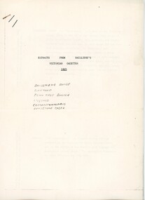
Booklet - Extracts from Bailliere's Victorian Gazetter 1865, Robert Whitworth, 1865
... Robert Whitworth (1831 -1901), an England-born journalist and author worked with the government printer Ferdinand François Balliere in producing gazetteers of the Australian colonies. The first was a gazetteer of Victoria printed in 1865. ...Emerald Museum & Nobelius Heritage Park 5 Crichton Rd Emerald yarra-valley-and-the-dandenong-ranges Robert Whitworth (1831 -1901), an England-born journalist and author worked with the government printer Ferdinand François Balliere in producing gazetteers of the Australian colonies. The first was a gazetteer of Victoria printed in 1865. ...Robert Whitworth (1831 -1901), an England-born journalist and author worked with the government printer Ferdinand François Balliere in producing gazetteers of the Australian colonies. The first was a gazetteer of Victoria printed in 1865. This copied extract from that gazetter provides information about the fauna and flora and geology of Emerald and environs at an early period of European settlement in Victoria.This gazetter extract provides a picture of Emerald and environs as described by a settler in the mid-19th century.Four foolscap pages of information photocopied regarding the Dandenong Ranges and environs. Pages attached with a staple.On first page: ' EXTRACTS FROM BAILLIERE'S / VICTORIAN GAZETTER / 1865 / DANDENONG RANGE / EMERALD / FERN TREE GULLIES / LILYDALE / CORRANWARRABUL / DANDENONG CREEK'robert whitworth, balliere, gazetter, emerald, 1865 -
 Yarrawonga and Mulwala Pioneer Museum
Book, The Specialty Press, The New Elizabethan World Atlas Illustrated, 1952
... Early world history and it's development and comprehensive gazetteer....Early world history and it's development and comprehensive gazetteer. The New Elizabethan World Atlas Illustrated Book The Specialty Press Colourgravure publications ...Provides names of countries and their borders as they were during the 1950'sMaroon hard cover illustrated atlas. Front embossed with title and royal seal. 152 pages. Contains detailed maps of world countries in colour. Early world history and it's development and comprehensive gazetteer.Owners name written in front pagesmaps