Federation University Historical Collection
Book - Newspaper clippings, Eureka Stockade Newspaper Clippings, 1923-2015
... .
* Ballarat Courier 9/12/1998, - People and Places: Eureka Dawn Walk [photographs of Dawn Walk participants, including Don Chipp and Jack Harvery
* Ballarat Courier 17/12/1998, - Spirit of cooperation set up Eureka centre , (City of Ballarat chief executive officer Janet Dore gives the council's point of view on the story behind the Eureka Stockade centre, perhaps prompted by Paul Murphy's recent statements, : many individuals have participated cooperatively, the state and federal governments have cooperated as have the Eureka Stockade Memorial Trust Committee, the Eureka Project Special Committee, the Centre Historic Contents sub-committee, the Eureka's Children group, community donors, the Eureka Stockade Advisory Committee, and the Sovereign Hill Museums Association). [Photos....
* Ballarat Courier 9/12/1998, - People and Places: Eureka Dawn Walk [photographs of Dawn Walk participants, including Don Chipp and Jack Harvery
* Ballarat Courier 17/12/1998, - Spirit of cooperation set up Eureka centre , (City of Ballarat chief executive officer Janet Dore gives the council's point of view on the story behind the Eureka Stockade centre, perhaps prompted by Paul Murphy's recent statements, : many individuals have participated cooperatively, the state and federal governments have cooperated as have the Eureka Stockade Memorial Trust Committee, the Eureka Project Special Committee, the Centre Historic Contents sub-committee, the Eureka's Children group, community donors, the Eureka Stockade Advisory Committee, and the Sovereign Hill Museums Association). [Photos ...
The Eureka Stockade was fought on the Eureka Lead, Ballarat East on 03 December 1854.
Keith Rash was a signwriter who learnt his trade at the Ballarat School of Mines. He was very interested in local history and wrote articles for the local newspapers. The clippings on Eureka would have been used to inform his articles, and research on the site of the Eureka Stockade.
Ken Clements was former Academic Registrar at Ballarat College of Advanced Education (now University of Ballarat). He was a committee member of the Eureka Stockade Memorial Park Committee for a number of years.
Dr Dorothy Wickham has researched Eureka over a number of decades, and has published a number of titles on the topic.
Clare Gervasoni has researched Eureka over a number of decades, and has published a number of titles on the topic, including coordination of www.Eurekapedia.org for Ballarat Reform League Inc. Three white A4 folders of newspaper clippings dating from 1923 to 2012. The clippings are in chronological order. The clippings were collected by Keith Rash, and were later supplemented by clippings collected by Ken Clements. Further clippings collected by Dorothy Wickham, mainly around the 1990s were inserted throughout the folders in chronological order, as well as later clippings by Clare Gervasoni
.1) Folder One - Eureka Cuttings 1923 - 1984
* Courier 05/05/1923 - Eureka Progress Association (W. Groves, Stockader Phillips of Rocky Lead, Stockader Wilson, G. Lakeland, Eureka Hall.)
* Courier 10.08.1931 - Banquet at Eureka - Progress Association's Annual Meeting (McGregor, Parsons, W.J. McAdam, 75th anniversary. Elsworth, Kent, Robert McGregor)
*Courier 11/08/1932 - Eureka Reserve - Committee Annual Social. (E. Parsons, C.C. Phillips, D.C. McGrath, T.T. Hollway, Bolster, Mackenzie, Mares, Hendy)
* Courier 07/07/1939 - Eureka Improvement Committee, Eureka Reserve
* Courier 04/12/1950 - Australian Democracy Was Born at Eureka
* Courier 04/09/1951 - Council Seeks Development of Eureka Land - potential housing Commission development on site of Last Chance Mine. (J. Welsh).
* Ballarat Courier 12/1952 - Few Remembered Eureka Affair (98th anniversary, A.W. Nicholson, C.E. Brown, L. O'Brien, R. Joshua, Soldiers' Memorial Band)
* Courier 07/12/1953 - Few Commemorated the Affair at Eureka - 99th anniversary at the Stockade reserve (F.J. Cutts, L. O'Brien, R. Joshua, Peter Lalor, C.E. Brown.
* Courier 14/04/1954 - Eureka Centenary - meeting to determine form of commemoration.
* Courier 15/04/1954 - Getting ready - Centenary celebrations (Picture of Diggers Memorial, F.J. Cutts, C. Mott).
* Courier 15/04/1954 - Eureka Centenary Planned (F.J. Cutts, Geoffrey Searle, Edgar Bartrop, G. Swenson, B. Parsons, T.E. Carter, M. Collins, Mrs L.M. Quinlan, Grenville, Eureka Progress Association, Arthur Jones, E.J. Crimmins, Bernard D'Arcy, A.W. [Bert] Strange).
* Guardian 25/11/1954 - Diary of a Eureka Stockader [signed RDW] (Bentley, Fletcher, McIntyre, Westerby, Ballarat Reform League, monster meeting, Bakery Hill, Charles Hotham)
* Argus 04/12/1954 - Eureka Day Marred by Storm (image of Bert O'Toole in Red Coat uniform, Peter Lalor Statue, A.C. Pittard, F.J. Cutts, Bernard D'Arcy, L. Moyle, Catherine Smith, wounded, death, Eureka Celebrations, anniversary, John Cain
*Age Literary Supplement, 04/12/1954 - The motives that prompted the tragic Eureka rising . (image of Charles Hotham, government troops attack, Eureka Stockade Monument) 1851 discovery of gold in Victoria, centenary of Eureka Stockade, author MM, Governor Latrobe, law abiding nature of most miners, most miners were British but other nationalities represented, miners former occupations were varied, many did not "strike it rich", by 1853 the earnings of most diggers had fallen very low, 30/- licence fee, digger hunts, cries of "Joe" or "The Traps", 5 pound fine or 6 month imprisonment for not carrying Licence, La Trobe had hired ex-convicts as police, Governor Charles Hotham 1854, Bentlys Hotel, Commissioner Rede, miners leader Peter Lalor, Carboni Raffaello, Press warning by "Age", Ballarat Reform League, November 29 diggers meeting, licences burned, November 30 licence hunt, new flag and Southern Cross oath, the Stockade, revolution ?, Stockade Garrison, December 3 1854, the battle, 125 prisoners, 13 charged with high treason, all prisoners acquitted, Lalor and Vern into hiding, 'democratic revolution' or 'undisguised rebellion' ? , Miner's Right, Chartist ideas involved, Lalor became a member of Victorian parliament, Eureka monument inscription, little revolutionary significance.
* The Argus 06/12/1954 - 100th Eureka Day ( [ Images - bearded miners, Bert O'Toole, simulated battle, red coats] battle tableau, Centenary celebrations. Mr Cain Premier, Spirit of Eureka).
* Ballarat Courier 22/04/1961 Attack on the Paint
( [Image - Eureka Monument Guns] vandals).
* Ballarat Courier 13/09/1962 - Little-Known Aspects of Eureka Affair (E.J. Crimmins and the 109th Eureka Anniversary); Eureka Drilling (Photo of M. Milligan drilling for water for the Eureka Pool)
* Ballarat Courier 10/12/1963 - Eureka Relics in Public Display (Trev Negri), Little-known aspects of the Eureka affair (E J Crimmins, 13 State prisoners, Creswick men, M Greville), Eureka Request (Apex explanatory notice).
* Ballarat Courier 12/05/1964 - Plaque to tell Eureka Story (Apex donation on monument).
* Ballarat Courier 09/06/1964 - Permission is sought (re Eureka Reserve small Hall).
* Ballarat Courier 28/08/ 1964 - Eureka should be much better attraction (Mayor Cr Webb, Rotary).
* No Chlorination at Stockade Pool 24/08/1964 (A Jones secretary)
* Ballarat Courier 10/10/1964 - Assurance given on Eureka Swimming Pool (Murray Byrne MLC, Bill Stephen MLA, pool plans [Images - Photo of Jones, Stephen Byrne - diagram of Eureka reserve swimming pools, caravan park, monument area] )
* Ballarat Courier 23/06/1964 - Pool plans ready for tenders MLA (Black Hill)
* Ballarat Courier 26/11/1966 - Eureka: Was that clash in 1854 inevitable ? ([Image - Monument, Peter Lalor statue], by J J Sheehan, foreigners, Chartists, poorly armed. * 03/12/1966 Part 2 - Eureka: No plan by the Diggers to Attack, by j j Sheehan ([Images - Eureka collection, W C Colbourne and G Brookes with old rifle] Corrupt, Instructed, Withers' view, The last hunt, Police spies).
* Ballarat Courier 19/12/1968 - Eureka commemoration definite next year,1854 - (Connolly Association, 3 December, 'Finest thing in Australasian history', few attending, L O'Brien, public apathy, A Williams, successful 1954 centenary, W. Roff, Eureka Progress Association)
* 23/11/67 - Eureka and Miners' rights (G P Ryan letter, no representation, excessive licence system, offensive administration.brutality, Gov Hotham, barricade on Eureka lead, Miners' Rights replaced Licences but now worthless, mining monopolies, democracy).
* Eureka Flag Ceremony (L O'Brien, false report, revive annual Eureka service).
* Ballarat Courier 12/05/1867 Questions of Eureka (W Thompson letter, why military names on monument ? Why mount irrelevant cannons on monument ? Where is the flag ?).
Lalor's refuge (between Bungaree and Bullarook ?, Fr t Linane ). Building linked with Ballarat (at French end of Collins Street Melbourne, Sir Robert Nickle, relief march to Ballarat, historian E Moorhead, 40th regiment link ).
* Ballarat Courier 08/01/1968 - Too little history at Eureka says Visitor (Image - Eureka monument, Mrs L Riley, frequent complaint, B McOrist, proposed Stockade model).
* Ballarat Courier c 1968 - Gallery Eureka flag may be the original (Cr W Roff, at Ballarat Art Gallery, fraud ?, matching pieces).
* Ballarat Courier 11/04/1968 Pool of reflection ([Image - Eureka pool and willows], near full again).
* Ballarat Courier 20/08/1968 - Eureka Reserve (Rotary Clubs' proposed project).
*Ballarat Courier 05/10/1968 - Picturesque Willows ([Image- willows in good condition at Eureka Stockade]).
* Ballarat Courier, November 1968 - Eureka Ceremony will be Revived (Eureka Progress Association to revive Eureka Commemoration at the site, Connolly Association Australia, J. Garvey, A. Jones) [Photo of L. O'Brien, A, Jones, R.A. Mitchell, Jim Styker and Alan Mills
*Ballarat Courier 15/11/1968 - Walkathon for Stockade Diorama (planned life-size Diorama at Stockade depicting the Eureka riot, Rotary Cup walkathon fundraiser.
*Ballarat Courier 26/11/1968 - Discussing plans ([Image - Les O'Brien, Arthur Jones, Alan Mills et al], memorial service Sunday).
* Ballarat Courier 26/11/1968 - Eureka ceremony will be revived (four year lapse, Connolly Association, Eureka Progress Association)
* Ballarat Courier 02/12/1968 - 500 attend Eureka ceremony (114th commemoration, on island in Lake, Mayor Cr M J Brown, speaker Mr Dudley Erwin MLA, significance to Australia, Connolly Association morning ceremony, Bernie Nolan, W Hartley).
* Courier 1969 - Letters to the editor - Peter Lalor's Grave, Losing Places of Beauty loss of verandahs, Eureka Stockade Caravan Park, Eureka Swimming Pool), Ireland's Dilemma (Catholic Church), Small Group in "Affair" (F.R. Muller)
* Courier 22/04/1969 - $7000 grant for Eureka Diorama (Sir Henry Bolte approves grant, $2 for $1, Rotary walkathon basis, City Council interest, Diorama details, information about Eureka for public, Eureka Park Sovereign Hill and Montrose cottage combination).
* Courier 21/08/1969 - Mayor turns sod at Diorama site ([Image- Mayor Cr M J Brown et al], life size representation of stockade scene, Mr W F Stephen MLA).
* Courier 06/12/1969 - The 'affair at Eureka' ([Image- Diorama] Few remembered anniversary of bid for democratic Government in 1850s, Mayor Cr Alec Mills, Murray Byrne, Colonial secretary J Foster resignation, reforms, hostility, unpopular, end of era).
* Courier mixed 1969 - City link with Eureka Stockade threatened, - Eureka signposts [Diggers Memorial, Soldiers Memorial], - Eureka Anniversary - Souvenir of Eureka (William Cowland's pistol).
* Courier :/05/1970 - Fascinated ([Image- children at near completed Diorama]).
* Courier 10/08/1970 - Mayor opens Eureka Diorama ([Image- Diorama scene of 3 December 1854 battle], Mayor Cr A E Mills, Rotarians, Eric Pearce voice tape recording).
* Courier 08/08/1970 - Eureka Diorama should be Popular-Rotarian ([Image- Diorama shed], City's new drawcard, Diorama Opening para and advert).
* Courier 12/09/1970 - The Quick change Eureka Stockade ([Image- Eureka Stockade Hotel], was Australia Felix Hotel, Mr Kevin Worthington).
* Courier 22/09/1970 - Missing golden opportunities (message unheeded, American tourists misled, bewildered tourists).
* Courier 20/10/1970 - Ballarat's monument to vandalism ? (Ballarat, Wendouree and South Rotary clubs' pride: Eureka Diorama, joy and heartaches, vandalism damage, thoughtless and vicious).
* Courier 20/10/1970 - Marked for demolition ([Image- Ballarat east railyard] troops path to Eureka stockade).
* Courier 20/10/1970 - Diorama sound system target for vandals ([Image- Jack Redman removing foreign material from diorama starting mechanism).
* Courier 03/11/1970 - Record Good but Facts are Wrong ([Image- depiction of Eureka scene], article by Paul Hughes, RCA LP record based on musical play re Eureka Stockade, errors)
* Courier 11/03/1970 - Diorama for Eureka Stockade ([Images- view of park, view of diorama]).
* Courier 4/12/1970 - Anniversary of Eureka uprising ([Images- Southern Cross flag over Montrose cottage, R Fenton and V Demedeze], 107th anniversary, Scouts Eureka re-enactment, Diggers didn't mind delay).
* Courier 16/04/1971 - Lake disappearing ([Image- Lake Elsworth being filled], Olympic standard pool planned for same site).
* Courier 31/07/1971 - Birthplace of Peter Lalor ([Image- 211 year old Lalor home in Ireland], Eureka Stockade (park) name change to Eureka Stockade Memorial Park (in Sept. 1972).
* Courier 01/02/1971 Eureka Stockade Gardens - ([Images- Gardens near Caretakers Cottage, Miss J Hetherington and begonias in Eureka Stockade hothouse).
* Courier 11/1971 - Eureka Grant (for toilet block in Eureka Caravan Park), Ancestor Died in Stockade Battle (William Clifton), $93,887 Tender for Eureka Pool)
* Courier 10/12/1971 - Eureka FILM 'iMMORAL' ( Erwin's attack, DUDLEY ERWIN MP, suggested cuts).
* Courier 21/02/1972 - It is not a subsidy (says Stockade Director, re film, Added bonus, also Descendant upset- letter from Peter A Lalor re film content).
* Ballarat Courier 31/10/1973 - Eureka Stockade a National Shrine, (Editorial , Minister Grassby's support) - Eureka 'Shrine of our History', (Grassby's pledge).
* Ballarat Courier 14/02/1973, - $1000 Grant for Eureka Flag (from State government to Ballarat Art Gallery, Bill Stephen MLA, Murray Byrne Minister for Tourism).
* Ballarat Courier 26/05/1973, - Eureka Flag Restored (by Val D'Angri, Peter Lalor details, [Images- Val at work on flag, painting of 1854 Ballarat]).
* Ballarat Courier 26/10/1973 - Taking another look at Eureka (Editorial, historical and social significance of Eureka Stockade, Neighbour attractions, Thinking BIG), and Editorial report, Put up the Stockade again - and a Monorail ?
* Ballarat Courier 31/10/1973 - Eureka Stockade a National Shrine
(Minister's support)
* Ballarat Courier October 1973 - Eureka a 'Shrine of our History' (Grassby's pledge, Alex Barnett's plans for Eureka Stockade ).
* Ballarat Courier 03/11/1973, - Build Eureka into a tourist drawcard ,(Challenge to Clubs. W H McGregor; Ceremony, Tram Link, the "Iceberg").
* Ballarat Courier 08/11/1973, - Grassby to get Eureka Plans - (from Alex Barnett).
* Ballarat Courier 29/11/1973, - Memorial Plans with Town Hall (Architect plans also sent to Mr Grassby).
* Ballarat Courier 13/11/1973, - Prime Minister will unveil Eureka Flag [Image - Erecting Flag frame at Ballarat Art gallery, Val D'Angri].
* Ballarat Courier 14/11/1973, - What plan for the Eureka memorial ? (Public entitled to know, National concept) and (Eureka Upgrading).
* Ballarat Courier 24/11/1973, - Connolly Opposition to Eureka Proposals (Association protests about limited support for commemoration of Eureka) and (Gallery search for Lalor descendant).
*Ballarat Courier 24/11/1973, - The Affair at Eureka (Part one by J J Sheehan) [Images -Jones' Circus tent, and Stockade location, also Peter Lalor photo, also artist's impression of the 13 men on trial]. Part 2 )3/11/1973 (Eureka Diorama)
* Ballarat Courier 01/12/1973, - Grassby to see Eureka Plan on Site [Image- Architect's sketch of proposed $450,000 Museum building].
*Ballarat Courier 01/12/1973, - The Affair at Eureka (The fight for justice, concluding J J Sheehan series), [Images - painting of fight, and the supposed site of the Stockade].
* Ballarat Courier 02/12/1973, Victorian Treasures at Art Gallery (Eureka Flag and "Moonrise exhibition), [Image - J Nicholson cleaning 'Peter Lalor' portrait].
* Ballarat Courier 03/12/1973, - The Events Which led up to Eureka (Licence contentions,the perceived need for fortification around the workings at the Eureka lead, the death of James Scobie, the burning of Bentley's Hotel, the conviction of three miners on 20 November, arrival of armed soldiers at the Camp. Also Raffaello observations, and advert for public viewing of Eureka Flag. [Image - Diggers and Soldiers names on Eureka Monument].
* Ballarat Courier 03/12/1973, - The past celebrated but what of the future ? (119th anniversary of the Eureka Stockade uprising, but current politicians are under close scrutiny)
* Ballarat Courier 03/12/1973, - Teacher-Politician is behind Eureka story (J J Sheehan profile).
*Ballarat Courier 04/12/1973 - A Noteworthy Day in Ballarat - (Prime Minister Whitlam unveiled the famous Eureka Flag at the Art gallery).
* Ballarat Courier 04/12/1973, - Newcomers told about migrants at Eureka (migrants from >20 countries, comradeship after battle and defeat, new nation in peace and tranquility. Minister for Immigration Mr Al Grassby at Sovereign Hill. Liberties. A Shrine. [Image- Al Grassby and newly arrived migrants at Sovereign Hill].
*Ballarat Courier 04/12/1973, - Grassby leads colorful Eureka commemoration (cheering school children, flag, wreath, World Fame for Eureka affair, boy's coach trip, two sides to Eureka battle.) [Image- Mr Grassby and group of children]. (National day proposed by Mr Grassby).
* Ballarat Courier 04/12/1973, Eureka as National Monument (PM commends stockade plan, Mr Whitlam on Eureka commemoration day supports plans to make Eureka Stockade a national monument. Flag saved and restored, TV hitch. New Australian anthem needed to match the 'new nationalism'. [Image - Gough Whitlam and group at flag presentation and unfurling ceremony.]
* Ballarat Courier 04/12/1973, - Eureka ! It's Digger Al (Al Grassby at 119th anniversary of the Eureka Stockade rebellion). [Images - scenes of Al Grassby at Sovereign Hill].
* Ballarat Courier 05/12/1973, - Talk, But No Cash: Stephen (Mr Bill Stephen MLA comments on visit by Whitlam and Grassby). - Eureka Flag Australia's most valuable relic: PM (Gough Whitlam report to Federal Parliament yesterday, Hospitality from Mr Dudley Erwin)
* Ballarat Courier 10/12/1973, - Flag restorer stitched her way into history (Val D"Angri has stitched her way into Australian History as the person who restored the Eureka Flag. [Image - Mrs Val D'Angri, Eureka Flag needlewoman ].
* Ballarat Courier, 1974 - Location of the Eureka Stockade (Bert Strange), Misplaced Stockade (Maurice Calnin, T.C. Cleary, diary), Stockade Site (Bob O'Brien), Eureka Flag Stolen (John Shannon)
*Ballarat Courier 6 May 1974, - Committee formed for $1.25 M. Eureka Project - ( a permanent memorial).
*Ballarat Courier 6 May 1974, - Federal Govt Aid likely for Eureka (Federal Labor Government wants Eureka Stockade site to be a major tourist attraction, Eureka booklet proposed).
*Ballarat Courier 10 May 1974, - Peter Lalor Stories Interest Society (Ballarat Historical Society seeks reports of Peter Lalor during escape after the Eureka affair). Also Eureka Shrine, The Eureka 'affair', Eureka film premier.
* 29/07/1974 - Eureka Memorial Plans Need Full Support (Eureka Stockade Association)
* Ballarat Courier 11/5/1974 and 6/6/1974 - Stockade Site (Rob O'Brien, Eureka Interesting Story
* Ballarat Courier 30/01/1974 - Eureka Remembered in Italy (Al Grasby, Raffaello Carboni, Urbino); Eureka Memorial on Way (Eureka Stockade Association) {photo of Gordon Cornell, Alec Barnett, Bruce Bartrop]
* Ballarat Courier, May 1974 and 11 May 1974 - Location of the Eureka Stockade (Bert Strange); Stockade Site (Bob O'Brien)
* [Ballarat Courier?] 10/07/1979 - City's Oldest Memorial is Over Diggers' Graves. (An article on the grave over the diggers who were killed as a result of the Eureka Stockade battle which was erected on 22 March 1856.
.2) Folder Two- Eureka Cuttings c1980-2004
Ballarat Courier ~9/1980, - First-hand account of hardship omitted (Frank Titan letter re Tom Evans' use of selected evidence in his proclamation that
democracy was not born at Eureka Stockade. "Democracy was won at the Stockade on 3/12/1854. [Cartoon 'A beach view of the Eureka Flag debate'].
Ballarat News ~1980, Names (Diggers & Troopers)
of deceased on Eureka Stockade Monument. [Photo of white marble tablet]
Ballarat Courier 4 July 1981, Eureka Papers Gift to City, Peter Lalor letters, Stephen Cumming diary. [Photo - Town Clerk Ian Smith, Cr Jessie Scott and donor Bruce Evans].
* The Sun Travel Supplement, 06 April 1984 - A Bloody Moment Re-visited by Alec Hepburn - (Diorama, Eureka Stockade Replica, Montrose Cottage) [Image of Gerard Rushforth to the reconstruction of the Eureka Stockade
* Ballarat Courier, 10/04/1984 - Eureka Incident 'an uprising of the scum of goldfields. [photo of John Callinan with the Diggers Grave monument]
* The Age, 06/05/1987 - Eureka! Man found whose father was there by John Lahey (Article on Terence Brady, who was a 4 month old baby at the Eureka Stockade battle.
* Ballarat Courier 13 June 1984, 'Eureka Stockade'.....a Panning, (American critic J J O'Connor pans the Australian TV Mini-series.
Book 2 - C1990-2004
* Ballarat Courier ~1990,- High-calibre Restoration, (World War I German Howitzer being restored after about 70 years exposure in the Eureka Stockade Memorial Park). [Photo of wheeled Gun, and article by author Peter Butters].
* Ballarat Courier, ~1990, A Changing Track to Eureka, a 'Room for a View' article by Alex Barnett OAM. (comment about the Stockade site and the tracks leading to it). [Photo of painting by Charles Doudiet depicting the diggers swearing allegiance to the southern Cross on 1 December 1854].
* Ballarat News 22 March 1990 - Eureka Troopers Slept Here (article on the Werribee Hunt Hotel, near the Ballarat Gold Course, where troopers slept and watered their horses on the way to Ballarat in 1854. [photograph of the hotel]
* Ballarat Courier, 23 August 1991 - Eureka relics Return to Ballarat by Gemma Daley. Items acquired by Sovereign Hill - including a Ground plan of James Bentley's Eureka Hotel, autographed statement by Michael Carroll. (photograph of Peter Hiscock holding a set of percussion pistols, the Plan of the Eureka Hotel]
* 30 November 1992 - Ballarat Courier 'Hayden Pays a Visit' by Julia Balderstone (Article on the visit of Governor-General Bill Hayden to Ballarat, the launch of Bob O'Brien's book 'Massacre at Eureka: The untold Story' ) [Photographs of Bill Hayden, Mayor James Coglan, Sovereign Hill, Bob O'Brien)
* Ballarat Courier 03 December 1994 - Awareness grows of flag's meaning by Lorrie Brown (article on the Ballarat Trades Hall replica of the Eureka Flag. The replica flag was made by the then Trades Hall caretaker Tom Ellis. The replica flag was used in a Trades Hall march in 1945 and then disappeared until the mid 1980s (Image of David Miller nad Graeme Shearer in front of the flag.)
Verso - Robert and Pamela Sublet and their link to the Eureka Stockade via their ancestor Charles Sublet de Bourgy and the site of the Eureka Stockade.
* 04 May 1996 Ballarat Courier Saturday Magazine Extra 'Our Next Flag?' by Gabrielle Hodson (An article on the Australian Flag and the Eureka Flag with interview with Gayle Hart (Ballarat Fine Art Gallery)
* Ballarat Courier, 15 February 1995 - 'Knockers' Harming the Story of Eureka - an opinion piece by Lewis L. Gay (descendant of William Gay)
* Ballarat Courier, 10 July 1996 - Facts, not our bias, are Eureka's basis, an opinion piece by Tom Evans
* Ballarat Courier 03 September 1996 - Tell Warts and All of Eureka by Weston Bate (image of Weston Bate)
* The Age, 21 December 1996 - Mining a rich vein of passion by Mary Ryllis Clark (Eureka overview with information on Charles Doudiet).
* Ballarat Courier, 07 July 1997 - Eureka Flag Row (Sale by auction of Eureka Flag piece held by Lex McClintock - associated with Communist Party and Evelyn Shaw) [Photo of Anne Beggs Sunter beside the Eureka Flag]
* Ballarat Courier, 02 August 1997; images of the Eureka sail on the Eureka centre from different locations.
* Ballarat Courier 23 October 1997, Eureka Stockade Centre Agreement is signed, (Sovereign Hill to manage new Eureka Centre). [p 1 Photo Doug Sarah, Janet Dore, James Coghlan, Peter Tobin, and Peter Hiscock at table; p 2 photo of new Eureka Centre and reference to 21 year management agreement between City of Ballarat and Sovereign Hill Museums Association.
* Ballarat Courier 23 October 1997, 'A Handsome Addition to our Heritage Assets' [Plan of Bentley's Eureka Hotel ason 17 October 1854 it was when it burned ]
* Ballarat Courier 03 November 1997 - Different Eureka Flag. Letter to the editor from A.D. Glasson.
* * Ballarat Courier 23 October 1997, 'Did Eureka Claim the Drummer Boy' Dorothy Wickham prooves the Drummer Boy of the 12 Regiment. John Egan. did not die in the events leading to the Eureka Stockade.
* Ballarat Courier ~1998, - Alex and Audrey thanked, (Total of 90 years work for Eureka Stockade Memorial Park Committee recognised), [Photo of Gordon Taite, Alex Barnett and John Barnes.
* Ballarat Couruer, 04 February 1998 - Exciting Eureka Flag Find in UK by Stuart Howie. (Eureka Flag held in the Suffold Military Museum) [Jan Penney holds with a Eureka centre logo.]
* Ballarat Courier 23 February 1998, Eureka Centre almost ready, (Workers adding finishing touches, description of $4m Centre by Manager Jan Penney). [Photo of new Eureka Centre, Mothers Art figures, Jan Penney, stage coach, Trooper John King]. [Photo Dorothy Wickham an d Governement Camp]
* Ballarat Courier 23 February 1998, Forging links with Irish (Article by Leanne Keem on visitors from County Wicklow, 1798 Rebellion, convicts, Wicklow Historic Gaol.) [Photograph at Sovereign Hill of Joan Kavanagh, Pat Vance, Balise Treacy)
* Ballarat Courier 28 March 1998, On to Camp Street, Premier urges at Eureka opening, (Comments by Mr Kennett about Eureka and the Ballarat community). [Various photos and paras about participants and about the Centre].
* Ballarat Courier 28 March 1998, EUREKA CENTRE SETS FULL SAIL, (celebration of launch of new centre by Premier Jeff Kennett). [Cartoon re Red Carpet and flag pieces].
* Ballarat Courier 17 November 1998, National Eureka Day idea 'could boost city' (Mayor Judy Verlin)
* Ballarat Courier 28 November 1998, - MP backs Eureka Sunday, (Michael Ronaldson supports idea of a national Eureka Sunday to recognise Eureka's significance). [Photo of Michael Ronaldson MHR].
* Ballarat Courier 1/12/1998, - Red Eureka flag symbolic for anniversary, (red spotlight on giant Eureka flag model above the new Eureka Centre for 144th anniversary week, and outline of displays in Centre by manager
Dr Jan Penny). [Photos - red 'Eureka Flag' on new Stockade Centre, and cartoon re 'tomato sauce'].
* Ballarat Courier 2/12/1998, - Eureka enthusiast hopes for national day of celebration, (Jack Harvey expresses his hope that 'Eureka Day' might replace 'Australia Day' as our national day for celebration of anniversary of the formation of Australia, especially if Australia becomes a republic. History of the Dawn Walk in a list). [Cartoon re
Eureka Walk Backpacker].
* The News 2/12/1998 - Lanterns to Light Path on Eureka Walk by Toni Lea-Howie - Dawn walk, lanterns, Jack Harvey,
* Ballarat Courier 3/12/1998,- Marching the light fantastic, (Lighting the way, lanterns being prepared at Mining Exchange under direction of maker Graeme Dunstan in readiness for Sunday dawn walk, and other details of the Sunday program). [Photo of Belinda Dyer and Michael McTigue with several lanterns and a Eureka flag in the
background].
* Ballarat Courier 4/12/1898, - Old trash reveals gold rush lifestyle , (display of artefacts dug from ground before new Eureka Centre built, Dr Jan Penny spoke, Minister Rob Maclellan launched the display, Cr James Coghlan announced the formation of the Eureka Stockaders support group with Peter Tobin and Alex Barnett as Life Members, article by Diane Squires. [Photo of Robert Maclellan and Gael Shannon with archaeological artefacts].
* Ballarat Courier 04/12/1998 'Many Behind New Eureka Centre' by Paul Murphy. (An article about the origins of the Eureka Stockade centre through the eyes of Paul Murphy, Executive Office of Eureka's Children. It includes the 1988 Bicentennial Eureka celebrations, Eureka Commemorative Society, Peter Tobin, Eureka Stockade Memorial Trust) Also inclides a letter from Bob O'Biren on the Origins of the Eureka Flag.
* Ballarat Courier 5/12/1998, - Eureka walk revisits past , (Lantern bearers in a dawn walk will follow path taken in 1854 by troops as they marched to the Eureka Stockade, article by Rohan Wade). [Photo of Wayne Parker and Peter Freund discussing the internet recording of the dawn walk].
* Ballarat News 06/12/1995 - Lest we forget the fallen at Eureka by Peter Butters (William Westgarth, Captain Wise, Charles Rich, coffins, Bakery Hill meeting, Eureka monument, James Scobie, George Scobie.
* Ballarat Courier 7/12/1998, - DAWN HOMAGE TO EUREKA HEROES, (300 take part in Dawn Walk, organiser Margaret Rich describes the community response and participation as fabulous and thanked Ballarat Fine Art Gallery for underwriting this years event). [Photo of dawn walkers on way to Eureka Stockade on Sunday, and photo of walk Leader Jack Harvey].
* Ballarat Courier 7/12/1998, - Walk sees the dawn of a national day, (3.30am marshalling of dawn walkers at Mining Exchange building by leader Jack Harvey and lantern maker Graeme Dunstan was spectacular; at the Eureka monument Don Chip addressed the large gathering on the significance of Eureka, Big turnout draws praise from Dore, Gallery echoes stirring oath).[Photo of Jack Harvey, Janet Dore, and Margaret Rich, Photo of Evelyn Healy, Cartoon re Ho Ho Ho ].
* Ballarat Courier 7/12/1998, - Miners were fighting for a fair go : Chipp, (Stirring Eureka address by Democrats founder Don Chipp,University lecturer Jack Harvey shares his passion, Walk invite for Jeff Kennett). [Photos of Don Chipp, Phil Cleary,Tobi and Chris Kelly, and other dawn walkers].
* Ballarat Courier 8/12/1998, - Eureka day just not for historians , (Editorial re inaugural National Eureka Sunday
with comments about the program and the participation of many who are not historians).
* Ballarat Courier 8/12/1998, - 'Children' threaten Eureka walk, (Paul Murphy declares that 'Eureka's Children' group would disrupt next years National Eureka Day Dawn Walk unless group criticisms of the 1998 program are
heeded and changes made. Janet Dore states that Council noted advice from several community groups in setting the program). [Photo of 1998 dawn walkers].
* Ballarat Courier 9/12/1998, - Donors vital part of Eureka centre, (Dr Jan Penney, Manager of the Eureka Centre, praised donors towards cost of the Centre and the exhibits in contradiction of an article by Paul Murphy of 'Eureka's Children' group). [Photo of Dr Jan Penney].
* Ballarat Courier 9/12/1998, - Dawn Walk will continue to grow , (Editorial comment on Paul Murphy's criticism of the recent commemoration of Eureka Day including the date, the march, and use of the southern cross).
* Ballarat Courier 9/12/1998, - People and Places: Eureka Dawn Walk [photographs of Dawn Walk participants, including Don Chipp and Jack Harvery
* Ballarat Courier 17/12/1998, - Spirit of cooperation set up Eureka centre , (City of Ballarat chief executive officer Janet Dore gives the council's point of view on the story behind the Eureka Stockade centre, perhaps prompted by Paul Murphy's recent statements, : many individuals have participated cooperatively, the state and federal governments have cooperated as have the Eureka Stockade Memorial Trust Committee, the Eureka Project Special Committee, the Centre Historic Contents sub-committee, the Eureka's Children group, community donors, the Eureka Stockade Advisory Committee, and the Sovereign Hill Museums Association). [Photos of the Eureka Stockade centre, and Janet Dore].
* Ballarat Courier 13/2/1999, - Leaky Eureka Centre leaves visitors out in cold, (Leaky ceiling leads to closure of Eureka Stockade Centre at about 2.30pm yesterday after extremely high rainfall despite much work done on earthen wall after earlier trouble). [Photo of Dr Jan Penny in the Centre Cafe and a bucket catching water].
* Melbourne Weekly, 1-7 March 1999 - Ballarat's Eureka Stockade (overview of the Eureka Stockade centre, archaeology) [Photo of Eureka sail on the Eureka Stockade centre]
* Sunday Age 7/11/1999, - Maintaining the Eureka rage, (Paul Heinrichs meets the heirs of Australia's first republicans; discussion of republican pressures and other community views in relation to the Eureka rebellion, assuming Paul H is the author of the article). [Photo of Veterans of the Eureka rebellion at a reunion in 1904 and photo of 'Eureka's Children' Robert Dublet. John Ireland, Christine Gillespie and Paul Murphy unfurling a Eureka flag at the Old Melbourne Gaol - cross purposes ?]
* Family Salutes a Link with History by Tony Wright (John King descendants) [Owen and John King hold a Eureka Flag]
* Eureka Children Claim Historic Flag Was Stolen by Rohan Wade (contends Eureka Flag was unlawfully removed from the Eureka Stockade.
* The Making of a Eureka Myth by Tom Evans (too much emphasis on the role of Eureka in the move to Australian Independence)
* Ballarat Courier, 06/12/1999 - Brave Terrier's Statue Unveiled by Peter Litras (Article about the statue to the Pikeman's Dog which was unveiled at the Eureka Stockade Centre by Victorian Premier, Steve Bracks.
* Ballarat Courier 03/12/1999 - Streets to Light Up on Eureka Sunday (Article on the Eureka Dawn Walk and lanterns. The walk was attended by Irish Ambassador Richard O'Brien , and Federal Senator for Victoria Tsebin Tchen).
* Ballarat Courier 1/2/2000, - Eureka myths, (Tom Evans, historian and former member of parliament, writes we should be wary of large claims about the significance of Eureka in the development of the Australian spirit). [Photo of Eureka/an artists impression, and photo of Historian Tom Evans].
* Ballarat Courier ~March 2000, - Monument to Eureka, (Peter Butters discusses the Eureka monument in relation to ecology of the Stockade reserve with particular reference to tree removal). [Photo of early view of Eureka monument].
* Ballarat courier 30 April 2000, - Eureka Stockade work a family tradition (Alex Barnett comments on his recent award of an OAM), [photo of Alex Barnett and new Eureka Centre].
* Ballarat Courier 13 May 2000, - In Retrospect (para 3 re 'Mrs Anne Franks').
* Balalrat Courier 18/07/2000 - Eureka Group Wants Headstone Removed by Lyndal Reading (Article about the headstone to the drummer boy, John Egan, erected in the Ballaarat Old Cemetery in 1988. Dorothy Wickham's research discovered that the drummer boy did not die as the result of a pre-Eureka inceident, therefore Eureka's Children called for the gravestone to be removed.) [Photo of Paul Murphy and the headstone]
* Ballarat Courier 29 November 2000, - Eureka Guide to December 3, 1854 (four pages of articles, adverts and photos including authors Angela Carey, Joy King, Tom Evans, Anne Beggs Sunter, Bob O'Brien, Steve Bracks, Peter Kennedy and Weston Bate).
* Ballarat Courier 12 December 2000, - Union should bow out of Eureka Debate (Tom Evans letter).
* Ballarat Courier ~2002, - Eureka Stockade a Family Tradition (Alex Barnett receives OAM), [Photo of Alex and new Eureka Centre].
* Ballarat Courier, 30 October 2002 - Democracy's debt to goldfields pioneer by Paul Williams [photo of J.B. Humffray and a number of people around Humffray's grave]
* Ballarat Courier, 03 December 2002 - Unfit to Fly by Mariza Fiamengo - Failed attempts to fly the Eureka Flag at Parliament House, Canberra)
*Ballarat Courier 10 December 2002 – Charter Campaign rewrites history, by Tom Evans, including an image from Doudiet.
* Ballarat Courier 31 July 2002, - No Right From Eureka (Mjner's Right and Australian Democracy not 'born at Eureka'), letter by Tom Evans.
* Ballarat Courier, 07 September 2002 - Statue to honour Italian Eureka democracy fighter by Julia Hodges. (Preliminary sketches for a statue of Raffaello Carboni by Gary Anderson) [Preliminary sketch for statue]
* Ballarat Courier 10 December 2002, - Charter Campaign Rewrites History (Eureka did not gain democracy for Victoria), article by Tom Evans, [Photo of C.Doudiet's sketch of soldiers at Eureka Stockade.]
* Herald Sun, 04 April 2003 - Rebels with a cause
* Ballarat Courier 5 August 2003, - Bloodline claim to Eureka irrelevant (Denial of claim by 'Eureka Children' that they know best about interpretation of Eureka), article by Dr Paul Laffey.
* Ballarat Courier 21 August 2003, - Information session on Eureka Gardens (Notice of public meeting at Eureka Centre),
* Ballarat Courier 24 October 2003, - Which is the true Eureka version ? (argument that there is only one true Eureka story), [letter by Tom Evans].
* Ballarat Courier 28 October 2003, - Many threads in a complex fabric (criticism of Tom Evans' case for the one true version of Eureka), letter by Ken Clements.
* Ballarat Courier, 2004 - Australia Port Stamp Issue: Eureka 'spirit' honoured - stamps issued for 150th anniversary
* Ballarat Courier, 2004 - Think About the Ideals by Dot Wickham (Ballarat reform League, Chartism (photo of military reenactors in the Ballaarat Old Cemetery)
* Ballarat Courier, 2004 - The Flames that Lit Eureka by Peter Butters (burning of the Eureka Hotel)
* Ballarat Courier 27 January 2004, - Democracy not born at Eureka (Claim that England granted 'Australian' colonies democracy two years before the Eureka battle), letter by Tom Evans.
* Ballarat Courier 4 February 2004, - Forget Eureka, what about Westminster ? (Denial that Eureka was the birthplace of Australian democracy), letter by Tom Jobling, [plus Eureka flag cartoon and sundry other letters].
* Ballarat Courier 23 February 2004, - Eureka coin makes its mark (Minting of $1 coins to mark 150th anniversary of Eureka Stockade), report by Katie Maheras, [Photo of coin].
* Ballarat Courier 2004, -Eureka is for one and all (Eureka provides inspiration for many different ideologies but is not owned by any of them), Senator John Faulkner expresses his view about Eureka, [photo of new Eureka centre during recent dawn walk].
* Ballarat Courier ~2004, - Eureka : from the horse's mouth (An account by W Bourke of the Eureka fight as recorded in the Courier of 2 December 1904), one article in a series by Dot Wickham, [photo of Eureka veterans at 1904 jubilee celebrations, and photo of sketch of Eureka site].
* Eureka! The Past Gets a New Image with a Telling Makeover (an article by David Rood on historian Clare Wright's postdoctoral thesis 'Eureka's Women: An intimate History of Sex, Class and Culture on the Victorian Goldfields'.
* The Sunday Age 31 October 2004 'Eureka: A job worth doing weld' (An article by Claire Miller on the 150th anniversary sculpture by Anton Hasell in the Eureka Stockade Gardens)
* The Age 23 October 2004, - The Eureka Myth (An article by James Button discussing the meaning of the gold-rush uprising), [photos of tattered Eureka flag, impression of crowd hailing defendant after treason acquittal, and Peter Lalor actor; and copy of Mark Twain's famous 1890s quote re Eureka].
*`Ballarat Courier 27 October 2004, - Eureka flag to fly during historic journey to ice continent ('Ice Maidens' plan trek to South Pole), [Photo of 'Ice Maidens' and Minister Mary Delahunty, and modern version of Eureka flag].
* Ballarat Courier 1 November 2004, - Eureka 150th Anniversary Conference Dinner (Guest Speaker Gough Whitlam at University of Ballarat on 26 November), [Images of version of Eureka flag, and logos of Victoria, Eureka Spirit 150, City of Ballarat, and University of Ballarat].
* Ballarat Courier 5 November 2004, - Sculpture evokes life at Eureka (Interpretive sculpture titled 'Eureka Circle' by Dr Anton Hasell is being erected in Eureka Gardens), [Photo of Dr Hasell and image of the sculpture).
* Ballarat Courier 5 November 2004, Plenty of stitches in time help re-create the history of Eureka (Eureka Women's Sewing Circle making banners based on the Eureka flag, report by Karen McCann), [Photo of Maisie Spry, Nancy Taite, Shirlie Jones,
Thelma Lyle, Heather Caddy and a banner; and a photo of Marion Macleod at work].
* Ballarat Courier 6 November 2004, - A rich vein of golden history (An account by Dot Wickham about the history of the Eureka Lead; another in 'The Rest is History' series ), [Photo of Peter Butters, Eric Andrews, Dot Wickham and Tom Evans at old Eureka Lead; and photo of author Dot Wickham].
* Ballarat Courier 11 November 2004, - Historic miners' charter honoured in parliament (Copy of Reform League Charter to be presented to State Parliament and Professor Weston Bate will unveil a plaque at Bakery Hill commemorating the Ballarat Reform League; report by Jason Shields).
* Ballarat Courier 11 November 2004, - Our 'priceless' Eureka flag (Article by Professor Garry Carnegien re estimates of monetary value of the flag), [image of tattered Eureka flag].
* Ballarat Courier 11 November 2004, - Eureka 150 (Feature coming in The Courier on 24 November), [Images of City of Ballarat and The Courier logos].
* Ballarat Courier 12 November 2004, - Eureka rebellion all about justice (Letter by Des Williams criticising Tom Evans'
altered quotations, and stressing the injustices that existed before Eureka and that the miners charged over the affair were found to be not guilty).
* Ballarat Courier 12 November 2014, - Eureka retains a special place in modern Victoria (Editorial comments on the high
interest in the coming 150th anniversary of Eureka and lists some of the commemorative events planned).
* Ballarat Courier 12 November 2004, - Charter vital to history : Bracks (Article by Jason Shields asserting that the Ballarat
Reform League Charter is a landmark document in the history of our nation, quoting Steve Bracks, David Vendy and others)
[Photo of Mayor David Vendy and L.A. Speaker Judy Maddigan; photo of replica Eureka flag flying over Parliament House;
photo of Weston Bate and John Semmens unveiling Reform League plaque; copy of 'Call for freedom' from 1854 Ballarat
Times; and advert for 'the scenes of Eureka' to be in the courier on 24 November].
* Ballarat Courier 13 November 2004, - Wanted: people to fly flags (Flag-bearers
Needed for Parade of Nations as part of Eureka 150 celebrations).
* Ballarat Courier 16 November 2004, - Latham to visit Eureka 150, while PM says no (Federal government appears to be snubbing Eureka’s significance, and Anarchists
Demand an an apology for the Eureka ‘massacre’; article by Michael Ruffles) [Image of replica Eureka flag to be raised at Bakery Hill for the Monster Meeting simulation].
* Ballarat Courier 16 November 2004, - Democracy on display (Article by Eugene Kneebone re University of Ballarat Conference on democracy as part of Eureka 150 celebrations) [Image of Conference guests Weston Bate and Gough Whitlam].
* Ballarat Courier 20 November 2004, - But wait there’s more (Article by Peter Dwyer in ‘The State We’re In’ series, great Ballarat Events with another coming soon in the Eureka 150 celebrations) [Image of tattered Eureka flag].
* Ballarat Courier 20 November 2004, - Broadcast for Eureka (Ballarat Amateur Radio Group to broadcast worldwide carefully researched stories of Eureka from 27 November to 5 December) [Image of advert ‘The Stories of Eureka’].
* Ballarat Courier 20 November 2004, - PM sends Eureka message (A report by Karen McCann outlining John Howard’s view that Eureka was central to the development of the nation as an independent democratic country) [Image of PM John Howard].
* Ballarat Courier 22 November 2004, - Conference boost. under page heading ‘The Stories of Eureka 150, November 24 (Report by Michael Ruffles that Richard Franklin, Martin Kingham and Susan Mitchell would also speak at the University Democracy Conference, that Geoff Howard had presented a Eureka flag to Canadian Lead Primary School and spoken to the students about the significance of Eureka, that about 600 aborigines were living in the Ballarat area 50 years before 1854, and that a group of about 40 people would walk from Bendigo to Ballarat along the Great Dividing Trail arriving at the Eureka Reserve on 5 December) [Images of Martin Kingham, Susan Mitchell, Jose Ramos-Horta and Marjorie Mowlam].
* Ballarat Courier 23 November 2004, - CELEBRATION TOURISM BOOM (Front page article by Catherine Best, Massive influx expected for Eureka 150 commemoration, comments on various aspects of the program) [Image of Kim Rowe at Ballarat Visitor Information Centre].
* Ballarat Courier 23 November 2004, - Eureka 159 (Article by Catherine Best, Alcohol ban at major events, Sovereign Hill special show of ‘Blood on the Southern Cross’ sold-out; and report by Simon Gladman about addition of colour to activities by 10 volunteers sewing 50 decorative banners) [Cartoon re troops demanding their rum ration, Images of Marion MacLeod and Shirley Jones working on banners].
* Ballarat Courier 23 November 2004, - Show to go north following success, under page heading ‘Eureka 150’ (Article by Karen McCann re musical production titled ‘Eureka’, section re Sebastopol College flying Eureka flag proudly, and editorial comment about Courier publication ‘Eureka 150’ including contributions by Dot Wickham, Anne Beggs Sunter and Weston Bate) [Cartoon re Sydney understanding of Eureka, Images of Peter Dwyer, David Ellery and Ron Egeberg with a copy of the Eureka 150 publication, and images of Catherine King raising a flag at Sebastopol College with student Dellaram Jamli watching].
* Ballarat Courier 24 November 2004 - Eureka 150 Inside Today (page 1 heading advertising enclosed publication).
* Ballarat Courier 24 November 2004 – Eureka 150 (Public invited to open forum, an article by Catherine best; Memorabilia goes on display, items from 125th anniversary display; Meeting to mark spirit of ‘fair go’, at Maritime Union meeting in Melbourne on 1 December; and Author shares insight, John Molony spoke at ACUB on 22 November), [Image of Pearl May, Bruce Bartrop, Doug Sarah, and Peter Davies with Eureka memorabilia; Listing of the 150th celebrations Program].
* Ballarat Courier 24 November 2004 – Let us simply enjoy Eureka (Letter by Allistair McCoy re cost of Eureka celebrations and government attitude to the Eureka affair).
* Ballarat Courier 25 November 2004 – Eureka 150 (Delegates gather to discuss democracy, article by Catherine Best; Eureka history drama display in exhibition at Ballarat fine art gallery, article by Michael Ruffles; Sovereign Hill prepares for a rush of visitors, article by Michael Ruffles including comments by Jeremy Johnson), [Image of Gordon Morrison preparing the Eureka exhibition; listing of Eureka 150 Program].
* Ballarat Courier 25 November 2004 – Eureka 150 IT’S HERE (Page 1 article by Michael Ruffles re the first of eleven days of celebration) [Image of Jeroen Boersma, Peter Bray, and Chris Zakynthinos celebrating Sovereign Hill’s recent Tourism awards success].
* Ballarat Courier 25 November 2004 – Eureka 150, Spirit lives on:unions
(Article by Michael Ruffles outlining union involvement in the celebrations) [Image of Brian Boyd and Graeme Shearer at Ballarat Trades Hall].
* Ballarat Courier 25 November 2004 – Personal feelings over proven facts (Letter by Tom Evans re Eureka rebels’ plans to plunder and destroy Ballarat after annihilating the Government camp).
* Ballarat Courier 26 November 2004 – Latham Fires Up Launch (Eureka 150 conference underway in report by Catherine Best; On track for name change in report by Karen McCann, Steve Bracks supported a name change for the Ballarat train line to Eureka train line) [Image of Mark Latham and simulated flag on Eureka Centre].
* Ballarat Courier 26 November 2004 – Eureka 150 page 7 reports by Michael Ruffles (Italians honoured, concert to celebrate contribution of
Italians to life on the goldfields 150 years ago; Campaigning to ditch our colony status by Peter Consandine through speaking about Eureka from a Republican perspective; Putting the Redcoat perspective by Lt Col Neil Smith) [Image of Peter Consandine].
* Ballarat Courier 26 November 2004 – Eureka 150 (Reports by Catherine Best, Alcohol ban dumped after Council plan defeated; Sailors to march in Ballarat from frigate HMAS Ballarat; Pupils in own dawn walk at Grainery Lane Theatre; Festivities move into top gear with official opening and start of formal program; MP fires up launch from page 1)
[Image of six Wendouree Primary School pupils rehearsing Dawn Walk re-enactment; listing of remaining Program].
*Ballarat Courier 27 November 2004 – Eureka 150 (Symbolic hand-over, report of symbolic replicas of ‘Miner’s rights’; Call for Redcoats to return to UK, Paul Murphy claims that bodies of Redcoats killed at Eureka should be exhumed and sent to Britain but Ron Egeberg and Peter Lalor II disagree) and [Image of Theo Theophanous and Geoff Strang with commemorative Miners’ Right and image of Cr Stephen Jones with Redcoat models and Eureka Centre in background].
*Ballarat Courier 27 November 2004 – From many lands to Ballarat’s goldfields (Article by Dot Wickham in ‘The rest is History series’, various nationalities and major ideas featured in the Eureka story) and [Image of author Dot, and Image of Chinese at goldfields from Doudiet painting].
*Ballarat Courier 27 November 2004 – Eureka 150 (Diversity honoured, report by Emma-Kate Rickard of concert at Mining Exchange which celebrated the harmony between people of different nationalities at Eureka) and [Image of crowd watching ‘Wave the Flag’ concert at Mining exchange, and listing of Eureka 150 Program]
*Ballarat Courier 27 November 2004 – Eureka 150 (Charter our ‘Declaration’, report by Catherine Best quoting remarks by Steve Bracks, Kerry Cox, Jose Ramos Horta, Gustav Nossal, and Alexandra Curtain at first day of Democracy conference) and [Images of these people].
*Ballarat Courier 29 November 2004 – Eureka 150 (‘Bakery Hill lights up once again’, commemorations of the 29 November 1854 Monster Meeting at Bakery Hill Ballarat and also at Federation Square Melbourne in article by Michael Ruffles, and report on ‘Musical tribute to Italians’, David Volk explained the tribute to the contribution made by Italians at Eureka and in the multicultural Ballarat), [Image of Hugh McKelvey, Alison Thompson, Peggy Ludt-Nash and Sarah Walters, and Italian flag].
*Ballarat Courier 29 November 2004,page 6 - Eureka 150 (‘Diverse views get a hearing’, report by Catherine Best of forum discussing claims of some groups that they are underrepresented in Australian democracy; ‘Call for more politics at school’ in report of talk by Adam Spencer; ‘For democracy, just listen; Dr Mowlam’, government must listen to the people, in report by Catherine Best), [Images of Tan Le, Adam Spencer, Marjorie Mowlam and remainder of Eureka 150 Program].
*Ballarat Courier 30 November 2004 – Eureka 150 (‘Monster of a day for city’, report by Catherine Best re yesterday’s re-enactment of the Monster Meeting, the first raising of the Eureka flag, the burning of licences, the march by 16 national flag-bearers, the swearing of the digger’s oath, the release of homing pigeons as a symbol of hope and peace; ‘Descendant travels from England for big occasion’, and report of participation in Eureka 150 by great-great-grandson of Alfred Madocks, Tony Fyson, from England), [Images of raising of Eureka flag, Youth team carrying Eureka flag along Victoria Street to Bakery Hill, and Tony Fyson].
*Ballarat Courier 30 November, page 7 – Eureka 150 (‘Goldfields history retold in exhibition’ report by Michael Ruffles of “Eureka Revisited-The Contest of Memories” exhibition at The Ballarat Fine Art Gallery, curated by Ann Beggs-Sunter, unveiled by Minister Mary Delahunty; ‘Critical documents go on show’, report by Joan Hunt that replicas of Ballarat Reform League Charter, miners’ resolutions and advertisement for the Monster meeting are on show at the PROV Ballarat Archives Centre; and ‘Senator seeks support to fly Eureka flag in Canberra’ Gavin Marshall tells of plan to get Eureka flag raised in Senate Foyer on Friday), [Images of Mary Delahuntly with art exhibit, Dot Wickham with small replica of Eureka flag, and list of remaining Program events].
*Ballarat Courier 1 December 2004 – A typical Australian turning point that all of us can honour (article by Michael Easson urging that the Eureka Stockade should appeal to conservatives as well as Laborites).
*Ballarat Courier 1 December 2004, page 8 – Eureka 150 (‘Golden chance to recall the 1850s’ article by Michael Ruffles re Australian Gold Panning Championships, including flat-pan section, in Ballarat this coming weekend; ‘Experience the tension leading to the battle’ through Eureka type activities at Sovereign Hill this weekend; ‘Redcoats unsung heroes’ Neil Smith advocates that Redcoats be recognised for doing their duty as they understood it), [Images of actors as Peter Lalor and some Miners after Monster Meeting, Neil Smith with Alister Smith and Matthew Dowler, and List of remaining Program events].
*Ballarat Courier 1 December 2004 – Eureka 150 (‘Flag flies Friday’ report by Michael Ruffles that Eureka flag will fly in foyer of Australian Senate on Friday; ‘All’s fair in war and collecting’ article re 17th Eureka Collectables and Militaria Fair planned for this weekend; ‘Encyclopaedia of a rebellion’ publication to be released at weekend, it carries stories of the ordinary people of Eureka), [Images of Nick Smith and David Wright with military memorabilia, and Catherine King, Justin Corfield, Clare Gervasoni and Dorothy Wickham with copies of ‘Eureka Encyclopaedia’
*Ballarat Courier 2 December 2004 page 1 – REUNITE THE FLAG (Premier’s Eureka 150 Plea, Michael Ruffles reports on Steve Bracks’ call that all fragments of the Eureka flag be returned to Ballarat) [Images of part of Eureka flag, Catherine King and Steve Bracks].
*Ballarat Courier 2 December 2004 page 3 – Eureka 150 (Concern at choice of Hicks, report by Andrew Jefferson about the father of David Hicks being named to lead the Dawn Walk on Sunday; Pride of Southern Cross flies on top of the world, report by John Murphy and John McMahon of a recent trip to the Himalayas with a replica Eureka flag; Democracy symbol has parliamentary
approval, Michael Ruffles reports that Catherine King has negotiated for a Eureka flag to be flown in foyer of House of Representatives on Friday; Push to reunite pieces of the scattered flag, continued from Page 1) [Images of Terry Hicks, John Murphy and John McMahon with Eureka flag in front of mountains, and Catherine King].
*Ballarat Courier 2 December 2004 page 5 – Eureka 150 (Navy rekindles local bond, report by Michael Ruffles of ‘HMAS Ballarat’ taking part in Eureka celebrations including a return to Sebastopol College by ex-student Daniel Hooper; A very charitable crew, HMAS Ballarat crew members assisted several local charities and schools on Wednesday; Eureka celebrations go live on radio, ABC and SBS will broadcast features from the Olympic program) [Images of Kayleigh Lord and Seahawk helicopter, Daniel Lord and Sharon Mudge with some St Aloysius students, and Daniel Hooper at Sebastopol College].
*Vanguard 1 December 2004 – page 1, Eureka diggers showed the way (Oppose aggression, Action precipitated political development, Essential services under attack, Better quality of life and Cultural Identity is important) [diagram of Australia with image of Eureka flag superimposed].
Showed *Ballarat Courier 2 December 2004 – LETTERS TO EDITOR (Eureka conference cost not egalitarian, letter by Frank Williams protesting about $660 registration fee for international conference being held at the University of Ballarat).
*Ballarat Courier 3 December 2004 – Eureka (Cover page 1, 1923 memorial listing names of Diggers and Soldiers who died at Eureka, Cover “pages 2 &3” opinions of 20 notables re meaning of Eureka in 2004, and “page 4” the diggers’ oath.) [Images of the deceased’s names, images of the 20 surveyed, and words of the diggers’ oath].
*Ballarat Courier 3 December 2004 – EDITORIAL (Debate keeps Eureka alive and healthy in discussion re Australian democracy).
*Ballarat Courier 3 December 2004 – LETTERS TO THE EDITOR (Eureka should never have happened in letter by Cordell Kent re adequacy of the courts, Different attacks on the same problem in letter by Don Woodward re J B Humffray and Peter Lalor, and Eureka expense a waste of money in letter by Raymond Morris re lack of interest in Eureka by most Australians.)
*Ballarat Courier 3 December 2004 – Eureka 150 (Page 3 Hicks walk anger, report by Karen McCann re continuing public debate about Terry Hicks’ participation in the dawn walk; page 3 Bracks questions dawn route, perhaps it should not start from the soldiers camp site ?, and also on page 3 A great occasion for Ballarat in which Steve Bracks notes why it is also a great occasion for Australia; page 4 Crew free to sail in any time, in Catherine Best’s report of Freedom of City to crew of HMAS Ballarat; United report of Indigenous smoking ceremony; page 4 Message reaches across the country in report by Andrew Jefferson of reception held on Thursday evening attended by Mary Delahuntley and Steve Bracks; page 5 Hundreds expected to gather in article by Catherine Best about the dawn ceremony and other events planned for Eureka day) [Images of Terry Hicks, Margaret Mavety, Kylie Newland, Brian Molloy, Brad O’Neill, Steve Bracks, cartoon of David Hicks’ dawn walk in a prison cell, Andy Barnes, David Hunter, Geoff Clark, Shirahan Brown, Ted Lovett, Steve Bracks].
*Ballarat Courier 4 December 2004 – Eureka 150 (Descendants back Hicks in report by Karen McCann quoting comments by members of the Lalor family; Flag displayed in Britain, Activists forum in city tonight, King urges all to reflect;
Family reflects on its historic link in quotes by Des and Sadie Morrish) [Images of cartoon re site of Eureka Stockade. Des Morrish at Anastasia Hayes’ gravesite].
*Ballarat Courier 4 December 2004 page 1 – DAWN AT THE EUREKA (Report by Catherine Best of the gathering at ‘Eureka Stockade’ yesterday morning, cont. on page 2) [Image of dawn ceremony, firelight people and Eureka Centre];
(page 2 – Eureka 150, Hundreds turn out at dawn, cont. from page 1 report and comments re the ceremony on the edge of Lake Penhalluriak within the Stockade Reserve; Baker’s spirit returns to hill as Bruce Gow tells of his ancestor John Balderston being the original baker at Bakery Hill) and [Images of Lake Penhalluriak including the huge Eureka flag model, wreath laying, warmth from fire, choir of 170 singers, and Bruce Gow with portrait of John Balderston].
*Ballarat Courier 4 December page 5 - Eureka 150 (Workers walk off the job, report by Michael Ruffles of protest by ‘Eureka Tiles’ workers yesterday while the shindig was proceeding; Echoes of Freedom beat rises, report by Andrew Jefferson of Friday night concert and plans for a musical Saturday; and Sharing historic stories, Annie Stewart told stories of the goldfields to primary students at Central Highlands Regional Library yesterday) and [Images of Kelly McMeeken and Keziah Burns dancing, and Hugh Masekela performing].
*Australian 4 December 2004 – Tension over Hicks’ father at Eureka (Letters from Leigh Matters, George Finlay. John Dobinson, and Raymond Morris).
*Ballarat Courier 4 December 2004 – The State We’re In (Gone, but never forgotten, article by Peter Dwyer featuring the death and destruction but also the inspiration of Eureka) and [Image of children of Youth Co-ordination Team carrying replica Eureka Flag to Bakery Hill for Monster meeting simulation].
*Ballarat Courier 4 December 2004 – Weekend Features (From Eureka to Gallipoli, article by Anne Beggs Sunter re the grave of Joseph Peter Lalor at Gallipoli, he was a grandson of ‘Eureka’ Peter Lalor, Mount Clear Secondary College had developed a relationship with Gallipoli Anatolian High School and a group of MCSC personnel had taken a photo of the J P Lalor grave) and [Image of Captain Peter Lalor’s grave at Gallipoli with flowers from MCSC and GAHS].
*Ballarat Courier 6 December 2004 page 1 – Eureka 150 (Celebration huge success, report by Michael Ruffles outlining the extensive program and the world wide coverage it had received) and [Images of Deborah Conway singing at Echoes of Freedom Festival of Music, Leo Howard rode in car instead of walking, and local Prospectors placed modern day information about prospecting and mining in a time capsule to be opened at 200th Eureka Anniversary].
*Ballarat Courier 6 December 2004 page2 – Eureka 150 (Event a huge success, continued from page 1; History’s echo felt, article by Karen McCann mentioning local individuals with links to Eureka people : Leo Howard grandson of Patrick Howard, Val D’Angri great grand daughter of Anastasia Withers, Colin Holmes whose wife was a descendant of a nine year old boy at Eureka, Gary Winstanley a leading unionist, and Peter Lalor great great grandson of ‘Eureka Peter Lalor’; and Bells take their toll on the weary ringers, report of the Town Hall bell-ringers who kept the bells ringing all through the Eureka weekend) and [Images of Eureka March from Bakery Hill to the Eureka Centre on Saturday, Leo Howard, Norm Hand, Ron Furlonger, and Fergus McLaren].
*Ballarat Courier 6 December 2004 page 3 – Eureka 150 (Songs of justice draw thousands, report of music festival by Karen McCann; Walkers complete trek, report by Simon Goodwin of the ‘Follow the Southern Cross walk’ along the Great Dividing Trail from Bendigo arriving at the Eureka Centre yesterday) and [Images of George Telek on stage, Steve Moneghetti, Rosie Annear, and Patricia Grant, Adam Simmons musician, and Grand Union Band at Music festival].
*Ballarat Courier 6 December 2004 page 4 – Eureka 150 (Flag plea rebuffed, report by Andrew Jefferson that State Library of Victoria will not hand over a piece of the original Eureka flag and news of other fragments; Special day reaps gold find, report of John Campbell’s nugget found on Friday; and Miners leave time capsule for 200th, report by Karen McCann of prospecting and mining equipment being sealed in a time capsule) and [Images of John Campbell with his nugget, and prospectors with the time capsule].
*Ballarat Courier 6 December 2004 page 5 – Eureka 150 (Hicks firm despite jeers, report by Michael Ruffles of Friday’s Dawn Walk by almost 800 people led by Terry Hicks; Redcoats recall soldiers, wreath laid to honour the soldiers killed at Eureka; tour of graves a chance to remember ancestors, Callinan family had four ancestors at Eureka and 30 members of this family joined over 100 others in a tour of the Old Ballarat Cemetery) and [Images of Terry Hicks at Dawn Walk, Peter Cox dressed as a Redcoat, and Leigh Callinan at Old Ballarat Cemetery].
*Ballarat Courier 7 December 2004 page 8 – Eureka Celebration a magnificent event (para congratulating all who assisted in the 150th anniversary activities to ensure that the events of December 1854 will be elevated in the minds of Australians; and Eureka precinct is splendid, letter from Ron Marshall congratulating the City Council and staff for the good condition of the Eureka precinct).
*Ballarat Courier 10 December 2004 – Eureka Flag should not fly in Canberra (Letter by Bev Hoath arguing that the Eureka flag is an expensive stunt by ALP for political purposes).
*Ballarat Courier 11 December 2004 – letters re Eureka ( Hicks and Eureka: where’s the link ?, by Denis Bateman; Reckless Eureka claim repudiated, by Tom Evans).
*Ballarat Courier 13 December 2004 page 8 – letters re Eureka ( What does PM find offensive in Eureka ? by Ian Braybrook; Hicks should not have been asked, by Brenda Rawlins; Hicks hijacked true meaning of Eureka, by Michael G Kershaw; and Peter Tobin would be grinning wryly, by Maree Harrison).
*Ballarat Courier 13 December 2004 – [Image of Arthur Beech and Petera Clamp with flag of Eureka Probus Club].
*Ballarat Courier 16 December 2004 – Hicks choice for Eureka absurd (Letter by Jason Hamilton putting the case that Hicks should not have had a role in Eureka celebrations).
*Ballarat Courier 17 December 2004 – letters re Eureka (Celebrations have silenced the critics, by Colin a Holmes; Time to rescue our Eureka flag, by Kevin Jackson).
*Ballarat Courier 20 December 2004 – Figures don’t back the Eureka myth, letter by Robert Carter.
*Ballarat Courier 21 December 2004 – View of Eureka is misguided, letter by Mark Mitchell.
Book 3 - 2018 onwards
*Ballarat News 30 November 2005 - Eureka Week 2005, Reflections of Eureka, (Centre) open free on Eureka Day. [Image of Eureka Centre and open day advert.]
*Ballarat Courier ~2006 – Stalwart of Eureka Street. Notes of interview with Alex Barnett.
* The Age, 02 September 2006 - Gripping Diary Captures Pivotal Moments in Australian History by Karen Kissane. Article on the Samuel Lazarus Diary. Includes image by J.B. Henderson.
* Ballarat Courier, 02 December 2006 - Multicultural Eureka by Dorothy Wickham - Eureka Stockade participants came from 18 cultures.
*Ballarat Courier ~April 2008 – Eureka: make it a centre of attention. Article by Eugene Kneebone in ‘Kneejerk’ series as Chairman of CHACC; “… the Eureka Centre in 1997 could never achieve its vision. The funding package was simply insufficient to design, build and equip a national icon.”
*Ballarat Courier 28 November 2009 – Goldfields tension leads to battle, article by Dot Wickham in
‘The rest is history’ series’. [Image of 2004 Eureka Day celebration].
*Ballarat Courier 14 April 2010 – Eureka Centre is flagging, article by Meg Rayner, new Museum for Australian Democracy work stalls. [Image through cut wire of flagless new centre].
*Ballarat Courier 13 May 2010 – Ballarat Visitor Information Centre …on the Move Again, [Image of Eureka Centre and two previous locations of Information Centre]. Later page editorial inviting expression of public opinion re suitable location for the Visitor Information Centre.
*Ballarat Courier 21 May 2010 - $11m plans unveiled, Redevelopment to double size of Eureka Centre…..to become a national heritage showpiece, article by Kim Quinlan. [Image of design of new look centre].
*Ballarat Courier 26 May 2010 – ‘Sacred Cow’ is a burden to the city, $12m on a new Eureka Centre is crazy: letter to Editor by Bob House, Wendouree.
*City of Ballarat Community Magazine June 2010 – Australian Centre for Democracy at Eureka designs now available, [Image of artists impression of the Australian Centre for Democracy at Eureka].
*Ballarat Courier 12 July 2010 – Lighting the Sky, Eureka Centre plans for a night sky flag show; article by Meg Rayner. [Image of Eureka Centre and flagpole].
*Ballarat Courier 13 July 2010 – ‘Web words’ on ‘Opinion’ page re Plan for Eureka Centre flag.
*Ballarat Courier 18 August 2010 – Eureka flag to undergo works in SA, page 3 continuation of article from page 1.
*Ballarat Courier 18 August 2010 – Original Eureka flag heads to Adelaide for works, ‘On the Move’ page 1 article by Marcus Power, restoration of the flag and construction of a new climate-controlled display case. [Image of the original Eureka flag].
*Ballarat Courier 19 August 2010 - $100,000 set for Eureka Flag work, comments by Marcus Power. Also Flag’s home under scrutiny: invitation for expression of opinion re where the flag should be housed.
*Ballarat Courier 19 August 2010 – Our flag will be missed, but conservation is important, Editorial re conservation of the Eureka flag.
*Ballarat Courier 20 August 2010 – Lone objector puts $11m Eureka works on hold, report by Marcus Power; and page 2 [Image of artists impression of new Eureka Centre].
*Ballarat Courier 21 August 2010 – Keep flag at gallery for now, article by Angela Carey in series ‘The State We’re In’. [Image of Doudiet’s sketch of Ballarat miners swearing allegiance to the Southern Cross].
*Ballarat Courier 21 August 2010 – Women conserving the flag, outline of the history of the Eureka flag by Anne Beggs Sunter ( in ‘HERSTORY’ series), expressing passionately that the flag after conservation must be returned to the Art Gallery. [Images of Anne, the Eureka Flag and Val D’Angri].
*Ballarat Courier 28 August 2010 - The flag must stay permanently at the gallery, letter from Yvonne Horsfield citing the Eureka Centre as a lemon
*Ballarat Courier 30 August 2019 – Sun sets on Icon, visitors farewell Eureka Centre after 12 years of operation and new development to be a Centre for democracy at Eureka; article by Erin Williams. [Images of Anne Hardy, Tracey Coates, Shane Holsgrove, and their views about the Eureka Centre].
*Ballarat Courier 22 September 2010 – Come Oprah, but let’s check our history, letter from Tom Jobling asserting that Eureka had nothing to do with the birth of democracy in Australia.
*Ballarat Community Magazine September 2010 – Major conservation works for Eureka Flag, extensive repair and renovation work to be done in Adelaide with cost to be met by City of Ballarat and the National Museum of Australia in Canberra.
*Ballarat Courier 27 January 2011 – Democracy Centre works under way, brief outline of soil and other works in preparation for the extending building work to begin in May 2011.
*Ballarat Courier 19 February 2011 – Eureka centre works on track, report by Pat Nolan describing recent site works and proclaiming that tens of thousands of students will be able to visit each year. [Image of earthworks near Eureka Centre].
*Ballarat Courier 10 May 2011 – Help decide flag’s home, where will our Eureka icon go when it returns ? Article by Fiona Henderson inviting online expressions of opinions. [Image of Craig Fletcher, Joy King, Maryanne Gooden and Kristin Phillips inspecting work done on the Eureka flag at Artlab in Adelaide. Also, New (governance) structure proposed for (Eureka) centre, article by Fiona Henderson suggesting that the Centre be managed by a limited company rather than by Council; [Image of Eureka Centre and site works]. Page 3 [Image of Eureka flag and ‘Debate fires up’ caption, also images of Art Gallery (option 1) and Eureka Centre (option 2)].
*Ballarat Courier 17 May 2011 – Flag needs home of quiet dignity, letter by John Williams arguing for the Art Gallery to be that home.
*Ballarat Courier 21 May 2011 – Flag must stay at art gallery, article by Anne Beggs Sunter (within HERSTORY series) arguing that the Art Gallery is the proper place for the Eureka flag. [Image of the Eureka flag],
*Ballarat Courier 21 May 2011 – Two letters (i) Flag’s rightful place is in city’s art gallery, by Ron Batten, and (ii) Dispersed Eureka heritage good for city, by Elizabeth Trudgeon.
*Ballarat Courier 12 July 2011 – Flag’s new home, Art Gallery agrees to lend Eureka icon; front page headline. [Image of soldiers with guns aloft in front of the Eureka flag]. And on page 4, Icon to return (on loan) to stockade, article by Tom McIlroy. [Images of the Eureka battle, the flag, the Eureka Centre]. And on page 5, 1895 to 2011 history of Eureka flag with two images of the flag; Seamstress’ connection to the flag dates back to 1854, [Image of Val D’Angri and the flag]; Local firm may win contract to construct the Australian Centre of democracy at Eureka, article by Evan Shuurman
* Good Weekend 11 September 2004. [Gough Whitlam holding Eureka FLag, and Val D'Angri stiching a Eureka Flag with a sewing machine.
*Ballarat Courier 30 September 2011 – ‘All running smoothly at Eureka site’, news article, [Image of Mayor Craig Fletcher looking at plans for Australian Centre of Democracy at Eureka].
*Ballarat Courier 26 November 2011 – ‘157 years on’. Editorial re coming anniversary.
*Ballarat Courier 29 November 2011 p5 – ‘Eureka events this week’. Editorial para re 157th anniversary plans.
*Ballarat Courier 2 December 2011 p5 – ‘Eureka in focus (Schools commemorate anniversary)’, report by Colin MacGillivray including some details of this years Eureka anniversary celebrations.
*Ballarat Courier 2 December 2011 p1 – ‘It’s Back (Eureka flag’s top-secret return to Gallery)’, report by Brendan Gullifer advising that there was an unveiling of the restored flag today. [Image of Eureka flag prior to restoration].
*Ballarat Courier 2 December 2011 p4 – ‘Flag to return to art gallery’, from p1. The Eureka flag is described as one of the most recognisable symbols of Australian history.
*Ballarat Courier 3 December 2011 – ‘Five-star repair (Eureka flag fixed and back in town) and (Stitch in time saves icon)’, reports by Jordan Oliver. [Image of conservator Kristin Phillips inspecting restored flag at Art Gallery of Ballarat].
*Ballarat Courier 3 December 2011 p3 – ‘City reflects on uprising and birth of democracy’, report by Jordan Oliver re 157th Eureka anniversary celebrations. [Image of activities in a history lesson for school pupils at Old Ballarat cemetery].
*Ballarat Courier 3 December 2011 p18 – ‘Eureka Flag returns home’, Web word from Over it praising Val D’Angri’s original restoration of the flag and asserting that it should not be lent to the Australian Centre for Democracy.
*Ballarat Courier 4 December 2011 – ‘Spirit of Eureka, Ceremony marks 157 years’. Report by Tom McIlroy. [Image of troops firing a volley in salute of the men and women of Eureka. And Image of troops at the Ballarat Old Cemetery].
*Ballarat Courier 5 December 2011 – ‘Who is making the decisions ?’, letter to Editor from Gerald Jenzen in which he queries the role of the new Museum of Australian Democracy.
*Ballarat Courier 1 March 2012 – ‘Query on Management of Eureka Centre plan’, letter to Editor from Gerald Jenzen re Council’s legal obligations in managing this $11m project.
*Ballarat Courier 25 April 2012 – ‘Eureka project by year’s end (Centre director not finalised)’, report by Fiona Henderson including comments by Katherine Armstrong (project manager). [Image of construction works at new Eureka Centre].
*Ballarat Courier 17 May 2012 – ‘Project to finish in months ( Early opening expected)’, report by Jordan Oliver of the current stages in various aspects of the works. [Images of New spaces in the Centre, Richard Nicholson looking at the near completed Centre, Councillors inside the Centre, Councillors looking at construction methods, and a staffer levelling concrete].
*Australian 18 August 2012 p22 – ‘Eureka Moment’, Ken Henry compares the circumstances of the Eureka Stockade with present government concern about returns from natural resources.
*Ballarat Courier 5 September 2012 – ‘Eureka Flag to feature’, Fiona Henderson reports on comments by deputy Premier Peter Ryan during launch of new M.A.D.E logo.
*Ballarat Courier 28 November 2012 p23 - ‘Eureka, Rebellion under the southern cross’, diggers oath from 29 November 1854 and story of Eureka by Program Manager Liz Zelencich.
*Ballarat Courier 28 November 2012 p25 – ‘The People of Eureka’, biographical paragraphs of Peter Lalor, Sir Charles Hotham, Rafaello Carboni, J.B. Humfray and
James Scobie. [Images of each except cartoon of Scobie.]
*Ballarat Courier 4 December 2012 p4 – ‘History, hope and a …. (see p5)’, Democracy museum won’t open until May, Generations keep the Eureka story alive; reports by Pat Nolan. [Images of David Battersby, Paul Murphy and Shane Howard, also Eureka cupcakes].
*Ballarat Courier 4 December 2012 p5 – ‘(see p4)….feeling of solidarity’, Eureka resonates with a modern struggle, Rebel spirit is alive and well; reports and comments by Pat Nolan. [Images of Eureka marchers, supporters at march, flags at march, and advert for Eureka Carols on 16 December].
*Ballarat Courier 5 December 2012 – ‘Time to rally around the flag’, 158 years since their battle, it is time for us reclaim the Eureka flag back from the hard left of the union movement and the rednecks of the right; article by Peter Fitzsimons. [Image of Charles Doudiet’s painting of miners swearing allegiance to the Eureka flag; is there a case to make it the national flag ? ].
*Ballarat Courier 21 January 2013 – ‘Eureka : behind the scenes’, Museum of Australian Democracy opens its doors interim report by Pat Nolan. [Images from inside and surrounds of the new Eureka Centre].
*Ballarat Courier 23 January 2013 – ‘ ‘Disturbing experience at MADE open day’, letter from Kay Wheeler claiming that the Eureka experience has been lost,
* 'Flag Piece Home' - Adrian Milane, Jane Smith, Flag remnant [images of Adrian Milane, Jane Scott and the Flag piece]F1997
*Ballarat Courier 5 April 2014 p7 – ‘M.A.D.E. strife as budget blown’, …from p1…report by Rachel Afflick claiming that the centre had expended its annual budget in six months. Also ‘M.A.D.E. Timeline’.
*Ballarat Courier 11 April 2014 – ‘M.A.D.E. on a tight deadline’, issues that need to be resolved before 160th anniversary of Eureka in December in article by Ron Egeberg.[Images of interior of new centre].
*Ballarat Courier 5 May 2014 – ‘Rights, freedom made possible’, article by Jane Smith MADE Director explaining how it has evolved in its first 12 months. [Images of the Eureka Flag, MADE plaque and Jane Smith].
*Ballarat Courier 1 December 2014 p1 – ‘Eureka still vital 160 years later’, Celebrations to mark rebellion’s anniversary in article by Nicole Cairns and table of Celebration Events.[Image of part of Ballarat old cemetery].
*Ballarat Courier 1 December 2014 p9 – ‘EUREKA 160 1854 – 2014’ advert for Eureka Day Wednesday Dec 3 commemorative events at M.A.D.E.
*Ballarat Courier 2 December 2014 p12 – ‘Eureka rebellion through pupil’s words’, verses by Sonia Vlatkovic of Canberra.
*Ballarat Courier 3 December 2014 – ‘Revolutions have a long legacy’, the stockaders have left an enduring legacy in today’s society, in article by Jane Smith.
*Ballarat Courier 4 December 2014 p6 – ‘Crowd pays tribute…’, Eureka Anniversary reports by Gav McGrath; Government conspired with police: historian (John Molony), Flag raises rebellion victory query, and Pupils become part of the story. [Image of Eureka flag copy flying above Toorak House (Governor Hotham’s official residence at time of battle. Also image of Gold Commissioner Rede (actor Ian Burton) being heckled by miners (acted by school children)].
*Ballarat Courier 4 December 2014 p7 – Continuation of p6 above. ‘…160 years after battle’ Reports by David Jeans : Recreated flag flies for duration of original fight, and Pikeman’s Dog unveiled at site. [Image of Noel White, Australia’s ambassador to Ireland, at statue memorialising the Pikeman’s Dog. Also image of people watching as Wathaurong elder Uncle Bryon Powell conducts a welcome to Country and Smoking Ceremony ].
*Ballarat Courier 4 December 2014 p13 – ‘Eureka spirit lives on today’, an edited version of speech made by Hon. Steve Bracks at 160th anniversary of Eureka on Wednesday; Steve Bracks was patron of M.A.D.E. and a former Premier of Victoria, [Image of Steve Bracks in front of MADE logo].
*Ballarat Courier 4 December 2014 p15 – ‘Eureka 160 1854 – 2014’, a list of events for 6th and 7th of December, submitted by MADE.
*Ballarat Courier 8 December 2014 – ‘Paying respect for democracy’, report by William Vallely re dozens attending graves ceremony in rain at Ballarat Old Cemetery.
*Ballarat Courier 23 December 2014 – ‘Eureka Rebellion rekindled’, Miners’ descendants demand ownership of the stockade flag, in article by Gav McGrath in which he refers to statements by Julian Burnside QC. [Image of Eureka flag and image of Julian Burnside beside quote : “The flag never became (Trooper) King’s property, if anything, he took it on behalf of the Crown”]. Also ‘Reward offered for evidence of the battle’s Union Jack flag’, in report by Fiona Henderson.
* Flyer, c2014 - Have you seen the Eureka Jack? $10,000 reward offered for further information on this flag. The Eureka Jack is believed to be a Union Jack flag hoisted beneath the Eureka Flag on the morning of 03 December 1854.
* Ballarat Courier 23 December 2014. Miners descendants demand ownership of the Stockade flag. Julian Burnside supports their case.
*Ballarat Courier 5 May 2015 – ‘Strengthening the Eureka story’, article by Jane Smith in which she outlines recent statements by leading Australians which indicate that they are aware of Eureka’s role in the development of Australian democracy, [Image of M.A.D.E. logo ].
*Ballarat Courier 30 June 2015 – ‘M.A.D.E. in Ballarat, showcasing Google’, article re MADE joining with 13 other Australian organisations in the Google Cultural Institute. [Image of
* Ballarat Courier, 16 April 2016 - Eureka Symbol is still strong by Matthew Dixon [Photograph of Jane Smith in front of the flag]
* Ballarat Courier, 16 April 2016 - Flag Meaning Has Been Losnt Among Some/Should Flag Be Protected by Matthew Dixon. [Photograph of Val D'Angri with a fragment of the Eureka Flag.
* Ballarat COurier, 23 April 2016 - Tunnell of Tall Tales by Amber Wilson (Storyteller Anne E. Stewart's Eureka ghost story.) [Photograph of Anne E. Stewart]
* Ballarat Courier, 06 September 2017 - The drama of the disappearing diorama by Caleb Cluff (Also Lake Elsworth Swimming Pool) This article used this item for research and features images from the news clippings.
* The Miner, 01 March 2018 - Council continues its commitment to MADE and the Eureka Story
* Ballarat Courier, 22 February 2018 - City of Ballarat votes to wind up MADE and rename it Eureka Centre by Ashleigh McMillan - https://www.thecourier.com.au/story/5243544/city-of-ballarat-votes-to-wind-up-made-and-rename-it-eureka-centre/
* Ballarat Courier, 12 February 2018 - - Decision on future of MADE looms, nine options presented by Rochelle Kirkham. https://www.thecourier.com.au/story/5220740/could-made-become-an-office-space/
* Ballarat Courier, 01 February 2018 - A change of name and a focus on Eureka are the keys to survival by Caleb Cluff - MADE interim CEO Rebecca MacFarling speaks on the survival of MADE - https://www.thecourier.com.au/story/5202742/call-it-the-eureka-museum-says-interim-made-ceo-macfarling/
* Ballarat Courier, 22 March 2018 - MADE to shut doors next week before reopening under City of Ballarat by • Siobhan Calafiore ( Closing of MADE to open as a City of Ballarat facility) - https://www.thecourier.com.au/story/5300446/made-to-shut-doors-next-week-before-reopening-under-city-of-ballarat/
* Ballarat Courier, 12 May 2018 - Full Page advertisement - We the Undersigned believe it is time the Eureka Flag was Returned to the Gallery. Paragraphs written by Ron Radford, Margaret Rich, Kate Redwood, Neville Oddie, Owen and Jim King, Anne Beggs Sunter, Peter Hiscock, Robert Selkirk, Iain Selkirk, and supported by around 50 people including Eric Archer, Konstantin Probst, Luigi and Athalie Bazzani, Liz Blizzard, Gary Bunn, Val D'Angri, Giancarlo Faustini, Andrew Ferry, Clare Gervasoni, Yvonne Horsfield, Bill and Heather Horrocks, Robert and Emma House, Ewan Jones, Dean Kittelty, John Mildren, Phil and Geraldine Roberts, Warwick and Julie Sellens, Christine Sutton, Val Tudball. Kevin and Linda Zibell.
eureka, democracy, eureka stockade, ballarat reform league, eureka progress association, eureka stockade memorial park, ballarat, ballarat east, peter lalor, eureka film, eureka reserve, commemoration, centenary, ballaarat old cemetery, ballarat cemetery, diggers' graves, diggers graves, bert o'toole, eureka pool, black hill memorial swimming pool, swiming pool, stockade pool, eureka flag, ballarat fine art gallery, art gallery of ballarat, eureka diorama, tom mccarthy, kevin worthington, eureka stockade hotel, eureka lake, eureka stockade gardens, val d'angri, flag conservation, gough whitlam, eureka progress hall, dorothy wickham, clare gervasoni, anne beggs sunter, keith rash, anastasia withers, gary winstanley, colin holmes, steve bracks, jose ramos horta, gus nossal, alexandra curtain, swimming pool, newsclips, eureka sail, red eureka sail, news clippings, scrap book, ballarat reform league charter, paul murphy, ken clements, john egan, eureka clippings, raffaello carboni, urbino, italu, eureka swimming pool, al grasby, eureka stockade association, gordon cornell, bruce bartrop, alec barnett, alex barnett

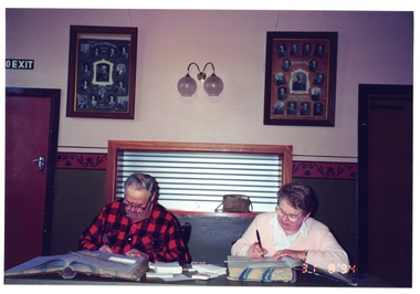 Buninyong & District Historical Society
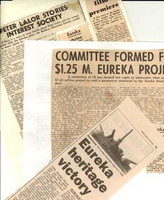 Federation University Historical Collection
 Learmonth and District Historical Society Inc.
 Learmonth and District Historical Society Inc.
 Learmonth and District Historical Society Inc.
 Learmonth and District Historical Society Inc.
 Learmonth and District Historical Society Inc.
 Learmonth and District Historical Society Inc.
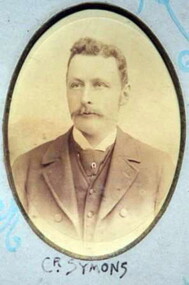 Learmonth and District Historical Society Inc.
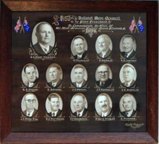 Learmonth and District Historical Society Inc.
 Learmonth and District Historical Society Inc.
 Learmonth and District Historical Society Inc.
 Learmonth and District Historical Society Inc.
 Learmonth and District Historical Society Inc.
 Learmonth and District Historical Society Inc.
 Learmonth and District Historical Society Inc.
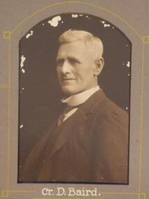 Learmonth and District Historical Society Inc.
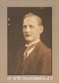 Learmonth and District Historical Society Inc.
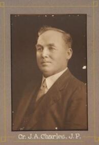 Learmonth and District Historical Society Inc.
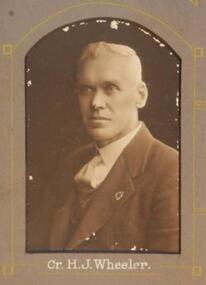 Learmonth and District Historical Society Inc.
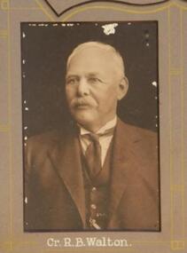 Learmonth and District Historical Society Inc.
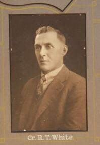 Learmonth and District Historical Society Inc.
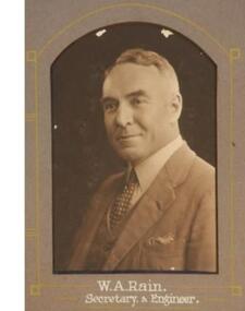 Learmonth and District Historical Society Inc.
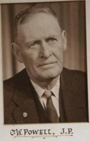 Learmonth and District Historical Society Inc.
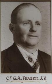 Learmonth and District Historical Society Inc.
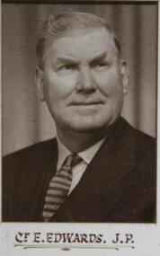 Learmonth and District Historical Society Inc.
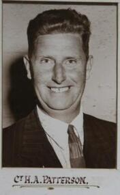 Learmonth and District Historical Society Inc.
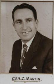 Learmonth and District Historical Society Inc.
 Learmonth and District Historical Society Inc.
 Learmonth and District Historical Society Inc.