
Showing 86 items matching "historical geological collection"
-
 The Beechworth Burke Museum
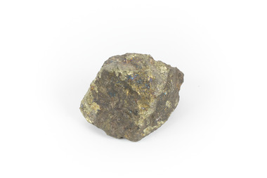
Geological specimen - Chalcopyrite
... geology...mount lyell...mount lyell mines...fools gold...mohs scale...crystals...minerals...historical geological collection...Many of these specimens were sent to research and collecting organisations across Australia, including the Burke Museum, to educate and encourage further study. burke museum beechworth indigo shire beechworth museum geology geological specimen chalcopyrite copper pyrites copper mining tasmanian geology mount lyell mount lyell mines fools gold mohs scale crystals minerals historical geological collection victorian geological survey a.r.c selwyn gold rush van diemans land This hand sized solid mineral specimen has shades of brass-yellow with spots of iridescent green-black tarnish. ...This specimen originated from Mount Lyell on the west coast of Tasmania, where a large group of open cut and underground copper-silver-gold mines began operating in 1883. Between 1893-1994, the Mt Lyell Mining and Railway Company were responsible for operations. The Mt Lyell copper-gold mines produce some excellent crystallised specimens of chalcopyrite and other minerals. The deposits are generally considered to be of Cambrian volcanic origin, but there are indications of Devonian granitic influence on the ores, plus local remobilisation during Devonian deformation. Over 120 million tonnes of ore was produced from several workings, including the main Prince Lyell mine and the North Lyell mine, which was also of great importance. The Mount Lyell mines have a long history of human and environmental disasters, including the 1912 North Lyell fire that killed 42 miners, and two separate incidents in 2013 in which three people lost their lives. The environmental impacts from this complex of mines are extensive, with waste tailings and heavy metal contamination flowing directly into the King and Queen River catchments. In 1954, the eminent Australian historian, Geoffrey Blainey, published 'The Peaks of Lyell' which delves into the history of the 1912 North Mount Lyell Disaster.Chalcopyrite does not contain the most copper in its structure relative to other minerals, but it is the most important copper ore since it can be found in many localities and occurs in a variety of ore types. The brassy-yellow colours in Chalcopyrite mean it is often confused with pyrites and gold, leading to use of the term, "fool's gold." Chalcopyrite has been the primary ore of copper since smelting began five thousand years ago. This specimen is part of a larger collection of geological and mineral specimens collected from around Australia (and some parts of the world) and donated to the Burke Museum between 1868-1880. A large percentage of these specimens were collected in Victoria as part of the Geological Survey of Victoria that begun in 1852 (in response to the Gold Rush) to study and map the geology of Victoria. Collecting geological specimens was an important part of mapping and understanding the scientific makeup of the earth. Many of these specimens were sent to research and collecting organisations across Australia, including the Burke Museum, to educate and encourage further study.This hand sized solid mineral specimen has shades of brass-yellow with spots of iridescent green-black tarnish. Chalcopyrite is a copper iron sulphide mineral and a major ore of copper common in sulphide veins and disseminated in igneous rocks. Chalcopyrite has a hardness of 3.5-4 on the Mohs Scale. It is a member of the tetragonal crystal system and has metallic lustre and opaque transparency.burke museum, beechworth, indigo shire, beechworth museum, geology, geological specimen, chalcopyrite, copper pyrites, copper mining, tasmanian geology, mount lyell, mount lyell mines, fools gold, mohs scale, crystals, minerals, historical geological collection, victorian geological survey, a.r.c selwyn, gold rush, van diemans land -
 Federation University Historical Collection
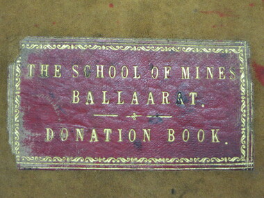
Book - Ledger, Ballarat School of Mines Donation Book, 1878 - 1895, 1878-1895
... The Museum was emptied in the 1960s with items being distrubuted to the Ballarat Historical Society, returned to original lenders (ie Pern Collection), of disposed of. ballarat school of mines doantions museum ballarat school of mines museum safety cage botanical garden materia medica garden library bella guerin james oddie phoenix foundry w.h. shaw john lynch henry sutton aboriginal stone axe tomahawk geological specimens moonta fedinand krause oddie collection of minerals thomas bath spears Solomon Islands King Billy bows and arrows ancient coins birds eggs snakes Donations to the Ballarat School of Mines include:
34. ...The Donation Book relates to the Ballarat School of Mines Museum which opened in 1872. Very few of these items are still held by Federation University. The Museum was emptied in the 1960s with items being distrubuted to the Ballarat Historical Society, returned to original lenders (ie Pern Collection), of disposed of. Donations to the Ballarat School of Mines include: 34. M. Hamburger, Ballarat - bunsen burner 41. W.H. Shaw, Phoenix Foundry - 81 nos of 'Engineer' 89. Juvenile Industrial Exhibition Association Committee per Joseph Flude - dies used for striking medals awarded to successful exhibits. 165. Ferdinand Von Mueller 172 Ferdinand Von Mueller o hortus siccus 6 197. James Stoddart 203. Edward Gazzard, North Creswick - Model of safety Cage invented and made by donor 218. E. Morey 222. Alfred Lestor 228. J.J. Sleep, Ballarat, patent Lever escarpment Clock (displayed in laboratories) 237. Bernard Smith (Warden) per favor of James M. Bickett - Bust of Mr John Lynch, Smythesdale. (Note: This item is not in the present Federation University Historical Collection) 241. James Oddie, J.P., Ballarat, Copy of 'the Chemist and Druggist' 267. John Lynch Junior, Smythesdale - Cast of "Golden Age" nugget, found at Browns by Co-operative party, 12 men. Weight 75 oz, 12 dwts, 12 grs.(Note: This item is not in the present Federation University Historical Collection) 270. Isaac Davis, Main Road, Ballarat 294. W. H. Shaw, Ballarat - 94 nos of 'The Engineer' 295. Rivett Henry Bland, Clunes - Specimen of water pipe from the Port Phillip Company's mine encrusted with carbonites of lime and magnesium (Note: This item is not in the present Federation University Historical Collection) 299. D.J. Williams, Queenscliff - 1 case shells from Fiji 305. C. Retallack, Ballarat 314. William Henry Shaw, Ballarat - glass case 323. W. Longley, Ballarat - Botanical Specimen (Note: This item is not in the present Federation University Historical Collection) 327. W. H. Angove, Perth 337. J. Cosmo Newbery, B Sc, Melbourne 343. James Hector, M.D., New Zealand 353. R.S. Mitchell, Ballarat - 8 specimens live plants (medicinal) (for the Ballarat School of Mines Garden) 355. W. Magee, Ballarat - Sugar cane plants and seeds (for the Ballarat School of Mines Garden) 363. James Hector, Wellington, new Zealand 371. William Wesley, 28 Essex St, Strand, London - Scientific book circular 380. Jacob Upfold (deceased) per favor of the trustees - bequest of steam engine indicator and belongings (boothe and case) 381. Joseph Mitchell, 22 Macarthur Street, Ballarat - sod of turf cut from Warboy's High Few, County Huntingdon, England, 1872. 394. W.H. Barnard 401. James Orr 418. F. Ratte, Sydney 440. Alfred Mica Smith, Sandhurst (Bendigo), Inaugural Address, delivered to the Bendigo School of Mines Science Society, June 20. 1881 by P.H. Macgillivray, MA, MRCS, FLS, President. (Note: This item is not in the present Federation University Historical Collection) (Note: This item is not in the present Federation University Historical Collection) 446. C. C. Shoppee, Ballarat 462. Dr Bunce, Ballarat 468. James Black, Mining Manager "Kerrit Bureet' 479. J.S. North, Mining Manager No. 2 Queen Co, Black Hill Ballarat. 505. Smith Tibbitts - A block of ancient leaves from the Nigtingbool Estate near Haddon on the Ballarat district from shaft 80 feet deep. (Note: This item is not in the present Federation University Historical Collection) 512. F.W. Niven, Ballarat - "A Handy Book to Tasmania" 522. James Hector, Wellington, New Zealand 549. C.E. Grainger, Manager Ballarat Woollen Mills - samples of dyed and raw wools 600. (4 July 1882) Henry Sutton, Ballarat - 13th annual report of the Aeronautical Society of Great Britain; 2 papers from the Proceedings of the Royal Society, nos 217 and 218- 1882, "One a new electrical storage battery by Henry Sutton, Ballarat, Victoria. 608. H. Glenny J.P., Ballarat - Specimen of Asbestos from Tasmania 610. M.H. Edelmann, Munich, Germany 674. W.H. Shaw, Phoenix Foundry - Steel boring 95 feet long taken from bed-plate of locomotive engine. 675 - H.R. Hancock J.P. pre favour Mr James Pryor, Moonta Mines 676. Baron Ferdinand Von Mueller KCMG, etc, Melbourne 678. E.F.A. Gaunt, Royal Navy, H.M.S. Nelson, per favour Lyde Gaunt - Specimen of manganese ore from the mines - Russell - New Zealand 728. Dr Pinnock, Ballarat 760. Simon Morrison, Ballarat 784. James Shugg, Hamilton - 1 case fossils from Muddy Creek, near Hamilton. (Note: This item is not in the present Federation University Historical Collection) 786. W. Bolam (inspector of Schools), Melbourne - 2 spears and 1 fishing prong Fijian 806. James Oddie, Ballarat 708. Henry G. Hanks, San Francisco 786. W. Bolam (Inspector of Government Schools Melbourne) - 2 spears and one fishing prong Fijian 824. Henrique Gorceixm Onro Preto, Brazil 840. W. Laplau, Ballarat - Gas furnace with a large assortment of fittings, also large gas holder and oil-heating apparatus 854. Robert Borch, Main Road, Ballarat - Improved safety chain (Note: This item is not in the present Federation University Historical Collection) 928. James Oddie 944. James P. Munroe, Registrar, Massachusetts 952. L.E. Cutter per favour of Mr F.J. Martell - Unexploded bomb shell from the Eureka Stockade 957. H. Glenny, Hobart 962. George Hart, Ballarat - eagle 976. Henry Sutton, Ballarat - 1 volume "Plattner on the Blowpipe" 978. J.W. Flatow, 45 Madeline Street, Carlton, Melbourne 984. Charles C Shoppee Ballarat - Copies of ancient coins 989-95 - Specimens from Moonta, South Australia 985. W.H. Wooster BOlwarra - books microscope related 1179. James Oddie - Live hedgehog 1181 C. Crisp, Bacchus Marsh, Portugal Copper Coin, 1785 1248 James Oddie, Solomon Islands - Bow and arrows & Spears 1285. C. Colyer, Smythesdale 1327. John L. McKenna, Smeaton - Fragment of Stone Axe. 1395. Mrs O. Skoglund, Nerrina 1428. Daniel Brophy, Ballarat - Collection of mineral specimen form Silverton (Collected by Mrs James Murray) 1442. Henry Sutton, Ballarat - Specimens of fossil fruits collected at Haddon by Charles Brown. 1444. Mining Department - Underground Mine Workings from Band of Hope and others. 1517. W.H. Wooster, Ballarat 1592. Bishop of Ballarat - Stone Axe and other native items 1669. H. McHaffier, Napoleons - 1 Spanish silver coin 1681. James Oddie, Dunedin 1688. W. Burbridge, Ballarat - Native Tomahawk from Metung 1708. A. Doepel, Ballarat 1712. Marty Guerin, Ballarat 1735. Bella Guerin. M.A., Ballarat - Copy Wide Awake Vol 1 No 7 May 28th 1887 and The Bulletin, March 19th 1887. 1747. Bella Geurin M.A., Ballarat - Copy Wide Awake Vol 1 No 8 June 4 1887 1751. Bella Geurin M.A., Ballarat - Copy Wide Awake Vol 1 No 9 June 11th 1887 1842. Linnean Society, London England - Charter, By Laws, Proceedings, Transactions, Journals 1853. W.J. Corbould, Silverton, NSW - chloride of silver from Pinnacles, Broken Hill, Silverton 1888. W. J. Corbould, Sample of metallic silver from Silverton, NSW 1928. E. Morey, Ballarat - Steam Engine 1937. Henry Sutton A.S.I.E., Ballarat - Plate Electric Machine, chimes and Sportman (number crossed out) 1951. Henry Sutton A.S.I.E., Ballarat - Plate Electric Machine, chimes and Sportman 1981. Harrie Wood (per W.H.B.[Barnard?), Ballarat 1996. W.H. Shaw, Phoenix Foundry - Papers "The Vict Engineer July 1887, May June July August 1888 and others 2014. Harrie Wood, Sydney - Report Department of Mines, 18872027. W.J. Bechervaise - Copy of Book by Baldwin Spencer 2034. A.G. Randall - Native Hatchet 2045. W.H. Corbould, Silverton, Collection of silver ores 2051. Fowler, Tarnagulla - Native Tomahawk 2123-2131. James Oddie, London 2163. Roff. F. Taplier, Sturt Street - Native Tomahawk 2178. Syd. Johnson, Meredith - Native Tomahawk, Greenstone 2184. Mr Tupp for Hall - Native Spear and Club 2292. Emmanuel Steinfeld, Melbourne 2313. A. Atwood, Rowlands Factory, Dana Street 2361. Dr Pinnock, Ballarat - Collection of Living Sponges 2363. P. Curnow, Ballarat - Piece of wood with stone naturally embedded 2364. R. Dowling, Waubra 2875. Mrs C, Flude, Ballarat - Collection of (5) mineral specimens 3460. Joseph Weir, Ballarat - Sample of rolled Annibar 3466. J. Hart, Ballarat - Native Shield - supposed to have been made by King Billy 4784. Mr. O. Woolnaugh, Pleasant Street - Four Native Tomahawks 6469. L. Balhausen, Ballarat 3472. John English, Smeaton - three samples of auriferous wash dirt 3607. Columbia College, New York - Handbook of Information of the Columbia College in the Ciry of New York 1892-3. 3672. L.A. Samuels, Bendigo 3724. P. Paperhagen 3736. The Late Rivett Henry Bland per John Noble Wilson - Collection of mineral specimens and fossils 3752. G.A. Denny, South Africa 3755. J. Carroll, Ballarat - Specimen of Native bread found in Ballarat East. 4765. J. Donnelly, Springs, Bungaree I. Fowler, Coolgardie, Specimen of Gold Bearing Quartz ballarat school of mines, doantions, museum, ballarat school of mines museum, safety cage, botanical garden, materia medica garden, library, bella guerin, james oddie, phoenix foundry, w.h. shaw, john lynch, henry sutton, aboriginal, stone axe, tomahawk, geological specimens, moonta, fedinand krause, oddie collection of minerals, thomas bath, spears, solomon islands, king billy, bows and arrows, ancient coins, birds eggs, snakes -
 The Beechworth Burke Museum
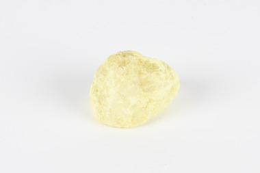
Geological specimen - Native Sulphur, unknown
... historical and current uses, and for its nature as one of the most abundant minerals on the planet. Sulphur's importance comes both from its abundance and its role in ensuring survival, creating other minerals, and daily human life. This specimen is significant as representative of sulphur's solid properties. This specimen is part of a larger collection of geological ...Native Sulphur in its solid form is a yellow crystalline mineral that forms near volcanic vents and fumaroles where it is the solid form of hot gases. It is also frequently found in the subsurface as a by-product of sulphide ore mineralization. In all its forms, sulphur is one of the most commonly occurring minerals on the planet, especially in natural gases, and is key to the make-up of a range of other minerals. It is essential to continuing life on earth, and was used in ancient societies as part of medical care, religious rites, and entertainment, and was key to the invention of gunpowder by the Chinese. Native Sulphur in its solid form is a yellow crystalline mineral that forms near volcanic vents and fumaroles where it is the solid form of hot gases. It is also frequently found in the subsurface as a by-product of sulphide ore mineralization. In all its forms, sulphur is one of the most commonly occurring minerals on the planet, especially in natural gases, and is key to the make-up of a range of other minerals. It is essential to continuing life on earth and was used in ancient societies as part of medical care, religious rites, and entertainment, and was key to the invention of gunpowder by the Chinese. The exact site of extraction for this specimen is unknown, but it was probably collected in New Zealand in the 1850s. Sulphur is significant both for its historical and current uses, and for its nature as one of the most abundant minerals on the planet. Sulphur's importance comes both from its abundance and its role in ensuring survival, creating other minerals, and daily human life. This specimen is significant as representative of sulphur's solid properties. This specimen is part of a larger collection of geological and mineral specimens collected from around Australia (and some parts of the world) and donated to the Burke Museum between 1868-1880. A large percentage of these specimens were collected in Victoria as part of the Geological Survey of Victoria that begun in 1852 (in response to the Gold Rush) to study and map the geology of Victoria. Collecting geological specimens was an important part of mapping and understanding the scientific makeup of the earth. Many of these specimens were sent to research and collecting organisations across Australia, including the Burke Museum, to educate and encourage further study.A solid, small, crystalline mineral specimen that is largely bright yellow, with some darker spotting. geological specimen, geology, geology collection, burke museum, beechworth, sulphur, native sulphur, new zealand, native sulphur specimen, sulphur specimen -
 The Beechworth Burke Museum
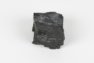
Geological specimen - Bituminous Coal, Unknown
... This specimen is significant as it was collected from the locality of Cape Paterson in Victoria, an area that has since become historically instrumental in the mining of coal and other substances in the state of Victoria. This specimen is part of a larger collection of geological and mineral specimens collected from around Australia (and some parts of the world) and donated to the Burke Museum between 1868-1880. ...Bituminous coal is the most common type of coal, abundantly found in ancient coal deposits which can be dated back millions of years. Often referred to as soft or black coal, this specimen exhibits a high carbon content, ranging from 76-86%. It also holds a relatively high energy density (27 MJ/kg) meaning that it releases significant amounts of energy when burned. Bituminous coal is most commonly used for electricity generation, as well as in the production of steel. This particular piece of coal was collected as part of the Geological Survey of Victoria in the nineteenth century. It originates from Cape Paterson, a seaside village located in South Gippsland, Victoria (located on Bunurong Country). The discovery of bituminous coal in this locality was first made in 1826 by explorer William Hovell. More discoveries were gradually made over the following decades and in 1859 the Victorian Coal Company commenced the first active coal mining operations in the state by sinking a number of shafts and bores near the area of Cape Paterson. Evidence of this coal-focused past can be found today at the State Coal Mine Museum in the nearby town of Wonthaggi. This specimen is significant as it was collected from the locality of Cape Paterson in Victoria, an area that has since become historically instrumental in the mining of coal and other substances in the state of Victoria. This specimen is part of a larger collection of geological and mineral specimens collected from around Australia (and some parts of the world) and donated to the Burke Museum between 1868-1880. A large percentage of these specimens were collected in Victoria as part of the Geological Survey of Victoria that begun in 1852 (in response to the Gold Rush) to study and map the geology of Victoria. Collecting geological specimens was an important part of mapping and understanding the scientific makeup of the earth. Many of these specimens were sent to research and collecting organisations across Australia, including the Burke Museum, to educate and encourage further study. A solid hand-sized piece of bituminous coal with a shiny black-grey surface and jagged edges.Existing Label: BITUMINOUS COAL / Locality: Cape / Patterson, VIC. burke museum, beechworth, geological, geological specimen, state coal mine museum, wonthaggi coal mine, victorian coal company, bituminous coal, coal victoria, coal energy generation, william hovell, cape paterson, coal specimen -
 The Beechworth Burke Museum
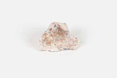
Geological specimen - Opal Bearing Stone, Unknown
... historical significance. It is from Lightning Ridge, which is well-known for being a large producer of opal stones, most famously black opal. The history of the period dates back to 140 million years, with the discovery of black opal in the early 1900s causing interest in the area. This specimen is part of a larger collection of geological ...There are 17 opal fields in Australia. This opal bearing stone was found in Lightning Ridge, NSW over what is known as the Great Australian Basin. This basin was formed and covers an area of 1.7 million square kilometers in eastern Australia in the Cretaceous period. This basin used to contain an inland sea, which provided an environment where silcrete eventually formed when water levels changed. This eventually seeped into other structures, and eventually hardened and formed opal. Lightning Ridge has a population of around 2000 people, with about 80 000 visitors every year. It is a historic mining town, and is known for its deposits of a rare black opal. Mining started in the area in the late 1800s, early 1900s when the black opal was discovered. This opal-bearing stone is of social and historical significance. It is from Lightning Ridge, which is well-known for being a large producer of opal stones, most famously black opal. The history of the period dates back to 140 million years, with the discovery of black opal in the early 1900s causing interest in the area. This specimen is part of a larger collection of geological and mineral specimens collected from around Australia (and some parts of the world) and donated to the Burke Museum between 1868-1880. A large percentage of these specimens were collected in Victoria as part of the Geological Survey of Victoria that begun in 1852 (in response to the Gold Rush) to study and map the geology of Victoria. Collecting geological specimens was an important part of mapping and understanding the scientific makeup of the earth. Many of these specimens were sent to research and collecting organisations across Australia, including the Burke Museum, to educate and encourage further study.***A palm-sized solid mineral specimen in shades of beige and light orange*** silica based? burke museum, beechworth, geological, geological specimen, opal, opal fields, australia, lightning ridge, new south wales, great australian basin, cretaceous, silcrete, black opal, mining -
 The Beechworth Burke Museum
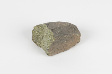
Geological specimen - Olivine Crystals, Unknown
... historically and socially significant. The olivine was found in the Newer Volcanic Province, an area which contains over 400 dormant volcanoes. This olivine is one part of a volcanic bomb, which would have ejected when magma erupted out of a volcano. This specimen is part of a larger collection of geological ...Olivine is mostly found on the Earth's surface in igneous rocks that are dark-coloured. It is common at divergent plate boundaries and at warm spots, such as volcanic areas. It crystalises and forms during the cooling of magma. Olivine is used in refractory sand, bricks, and gemstones. Olivine has been found on a number of meteorites, which might have originated from large asteroids or the mantle of a now-destroyed planet. This olivine crystal is thought to originate from Mount Noorat, with speculation that it could have originated from Mount Shadwell. Mount Noorat is a dormant volcano cone located in the Newer Volcanics Province of Victoria. Mount Noorat belongs to the Kirrae Wuurong people, who used the Mount as a place for meetings and gatherings prior to European settlement. Contact was first made between European settlers and the Indigenous people in 1841. The Mount has mostly been used for cattle and sheep grazing. Mount Shadwell is a well-known source of olivine and is the highest of a gathering of volcanic cones. The New Volcanic Province is located in South East Australia and covers 15000 square kilometres. It contains 400 explosive vents and small shield volcanoes. The last eruption is thought to have occurred 5000 years ago at Mount Gambier and Mount Schank. This olivine crystal has been identified as a volcanic bomb, which is a molten rock which was pushed out and ejected into the air when a volcano reupts. A rock needs to be larger than 65 mm in diameter to be classified as a volcanic bomb. This olivine volcanic bomb and its locality is historically and socially significant. The olivine was found in the Newer Volcanic Province, an area which contains over 400 dormant volcanoes. This olivine is one part of a volcanic bomb, which would have ejected when magma erupted out of a volcano. This specimen is part of a larger collection of geological and mineral specimens collected from around Australia (and some parts of the world) and donated to the Burke Museum between 1868-1880. A large percentage of these specimens were collected in Victoria as part of the Geological Survey of Victoria that begun in 1852 (in response to the Gold Rush) to study and map the geology of Victoria. Collecting geological specimens was an important part of mapping and understanding the scientific makeup of the earth. Many of these specimens were sent to research and collecting organisations across Australia, including the Burke Museum, to educate and encourage further study.A solid iron-magnesium silicate mineral with shades of green and brownburke museum, beechworth, geological, geological specimen, olivine, igneous rock, volcanic, gemstones, volcanic bomb, meteorites, asteroids, plantes, mount noorat, mount shadwell, indigenous, kirrae wuurong people, newer volcanics province, victoria, european settlement, eruption -
 The Beechworth Burke Museum
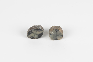
Geological specimen - Chiastolite
... historically significant. It is a very rare sort of andalusite mineral. It is from one of only two locations where it is regularly found in Australia. The carbon cross has made it an important religious symbol in the past. Its ability to withstand high temperatures has made it a common ingredient in heat-resistant bricks and ceramics today. This specimen is part of a larger collection of geological ...It is made up of andalusite. Andalusite is a rock-forming mineral, sometimes found in granite or schist. It is often used to make glass, ceramic products, chemicals, and heat-resistant bricks as it can withstand high temperatures without changing. The chiastolite contains particles of graphite, which arranges in geometric patterns. When crystal growth occurs in the rock, the granite particles concentrate at crystal interfaces and can result in cross shapes. These ‘cross stones’ have been valued and used for their spiritual or religious meaning and used as charms, gems, or amulets. Chiastolite was first discovered in 1754, seen in a description in a published book by a palaeontologist, Franciscan priest, and Spanish author, Jose Torrubia. Deposits have been found in Australia, France, the USA, Chile, Canada, Spain, Brazil, Sri Lanka, and Russia. Deposits have been found in Western Australia and South Australia. This particular specimen was found in Bimbowrie, South Australia. Other chiastolite specimens have been found in Bimbowrie, along with jasper, quartz, and aventurine in the form of rolled pebbles or schist. This chiastolite specimen is socially and historically significant. It is a very rare sort of andalusite mineral. It is from one of only two locations where it is regularly found in Australia. The carbon cross has made it an important religious symbol in the past. Its ability to withstand high temperatures has made it a common ingredient in heat-resistant bricks and ceramics today. This specimen is part of a larger collection of geological and mineral specimens collected from around Australia (and some parts of the world) and donated to the Burke Museum between 1868-1880. A large percentage of these specimens were collected in Victoria as part of the Geological Survey of Victoria that begun in 1852 (in response to the Gold Rush) to study and map the geology of Victoria. Collecting geological specimens was an important part of mapping and understanding the scientific makeup of the earth. Many of these specimens were sent to research and collecting organisations across Australia, including the Burke Museum, to educate and encourage further study.A metamorphic mineral consisting of andalusite, with a cross shaped graphite pattern in colours of grey, brown and yellowburke museum, beechworth, geological, geological specimen, andalusite, chiastolite, geometric, cross stone, spiritual, religious, australia, south australia, bimbowrie, quartz, jasper, aventurine, schist -
 The Beechworth Burke Museum
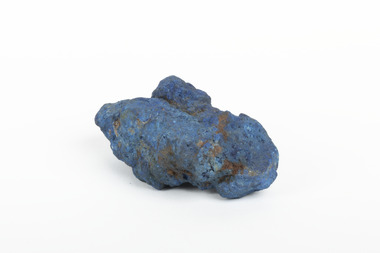
Geological specimen - Azurite, Unknown
... Named for its deep blue colour, azurite was historically used for pigment making and as a gemstone, despite its softness. This specimen was donated to the Burke Museum between 1868-1880 as part of a larger collection of geological and mineral specimens. ...Azurite is a secondary copper mineral made by the weathering of copper sulphide ore deposits. Azurite is formed from copper, carbon, oxygen and hydrogen. There are over 45 forms of azurite that are more well-known, however over 100 forms have been found. Azurite is also commonly found together with Malachite, and Azurite is often psuedomorphed to Malachite. This specimen was found at the Great Cobar Copper Mine in New South Wales, which was founded in 1870. At the time it was one of the largest mining operations in the world. It was the largest copper mine in Australia and housed the southern hemisphere’s tallest chimney stack. The international price of copper collapsed at the end of World War 1 which led to the closure of the Great Cobar Mine on March 16th 1919. A year later on March 10th 1920 an underground fire in the CSA (Cornish, Scottish, Australian) mine started and burned for 16 years. The closure of the mine and the fire left thousands jobless and many people left the area. These were factors in Cobar facing a long stretch of poverty, until a boom in the 1960s led to the reopening of the mine. The mine still operates today, obtained by Metals Acquisition Limited in June 2023. Azurite is considered an uncommon mineral. Named for its deep blue colour, azurite was historically used for pigment making and as a gemstone, despite its softness. This specimen was donated to the Burke Museum between 1868-1880 as part of a larger collection of geological and mineral specimens. Many of the specimens in this collection were obtained as part of the Geological Survey of Victoria, which started in 1852. The Survey aimed to map the scientific makeup of the earth.A solid copper mineral with shades of darker blues almost covering it.burke museum, beechworth, indigo shire, beechworth museum, geological, geological specimen, mineralogy, cobar mines, great cobar copper mine, cobar mining, new south wales, azurite, azurite specimen -
 The Beechworth Burke Museum
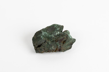
Geological specimen - Malachite, Unknown
... historically. It has been cut and sculpted into beads for jewellery use as its rich colour and distinct yet unique patterns have made it a well sought after gemstone. Its' continued use over time only heightens the value and significance of this mineral. Burke Museum Burke Museum Collection Beechworth Museum Beechworth Geological ...This specimen is a copper-carbonate malachite mineral. It is often found as crystalline aggregates or crusts, which have a banded agate-like appearance while also commonly found as botryoidal clusters of radiating crystals. Malachite is often bright green in colour, with dark green and blackish blooms or stripes/bands throughout the mineral. This particular specimen was recovered from the Burra Burra Copper Mine located Burra, South Australia. By the 1860's, South Australia was known as the "Copper Kingdom" due to its large amount of copper mines and huge success in the copper mining industry. Burra Burra was no exception to this phenomena, as this mining company was greatly famous and successful, being nicknamed the "Monster Mine". It was first established in 1848 and was the largest metal mine in Australia up until 1860. This specimen is significant as it highlights the historic use and value of malachite and the rarity of the mineral. Malachite is a rare gemstone which has been used in various ways historically. It has been cut and sculpted into beads for jewellery use as its rich colour and distinct yet unique patterns have made it a well sought after gemstone. Its' continued use over time only heightens the value and significance of this mineral.A hand-sized solid copper-carbonate hydroxide mineral specimen in shades of blue, green and copper tones throughout.MALACHITE / (Copper carbonite) / Locality: Burra, South Aust. | Malachite / Burra Burra / South Australia / (good specimen) / needs a wash / BBburke museum, burke museum collection, beechworth museum, beechworth, geological specimen, geological, mineral, mineraology, copper carbonate, malachite, burra burra mine, copper mining -
 The Beechworth Burke Museum
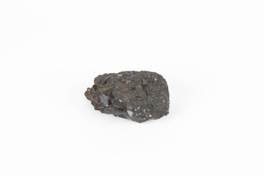
Geological specimen - Garnet crystals in galena, Unknown
... geological surveyers in Victoria and Australia during the early to late 19th Century. The fact that it is only found in one mining area of Australia, shows that this specimen is rare for examples of Australian Galena. This mineral specimen is one part to a larger collection, aquistion, and distribution of Garnet in Galena around Australia and parts of the world and donated to the Burke Museum between 1860-1880. While this specimen was not found by the Victorian Geological Survey, it shows the historical ...Majority of Galena in Australia is found in hydrothermal deposits emplaced around 1680 million years ago which have been heavily metamorphosed. Galena is the natural mineral form of lead sulfaide. It occurs generally as fine to large crystals due to syntectonic remobilization at low temperatures and moves to a suitable location. The colour is a shining lead and silvery gray with high specific gravity between 7.2 and 7.6 gms/cm3 and contains 86.6 lead sulfaide in its purest form. Its cyrstal system is cubic with perfect cleavages, and contract penetration and lamellar twinning. This particular specimen is from the Broken Hill mine, it is one of the largest lead mines located in Western New South Wales and still has ore reserves amounting to 20.9 million tonnes of ore grading of 7.4% lead, 9.4% zinc, and 61.5 million oz of Silver. Throughout its history, it has produced over 200 million tonnes of ore throughout its 127 years of mining history dating back to 1885. Galena mineral ore found in Australia is considered rare, as it is only currently found in the Broken Hill Mine of Western New South Wales. It represents heritage value through the systematic collecting of the geological surveyers in Victoria and Australia during the early to late 19th Century. The fact that it is only found in one mining area of Australia, shows that this specimen is rare for examples of Australian Galena. This mineral specimen is one part to a larger collection, aquistion, and distribution of Garnet in Galena around Australia and parts of the world and donated to the Burke Museum between 1860-1880. While this specimen was not found by the Victorian Geological Survey, it shows the historical need for mapping geological areas around the Gold Rush region to further identify areas of precious metal and gem aquisition. Additionally, collecting these specimens was an important part of mapping the scientific make up of the earth's surface. Many were sent to institutions for further contribution to research and scientific knowledge of the specimens. A solid coin-sized lead and zinc sulphaide and zinc silicate ore mineral in shades of black and red with shiny black points. GARNET CRYSTALS in / GALENA (lead sulphide), / SPALERITE (zinc sulphide), / WILLEMITE (zinc silicate) ore. / Locality: Broken Hill, NSWburke museum, #beechworth, indigo shire, beechworth museum, geological, geological specimen, mineral, galena, galena quartz, broken hill mine, broken hill, nsw -
 The Beechworth Burke Museum
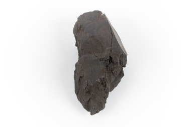
Geological specimen - Brown coal
... The Victorian Heritage Database has listed the Lal Lal Coal Mine with local significance, with their Statement of Significance stating: "The Lal Lal coal mine is historically significant as the site of the first discovery of lignite (brown coal) in Victoria, and one that promised important benefits to regional and state industries that were reliant on coal imports at the time. The significance of the stie is reduced by the poor state of preservation of the coal mining and processing fabric". This specimen is part of a larger collection of geological ...This particular specimen was recovered from the Lal Lal Coal and Iron Mine in Victoria, 19km from Ballarat. Brown Coal was discovered here in 1857, just alongside the Geelong to Ballarat Railway line. This discovery of lignite (brown coal) was the first in Victoria, which would bring important benefits to the region and state, both of which had previously been reliant on coal imports. In the 1860s, iron ore was found just 5km from Lal Lal, and the area was converted into an Iron Ore Mine. The Lal Lal Iron Mining Company took over operations in 1874, who then peaked iron production in 1884. This mine continued operations until June 1884, when the blast furnace was extinguished and never recommenced. The blast furnace at Lal Lal is considered one of the most important and highly significant sites ion early industrial history in Australia, as it is the only remaining best furnace from the nineteenth century in the Southern Hemisphere. The furnace ruins are 17 metres high, and are clearly visible today on Iron Mine Road, Lal Lal, near the Bungal Dam. This specimen of Lignite (brown coal) is significant, as it was mined from the area where brown coal was first discovered in Victoria, leading to an important and controversial future of the mining and use of brown coal in this State. The Victorian Heritage Database has listed the Lal Lal Coal Mine with local significance, with their Statement of Significance stating: "The Lal Lal coal mine is historically significant as the site of the first discovery of lignite (brown coal) in Victoria, and one that promised important benefits to regional and state industries that were reliant on coal imports at the time. The significance of the stie is reduced by the poor state of preservation of the coal mining and processing fabric". This specimen is part of a larger collection of geological and mineral specimens collected from around Australia (and some parts of the world) and donated to the Burke Museum between 1868-1880. A large percentage of these specimens were collected in Victoria as part of the Geological Survey of Victoria that begun in 1852 (in response to the Gold Rush) to study and map the geology of Victoria. Collecting geological specimens was an important part of mapping and understanding the scientific makeup of the earth. Many of these specimens were sent to research and collecting organisations across Australia, including the Burke Museum, to educate and encourage further study.A hand-sized light-weight, soft and combustable sedimentary rock specimen, that is dark brown in colour. The specimen has jagged edges, as though parts of the rock have crumbled away. Brown coal, or Lignite, is formed naturally from compressed peat, and is typically found in natural basins. The stages to the formation of coal ('coalification') begin with plant material and wood, which will decay if it is not subjected to deep burial or heating, and turn into Peat. Peat, when sufficiently compressed naturally, will turn into Brown Coal (Lignite), and finally into Black Coal (sub-bituminous, bituminous and anthracite). Each successive stage has a higher energy content and lower water content. It is brownish-black in colour. Brown Coal has a high moisture content, between 50 and 75 percent, and a low carbon content. Some Brown Coals may be stratified, with layers of plant matter, which means little coalification has occurred beyond the peat natural processing stage. When Brown Coal is submerged in dilute nitric acid or boiling potassium hydroxide solution, it reacts to produce a reddish solution, of which higher-ranked coals do not. When brown coal is pulverised and burned in boilers, the steam is used to drive turbines, which generates electricity. It is the lowest rank of coal, as when burned, it creates a relatively low heat content, which in turn does not create a great output of steam. burke museum, beechworth, indigo shire, beechworth museum, geological, geological specimen, mineralogy, brown coal, brown coal specimen, lignite, lal lal, lal lal coal mine, lal lal iron mine, ballarat, blast furnace -
 Flagstaff Hill Maritime Museum and Village
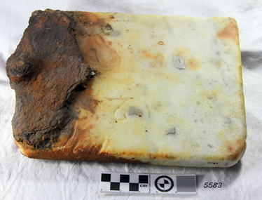
Geological specimen - Marble, 1873-1878
... historical themes of the time. The collections historically significance is that it is associated unfortunately with the worst and best-known shipwreck in Victoria's history. flagstaff hill warrnambool shipwrecked coast flagstaff hill maritime museum maritime museum shipwreck coast flagstaff hill maritime village great ocean road loch line loch ard captain gibbs eva carmichael tom pearce glenample station mutton bird island loch ard gorge marble fireplace wrought iron fireplace surround None Rectangular piece of cream coloured marble fireplace surround, with an embedded section of wrought iron in one end. Recovered from the wreck of the Loch Ard. Geological ...The Loch Ard got its name from ”Loch Ard” a loch that lies west of Aberfoyle, and east of Loch Lomond. It means "high lake" in Scottish Gaelic. The vessel belonged to the famous Loch Line which sailed many vessels from England to Australia. The Loch Ard was built in Glasgow by Barclay, Curdle and Co. in 1873, the vessel was a three-masted square-rigged iron sailing ship that measured 79.87 meters in length, 11.58 m in width, and 7 m in depth with a gross tonnage of 1693 tons with a mainmast that measured a massive 45.7 m in height. Loch Ard made three trips to Australia and one trip to Calcutta before its fateful voyage. Loch Ard left England on March 2, 1878, under the command of 29-year-old Captain Gibbs, who was newly married. The ship was bound for Melbourne with a crew of 37, plus 17 passengers. The general cargo reflected the affluence of Melbourne at the time. Onboard were straw hats, umbrella, perfumes, clay pipes, pianos, clocks, confectionery, linen and candles, as well as a heavier load of railway irons, cement, lead and copper. There were other items included that were intended for display in the Melbourne International Exhibition of 1880. The voyage to Port Phillip was long but uneventful. Then at 3 am on June 1, 1878, Captain Gibbs was expecting to see land. But the Loch Ard was running into a fog which greatly reduced visibility. Captain Gibbs was becoming anxious as there was no sign of land or the Cape Otway lighthouse. At 4 am the fog lifted and a lookout aloft announced that he could see breakers. The sheer cliffs of Victoria's west coast came into view, and Captain Gibbs realised that the ship was much closer to them than expected. He ordered as much sail to be set as time would permit and then attempted to steer the vessel out to sea. On coming head-on into the wind, the ship lost momentum, the sails fell limp and Loch Ard's bow swung back towards land. Gibbs then ordered the anchors to be released in an attempt to hold its position. The anchors sank some 50 fathoms - but did not hold. By this time the ship was among the breakers and the tall cliffs of Mutton Bird Island rose behind. Just half a mile from the coast, the ship's bow was suddenly pulled around by the anchor. The captain tried to tack out to sea, but the ship struck a reef at the base of Mutton Bird Island, near Port Campbell. Waves subsequently broke over the ship and the top deck became loosened from the hull. The masts and rigging came crashing down knocking passengers and crew overboard. When a lifeboat was finally launched, it crashed into the side of Loch Ard and capsized. Tom Pearce, who had launched the boat, managed to cling to its overturned hull and shelter beneath it. He drifted out to sea and then on the flood tide came into what is now known as Loch Ard Gorge. He swam to shore, bruised and dazed, and found a cave in which to shelter. Some of the crew stayed below deck to shelter from the falling rigging but drowned when the ship slipped off the reef into deeper water. Eva Carmichael a passenger had raced onto the deck to find out what was happening only to be confronted by towering cliffs looming above the stricken ship. In all the chaos, Captain Gibbs grabbed Eva and said, "If you are saved Eva, let my dear wife know that I died like a sailor". That was the last Eva Carmichael saw of the captain. She was swept off the ship by a huge wave. Eva saw Tom Pearce on a small rocky beach and yelled to attract his attention. He dived in and swam to the exhausted woman and dragged her to shore. He took her to the cave and broke the open case of brandy which had washed up on the beach. He opened a bottle to revive the unconscious woman. A few hours later Tom scaled a cliff in search of help. He followed hoof prints and came by chance upon two men from nearby Glenample Station three and a half miles away. In a complete state of exhaustion, he told the men of the tragedy. Tom then returned to the gorge while the two men rode back to the station to get help. By the time they reached Loch Ard Gorge, it was cold and dark. The two shipwreck survivors were taken to Glenample Station to recover. Eva stayed at the station for six weeks before returning to Ireland by steamship. In Melbourne, Tom Pearce received a hero's welcome. He was presented with the first gold medal of the Royal Humane Society of Victoria and a £1000 cheque from the Victorian Government. Concerts were performed to honour the young man's bravery and to raise money for those who lost family in the disaster. Of the 54 crew members and passengers on board, only two survived: the apprentice, Tom Pearce and the young woman passenger, Eva Carmichael, who lost her family in the tragedy. Ten days after the Loch Ard tragedy, salvage rights to the wreck were sold at auction for £2,120. Cargo valued at £3,000 was salvaged and placed on the beach, but most washed back into the sea when another storm developed. The wreck of Loch Ard still lies at the base of Mutton Bird Island. Much of the cargo has now been salvaged and some items were washed up into Loch Ard Gorge. Cargo and artefacts have also been illegally salvaged over many years before protective legislation was introduced in March 1982. One of the most unlikely pieces of cargo to have survived the shipwreck was a Minton majolica peacock- one of only nine in the world. The peacock was destined for the Melbourne 1880 International Exhibition. It had been well packed, which gave it adequate protection during the violent storm. Today the Minton peacock can be seen at the Flagstaff Hill Maritime Museum in Warrnambool. From Australia's most dramatic shipwreck, it has now become Australia's most valuable shipwreck artifact and is one of very few 'objects' on the Victorian State Heritage Register. The shipwreck of the Loch Ard is of significance for Victoria and is registered on the Victorian Heritage Register ( S 417). Flagstaff Hill has a varied collection of artefacts from Loch Ard and its collection is significant for being one of the largest accumulation of artefacts from this notable Victorian shipwreck. The collections object is to also give us a snapshot into history so we can interpret the story of this tragic event. The collection is also archaeologically significant as it represents aspects of Victoria's shipping history that allows us to interpret Victoria's social and historical themes of the time. The collections historically significance is that it is associated unfortunately with the worst and best-known shipwreck in Victoria's history. Rectangular piece of cream coloured marble fireplace surround, with an embedded section of wrought iron in one end. Recovered from the wreck of the Loch Ard. Noneflagstaff hill, warrnambool, shipwrecked coast, flagstaff hill maritime museum, maritime museum, shipwreck coast, flagstaff hill maritime village, great ocean road, loch line, loch ard, captain gibbs, eva carmichael, tom pearce, glenample station, mutton bird island, loch ard gorge, marble fireplace, wrought iron, fireplace surround -
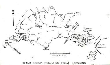 Phillip Island and District Historical Society Inc.
Photograph
... One of a collection of over 400 photographs in an album commenced in 1960 and presented to the Phillip Island & Westernport Historical Society by the Shire of Phillip Island local history photography phillip island black & white photograph phillip island geology Map Dr G Baker John Jenner Bryant West Photograph of a map of Phillip Island in the making and showing fourteen separate Islands before natural processes joined them. ...One of a collection of over 400 photographs in an album commenced in 1960 and presented to the Phillip Island & Westernport Historical Society by the Shire of Phillip IslandPhotograph of a map of Phillip Island in the making and showing fourteen separate Islands before natural processes joined them.local history, photography, phillip island, black & white photograph, phillip island geology, map, dr g baker, john jenner, bryant west -
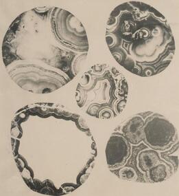 Phillip Island and District Historical Society Inc.
Photograph
... One of a collection of over 400 photographs in an album commenced in 1960 and presented to the Phillip Island & Westernport Historical Society by the Shire of Phillip Island local history photography polished amygdales black & white photograph geology John Jenner Bryant West Photograph of five polished surfaces of Amygdales from Pyramid Rock. ...One of a collection of over 400 photographs in an album commenced in 1960 and presented to the Phillip Island & Westernport Historical Society by the Shire of Phillip IslandPhotograph of five polished surfaces of Amygdales from Pyramid Rock. Enlarged by four times.local history, photography, polished amygdales, black & white photograph, geology, john jenner, bryant west -
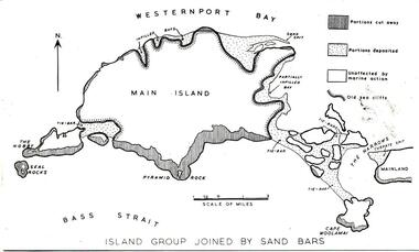 Phillip Island and District Historical Society Inc.
Photograph
... One of a collection of over 400 photographs in an album commenced in 1960 and presented to the Phillip Island & Westernport Historical Society by the Shire of Phillip Island local history photography phillip island black & white photograph phillip island geology map Map of Phillip Island John Jenner Bryant West Photograph of a map of Phillip Island showing a late stage in the geological formation Photograph Bryant West Dr G Baker ...One of a collection of over 400 photographs in an album commenced in 1960 and presented to the Phillip Island & Westernport Historical Society by the Shire of Phillip IslandPhotograph of a map of Phillip Island showing a late stage in the geological formationlocal history, photography, phillip island, black & white photograph, phillip island geology, map, map of phillip island, john jenner, bryant west -
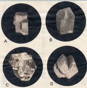 Phillip Island and District Historical Society Inc.
Photograph
... One of a collection of over 400 photographs in an album commenced in 1960 and presented to the Phillip Island & Westernport Historical Society by the Shire of Phillip Island local history photography mineral crystals black & white photograph geology Cape Woolamai John Jenner Bryant West Photograph of four mineral crystals from Cape Woolamai. ...One of a collection of over 400 photographs in an album commenced in 1960 and presented to the Phillip Island & Westernport Historical Society by the Shire of Phillip IslandPhotograph of four mineral crystals from Cape Woolamai. A, B and D are twinned monoclinic crystals of orthoclase-perthite. C, Lexagonal crystals.local history, photography, mineral crystals, black & white photograph, geology, cape woolamai, john jenner, bryant west -
 Phillip Island and District Historical Society Inc.
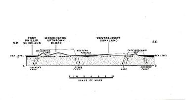
Photograph
... One of a collection of over 400 photographs in an album commenced in 1960 and presented to the Phillip Island & Westernport Historical Society by the Shire of Phillip Island local history photography geological fault block movements black & white photograph geology phillip island mornington peninsula Sketches John Jenner Bryant West Photograph of a sketch of a geological section across Mornington Peninsular Western Passage and Phillip Island. ...One of a collection of over 400 photographs in an album commenced in 1960 and presented to the Phillip Island & Westernport Historical Society by the Shire of Phillip IslandPhotograph of a sketch of a geological section across Mornington Peninsular Western Passage and Phillip Island. Drawn by Dr G Bakerlocal history, photography, geological fault block movements, black & white photograph, geology, phillip island, mornington peninsula, sketches, john jenner, bryant west -
 Phillip Island and District Historical Society Inc.
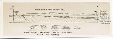
Photograph
... One of a collection of over 400 photographs in an album commenced in 1960 and presented to the Phillip Island & Westernport Historical Society by the Shire of Phillip Island local history photography geological section across phillip island black & white photograph geography topography cowes pyramid rock Sketches Dr G Baker John Jenner Bryant West Geological section from Pyramid Rock to Cowes Photograph of a sketch of the geological section from Pyramid Rock to Cowes - drawn by Dr G Baker, CSIRO, University of Melbourne. ...One of a collection of over 400 photographs in an album commenced in 1960 and presented to the Phillip Island & Westernport Historical Society by the Shire of Phillip IslandPhotograph of a sketch of the geological section from Pyramid Rock to Cowes - drawn by Dr G Baker, CSIRO, University of Melbourne.Geological section from Pyramid Rock to Coweslocal history, photography, geological section across phillip island, black & white photograph, geography, topography, cowes, pyramid rock, sketches, dr g baker, john jenner, bryant west -
 Phillip Island and District Historical Society Inc.
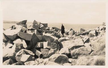
Photograph
... One of a collection of over 400 photographs in an album commenced in 1960 and presented to the Phillip Island & Westernport Historical Society by the Shire of Phillip Island local history photography dr g baker black & white photograph geology coastline cape woolamai John Jenner Bryant West Photograph of Dr G Baker standing on the granite of Woolamai "Jetty". ...One of a collection of over 400 photographs in an album commenced in 1960 and presented to the Phillip Island & Westernport Historical Society by the Shire of Phillip IslandPhotograph of Dr G Baker standing on the granite of Woolamai "Jetty". Dr Baker - CSIRO University of Melbourne - drew several Geological Sketches of Phillip Island and Westernport.local history, photography, dr g baker, black & white photograph, geology, coastline, cape woolamai, john jenner, bryant west -
 Phillip Island and District Historical Society Inc.
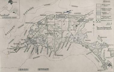
Photograph
... One of a collection of over 400 photographs in an album commenced in 1960 and presented to the Phillip Island & Westernport Historical Society by the Shire of Phillip Island local history photography phillip island map black & white photograph maps & mapping phillip island geology John Jenner Bryant West Photograph of a geological map of Phillip Island Photograph Bryant West ...One of a collection of over 400 photographs in an album commenced in 1960 and presented to the Phillip Island & Westernport Historical Society by the Shire of Phillip IslandPhotograph of a geological map of Phillip Islandlocal history, photography, phillip island map, black & white photograph, maps & mapping, phillip island, geology, john jenner, bryant west -
 Phillip Island and District Historical Society Inc.
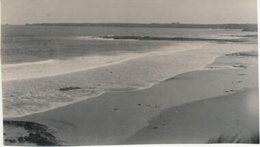
Photograph
... One of a collection of over 400 photographs in an album commenced in 1960 and presented to the Phillip Island & Westernport Historical Society by the Shire of Phillip Island local history photography basalt jetty surf beach black & white photograph coastline geology rock formations John Jenner Bryant West Photograph of the basalt Jetty and geological feature near Surf Beach Photograph Bryant West ...One of a collection of over 400 photographs in an album commenced in 1960 and presented to the Phillip Island & Westernport Historical Society by the Shire of Phillip IslandPhotograph of the basalt Jetty and geological feature near Surf Beachlocal history, photography, basalt jetty, surf beach, black & white photograph, coastline, geology, rock formations, john jenner, bryant west -
 Ringwood and District Historical Society
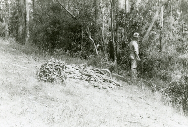
Photographs, 1979-80 MMBW pipe line project at Hubbard Reserve, North Ringwood � Boring mole pit
... geological fault that occurs along the line. The work took place from October 1979 to May 1980 on the southern boundary of Hubbard Reserve, North Ringwood. The collection was presented to the Ringwood Historical...geological fault that occurs along the line. The work took place from October 1979 to May 1980 on the southern boundary of Hubbard Reserve, North Ringwood. The collection was presented to the Ringwood Historical ...E560 N5 Dec 1979 A43 Boring mole pit near big box tree in 39 Burlock Avenue backyard Part of a 43-photo record of the MMBW�s engineering feat in drilling a 12 inch pipe line up to 40 feet deep through rock hardened by volcanic action associated with geological fault that occurs along the line. The work took place from October 1979 to May 1980 on the southern boundary of Hubbard Reserve, North Ringwood. The collection was presented to the Ringwood Historical Research Group by J Clarke on 9th June 1980. -
 Ringwood and District Historical Society
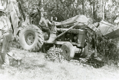
Photographs, 1979-80 MMBW pipe line project at Hubbard Reserve, North Ringwood � Back-hoe at pit
... geological fault that occurs along the line. The work took place from October 1979 to May 1980 on the southern boundary of Hubbard Reserve, North Ringwood. The collection was presented to the Ringwood Historical...geological fault that occurs along the line. The work took place from October 1979 to May 1980 on the southern boundary of Hubbard Reserve, North Ringwood. The collection was presented to the Ringwood Historical ...E560 N6 Dec 1979 A43 The back-hoe works on the beginnings of pit in 39 Burlock Avenue backyard Part of a 43-photo record of the MMBW�s engineering feat in drilling a 12 inch pipe line up to 40 feet deep through rock hardened by volcanic action associated with geological fault that occurs along the line. The work took place from October 1979 to May 1980 on the southern boundary of Hubbard Reserve, North Ringwood. The collection was presented to the Ringwood Historical Research Group by J Clarke on 9th June 1980. -
 Ringwood and District Historical Society
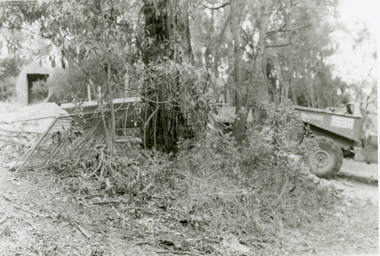
Photographs, 1979-80 MMBW pipe line project at Hubbard Reserve, North Ringwood � Cover of mole pit
... geological fault that occurs along the line. The work took place from October 1979 to May 1980 on the southern boundary of Hubbard Reserve, North Ringwood. The collection was presented to the Ringwood Historical...geological fault that occurs along the line. The work took place from October 1979 to May 1980 on the southern boundary of Hubbard Reserve, North Ringwood. The collection was presented to the Ringwood Historical ...E560 N24 Jan 1980 A43 Cover of mole pit near big box tree in 39 Burlock Avenue backyard Part of a 43-photo record of the MMBW�s engineering feat in drilling a 12 inch pipe line up to 40 feet deep through rock hardened by volcanic action associated with geological fault that occurs along the line. The work took place from October 1979 to May 1980 on the southern boundary of Hubbard Reserve, North Ringwood. The collection was presented to the Ringwood Historical Research Group by J Clarke on 9th June 1980. -
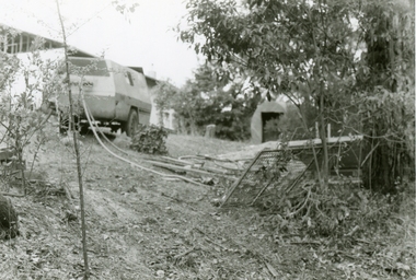 Ringwood and District Historical Society
Photographs, 1979-80 MMBW pipe line project at Hubbard Reserve, North Ringwood � Compressor unit in backyard
... geological fault that occurs along the line. The work took place from October 1979 to May 1980 on the southern boundary of Hubbard Reserve, North Ringwood. The collection was presented to the Ringwood Historical...geological fault that occurs along the line. The work took place from October 1979 to May 1980 on the southern boundary of Hubbard Reserve, North Ringwood. The collection was presented to the Ringwood Historical ...Part of a 43-photo record of the MMBW�s engineering feat in drilling a 12 inch pipe line up to 40 feet deep through rock hardened by volcanic action associated with geological fault that occurs along the line. The work took place from October 1979 to May 1980 on the southern boundary of Hubbard Reserve, North Ringwood. The collection was presented to the Ringwood Historical Research Group by J Clarke on 9th June 1980.E560 N23 Jan 1980 A43 Compressor unit in backyard of 39 Burlock Avenue -
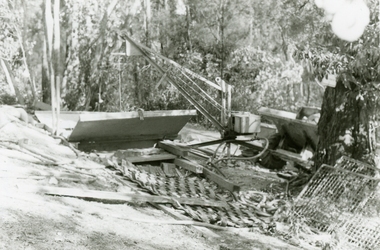 Ringwood and District Historical Society
Photographs, 1979-80 MMBW pipe line project at Hubbard Reserve, North Ringwood � Work on boring mole pit
... geological fault that occurs along the line. The work took place from October 1979 to May 1980 on the southern boundary of Hubbard Reserve, North Ringwood. The collection was presented to the Ringwood Historical...geological fault that occurs along the line. The work took place from October 1979 to May 1980 on the southern boundary of Hubbard Reserve, North Ringwood. The collection was presented to the Ringwood Historical ...Part of a 43-photo record of the MMBW�s engineering feat in drilling a 12 inch pipe line up to 40 feet deep through rock hardened by volcanic action associated with geological fault that occurs along the line. The work took place from October 1979 to May 1980 on the southern boundary of Hubbard Reserve, North Ringwood. The collection was presented to the Ringwood Historical Research Group by J Clarke on 9th June 1980.E560 N22Jan 1980 A43 Work on mole boring pit in 39 Burlock Avenue backyard -
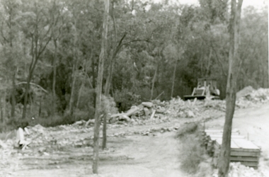 Ringwood and District Historical Society
Photographs, 1979-80 MMBW pipe line project at Hubbard Reserve, North Ringwood � Filling at 29 Burlock Avenue
... geological fault that occurs along the line. The work took place from October 1979 to May 1980 on the southern boundary of Hubbard Reserve, North Ringwood. The collection was presented to the Ringwood Historical...geological fault that occurs along the line. The work took place from October 1979 to May 1980 on the southern boundary of Hubbard Reserve, North Ringwood. The collection was presented to the Ringwood Historical ...Part of a 43-photo record of the MMBW�s engineering feat in drilling a 12 inch pipe line up to 40 feet deep through rock hardened by volcanic action associated with geological fault that occurs along the line. The work took place from October 1979 to May 1980 on the southern boundary of Hubbard Reserve, North Ringwood. The collection was presented to the Ringwood Historical Research Group by J Clarke on 9th June 1980.E560 N10 Dec 1979 A43 Filling at 29 Burlock Avenue -
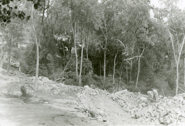 Ringwood and District Historical Society
Photographs, 1979-80 MMBW pipe line project at Hubbard Reserve, North Ringwood � Filling behind 29 Burlock Avenue just off sewer line
... geological fault that occurs along the line. The work took place from October 1979 to May 1980 on the southern boundary of Hubbard Reserve, North Ringwood. The collection was presented to the Ringwood Historical...geological fault that occurs along the line. The work took place from October 1979 to May 1980 on the southern boundary of Hubbard Reserve, North Ringwood. The collection was presented to the Ringwood Historical ...Part of a 43-photo record of the MMBW�s engineering feat in drilling a 12 inch pipe line up to 40 feet deep through rock hardened by volcanic action associated with geological fault that occurs along the line. The work took place from October 1979 to May 1980 on the southern boundary of Hubbard Reserve, North Ringwood. The collection was presented to the Ringwood Historical Research Group by J Clarke on 9th June 1980.E560 N9 Dec 1979 A43 Filling behind 29 Burlock Avenue just off sewer line -
 Ringwood and District Historical Society
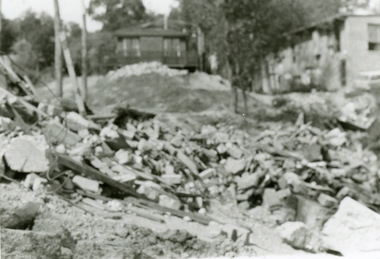
Photographs, 1979-80 MMBW pipe line project at Hubbard Reserve, North Ringwood � Filling at 29 Burlock Avenue
... geological fault that occurs along the line. The work took place from October 1979 to May 1980 on the southern boundary of Hubbard Reserve, North Ringwood. The collection was presented to the Ringwood Historical...geological fault that occurs along the line. The work took place from October 1979 to May 1980 on the southern boundary of Hubbard Reserve, North Ringwood. The collection was presented to the Ringwood Historical ...Part of a 43-photo record of the MMBW�s engineering feat in drilling a 12 inch pipe line up to 40 feet deep through rock hardened by volcanic action associated with geological fault that occurs along the line. The work took place from October 1979 to May 1980 on the southern boundary of Hubbard Reserve, North Ringwood. The collection was presented to the Ringwood Historical Research Group by J Clarke on 9th June 1980.E560 N11 Dec 1979 A43 Filling at 29 Burlock Avenue -
 Ringwood and District Historical Society
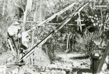
Photographs, 1979-80 MMBW pipe line project at Hubbard Reserve, North Ringwood � Closeup of revolving airwinch near Hibberd's house
... geological fault that occurs along the line. The work took place from October 1979 to May 1980 on the southern boundary of Hubbard Reserve, North Ringwood. The collection was presented to the Ringwood Historical...geological fault that occurs along the line. The work took place from October 1979 to May 1980 on the southern boundary of Hubbard Reserve, North Ringwood. The collection was presented to the Ringwood Historical ...Part of a 43-photo record of the MMBW�s engineering feat in drilling a 12 inch pipe line up to 40 feet deep through rock hardened by volcanic action associated with geological fault that occurs along the line. The work took place from October 1979 to May 1980 on the southern boundary of Hubbard Reserve, North Ringwood. The collection was presented to the Ringwood Historical Research Group by J Clarke on 9th June 1980.E560 N31 Jan 1980 A43 Closeup of revolving airwinch near Hibberd's house
