
Showing 87 items matching "housing types"
-
 Whitehorse Historical Society Inc.
Newsletter - Whitehorse Historical Society Newsletters 1980, 1980
... ...Housing Types...Produced by Whitehorse Historical Society in 1980 Commonwealth Social Services Heritage Week The Matilda Waltzers Union Railway Crossings Nunawading Shire Lilydale Shire Collingwood city Fitzroy Housing Types Phillip Island Pengiun Parade Mitcham Station masters house 150 years of permanent settlement in Victoria Newsletters published in 1980. ...Newsletters published in 1980. Featuring articles on: Commonwealth Social Services, 1909-1965 Heritage Week One Hundred Years Ago Factories, mining, farming, rural, investors, transport The Matilda Waltzers Union rules, Lord Hopetoun Railway crossings, boom gates, Springvale and Mitcham Road crossings Nunawading Shire, Gazette, 1879. Proclaimed an Area 7/8/1857. Councilors, population, officers Lilydale Shire, proclaimed a district 19/9/1856, and brief history Collingwood City, proclaimed 4/1855 Fitzroy, proclaimed Municipality 9/9/1856 Housing Types, styles, materials Phillip Island Penguin Parade, 50th Anniversary, 1980 Mitcham Station masters house bulldozed 150 years of Permanent Settlement in VictoriaTyped newslettersnon-fictionNewsletters published in 1980. Featuring articles on: Commonwealth Social Services, 1909-1965 Heritage Week One Hundred Years Ago Factories, mining, farming, rural, investors, transport The Matilda Waltzers Union rules, Lord Hopetoun Railway crossings, boom gates, Springvale and Mitcham Road crossings Nunawading Shire, Gazette, 1879. Proclaimed an Area 7/8/1857. Councilors, population, officers Lilydale Shire, proclaimed a district 19/9/1856, and brief history Collingwood City, proclaimed 4/1855 Fitzroy, proclaimed Municipality 9/9/1856 Housing Types, styles, materials Phillip Island Penguin Parade, 50th Anniversary, 1980 Mitcham Station masters house bulldozed 150 years of Permanent Settlement in Victoriacommonwealth social services, heritage week, the matilda waltzers union, railway crossings, nunawading shire, lilydale shire, collingwood city, fitzroy, housing types, phillip island pengiun parade, mitcham station masters house, 150 years of permanent settlement in victoria -
 Eltham District Historical Society Inc
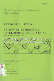
Document - Book, Econsult Planning and Development Pty Ltd, Residential Study: Review of Residential Development Regulations; Final Report; Volumes 1 and 2, October 1991
... *To determine the housing types and lot sizes, required by new residents in different locations...*To determine the housing types and lot sizes, required by new residents in different locations residential development Housing Two A4 bound volumes with green coloured face sheets and clear plastic covers. ...Report by Consultants Econsult Planning & Development produced under the Steering Committee guidance of the City of Doncaster and Templestowe and the Shire of Eltham recognising a lack of diversity in housing stock to meet changing housing needs. The Study objectives are: *To provide for a wide variety of housing choices and lot sizes *To make housing more accessible taking into account the Australian Model Code *To maintain residnetial amenity by taking into account significant local features *To prepare guidelines and policities which consider slope, lot, size, location, availability of services and significant vegeation. *To determine the housing types and lot sizes, required by new residents in different locationsresidential development, housing -
 Kiewa Valley Historical Society
Folder - Early Photos of Mt Beauty
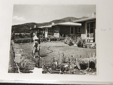
... Drawing Plan of 'Kiewa Scheme Mt Beauty Housing Type "G". 7. 5 pages on "Twelve Tips on Caring for Old Buildings 8. ...Drawing Plan of 'Mt Beauty Housing. Use of Prefabricated Cubicles for Houses. Type C.1 6. Drawing Plan of 'Kiewa Scheme Mt Beauty Housing Type "G". 7. 5 pages on "Twelve Tips on Caring for Old Buildings 8. ...Mt Beauty township was built during the 1950's to house the employees of the State Electricity Commission working on the Kiewa Hydro Electric Scheme. After the completion of the Kiewa Hydro Electric Scheme many houses were sold and the public buildings handed over to the Alpine Shire. Mt Beauty has always been a tourist destination especially with its proximity to the ski fields at Falls Creek.This folder contains many early photos of Mt Beauty showing the construction town during its development during the Kiewa Hydro Electric Scheme and its early days of tourism. A3 size black plastic folder with clear plastic sleeves holding early black & white photos of Mt Beauty township. Also included are: 1. 3 foolscap pages -Nov., 1953 Kiewa Hydro-Electric Scheme Progress. 2. SECV Drawing Plan (No. K6242) of Mt Beauty House - 3 angles and floor plan, English Pre-cut Type 3B.ILA with note that all houses with prefix 3B are similar. 3. Orange, black and white pamphlet "Welcome to Kiewa" 4. Tourist postcard 'fold-up' of 11 postcards "Mt Beauty and the Kiewa Scheme, Victoria 5. Drawing Plan of 'Mt Beauty Housing. Use of Prefabricated Cubicles for Houses. Type C.1 6. Drawing Plan of 'Kiewa Scheme Mt Beauty Housing Type "G". 7. 5 pages on "Twelve Tips on Caring for Old Buildings 8. Booklet advertising Mt Beauty housing for sale including activities available in the area. (1960's) 9. List of Photos from SECV held by KVHS Some photos have handwritten labels mt beauty. secv. kiewa hydro electric scheme.tourism. housing. construction town. falls creek. -
 Kiewa Valley Historical Society
Plan - Mt Beauty House
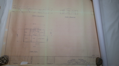
... housing...english pre-cut type housing...Printed at the bottom - 'Kiewa Scheme / Mt Beauty Housing / English pre-cut Type 3B ILA /. There are further notes printed at the bottom of the sheet.... provided at the time eg. laundry, toilet etc. mt beauty housing english pre-cut type housing house plan state electricity commission of victoria Large sheet with title at top "State Electricity Commission of Victoria" showing 'front', 'right' and 'left' elevations and the 'floor plan'. ...Mt Beauty was a construction town built from 1948. The houses were English Pre-cut Types - several of each type were erected with several variations. This house had 3 bedrooms and is dated as 'traced on 18 Dec. 1956'. Mt Beauty is a construction town built by the SECV during the Kiewa Hydro Electric Scheme for workers and their families. Houses were provided along with many other facilities eg. schools. This house plan is a good indication of the quality of housing provided at the time eg. laundry, toilet etc. Large sheet with title at top "State Electricity Commission of Victoria" showing 'front', 'right' and 'left' elevations and the 'floor plan'. Printed at the bottom - 'Kiewa Scheme / Mt Beauty Housing / English pre-cut Type 3B ILA /. There are further notes printed at the bottom of the sheet.mt beauty housing, english pre-cut type housing, house plan, state electricity commission of victoria -
 Flagstaff Hill Maritime Museum and Village
Tool - Adze, Ward & Payne Ltd, Between 1843 to Mid 20th Century
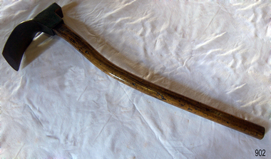
... types of edged tools including drills and wood planes. In 1967 Wilkinson Sword purchased all the company's share capital and continued to sell Ward & Payne tools until 1970 when a fire burned the factory down and housing development was built on the site....types of edged tools including drills and wood planes. In 1967 Wilkinson Sword purchased all the company's share capital and continued to sell Ward & Payne tools until 1970 when a fire burned the factory down and housing development was built on the site. ...An adze is an ancient and versatile cutting tool and has been in use for thousands of years. Adze are similar to an axe but with the cutting edge perpendicular to the handle rather than parallel. They have been used since the Stone Age. Adzes are hand tools used for smoothing or carving wood. The subject item was made by Ward & Payne of the Limbrick Works at Hillsborough, Sheffield England manufacturers of hand-forged tools. Their trademark registered in 1850 was a Letter "W" & "P" stamped into the steel. The firm was established by David Ward (1767-1822) in 1803 the company became David Ward & Sons, in 1837 after Ward's son Edward joined the firm. In 1845 Henry Payne the founder's son-in-law became a partner but died in 1850 after which the company reverted to the Ward family. The business then concentrated on making carving tools, chisels and gouges. In 1882 David Ward's grandson David Ward Jr. (1835-1889) purchased land and built a factory at Sheffield North known as the "Limerick Wheel". For a time Wards operated from both 106-114 West Street Sheffield and at Limbrick Road, Hillsborough on the river Loxley. By 1911 they had expanded into making spades, forks, sheep shears and many other types of edged tools including drills and wood planes. In 1967 Wilkinson Sword purchased all the company's share capital and continued to sell Ward & Payne tools until 1970 when a fire burned the factory down and housing development was built on the site.The subject item is significant as it gives a snapshot of the technological development of sailing ships and their operation before steam-powered vessels took over around the world. Tools such as the subject item demonstrate the traditional craftsmanship and skill of the shipwright and the aesthetic quality of the timber ships designs of the time. Adze with wooden handle curved painted green with patent number and maker's name inscribed on inside curve of blade. Inscribed "Patd 561 Ward" "2w". flagstaff hill, warrnambool, flagstaff-hill, flagstaff-hill-maritime-museum, maritime-museum, shipwreck-coast, flagstaff-hill-maritime-village, smoothing tool, hand tool, carpenders tool, adze, coopers tool, woodworking tools -
Federation University Historical Collection
Document - Document - Letter, Ballarat Junior Technical School: Letter from Mr Garner, Head Master, to Mr R Watson, Geelong, 1953
... The housing situation is difficult at present but he will continue to make enguiries and forward information to him. ballarat junior technical school l garnar junior technical certificate head master mr r watson promotion back to bjts housing situation enquiries . Yellow paper typed Ballarat Junior Technical School: Letter from Mr Garner, Head Master, to Mr R Watson, Geelong, 1953 Document Document - Letter ...Letter from Mr Garner to Mr R Watson congratulating him on his promotion back to Ballarat Junior Technical School. His former colleagues hold him in high regard. The housing situation is difficult at present but he will continue to make enguiries and forward information to him.. Yellow paper typedballarat junior technical school, l garnar, junior technical certificate, head master, mr r watson, promotion back to bjts, housing situation enquiries -
 City of Moorabbin Historical Society (Operating the Box Cottage Museum)
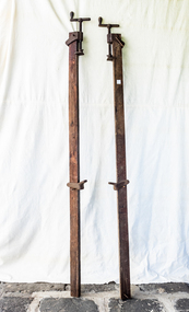
Building Equipment, floorboard clamps, 20thC
... Builders used these clamps to lay and secure floor boards when building houses in the Moorabbin area in 20thC These floor board clamps are typical of the type used by builders in the new housing estates of City of Moorabbin in the 20thC 2 Long pieces of wood with space holes, in which steel wedge plates are inserted and large steel screws at the top of wood. ...Builders used these clamps to lay and secure floor boards when building houses in the Moorabbin area in 20thCThese floor board clamps are typical of the type used by builders in the new housing estates of City of Moorabbin in the 20thC2 Long pieces of wood with space holes, in which steel wedge plates are inserted and large steel screws at the top of wood. -
 City of Moorabbin Historical Society (Operating the Box Cottage Museum)
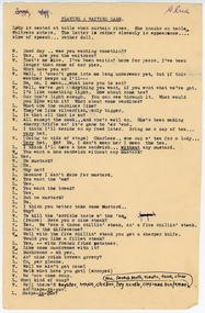
Work on paper - Documents, Typed, 'One Act Play ' 2pp, 'Playing a Waiting Game' Gladys Reed 1950, c1950
... typed script and some clothing props used in the play when performed by the Society. Drama, Musical and Choral Societies were founded by local residents in the City of Moorabbin to provide social, artistic and musical entertainment and development in their communities. early settlers moorabbin shire mechanics institute cheltenham ormond choral society postworld war 11 settlers housing estates moorabbin 1950 bentleigh ormond moorabbin cheltenham drama societies musical society cheltenham clark judy reed gladys reed george Typed script x 2 pages signed G.Reed 2x Note paper sheets with typed script for a One Act Play - ;' Playing a Waiting Game ' 'Playing a Waiting Game' Gladys Reed 1950 Work on paper Documents, Typed, 'One Act Play ' 2pp Mrs Gladys Reed ...Gladys Reed created this script for a One Act Play by Ormond Choral Society c 1950. Judy Clark, her daughter, donated this typed script and some clothing props used in the play when performed by the Society.Drama, Musical and Choral Societies were founded by local residents in the City of Moorabbin to provide social, artistic and musical entertainment and development in their communities. 2x Note paper sheets with typed script for a One Act Play - ;' Playing a Waiting Game 'Typed script x 2 pages signed G.Reedearly settlers, moorabbin shire, mechanics institute cheltenham, ormond choral society, postworld war 11 settlers, housing estates moorabbin 1950, bentleigh, ormond, moorabbin, cheltenham, drama societies, musical society cheltenham, clark judy, reed gladys, reed george -
 City of Moorabbin Historical Society (Operating the Box Cottage Museum)
Office Equipment, rubber stamps, c1950
... These stamps were used by George Reed who was a draftsman who lived in Bentleigh , City of Moorabbin in mid 20th C Throughout the 20thC most offices used this type of rubber stamp , usually made by a printer, to save writing the name, company, address, phone number, etc on invoices, receipts, letters, quotes etc office equipment, stamps, ink pads, early settlers, moorabbin shire, mechanics institute cheltenham, postworld war 11 settlers, housing estates moorabbin 1950, bentleigh, ormond, moorabbin, cheltenham, clark judy, reed gladys, reed george G. ...These stamps were used by George Reed who was a draftsman who lived in Bentleigh , City of Moorabbin in mid 20th CThroughout the 20thC most offices used this type of rubber stamp , usually made by a printer, to save writing the name, company, address, phone number, etc on invoices, receipts, letters, quotes etc 2x stamps with wooden and plastic handles and rubber impression platesG. Reed Bentleighoffice equipment, stamps, ink pads, early settlers, moorabbin shire, mechanics institute cheltenham, postworld war 11 settlers, housing estates moorabbin 1950, bentleigh, ormond, moorabbin, cheltenham, clark judy, reed gladys, reed george -
 City of Moorabbin Historical Society (Operating the Box Cottage Museum)
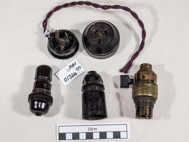
Electrical, fittings 3 bakelite 1 brass c1930, c1931
... The supply of electricity to homes in the City of Moorabbin in the early 20th Century brought many welcome changes to domestic and commercial life electricity, electric lights, electric irons, bakelite, market gardeners, early settlers, moorabbin shire, mechanics institute cheltenham, postworld war 11 settlers, housing estates moorabbin 1950, bentleigh, ormond, moorabbin, cheltenham, clark judy, reed gladys, reed george a) Australian Made / PIMI b) British Made in England c) No marks d) no marks 3 Electrical, fittings c 1931 a) a bakelite plug and socket Made in Australia b) a bakelite bayonet fitting Made in England ;c) Bakelite screw type with no markings d) A large brass and porcelain screw type with no markings L8 Electrical, fittings 3 bakelite 1 brass c1930 ...As supply of electricity became available in the Moorabbin Shire c 1920 homes gradually changed from Gas lighting to Electrical lighting and bakelite was used for fittings. Bakelite was a safe non-conductor of the electric current. Housewives, who had ironed clothes with flat irons heated on the hearth of open fires, were delighted to be able to stand on a chair and remove the light globe and plug in their new clean and efficient electric iron. The supply of electricity to homes in the City of Moorabbin in the early 20th Century brought many welcome changes to domestic and commercial life 3 Electrical, fittings c 1931 a) a bakelite plug and socket Made in Australia b) a bakelite bayonet fitting Made in England ;c) Bakelite screw type with no markings d) A large brass and porcelain screw type with no markings L8 a) Australian Made / PIMI b) British Made in England c) No marks d) no marks electricity, electric lights, electric irons, bakelite, market gardeners, early settlers, moorabbin shire, mechanics institute cheltenham, postworld war 11 settlers, housing estates moorabbin 1950, bentleigh, ormond, moorabbin, cheltenham, clark judy, reed gladys, reed george -
 Flagstaff Hill Maritime Museum and Village
Domestic object - Lamp Burner, Isaac Sherwood & Son Ltd, 1904-1920
... These types of items give a snapshot into domestic and social life during this period. warrnambool flagstaff-hill shipwreck-coast flagstaff hill warrnambool flagstaff-hill flagstaff-hill-maritime-museum maritime-museum shipwreck-coast flagstaff-hill-maritime-village lamp burner Sconces Kerosene Lamp Wick Adjuster Sherwood & Son Ltd Sherwood-Linley Made in England Sherwoods LTD Birmingham Lamp Burner housing, brass with wick-screw (no wick). ...Sherwood Ltd. Was a manufacturer of oil lamps and burners at the Nechells Park Works Birmingham UK and regarded at the time as a renowned name in the oil lamp and burner manufacturing industries in Birmingham during the early part of the 20th century. They started selling as ‘Isaac Sherwood & Son Ltd.’ in 1904, later around 1920 they merged with Linley and Co makers of American pattern lamps and became ‘Sherwood-Linley” moving to 44-50, Granville St. Birmingham. They became one of the largest manufacturers of lighting devices and burners in England. They produced all sorts of illumination devices and became famous for their oil burners. Apart from oil burners, they produced table and floor lamps, sconces, lanterns and chandeliers that made Sherwood unique. A Significant item as part of a kerosene lamp that was commonplace in homes and other premises during the early 20th century as a means of lighting before electric lighting became the standard. These types of items give a snapshot into domestic and social life during this period.Lamp Burner housing, brass with wick-screw (no wick). Made in England Sherwoods LTD Birminghamwarrnambool, flagstaff-hill, shipwreck-coast, flagstaff hill, warrnambool, flagstaff-hill, flagstaff-hill-maritime-museum, maritime-museum, shipwreck-coast, flagstaff-hill-maritime-village, lamp burner, sconces, kerosene lamp, wick adjuster, sherwood & son ltd, sherwood-linley -
 Ringwood and District Historical Society
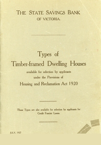
Booklet, Types of Timber Framed Dwelling Houses, Victoria, 1927
... Grey covered booklet of plans for 53 dwelling houses available for selection by applicants under the Housing and Reclamation Act 1920. Published by the State Saving Bank of Victoria Types of Timber Framed Dwelling Houses, Victoria, 1927 Booklet ...Plans show how the modern house has progressed and evolved since 1920.Grey covered booklet of plans for 53 dwelling houses available for selection by applicants under the Housing and Reclamation Act 1920. Published by the State Saving Bank of Victoria -
 Ringwood and District Historical Society
Photograph, View from Loughnan's Hill looking east c1930
... Typed below photograph, "View from Loughnans Hill c1930. Maroondah Highway, Catholic church all top right corner". Black and white photograph taken from vacant land on hill. Scene overlooks housing ...Black and white photograph taken from vacant land on hill. Scene overlooks housing and trees. Mountains in background. (2 copies)Typed on photograph, "View looking east". Typed below photograph, "View from Loughnans Hill c1930. Maroondah Highway, Catholic church all top right corner". -
 Ringwood and District Historical Society
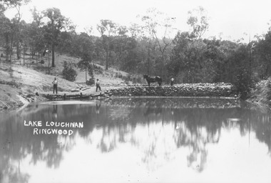
Photograph, Lake Loughnan Ringwood. c1920's
... Typed below photograph: "Building the recreational man-made lake on the north side of Loughnans Hill. It was the local swimming hole in Werac Drive gully beyond Kubis Drive. Now site of a new housing...Typed below photograph: "Building the recreational man-made lake on the north side of Loughnans Hill. It was the local swimming hole in Werac Drive gully beyond Kubis Drive. Now site of a new housing ...Black and white photograph (2 images- RE0080, RE0081. 2 copies of each)Typed below photograph: "Building the recreational man-made lake on the north side of Loughnans Hill. It was the local swimming hole in Werac Drive gully beyond Kubis Drive. Now site of a new housing estate." Written on Photo "Lake Loughnan Ringwood" -
 Ringwood and District Historical Society
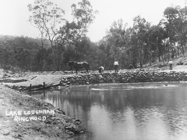
Photograph, Lake Loughnan Ringwood. c1920's
... Typed below one photograph: "Building the recreational man-made lake on the north side of Loughnans Hill. It was the local swimming hole in Werac Drive gully beyond Kubis Drive. Now site of a new housing...Typed below one photograph: "Building the recreational man-made lake on the north side of Loughnans Hill. It was the local swimming hole in Werac Drive gully beyond Kubis Drive. Now site of a new housing ...Black and white photograph (2 copies)Typed below one photograph: "Building the recreational man-made lake on the north side of Loughnans Hill. It was the local swimming hole in Werac Drive gully beyond Kubis Drive. Now site of a new housing estate". Written on photo: 'Lake Loughnan Ringwood'. -
 Flagstaff Hill Maritime Museum and Village
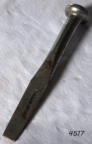
Tool - Caulking Tool, Ward & Payne Ltd, Late 19th century
... types of edged tools including drills and wood planes. In 1967 Wilkinson Sword purchased all the company's share capital and continued to sell Ward & Payne tools until 1970 when a fire burned the factory down and housing development was built on the site. ...types of edged tools including drills and wood planes. In 1967 Wilkinson Sword purchased all the company's share capital and continued to sell Ward & Payne tools until 1970 when a fire burned the factory down and housing development was built on the site. ...Caulking is the traditional technique used on wooden vessels built with butted or clinker-built planks to fill the gaps between these planks while still allowing the wood to flex and move. This involved driving the irons, hammered in with the mallet, deep into the seams to open them up. After this, spun yarn, oakum (hemp) or cotton was driven deep into the gaps. The hemp or cotton was soaked in creosote or pine tar to make the joins watertight. Caulking also played a structural role in tightening up the hull or deck by reducing the longitudinal movement of the neighbouring planks. The subject item was made by Ward & Payne of the Limbrick Works at Hillsborough, Sheffield England manufacturers of hand-forged tools. Their trademark registered in 1850 was a Letter "W" & "P" stamped into the steel. The firm was established by David Ward (1767-1822) in 1803 the company became David Ward & Sons, in 1837 after Ward's son Edward joined the firm. In 1845 Henry Payne the founder's son-in-law became a partner but died in 1850 after which the company reverted to the Ward family. The business then concentrated on making carving tools, chisels and gouges. In 1882 David Ward's grandson David Ward Jr. (1835-1889) purchased land and built a factory at Sheffield North known as the "Limerick Wheel". For a time Wards operated from both 106-114 West Street Sheffield and at Limbrick Road, Hillsborough on the river Loxley. By 1911 they had expanded into making spades, forks, sheep shears and many other types of edged tools including drills and wood planes. In 1967 Wilkinson Sword purchased all the company's share capital and continued to sell Ward & Payne tools until 1970 when a fire burned the factory down and housing development was built on the site. The subject item is significant as it gives a snapshot of the technological development of sailing ships and their operation before steam-powered vessels took over around the world. Tools such as the subject item demonstrate the traditional craftsmanship and skill of the shipwright and the aesthetic quality of the timber ships designs of the time. Caulking tool with square end"WARD Sheffield"flagstaff hill, warrnambool, flagstaff hill maritime museum, shipwreck coast, flagstaff hill maritime village, james s steele, caulking iron, caulking tool, shipwright tools, ward & payne sheffield, forged tools -
 Eltham District Historical Society Inc
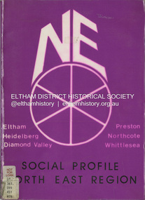
Book, North Eastern Suburbs Family and Community Services Regional Consultative Council, Social Profile North East Region, January 1985
... Sections include demographic profiles (including family type and migrant populations), workforce, housing, education, support services, children's services, transport, recreation and leisure facilities, local government authorities, and local government area profile summaries. ...Comprehensive statistical overview of Melbourne's north east region. The profile draws on census data for 1976 and 1981. Local Government summaries for the local government areas of Diamond Valley, Eltham, Heidelberg, Northcote, Preston and Whittlesea. Sections include demographic profiles (including family type and migrant populations), workforce, housing, education, support services, children's services, transport, recreation and leisure facilities, local government authorities, and local government area profile summaries.non-fictionComprehensive statistical overview of Melbourne's north east region. The profile draws on census data for 1976 and 1981. Local Government summaries for the local government areas of Diamond Valley, Eltham, Heidelberg, Northcote, Preston and Whittlesea. Sections include demographic profiles (including family type and migrant populations), workforce, housing, education, support services, children's services, transport, recreation and leisure facilities, local government authorities, and local government area profile summaries.population, social profile, social service, demographics -
 Eltham District Historical Society Inc
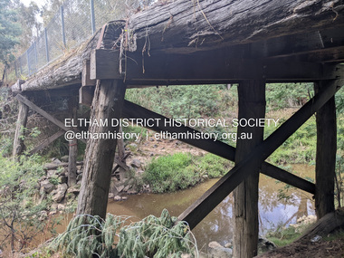
Photograph, Tess Justine (Nillumbik Shire Council), Murray's Bridge over the Diamond Creek, Eltham North, 19 Feb 2022
... housing estates like the Glen Park Estate. That did not eventuate. Whilst the bridge was indeed old (90 years), the core structure being completed in 1931, it had been modified substantially from original and hence had no significant historic value – i.e., it was not a representative example of its type, construction, and age. ...housing estates like the Glen Park Estate. That did not eventuate. Whilst the bridge was indeed old (90 years), the core structure being completed in 1931, it had been modified substantially from original and hence had no significant historic value – i.e., it was not a representative example of its type, construction, and age. ...Murray's Bridge over the Diamond Creek on the Diamond Creek Trail just prior to demolition and replacement with a new steel bridge. Heritage advice obtained by Nillumbik Shire Council, following a suggestion by the Eltham District Historical Society (EDHS), is that the original bridge appears to have been a simplified version of the Country Roads Board’s (CRB) standard timber bridge design of the early-to-mid 1920s. In c1990 Murray’s bridge was renovated with three recycled steel girders as part of a bike/pedestrian path in the reserve. During these alterations many parts of the bridge were removed, and some were replaced. Heritage advice indicates the condition of Murray’s bridge is poor. The remaining original parts are all in poor condition, with severe weathering, splitting and rot, especially to the stringers retained on the bridge. Heritage advice is that Murray’s Bridge does not have sufficient significance in the cultural history of the Nillumbik area to warrant inclusion in the Nillumbik Shire Heritage Overlay and also does not have sufficient significance as a rare survivor to warrant inclusion in the Nillumbik Shire Heritage Overlay. There are no indications in the historical record that this site was individually important to the cultural history of this area. EDHS is comfortable with the heritage advice provided to Council and has worked closely on this project with Council. EDHS has suggested some of the removed timbers be used in the vicinity of the bridge for landscaping and possibly seating, so as to retain these remnants close to the site of the original bridge, which is the last old timber bridge along the lower reaches of the Diamond Creek. Mary (Sweeney) Murray and John Wright Murray selected 80 acres, Lot C Section 16 and Lot 5 Section 17 Parish of Nillumbik, under an occupation license in 1866. John died in 1867 and freehold was granted to his son John in 1873. The farm was known as ‘Laurel Hill’. John Junior was an Eltham Shire councillor and sometime president from 1887 up until 1897. He added Lot A Section 16 to the farm in ca1888. John and his younger brother James arranged to rent/purchase Lot B Section 17, across Diamond Creek to the west, in ca1900. It appears that John and James farmed separately for a few years, with a new homestead built for James ad family on the high point of Lot B Section 17 in ca1910. John sold off Lot 5 Section 17 in 1912. When John died in 1912 James took over the land on both sides of the Diamond Creek. The old homestead on the west side of the Creek disappeared. A farm bridge over Diamond Creek from this period may have been located close to the northern boundary of the farm. John Langlands, owner of the farm known as ‘Ihurst’ on the west side of Diamond Creek to the south of the Murray’s land, died in 1907. In 1909 his land was then subdivided into 100 lots to become the ‘Glen Park Estate’. Other similar subdivisions of nineteenth century farms around Eltham in this period included the ‘Franktonia (or Beard’s) Estate’ to the northeast and ‘Bonsack’s Estate’ between Eltham and Greensborough. Soon after the opening of the railway extension line from Eltham to Hurstbridge in 1912, Glen Park and nearby residents including James Murray agitated for a railway station or siding to be located half-way between Eltham and Hurstbridge, so that the Glen Park residents who used the railway daily did not have to walk into the Eltham or Hurstbridge stations. Some believed Coleman’s Corner (opposite Edendale Farm) was an appropriate spot for the platform. James Murray was among those who thought the railway should be located on his land, closer to half-way between Eltham and Hurstbridge stations. The Railways Commissioners warned that the locals would have to fund these works themselves. The Glen Park Estate residents initially had difficulty accessing Eltham by road, with only an old low-level bridge over Diamond Creek at the south end of their estate. A new timber trestle bridge across the creek, now on Wattletree Road, was opened in 1915. Road access to the north was gained in 1927 when the new Murray’s Road, which crossed the Murray’s land, was built. Residents continued to agitate for a Glen Park station. By 1926 the Railways Commissioners’ preferred site was on the Murray’s land. They arranged an estimate of cost of a full-length platform. The estimate was too much for the locals, who in 1928 argued unsuccessfully for a shorter and hence cheaper platform. By 1929 Murray had agreed to donate the land, but the locals would still have to fund the works. Murray decided, unilaterally it would appear, to commence work on a timber trestle road bridge over Diamond Creek to link the new Murray Road to the proposed station. Late in 1929 he stopped work on the bridge, for reasons unknown, but started work again and completed the bridge in 1931. There is no further newspaper evidence of the campaign for the Glen Park station until 1939, when Murray and another local, Mr Maxwell, met the Railways Commissioner. The Glen Park locale now included 45 homes on the west side of the creek and 20 on the Eltham side. Most of the residents used the train every day. The Commissioner remained adamant that only a full-length platform could be built for safety reasons. It appears the campaign dissolved at this point. The increasing move to cars may have had an impact. There is no evidence of Murray’s bridge ever being connected to Murray’s Road, or of it having wide use for any purpose by locals. James Murray died in 1947 and the farm was taken over by his son James (Jim). Jim started to sell off parts of the farm in the 1980s, retaining a few acres around the ca1910 homestead and building a new house there. Recreation reserves were established along the creek. In ca1990 Murray’s bridge was renovated with steel girders as part of a bike/pedestrian path in the reserve. The old farmhouse was demolished in ca2014. * * * A theory posted on local community Facebook groups was that the bridge was built in the 1860s and was built to be more robust than was necessary for the movement of cows from one side of the creek to the other. It was suggested the robustness was necessary to support the weight of gold ore being transferred from a mine on Murray’s land to a railway siding near Murrays Bridge (presumably for transfer and processing at Diamond Creek). Perhaps this may have been one of the motivators for Murray, who really knows? Knowing when mining operations ceased on his land and how that fits the overall timeline would be useful but at the time the bridge was built, local gold production was minimal at best. The known facts are: • The railway line came to Eltham in 1902. • The extension of the railway from Eltham to Hurstbridge was constructed in 1912 so no railway line even existed through Murray's property until 1912 and the Victorian Railways maps at the time show no such siding on Murray’s property. • In 1923 a new company was formed in anticipation of the old Diamond Creek Gold Mine being re-opened. The mine had been previously closed and flooded. It was noted in the press at the time that the mine was within a mile of the railway. Nothing really came of this. • Construction of Murrays Bridge was commenced by James Murray in early 1929 in anticipation of a proposed flag station being nominated on his land, but work ceased shortly afterwards. The proposed flag station was commonly referred to as Glen Park as the residents of the Glen Park Estate wanted Option 1, located near them with the platform adjacent to Colemans corner. This was probably never going to fly as it was virtually in eyesight of Eltham station. Allandale Road was the third option, but the Commissioners' preferred option was No. 2 - on Murray's property. • The Railway Commissioners were not going to finance any such station and the works had to be funded by private landowners and residents, hence Murray investing in this himself. • Murray recommenced work two years later and finished his bridge in 1931 but unfortunately for him, the proposed flag station never eventuated. The bluestone siding you reference may well have been built by Murray as part of the proposed station platform. • Up until then, apart from the Main Road bridge, which was washed away in 1924, virtually all local crossings over the Diamond Creek were low lying bridges – Kaylocks Bridge at Brougham Street, Diamond Street bridge, Glen Park Road bridge. It is expected that Murray also had a low-lying bridge to connect his land either side of the creek. These were all washed away or severely damaged multiple times in the 1920s. Lessons were learnt, and Murrays Bridge appears to have been built in accordance with Country Road Board standards of the time. Flood damage was ongoing, and even more recently constructed raised bridges kept getting washed away, e.g., the new Wattle Tree Road bridge in 1958 just months after completion. Murray’s bridge was reinforced with steel some 30 years ago presumably to provide additional floodwater resistance, given the history of bridges disappearing in floodwaters. • In March 1932 it was reported in the Advertiser that there were still some prospectors operating around Eltham North who apart from further scarring the face of the earth over the previous two years had gained significant experience but little gold - hardly a driving factor for constructing a dedicated railway siding and bridge to transfer gold ore. It is far more probable that James Murray was hoping to have the railway station located on his property and invested his money by building the bridge to lead to it as well as a station platform. Had the station eventuated, it may well have driven up the value of his land for subdivision and new housing estates like the Glen Park Estate. That did not eventuate. Whilst the bridge was indeed old (90 years), the core structure being completed in 1931, it had been modified substantially from original and hence had no significant historic value – i.e., it was not a representative example of its type, construction, and age. Given that the bridge was not worthy of saving, the Eltham District Historical Society with Council’s support, and the Eltham Woodworkers group endeavoured to see what suitable sized timbers were salvageable to fabricate a commemorative seat. Unfortunately, the experts at the Woodworkers group were unable to salvage any suitable length/width timbers to fabricate the seat due to the presence of rot. Last remaining wooden trestle bridge on the Diamond Creek Trail just prior to demolition and replacementBorn digital image (27)diamond creek (creek), diamond creek trail, murrays bridge, ‘laurel hill’, john wright murray, mary (sweeney) murra, john murray jnr, james murray, john langlands, ‘ihurst’, ‘glen park estate’, beard's estate, franktonia, bonsack's estate, glen park estate, glen park railway station -
 Eltham District Historical Society Inc
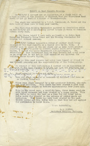
Document - Report, G.E. Newton, Road Reserve Housing, Aug. 1957
... Newton houses Hurstbridge Road reserve Road Reserve Housing Shack Single typed foolscap page Originally inserted loose with other processing envelopes of negatives and prints within a binder of 78 foolscap pages containing a sequence of photos, adhered via glue or sticky tape, with typed or handwritten headings and captions in pencil, contained in a green foolscap binder with spring clasp spine for retaining loose pages. ...Shack built on road reserve without permit Most probably up on Simms Road, Kinglake Other areas where illegal shacks were built were at the junction of Flat Rock Road and Cherry Tree Road, Hurstbridge. At times, Building Surveyor George E Newton would have to attend to these shacks for inspection and issue demolition orders Related to photos: EDHS_05580-1/2/3Record of various Shire of Eltham infrastructure works undertaken during the period of 1952-1962 involving bridge and road reconstruction projects, sometimes with Eltham Shire Council Project Reference numbers quoted. It was during this period that a number of significant improvements were made to roads and new bridges constructed within the shire that remain in place as of present day (2022). In many situations, the photos provide a tangible visible record of infrastructure that existed throughout the early days of the Shire. The album was put together by or under the direction of the Shire Engineer, J.A. McDonald.infrastructure, shire of eltham, building surveyor, cherry tree road, flat rock road, george e. newton, houses, hurstbridge, road reserve, road reserve housing, shack -
Glen Eira Historical Society
Book - Hillcrest Estate Draft Heritage Guidelines July 2000
... housing estate developed by the AV Jennings Construction Co., later known as Jennings Group Limited.' Developed during the Depression years of the early 1930s, it is considered an 'unusually intact example of an interwar garden estate' and is also considered noteworthy for its aesthetic values. The Report describes typical features for two house forms typical of the area: the single-storey villa with decorative porch and the single storey villa with decorative verandah. It gives guidelines on the types...housing estate developed by the AV Jennings Construction Co., later known as Jennings Group Limited.' Developed during the Depression years of the early 1930s, it is considered an 'unusually intact example of an interwar garden estate' and is also considered noteworthy for its aesthetic values. The Report describes typical features for two house forms typical of the area: the single-storey villa with decorative porch and the single storey villa with decorative verandah. It gives guidelines on the types ...2 items about Hillcrest Estate and heritage: 1/A 20 page report giving draft heritage guidelines by the City of Glen Eira for properties within the Hillcrest Estate Heritage Area of Caulfield South, including Hillcrest Avenue numbers 1 and 3-12 and Marara Road numbers 27 and 28. The Heritage Area has been assessed as noteworthy as 'the first housing estate developed by the AV Jennings Construction Co., later known as Jennings Group Limited.' Developed during the Depression years of the early 1930s, it is considered an 'unusually intact example of an interwar garden estate' and is also considered noteworthy for its aesthetic values. The Report describes typical features for two house forms typical of the area: the single-storey villa with decorative porch and the single storey villa with decorative verandah. It gives guidelines on the types of changes which can be made to houses within the Heritage Area. Included are photographs of typical houses and design features, maps, and diagrams showing acceptable zones for additions, amongst other Sections (eg. Key design checklist). 2/A three page photocopy taken from Andrew Ward's Heritage Study for The Hillcrest Estate Historic Area.hillcrest estate, glen eira heritage management plan, glen eira planning scheme, glen eira city council, hillcrest estate heritage area, hillcrest avenue, merri street, marara road, eumerella street, av jennings construction co, jennings group limited, caulfield south, jennings albert, brick houses, architectural styles, architectural features, housing estates, garden estate, heritage studies, glen eira city council, city of glen eira, draft heritage guidelines july 2000, glen huntly, vines william, gurney edward, eumeralla street, 'karkill', house names, cropmpton court, booran road, estate agents -
 Bendigo Military Museum
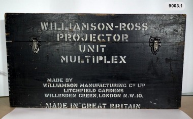
Instrument - Multiplex Unit Projector, Williamson Manufacturing Co, Circa 1950
... TYPE MPC, LITCHFIELD GARDENS, LONDON AND READING. A black wooden box containing a Multiplex Unit Projector (incomplete). The Multiplex has a Lamp Head, Barrel Housing, Body of the Projector and a Platen which is missing. .1 Protective wooden box .2 Multiplex Instrument .3 Multiplex Instrument Parts Diagram .4 A bank of Multiplex projectors in operation Multiplex Unit Projector Instrument Multiplex Unit Projector Williamson Manufacturing Co ...Multiplex mechanical stereoplotting equipment was used at the Army Survey Regiment, Fortuna Bendigo. c1950s. Multiplex equipment was imported from the UK in 1951 and introduced in the following year, to accelerate map production output covering CMF training areas at 1:25,000 map scale. Multiplex plotting was a productive advancement replacing the ‘Arundel’ method of graphical plotting planimetric detail that was expensive and slow, especially in timbered mountainous terrain. Air photos were made into small diapositives and mounted on racks in the exact position relative to when the aerial photos were taken. The technicians operated the Multiplex in a darkened room, with one photo projected with a green filter and the other through a red filter to form a 3D view of the overlapping photos. The 3D model projected onto a platen, which was a small platform that was raised up and down. The technician viewed the 3D image with special glasses fitted with red and green lenses. In the centre of the platen was a small pinhole that served as a floating mark, with a vertical pencil located exactly below the pinhole. This tracing table was moved to follow the topographic feature or contour line and draw it on the paper underneath. The technician raising or lowering the platform’s floating mark to match the height of the 3D terrain. It also replaced the slotted template method of mechanical adjustment of strips of aerial photography, however was restricted to each strip rather than between strips in the block. Although the Multiplex was phased out of production in 1968, it was used in the training of photogrammetry and aero-triangulation at the School of Military Survey located at Bonegilla, Victoria until the early 1990s. The history of the Multiplex is covered in more detail with additional historic photographs, in pages 50 to 51 of Valerie Lovejoy’s book 'Mapmakers of Fortuna – A history of the Army Survey Regiment’ ISBN: 0-646-42120-4. This instrument is only one of the projectors of a set and is unfortunately missing its platen, coloured filters and coloured glasses. A cardboard set of glasses is included as an example. Another Multiplex instrument is in the collection as Item 9039.4A black wooden box containing a Multiplex Unit Projector (incomplete). The Multiplex has a Lamp Head, Barrel Housing, Body of the Projector and a Platen which is missing. .1 Protective wooden box .2 Multiplex Instrument .3 Multiplex Instrument Parts Diagram .4 A bank of Multiplex projectors in operation WILLIAMSON MANUFACTURING CO, PHOTOGRAPHIC ENGINEERS, SERIAL NUMBER 3437, TYPE MPC, LITCHFIELD GARDENS, LONDON AND READING.royal australian survey corps, rasvy, fortuna, army survey regiment, army svy regt -
 Bendigo Military Museum
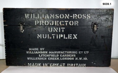
Instrument - Multiplex Unit Projector, Williamson Manufacturing Co, Circa 1950
... TYPE MPC, LITCHFIELD GARDENS, LONDON AND READING. A black wooden box containing a Multiplex Unit Projector (incomplete). The Multiplex has a Lamp Head, Barrel Housing, Body of the Projector and a Platen. .1 Protective wooden box .2 Multiplex Instrument .3 Multiplex Instrument Parts Diagram .4 A bank of Multiplex projectors in operation Multiplex Unit Projector Instrument Multiplex Unit Projector Williamson Manufacturing Co ...Multiplex mechanical stereoplotting equipment was used at the Army Survey Regiment, Fortuna Bendigo. c1950s. Multiplex equipment was imported from the UK in 1951 and introduced in the following year, to accelerate map production output covering CMF training areas at 1:25,000 map scale. Multiplex plotting was a productive advancement replacing the ‘Arundel’ method of graphical plotting planimetric detail that was expensive and slow, especially in timbered mountainous terrain. Air photos were made into small diapositives and mounted on racks in the exact position relative to when the aerial photos were taken. The technicians operated the Multiplex in a darkened room, with one photo projected with a green filter and the other through a red filter to form a 3D view of the overlapping photos. The 3D model projected onto a platen, which was a small platform that was raised up and down. The technician viewed the 3D image with special glasses fitted with red and green lenses. In the centre of the platen was a small pinhole that served as a floating mark, with a vertical pencil located exactly below the pinhole. This tracing table was moved to follow the topographic feature or contour line and draw it on the paper underneath. The technician raising or lowering the platform’s floating mark to match the height of the 3D terrain. It also replaced the slotted template method of mechanical adjustment of strips of aerial photography, however was restricted to each strip rather than between strips in the block. Although the Multiplex was phased out of production in 1968, it was used in the training of photogrammetry and aero-triangulation at the School of Military Survey located at Bonegilla, Victoria until the early 1990s. The history of the Multiplex is covered in more detail with additional historic photographs, in pages 50 to 51 of Valerie Lovejoy’s book 'Mapmakers of Fortuna – A history of the Army Survey Regiment’ ISBN: 0-646-42120-4. This instrument is only one of the projectors of a set and is unfortunately missing its coloured filters and coloured glasses. Another instrument is in the collection as Item 9003.4A black wooden box containing a Multiplex Unit Projector (incomplete). The Multiplex has a Lamp Head, Barrel Housing, Body of the Projector and a Platen. .1 Protective wooden box .2 Multiplex Instrument .3 Multiplex Instrument Parts Diagram .4 A bank of Multiplex projectors in operation WILLIAMSON MANUFACTURING CO, PHOTOGRAPHIC ENGINEERS, SERIAL NUMBER 3187, TYPE MPC, LITCHFIELD GARDENS, LONDON AND READING.royal australian survey corps, rasvy, fortuna, army survey regiment, army svy regt -
 Eltham District Historical Society Inc
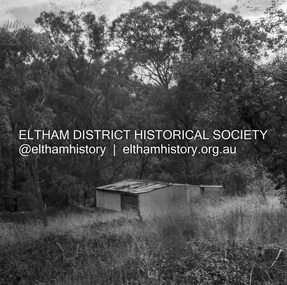
Negative - Photograph, J.A. McDonald, Road Reserve Housing, Mar. 1961
... Newton houses Hurstbridge Kinglake Road reserve Road Reserve Housing Scan - 120 format 6x6 negative Shack Simms Road Medium format 120/Kodak 620 6x6 cm black and white negative (1 of 12) contained in envelope with various inscriptions and markings Originally inserted loose with other processing envelopes of negatives and prints within a binder of 78 foolscap pages containing a sequence of photos, adhered via glue or sticky tape, with typed or handwritten headings and captions in pencil, contained in a green foolscap binder with spring clasp spine for retaining loose pages. ...Shack built on road reserve without permit Most probably up on Simms Road, Kinglake Other areas where illegal shacks were built wer at the junction of Flat Rock Road and Cherry Tree Road, Hurstbridge. At times, Building Surveyor George E Newton would have to attend to these shacks for inspection and issue demolition ordersRecord of various Shire of Eltham infrastructure works undertaken during the period of 1952-1962 involving bridge and road reconstruction projects, sometimes with Eltham Shire Council Project Reference numbers quoted. It was during this period that a number of significant improvements were made to roads and new bridges constructed within the shire that remain in place as of present day (2022). In many situations, the photos provide a tangible visible record of infrastructure that existed throughout the early days of the Shire. The album was put together by or under the direction of the Shire Engineer, J.A. McDonald.infrastructure, shire of eltham, 1961-03, building surveyor, cherry tree road, flat rock road, george e. newton, houses, hurstbridge, kinglake, road reserve, road reserve housing, scan - 120 format 6x6 negative, shack, simms road -
 Eltham District Historical Society Inc
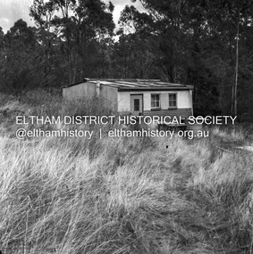
Negative - Photograph, J.A. McDonald, Road Reserve Housing, Mar. 1961
... Newton houses Hurstbridge Kinglake Road reserve Road Reserve Housing Scan - 120 format 6x6 negative Shack Simms Road Medium format 120/Kodak 620 6x6 cm black and white negative (1 of 12) contained in envelope with various inscriptions and markings Originally inserted loose with other processing envelopes of negatives and prints within a binder of 78 foolscap pages containing a sequence of photos, adhered via glue or sticky tape, with typed or handwritten headings and captions in pencil, contained in a green foolscap binder with spring clasp spine for retaining loose pages. ...Shack built on road reserve without permit Most probably up on Simms Road, Kinglake Other areas where illegal shacks were built wer at the junction of Flat Rock Road and Cherry Tree Road, Hurstbridge. At times, Building Surveyor George E Newton would have to attend to these shacks for inspection and issue demolition ordersRecord of various Shire of Eltham infrastructure works undertaken during the period of 1952-1962 involving bridge and road reconstruction projects, sometimes with Eltham Shire Council Project Reference numbers quoted. It was during this period that a number of significant improvements were made to roads and new bridges constructed within the shire that remain in place as of present day (2022). In many situations, the photos provide a tangible visible record of infrastructure that existed throughout the early days of the Shire. The album was put together by or under the direction of the Shire Engineer, J.A. McDonald.infrastructure, shire of eltham, 1961-03, building surveyor, cherry tree road, flat rock road, george e. newton, houses, hurstbridge, kinglake, road reserve, road reserve housing, scan - 120 format 6x6 negative, shack, simms road -
 Eltham District Historical Society Inc
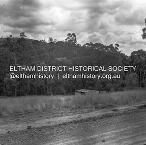
Negative - Photograph, J.A. McDonald, Road Reserve Housing, Mar. 1961
... Newton houses Hurstbridge Kinglake Road reserve Road Reserve Housing Scan - 120 format 6x6 negative Shack Simms Road Medium format 120/Kodak 620 6x6 cm black and white negative (1 of 12) contained in envelope with various inscriptions and markings Originally inserted loose with other processing envelopes of negatives and prints within a binder of 78 foolscap pages containing a sequence of photos, adhered via glue or sticky tape, with typed or handwritten headings and captions in pencil, contained in a green foolscap binder with spring clasp spine for retaining loose pages. ...Shack built on road reserve without permit Most probably up on Simms Road, Kinglake Other areas where illegal shacks were built were at the junction of Flat Rock Road and Cherry Tree Road, Hurstbridge. At times, Building Surveyor George E Newton would have to attend to these shacks for inspection and issue demolition ordersRecord of various Shire of Eltham infrastructure works undertaken during the period of 1952-1962 involving bridge and road reconstruction projects, sometimes with Eltham Shire Council Project Reference numbers quoted. It was during this period that a number of significant improvements were made to roads and new bridges constructed within the shire that remain in place as of present day (2022). In many situations, the photos provide a tangible visible record of infrastructure that existed throughout the early days of the Shire. The album was put together by or under the direction of the Shire Engineer, J.A. McDonald.infrastructure, shire of eltham, 1961-03, building surveyor, cherry tree road, flat rock road, george e. newton, houses, hurstbridge, kinglake, road reserve, road reserve housing, scan - 120 format 6x6 negative, shack, simms road -
 Queenscliffe Maritime Museum
Equipment - Two pullies used on breeches buoys
... type pulley used to attach to a line spread between two points to transfer persons or goods. Used as part of rocket rescue. Lifeboat crew used this equipment for training in the use of rockets and breeches buoy rescue during the Lifeboat service between 1926 and 1976. brass pulley rescue rocket Two brass pulleys surrounded with a brass housing which is hinged to allow a line to be attached. ...Snap type pulley used to attach to a line spread between two points to transfer persons or goods. Used as part of rocket rescue.Lifeboat crew used this equipment for training in the use of rockets and breeches buoy rescue during the Lifeboat service between 1926 and 1976.Two brass pulleys surrounded with a brass housing which is hinged to allow a line to be attached.brass, pulley, rescue, rocket -
 Kiewa Valley Historical Society
Photos - Mills Family x 15
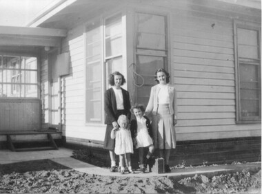
... The "70 Lakeside Ave" photos show the type of housing provided by the SECV and that the garden hadn't been created. 4. ...Brian and Jill Mills lived with their children at Lakeside Ave. Mt Beauty. Brian was in the airforce.4 photos were taken during the construction of the Kiewa Hydro Electric Scheme. 1. The "Mills Kids" beside the river - show the fashion of the time and how families spent their recreational time. 2.& 3. The "70 Lakeside Ave" photos show the type of housing provided by the SECV and that the garden hadn't been created. 4. SEC marshalling yards, Mt Beauty c 1940s-50s. An historic photo of 1940s/50s buses used to transport KHES workers to their work sites, some of which were on the High Plains.15 large photos scanned in colour. 5 have labels written on the backOn the back "Brian Mills" (in airforce uniform); "Mills Kids / 78 L/side Ave"; "70 Lakeside Ave"; "70 L/side Ave" and "SEC Marshalling yards - Mt Beauty (and Donor's name and address.lakeside ave mt beauty, brian mills -
 Kiewa Valley Historical Society
Photograph, logging at McKay Creek, Logging at McKay Creek, 1949/50
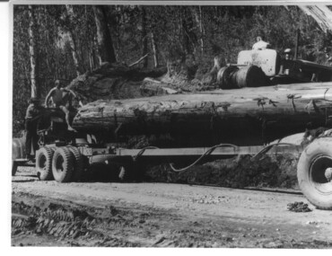
... housing and camps and provided a much needed resource as there was a general shortage of this commodity. The power station was relocated underground owing to repeated problems with landslides in the area. Restricted financial resources and the repositioning of the power station retarded construction activities and it was not completed until early 1961. An historical pictorial record of the type ...This photo was most likely taken at the site of the proposed McKay Creek Power Station. Excavation of this site was commenced in 1951 but an access road (a rough, narrow track) was put it in 1948 and widened in 1954. The State Electricity Commission would have milled logs from this area at their mill at Howman's Gap. The timber was used for building of housing and camps and provided a much needed resource as there was a general shortage of this commodity. The power station was relocated underground owing to repeated problems with landslides in the area. Restricted financial resources and the repositioning of the power station retarded construction activities and it was not completed until early 1961. An historical pictorial record of the type of machinery used in the 1950's - logging truck with bogie attached, the bull dozer and winch for hauling logs to the truck and note the lack of protective clothing!Black and white photograph showing a logging truck, bogie and bull dozer with winch for hauling the logs to the truck. Two men are on the truck, a driver on the bull dozer and a large log on the bogie. Hand written on the back of photo "Logging at McKay Creek".logging, mckay creek, timber, machinery -
 Kiewa Valley Historical Society
Book - Reference Cooking, SEC Cook Book of Family Favourites, Circa 1950
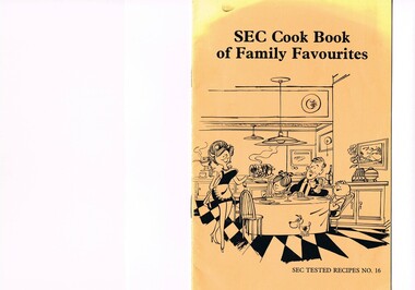
... type of Australian but also the overseas based non rural culture tourist or immigrant. It allowed the intermingling of ideas in a non company controlled environment. The Mount Beauty and Bogong Village has, and even up to the 3000 Millennium, the same housing construction, as was built by the SEC. ...This SEC cook book was produced circa 1950s when the Kiewa Hydro Electricity Scheme and its Commission was in full swing. The Commission had constructed two settlements, Mount Beauty and Bogong Village to house construction workers and their families in a "closed" community. These "closed" communities were for SEC staff and construction workers only. Entry into these villages was restricted to "SEC pass" carrying construction staff and their families. All facilities such as retail, sporting and other community services was provided by the SEC. This created an isolated community in which limited individual choice or administrative family leeway was available. It was a typical company town (live and work for the company). The Company was in the Kiewa Valley constructing power stations for the Kiewa Hydro Electricity Scheme of Victoria. In one way the individual did not need to be concerned with living costs, educational needs for children, and recreational amenities and therefore "normal" community survival /living methods did not apply. This living, although restrictive, was quite simple. When the scheme was completed, in 1961, marking the end of company town, caused some of the employees, who had enjoyed the "controlled" township environment, a fair degree of angst in having the new 'laissez-faire" controls thrust upon them. This was magnified when both Mount Beauty and Bogong Village became meshed into the Bright Shire, vis-a-vis, local government. This cook book is a prime example of " the company is looking after you" and leave the worrying to us. This environment of a "company town", which creates the atmosphere of minimal personal responsibilities, is still present in a few remote mining towns in Australia at the beginning of the 21st Century.This book is a classical example of the psychological control in which the company had its construction workers families living in. The motto of many companies who had employees in isolated regions was "keep them happy". A happy and contented worker is a more productive worker. This was a period in time (1950s to 1970s) when social psychology was gaining recognition in the Australian workforce as well as internationally. At the end of the construction of all the power stations both the Mount Beauty settlement and the Bogong Village became more integrated into the main stream of rural Australia environment. Development of tourism in the region opened up not only interaction with a greater cross section of the ever expanding type of Australian but also the overseas based non rural culture tourist or immigrant. It allowed the intermingling of ideas in a non company controlled environment. The Mount Beauty and Bogong Village has, and even up to the 3000 Millennium, the same housing construction, as was built by the SEC. There has only been a very gradual change to modern domestic architectural home styles. This SEC cookbook has a folded cover with two staples at the spine, securing eight double sided pages. The white pages contain black print and sketches(3), and one black and white photograph (of the author). The front cover is mainly orange in colour with a gradual fading into yellow(at the top). The cover is approximately 210 g/m2 in thickness and each page is approximately 90 g/m2 thick. Front cover: top of page "SEC Cook Book of Family Favourites", in the middle a sketch, black on orange background, of a smiling mother walking from the kitchen to the dining table with a steaming rolled roast and vegetables in one hand and a gravy pot in the other. The furniture and decor relates to the 1950s. Below this sketch is printed"SEC TESTED RECIPES NO. 16" Inside cover: on top of the page is a black and white sketch of a pineapple, apple pear fish with scales, bunch of grapes with leaves a pork roll (head of pig one end and a roll ending on the other, on top of this food arrangement rests a fruit pie. Below this sketch are printed in black print the books contents.The first side of the first page is a black and white photograph Mary Dunne, the SEC Home Service supervisor who provided a signed foreword. The inside back cover has a promotional segment detailing a black and white photograph of a smiling (and happy) couple in the foreground with an electric stove in the distance. The written motto below this photograph is" to Live better -and save money they'll join the Power People. "the new tariff is(1960s) - First 75kWh --6 cents per kWh Next 435 kWh---2.3 cents per kWh Balance --1.7 cents per kWh The rate per killowatt-hour for the final block drops from 2.1 cents to 1.7 cents --a reduction of 19%.cooking recipes circa 1950s, domestic food, sec victoria cook books, recipes circa 1950s -
 Warrnambool and District Historical Society Inc.
Souvenir - Personal item: Rouge holder
... There were Palaces of Industry, Engineering, Horticulture and Art and Pavilions housing exhibits from most countries in the British Empire. 17 million people visited in 1923 and there were 11 million visitors in 1925 when the exhibiton was re-developed. Wembley Stadium was reconstructed in 2002. This item has no local provenance but is of some interest because of its connection to the British Empire Exhibition of 1925. It is a good example of the type ...This is a souvenir of the British Empire Exhibition of 1925. This exhibition, designed to showcase the industrial and natural resources of the countries in the British Empire was on a 216 acre site at Wembley, England. In 1923 the Wembley Stadium was completed and the F.A. Cup Final was held there. In 1924 the Exhibition was opened by King George V in a first ever radio broadcast by a British monarch. There were Palaces of Industry, Engineering, Horticulture and Art and Pavilions housing exhibits from most countries in the British Empire. 17 million people visited in 1923 and there were 11 million visitors in 1925 when the exhibiton was re-developed. Wembley Stadium was reconstructed in 2002. This item has no local provenance but is of some interest because of its connection to the British Empire Exhibition of 1925. It is a good example of the type of souvenir that was bought by visitors to the Exhibition. This is an enamelled metal container, circular (octagonal on the outside edges) in shape with a short handle. The central area is slightly recessed to take a small amount of rouge (a red powder compound for the face, usually the cheeks). A pad to apply the rouge to the face is missing. There is a metal hinged lid with a clip and a small ring at the end of the handle, possibly to contain a chain for it to hang around the neck. The wording on the front is black on a blue and green enamelled backgroundRaised image of a lion with the words underneath ‘British Empire Exhibition, 1925’rouge holder, british empire exhibition 1925
