Showing 174 items matching "infrastructure victoria"
-
 Melbourne Tram Museum
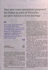
Document, Infrastructure Victoria, "Victoria Infrastructure Stategy 2025 -2055', 2025
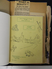
... "Victoria Infrastructure Stategy 2025 -2055'......Infrastructure Victoria...Report prepared by Infrastructure Victoria, titled "Victoria Infrastructure Strategy 2025 -2055' providing a 30-year plan for Victoria's Infrastructure, including a table of contents, summary, recommendations, and future options. ...Infrastructure Victoria...Melbourne Tram Museum 8 Wallen Road Hawthorn melbourne Report prepared by Infrastructure Victoria, titled "Victoria Infrastructure Strategy 2025 -2055' providing a 30-year plan for Victoria's Infrastructure, including a table of contents, summary, recommendations, and future options. ...Report prepared by Infrastructure Victoria, titled "Victoria Infrastructure Strategy 2025 -2055' providing a 30-year plan for Victoria's Infrastructure, including a table of contents, summary, recommendations, and future options. Has recommendations for housing, an accessible community (transport), a healthy and safe environment, climate change, productivity and a strategy to achieve these. The section about tramways has been extract - pages 38 to 40, includes recommendations for new tram lines around the city, including the Arden precinct, Fisherman's Bend, and other suburbs. Includes a map of the proposals. The newspaper report from NW City News of 18/11/2025 gives details of the proposals for the Arden - Kensington and Flemington Bridge areas.Demonstrates a report from Infrastructure Report on future proposals for infrastructure and tramways in Melbourne.Document - digital image - 250 pages, extracts and one page of NW City News report on the document.new tramways, victorian government, infrastructure victoria, report -
 Greensborough Historical Society
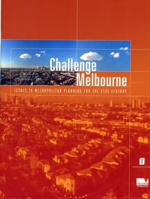
Book, Victoria. Department of Infrastructure, Challenge Melbourne: issues in metropolitan planning for the 21st century, 2000
... ...infrastructure victoria...Victoria. Department of Infrastructure...Greensborough Historical Society 34A Glenauburn Road Lower Plenty Lower Plenty melbourne A report on Melbourne's future growth and a strategic plan to manage this growth, 2000. melbourne (victoria) town planning infrastructure victoria 36 p., text, col. illus., maps and col. plans Challenge Melbourne: issues in metropolitan planning for the 21st century Book Book Victoria. ...A report on Melbourne's future growth and a strategic plan to manage this growth, 2000.36 p., text, col. illus., maps and col. plansmelbourne (victoria), town planning, infrastructure victoria -
 Greensborough Historical Society
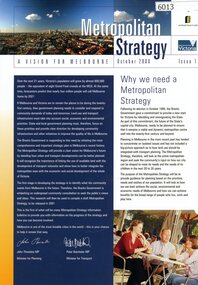
Booklet, Victoria. Department of Infrastructure, Metropolitan strategy: a vision for Melbourne, October 2000, 2000
... ...infrastructure victoria...Victoria. Department of Infrastructure...Greensborough Historical Society 34A Glenauburn Road Lower Plenty Lower Plenty melbourne A report on Melbourne's future growth and a strategic plan to manage this growth, 2000. melbourne (victoria) town planning infrastructure victoria 8 p., text, col. illus. Metropolitan strategy: a vision for Melbourne, October 2000. ...A report on Melbourne's future growth and a strategic plan to manage this growth, 2000.8 p., text, col. illus.melbourne (victoria), town planning, infrastructure victoria -
 Victorian Railway History Library
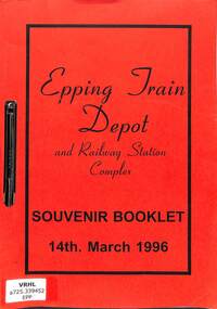
Booklet, Metropolitan Transit, Epping Train Depot and Railway Station Complex: Souvenir Booklet 14th March 1996, 1996
... railroad infrastructure - Victoria...railroad infrastructure - Victoria Electric trains - Victoria - history A souvenir booklet to commemorate the opening of the new Epping station and the train stabling depot next to it on 14-03-96. maps, p.12. ...A souvenir booklet to commemorate the opening of the new Epping station and the train stabling depot next to it on 14-03-96.maps, p.12.non-fictionA souvenir booklet to commemorate the opening of the new Epping station and the train stabling depot next to it on 14-03-96.railroad infrastructure - victoria, electric trains - victoria - history -
 Victorian Railway History Library
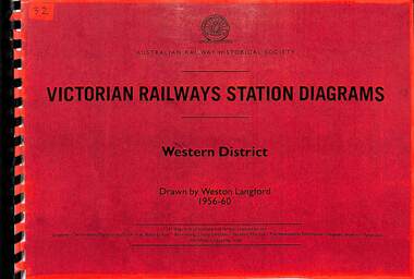
Book, Langford, Weston, Victorian Railway Station Diagrams 1956-1960 - Western District, 1956-1960
... railroad infrastructure - Victoria...Victorian Railway History Library 39 St Edmonds Rd Prahran Prahran railroad infrastructure - Victoria railroads - Victoria Railway diagrams of all the stations in the Western district of Victoria in 1956 to 1960. maps, p.56. ...Railway diagrams of all the stations in the Western district of Victoria in 1956 to 1960.maps, p.56.non-fictionRailway diagrams of all the stations in the Western district of Victoria in 1956 to 1960.railroad infrastructure - victoria, railroads - victoria -
 Victorian Railway History Library
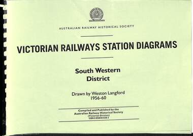
Book, Langford, Weston, Victorian Railway Station Diagrams 1956-1960 - South Western District, 1956-1960
... railroad infrastructure - Victoria...Victorian Railway History Library 39 St Edmonds Rd Prahran Prahran railroad infrastructure - Victoria railroads - Victoria Railway diagrams of all the stations in the South Western district of Victoria in 1956 to 1960. maps, p.76. ...Railway diagrams of all the stations in the South Western district of Victoria in 1956 to 1960.maps, p.76.non-fictionRailway diagrams of all the stations in the South Western district of Victoria in 1956 to 1960.railroad infrastructure - victoria, railroads - victoria -
 Victorian Railway History Library
Book, Langford, Weston, Victorian Railway Station Diagrams 1956-1960 - Eastern and South Eastern District, 1956-1960
... railroad infrastructure - Victoria...Victorian Railway History Library 39 St Edmonds Rd Prahran Prahran railroad infrastructure - Victoria railroads - Victoria Railway diagrams of all the stations in the Eastern and South Eastern district of Victoria in 1956 to 1960. maps, p.67. ...Railway diagrams of all the stations in the Eastern and South Eastern district of Victoria in 1956 to 1960.maps, p.67.non-fictionRailway diagrams of all the stations in the Eastern and South Eastern district of Victoria in 1956 to 1960.railroad infrastructure - victoria, railroads - victoria -
 Victorian Railway History Library
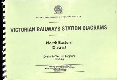
Book, Langford, Weston, Victorian Railway Station Diagrams 1956-1960 - North Eastern District, 1956-1960
... railroad infrastructure - Victoria...Victorian Railway History Library 39 St Edmonds Rd Prahran Prahran railroad infrastructure - Victoria railroads - Victoria Railway diagrams of all the stations in the North Eastern district of Victoria in 1956 to 1960. maps, p.132. ...Railway diagrams of all the stations in the North Eastern district of Victoria in 1956 to 1960.maps, p.132.non-fictionRailway diagrams of all the stations in the North Eastern district of Victoria in 1956 to 1960.railroad infrastructure - victoria, railroads - victoria -
 Victorian Railway History Library
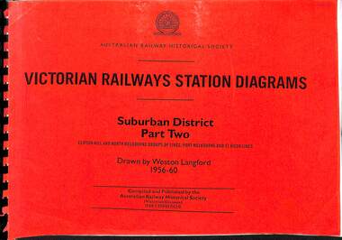
Book, Langford, Weston, Victorian Railway Station Diagrams 1956-1960 - Suburban District Part Two, 1956-1960
... railroad infrastructure - Victoria...Victorian Railway History Library 39 St Edmonds Rd Prahran Prahran railroad infrastructure - Victoria railroads - Victoria Railway diagrams of the stations on the Clifton Hill, North Melbourne Port Melbourne & St Kilda group of lines in the Suburban district of Melbourne Victoria in 1956 to 1960. maps, p.52. ...Railway diagrams of the stations on the Clifton Hill, North Melbourne Port Melbourne & St Kilda group of lines in the Suburban district of Melbourne Victoria in 1956 to 1960.maps, p.52.non-fictionRailway diagrams of the stations on the Clifton Hill, North Melbourne Port Melbourne & St Kilda group of lines in the Suburban district of Melbourne Victoria in 1956 to 1960.railroad infrastructure - victoria, railroads - victoria -
 Victorian Railway History Library
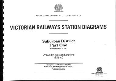
Book, Langford, Weston, Victorian Railway Station Diagrams 1956-1960 - Suburban District Part One, 1956-1960
... railroad infrastructure - Victoria...Victorian Railway History Library 39 St Edmonds Rd Prahran Prahran railroad infrastructure - Victoria railroads - Victoria Railway diagrams of all the stations on the Richmond group of lines in the Suburban district of Melbourne Victoria in 1956 to 1960. maps, p.64. ...Railway diagrams of all the stations on the Richmond group of lines in the Suburban district of Melbourne Victoria in 1956 to 1960.maps, p.64.non-fictionRailway diagrams of all the stations on the Richmond group of lines in the Suburban district of Melbourne Victoria in 1956 to 1960.railroad infrastructure - victoria, railroads - victoria -
 Victorian Railway History Library
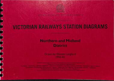
Book, Langford, Weston, Victorian Railway Station Diagrams 1956-1960 - Northern and Midland District, 1956-1960
... railroad infrastructure - Victoria...Victorian Railway History Library 39 St Edmonds Rd Prahran Prahran railroad infrastructure - Victoria railroads - Victoria Railway diagrams of all the stations in the Northern and Midland district of Victoria in 1956 to 1960. maps, p.43. ...Railway diagrams of all the stations in the Northern and Midland district of Victoria in 1956 to 1960.maps, p.43.non-fictionRailway diagrams of all the stations in the Northern and Midland district of Victoria in 1956 to 1960.railroad infrastructure - victoria, railroads - victoria -
 Victorian Railway History Library
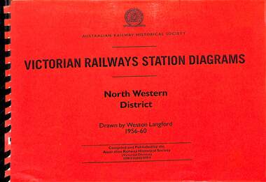
Book, Langford, Weston, Victorian Railway Station Diagrams 1956-1960 - North Western District, 1956-1960
... railroad infrastructure - Victoria...Victorian Railway History Library 39 St Edmonds Rd Prahran Prahran railroad infrastructure - Victoria railroads - Victoria Railway diagrams of all the stations in the North Western district of Victoria in 1956 to 1960. maps, p.84. ...Railway diagrams of all the stations in the North Western district of Victoria in 1956 to 1960.maps, p.84.non-fictionRailway diagrams of all the stations in the North Western district of Victoria in 1956 to 1960.railroad infrastructure - victoria, railroads - victoria -
 Victorian Railway History Library
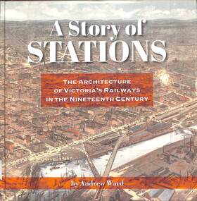
Book, Ward, Andrew, A Story of Stations The Architecture of Victoria's Railways in the Nineteenth Century, 2019
... railroad infrastructure - Victoria...Victorian Railway History Library 39 St Edmonds Rd Prahran Prahran railroad infrastructure - Victoria Railroads - Victoria - history Details of the architecture of railway stations building in Victoria Australia in the 19th century. index, ill, maps, p.337. ...Details of the architecture of railway stations building in Victoria Australia in the 19th century.index, ill, maps, p.337.non-fictionDetails of the architecture of railway stations building in Victoria Australia in the 19th century.railroad infrastructure - victoria, railroads - victoria - history -
 Victorian Railway History Library
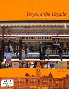
Book, Davies, Jenny, Beyond the Facade Flinders Street, more than just a railway station, 2008
... railroad infrastructure - Victoria...Victorian Railway History Library 39 St Edmonds Rd Prahran Prahran railroad infrastructure - Victoria Flinders St Station - Victoria - history A history of the Flinders St station and the shops and facilities in the 1910 built building. index, ill, p.338. ...A history of the Flinders St station and the shops and facilities in the 1910 built building.index, ill, p.338.non-fictionA history of the Flinders St station and the shops and facilities in the 1910 built building.railroad infrastructure - victoria, flinders st station - victoria - history -
 Victorian Railway History Library
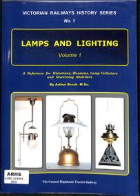
Book, Brook, Arthur, Victorian Railways History Series No. 1 Lamps and Lighting, 2019
... railroad infrastructure - Victoria...Victorian Railway History Library 39 St Edmonds Rd Prahran Prahran railroad infrastructure - Victoria Railway lamps and lighting - Victoria - history Details and history of railway lamps and station lighting on the Victorian Railways. index, ill, p.202. ...Details and history of railway lamps and station lighting on the Victorian Railways.index, ill, p.202.non-fictionDetails and history of railway lamps and station lighting on the Victorian Railways.railroad infrastructure - victoria, railway lamps and lighting - victoria - history -
 Victorian Railway History Library
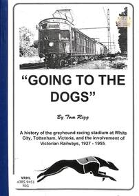
Book, Rigg, Tom, Going To The Dogs, 1997
... railroad infrastructure - Victoria...Victorian Railway History Library 39 St Edmonds Rd Prahran Prahran railroad infrastructure - Victoria Railroad operations - Victoria - history A history of the greyhound racing stadium at White City, Tottenham, Victoria, on the Bendigo line, and the involvement of Victorian Railways, 1927-1955. ill, p.20. ...A history of the greyhound racing stadium at White City, Tottenham, Victoria, on the Bendigo line, and the involvement of Victorian Railways, 1927-1955.ill, p.20.non-fictionA history of the greyhound racing stadium at White City, Tottenham, Victoria, on the Bendigo line, and the involvement of Victorian Railways, 1927-1955.railroad infrastructure - victoria, railroad operations - victoria - history -
 Victorian Railway History Library
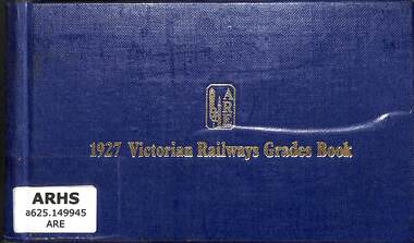
Book, The Association of Railway Enthusiasts, 1927 Victorian Railways Grades Book, 1975
... Railway infrastructure - Victoria...Railway infrastructure - Victoria Gradient diagrams - Victoria A reprinted edition of the gradiant and curvature diagrams of all the Victorian Government Railways in 1927 maps, p.197. 1927 Victorian Railways Grades Book Book The Association of Railway Enthusiasts ...A reprinted edition of the gradiant and curvature diagrams of all the Victorian Government Railways in 1927maps, p.197.A reprinted edition of the gradiant and curvature diagrams of all the Victorian Government Railways in 1927railway infrastructure - victoria, gradient diagrams - victoria -
 Victorian Railway History Library
Book, The Association of Railway Enthusiasts, 1927 Victorian Railways Grades Book - Supplementary Diagrams
... Railway infrastructure - Victoria...Railway infrastructure - Victoria Gradient diagrams - Victoria A reprinted edition of the gradiant and curvature diagrams of all the Victorian Government Railways in 1927 maps, p.198. 1927 Victorian Railways Grades Book - Supplementary Diagrams Book The Association of Railway Enthusiasts ...A reprinted edition of the gradiant and curvature diagrams of all the Victorian Government Railways in 1927maps, p.198.A reprinted edition of the gradiant and curvature diagrams of all the Victorian Government Railways in 1927railway infrastructure - victoria, gradient diagrams - victoria -
 Victorian Railway History Library
Book, Brook, Arthur, Buffer Stops and Baulks, 2007
... Railway infrastructure - Victoria...Railway infrastructure - Victoria Railway infrastructure - Australia A reference book for historians, museums and discerning railway modelers about the different buffer stops and baulks used on the Victorian Railways. ill, p.104. ...A reference book for historians, museums and discerning railway modelers about the different buffer stops and baulks used on the Victorian Railways.ill, p.104.A reference book for historians, museums and discerning railway modelers about the different buffer stops and baulks used on the Victorian Railways.railway infrastructure - victoria, railway infrastructure - australia -
 Ballarat Heritage Services
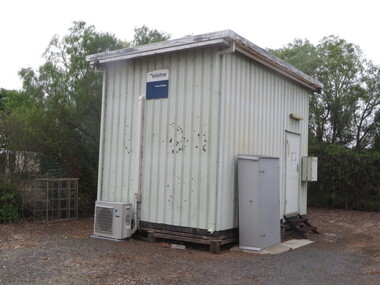
Photograph - Colour, Telepone Exchange at Cressy, Victoria, 2016, 26/01/2016
... Colour photographs of old telephone and post office infrastructure at Cressy, Victoria....Ballarat Heritage Services PO Box 2209 Bakery Hill Post Office goldfields cressy telephone exchange telephone payphone church cressy public hall post office Colour photographs of old telephone and post office infrastructure at Cressy, Victoria. Telepone Exchange at Cressy, Victoria, 2016 Photograph - Colour ...Colour photographs of old telephone and post office infrastructure at Cressy, Victoria.cressy, telephone exchange, telephone, payphone, church, cressy public hall, post office -
 Melbourne Tram Museum
Newspaper, The Age, “Push to scrap rego and myki”, 25/03/2020 12:00:00 AM
... Newspaper clippings titled: “Push to scrap rego and myki” by Timna Jacks Newspaper clipping from the Age 25/03/2020 Infrastructure Victoria wants to replace car insurance, registration and myki with a pay as you go system. ...Melbourne Tram Museum 8 Wallen Road Hawthorn melbourne Trams tramways Public Transport Melbourne Ticket Myki Newspaper clippings titled: “Push to scrap rego and myki” by Timna Jacks Newspaper clipping from the Age 25/03/2020 Infrastructure Victoria wants to replace car insurance, registration and myki with a pay as you go system. ...Newspaper clippings titled: “Push to scrap rego and myki” by Timna Jacks Newspaper clipping from the Age 25/03/2020 Infrastructure Victoria wants to replace car insurance, registration and myki with a pay as you go system. Proposal for tram users to pay 74c per kilometre. Has a photo of a tram being cleaned.trams, tramways, public transport, melbourne, ticket, myki -
 Melbourne Tram Museum
Magazine, Department of Infrastructure (DOI), "New Home for Heritage Trams", Dec. 1998
... Eight page magazine, folded A3 printed on gloss paper, blue and black ink, "Infrazine" - Department of Infrastructure Victoria, Issue 11, December 1998 with the main article on the redevelopment of Hawthorn Tram depot - titled "New Home for Heritage Trams". ...Melbourne Tram Museum 8 Wallen Road Hawthorn melbourne Trams tramways Hawthorn Depot PTC DOI Reconstruction Eight page magazine, folded A3 printed on gloss paper, blue and black ink, "Infrazine" - Department of Infrastructure Victoria, Issue 11, December 1998 with the main article on the redevelopment of Hawthorn Tram depot - titled "New Home for Heritage Trams". ...Eight page magazine, folded A3 printed on gloss paper, blue and black ink, "Infrazine" - Department of Infrastructure Victoria, Issue 11, December 1998 with the main article on the redevelopment of Hawthorn Tram depot - titled "New Home for Heritage Trams". Gives details of the history of the depot, involvement of the Department of Infrastructure, Public Transport Corporation, and the Urban Land Corporation, TMSV and the future use of the heritage trams. Article signed by Brandon Mack. Other items cover legal services, the Marine Board, regional offices.trams, tramways, hawthorn depot, ptc, doi, reconstruction -
 Melbourne Tram Museum
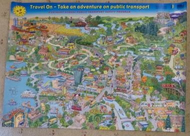
Poster, Creative Country Pty Ltd, "Travel On - Take and adventure on public transport", 2000
... In top right hand corner has Dept. of Infrastructure logo, Victoria the Place to Be logo. Part of Public Transport Education Program. ...In top right hand corner has Dept. of Infrastructure logo, Victoria the Place to Be logo. Part of Public Transport Education Program. ...Poster - full colour printed on gloss paper, titled "Travel On - Take and adventure on public transport" with sub title "A Primary School public transport Safety Program". Made by Creative Country Pty Ltd in 2000 (name and date on bottom edge). showing various forms of public transport; includes trains, trams, boats, puffing billy, restaurant tram, Luna Park, paddle steamers and various features of Melbourne itself. In top right hand corner has Dept. of Infrastructure logo, Victoria the Place to Be logo. Part of Public Transport Education Program. Two copies held.trams, tramways, public transport, education, training, safety, children -
Melbourne Tram Museum
Document - Digital Image, Victorian Transport Action Group (VTAG), "Melbourne’s Tram Plan Response Filling the Gaps", March 2024
... Redirect routes 3, 5 and 12 (detailed in Table 2) with the opening of MM1 to improve the distribution of tram services through the central area. 3. Direct Infrastructure Victoria to undertake the specific planning process as part of the next state infrastructure plan to canvas a range of possible network enhancements. 4. ...Redirect routes 3, 5 and 12 (detailed in Table 2) with the opening of MM1 to improve the distribution of tram services through the central area. 3. Direct Infrastructure Victoria to undertake the specific planning process as part of the next state infrastructure plan to canvas a range of possible network enhancements. 4. ...Document produced by the Victorian Transport Action Group as a response to the Department of Transport "Melbourne Tram Plan" of Oct. 2023 - see item 7364. VTAG have produced a number of initiatives and looks at a number of route proposals that have been made by Government but as of the end of 2024, little progress has been made on any of them. Initiatives suggested are: 1. Confirm its commitment to previously announced projects (listed in Table 1) and provide indicative timeframes for completion. 2. Redirect routes 3, 5 and 12 (detailed in Table 2) with the opening of MM1 to improve the distribution of tram services through the central area. 3. Direct Infrastructure Victoria to undertake the specific planning process as part of the next state infrastructure plan to canvas a range of possible network enhancements. 4. Revise the selection of stops for upgrade to level access to include the practical considerations of technical feasibility and constructability to ensure that as many stops as possible are delivered as a priority. 5. Expand the corridor-based approach being applied to upgrade stops to include the implementation of traffic priority along the selected corridors. 6. Adopt a 15mins, or at least 20 mins, as the maximum headway for all Melbourne tram routes. Notes changes that will be needed as a result of the Melbourne Metro in 2025, tram stops, energy efficiency, renewing the fleet and infrastructure, network performance, and passenger experience. Demonstrates a response to the Vic Govt's tram plan by an Action Group.Digital copy of a 21 A4 page document produced by the Victorian Transport Action Group March 2024. tramways, victorian government, department of transport, planning, vtag -
 Orbost & District Historical Society
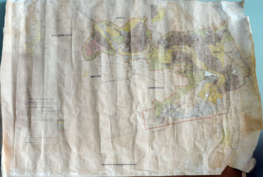
plan, before 1948
... (ref. 4 East Gippsland CMA Submission to Inquiry into Flood Mitigation Infrastructure in Victoria) ...(ref. 4 East Gippsland CMA Submission to Inquiry into Flood Mitigation Infrastructure in Victoria) This plan is significant as a historical document. ...Drainage infrastructure was developed and maintained in this region by the Snowy River Improvement Trust. The Trust was administered by a local committee and its activities funded by a local rate charged on the farmers and land owners in the Trust’s designated district. The level of the rate charged by the Trust was designed to be proportionate to the benefit derived from the works undertaken. Financial assistance was provided by the State Government from time to time for specific projects such as post flood repairs but not for new capital works. The Trust undertook new drainage and river management works including tree planting, rock beach construction and servicing of the drains and flood gates. The Trust also provided a personal flood warning service to the farmers in its district. The Trust ceased to operate in 1997 with the advent of the East Gippsland Catchment Management Authority. The infrastructure developed by the Trust continues to provide a service to the farmers in the region. (ref. 4 East Gippsland CMA Submission to Inquiry into Flood Mitigation Infrastructure in Victoria) This plan is significant as a historical document. The Snowy River Improvement Trust was vital to the Orbost district because of its ability to apply local knowledge and to engage the local farming community.A large plan of divisions of land for the purpose of levying the Snowy River Improvement District - Bete Bolong, Orbost, Waygara, Newmerella and Orbost East. The properties are coloured according to levy amount. The scale is 1" - 20 chains. snowy-river-improvement-trust -
 Warrnambool and District Historical Society Inc.
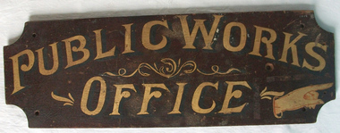
Sign - Public Works Office
... The first states Public Works Office, which was operational in Victoria between 1855 and 1987 dealt with many aspects of the states infrastructure. ...The first states Public Works Office, which was operational in Victoria between 1855 and 1987 dealt with many aspects of the states infrastructure. ...This sign points has two different messages. The first states Public Works Office, which was operational in Victoria between 1855 and 1987 dealt with many aspects of the states infrastructure. It had many different reponsibilities and roles from building government accommodation and fit out of buildings, licences for unused roads and water ways, main roads and bridges, ports and harbour,and water supplies. Much of this work was managed through local offices such as the one at Warrnambool. The sign on the reverse which states Witnesses Waiting Room relates to the court house which is where this sign originated.The Warrnambool court house was built in 1870-71 by the Victorian Public Works department and it is possible that this sign relates to that period.It is one of a number of public buildings built in the period 1870-1890 including the Police station and stables and police quarters, the Post Office and drill Hall , all in the same vicinity. This building reflects the growth of the town and also the importance it held at the time from a state level. The building while no longer used as a court house is a building of significance to Warrnambool as well as to the state of Victoria, being one of six around the state which were built in free classical style. This sign denotes the waiting room for witnesses which was situated on the western side of the building.A tangible link which provides historical and social significance to Warrnambool.Rectangular wooden sign with rounded corners. There is text on both sides painted in gold paint with shadow in black. One side is a darker brown stain . There are screw holes in each corner.and one hole on left middle of sign. Rounded edge on one side.Side 1:Witnesses Waiting Room Side 2:Public Works Office.warrnambool, warrnambool court house, public works department warrnambool -
 Kiewa Valley Historical Society
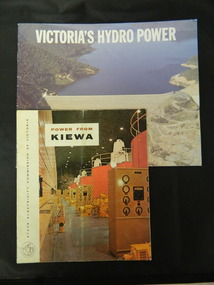
Booklets - Kiewa Hydro Electric Scheme, 1. "Power From Kiewa" and 2. "Victoria's Hydro Power", 1. Made in July 1968 and 2. Made in Aug. 1985
... The State Electricity Commission of Victoria built the Kiewa Hydro Electric Scheme establishing infrastructure such as the Bogong and Mt Beauty townships and the opportunity for tourism in the area. state electricity commission of victoria; kiewa hydro electric scheme; victoria's hydro electric power; kiewa; mckay creek power station; clover power station; west kiewa power station 1. ...1. The State Electricity Commission of Victoria built the Kiewa Hydro Electric Scheme from the 1930's to the 1960's. This booklet was to inform visitors and to promote tourism. 2. The State Electricity Commission built several hydro power stations from 1928 - 1981. This booklet names each with a summary and explanation.The State Electricity Commission of Victoria built the Kiewa Hydro Electric Scheme establishing infrastructure such as the Bogong and Mt Beauty townships and the opportunity for tourism in the area.1. Colored soft cover with photo of McKay Creek Power Station on the front and Mt Beauty township on the back. Published by the SECV 2. Colored soft cover with Rocky Valley Dam on the front and inserted photo of a stream and snow on the back. Published by the SEC.state electricity commission of victoria; kiewa hydro electric scheme; victoria's hydro electric power; kiewa; mckay creek power station; clover power station; west kiewa power station -
 Kiewa Valley Historical Society
Folder - Bogong High Plains and Falls Creek, 1960's and 1970's
... Victoria construction of the Kiewa Hydro Electric Scheme. With the completion of the power stations on the Bogong High plains, tourism has created a new focus and different infrastructure/lifestyle for the community. ...Tourism on the Bogong High Plains developed after/during the State Electricity Commission of Victoria construction of the Kiewa Hydro Electric Scheme.With the completion of the power stations on the Bogong High plains, tourism has created a new focus and different infrastructure/lifestyle for the community.A blue folder with a collection of papers & booklets on: 1. Discovery of Bogong High Plains 1962 2. SECV Discovery of Bogong High Plains 1968 3. SECV Kiewa Hydro Electric Scheme 1911 - 1961 4. Newspaper cutting - Mt Beauty 1974 5. McKay Creek Power Station and Clover Power Station 6. Falls Creek and Mt Beauty Tourist Map & brochures 7. Bogong High Plains Tour 1973bogong high plains; falls creek; tourism; -
 Kiewa Valley Historical Society
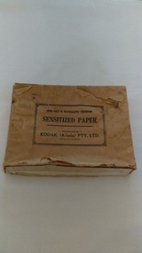
Photographs of small box originally used to contain sensitized photographic paper
... Victoria. SECV official photographers took photographs of most stages of construction of the Hydro Electric Scheme and referenced each photo with a number and dating system as an historical record and for reference for other projects. This provided a thorough history of the construction of the Hydro Electric Scheme, some of the workers involved in its construction and the infrastructure ...The Junction Dam and Clover Dam Power Station, stages of the Kiewa Hydro-Electric Scheme, were needed to meet the increased power demands of the wartime industry in Victoria. Clover added 26 megawatts to the grid. Junction Dam was completed and ready to hold water by September 1943, but was emptied in December 1943 and not filled again until May 1944. Construction of Clover Power Station commenced in July 1941 and both turbines were in service by May 1945.Clover Power Station and Junction Dam were part of the Kiewa Hydro Electric Scheme constructed by the State Electricity Commission of Victoria. SECV official photographers took photographs of most stages of construction of the Hydro Electric Scheme and referenced each photo with a number and dating system as an historical record and for reference for other projects. This provided a thorough history of the construction of the Hydro Electric Scheme, some of the workers involved in its construction and the infrastructure supporting its construction, such a Bogong Village.Small light brown cardboard box originally containing sensitized photographic paper, now containing a range of black and white photographs of the Kiewa Hydro Electric System taken by the official SECV photographer Box has some damage – Front panel on lid is missing. Top has a puncture in top right corner and some peeling of paper along sides and at edges. Printed on the top of the box in black ink: OPEN ONLY IN PHOTOGRAPHIC DARK ROOM SENSITIZED PAPER Manufactured by – KODAK (A/asia) PTY. LTD. Melbourne Australia Green and white sticker on right side of lid and bottom right side of box, torn at join 1. 1B1 Single Weight Soft. Available in Soft (1) Medium (2) Contrast (3) Extra Contrast (4) Single and Double Weight Stamped at bottom of sticker in grey ink G8087 CK photographic paper box; state electricity commission of victoria; official photographer; kiewa hydro electric scheme; clover power station; junction dam; bogong village -
 Kiewa Valley Historical Society
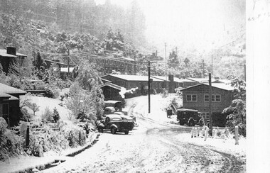
Photographs – Set of 9 black and white photographs and photocopies of original photographs depicting the early days of Bogong Village during the 1940’s, circa 1940's
... Photos show the terrain in which Bogong Village was built, the early construction used for the temporary buildings and the housing and the amount of infrastructure required to accommodate the needs of the residents of the area including workers, their families and other support staff. Bogong Village; 1939 fires; Kiewa Hydro Electric Scheme; 1. Handwritten under photo – August 1948 2. Printed under photo: STATE ELECTRICITY COMMISSION OF VICTORIA ...Bogong Village, which was known as “The Junction”, is well recorded. The first tent camp was at the junction of Pretty Valley and Rocky Valley streams in the early 40’s. Further downstream were the sawmill, stables and blacksmith’s forge. Horses were the main mode of transport in the early days. The road to Bogong had reached the lookout spur just beyond Roper’s Spur track just before the 1939 fires. The early forties saw rapid growth of the village, with single and married men’s quarters, workshops, mess huts and administrative offices. The facilities necessary for communal living were quickly in place- a post office, police station, co-op store, medical centre, community hall/theatre, tennis courts and school. Much of the temporary accommodation that housed groups such as the Albion Quarrying Company were in the area now under water.Pictorial history of the early years of Bogong Village including one photo taken following the devastating fires of 1939. Photos show the terrain in which Bogong Village was built, the early construction used for the temporary buildings and the housing and the amount of infrastructure required to accommodate the needs of the residents of the area including workers, their families and other support staff. Set of 9 black and white photographs and photocopies of photographs depicting early buildings at Bogong Village . Photos show very early construction buildings as well as the village in various weather conditions, including snowing and after bush fires. (some official SECV photographs) 1. Bogong Village in heavy snow 2. Bogong Township during heavy snow (SECV Official Photo) 3. VIP Lodge at Bogong in the snow 4. Bogong Village - circa 1940’s 5. Bogong Village under street lights 6. Lewis Construction Camp (SECV Official Photo) 7. Albion Quarrying Co. Camp (SECV Official Photo) 8. Tent camp and early buildings following 1939 fires 9. Typical house – Bogong Village 1. Handwritten under photo – August 1948 2. Printed under photo: STATE ELECTRICITY COMMISSION OF VICTORIA Date: 25.8.48 Time: 9am No:K 4680 Kiewa Hydro-Electric Works. Bogong Township 3. Handwritten on back of photo- V.I.P. Lodge, Bogong 4 – 5. No markings 6. Printed under photo: STATE ELECTRICITY COMMISSION OF VICTORIA Date: 28.11.40 Time: 1.40pm No:K284 Kiewa Hydro-Electric Works. Lewis Construction Camp 7. Printed under photo: STATE ELECTRICITY COMMISSION OF VICTORIA Date: 11.1.41 Time: 10.40am No:K294 Kiewa Hydro-Electric Works. Albion Quarrying Co. Camp – Bogong. Handwritten on back of photo: On the floor of the present dam 8. No markings 9. Printed under photo: STATE ELECTRICITY COMMISSION OF VICTORIA Date: 11.1.46 Time: 1.23pm No:K2181 Kiewa Hydro-Electric Works. Bogong – Typical House bogong village; 1939 fires; kiewa hydro electric scheme;