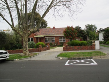
Showing 4389 items matching "interwar housing"
-
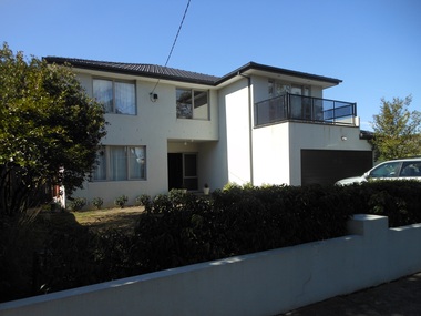
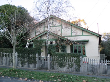
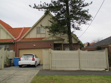
 Surrey Hills Historical Society Collection
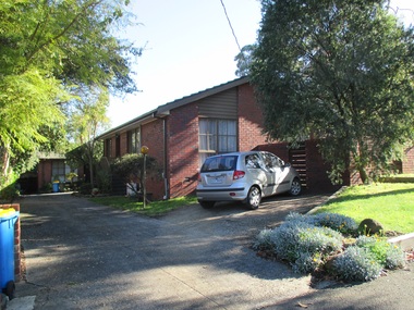
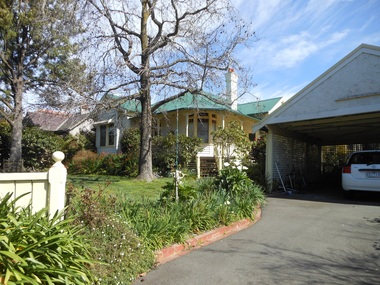
Photograph - 1 Neath Street, Surrey Hills, The Street Where You Live Project
... ...especially interwar housing and post 1950's housing....At particular risk were properties not covered by heritage overlays especially interwar housing and post 1950's housing. The Street Where You Live Project Photograph 1 Neath Street, Surrey Hills ...Photos documenting this address as part of a photographic series undertaken by volunteer photographers during 2013 and 2014 for The Street Where You Live Project. This was organised through the Surrey Hills Neighbourhood Centre and covered the postcode 3127 in the cities of Boroondara and Whitehorse.these photos provide a snapshot of real estate in the suburbs of mont albert and surrey hills during a period of rapid change with many properties on large blocks demolished to create higher density residential development or renewal of single dwellings. at particular risk were properties not covered by heritage overlays, especially interwar housing and post 1950's housing. -
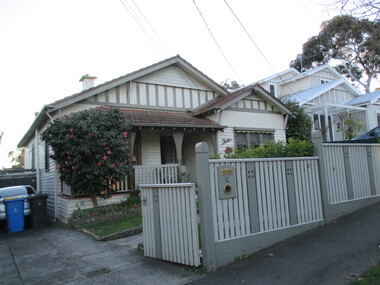
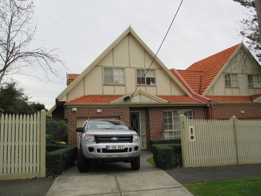
 Surrey Hills Historical Society Collection
Photograph - 1 Barloa Road, Surrey Hills, The Street Where You Live Project
... ...especially interwar housing and post 1950's housing....At particular risk were properties not covered by heritage overlays especially interwar housing and post 1950's housing. The Street Where You Live Project Photograph 1 Barloa Road, Surrey Hills ...Photos documenting this address as part of a photographic series undertaken by volunteer photographers during 2013 and 2014 for The Street Where You Live Project. This was organised through the Surrey Hills Neighbourhood Centre and covered the postcode 3127 in the cities of Boroondara and Whitehorse.these photos provide a snapshot of real estate in the suburbs of mont albert and surrey hills during a period of rapid change with many properties on large blocks demolished to create higher density residential development or renewal of single dwellings. at particular risk were properties not covered by heritage overlays, especially interwar housing and post 1950's housing. -
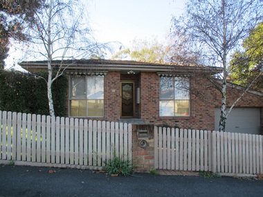
 Surrey Hills Historical Society Collection
Photograph - 2 Barloa Road, Surrey Hills, The Street Where You Live Project
... ...especially interwar housing and post 1950's housing....At particular risk were properties not covered by heritage overlays especially interwar housing and post 1950's housing. The Street Where You Live Project Photograph 2 Barloa Road, Surrey Hills ...Photos documenting this address as part of a photographic series undertaken by volunteer photographers during 2013 and 2014 for The Street Where You Live Project. This was organised through the Surrey Hills Neighbourhood Centre and covered the postcode 3127 in the cities of Boroondara and Whitehorse.these photos provide a snapshot of real estate in the suburbs of mont albert and surrey hills during a period of rapid change with many properties on large blocks demolished to create higher density residential development or renewal of single dwellings. at particular risk were properties not covered by heritage overlays, especially interwar housing and post 1950's housing. -
 Surrey Hills Historical Society Collection
Photograph - 3 Barloa Road, Surrey Hills, The Street Where You Live Project
... ...especially interwar housing and post 1950's housing....At particular risk were properties not covered by heritage overlays especially interwar housing and post 1950's housing. The Street Where You Live Project Photograph 3 Barloa Road, Surrey Hills ...Photos documenting this address as part of a photographic series undertaken by volunteer photographers during 2013 and 2014 for The Street Where You Live Project. This was organised through the Surrey Hills Neighbourhood Centre and covered the postcode 3127 in the cities of Boroondara and Whitehorse.these photos provide a snapshot of real estate in the suburbs of mont albert and surrey hills during a period of rapid change with many properties on large blocks demolished to create higher density residential development or renewal of single dwellings. at particular risk were properties not covered by heritage overlays, especially interwar housing and post 1950's housing. -
 Surrey Hills Historical Society Collection
Photograph - 4 Barloa Road, Surrey Hills, The Street Where You Live Project
... ...especially interwar housing and post 1950's housing....At particular risk were properties not covered by heritage overlays especially interwar housing and post 1950's housing. The Street Where You Live Project Photograph 4 Barloa Road, Surrey Hills ...Photos documenting this address as part of a photographic series undertaken by volunteer photographers during 2013 and 2014 for The Street Where You Live Project. This was organised through the Surrey Hills Neighbourhood Centre and covered the postcode 3127 in the cities of Boroondara and Whitehorse.these photos provide a snapshot of real estate in the suburbs of mont albert and surrey hills during a period of rapid change with many properties on large blocks demolished to create higher density residential development or renewal of single dwellings. at particular risk were properties not covered by heritage overlays, especially interwar housing and post 1950's housing. -
 Surrey Hills Historical Society Collection
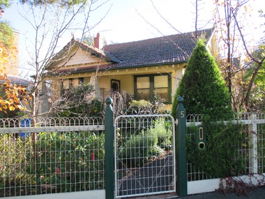
Photograph - 5 Barloa Road, Surrey Hills, The Street Where You Live Project
... ...especially interwar housing and post 1950's housing....At particular risk were properties not covered by heritage overlays especially interwar housing and post 1950's housing. The Street Where You Live Project Photograph 5 Barloa Road, Surrey Hills ...Photos documenting this address as part of a photographic series undertaken by volunteer photographers during 2013 and 2014 for The Street Where You Live Project. This was organised through the Surrey Hills Neighbourhood Centre and covered the postcode 3127 in the cities of Boroondara and Whitehorse.these photos provide a snapshot of real estate in the suburbs of mont albert and surrey hills during a period of rapid change with many properties on large blocks demolished to create higher density residential development or renewal of single dwellings. at particular risk were properties not covered by heritage overlays, especially interwar housing and post 1950's housing. -
 Surrey Hills Historical Society Collection
Photograph - 5A Barloa Road, Surrey Hills, The Street Where You Live Project
... ...especially interwar housing and post 1950's housing....At particular risk were properties not covered by heritage overlays especially interwar housing and post 1950's housing. The Street Where You Live Project Photograph 5A Barloa Road, Surrey Hills ...Photos documenting this address as part of a photographic series undertaken by volunteer photographers during 2013 and 2014 for The Street Where You Live Project. This was organised through the Surrey Hills Neighbourhood Centre and covered the postcode 3127 in the cities of Boroondara and Whitehorse.these photos provide a snapshot of real estate in the suburbs of mont albert and surrey hills during a period of rapid change with many properties on large blocks demolished to create higher density residential development or renewal of single dwellings. at particular risk were properties not covered by heritage overlays, especially interwar housing and post 1950's housing. -
 Surrey Hills Historical Society Collection
Photograph - 6 Barloa Road, Surrey Hills, The Street Where You Live Project
... ...especially interwar housing and post 1950's housing....At particular risk were properties not covered by heritage overlays especially interwar housing and post 1950's housing. The Street Where You Live Project Photograph 6 Barloa Road, Surrey Hills ...Photos documenting this address as part of a photographic series undertaken by volunteer photographers during 2013 and 2014 for The Street Where You Live Project. This was organised through the Surrey Hills Neighbourhood Centre and covered the postcode 3127 in the cities of Boroondara and Whitehorse.these photos provide a snapshot of real estate in the suburbs of mont albert and surrey hills during a period of rapid change with many properties on large blocks demolished to create higher density residential development or renewal of single dwellings. at particular risk were properties not covered by heritage overlays, especially interwar housing and post 1950's housing. -
 Surrey Hills Historical Society Collection
Photograph - 7 Barloa Road, Surrey Hills, The Street Where You Live Project
... ...especially interwar housing and post 1950's housing....At particular risk were properties not covered by heritage overlays especially interwar housing and post 1950's housing. The Street Where You Live Project Photograph 7 Barloa Road, Surrey Hills ...Photos documenting this address as part of a photographic series undertaken by volunteer photographers during 2013 and 2014 for The Street Where You Live Project. This was organised through the Surrey Hills Neighbourhood Centre and covered the postcode 3127 in the cities of Boroondara and Whitehorse.these photos provide a snapshot of real estate in the suburbs of mont albert and surrey hills during a period of rapid change with many properties on large blocks demolished to create higher density residential development or renewal of single dwellings. at particular risk were properties not covered by heritage overlays, especially interwar housing and post 1950's housing. -
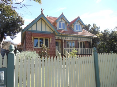
 Kew Historical Society Inc
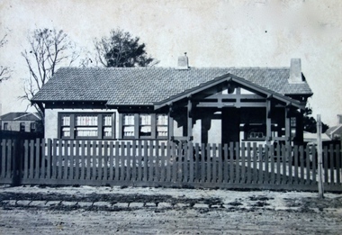
Photograph - Cosy Five Roomed Rough Cast Bungalow, Kew, J E Barnes, c.1920
... josiah earl barnes, j e barnes, photography - kew, interwar housing - victoria, 1920s housing - kew...He clearly also completed commercial jobs for local businesses, as is the case in this photograph of a house for a local real estate and financial agent. josiah earl barnes, j e barnes, photography - kew, interwar housing - victoria, 1920s housing - kew Illegible inscription. ...Subdivision plans are historically important documents used as evidence of the growth of suburbs in Australia. They frequently provide information about when the land was sold on which a built structure was subsequently constructed as well as evidence relating to surveyors and real estate and financial agents. The numerous subdivision plans in the Kew Historical Society's collection represent working documents, ranging from the initial sketches made in planning a subdivision to printed plans on which auctioneers or agents listed the prices for which individual lots were sold. In a number of cases, the reverse of a subdivision plan in the collection includes a photograph of a house that was also for sale by the agent. These photographs provide significant heritage information relating house design and decoration, fencing and household gardens. The photograph is also aesthetically significant as it was taken by J. E. Barnes, a nationally significant photographer. He was the most important photographer to have worked in Kew. He was active as a photographer in the district from c.1906 until his death in 1921. Best known as 'the Embarkation Photographer' (see the Australian War Memorial collection), Josiah Earl Barnes was also the official photographer employed by the Borough (and later Town, then City) of Kew. He clearly also completed commercial jobs for local businesses, as is the case in this photograph of a house for a local real estate and financial agent. A modest weatherboard house with rough-cast rendered walls. The gabled entrance incorporates elements of the Japanese aesthetic. The strong lines of the dark timber gable are reinforced by the colour and shape of the pickets in the fence. In contrast to an earlier period, the chimneys appear truncated. The use of extensive double-hung sash windows in the front rooms reflects a new interest in light in houses. The use of separate sunshades over windows in an earlier period is here replaced by an extension of the roofline over the window. The photographer Josiah Barnes died in 1921; so, the photograph of the house must predate this date. The location of the house, which was advertised for sale, has to date not been identified. Illegible inscription. Photographer's information on mount.josiah earl barnes, j e barnes, photography - kew, interwar housing - victoria, 1920s housing - kew -
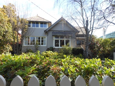
 Surrey Hills Historical Society Collection
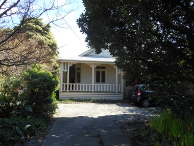
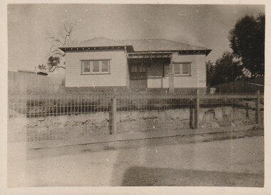
Work on paper - Photograph, 50 Broughton Road, Surrey Hills, c1924
... ...interwar housing...Broughton Road Surrey Hills Norman Pryde Hilda Pryde Hilda Gwendoline Scales 'Strathaven' house names 1920-1929 Moran & Cato Norma Pryde Norma Cleak Jenny Pomeray interwar housing NIL An original B&W photo of a simple timber home set behind a woven wire fence and taken from across the street. ...Information from the donor by email gives: My grandparents Norman & Hilda Pryde lived at 50 Broughton Rd, Surrey Hills. The home was named 'Strathaven' after the town in Scotland where Norman's father came from. They married in 1923. I know they lived there in 1924 when my mother Norma was born. Norman worked for Moran & Cato so I know they moved around a lot for his work and I think they rented out the house from time to time. During some time in the 1920s they were listed on electoral rolls in Nyah West and then in 1942 they were listed in Hamilton. When the war ended they came back to Melbourne and in the late 1940s built a home at Blackburn. Their daughter was at school in Grade 6 at Surrey Hills State School in 1935. See related photo. At the time of the donation, this simple home was still extant. Since then, c2021, it was demolished and replaced by a large single dwelling.This photo is representative of the simple interwar home that infilled earlier scattered residential development in this part of Surrey Hills.An original B&W photo of a simple timber home set behind a woven wire fence and taken from across the street. The garden looks relatively undeveloped.NILbroughton road, surrey hills, norman pryde, hilda pryde, hilda gwendoline scales, 'strathaven', house names, 1920-1929, moran & cato, norma pryde, norma cleak, jenny pomeray, interwar housing -
 Glen Eira Historical Society
Book - Hillcrest Estate Draft Heritage Guidelines July 2000
... The Heritage Area has been assessed as noteworthy as 'the first housing estate developed by the AV Jennings Construction Co., later known as Jennings Group Limited.' Developed during the Depression years of the early 1930s, it is considered an 'unusually intact example of an interwar garden estate' and is also considered noteworthy for its aesthetic values. ...The Heritage Area has been assessed as noteworthy as 'the first housing estate developed by the AV Jennings Construction Co., later known as Jennings Group Limited.' Developed during the Depression years of the early 1930s, it is considered an 'unusually intact example of an interwar garden estate' and is also considered noteworthy for its aesthetic values. ...2 items about Hillcrest Estate and heritage: 1/A 20 page report giving draft heritage guidelines by the City of Glen Eira for properties within the Hillcrest Estate Heritage Area of Caulfield South, including Hillcrest Avenue numbers 1 and 3-12 and Marara Road numbers 27 and 28. The Heritage Area has been assessed as noteworthy as 'the first housing estate developed by the AV Jennings Construction Co., later known as Jennings Group Limited.' Developed during the Depression years of the early 1930s, it is considered an 'unusually intact example of an interwar garden estate' and is also considered noteworthy for its aesthetic values. The Report describes typical features for two house forms typical of the area: the single-storey villa with decorative porch and the single storey villa with decorative verandah. It gives guidelines on the types of changes which can be made to houses within the Heritage Area. Included are photographs of typical houses and design features, maps, and diagrams showing acceptable zones for additions, amongst other Sections (eg. Key design checklist). 2/A three page photocopy taken from Andrew Ward's Heritage Study for The Hillcrest Estate Historic Area.hillcrest estate, glen eira heritage management plan, glen eira planning scheme, glen eira city council, hillcrest estate heritage area, hillcrest avenue, merri street, marara road, eumerella street, av jennings construction co, jennings group limited, caulfield south, jennings albert, brick houses, architectural styles, architectural features, housing estates, garden estate, heritage studies, glen eira city council, city of glen eira, draft heritage guidelines july 2000, glen huntly, vines william, gurney edward, eumeralla street, 'karkill', house names, cropmpton court, booran road, estate agents -
 Broadmeadows Historical Society & Museum
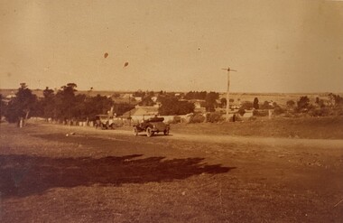
Photograph - Area - Suburb, Fawkner Street Westmeadows Looking North
... Housing Commission estate in the late 1940s. Historically, Westmeadows was a key waypoint along the Old Sydney Road, and its built environment—including bluestone bridges and early civic buildings—offers insight into Melbourne’s colonial and interwar development. ...Housing Commission estate in the late 1940s. Historically, Westmeadows was a key waypoint along the Old Sydney Road, and its built environment—including bluestone bridges and early civic buildings—offers insight into Melbourne’s colonial and interwar development. ...This photograph captures a historically significant streetscape in Westmeadows, formerly known as Broadmeadows Township, looking north from Fawkner Street. The image features a dirt road with a vintage automobile parked along its path, flanked by trees and modest residential buildings in the background. A tall utility or signpost stands prominently, indicative of early infrastructure in the area. The scene reflects the semi-rural character of Westmeadows prior to its suburban expansion in the post-war period. The presence of unsealed roads and early 20th-century vehicles suggests a time when the township served as a quiet residential and agricultural community, before the development of the Broadmeadows Housing Commission estate in the late 1940s. Historically, Westmeadows was a key waypoint along the Old Sydney Road, and its built environment—including bluestone bridges and early civic buildings—offers insight into Melbourne’s colonial and interwar development. This photograph contributes to the visual documentation of the City of Hume’s transformation from rural township to suburban district.This photograph holds historical and cultural significance as a visual record of Westmeadows, a township in Melbourne’s north-west, during the early 20th century. Captured from Fawkner Street looking north, the image depicts a dirt road flanked by modest residential buildings and mature trees, with a vintage automobile parked in the foreground. The presence of a tall utility or signpost adds to the authenticity of the streetscape. The image is emblematic of Westmeadows’ semi-rural character prior to its suburban transformation in the post-war era. It reflects the township’s role as a quiet residential and agricultural community, shaped by its proximity to the Old Sydney Road and its historical function as a waypoint for travelers. The architectural style and infrastructure visible in the photograph provide insight into the urban morphology and transport conditions of the time. As a primary source, the photograph contributes to the documentation of Melbourne’s suburban expansion, offering valuable context for researchers, historians, and urban planners studying the evolution of the City of Hume. It is significant for its ability to convey the lived experience, landscape, and development patterns of a community in transition.Sepia tone photo. Two cars on road. Trees, some buildings behind. Open land. Street view.'Looking north Fawkner Street Westmeadows'/'PH-0018' (old catalogue number)westmeadows, fawkner street, north, car -
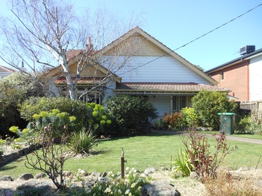
 Surrey Hills Historical Society Collection
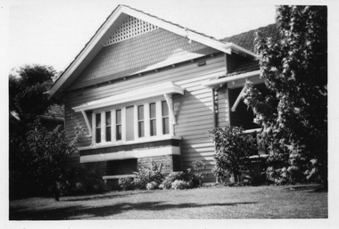
Digital photo, George L Coop, 688 Whitehorse Road, Mont Albert c 1953, c1953
... The California bungalow style of housing was the dominant style of housing built in the interwar period through the northern parts of Surrey Hills and Mont Albert as formerly semi-rural land was subdivided for new housing. ...This was the home of 3 generations of the Coop family: 1. Josephine and George Frank Coop (noted in Box Hill Rate Books for 1947-1954). 2. George Burton Coop (1906-1960) and his family. He was Assistant Chief Architect of Victoria in the Public Works Department (P.W.D.) George Burton Coop was born in c1906 in Williamstown, the son of Josephine Vistarini and George Frank Coop. He married Winifred Alice Trewartha in 1936 and they are listed in the electoral rolls at 688 Whitehorse Road in 1937. George died 3/4/1960, aged 54 years at Mont Albert. 3. George Burton and Alice Coop had 2 children: George Lister Coop - born St Georges Hospital, 8/10/1937 Alison - born c1945. The donor George Lister Coop informed that he initially attended Chatham State School because his first home was the Spanish Mission style flats at 346 Whitehorse Road, opposite Brenbeal Street, Balwyn. When his grandparents died, the family moved to 688 Whitehorse Road and he then attended Mont Albert Central School. The California bungalow style of housing was the dominant style of housing built in the interwar period through the northern parts of Surrey Hills and Mont Albert as formerly semi-rural land was subdivided for new housing. It was relatively inexpensive and affordable. In Australia the Californian bungalow drew upon elements that were popular across the United States from around 1910 to 1939. In Australia the style became popular from 1913. In Melbourne both timber and red brick were used as the main building material. Typically they are one or one and a half story houses and feature sloping roofs and eaves with unenclosed rafters and often a feature a dormer window (or an attic vent designed to look like one) over the main portion of the house. Decorative elements include wood shingles, part stucco rendered exteriors, brick, stone, rendered or a combination of these treatments to exterior chimneys and front porches supported by heavy timber, brick or stucco columns.A black & white photo taken at an angle of a Californian bungalow.californian bungalow, whitehorse road, george frank coop, (miss) josephine vistarini, (mrs) josephine coop, george burton coop, (miss) winifred trewartha, (mrs) winifred coop, george lister coop, alison coop -
 Surrey Hills Historical Society Collection
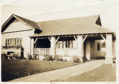
Digital photo, George L Coop, 688 Whitehorse Rd. Mont Albert c1950, c1950
... The California bungalow style of housing was the dominant style of housing built in the interwar period through the northern parts of Surrey Hills and Mont Albert as formerly semi-rural land was subdivided for new housing. ...This was the home of 3 generations of the Coop family: 1. Josephine and George Frank Coop (noted in Box Hill Rate Books for 1947-1954). 2. George Burton Coop (1906-1960) and his family. He was Assistant Chief Architect of Victoria in the Public Works Department (P.W.D.) George Burton Coop was born in c1906 in Williamstown, the son of Josephine Vistarini and George Frank Coop. He married Winifred Alice Trewartha in 1936 and they are listed in the electoral rolls at 688 Whitehorse Road in 1937. George died 3/4/1960, aged 54 years at Mont Albert. 3. George Burton and Alice Coop had 2 children: George Lister Coop - born St Georges Hospital, 8/10/1937 Alison - born c1945. The donor George Lister Coop informed that he initially attended Chatham State School because his first home was the Spanish Mission style flats at 346 Whitehorse Road, opposite Brenbeal Street, Balwyn. When his grandparents died, the family moved to 688 Whitehorse Road and he then attended Mont Albert Central School. The California bungalow style of housing was the dominant style of housing built in the interwar period through the northern parts of Surrey Hills and Mont Albert as formerly semi-rural land was subdivided for new housing. It was relatively inexpensive and affordable. In Australia the Californian bungalow drew upon elements that were popular across the United States from around 1910 to 1939. In Australia the style became popular from 1913. In Melbourne both timber and red brick were used as the main building material. Typically they are one or one and a half story houses and feature sloping roofs and eaves with unenclosed rafters and often a feature a dormer window (or an attic vent designed to look like one) over the main portion of the house. Decorative elements include wood shingles, part stucco rendered exteriors, brick, stone, rendered or a combination of these treatments to exterior chimneys and front porches supported by heavy timber, brick or stucco columns.A sepia photo taken at an angle from the street corner of the property. It is of a Californian bungalow with a driveway that extends through a carport, attached and roofed as part of the house, to the rear of the property. The veranda is accessed from under this covered area. The veranda and carport are supported by brick pillars and the veranda balustrades between are plain with an occasional wider feature panel. The front door is in shadow. There are rolled up striped canvas blinds on the veranda and at least 2 cane chairs. The main structure of the house is weatherboard with a terracotta tiled roof. There is a flower bed across the front of the house with an elevated brick flower box under the main window. There are no chimneys visible.californian bungalow, whitehorse road, george frank coop, (miss) josephine vistarini, (mrs) josephine coop, george burton coop, (miss) winifred trewartha, (mrs) winifred coop, george lister coop, alison coop -
 Surrey Hills Historical Society Collection
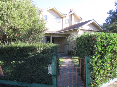
Photograph - 1 Bedford Avenue, Surrey Hills, The Street Where You Live Project
... At particular risk were properties not covered by heritage overlays in particular interwar housing and post 1950's housing. The Street Where You Live Project Photograph 1 Bedford Avenue, Surrey Hills ...Photos documenting this address as part of a photographic series undertaken by volunteer photographers during 2013 and 2014 for The Street Where You Live Project. This was organised through the Surrey Hills Neighbourhood Centre and covered the postcode 3127 in the cities of Boroondara and Whitehorse.These photos provide a snapshot of real estate in the suburbs of Mont Albert and Surrey Hills during a period of rapid change with many properties on large blocks demolished to create higher density residential development or renewal of single dwellings. At particular risk were properties not covered by heritage overlays in particular interwar housing and post 1950's housing. -
 Surrey Hills Historical Society Collection
Photograph - 3 Bedford Avenue, Surrey Hills, The Street Where You Live Project
... At particular risk were properties not covered by heritage overlays in particular interwar housing and post 1950's housing. The Street Where You Live Project Photograph 3 Bedford Avenue, Surrey Hills ...Photos documenting this address as part of a photographic series undertaken by volunteer photographers during 2013 and 2014 for The Street Where You Live Project. This was organised through the Surrey Hills Neighbourhood Centre and covered the postcode 3127 in the cities of Boroondara and Whitehorse.These photos provide a snapshot of real estate in the suburbs of Mont Albert and Surrey Hills during a period of rapid change with many properties on large blocks demolished to create higher density residential development or renewal of single dwellings. At particular risk were properties not covered by heritage overlays in particular interwar housing and post 1950's housing. -
 Surrey Hills Historical Society Collection
Photograph - 5 Bedford Avenue, Surrey Hills, The Street Where You Live Project
... At particular risk were properties not covered by heritage overlays in particular interwar housing and post 1950's housing. The Street Where You Live Project Photograph 5 Bedford Avenue, Surrey Hills ...Photos documenting this address as part of a photographic series undertaken by volunteer photographers during 2013 and 2014 for The Street Where You Live Project. This was organised through the Surrey Hills Neighbourhood Centre and covered the postcode 3127 in the cities of Boroondara and Whitehorse.These photos provide a snapshot of real estate in the suburbs of Mont Albert and Surrey Hills during a period of rapid change with many properties on large blocks demolished to create higher density residential development or renewal of single dwellings. At particular risk were properties not covered by heritage overlays in particular interwar housing and post 1950's housing. -
 Surrey Hills Historical Society Collection
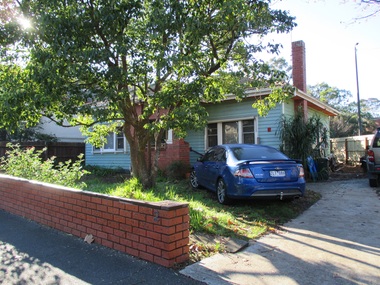
Photograph - 1 Blackburn Street, Surrey Hills, The Street Where You Live Project
... At particular risk were properties not covered by heritage overlays in particular interwar housing and post 1950's housing. The Street Where You Live Project Photograph 1 Blackburn Street, Surrey Hills ...Photos documenting this address as part of a photographic series undertaken by volunteer photographers during 2013 and 2014 for The Street Where You Live Project. This was organised through the Surrey Hills Neighbourhood Centre and covered the postcode 3127 in the cities of Boroondara and Whitehorse.These photos provide a snapshot of real estate in the suburbs of Mont Albert and Surrey Hills during a period of rapid change with many properties on large blocks demolished to create higher density residential development or renewal of single dwellings. At particular risk were properties not covered by heritage overlays in particular interwar housing and post 1950's housing. -
 Surrey Hills Historical Society Collection
Photograph - 2 Blackburn Street, Surrey Hills, The Street Where You Live Project
... At particular risk were properties not covered by heritage overlays in particular interwar housing and post 1950's housing. The Street Where You Live Project Photograph 2 Blackburn Street, Surrey Hills ...Photos documenting this address as part of a photographic series undertaken by volunteer photographers during 2013 and 2014 for The Street Where You Live Project. This was organised through the Surrey Hills Neighbourhood Centre and covered the postcode 3127 in the cities of Boroondara and Whitehorse.These photos provide a snapshot of real estate in the suburbs of Mont Albert and Surrey Hills during a period of rapid change with many properties on large blocks demolished to create higher density residential development or renewal of single dwellings. At particular risk were properties not covered by heritage overlays in particular interwar housing and post 1950's housing. -
 Surrey Hills Historical Society Collection
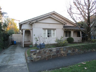
Photograph - 3 Blackburn Street, Surrey Hills, The Street Where You Live Project
... At particular risk were properties not covered by heritage overlays in particular interwar housing and post 1950's housing. The Street Where You Live Project Photograph 3 Blackburn Street, Surrey Hills ...Photos documenting this address as part of a photographic series undertaken by volunteer photographers during 2013 and 2014 for The Street Where You Live Project. This was organised through the Surrey Hills Neighbourhood Centre and covered the postcode 3127 in the cities of Boroondara and Whitehorse.These photos provide a snapshot of real estate in the suburbs of Mont Albert and Surrey Hills during a period of rapid change with many properties on large blocks demolished to create higher density residential development or renewal of single dwellings. At particular risk were properties not covered by heritage overlays in particular interwar housing and post 1950's housing. -
 Surrey Hills Historical Society Collection
Photograph - 4 Blackburn Street, Surrey Hills, The Street Where You Live Project
... At particular risk were properties not covered by heritage overlays in particular interwar housing and post 1950's housing. The Street Where You Live Project Photograph 4 Blackburn Street, Surrey Hills ...Photos documenting this address as part of a photographic series undertaken by volunteer photographers during 2013 and 2014 for The Street Where You Live Project. This was organised through the Surrey Hills Neighbourhood Centre and covered the postcode 3127 in the cities of Boroondara and Whitehorse.These photos provide a snapshot of real estate in the suburbs of Mont Albert and Surrey Hills during a period of rapid change with many properties on large blocks demolished to create higher density residential development or renewal of single dwellings. At particular risk were properties not covered by heritage overlays in particular interwar housing and post 1950's housing. -
 Surrey Hills Historical Society Collection
Photograph - 5 Blackburn Street, Surrey Hills, The Street Where You Live Project
... At particular risk were properties not covered by heritage overlays in particular interwar housing and post 1950's housing. The Street Where You Live Project Photograph 5 Blackburn Street, Surrey Hills ...Photos documenting this address as part of a photographic series undertaken by volunteer photographers during 2013 and 2014 for The Street Where You Live Project. This was organised through the Surrey Hills Neighbourhood Centre and covered the postcode 3127 in the cities of Boroondara and Whitehorse.These photos provide a snapshot of real estate in the suburbs of Mont Albert and Surrey Hills during a period of rapid change with many properties on large blocks demolished to create higher density residential development or renewal of single dwellings. At particular risk were properties not covered by heritage overlays in particular interwar housing and post 1950's housing. -
 Surrey Hills Historical Society Collection
Photograph - 6 Blackburn Street, Surrey Hills, The Street Where You Live Project
... At particular risk were properties not covered by heritage overlays, in particular interwar housing and post 1950's housing. The Street Where You Live Project Photograph 6 Blackburn Street, Surrey Hills ...Photos documenting this address as part of a photographic series undertaken by volunteer photographers during 2013 and 2014 for The Street Where You Live Project. This was organised through the Surrey Hills Neighbourhood Centre and covered the postcode 3127 in the cities of Boroondara and Whitehorse.These photos provide a snapshot of real estate in the suburbs of Mont Albert and Surrey Hills during a period of rapid change with many properties on large blocks demolished to create higher density residential development or renewal of single dwellings. At particular risk were properties not covered by heritage overlays, in particular interwar housing and post 1950's housing. -
 Surrey Hills Historical Society Collection
Photograph - 7 Blackburn Street, The Street Where You Live Project
... At particular risk were properties not covered by heritage overlays, in particular interwar housing and post 1950's housing. The Street Where You Live Project Photograph 7 Blackburn Street ...Photos documenting this address as part of a photographic series undertaken by volunteer photographers during 2013 and 2014 for The Street Where You Live Project. This was organised through the Surrey Hills Neighbourhood Centre and covered the postcode 3127 in the cities of Boroondara and Whitehorse.These photos provide a snapshot of real estate in the suburbs of Mont Albert and Surrey Hills during a period of rapid change with many properties on large blocks demolished to create higher density residential development or renewal of single dwellings. At particular risk were properties not covered by heritage overlays, in particular interwar housing and post 1950's housing. -
 Surrey Hills Historical Society Collection
Photograph - 8 Blackburn Street, Surrey Hills, The Street Where You Live Project
... At particular risk were properties not covered by heritage overlays, in particular interwar housing and post 1950's housing. The Street Where You Live Project Photograph 8 Blackburn Street, Surrey Hills ...Photos documenting this address as part of a photographic series undertaken by volunteer photographers during 2013 and 2014 for The Street Where You Live Project. This was organised through the Surrey Hills Neighbourhood Centre and covered the postcode 3127 in the cities of Boroondara and Whitehorse.These photos provide a snapshot of real estate in the suburbs of Mont Albert and Surrey Hills during a period of rapid change with many properties on large blocks demolished to create higher density residential development or renewal of single dwellings. At particular risk were properties not covered by heritage overlays, in particular interwar housing and post 1950's housing. -
 Surrey Hills Historical Society Collection
Photograph - 8A Blackburn Street, Surrey Hills, The Street Where You Live Project
... At particular risk were properties not covered by heritage overlays, in particular interwar housing and post 1950's housing. The Street Where You Live Project Photograph 8A Blackburn Street, Surrey Hills ...Photos documenting this address as part of a photographic series undertaken by volunteer photographers during 2013 and 2014 for The Street Where You Live Project. This was organised through the Surrey Hills Neighbourhood Centre and covered the postcode 3127 in the cities of Boroondara and Whitehorse.These photos provide a snapshot of real estate in the suburbs of Mont Albert and Surrey Hills during a period of rapid change with many properties on large blocks demolished to create higher density residential development or renewal of single dwellings. At particular risk were properties not covered by heritage overlays, in particular interwar housing and post 1950's housing. -
 Surrey Hills Historical Society Collection
Photograph - 9 Blackburn Street, Surrey Hills, The Street Where You Live Project
... At particular risk were properties not covered by heritage overlays, in particular interwar housing and post 1950's housing. The Street Where You Live Project Photograph 9 Blackburn Street, Surrey Hills ...Photos documenting this address as part of a photographic series undertaken by volunteer photographers during 2013 and 2014 for The Street Where You Live Project. This was organised through the Surrey Hills Neighbourhood Centre and covered the postcode 3127 in the cities of Boroondara and Whitehorse.These photos provide a snapshot of real estate in the suburbs of Mont Albert and Surrey Hills during a period of rapid change with many properties on large blocks demolished to create higher density residential development or renewal of single dwellings. At particular risk were properties not covered by heritage overlays, in particular interwar housing and post 1950's housing. -
 Surrey Hills Historical Society Collection
Photograph - 10 Blackburn Street, Surrey Hills, The Street Where You Live Project
... At particular risk were properties not covered by heritage overlays, in particular interwar housing and post 1950's housing. The Street Where You Live Project Photograph 10 Blackburn Street, Surrey Hills ...Photos documenting this address as part of a photographic series undertaken by volunteer photographers during 2013 and 2014 for The Street Where You Live Project. This was organised through the Surrey Hills Neighbourhood Centre and covered the postcode 3127 in the cities of Boroondara and Whitehorse.These photos provide a snapshot of real estate in the suburbs of Mont Albert and Surrey Hills during a period of rapid change with many properties on large blocks demolished to create higher density residential development or renewal of single dwellings. At particular risk were properties not covered by heritage overlays, in particular interwar housing and post 1950's housing. -
 Surrey Hills Historical Society Collection
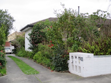
Photograph - 11 Blackburn Street, Surrey Hills, The Street Where You Live Project
... At particular risk were properties not covered by heritage overlays, in particular interwar housing and post 1950's housing. The Street Where You Live Project Photograph 11 Blackburn Street, Surrey Hills ...Photos documenting this address as part of a photographic series undertaken by volunteer photographers during 2013 and 2014 for The Street Where You Live Project. This was organised through the Surrey Hills Neighbourhood Centre and covered the postcode 3127 in the cities of Boroondara and Whitehorse.These photos provide a snapshot of real estate in the suburbs of Mont Albert and Surrey Hills during a period of rapid change with many properties on large blocks demolished to create higher density residential development or renewal of single dwellings. At particular risk were properties not covered by heritage overlays, in particular interwar housing and post 1950's housing.