
Showing 40 items matching "irrigation areas and districts"
-
 University of Melbourne, Burnley Campus Archives
Book - Bulletin NSW Department of Agriculture, J. E. Jessup et al, Pasture and Fodder Crops for the Murrumbidgee and Coleambally Irrigation Areas and Associated Districts, 1967
... Pasture and Fodder Crops for the Murrumbidgee and Coleambally Irrigation Areas and Associated Districts......Irrigation areas and districts...Map of Murrumbidgee Irrigation Areas and Associated Irrigation Districts on back cover....Map of Murrumbidgee Irrigation Areas and Associated Irrigation Districts on back cover. ...1st edition of the bulletin 1967 Division of Plant Industry New South Wales Department of AgricultureBook with heavy paper cover and staples. N.S.W. Dept. of Agriculture Division of Plant Industry Bulletin P248, 1967. By J. E. Jessup, Special Agronomist, Formerly District Agronomist, Leeton and D. E. Wallin, District Agronomist, Griffin. Map of Murrumbidgee Irrigation Areas and Associated Irrigation Districts on back cover.pastures, fodder crops, murrumbidgee, coleambally, irrigation, agronomy, irrigation areas and districts, nsw division of plant industry, j.e jessup, d e wallin -
Tatura Irrigation & Wartime Camps Museum
Book, Register of Lands, 1984
... Black lettering, SR & WSC Victoria, Register of Lands, Rodney Irrigation area of Goulburn Murray Irrigation District. 1983-84 Irrigation Season...Black lettering, SR & WSC Victoria, Register of Lands, Rodney Irrigation area of Goulburn Murray Irrigation District. 1983-84 Irrigation Season Register of Lands Book ...Register of Lands in Tatura district regarding annual water rights for farms 1983-84Grey back cover, pale green front cover, blue cloth spine. Black lettering, SR & WSC Victoria, Register of Lands, Rodney Irrigation area of Goulburn Murray Irrigation District. 1983-84 Irrigation Seasonfarming, irrigation, books, rural, industry -
Tatura Irrigation & Wartime Camps Museum
Book, Register of Lands 1975-76, 1976
... Mast copy of Register of lands, Rodney Irrigation area of Goulburn-Murray Irrigaiton District 1975-76....Mast copy of Register of lands, Rodney Irrigation area of Goulburn-Murray Irrigaiton District 1975-76. irrigation farming books irrigaton rural industry Black back cover, beige front cover, black writing, blue cloth spine. black edge Register of Lands 1975-76 Book ...Mast copy of Register of lands, Rodney Irrigation area of Goulburn-Murray Irrigaiton District 1975-76.Black back cover, beige front cover, black writing, blue cloth spine. black edgeirrigation, farming, books, irrigaton, rural, industry -
Tatura Irrigation & Wartime Camps Museum
Book, Register of Lands, 1982-83
... Registerof Lands - rates payable. Rodney Irrigation area of the Goulburn Murray Irrigation District. 1982-1983 season...Registerof Lands - rates payable. Rodney Irrigation area of the Goulburn Murray Irrigation District. 1982-1983 season irrigation books history local rural industry Beige front, black back cover. ...Registerof Lands - rates payable. Rodney Irrigation area of the Goulburn Murray Irrigation District. 1982-1983 seasonBeige front, black back cover. Spine cover missing. Black writing. S R & WSC. 82/83 on spine.irrigation, books, history, local, rural, industry -
Tatura Irrigation & Wartime Camps Museum
Book, Register of Lands, 1979-1980
... Register of Lands - rates payable. Rodney irrigation area of the Goulburn-Murray Irrigation District. 1979-1980 irrigation season...Register of Lands - rates payable. Rodney irrigation area of the Goulburn-Murray Irrigation District. 1979-1980 irrigation season irrigation books history local rural industries Beige front, black back cover.Greeen cloth spine, black writing. ...Register of Lands - rates payable. Rodney irrigation area of the Goulburn-Murray Irrigation District. 1979-1980 irrigation seasonBeige front, black back cover.Greeen cloth spine, black writing. State "Rivers & Water Supply Commission, Vic. 79/80" on spine.irrigation, books, history, local, rural, industries -
 Bacchus Marsh & District Historical Society
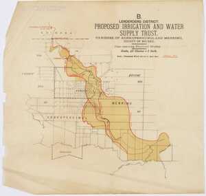
Map, Lerderderg District Proposed Irrigation and Water Supply Trust (B) Plan Showing Proposed Works
... Printed paper map of the proposed Lerderderg District Irrigation and Water Supply area showing proposed works. ...Irrigation Water Supply Lerderderg Irrigation and Water Supply Trust Printed paper map of the proposed Lerderderg District Irrigation and Water Supply area showing proposed works. ...The 1886 Irrigation Act in Victoria introduced the first legislation in Australia designed to enable the creation of a detailed scheme for agricultural irrigation. Part of the legislation saw the use of government funds for local irrigation projects. These local projects were managed by local irrigation trusts. The Lerderderg Irrigation and Water Supply Trust was formed in 1890. This map depicts the proposed area of the Trust and proposed works such as channels and weirs.Printed paper map of the proposed Lerderderg District Irrigation and Water Supply area showing proposed works. The map scale is 40 chains + 1 inch. The Lerderderg District lies within the Parishes of Korkuperrumul and Merrimu in the County of Bourke. At the top of the map above its title is the letter 'B; in capital lettering. A series of proposed channels are indicated on the map in red lines. A proposed weir site and alternative weir site are also indicated on the map. irrigation, water supply, lerderderg irrigation and water supply trust -
Emerald Museum & Nobelius Heritage Park
Document - Book, Nobelius Nursery Day book, June 1935-July 1936, Unknown maker, 1930s
... Trees sent to Irrigation Areas must be accompanied by Phylloxera Certificate in addition to the Fumigation Certificate, Post certificates to the District Inspector, (crossed out section) Dept. of Agric. ...Trees sent to Irrigation Areas must be accompanied by Phylloxera Certificate in addition to the Fumigation Certificate, Post certificates to the District Inspector, (crossed out section) Dept. of Agric. ...(CONTINUED FROM INSCRIPTION AND MARKS) 1 qr 2 qrs 3 qrs 1 cwt 2/2 3/7 5/2 6/8 Railway freight on Trees to Mile End, 4 cwt about £1.10.6, per cwt 8/2, Vic 5/5, S.A. 2/9 Railway freight on Trees to Orange, N.S.W. 1 cwt about 11/5, per qr Vic 2/9, N.S.W. 1/7. 4/4 - 11/- qr parcel. Railway freight on Trees to Orange, N.S.W. 14 lbs. 8/- Railway Freight on Trees to Kelso, 8 cwt £1.15.0. Sydney Agent - Wright Heaton Pitt St. Launceston .. F.H. Stephens Pty Ltd. 41 St John St. L'ton & 11 William St Canberra. 14 lbs (by passenger) 8/6 Fgh to Leura NSW on Cash 1 1/2 cwt 18/11(CONTINUED FROM INSCRIPTION AND MARKS) Cherries for certain places in N.S.W. (including Armidale & Glen Innes) must be dipped in Tar Distillate, and certificate sent to Inspector at Albury. Fumigate for Leeton, Tasmania, Queensland, New Zealand. Consignments to N.Z. containing Apple, Pear, or Quince Trees must be accompanied by a Fire-blight certificate as well as the ordinary Nursery certificate and form of invoice. Bundles to N.S.W must not be large, in Bdles not over 1 cwt 1 qr where a number of Bdles and consigned as each bundle weight and a cheaper rate of Fgt will be charged otherwise bundles not to exceed 2 cwt. India. Cases not to weigh over 5 mounds = 3 cwt 2 qr 18 lbs and not to exceed 8 x 5 x 4 Shipping freight to Adelaide 20/- per ton Shipping freight to Sydney 15/- per ton Shipping freight to Fremantle 38/- per ton about 6/6 per 100 tress Shipping freight to Albany about 4/8 per 100 trees Railway freight to Albury on plants in soil packed in casesHard cover day book with red cover and burgundy spine. Label affixed to front cover reads 'Sales 15/6/35 - 25/7/36.' Extensive hand-written notes on inner front cover. 87 pages total, all used.Label on outer front cover: 'Sales 15/6/35 - 25/7/36.' Notes on inner front cover: Manure July 20th 1936 at Shed Blood & Bone 11/6 bag Super 7/6 bag Organite 5/6 bag Super Ammonia 9/6 bag Freight on case to Leura N.S.W. 1 1/2 (illegible) 18/11 1935 Reaper Binder (illegible) @ H/Ball 1936 Labels 12/6 per box Straw 3/- cwt Trees for Leeton send Fumigation Certificate to J.C. Guy Cole District Inspector P.O. Box 111. Leeton. Trees for Griffith or Yenda send certificate to District Inspector (crossed out section) Dept. of Agric. Leeton N.S.W. Trees sent to Irrigation Areas must be accompanied by Phylloxera Certificate in addition to the Fumigation Certificate, Post certificates to the District Inspector, (crossed out section) Dept. of Agric. Leeton N.S.W. All trees for N.S.W must have Lucerne Flea Certificate posted to Border (illegible) Inspector Albury N.S.W. showing on contents what varieties of trees, also whether sent by rail or boat. Contents must also be marked on label.documents, sales records, financial records -
Emerald Museum & Nobelius Heritage Park
Document - Book, Nobelius Nursery Sales Day Book, May 1934-June 1935, 1930s
... Trees sent to irrigation areas must be accompanied by Phylloxera certificate in addition to the fumigation certificate Post certificates to the district inspector of the water conservation and [?] ...Trees sent to irrigation areas must be accompanied by Phylloxera certificate in addition to the fumigation certificate Post certificates to the district inspector of the water conservation and [?] ...CONTINUATION OF INSCRIPTION... Trees sent to irrigation areas must be accompanied by Phylloxera certificate in addition to the fumigation certificate Post certificates to the district inspector of the water conservation and [?] commissioner or Griffith whatever the case may be All trees N.S.W. (except parcels posted) must have lucerne flee certificate posted to fruit inspector at Albury (Mr C F Benton) and contents marked on label Cherries for certain places in N.S.W (including Armadale and Glen Innes) must be dipped in tar distillate and advise and send the certificate to Inspector at Albury that the same has been done Fumigate for Leecton TAS and all [?] area in N.S.W [?] Consignments to NZ containing apple, pear or quince [?] must be accompanied by a fire-blight certificate as well as the ordinary nursery certificate and form of invoice All trees fro N.S.W, must show on contents what variety of trees whether railed or shipped and bundles must not be over 2cwt Cherry dipping certificate required by inspector at Albury / For India Cases not to weight over 5 [?] =3cwt. 2qts. 18lbs and cases not to exceed 18 x 5 x 4 / Trees dispatched to NSW should be in bdles not over 1 cwt 1qr and consigned as each bundle weight and a cheaper rate of freight if gt will be charged Launceston agent J H Stephens 41 St John St Launceston and 11 Willaims St Carrier Camberwell J R Massey 20 Camberwell Rd Auburn Sydney agent Bright [?] and co Pitt St Sydney NSW"historically, and socially significant as the entries give an insight into the growth of the company and the details payments from local and other government offices and overseas customers as well as significant companies associations and people.Hard cover sales book, with green embossed cover (alligator print cover) and red spine, book has a total of 90 pages not all used, date starts 21 May 1934 and concludes June 14 1935Front cover "Sales Book 1934 from May to June 14th 1935" Front end paper "Tree for Leeton send fumigation certificate to J G Guy Cole district inspector book 111 [?] Trees for Griffith in Yenda to district inspector Griffith or Yenda as the case may bedocuments, financial records, sales records -
Emerald Museum & Nobelius Heritage Park
Document - Book, Nobelius Nursery day book, July 1936-July 1937, Norman Bros Pty. Ltd, 1930s
... Trees sent to irrigation areas must be accompanied by Phylloxera Certificate in addition to the fumigation certificate, post certif to the district inspector, Dept of Agric, Leeton, N.S.W. ...Trees sent to irrigation areas must be accompanied by Phylloxera Certificate in addition to the fumigation certificate, post certif to the district inspector, Dept of Agric, Leeton, N.S.W. ...CONTINUATION OF INSCRIPTION... Trees sent to irrigation areas must be accompanied by Phylloxera Certificate in addition to the fumigation certificate, post certif to the district inspector, Dept of Agric, Leeton, N.S.W. All trees for N.S.W. must have Lucerne Flea Certificate posted to Border Fruit Inspector, Albury, showing on same contents, what varieties of trees, also whether sent by rail or boat, Contents must also be marked on label for trees. Cherries for certain districts in N.S.W. (including Armadale and Glen Innes) must be dipped in tar Distillate, and certificate to that effect sent to Inspector at Albury. Fumigate for Leeton, Tamania, Queensland and New Zealand. Consignments to N.Z. containing Apple, Pear, or Quince trees must be accompanied by a Fire blight Certificate as well as the ordinary Nursery Certificate and form of invoice. Bundles to N.S.W. must not be large, in bundles not over 1 cwr 1qr where a number of bundles and consigned as each bundle weight and a cheaper rate of Fgt will be charged, otherwise bundles not to exceed 2 cwt India- cases not to weigh over 5 maunds = 3 cwt 2 qrs, 18 Ibs and not to exceed 8 x 5 x 4. Send clean certificate from dept of agric also fumigation + Mal de barco for and [?] shipping freight to Adelaide 20/- per ton " to Sydney 15/- " " to Fremantle 38/- " about 6/6 per 100 trees " to Albany " " 4/8 "" Railway freight to Albury on plants in soil packed in cases-- 1 qr 2qrs 3qrs 1cwt 2/2 3/7 5/2 6/8 Railway freight to Mile End, 4 cwt, about £1. 10. 6, 8/2 cwt " Orange N S W 1 cwt about 11/5, per qr 4/4 " " 14Ibs 8/- " to Kelso 8 cwt £1. 15 Sydney Agent - Wright Heaton & Co, Pitt St, Sydney Launceston " F.H. Steohens Pty Ltd, 41 St John St, Launceston & 11 Williams St. Freight to Canberra 14 Ibs (by passenger) 8/6 " Leura N S W on case 1 1/2 cwt 18/11 Trees for WA must be stripped bark of all leaves and sprayed with bluestone rhine K and [?] me apple scab first [?]historically, and socially significant as the entries give an insight into the growth of the company and the details payments from local and other government offices and overseas customers as well as significant companies associations and people.Green/ Grey hard cover sales day book with red binding and white sticker on front cover, blue and white marbling on end pages, dates start July 25 1936 and conclude 19th July 1937, 93 pages in book all used.White sticker on front "Sales 5/7/36- 19/7/37" Adhered paper on front end page recto "Trees for Leeton and Irrigation A res, N.S.W., send Fumigation certificate to District Inspector, Leeton. N.S.W Trees for Griffith or Yenda, send Certificate to District Inspector Dept of Agric, Leeton N.S.W. (Griffith or Yenda as the case may be)documents, sales records, financial records -
Marysville & District Historical Society
THE TRIANGLE NEWS-VOL 41 NO 15-APRIL 25 2014
... marysville victoria australia lions donation to cystic fibrosis farmers need our help new contact details for triangle news what's on when in april/may 2014 seasonal influenza vaccine available the committee of management of the gallipoli park precinct marysville community market creative triangle marysville sub branch rsl adventurous cooks triangle community dinner buxton ridge vineyard wine tasting church notices heather jenkins wins the mavis hatfield trophy intrepid triangle bushwalkers marysville saddletramps inaugural ralph wait memorial ride burning continues despite high rainfall lions rich fruit cakes marysville & triangle community men's shed top end/central tour buxton recreation reserve committee meeting inviting public el kanah eat in eat out menu marysville road closure anzac day march amnesty peiod on open air burning in residential areas residential and rural real estate marysville triangle real estate lake mountain mountain mayhem marsyville midweek netball fire prevention irrigation systems alexandra district hospital heart week 2014 notice of special meetin of council buxton hotel parma night anzac day office closures season opener lunch anzac day services 2014 marysville preschool centre long day care & kindergarten buxton hall trivia night annual alexandra truck ute & rod show marysville cultural community 2 mime shows head of camp marysville vic the outdoor education group woodlands rainforest retreat position vacant murrindindi early years conference building beyond el kanah conference centre murrindindi shire council naming the community centre rooms and stadium advertisements THE TRIANGLE NEWS-VOL 41 NO 15-APRIL 25 2014 ...marysville, victoria, australia, lions donation to cystic fibrosis, farmers need our help, new contact details for triangle news, what's on when in april/may, 2014 seasonal influenza vaccine available, the committee of management of the gallipoli park precinct, marysville community market, creative triangle, marysville sub branch rsl, adventurous cooks, triangle community dinner, buxton ridge vineyard wine tasting, church notices, heather jenkins wins the mavis hatfield trophy, intrepid triangle bushwalkers, marysville saddletramps, inaugural ralph wait memorial ride, burning continues despite high rainfall, lions rich fruit cakes, marysville & triangle community men's shed, top end/central tour, buxton recreation reserve committee meeting inviting public, el kanah, eat in eat out menu, marysville road closure anzac day march, amnesty peiod on open air burning in residential areas, residential and rural real estate, marysville triangle real estate, lake mountain, mountain mayhem, marsyville midweek netball, fire prevention irrigation systems, alexandra district hospital heart week 2014, notice of special meetin of council, buxton hotel parma night, anzac day office closures, season opener lunch, anzac day services 2014, marysville preschool centre, long day care & kindergarten, buxton hall trivia night, annual alexandra truck ute & rod show, marysville cultural community, 2 mime shows, head of camp marysville vic, the outdoor education group, woodlands rainforest retreat position vacant, murrindindi early years conference building beyond, el kanah conference centre, murrindindi shire council, naming the community centre rooms and stadium, advertisements -
 Red Cliffs Military Museum
Document, Obituary, 12:MMMM, 1976 (exact); Walter Thomas West passed away 4th December 1976 and his funeral was held 7th of December
... irrigation district./ He lived there until his/ death on Saturday after playing bowls at the Red/ Cliffs rinks on Saturday/ afternoon./ Mr. West was born in Jeparit and served with the/ 24th Battalion in Egypt and/ Gallipoli./ He was awarded the Mili/tary Medal in France in/ 1917 and the Military Cross/ in 1918 when he captured/ single handed an enemy/ machine gun post./ He settled at Red Cliffs/ on his return when the/ area was placed under irri-/gation./ For 25 years he operated/ a unique partnership with/ the late Mr. ...irrigation district./ He lived there until his/ death on Saturday after playing bowls at the Red/ Cliffs rinks on Saturday/ afternoon./ Mr. West was born in Jeparit and served with the/ 24th Battalion in Egypt and/ Gallipoli./ He was awarded the Mili/tary Medal in France in/ 1917 and the Military Cross/ in 1918 when he captured/ single handed an enemy/ machine gun post./ He settled at Red Cliffs/ on his return when the/ area was placed under irri-/gation./ For 25 years he operated/ a unique partnership with/ the late Mr. ...Attached to his R.S.L. Membership Card along with the funeral notice, is a subsequent newspaper article written at the time of Walter West's death, which reads: Death of Pioneer Settler/ A pioneer settler of/ the Red Cliffs irigation/ district and one of the/ last men to be evacuated/ from Gallipoli, died sud/denly on Saturday night/ aged 84./ In 1922 Mr. Watler Thomas/ West came to Red Cliffs/ where he established Block/ 86 in the irrigation district./ He lived there until his/ death on Saturday after playing bowls at the Red/ Cliffs rinks on Saturday/ afternoon./ Mr. West was born in Jeparit and served with the/ 24th Battalion in Egypt and/ Gallipoli./ He was awarded the Mili/tary Medal in France in/ 1917 and the Military Cross/ in 1918 when he captured/ single handed an enemy/ machine gun post./ He settled at Red Cliffs/ on his return when the/ area was placed under irri-/gation./ For 25 years he operated/ a unique partnership with/ the late Mr. Martin Nippe, his adjoining property/ owner. The pair pooled their/ horticultural equipment for/ joint use./ Mr. West joined Mildura/ Legacy in 1942 and was an/ active member until his/ death./ The funeral will be held at the United Church, Red/ Cliffs this morning at 10.30Type written obituary, presumably used when Walter West,MC,MM, died.Walter West MC,MM/ Red Cliffs residents were saddened to learn of the sudden passing on Saturday last/ of Walter Thomas West MC,MM., a Pioneer/settler and well respected citizen./ "Wal" as he was affectionately known, was/ born at Dandenong some 84years ago./ He served with distinction in World War 1/ with 24th Battalion. He was an original ANZAC, and also saw service in/ Egypt and France. He received two awards for gallantry in the field - The Military/ Medal in France 1917 and the Military Cross in France/ in 1918 when he was responsible for the/ single handed capture of an enemy gun and crew./ He was an original soldier settler and developed/ his fruit block in Red Cliffs which is still/ operated by his son Tom. In 1922 he/ became an original Trustie of the Methodist/Church and was the last surviving original/ Trustie. He served on the Board of/ directors of the Red Cliffs Co-Operative Co.Ltd/ from 1954 to 1967, and was Chairman of Directors/ in 1963 and 1964. He showed a keen interest/ in youth activities and some excellent cricketers/ were produced as a result of his coaching of/ the Methodist Junior Cricket Team. He was an/ active and keen member of Mildura Legacy/ for 34 years, serving as President in 1947 and 1948./ He was secretary of the Cemetary Trust for many years, served on the Hospital Committee/ was a member of Memorial Lodge, a member of Red Cliffs Senior Citizens Club and a /member of Red Cliffs Sub-Branch R.S.L. since / it's inception./ He was a keen member of the Red Cliffs/ Bowling Club and took part in a club event on/ the day of his passing./ It was the pioneer settler and men with ability/ and initiative of Walter West that brought/ out the Community Spirit which resulted in/ the Red Cliffs we know today.1918, 1917, ww1, walter, thomas, west, mm, mc, 24th, battalion, aif, gallipoli, bullecourt -
 Bendigo Historical Society Inc.
Book - "A Mallee Album. Reflections on Mallee Life.", 1988
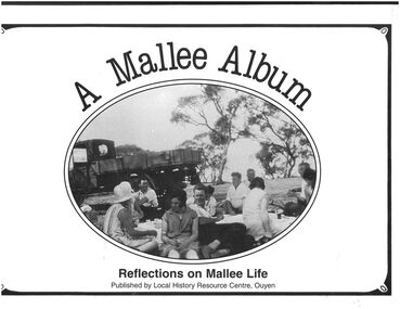
... A shire hall was built in 1918. A district hospital was built in 1929, and a higher education school was opened in 1928. ...A shire hall was built in 1918. A district hospital was built in 1929, and a higher education school was opened in 1928. ...Ouyen is a rural township near the centre of the Mallee region in north-west Victoria. It is on the Sunraysia Highway, 100 km south of Mildura, and is a railway junction for the lines to Mildura and westwards through the Mallee to Murrayville and Pinnaroo, South Australia. In 1903 the railway line was extended from Woomelang (80 km south of Ouyen) to Mildura, the site of an irrigation settlement on the Murray River. The prospect of farming in the Mallee had been enhanced by settlements at Hopetoun and Lascelles (both near Woomelang), and the opening of the railway line invited settlement along its route. Settlers began arriving in the Ouyen district in 1906, and the township was proclaimed in 1909. It is thought that the name was derived from an Aboriginal word meaning ghost or waterhole. West of Ouyen an area of land extending to the South Australian border was found to be adequate for farming and contained bore water (1906). Settlement spread westwards from about 1909 to Walpeup and beyond. Ouyen began functioning as a service centre. A school was opened in 1909 in a coffee palace and public hall. Within 15 years of its settlement Ouyen had 900 people, and was the administrative centre of Walpeup shire (1911). A shire hall was built in 1918. A district hospital was built in 1929, and a higher education school was opened in 1928. It became a high school in 1952. A Catholic primary school was also opened in 1952. By the 1930s, though, Ouyen had a local court, four banks, an agricultural society, sporting and racing clubs, and local industries such as cordial making, plaster sheet, a freezing works and an electricity generation plant. Silos were later built for the storage and railing of cereal grains."A Mallee Album. Reflections on Mallee Life" published by Local History Resource Centre, Ouyen. Foreword by The Local History Resource Centre Committee, Ouyen. A collection of images from the area and brief description associated with each image. Published in Australia by Local History Resource centre, Ouyen, 1988. White colored hard cover book. Black and white photograph on front cover. Titles printed in black. Book includes black and white photographs of local people and events. 153 pp.mallee, ouyen -
 Bendigo Historical Society Inc.
Book - BOOK: BENDIGO'S RICHES
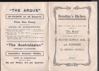
... Reprint of a Special Series of Articles which appeared in 'The Argus' on the Potential Wealth of the Water Supply, Soil, and Sunshine of The Bendigo District. Printed by Wilson and Mackinnon, Printers, Collins Street. ...Reprint of a Special Series of Articles which appeared in 'The Argus' on the Potential Wealth of the Water Supply, Soil, and Sunshine of The Bendigo District. Printed by Wilson and Mackinnon, Printers, Collins Street. ...Small booklet titled 'Bendigo's Riches'. Reprint of a Special Series of Articles which appeared in 'The Argus' on the Potential Wealth of the Water Supply, Soil, and Sunshine of The Bendigo District. Printed by Wilson and Mackinnon, Printers, Collins Street. Booklet mentions the potential wealth of Bendigo's Water, Soil and Sunshine; Orchards, Dairying, Tomato Growing, Fruit growing, Land, and Water Supply. Also discussed are Antiquated Mining Regulations, City Trust suggested, and its Advantages, Opportunities, 'The Argus' suggestions endorsed, Mine-owner's Opinion, The Mayor of Bendigo's Opinion, Statement by Strathfieldsaye Shire Secretary, Locked-up Area Useless for Timber, Shire Appeals for Unlocking the Land, 'The Argus' Thanked, Bendigo Chamber of Commerce, Bendigo City Council and Preserving Factory at Bendigo. Photos include Irrigated pastures, ryegrass and clovers on Mr. James Cumming's Farm; Irrigating Tomatoes on Mr. Elliot Borley's Farm, White Hills; Junction of Huntly and White Hills Irrigation Channels; Packing Tomatoes at Mr. B. Puig Y. Ventura's Garden, White Hills; and Tomato Patch on the Holding of Mr. T. L. Sweeny, Jun. Back of the booklet has subscription rates and price of The Argus. place, land, agricultural, book - bendigo's riches, the argus, wilson and mackinnon, councillor carolin, james cumming, dairying, mr elwood mead, tomato growing, mr b puig y ventura, mr elliot borley, fruitgrowers, bendigo fruitgrowers' co-operative society, mr w a hamilton ex-mla, upper coliban, coliban system, antiquated mining regulations, lands department, chaffey bros, mr g h crawford, mine-owners' association, councillor andrew, mr baillieu, miners' association, agricultural society, sir thomas bent, strathfieldsaye shire, mr r b brennan, mr t l sweeny jun, bendigo sewerage farm, councillor osborne, councillor lowndes, councillor t r long, bendigo chamber of commerce, bendigo city council, councillor andrew, councillor h a ross, councillor wilkie, h m leggo and co -
 Bendigo Historical Society Inc.
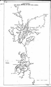
Map - STATE RIVERS AND WATER COMMISSION : COLIBAN DISTRICT IRRIGATION AND TOWN SUPPLY CHANNELS, 30/11/1956
... Title : Coliban district Plan showing Irrigation and Town Supply Channels. ...Title : Coliban district Plan showing Irrigation and Town Supply Channels. ...State Rivers and Water Supply Commission. Foolscap-size map. Title : Coliban district Plan showing Irrigation and Town Supply Channels. The map covers the area from Raywood to Guildford. Scale : 1 inch to 4 miles. Dated 30/11/56, number 5,491 in bottom right corner.state infrastructure, water supply, coliban system, state rivers and water supply commission. coliban system. -
 Kiewa Valley Historical Society
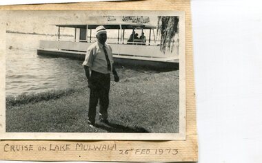
Photographs x 3- Cruise on Lake Mulwala, 25/2/1973
... irrigation of the surrounding district. The weir also serves as a crossing of the Murray between the two towns. It is a popular tourist destination for boating, fishing and other water recreation. Photographs demonstrate local Kiewa Valley residents enjoying a visit to the picturesque area ...Lake Mulwala is a man–made reservoir created through the construction of the Yarrawonga Weir across the Murray River, is located between Bundalong and Yarrawonga in Hume region of Victoria and Mulwala in the Riverina region of New South Wales, in eastern Australia. The weir was constructed in 1939 to provide water for irrigation of the surrounding district. The weir also serves as a crossing of the Murray between the two towns. It is a popular tourist destination for boating, fishing and other water recreation.Photographs demonstrate local Kiewa Valley residents enjoying a visit to the picturesque area of Lake Mulwala. Also provides a pictorial history of 1973.3 black and white photographs mounted on buff card. Photographs of a cruise on Lake Mulwala 25th Feb. 1973 1. Photo of unidentified man standing on the shore of Lake Mulwala beside cruise launch. 2. Group photo of people standing by cruise boat as others disembark. Woman in centre holding handbag may be Clare Roper (unconfirmed) 3. Photo of 2 men aboard cruise launch looking out over Lake Mulwala1. Handwritten at bottom of photo in black ink. 'Cruise on Lake Mulwala. 25th Feb. 1973' 2. Painted sign above cruise launch- Scenic Lake Cruises 3. No markingsclare roper -
 Bendigo Historical Society Inc.
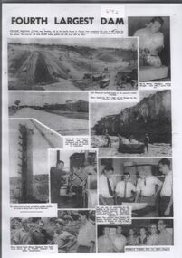
Document - Collection of photographs from newspaper on a single page
... area is 2,124 square kilometres (820 sq mi). The controlled spillway is capable of discharging 8,040 cubic metres per second (284,000 cu ft/s). Lake Eppalock supplies both stock and domestic water to the Campaspe irrigation district. ...area is 2,124 square kilometres (820 sq mi). The controlled spillway is capable of discharging 8,040 cubic metres per second (284,000 cu ft/s). Lake Eppalock supplies both stock and domestic water to the Campaspe irrigation district. ...John Perry Collection. Laminated copy of page from 'Weekly Times' newspaper, February, 1962. Nine images relating to establishing and building Eppalock Reservoir, 15 miles from Bendigo. The dam was built by the State Rivers and Water Supply Commission of Victoria. The dam wall height is 45 metres (148 ft) and the main embankment is 1,041 metres (3,415 ft) long. At 100% capacity the dam wall was designed to hold back 304,651 megalitres (6.7014×10¹⁰ imp gal; 8.0480×10¹⁰ US gal) of water. The surface area of Lake Eppalock is 3,011 hectares (7,440 acres) and the catchment area is 2,124 square kilometres (820 sq mi). The controlled spillway is capable of discharging 8,040 cubic metres per second (284,000 cu ft/s). Lake Eppalock supplies both stock and domestic water to the Campaspe irrigation district. It also serves as a water supply to Bendigo and Heathcote and, in more recent times, Ballarat. The lake is a major attraction for those engaging in watersports, with a number of tourist parks and accommodation facilities available. Permissible activities on the lake include high-speed boating, water skiing, sailing, canoeing, fishing and swimming. The lake's water levels were low for approximately eight years between 2002 and 2010 during a prolonged drought, which restricted the amount of recreational activity until rainfall in the latter half of 2010 returned the lake to 100 percent capacity. Built between 1961 and 1964, Lake Eppalock remains the only water storage on the Campaspe River system. dam, engineering, water, eppalock -
 Bendigo Historical Society Inc.
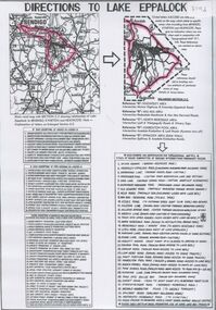
Document - Directions to Lake Eppalock with road descriptions and map
... area is 2,124 square kilometres (820 sq mi). The controlled spillway is capable of discharging 8,040 cubic metres per second (284,000 cu ft/s). Lake Eppalock supplies both stock and domestic water to the Campaspe irrigation district. ...area is 2,124 square kilometres (820 sq mi). The controlled spillway is capable of discharging 8,040 cubic metres per second (284,000 cu ft/s). Lake Eppalock supplies both stock and domestic water to the Campaspe irrigation district. ...John Perry Collection. Laminated copy of 'Directions to Lake Eppalock'. Gives directions in relationship of Lake Eppalock to Bendigo, Kyneton and Heathcote. Undated. Gives basic descriptions of bridges on lakebed, ford crossings on lakebed and inundated dwellings on lakebed. The dam was built by the State Rivers and Water Supply Commission of Victoria. The dam wall height is 45 metres (148 ft) and the main embankment is 1,041 metres (3,415 ft) long. At 100% capacity the dam wall was designed to hold back 304,651 megalitres (6.7014×10¹⁰ imp gal; 8.0480×10¹⁰ US gal) of water. The surface area of Lake Eppalock is 3,011 hectares (7,440 acres) and the catchment area is 2,124 square kilometres (820 sq mi). The controlled spillway is capable of discharging 8,040 cubic metres per second (284,000 cu ft/s). Lake Eppalock supplies both stock and domestic water to the Campaspe irrigation district. It also serves as a water supply to Bendigo and Heathcote and, in more recent times, Ballarat. The lake is a major attraction for those engaging in watersports, with a number of tourist parks and accommodation facilities available. Permissible activities on the lake include high-speed boating, water skiing, sailing, canoeing, fishing and swimming. The lake's water levels were low for approximately eight years between 2002 and 2010 during a prolonged drought, which restricted the amount of recreational activity until rainfall in the latter half of 2010 returned the lake to 100 percent capacity. Built between 1961 and 1964, Lake Eppalock remains the only water storage on the Campaspe River system.water, dam, directions, eppalock -
 Bendigo Historical Society Inc.
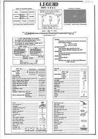
Document - Legend to maps A, B and C for Lake Eppalock
... area is 2,124 square kilometres (820 sq mi). The controlled spillway is capable of discharging 8,040 cubic metres per second (284,000 cu ft/s). Lake Eppalock supplies both stock and domestic water to the Campaspe irrigation district. ...area is 2,124 square kilometres (820 sq mi). The controlled spillway is capable of discharging 8,040 cubic metres per second (284,000 cu ft/s). Lake Eppalock supplies both stock and domestic water to the Campaspe irrigation district. ...John Perry Collection. Laminated 'legend' for Maps A, B and C for Lake Eppalock also in this collection. Black and White definitions and descriptions of objects and markers found on maps. Circa 1951. The dam was built by the State Rivers and Water Supply Commission of Victoria. The dam wall height is 45 metres (148 ft) and the main embankment is 1,041 metres (3,415 ft) long. At 100% capacity the dam wall was designed to hold back 304,651 megalitres (6.7014×10¹⁰ imp gal; 8.0480×10¹⁰ US gal) of water. The surface area of Lake Eppalock is 3,011 hectares (7,440 acres) and the catchment area is 2,124 square kilometres (820 sq mi). The controlled spillway is capable of discharging 8,040 cubic metres per second (284,000 cu ft/s). Lake Eppalock supplies both stock and domestic water to the Campaspe irrigation district. It also serves as a water supply to Bendigo and Heathcote and, in more recent times, Ballarat. The lake is a major attraction for those engaging in watersports, with a number of tourist parks and accommodation facilities available. Permissible activities on the lake include high-speed boating, water skiing, sailing, canoeing, fishing and swimming. The lake's water levels were low for approximately eight years between 2002 and 2010 during a prolonged drought, which restricted the amount of recreational activity until rainfall in the latter half of 2010 returned the lake to 100 percent capacity. Built between 1961 and 1964, Lake Eppalock remains the only water storage on the Campaspe River system.map, water, dam, reservoir, eppalock -
 Bendigo Historical Society Inc.
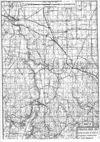
Map - General view of area of proposed construction of Lake Eppalock. Map 'A'
... area is 2,124 square kilometres (820 sq mi). The controlled spillway is capable of discharging 8,040 cubic metres per second (284,000 cu ft/s). Lake Eppalock supplies both stock and domestic water to the Campaspe irrigation district. ...area is 2,124 square kilometres (820 sq mi). The controlled spillway is capable of discharging 8,040 cubic metres per second (284,000 cu ft/s). Lake Eppalock supplies both stock and domestic water to the Campaspe irrigation district. ...John Perry Collection. Laminated map of proposed construction of Lake Eppalock. Map 'A'. Black and white map in laminate. Circa 1951. The dam was built by the State Rivers and Water Supply Commission of Victoria. The dam wall height is 45 metres (148 ft) and the main embankment is 1,041 metres (3,415 ft) long. At 100% capacity the dam wall was designed to hold back 304,651 megalitres (6.7014×10¹⁰ imp gal; 8.0480×10¹⁰ US gal) of water. The surface area of Lake Eppalock is 3,011 hectares (7,440 acres) and the catchment area is 2,124 square kilometres (820 sq mi). The controlled spillway is capable of discharging 8,040 cubic metres per second (284,000 cu ft/s). Lake Eppalock supplies both stock and domestic water to the Campaspe irrigation district. It also serves as a water supply to Bendigo and Heathcote and, in more recent times, Ballarat. The lake is a major attraction for those engaging in watersports, with a number of tourist parks and accommodation facilities available. Permissible activities on the lake include high-speed boating, water skiing, sailing, canoeing, fishing and swimming. The lake's water levels were low for approximately eight years between 2002 and 2010 during a prolonged drought, which restricted the amount of recreational activity until rainfall in the latter half of 2010 returned the lake to 100 percent capacity. Built between 1961 and 1964, Lake Eppalock remains the only water storage on the Campaspe River system.map, dam, water, weir, eppalock -
 Bendigo Historical Society Inc.
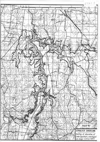
Map - Black and White map. Outline of Lake Eppalock. Map 'B'
... area is 2,124 square kilometres (820 sq mi). The controlled spillway is capable of discharging 8,040 cubic metres per second (284,000 cu ft/s). Lake Eppalock supplies both stock and domestic water to the Campaspe irrigation district. ...area is 2,124 square kilometres (820 sq mi). The controlled spillway is capable of discharging 8,040 cubic metres per second (284,000 cu ft/s). Lake Eppalock supplies both stock and domestic water to the Campaspe irrigation district. ...John Perry Collection. Laminated copy black and white map. Map 'B'. Outline of Lake Eppalcok, overlayed on map. Circa 1951. The dam was built by the State Rivers and Water Supply Commission of Victoria. The dam wall height is 45 metres (148 ft) and the main embankment is 1,041 metres (3,415 ft) long. At 100% capacity the dam wall was designed to hold back 304,651 megalitres (6.7014×10¹⁰ imp gal; 8.0480×10¹⁰ US gal) of water. The surface area of Lake Eppalock is 3,011 hectares (7,440 acres) and the catchment area is 2,124 square kilometres (820 sq mi). The controlled spillway is capable of discharging 8,040 cubic metres per second (284,000 cu ft/s). Lake Eppalock supplies both stock and domestic water to the Campaspe irrigation district. It also serves as a water supply to Bendigo and Heathcote and, in more recent times, Ballarat. The lake is a major attraction for those engaging in watersports, with a number of tourist parks and accommodation facilities available. Permissible activities on the lake include high-speed boating, water skiing, sailing, canoeing, fishing and swimming. The lake's water levels were low for approximately eight years between 2002 and 2010 during a prolonged drought, which restricted the amount of recreational activity until rainfall in the latter half of 2010 returned the lake to 100 percent capacity. Built between 1961 and 1964, Lake Eppalock remains the only water storage on the Campaspe River system.map, water, dam, reservoir, eppalock -
 Bendigo Historical Society Inc.
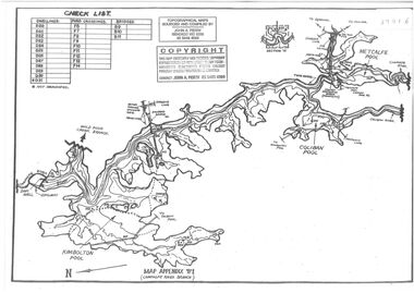
Map - Black and white map pertaining to Lake Eppalock
... area is 2,124 square kilometres (820 sq mi). The controlled spillway is capable of discharging 8,040 cubic metres per second (284,000 cu ft/s). Lake Eppalock supplies both stock and domestic water to the Campaspe irrigation district. ...area is 2,124 square kilometres (820 sq mi). The controlled spillway is capable of discharging 8,040 cubic metres per second (284,000 cu ft/s). Lake Eppalock supplies both stock and domestic water to the Campaspe irrigation district. ...John Perry Collection. Laminated copy of map relating to Lake Eppalock. Lists dwellings, ford crossings and bridges. The dam was built by the State Rivers and Water Supply Commission of Victoria. The dam wall height is 45 metres (148 ft) and the main embankment is 1,041 metres (3,415 ft) long. At 100% capacity the dam wall was designed to hold back 304,651 megalitres (6.7014×10¹⁰ imp gal; 8.0480×10¹⁰ US gal) of water. The surface area of Lake Eppalock is 3,011 hectares (7,440 acres) and the catchment area is 2,124 square kilometres (820 sq mi). The controlled spillway is capable of discharging 8,040 cubic metres per second (284,000 cu ft/s). Lake Eppalock supplies both stock and domestic water to the Campaspe irrigation district. It also serves as a water supply to Bendigo and Heathcote and, in more recent times, Ballarat. The lake is a major attraction for those engaging in watersports, with a number of tourist parks and accommodation facilities available. Permissible activities on the lake include high-speed boating, water skiing, sailing, canoeing, fishing and swimming. The lake's water levels were low for approximately eight years between 2002 and 2010 during a prolonged drought, which restricted the amount of recreational activity until rainfall in the latter half of 2010 returned the lake to 100 percent capacity. Built between 1961 and 1964, Lake Eppalock remains the only water storage on the Campaspe River system.map, water, dam, reservoir, eppalock -
 Bendigo Historical Society Inc.
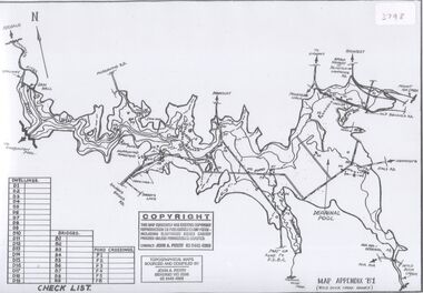
Map - Black and white map pertaining to Lake Eppalock
... area is 2,124 square kilometres (820 sq mi). The controlled spillway is capable of discharging 8,040 cubic metres per second (284,000 cu ft/s). Lake Eppalock supplies both stock and domestic water to the Campaspe irrigation district. ...area is 2,124 square kilometres (820 sq mi). The controlled spillway is capable of discharging 8,040 cubic metres per second (284,000 cu ft/s). Lake Eppalock supplies both stock and domestic water to the Campaspe irrigation district. ...John Perry Collection. Laminated copy of map pertaining to Lake Eppalock. Gives details of dwellings, bridges and ford crossings. The dam was built by the State Rivers and Water Supply Commission of Victoria. The dam wall height is 45 metres (148 ft) and the main embankment is 1,041 metres (3,415 ft) long. At 100% capacity the dam wall was designed to hold back 304,651 megalitres (6.7014×10¹⁰ imp gal; 8.0480×10¹⁰ US gal) of water. The surface area of Lake Eppalock is 3,011 hectares (7,440 acres) and the catchment area is 2,124 square kilometres (820 sq mi). The controlled spillway is capable of discharging 8,040 cubic metres per second (284,000 cu ft/s). Lake Eppalock supplies both stock and domestic water to the Campaspe irrigation district. It also serves as a water supply to Bendigo and Heathcote and, in more recent times, Ballarat. The lake is a major attraction for those engaging in watersports, with a number of tourist parks and accommodation facilities available. Permissible activities on the lake include high-speed boating, water skiing, sailing, canoeing, fishing and swimming. The lake's water levels were low for approximately eight years between 2002 and 2010 during a prolonged drought, which restricted the amount of recreational activity until rainfall in the latter half of 2010 returned the lake to 100 percent capacity. Built between 1961 and 1964, Lake Eppalock remains the only water storage on the Campaspe River system.eppalock, map, water, dam, reservoir -
 Bendigo Historical Society Inc.
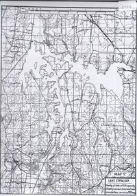
Map - Map of overlay of lake Eppalock at full capacity. Map 'C'
... area is 2,124 square kilometres (820 sq mi). The controlled spillway is capable of discharging 8,040 cubic metres per second (284,000 cu ft/s). Lake Eppalock supplies both stock and domestic water to the Campaspe irrigation district. ...area is 2,124 square kilometres (820 sq mi). The controlled spillway is capable of discharging 8,040 cubic metres per second (284,000 cu ft/s). Lake Eppalock supplies both stock and domestic water to the Campaspe irrigation district. ...John Perry collection. Map 'C'. Laminated map of overlay of Lake Eppalock at full capacity. Circa 1951. The dam was built by the State Rivers and Water Supply Commission of Victoria. The dam wall height is 45 metres (148 ft) and the main embankment is 1,041 metres (3,415 ft) long. At 100% capacity the dam wall was designed to hold back 304,651 megalitres (6.7014×10¹⁰ imp gal; 8.0480×10¹⁰ US gal) of water. The surface area of Lake Eppalock is 3,011 hectares (7,440 acres) and the catchment area is 2,124 square kilometres (820 sq mi). The controlled spillway is capable of discharging 8,040 cubic metres per second (284,000 cu ft/s). Lake Eppalock supplies both stock and domestic water to the Campaspe irrigation district. It also serves as a water supply to Bendigo and Heathcote and, in more recent times, Ballarat. The lake is a major attraction for those engaging in watersports, with a number of tourist parks and accommodation facilities available. Permissible activities on the lake include high-speed boating, water skiing, sailing, canoeing, fishing and swimming. The lake's water levels were low for approximately eight years between 2002 and 2010 during a prolonged drought, which restricted the amount of recreational activity until rainfall in the latter half of 2010 returned the lake to 100 percent capacity. Built between 1961 and 1964, Lake Eppalock remains the only water storage on the Campaspe River system.map, water, eppalock, dam, reservoir -
 Bendigo Historical Society Inc.
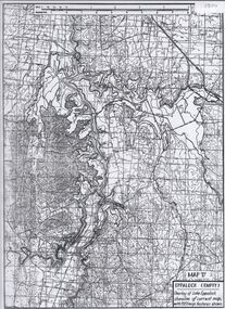
Map - Laminated map of Lake Eppalock empty. Map 'D'
... area is 2,124 square kilometres (820 sq mi). The controlled spillway is capable of discharging 8,040 cubic metres per second (284,000 cu ft/s). Lake Eppalock supplies both stock and domestic water to the Campaspe irrigation district. ...area is 2,124 square kilometres (820 sq mi). The controlled spillway is capable of discharging 8,040 cubic metres per second (284,000 cu ft/s). Lake Eppalock supplies both stock and domestic water to the Campaspe irrigation district. ...John Perry Collection. Laminated map of Lake Eppalock empty. Map 'D'. Circa 1951. The dam was built by the State Rivers and Water Supply Commission of Victoria. The dam wall height is 45 metres (148 ft) and the main embankment is 1,041 metres (3,415 ft) long. At 100% capacity the dam wall was designed to hold back 304,651 megalitres (6.7014×10¹⁰ imp gal; 8.0480×10¹⁰ US gal) of water. The surface area of Lake Eppalock is 3,011 hectares (7,440 acres) and the catchment area is 2,124 square kilometres (820 sq mi). The controlled spillway is capable of discharging 8,040 cubic metres per second (284,000 cu ft/s). Lake Eppalock supplies both stock and domestic water to the Campaspe irrigation district. It also serves as a water supply to Bendigo and Heathcote and, in more recent times, Ballarat. The lake is a major attraction for those engaging in watersports, with a number of tourist parks and accommodation facilities available. Permissible activities on the lake include high-speed boating, water skiing, sailing, canoeing, fishing and swimming. The lake's water levels were low for approximately eight years between 2002 and 2010 during a prolonged drought, which restricted the amount of recreational activity until rainfall in the latter half of 2010 returned the lake to 100 percent capacity. Built between 1961 and 1964, Lake Eppalock remains the only water storage on the Campaspe River system.map, water, dam, reservoir, eppalock -
 Bendigo Historical Society Inc.
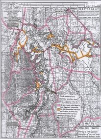
Map - Map of Lake Eppalock shoreline when empty
... area is 2,124 square kilometres (820 sq mi). The controlled spillway is capable of discharging 8,040 cubic metres per second (284,000 cu ft/s). Lake Eppalock supplies both stock and domestic water to the Campaspe irrigation district. ...area is 2,124 square kilometres (820 sq mi). The controlled spillway is capable of discharging 8,040 cubic metres per second (284,000 cu ft/s). Lake Eppalock supplies both stock and domestic water to the Campaspe irrigation district. ...John Perry Collection. Laminated copy of map detailing Lake Eppalock shoreline when empty. Circa 1951. Has colored highlighter lines following roads leading to lake shoreline and various inundated old roads and tracks on lakebed. The dam was built by the State Rivers and Water Supply Commission of Victoria. The dam wall height is 45 metres (148 ft) and the main embankment is 1,041 metres (3,415 ft) long. At 100% capacity the dam wall was designed to hold back 304,651 megalitres (6.7014×10¹⁰ imp gal; 8.0480×10¹⁰ US gal) of water. The surface area of Lake Eppalock is 3,011 hectares (7,440 acres) and the catchment area is 2,124 square kilometres (820 sq mi). The controlled spillway is capable of discharging 8,040 cubic metres per second (284,000 cu ft/s). Lake Eppalock supplies both stock and domestic water to the Campaspe irrigation district. It also serves as a water supply to Bendigo and Heathcote and, in more recent times, Ballarat. The lake is a major attraction for those engaging in watersports, with a number of tourist parks and accommodation facilities available. Permissible activities on the lake include high-speed boating, water skiing, sailing, canoeing, fishing and swimming. The lake's water levels were low for approximately eight years between 2002 and 2010 during a prolonged drought, which restricted the amount of recreational activity until rainfall in the latter half of 2010 returned the lake to 100 percent capacity. Built between 1961 and 1964, Lake Eppalock remains the only water storage on the Campaspe River system.map, eppalock, reservoir, lake, water -
 Bendigo Historical Society Inc.
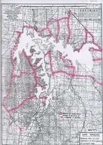
Map - Laminated map of Lake Eppalock at full capacity
... area is 2,124 square kilometres (820 sq mi). The controlled spillway is capable of discharging 8,040 cubic metres per second (284,000 cu ft/s). Lake Eppalock supplies both stock and domestic water to the Campaspe irrigation district. ...area is 2,124 square kilometres (820 sq mi). The controlled spillway is capable of discharging 8,040 cubic metres per second (284,000 cu ft/s). Lake Eppalock supplies both stock and domestic water to the Campaspe irrigation district. ...John Perry Collection. Laminated copy of map of Lake Eppalock at full capacity. Had highlighter markings of old roads which appear to be still in use. The dam was built by the State Rivers and Water Supply Commission of Victoria. The dam wall height is 45 metres (148 ft) and the main embankment is 1,041 metres (3,415 ft) long. At 100% capacity the dam wall was designed to hold back 304,651 megalitres (6.7014×10¹⁰ imp gal; 8.0480×10¹⁰ US gal) of water. The surface area of Lake Eppalock is 3,011 hectares (7,440 acres) and the catchment area is 2,124 square kilometres (820 sq mi). The controlled spillway is capable of discharging 8,040 cubic metres per second (284,000 cu ft/s). Lake Eppalock supplies both stock and domestic water to the Campaspe irrigation district. It also serves as a water supply to Bendigo and Heathcote and, in more recent times, Ballarat. The lake is a major attraction for those engaging in watersports, with a number of tourist parks and accommodation facilities available. Permissible activities on the lake include high-speed boating, water skiing, sailing, canoeing, fishing and swimming. The lake's water levels were low for approximately eight years between 2002 and 2010 during a prolonged drought, which restricted the amount of recreational activity until rainfall in the latter half of 2010 returned the lake to 100 percent capacity. Built between 1961 and 1964, Lake Eppalock remains the only water storage on the Campaspe River system.map, water, dam, reservoir, eppalock -
 Bendigo Historical Society Inc.
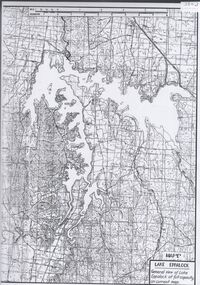
Map - Laminated map of Lake Eppalock at full capacity. Map 'E'
... area is 2,124 square kilometres (820 sq mi). The controlled spillway is capable of discharging 8,040 cubic metres per second (284,000 cu ft/s). Lake Eppalock supplies both stock and domestic water to the Campaspe irrigation district. ...area is 2,124 square kilometres (820 sq mi). The controlled spillway is capable of discharging 8,040 cubic metres per second (284,000 cu ft/s). Lake Eppalock supplies both stock and domestic water to the Campaspe irrigation district. ...John Perry Collection. Laminated map of Lake Eppalock at full capacity. Black and white. The dam was built by the State Rivers and Water Supply Commission of Victoria. The dam wall height is 45 metres (148 ft) and the main embankment is 1,041 metres (3,415 ft) long. At 100% capacity the dam wall was designed to hold back 304,651 megalitres (6.7014×10¹⁰ imp gal; 8.0480×10¹⁰ US gal) of water. The surface area of Lake Eppalock is 3,011 hectares (7,440 acres) and the catchment area is 2,124 square kilometres (820 sq mi). The controlled spillway is capable of discharging 8,040 cubic metres per second (284,000 cu ft/s). Lake Eppalock supplies both stock and domestic water to the Campaspe irrigation district. It also serves as a water supply to Bendigo and Heathcote and, in more recent times, Ballarat. The lake is a major attraction for those engaging in watersports, with a number of tourist parks and accommodation facilities available. Permissible activities on the lake include high-speed boating, water skiing, sailing, canoeing, fishing and swimming. The lake's water levels were low for approximately eight years between 2002 and 2010 during a prolonged drought, which restricted the amount of recreational activity until rainfall in the latter half of 2010 returned the lake to 100 percent capacity. Built between 1961 and 1964, Lake Eppalock remains the only water storage on the Campaspe River system.map, eppalock, water, dam, reservoir -
 Bendigo Historical Society Inc.
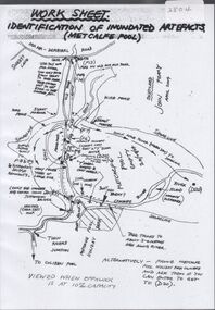
Map - Laminated worksheet - identification of inundated artifacts at Lake Eppalock
... area is 2,124 square kilometres (820 sq mi). The controlled spillway is capable of discharging 8,040 cubic metres per second (284,000 cu ft/s). Lake Eppalock supplies both stock and domestic water to the Campaspe irrigation district. ...area is 2,124 square kilometres (820 sq mi). The controlled spillway is capable of discharging 8,040 cubic metres per second (284,000 cu ft/s). Lake Eppalock supplies both stock and domestic water to the Campaspe irrigation district. ...John Perry Collection. Laminated copy of worksheet identifying inundated artifacts at Lake Eppalock when at 10% capacity. The dam was built by the State Rivers and Water Supply Commission of Victoria. The dam wall height is 45 metres (148 ft) and the main embankment is 1,041 metres (3,415 ft) long. At 100% capacity the dam wall was designed to hold back 304,651 megalitres (6.7014×10¹⁰ imp gal; 8.0480×10¹⁰ US gal) of water. The surface area of Lake Eppalock is 3,011 hectares (7,440 acres) and the catchment area is 2,124 square kilometres (820 sq mi). The controlled spillway is capable of discharging 8,040 cubic metres per second (284,000 cu ft/s). Lake Eppalock supplies both stock and domestic water to the Campaspe irrigation district. It also serves as a water supply to Bendigo and Heathcote and, in more recent times, Ballarat. The lake is a major attraction for those engaging in watersports, with a number of tourist parks and accommodation facilities available. Permissible activities on the lake include high-speed boating, water skiing, sailing, canoeing, fishing and swimming. The lake's water levels were low for approximately eight years between 2002 and 2010 during a prolonged drought, which restricted the amount of recreational activity until rainfall in the latter half of 2010 returned the lake to 100 percent capacity. Built between 1961 and 1964, Lake Eppalock remains the only water storage on the Campaspe River system.map, artifacts, eppalock, reservoir -
 Bendigo Historical Society Inc.
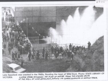
Document - Black and white laminated photo of flow of water from Lake Eppalock. 1964
... area is 2,124 square kilometres (820 sq mi). The controlled spillway is capable of discharging 8,040 cubic metres per second (284,000 cu ft/s). Lake Eppalock supplies both stock and domestic water to the Campaspe irrigation district. ...area is 2,124 square kilometres (820 sq mi). The controlled spillway is capable of discharging 8,040 cubic metres per second (284,000 cu ft/s). Lake Eppalock supplies both stock and domestic water to the Campaspe irrigation district. ...John Perry Collection. Laminated copy of photo of crowd watching flow of water from the opened valve at the wall of Lake Eppalock during its commissioning. March, 1964. Lake Eppalock was created by flooding to town of Wild Duck. The dam was built by the State Rivers and Water Supply Commission of Victoria. The dam wall height is 45 metres (148 ft) and the main embankment is 1,041 metres (3,415 ft) long. At 100% capacity the dam wall was designed to hold back 304,651 megalitres (6.7014×10¹⁰ imp gal; 8.0480×10¹⁰ US gal) of water. The surface area of Lake Eppalock is 3,011 hectares (7,440 acres) and the catchment area is 2,124 square kilometres (820 sq mi). The controlled spillway is capable of discharging 8,040 cubic metres per second (284,000 cu ft/s). Lake Eppalock supplies both stock and domestic water to the Campaspe irrigation district. It also serves as a water supply to Bendigo and Heathcote and, in more recent times, Ballarat. The lake is a major attraction for those engaging in watersports, with a number of tourist parks and accommodation facilities available. Permissible activities on the lake include high-speed boating, water skiing, sailing, canoeing, fishing and swimming. The lake's water levels were low for approximately eight years between 2002 and 2010 during a prolonged drought, which restricted the amount of recreational activity until rainfall in the latter half of 2010 returned the lake to 100 percent capacity. Built between 1961 and 1964, Lake Eppalock remains the only water storage on the Campaspe River system.water, dam, reservoir, eppalock, wild duck -
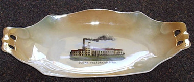 Maffra Sugarbeet Museum
Souvenir Plate
... The Sugar Beet industry was highly significant in the Maffra area for just under 50 years, and led to the construction of the Glenmaggie Weir and the consequent Macalister Irrigation District. ...A tangible reminder of how important the sugar beet factory and the sugar beet industry was to Maffra, is the production of souvenir-ware with images of the factory. The Sugar Beet industry was highly significant in the Maffra area for just under 50 years, and led to the construction of the Glenmaggie Weir and the consequent Macalister Irrigation District. The item lacks detailed provenance, but is obviously local.Oblong cream and tan souvenir plate with photograph of "Sugar Factory, Maffra" printed in centre. The ends are extended to form handles, each pierced with two holes.Sugar Factory Maffra [crown] / Victoria / China / Czechoslovakiasugarbeet
