Showing 59 items matching "kangaroo ground-st andrews rd"
-
 Eltham District Historical Society Inc
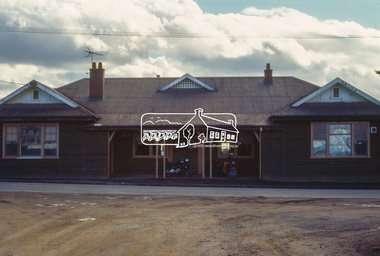
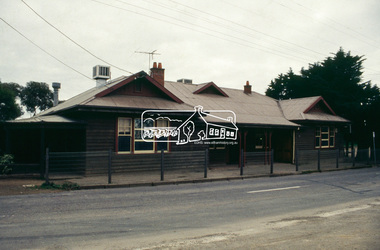
Photograph, Panton Hill Hotel, 633 Kangaroo Ground-St Andrews Rd, Panton Hill, c.May 1988
... Panton Hill Hotel, 633 Kangaroo Ground-St Andrews Rd, Panton Hill...Kangaroo Ground-St Andrews Rd...Eltham District Historical Society Inc 728 Main Rd Eltham melbourne Kangaroo Ground-St Andrews Rd Panton Hill Panton Hill Hotel Process Date MAY 88M 35mm colour positive transparency (1 of 25) Mount - Kodak Ektachrome Panton Hill Hotel, 633 Kangaroo Ground-St Andrews Rd, Panton Hill Photograph Photograph ...35mm colour positive transparency (1 of 25) Mount - Kodak EktachromeProcess Date MAY 88Mkangaroo ground-st andrews rd, panton hill, panton hill hotel -
 Eltham District Historical Society Inc
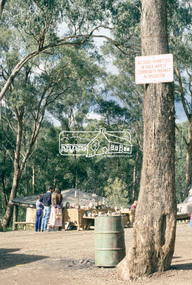
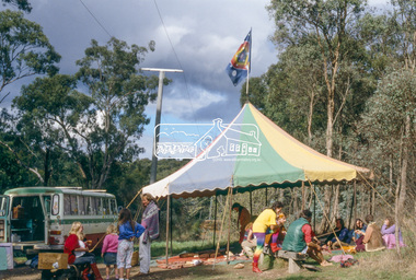
Photograph, St Andrews Community Market, Kangaroo Ground-St Andrews Rd, St Andrews, c.May 1988
... St Andrews Community Market, Kangaroo Ground-St Andrews Rd, St Andrews...Eltham District Historical Society Inc 728 Main Rd Eltham melbourne st andrews Burns Street St Andrews Market Process Date MAY 88M 35mm colour positive transparency (1 of 25) Mount - Kodak Ektachrome St Andrews Community Market, Kangaroo Ground-St Andrews Rd, St Andrews Photograph Photograph ...35mm colour positive transparency (1 of 25) Mount - Kodak EktachromeProcess Date MAY 88Mst andrews, burns street, st andrews market -
 Eltham District Historical Society Inc
Photograph, St Andrews Community Market, Kangaroo Ground-St Andrews Rd, St Andrews, c.May 1988
... St Andrews Community Market, Kangaroo Ground-St Andrews Rd, St Andrews...Eltham District Historical Society Inc 728 Main Rd Eltham melbourne st andrews burns street st andrews market Process Date MAY 88M 35mm colour positive transparency (1 of 25) Mount - Kodak Ektachrome St Andrews Community Market, Kangaroo Ground-St Andrews Rd, St Andrews Photograph Photograph ...35mm colour positive transparency (1 of 25) Mount - Kodak EktachromeProcess Date MAY 88Mst andrews, burns street, st andrews market -
 Eltham District Historical Society Inc
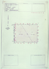
Slide - Photograph, Eltham Shire Council, Plan of Subdivision of Part of Crown Allotment 4, Section 2 at Kangaroo Ground, Parish of Nillumbik, County of Evelyn, 1969
... Kangaroo Ground...Kangaroo Ground-St Andrews Rd...Eltham District Historical Society Inc 728 Main Rd Eltham melbourne Infrastructure Kangaroo Ground Kangaroo Ground-St Andrews Rd Kimse Map Plan of Subdivision planning Subdivison Lots C6, Kimse, Kangaroo Ground-St Andrews Road, 4 August 1969 35mm colour positive transparency blue Agfacolour Service plastic mount Plan of Subdivision of Part of Crown Allotment 4, Section 2 at Kangaroo Ground, Parish of Nillumbik, County of Evelyn Slide Photograph Eltham Shire Council ...35mm colour positive transparency blue Agfacolour Service plastic mountC6, Kimse, Kangaroo Ground-St Andrews Road, 4 August 1969infrastructure, kangaroo ground, kangaroo ground-st andrews rd, kimse, map, plan of subdivision, planning, subdivison lots -
 Eltham District Historical Society Inc
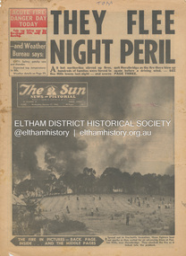
Newspaper - Newspaper articles, Sun News-Pictorial, They Flee Night Peril, The Sun News-Pictorial, Wednesday, January 17, p1, 1962
... Eltham District Historical Society Inc 728 Main Rd Eltham melbourne Various news articles pertaining to the January 1962 Victorian bushfires in the Dandenong and Healesville districts which by the third day had encompassed large areas of the State. Specific Eltham Shire districts mentioned include Panton Hill and Hurstbridge on page 1, Warrandyte on page 2, 3, 4 and 5, Hurstbridge, Smith’s Gully, Kinglake on page 3 and 4, Strathewen, Kangaroo Ground, Panton Hill, St. Andrews ...Various news articles pertaining to the January 1962 Victorian bushfires in the Dandenong and Healesville districts which by the third day had encompassed large areas of the State. Specific Eltham Shire districts mentioned include Panton Hill and Hurstbridge on page 1, Warrandyte on page 2, 3, 4 and 5, Hurstbridge, Smith’s Gully, Kinglake on page 3 and 4, Strathewen, Kangaroo Ground, Panton Hill, St. Andrews, Smith’s Gully on page 4 and Pound Bend, Smith’s Gully and Warrandyte on pages 20-21 • They Flee Night Peril, p1 (Illust.) • Their grim picnic; A flash fire strikes, p2 (Illust.) • Night of terror as towns quitted, p3 • Fought till he dropped, p3 (Illust.) • Rain in fire area, p3 • Wye River town goes, p3 • Black Friday Hero Dies In Fire; with wife, grandsons, p4 • Surrounded!, p4 (Illust.) • Main street houses ablaze, p4 • Hurstbridge is evacuated, p4 • Scores jump in river at Warrandyte, p5 • Hills people leave homes, p5 • “Fire” cry at Parlt., p5 • Blind – he’s safe now, p5 (Illust.) • Police Chief Runs Battle, p7 • From Fire Front: Hospital treats 34, p7 • Firms send help, p7 • Tragedy and Ruin: Third Day; Ferntree Gully; Warrandyte; Pound Bend; Smiths Gully; Escape for 18, pp20-21 (Illust.) • Church was a haven for the hurt, weary, p39 (Illust.) • A home is lost, p40 (Illust.) tom fielding collection, victorian bushfires - 1962, victorian bushfires – 1962, panton hill, hurstbridge, five ways crossroads, warrandyte south, dandenongs, upwey, mt. evelyn, monbulk, olinda, sassafras, st. andrews, warrandyte, christmas hills, yarra river, mitcham, whitehorse roiad, donvale, park orchards, metropolitan fire chief, w.t. aldridge, loughnan’s hill, ringwood, woori yallock, leslie ockwell, linda ockwell, kalorama, healesville, daylesford, fire damage – buildings, wye river, portland, eganstown, ballarat, sherbrooke park forest, forest commission headquarters, kallista, r.t. seaton, montrose, yallourn, central gippsland, smith’s creek, black friday, geoffrey ockwell, ronald ockwell, preston town hall, e.j. tenner, strathewen, kangaroo ground, eric farnsworth, adele farnsworth, robin farnsworth, roy cleland, ann cleland, belgrave, sassfras, kaloramalice commissioner porter, mansfield, box hill hospital, pound bend, ferntree gully, ferntree gully state school, w. carew, ann quinton -
 Eltham District Historical Society Inc
Photograph, Fay Bridge, Former cottage of Tom Ellis, 230 Kangaroo Ground-St Andrews Road, Kangaroo Ground, 13 November 2021
... Eltham District Historical Society Inc 728 Main Rd Eltham melbourne Tom Ellis was the great grandson of pioneer William Ellis Fay Bridge Collection 2021-11-13 Kangaroo Ground Kangaroo Ground-St Andrews Road Tom Ellis House 1 image - born digital Former cottage of Tom Ellis, 230 Kangaroo Ground-St Andrews Road, Kangaroo Ground Photograph Photograph Fay Bridge ...Tom Ellis was the great grandson of pioneer William Ellisfay bridge collection, 2021-11-13, kangaroo ground, kangaroo ground-st andrews road, tom ellis house -
 Eltham District Historical Society Inc
Document - Folder, Spicer, Whatmough, Chapman, Pill, Moreland families
... Rd Eltham melbourne Florence Spicer was born in Cottlesbridge and lived in the area all her life. Her ancestors included Robert Whatmough, Phoebe Chapman, John Pill, and Ada Moreland; she married Charles Spicer. Contents Transcribed and MS notes by Florence Spicer, undated: Spicer/Whatmough/Chapman/Pill/Moreland ancestry. MS notes, undated: Humphrey Spicer. MS notes, undated: Humphrey Spicer with list of children. Newspaper article: "Her 70 years in Cottlesbridge", Diamond Valley News, 4 April 1989. Florence Spicer's family history and current life. Florence Spicer Cottlesbridge Kangaroo Ground Panton Hill St Andrews ...Florence Spicer was born in Cottlesbridge and lived in the area all her life. Her ancestors included Robert Whatmough, Phoebe Chapman, John Pill, and Ada Moreland; she married Charles Spicer. Contents Transcribed and MS notes by Florence Spicer, undated: Spicer/Whatmough/Chapman/Pill/Moreland ancestry. MS notes, undated: Humphrey Spicer. MS notes, undated: Humphrey Spicer with list of children. Newspaper article: "Her 70 years in Cottlesbridge", Diamond Valley News, 4 April 1989. Florence Spicer's family history and current life. Newspaper clippings, A4 photocopies, etcflorence spicer, cottlesbridge, kangaroo ground, panton hill, st andrews victoria, nillumbik historical society, eltham district historical society, allwood house hurstbridge, john pill, jessie pill nee whatmough, ted pill, florence pill, cottlesbridge post office, charles spicer, st andrews primary school, ladies guild panton hill anglican church, kangaroo ground presbyterian ladies guild, senior citizens hurstbridge, panton hill fire station, robert whatmough, robert cook, emmet whatmough, lamplighter in melbourne, john batman, batman apple tree greensborough, diamond hill estate, phoebe chapman, whatmough park greensborough, jessie whatmough, edwin pill, ada moreland, martha burgess, mary mcmurray, st james church melbourne, george wright of westernport, william spicer, margaret spicer, george spicer, maryanne spicer, sarah spicer, mary spicer, john spicer, alexander humphrey spicer, clara spicer, samson spicer, martha spicer, john henry spicer, arthurs creek cemetery, david clark school master, little eltham school, william mcmurray, sarah mcmurray -
 Eltham District Historical Society Inc
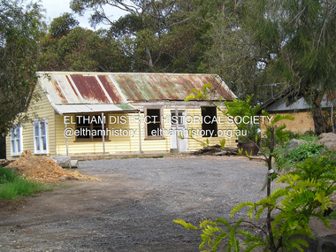
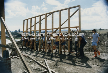
Photograph - Black and White Print, Kangaroo Ground Hall, 35 Kangaroo Ground-St Andrews Road, Kangaroo Ground, c.1988
... Eltham District Historical Society Inc 728 Main Rd Eltham melbourne Landscaping works in progress at the newly built Kangaroo Ground Hall located at 35 Kangaroo Ground-St Andrews Road, Kangaroo Ground The dedication plaque, mounted on a rock near the flag pole reads: This centre, jointly funded by the Shire of Eltham, Community Employment Programme, Country Fire Authority and State Emergency Service was opened by The Shire President of the Shire of Eltham Cr. ...Landscaping works in progress at the newly built Kangaroo Ground Hall located at 35 Kangaroo Ground-St Andrews Road, Kangaroo Ground The dedication plaque, mounted on a rock near the flag pole reads: This centre, jointly funded by the Shire of Eltham, Community Employment Programme, Country Fire Authority and State Emergency Service was opened by The Shire President of the Shire of Eltham Cr. Alan Baker at a ceremony attended by Members of Parliament, Councillors, & Representatives of the Victoria Police, Country Fire Authority, State Emergency Servicve, Ambulance Service Melbourne, Salvation Army & residents of the Shire of Eltham on Saturday, 13 February 1988. See also: Kangaroo Ground Hall. (2025, July 5). Retrieved from https://www.nillumbik.vic.gov.au/Council/Facilities-and-property/Council-facilities-for-hire/Kangaroo-Ground-HallMarked "G 90%"1988, eltham shire council property, kangaroo ground hall, mudbrick construction, nillumbik shire council property -
 Eltham District Historical Society Inc
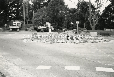
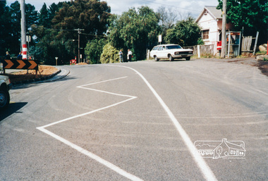
Photograph - Black and White Print, Construction of roundabout at intersection of Merritts Road and Kangaroo Ground-St Andrews Road, Panton Hill, c.1988
... Eltham District Historical Society Inc 728 Main Rd Eltham melbourne Panton Hill Memorial Park in background on right 1988 Infrastructure Road construction Roundabout Kangaroo Ground-St Andrews Road Merritts Road Panton Hill Panton Hill Memorial Park Black and White print approx. 10 x 15 cm Originally housed in a 34.5 x 36 x 2.5 cm expandable album with padded cream covers and gold accents; 18 page inserts with clear pocket inserts holding 6 photos per side, total capacity 216 10 x 15 cm photo prints; showing yellowing with age Construction of roundabout at intersection of Merritts Road and Kangaroo Ground-St Andrews Road, Panton Hill Photograph Black and White Print ...Panton Hill Memorial Park in background on right1988, infrastructure, road construction, roundabout, kangaroo ground-st andrews road, merritts road, panton hill, panton hill memorial park -
 Eltham District Historical Society Inc
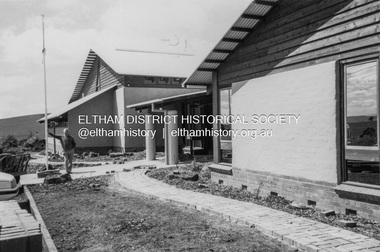
Photograph - Colour Print, SES members assisting with construction work on the Eltham Emergency Operations Centre and Kangaroo Ground Hall, 35 Kangaroo Ground-St Andrews Road, Kangaroo Ground, 1988
... Eltham District Historical Society Inc 728 Main Rd Eltham melbourne Located at 35 Kangaroo Ground-St Andrews Road, Kangaroo Ground The centre was jointly funded by the Shire of Eltham, Community Employment Programme, Country Fire Authority and State Emergency Service. ...Located at 35 Kangaroo Ground-St Andrews Road, Kangaroo Ground The centre was jointly funded by the Shire of Eltham, Community Employment Programme, Country Fire Authority and State Emergency Service. It was opened by the Shire President of the Shire of Eltham, Cr. Alan Baker, at a ceremony attended by Members of Parliament, Councillors, & Representatives of the Victoria Police, Country Fire Authority, State Emergency Service, Ambulance Service Melbourne, Salvation Army & residents of the Shire of Eltham on Saturday, 13 February 1988.construction, kangaroo ground hall, mudbrick construction, state emergency service (eltham), eltham emergency operations centre -
 Eltham District Historical Society Inc
Photograph, Main Road, Panton Hill
... Eltham District Historical Society Inc 728 Main Rd Eltham melbourne main road st andrews road kangaroo ground/st andrews road panton hill Colour photograph of Main Road, Panton Hill looking east. ...Colour photograph of Main Road, Panton Hill looking east. Panton Hill General Store immediately on right just out of view [37�38'31.0"S 145�14'22.5"E -37.641941, 145.239592]main road, st andrews road, kangaroo ground/st andrews road, panton hill -
 Eltham District Historical Society Inc
Photograph, Main Road, Panton Hill
... Eltham District Historical Society Inc 728 Main Rd Eltham melbourne main road st andrews road kangaroo ground/st andrews road bishops road roundabouts panton hill Colour photograph of Main Road Panton Hill showing roundabout at Bishops Road. ...Colour photograph of Main Road Panton Hill showing roundabout at Bishops Road.main road, st andrews road, kangaroo ground/st andrews road, bishops road, roundabouts, panton hill -
 Eltham District Historical Society Inc
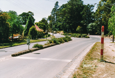
Photograph, Main Road, Panton Hill
... Eltham District Historical Society Inc 728 Main Rd Eltham melbourne main road st andrews road kangaroo ground/st andrews road bishops road roundabouts panton hill Six colour photographs of Main Road Panton Hill showing Bishops Road roundabout Main Road, Panton Hill Photograph ...Six colour photographs of Main Road Panton Hill showing Bishops Road roundaboutmain road, st andrews road, kangaroo ground/st andrews road, bishops road, roundabouts, panton hill -
 Eltham District Historical Society Inc
Photograph, Main Road, Panton Hill
... Eltham District Historical Society Inc 728 Main Rd Eltham melbourne main road st andrews road kangaroo ground/st andrews road bishops road roundabouts panton hill Two colour photographs of Main Road Panton Hill showing Bishops Road roundabout Main Road, Panton Hill Photograph ...Two colour photographs of Main Road Panton Hill showing Bishops Road roundaboutmain road, st andrews road, kangaroo ground/st andrews road, bishops road, roundabouts, panton hill -
 Eltham District Historical Society Inc
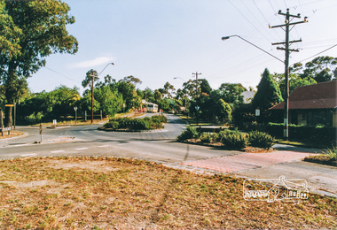
Photograph, Main Road, Panton Hill
... Eltham District Historical Society Inc 728 Main Rd Eltham melbourne main road st andrews road kangaroo ground/st andrews road church road roger road roundabouts panton hill Two colour photographs of Main Road Panton Hill showing roundabout at Church Road/Roger Road intersection Main Road, Panton Hill Photograph ...Two colour photographs of Main Road Panton Hill showing roundabout at Church Road/Roger Road intersectionmain road, st andrews road, kangaroo ground/st andrews road, church road, roger road, roundabouts, panton hill -
 Eltham District Historical Society Inc
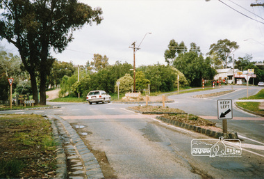
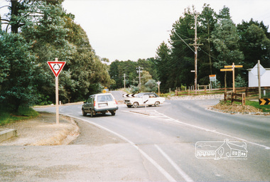
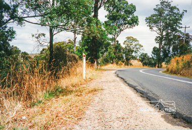
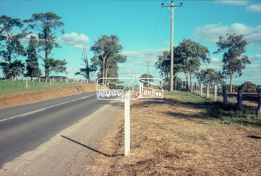
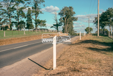
Photograph, Kangaroo Ground - St Andrews Road
... Eltham District Historical Society Inc 728 Main Rd Eltham melbourne roads st andrews road kangaroo ground/st andrews road panton hill kangaroo ground Five colour photographs of Kangaroo Ground/St Andrews Road, Kangaroo Ground/Panton Hill area Kangaroo Ground - St Andrews Road Photograph ...Five colour photographs of Kangaroo Ground/St Andrews Road, Kangaroo Ground/Panton Hill arearoads, st andrews road, kangaroo ground/st andrews road, panton hill, kangaroo ground -
 Eltham District Historical Society Inc
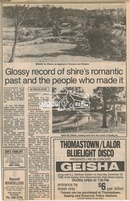
Newsclipping, Glossy record of shire's romantic past and the people who made it by Fab Calafuri, Diamond Valley News, 16 September 1986, 16 Sep 1986
... Eltham District Historical Society Inc 728 Main Rd Eltham melbourne A review of Pioneers and Painters Beryl Bradbury (nee Stokes) Collection Pioneers and Painters Alan Marshall Centenary Celebrations Christmas Hills Clifton Pugh David Newbury Dudley Street Eltham gareth jones roberts Hurstbridge John Perceval Joy Peck Kangaroo Ground Kinglake Lower Plenty Luther Haley General Store Main Road Montmorency Neil Douglas Panton Hill Peter Glass Research (Vic.) Sheila Ferguson shire of eltham Shire of Eltham Pioneers Photograph Collection St Andrews ...A review of Pioneers and PaintersDigital file only - Digitised by EDHS from a scrapbook on loan from Beryl Bradbury (nee Stokes), daughter of Frank Stokes.beryl bradbury (nee stokes) collection, pioneers and painters, alan marshall, centenary celebrations, christmas hills, clifton pugh, david newbury, dudley street, eltham, gareth jones roberts, hurstbridge, john perceval, joy peck, kangaroo ground, kinglake, lower plenty, luther haley general store, main road, montmorency, neil douglas, panton hill, peter glass, research (vic.), sheila ferguson, shire of eltham, shire of eltham pioneers photograph collection, st andrews, yarra glen -
 Eltham District Historical Society Inc
Negative - Photograph, J.A. McDonald, Kangaroo Ground-Queenstown Road, Aug. 1960
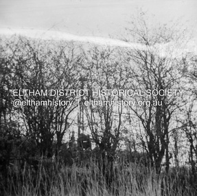
... Eltham District Historical Society Inc 728 Main Rd Eltham melbourne Beginning of roll of film Most likely at (Kangaroo Ground-St Andrews Road) “Rymers” Corner – shifting Hawthorn hedges on Tompkins property August 1960 Record of various Shire of Eltham infrastructure works undertaken during the period of 1952-1962 involving bridge and road reconstruction projects, sometimes with Eltham Shire Council Project Reference numbers quoted. ...Beginning of roll of film Most likely at (Kangaroo Ground-St Andrews Road) “Rymers” Corner – shifting Hawthorn hedges on Tompkins property August 1960Record of various Shire of Eltham infrastructure works undertaken during the period of 1952-1962 involving bridge and road reconstruction projects, sometimes with Eltham Shire Council Project Reference numbers quoted. It was during this period that a number of significant improvements were made to roads and new bridges constructed within the shire that remain in place as of present day (2022). In many situations, the photos provide a tangible visible record of infrastructure that existed throughout the early days of the Shire. The album was put together by or under the direction of the Shire Engineer, J.A. McDonald.infrastructure, shire of eltham, 1960-08, garden hill, kangaroo ground, kangaroo ground-queenstown road, kangaroo ground-st andrews road, rymers corner -
 Eltham District Historical Society Inc
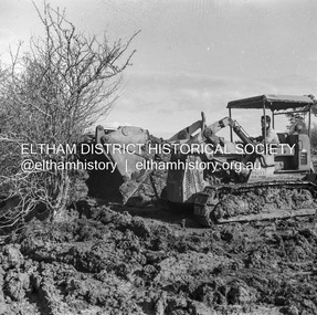
Negative - Photograph, J.A. McDonald, Kangaroo Ground-Queenstown Road, Aug. 1960
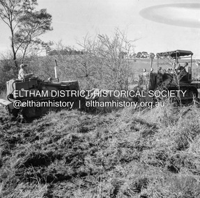
... Eltham District Historical Society Inc 728 Main Rd Eltham melbourne (Kangaroo Ground-St Andrews Road) “Rymers” Corner – shifting Hawthorn hedges on Tompkins property Council’s Drott 6 Woods Drott 9 August 1960 EDHS_05569-55 (EDHS_05577-3/4) and EDHS_05569-56 (EDHS_05577-5/6) - Hawthorn Hedges, Kangaroo Ground 50-50 ELTHAM, CUT THE HEDGES! ...(Kangaroo Ground-St Andrews Road) “Rymers” Corner – shifting Hawthorn hedges on Tompkins property Council’s Drott 6 Woods Drott 9 August 1960 EDHS_05569-55 (EDHS_05577-3/4) and EDHS_05569-56 (EDHS_05577-5/6) - Hawthorn Hedges, Kangaroo Ground 50-50 ELTHAM, CUT THE HEDGES! While all of us are talking about the road toll, Eltham Council must have been in long recess. Around Kangaroo Ground are farmers’ hawthorn hedges shrouding dangerous corners on busy roads. If the council does not insist on their removal for a distance clear enough for safe driving, then it must be held culpable for the accidents that are bound to happen. – WAKE UP (Melbourne) ELTHAM, CUT THE HEDGES! 50-50 (1960, 6 January), The Sun (News clipping held in SEA_74-1_007) ‘BAD HEDGES’ WILL GO “We know there are some bad hedges on corners in the Kangaroo Ground area, but roadworks this year will eliminate them,” the Eltham Shire secretary, Mr Maxwell B. Watson, said yesterday. A reader in 50-50 yesterday complained of farmers’ hawthorn hedges obscuring drivers’ views at bad corners on busy roads in the Kangaroo Ground district. Mr Watson said the roadworks were deviations to remove the sharp turns, and the road would cut back into paddocks. The hedges would go at the same time. Meanwhile, the shire had power to require owners to cut back hedges, and this would be done if specific instances were reported and found justifiable. ‘BAD HEDGES’ WILL GO (1960, January 7), The Sun (News clipping held in SEA_74-1_007)Record of various Shire of Eltham infrastructure works undertaken during the period of 1952-1962 involving bridge and road reconstruction projects, sometimes with Eltham Shire Council Project Reference numbers quoted. It was during this period that a number of significant improvements were made to roads and new bridges constructed within the shire that remain in place as of present day (2022). In many situations, the photos provide a tangible visible record of infrastructure that existed throughout the early days of the Shire. The album was put together by or under the direction of the Shire Engineer, J.A. McDonald.infrastructure, shire of eltham, 1960-08, garden hill, kangaroo ground, kangaroo ground-queenstown road, kangaroo ground-st andrews road, rymers corner, bulldozer, drott -
 Eltham District Historical Society Inc
Negative - Photograph, J.A. McDonald, Kangaroo Ground-Queenstown Road, Aug. 1960
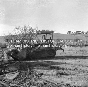
... Eltham District Historical Society Inc 728 Main Rd Eltham melbourne (Kangaroo Ground-St Andrews Road) “Rymers” Corner – shifting Hawthorn hedges on Tompkins property Council’s Drott 6 Woods Drott 9 August 1960 Showing hedge in rear already transported EDHS_05569-55 (EDHS_05577-3/4) and EDHS_05569-56 (EDHS_05577-5/6) - Hawthorn Hedges, Kangaroo Ground 50-50 ELTHAM, CUT THE HEDGES! ...(Kangaroo Ground-St Andrews Road) “Rymers” Corner – shifting Hawthorn hedges on Tompkins property Council’s Drott 6 Woods Drott 9 August 1960 Showing hedge in rear already transported EDHS_05569-55 (EDHS_05577-3/4) and EDHS_05569-56 (EDHS_05577-5/6) - Hawthorn Hedges, Kangaroo Ground 50-50 ELTHAM, CUT THE HEDGES! While all of us are talking about the road toll, Eltham Council must have been in long recess. Around Kangaroo Ground are farmers’ hawthorn hedges shrouding dangerous corners on busy roads. If the council does not insist on their removal for a distance clear enough for safe driving, then it must be held culpable for the accidents that are bound to happen. – WAKE UP (Melbourne) ELTHAM, CUT THE HEDGES! 50-50 (1960, 6 January), The Sun (News clipping held in SEA_74-1_007) ‘BAD HEDGES’ WILL GO “We know there are some bad hedges on corners in the Kangaroo Ground area, but roadworks this year will eliminate them,” the Eltham Shire secretary, Mr Maxwell B. Watson, said yesterday. A reader in 50-50 yesterday complained of farmers’ hawthorn hedges obscuring drivers’ views at bad corners on busy roads in the Kangaroo Ground district. Mr Watson said the roadworks were deviations to remove the sharp turns, and the road would cut back into paddocks. The hedges would go at the same time. Meanwhile, the shire had power to require owners to cut back hedges, and this would be done if specific instances were reported and found justifiable. ‘BAD HEDGES’ WILL GO (1960, January 7), The Sun (News clipping held in SEA_74-1_007)Record of various Shire of Eltham infrastructure works undertaken during the period of 1952-1962 involving bridge and road reconstruction projects, sometimes with Eltham Shire Council Project Reference numbers quoted. It was during this period that a number of significant improvements were made to roads and new bridges constructed within the shire that remain in place as of present day (2022). In many situations, the photos provide a tangible visible record of infrastructure that existed throughout the early days of the Shire. The album was put together by or under the direction of the Shire Engineer, J.A. McDonald.infrastructure, shire of eltham, 1960-08, garden hill, kangaroo ground, kangaroo ground-queenstown road, kangaroo ground-st andrews road, rymers corner, bulldozer, drott -
 Eltham District Historical Society Inc
Negative - Photograph, J.A. McDonald, Kangaroo Ground-Queenstown Road, Aug. 1960
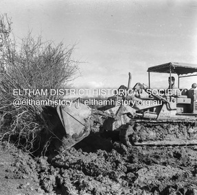
... Eltham District Historical Society Inc 728 Main Rd Eltham melbourne (Kangaroo Ground-St Andrews Road) “Rymers” Corner – shifting Hawthorn hedges on Tompkins property Council’s Drott 6 Woods Drott 9 August 1960 Showing method of lifting clumps of Hawthorn EDHS_05569-55 (EDHS_05577-3/4) and EDHS_05569-56 (EDHS_05577-5/6) - Hawthorn Hedges, Kangaroo Ground 50-50 ELTHAM, CUT THE HEDGES! ...(Kangaroo Ground-St Andrews Road) “Rymers” Corner – shifting Hawthorn hedges on Tompkins property Council’s Drott 6 Woods Drott 9 August 1960 Showing method of lifting clumps of Hawthorn EDHS_05569-55 (EDHS_05577-3/4) and EDHS_05569-56 (EDHS_05577-5/6) - Hawthorn Hedges, Kangaroo Ground 50-50 ELTHAM, CUT THE HEDGES! While all of us are talking about the road toll, Eltham Council must have been in long recess. Around Kangaroo Ground are farmers’ hawthorn hedges shrouding dangerous corners on busy roads. If the council does not insist on their removal for a distance clear enough for safe driving, then it must be held culpable for the accidents that are bound to happen. – WAKE UP (Melbourne) ELTHAM, CUT THE HEDGES! 50-50 (1960, 6 January), The Sun (News clipping held in SEA_74-1_007) ‘BAD HEDGES’ WILL GO “We know there are some bad hedges on corners in the Kangaroo Ground area, but roadworks this year will eliminate them,” the Eltham Shire secretary, Mr Maxwell B. Watson, said yesterday. A reader in 50-50 yesterday complained of farmers’ hawthorn hedges obscuring drivers’ views at bad corners on busy roads in the Kangaroo Ground district. Mr Watson said the roadworks were deviations to remove the sharp turns, and the road would cut back into paddocks. The hedges would go at the same time. Meanwhile, the shire had power to require owners to cut back hedges, and this would be done if specific instances were reported and found justifiable. ‘BAD HEDGES’ WILL GO (1960, January 7), The Sun (News clipping held in SEA_74-1_007)Record of various Shire of Eltham infrastructure works undertaken during the period of 1952-1962 involving bridge and road reconstruction projects, sometimes with Eltham Shire Council Project Reference numbers quoted. It was during this period that a number of significant improvements were made to roads and new bridges constructed within the shire that remain in place as of present day (2022). In many situations, the photos provide a tangible visible record of infrastructure that existed throughout the early days of the Shire. The album was put together by or under the direction of the Shire Engineer, J.A. McDonald.infrastructure, shire of eltham, 1960-08, garden hill, kangaroo ground, kangaroo ground-queenstown road, kangaroo ground-st andrews road, rymers corner, bulldozer, drott -
 Eltham District Historical Society Inc
Negative - Photograph, J.A. McDonald, Kangaroo Ground-Queenstown Road, Aug. 1960
... Eltham District Historical Society Inc 728 Main Rd Eltham melbourne (Kangaroo Ground-St Andrews Road) “Rymers” Corner – shifting Hawthorn hedges on Tompkins property Council’s Drott 6 Woods Drott 9 August 1960 Showing method of lifting clumps of Hawthorn EDHS_05569-55 (EDHS_05577-3/4) and EDHS_05569-56 (EDHS_05577-5/6) - Hawthorn Hedges, Kangaroo Ground 50-50 ELTHAM, CUT THE HEDGES! ...(Kangaroo Ground-St Andrews Road) “Rymers” Corner – shifting Hawthorn hedges on Tompkins property Council’s Drott 6 Woods Drott 9 August 1960 Showing method of lifting clumps of Hawthorn EDHS_05569-55 (EDHS_05577-3/4) and EDHS_05569-56 (EDHS_05577-5/6) - Hawthorn Hedges, Kangaroo Ground 50-50 ELTHAM, CUT THE HEDGES! While all of us are talking about the road toll, Eltham Council must have been in long recess. Around Kangaroo Ground are farmers’ hawthorn hedges shrouding dangerous corners on busy roads. If the council does not insist on their removal for a distance clear enough for safe driving, then it must be held culpable for the accidents that are bound to happen. – WAKE UP (Melbourne) ELTHAM, CUT THE HEDGES! 50-50 (1960, 6 January), The Sun (News clipping held in SEA_74-1_007) ‘BAD HEDGES’ WILL GO “We know there are some bad hedges on corners in the Kangaroo Ground area, but roadworks this year will eliminate them,” the Eltham Shire secretary, Mr Maxwell B. Watson, said yesterday. A reader in 50-50 yesterday complained of farmers’ hawthorn hedges obscuring drivers’ views at bad corners on busy roads in the Kangaroo Ground district. Mr Watson said the roadworks were deviations to remove the sharp turns, and the road would cut back into paddocks. The hedges would go at the same time. Meanwhile, the shire had power to require owners to cut back hedges, and this would be done if specific instances were reported and found justifiable. ‘BAD HEDGES’ WILL GO (1960, January 7), The Sun (News clipping held in SEA_74-1_007)Record of various Shire of Eltham infrastructure works undertaken during the period of 1952-1962 involving bridge and road reconstruction projects, sometimes with Eltham Shire Council Project Reference numbers quoted. It was during this period that a number of significant improvements were made to roads and new bridges constructed within the shire that remain in place as of present day (2022). In many situations, the photos provide a tangible visible record of infrastructure that existed throughout the early days of the Shire. The album was put together by or under the direction of the Shire Engineer, J.A. McDonald.infrastructure, shire of eltham, 1960-08, garden hill, kangaroo ground, kangaroo ground-queenstown road, kangaroo ground-st andrews road, rymers corner, bulldozer, drott -
 Eltham District Historical Society Inc
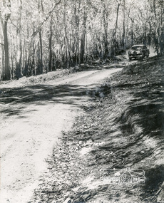
Album - Photograph, J.A. McDonald, Kangaroo Ground-Queenstown Road, Mar. 1959
... Eltham District Historical Society Inc 728 Main Rd Eltham melbourne (Kangaroo Ground-St Andrews Road) Realignment South of Alma Road, Panton Hill Opposite CA Sec., Parish of Greensborough March 1959 Record of various Shire of Eltham infrastructure works undertaken during the period of 1952-1962 involving bridge and road reconstruction projects, sometimes with Eltham Shire Council Project Reference numbers quoted. ...(Kangaroo Ground-St Andrews Road) Realignment South of Alma Road, Panton Hill Opposite CA Sec., Parish of Greensborough March 1959Record of various Shire of Eltham infrastructure works undertaken during the period of 1952-1962 involving bridge and road reconstruction projects, sometimes with Eltham Shire Council Project Reference numbers quoted. It was during this period that a number of significant improvements were made to roads and new bridges constructed within the shire that remain in place as of present day (2022). In many situations, the photos provide a tangible visible record of infrastructure that existed throughout the early days of the Shire. The album was put together by or under the direction of the Shire Engineer, J.A. McDonald.infrastructure, shire of eltham, bridge construction, heidelberg-kinglake road, road construction, 1959-03, alma road, kangaroo ground-queenstown road, kangaroo ground-st andrews road, panton hill -
 Eltham District Historical Society Inc
Slide - Photograph, Panton Hill Hotel, 633 Kangaroo Ground-St Andrews Road, Panton Hill, c.1992
... Eltham District Historical Society Inc 728 Main Rd Eltham melbourne Kangaroo Ground-St Andrews Road Panton Hill Panton Hill Hotel 35mm colour positive transparency Mount - Black and White Panton Hill Hotel, 633 Kangaroo Ground-St Andrews Road, Panton Hill Slide Photograph ...35mm colour positive transparency Mount - Black and Whitekangaroo ground-st andrews road, panton hill, panton hill hotel -
 Eltham District Historical Society Inc
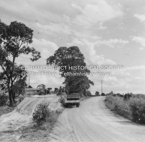
Slide - Photograph, Kangaroo Ground-St Andrews Road, Kangaroo Ground, c.May 1988
... Eltham District Historical Society Inc 728 Main Rd Eltham melbourne Kangaroo Ground-St Andrews Road, Kangaroo Ground, opposite Kangaroo Ground Pony Club, C.May 1988 infrastructure roads kangaroo ground Kangaroo Ground Pony Club Kangaroo Ground-St Andrews Road Process Date MAY 88M 35mm colour positive transparency (1 of 36) Mount - Kodak Kodachrome Kangaroo Ground-St Andrews Road, Kangaroo Ground Slide Photograph ...Kangaroo Ground-St Andrews Road, Kangaroo Ground, opposite Kangaroo Ground Pony Club, C.May 198835mm colour positive transparency (1 of 36) Mount - Kodak KodachromeProcess Date MAY 88Minfrastructure, roads, kangaroo ground, kangaroo ground pony club, kangaroo ground-st andrews road -
 Eltham District Historical Society Inc
Slide - Photograph, Kangaroo Ground-St Andrews Road, Kangaroo Ground, c.May 1988
... Eltham District Historical Society Inc 728 Main Rd Eltham melbourne Kangaroo Ground-St Andrews Road, Kangaroo Ground, opposite Kangaroo Ground Pony Club, C.May 1988 infrastructure roads kangaroo ground kangaroo ground pony club kangaroo ground-st andrews road Process Date MAY 88M 35mm colour positive transparency (1 of 36) Mount - Kodak Kodachrome Kangaroo Ground-St Andrews Road, Kangaroo Ground Slide Photograph ...Kangaroo Ground-St Andrews Road, Kangaroo Ground, opposite Kangaroo Ground Pony Club, C.May 198835mm colour positive transparency (1 of 36) Mount - Kodak KodachromeProcess Date MAY 88Minfrastructure, roads, kangaroo ground, kangaroo ground pony club, kangaroo ground-st andrews road -
 Eltham District Historical Society Inc
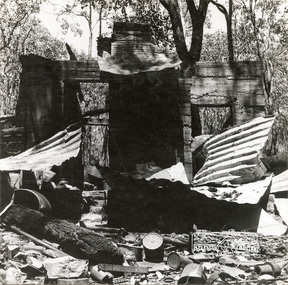
Photograph, George W. Bell, 'Windy' Gale's burnt out home, Wild Dog Creek Road, Jan. 1962, Jan 1962
... Eltham District Historical Society Inc 728 Main Rd Eltham melbourne Building of Pensioners Cottages at St Andrews; for those burnt out in the 1962 bushfires. A voluntary scheme of Mavis Gill through the Kangaroo Ground Relief Committee victorian bushfires - 1962 bushfires dick (windy) gale fire damage - buildings george w bell houses st andrews wild dog creek road mavis gill pensioners cottages 'Windy' Gale's burnt out home, Wild Dog Creek Road Photo Geo. ...Building of Pensioners Cottages at St Andrews; for those burnt out in the 1962 bushfires. A voluntary scheme of Mavis Gill through the Kangaroo Ground Relief CommitteeBlack and white photo mounted on card'Windy' Gale's burnt out home, Wild Dog Creek Road Photo Geo. W. Bell, Jan. 1962victorian bushfires - 1962, bushfires, dick (windy) gale, fire damage - buildings, george w bell, houses, st andrews, wild dog creek road, mavis gill, pensioners cottages -
 Eltham District Historical Society Inc
Photograph, George W. Bell, Mavis Gill making a turn near 'Windy' Gale's home, Wild Dog Creek Road, Jan. 1962, Jan 1962
... Eltham District Historical Society Inc 728 Main Rd Eltham melbourne Building of Pensioners Cottages at St Andrews; for those burnt out in the 1962 bushfires. A voluntary scheme of Mavis Gill through the Kangaroo Ground Relief Committee victorian bushfires - 1962 bushfires dick (windy) gale fire damage - buildings george w bell houses st andrews wild dog creek road mavis gill pensioners cottages Mavis Gill making a turn near 'Windy' Gale's place Wild Dog Creek area Photo Geo. ...Building of Pensioners Cottages at St Andrews; for those burnt out in the 1962 bushfires. A voluntary scheme of Mavis Gill through the Kangaroo Ground Relief CommitteeBlack and white photo mounted on cardMavis Gill making a turn near 'Windy' Gale's place Wild Dog Creek area Photo Geo. W. Bell, Jan. 1962victorian bushfires - 1962, bushfires, dick (windy) gale, fire damage - buildings, george w bell, houses, st andrews, wild dog creek road, mavis gill, pensioners cottages -
 Eltham District Historical Society Inc
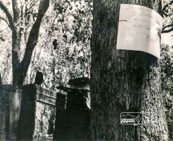
Photograph, George W. Bell, Message from 'Windy' Gale, Wild Dog Creek Road, Jan. 1962, Jan 1962
... Eltham District Historical Society Inc 728 Main Rd Eltham melbourne "Staying at Dinsdales up the hill, Windy" Building of Pensioners Cottages at St Andrews; for those burnt out in the 1962 bushfires. A voluntary scheme of Mavis Gill through the Kangaroo Ground ..."Staying at Dinsdales up the hill, Windy" Building of Pensioners Cottages at St Andrews; for those burnt out in the 1962 bushfires. A voluntary scheme of Mavis Gill through the Kangaroo Ground Relief CommitteeBlack and white photo mounted on cardMessage from resident Wild Dog Creek Road Photo Geo. W. Bell, Jan. 1962victorian bushfires - 1962, bushfires, dick (windy) gale, fire damage - buildings, george w bell, houses, st andrews, wild dog creek road, mavis gill, pensioners cottages, bill dinsdale -
 Eltham District Historical Society Inc
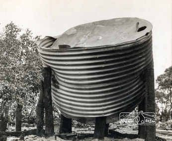
Photograph, George W. Bell, Christmas Hills bushfire, Jan. 1962, Jan 1962
... Eltham District Historical Society Inc 728 Main Rd Eltham melbourne Building of Pensioners Cottages at St Andrews; for those burnt out in the 1962 bushfires. A voluntary scheme of Mavis Gill through the Kangaroo Ground Relief Committee victorian bushfires - 1962 bushfires fire damage - buildings george w bell houses st andrews mavis gill pensioners cottages christmas hills water tank Christmas Hills bushfire Photo Geo. ...Building of Pensioners Cottages at St Andrews; for those burnt out in the 1962 bushfires. A voluntary scheme of Mavis Gill through the Kangaroo Ground Relief CommitteeBlack and white photo mounted on cardChristmas Hills bushfire Photo Geo. W. Bell, Jan. 1962victorian bushfires - 1962, bushfires, fire damage - buildings, george w bell, houses, st andrews, mavis gill, pensioners cottages, christmas hills, water tank