Showing 177 items matching "landscapes of significance"
-
 Melton City Libraries
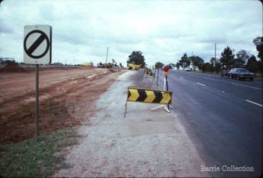
Photograph, Western Highway, 1983
... Landscapes of significance...It was the home of the family and stood for over 100 years. Landscapes of significance Misc. East of Reserve Road towards Ferris Road Western Highway Photograph Barrie Collection ...Construction of service road in front of the former Ann Dowling (Miers) 1866 Crown Grant, Title dated October 1870. She married Henri Miers in 1867.Their house was located on the site near the Myers Gully part of Ryans Creek. Built in 1867 and later named “Burnbank” by Martha Myers after the Street in Ballarat were she lived before arriving in Melton in 1907. She married Frederick Myers in 1908. He died in 1963, and Martha moved to a new home at 5 McKenzie Street Melton in 1968. Attempts made by the family to retain the historic cottage were unsuccessful. A demolition order imposed by the Housing Commission and it was pulled down by the family. It was the home of the family and stood for over 100 years.East of Reserve Road towards Ferris Roadlandscapes of significance, misc. -
 Melton City Libraries
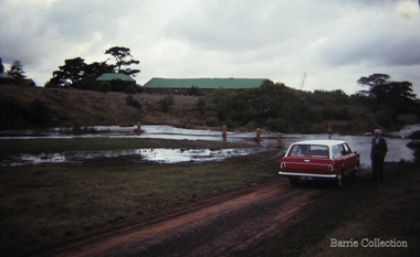
Photograph, Deanside, Kororoit Creek, Unknown
... Landscapes of significance...Melton City Libraries 31 McKenzie Street Melton melbourne Landscapes of significance Bon Barrie standing next to his car, Deanside property can be seen in the background of the photo. ...Bon Barrie standing next to his car, Deanside property can be seen in the background of the photo.landscapes of significance -
 Melton City Libraries
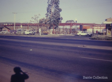
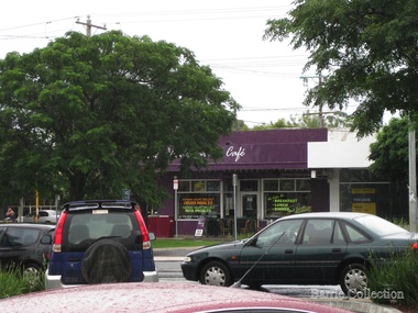
Photograph, High Street, Melton, c.1980
... Landscapes of significance...In 1973 Peter Staughton officially opened the newly located Lamp The Lamp has since been altered with the addition of an oval shaped lamp being placed above the capping. Landscapes of significance The development of McEwan Bakery Square. ...The Staughton Memorial Lamp 1903, memorial to Captain S.T Staughton, who died at an early age. The Staughton Memorial Lamp was removed from the High Street when the plantation trees removed and the road was rebuilt. 1970. The Lamp was taken to the Shire Council yard. The M&DHS investigated the location and state of the lamp, finding the base with its plaques and the column only. A photograph was taken while at the Council yard. An initiative of the M&DHS was set in motion to restore to monument and return it to the High Street. Peter Staughton a descendent of the family was approached and produced a design for the missing lamp section. After considerable deliberation it was agreed a capping would be appropriate for the top of the column. Architectural drawings were produced by Peter Staughton and students from RMIT were engaged to make the capping. The original lamp section as seen only in early newspaper photographs was not adopted due to the elaborate shape and the cost of production. The ongoing cost of replacing curved glass panes was a contributing factor in the choice of a capping. In 1973 Peter Staughton officially opened the newly located Lamp The Lamp has since been altered with the addition of an oval shaped lamp being placed above the capping. The development of McEwan Bakery Square. Magnet discount can be seen in the background.landscapes of significance -
 Melton City Libraries
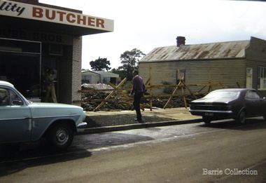
Photograph, High Street, Melton, c.1970
... Landscapes of significance...House of Parker, and K Masterson. Landscapes of significance Shops on the north side of High Street, Melton High Street, Melton Photograph Barrie Collection ...The shops pictured in the photographs include Andrews Real Estate–site of early bank, Riddell, Ross house “Iona”, Shelley Saddlery and Residence, Simpsons Butcher Shop, Backhouse Butcher, Carew and Miss Raleighs Shop. House of Parker, and K Masterson. Shops on the north side of High Street, Meltonlandscapes of significance -
 Melton City Libraries
Photograph, High Street, Melton, Unknown
... Landscapes of significance...Melton City Libraries 31 McKenzie Street Melton melbourne Landscapes of significance Shops on High Street, Melton High Street, Melton Photograph Barrie Collection ...Shops on High Street, Meltonlandscapes of significance -
 Melton City Libraries
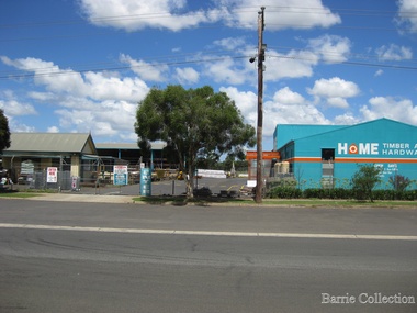
Photograph, Home Hardware, Unknown
... Landscapes of significance...Melton City Libraries 31 McKenzie Street Melton melbourne Landscapes of significance Mary Dowling and John Luby had a cottage built on Reserve Rd Melton, the current site of the hardware store Home Hardware Photograph Barrie Collection ...Mary Dowling and John Luby had a cottage built on Reserve Rd Melton, the current site of the hardware storelandscapes of significance -
 Melton City Libraries
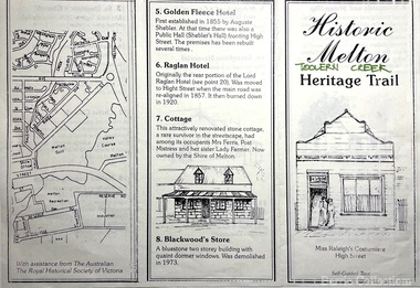
Pamphlet, Historic Melton Toolern Vale Heritage Trail, Unknown
... Landscapes of significance...Melton City Libraries 31 McKenzie Street Melton melbourne Landscapes of significance Local Architecture Tour of historic sites in Melton including Melton State School 430 and Uniting Church Historic Melton Toolern Vale Heritage Trail Pamphlet Barrie Collection ...Tour of historic sites in Melton including Melton State School 430 and Uniting Churchlandscapes of significance, local architecture -
 Melton City Libraries
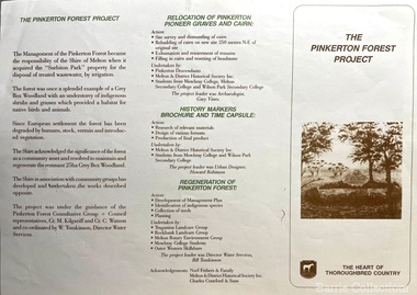
Pamphlet, The Pinkerton Forest Project, 1992
... Landscapes of significance...This occasion also marked the opening of the Pinkerton Forest Project, which saw 50 hectares of degraded woodland in Surbiton Park protected for regeneration". Landscapes of significance local identies Local special interest groups Pioneer Families Pamphlet about the relocation of the Pinkerton graves The Pinkerton Forest Project Pamphlet Barrie Collection ..."The Pinkerton family is remembered in Melton in part due to the historic graves of the original settler, Margaret Pinkerton, and four of her grandchildren, which were marked by a memorial cairn in 1931. Changes to sewage flood zoning in the area in the 1990s necessitated that these burials be relocated. Members of the Melton & District Historical Society oversaw a project to relocate the Pinkerton graves and cairn 200 metres from their original site to their current resting place at Mount Cottrell. This relocation ceremony took place on 8 November 1992, with the participation of local school students and with Pinkerton descendants playing a central role. This occasion also marked the opening of the Pinkerton Forest Project, which saw 50 hectares of degraded woodland in Surbiton Park protected for regeneration". Pamphlet about the relocation of the Pinkerton graveslandscapes of significance, local identies, local special interest groups, pioneer families -
 Melton City Libraries
Pamphlet, History & Folklore, Unknown
... Landscapes of significance...Melton City Libraries 31 McKenzie Street Melton melbourne Landscapes of significance Council Pamphlet about Melton's history History & Folklore Pamphlet Barrie Collection ...Pamphlet about Melton's historylandscapes of significance, council -
 Melton City Libraries
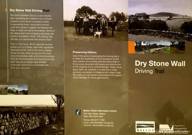
Pamphlet, Dry Stone Wall Driving Trail, Unknown
... ...Landscapes of significance...Council Landscapes of significance Dry Stone Wall trail brochure/pamphlet for visitors provided by Melton Visitor Information Centre Dry Stone Wall Driving Trail Pamphlet Barrie Collection ..."The dry stone walls provide a tangible link to the area’s white settlement, and they remain a symbol of the profound change in land usage from the original Kulin custodians to the European arrivals of the nineteenth century. The bulk of dry stone wall construction in Victoria occurred between the 1850s and 1880s. The gold rush of the early 1850s in particular inspired a flurry of construction. At this time, labour previously available for shepherding livestock dried up, as men gravitated to the goldfields to seek their fortunes. This necessitated the building of fencing to contain the district’s growing number of sheep, cattle and horses. An explosion in surveying, subdivision and the sale of Crown lands also contributed to a boost in construction. Government regulations that punished pastoralists for allowing their livestock to stray provided further incentive to fence-off previously open expanses of land. The major benefit of this type of fencing was that it utilised the materials at hand; the plentiful grey basalt that scattered the landscape. In the case of the dry stone walls built around Melton, the characteristic round or oval shape of the volcanic fieldstones on the western plains inspired some distinctive designs.54 Another advantage of dry stone walls was their ability to withstand the ravages of flood, fire and drought often experienced in the district. This durability accounts for the fact that many of these fences still exist today". Dry Stone Wall trail brochure/pamphlet for visitors provided by Melton Visitor Information Centrecouncil, landscapes of significance -
 Melton City Libraries
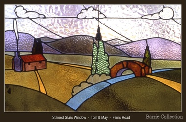
Decorative object, Stained glass window- Ferris Road, Unknown
... Landscapes of significance...Melton City Libraries 31 McKenzie Street Melton melbourne Tom and May Barrie lived on the family farm at Ferris Road Melton. Landscapes of significance Window from the Barrie family farm Stained glass window- Ferris Road Decorative object Barrie Collection ...Tom and May Barrie lived on the family farm at Ferris Road Melton. Window from the Barrie family farmlandscapes of significance -
 Melton City Libraries
Photograph, Old Gum Toolern Creek, Unknown
... Landscapes of significance...Melton City Libraries 31 McKenzie Street Melton melbourne Landscapes of significance Old Gum Toolern Creek from North side, Main Road. ...Old Gum Toolern Creek from North side, Main Road. landscapes of significance -
 Melton City Libraries
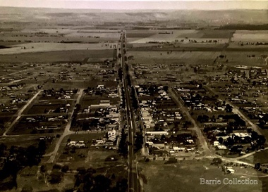
Photograph, Main Street, Melton, 1973
... Landscapes of significance...Melton City Libraries 31 McKenzie Street Melton melbourne Landscapes of significance Bird's eye view of Main Street, Melton, looking west. ...Bird's eye view of Main Street, Melton, looking west.landscapes of significance -
 Melton City Libraries
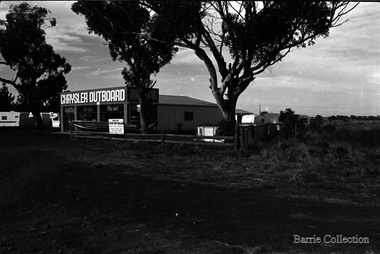
Photograph, Chrysler Outboard, 1975
... Landscapes of significance...Western Highway was changed to High Street. Landscapes of significance Chrysler Outboard, located on Western Highway, Melton. ...Photos taken by Bon Barrie. Western Highway was changed to High Street.Chrysler Outboard, located on Western Highway, Melton. Skin Inn Ballan advertisement on fencelandscapes of significance -
 Melton City Libraries
Photograph, Geoff Collins, Debbie, Coralie and Kim Barrie, 1987
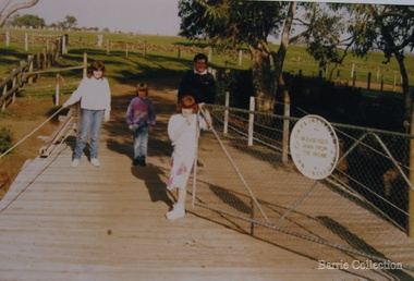
... ...landscapes of significance...Local identities landscapes of significance Geoff Collins, Debbie, Coralie and Kim Barrie entering Darlingsford property over bridge built in 1915 Geoff Collins, Debbie, Coralie and Kim Barrie Photograph Barrie Collection ...Charles Ernest Barrie b. Ballarat 1871 d. 1931 In May 1911 he purchased the property known as ‘Darlingsford.’ The name of the property is derived from Thomas Bell Darling the purchaser of 176 acres of Crown Grant land on the 29-3-1853 which formed part of the Barrie farm acreage. His three sons continued in the family farming tradition in Melton for the rest of their lives. By 1982 the last remaining connection with the ‘Darlingsford’ property and the Barries. Sons, Ernest (Bon) finally ceased. Edgar died in 1975, Ernest in 1985 and Tom in 1990. Bridge built in 1915. Geoff Collins, Debbie, Coralie and Kim Barrie entering Darlingsford property over bridge built in 1915local identities, landscapes of significance -
 Melton City Libraries
Photograph, Wendy Barrie on the Darlingsford Bridge, 1983
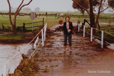
... ...landscapes of significance...He died in Jan 1887 Local identities landscapes of significance Photo was taken during the October floods Wendy Barrie on the Darlingsford Bridge Photograph Barrie Collection ...Property of Lot 1 Thomas Bell Darling 1853 1863 Ralph Parkinson 1887 Sold to Richard Manning (Cr and Hotelier) leased by John Walsh Minns family lived at the house in the time of Welsh. C Parkinson died in Jan 1887 Ralph Parkinson was a prominent citizen of Melton and was known for his generosity, and his involvement in the community and the Church of England. He had one daughter, his wife and other daughter died earlier. He died in Jan 1887Photo was taken during the October floodslocal identities, landscapes of significance -
 Melton City Libraries
Photograph, Myers Gully, 1935
... Landscapes of significance...Ann was a domestic servant in Williamstown and married Henri Miers in Melbourne in 1867.They built their house in Melton on the Ballarat road near the intersection of Reserveroad in 1867–Ryans Creek, referred to as Myers Gully Landscapes of significance Local identities pioneer families Myers Gully at the junction of Reserve Road, now known as Ryans Creek Myers Gully Photograph Barrie Collection ...Mary, Eliza and Ann Dowling arrived in Melbourne in June 1855 on the ship “Hotspur” as assisted immigrants. Mary married in Melton in 1857 to John Luby.The couple lived in Reserve Road Melton. Eliza married in Williamstown 1862 to William Daley a Bootmaker of Ann St, Williamstown. In 1865, Eliza and William lived in High Street Melton. Ann was a domestic servant in Williamstown and married Henri Miers in Melbourne in 1867.They built their house in Melton on the Ballarat road near the intersection of Reserveroad in 1867–Ryans Creek, referred to as Myers GullyMyers Gully at the junction of Reserve Road, now known as Ryans Creeklandscapes of significance, local identities, pioneer families -
 Melton City Libraries
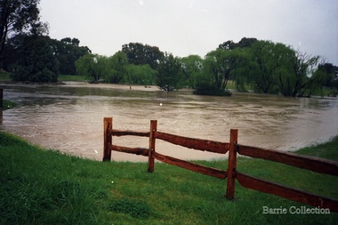
Photograph, Flood at Toolern Creek, Unknown
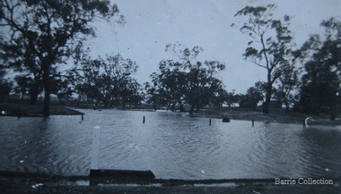
... Landscapes of significance...Melton City Libraries 31 McKenzie Street Melton melbourne Landscapes of significance Photos of a flood at Toolern Creek Flood at Toolern Creek Photograph Barrie Collection ...Photos of a flood at Toolern Creeklandscapes of significance -
 Melton City Libraries
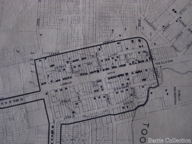
Map, Streets of Melton, 1963
... Landscapes of significance...From Walsingham Norfolk England WESTLEY Place Name of Jimmy Melrose Percival Gull Plane WESTLAKE Drive Early resident WHICKHAM Street Family Name Melton South WILSON Road Albert, Melton South YUILLE Street William Cross, early landowner, Rockbank run Landscapes of significance Zoomed in section of Melton Streets including Church and High Street Streets of Melton Map Barrie Collection ...MELTON’S STREETS Heritage Week 2014 What’s in a Name? Alphabetical List Aboriginal place names, Early Family Names and landowners, Agricultural, Shop and Commercial premises, Places and Events Melton & District Historical Society Street Naming Project 1972 – c 1998 Suburb Name – KURUNJANG - Kirkton, 1972, Brookfield, West, 1988 Melton and Town Centre - A joint collaboration with the Shire of Melton and Subdivision Developers ARNOLD Court – Family house - Arnolds Creek ALKEMADE Drive Family – Lime kilns Coimadia ALEXANDRA Street 1902 – Corination of King Edward VII and Queen Alexandra AVIATOR Place Event, location of plane crash – Jimmy Melrose 1936 Adina ?Annibee - Anniba? Agricultural Avon court .. .. BAKERY Square - Location of Jongebloed shop, bakehouse and stables BALUK Place Aboriginal BARLEYCORN Place Agricultural BILLING Place Name of Jimmy Melrose Uncle Noel Pemberton Billing BLACKWOOD Drive - Alexander Blackwood 1860c Registrar BARRIES Road C. E. Barrie “Darlingsford” farmer 1911, chaff mill owner BROOKLYN Road Staughton family residence. 1875 – Dismantled c 193? CAHILL Drive Family - Glenville Dairy CAMERON Court Family Canopus Place ? CANALLAN Drive Early Surveyor CAMPBELL Court Aviation – Melrose passenger 6th July 1936 CARBERRY Drive Michael, early landowner family CAREW Court Edward and Michael. Royal Hotel. Vera (Carew) Forran Singer - Opera CASEY Court Family CASHIN Court Family CHEVIOT Court Agriculture, breed of sheep CHESNEY Road was re named ( Minns Road being duplicated c 1973) CHRISTINA Crescent Christina McPherson, daughter of James and Mary Mary McPherson. Died 1955 aged 85 years COLLYER Close a deleted street (parallel to Yuille) re-used CORRIEDALE Road Breed of sheep CORR Court Teacher at first school, landowner CROXTON Court Name of the Hornbuckle and Knox family home DALEY Court - William Daley and family 1865 Bootmaker High Street DARLINGSFORD Boulevard - Name of early homestead Thomas B Darling 1853 DJERRIWARRH Court - Parish County of Bourke - very early map. DODEMAIDE Place Early land owners - Melton Football Team had 6 brothers playing c 1924 DONALD Court McPherson family 6 generations in Melton in 1936 DOUGAL Court DUNCAN Court .. .. DUNVEGAN Circuit Home of the McPherson family, castle Isle of Skye Name of bluestone house Smith Street (now at Willows) EMIL Court Jongebloed family EXELL Avenue Farming family Melton Sth- Closer Settlement 1907 EXFORD Road Exe former name of the Werribee river FARMER Court Name of early postmistress FERRIS Road John Ferris Farmer HANNAH Close First name of Hannah Watts – midwife HAYBALE Place Agricultural HELDER Court Early surveyor J Helder Wedge map HEWSON Street Winston Hewson Shire Engineer – check title c 1960 HENRY Street Township map c 1860 HESTON Street Heston Phoenix – C.J. Melrose plane HILDEGARDE Court Jimmy Melrose’s mothers name HOMESTEAD Close HORNBUCKLE Cres Farmers. Three members of family - Shire Presidents HURLEY Street Farmers IAIN Court Descendent of James and Mary McPherson JAMES MELROSE Drive Name appears on 2013 Melton information map JANG Place KURUN – jang KIRKTON Drive Name of the McPherson family home Toolern Vale Road KIRWIN Street Michael early landowners (deleted for freeway construction) KILPATRICKS Road Deleted when Barries Road was extended across Station Rd KOROROIT Court Early map, Parish of Kororoit. Creek name KNOX Circuit Family – Hornbuckle “Croxton Park” KURRUNJANG Drive Aboriginal name for people of the red earth – Suburb name Lara Place ? LLOYD Court Garage owners High Street. Laura lived to 100 years D 1955 LUBY Court John Luby – Crown Grant Land Title LITTLE Court MANNING Avenue Richard, hotel owner 1891 MARGARET Drive McPherson family McDONALD Street Melton South family name McKENZIE Street Township c1860 MORROW Street Early name MOWBRAY Crescent Name of English Melton, popularly believed origin of Melton MYERS Court Early setters c 1866 Crown Grant Land Title NIMMO Street Early name NIXON Street Name submitted by Mary nee Nixon Collins c1985 OLDERSHAW Road Early builder PALMERSTON Street Early township map c 1860 PEART Court Early name PENNYROYAL Avenue Plant growing by the creek. Early name used for the Toolern Toolam Creek PINKERTON Street Family name and early street map PINNACLE Crescent Agricultural - type of wheat PHOENIX Circuit C.J. Melrose Phoenix Heston Plane 2013 map PRATT Family PRIOR Court PYKE Place Brothers – early settlement 1838 RADFORD Court Land owners and business operators. Former Royal Hotel Grocer High Street demolished 1970 RAGLAN Court Hotel 19th century Lord Raglan RALEIGHS Road Oliver Reierson family (Norweigen) Shopkeeper – Dressmakers RIDDELL Drive (misspelt Riddle) Resident and land owner RODERICK Road McPherson family – a re occurring name ROLLAND Court Jones family ROSS Court Daniel. Landowner. Agnes Ross music teacher RUSSELL Court Robert. Early land surveyor of Melton 1853 RYAN Court Family early landowner. Member of the 1862 Road Board SHEBLER Place Augustus early Melton resident – Golden Fleece Hotel SHEEPFOLD Court Farming SHERWIN Court Sherwin Street earliest Township map– became Golf course SMITH Street Early township map. STRATHULLOH Circuit Strathtulloh Homestead. STAUGHTON Street Family – LARGE land owners Strachan ? SWANEY Court Marie Swaney earlier resident of Strathtulloh. SUTHERLAND Family name TOOLERN Street TOOLAM – TOOLERN Creek TULLIDGE St Road marked on 1861 map UNITT Street Early Township c 1860 WALLACE Square Cr Jack Wallace 5 terms as President 46 years unopposed WATTS Court Hannah Watts – midwife, cottage hospital WALSINGHAM Name of house of Minns family. From Walsingham Norfolk England WESTLEY Place Name of Jimmy Melrose Percival Gull Plane WESTLAKE Drive Early resident WHICKHAM Street Family Name Melton South WILSON Road Albert, Melton South YUILLE Street William Cross, early landowner, Rockbank run Zoomed in section of Melton Streets including Church and High Streetlandscapes of significance -
 Melton City Libraries
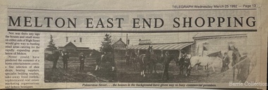
Newspaper, Melton East end shopping, 1992
... ...Landscapes of significance...Local Architecture Landscapes of significance Historical image of Palmerston Street in Melton Melton East end shopping Newspaper Barrie Collection Telegraph ...TOM COLLINS–from the reel to reel tape recording at Melton 1969 In the years between 1890 and to about 1913 Melton was a quiet little hamlet alongside the Toolern Creek, once called the Pennyroyal Creek, 24 miles from Melbourne on the Ballarat Road. There was a fair amount of woodland left around it, mostly grey and yellow box with sheoak, and golden wattle, which in spring time made a rather attractive setting. Most of the premises were in the main or High Street, with its line of elm and pepper trees on each side. Unitt, McKenzie and Henry streets each contained only a few dwellings. Hotels were four in number, Minns’s, Mrs Hay licencee, now Mac’s, Golden Fleece – Sheblers. The Royal or Ryan’s as it was then called, later Graham had the licence, and the Raglan - Kilpatricks had the licence and afterwards Tom Manning. This was situated about where Mr K. Young had his residence. There was a store attached to the hotel until about 1900. Both the Royal and the Raglan were delicensed, later on the Royal being converted to a green grocery and a boarding house, the Raglan was demolished. The Royal green grocery and boarding house was kept by E Carew and after he retired, E Radford. The Post and Telegraph Office was on the opposite side of the street to the Raglan Hotel about two doors west of the Shire Hall and was kept by Mrs Ferris and Lady Farmer until her retirement, when it was carried on by Miss Lottie Ross. A store was attached to the Post Office and was sometimes used as a store and at one time housed the National Bank. There were two full time banks at Melton, the other being the Commercial which built premises about 1904 and on the corner of High and Smith Streets, which it still occupies. Mr G Egan was the manager of the Commercial and Mr Stradling and later Mr Lee of the National. However as business was not thought good enough they reverted to a part time branch operated from Bacchus Marsh. Grocer shops were Chalmers, with a news agency and drapery now Arnolds, Jongebloeds had the bakery. Mr Fox also a produce merchant, was where Melton Real Estate is now, it was later occupied by Buchanans, Atleys, and Mrs Ross. Not long after the War Mrs Ross built the Post Office, since demolished where Miss Lottie Ross was the Post Mistress and later built the store which she conducted. It was later turned into a factory and in now the barbers shop. McNichols was just west of the Minns Hotel. He travelled as far a Ballan weekly, buying calves and dairy produce for sale in Melbourne. Afterwards he sold the business and bought Minns Hotel and changing the name to Macs. Blacksmiths were three in number. Blackwoods – later James Byrnes next door to Jongebloeds. Alex Cameron who learnt his trade with Blackwoods had his shop about the rear of where Ken Youngs Garage is now he later moved to the north west corner of High and Alexander Street. He was also the Registrar of Birth and Deaths and Electoral Registrar. After his retirement he was weighbridge keeper at Melton South. Two of his sons were engaged in the carpentry trade, but both died at an early age. Whittingtons shop was a few doors east of the Mechanics Hall and it was later occupied by Gordon Macdonald who did business there until about eight years ago. The butchers of the period were George Graham, that is where Mandy Lees hairdressing establishment is now. Euan MacDonald had premises later occupied by Whittingtons blacksmith shop. Later shifting next door. He left here about 1901, he slaughtererd animals at a slaughter house right where Chas Jones now resides, it had previously been a slaughter house and butcher shop of that site. George Spring also operated as a butcher for two or three years about the 1900 or so. Ted Simpsons shop was where John Kontek now has his Estate Agency, he used it as an branch shop from Bacchus Marsh bringing meat from there by a two horse lorry. Jimmy Butler the manager was well known and loved, his son was later a steeplechase jockey. The Court House and Police Station would be built sometime before 1900. The Constables at the time were McGuire, later Wade, Riely and McKenzie after that Robert Wilson and Seinfort were here, they were a bit later on. The Mechanics Hall was first opened by Ryan of the Royal Hotel who sold it to the Hall Committee. It was on Unitt Street and it was moved by McLellans the house shifters from Unitt Street to its present site. Bluestone premises formerly occupied by the bootmaker Carew, were later demolished and replaced by the brick frontage to the Hall. Keith Orensini [?] the local bricklayer built brick portion to the Hall. In the cottage adjoining the Hall a Frenchman named Baudin, had a boot repairing business.This cottage was the later residence of J Hill, a local carpenter and builder from whom I learnt my trade. Granny Watts was the well known local nurse and operated the Mid-Wifery Hospital in Yuille Street on the Sherwin Street corner. Mrs Nissen was on the opposite side of Yuille Street a short distance nearer the township. She conducted the laundry. Carew had a greengrocers shop next door to the Post Office in the High Street for some time before transferring to the Royal Hotel site. He also bought [?] calves for killing. W Cecil was a tank maker and also had a produce round, he lived on Pyke and Sherwin Street. Later Gus Shebler, builder and carpenter engaged in tank making being well known for good workmanship. Shebler was very energetic in forming the Gun Club which met for a good number of years where the golf course now has its headquarters. Of the four churches only three are in use, Christ Church, Scots and St Dominics. The Methodist closed down but later transferred to Melton South. Monthly stock sales were held at the yards in Unitt Street at Minns Hotel by McPhail Auctioneers, later held by McCarthur and McLeod. After the Council built the pound and sale yards they transferred sales to these premises, but lack of patronage caused them to be abandoned. A familiar sight in the district was blind Bob Nixon, who lived in a tumbled down cottage in Centenary Road near W Coburns, being led by his dog down the road to Melton, that is Palmerston street, to the Post Office, butcher and baker for his supplies and then back home. He was able to do his own cooking and other chores. Sundays he would come down Raleighs Road to the back of the church and tie his dog to a tree. Someone, mostly one of the boys would guide him into the church and out again after the service, when the dog would lead him home again. State School 430, a two roomed bluestone building it was the only school in the district, none at Melton South. The nearest would be Rockbank and Toolern Vale. Scholars had a fair distance to walk in most cases. The teachers were Mr T Lang Headmaster. I put a query here, Miss Winters, I’m not certain of the name, Mrs Skinner and Miss Silke as Assistant Teachers. Miss Augusta Cecil and Miss Maud Lang were Junior teachers. One boy who attended the school about the turn of the century was Hector Fraser who resided with his parents in Keilor Road, where Jim Gillespie now lives. He was an excellent gun shot and at the age of about 17 years his father took him to France or Monaco where he won the Gran Prix for pigeon shooting and became the champion boy shot of the world. However he died there from pneumonia. He shot under the name of “Parvo”. The Melbourne Hunt Club used to meet in Keilor Road north side just east of the Toolern Creek on what was originally Pykes Run. This was also the place where the races were held and the Sports Meetings. Dave Murphy, employed at Clarke’s Rockbank Station usually provided the fox which he liberated for the Club. Greyhound coursing was usually held on Moylans property Mt Kororoit, or Mt Misery as it was known then. Later it was held at Melton Park, Mr Matt Carberry was the judge and Percy Cook the slipper. Early in the 1900’s the Recreation Park was created and the Caledonian and the ANA sports meetings were held there, they were annual events. L Paterson from Melton South was a successful competitor in all the cycling events as a young man. He later in life became the Deputy Chief Officer of the Metropolitan Fire Brigade. The present Chief Officer of the Fire Brigade is John Paterson, nephew of his, and spent his early life in Exford where his father was manager of the Exford Estate. Notes Tom Collins was born c 1895. He lived on the south side of the Ballarat Road near the intersection of Keilor Road.Historical image of Palmerston Street in Meltonlocal architecture, landscapes of significance -
 Melton City Libraries
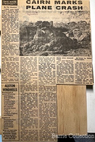
Newspaper, Cairn marks plane crash, 1976
... ...Landscapes of significance...Local Significant Events Landscapes of significance Regional Gazette article of a cairn erected by locals near the scene of the plane accident which involved Jimmy Melrose, and passenger, Alexander Campbell Cairn marks plane crash Newspaper Barrie Collection Regional Gazette ..."On 5 July 1936, locals in Melton South saw a plane emerge from behind clouds above the railway station, in heavy wind and rain. Engine roaring, the plane went into a spin and disintegrated into pieces in mid-air, before crashing to the ground near Arnold’s Creek. The pilot, young Australian aviator Jimmy Melrose, and a passenger, Alexander Campbell, were killed.Jimmy Melrose was a popular figure in international aviation, having been the youngest and only solo pilot to finish the London to Melbourne Centenary Air Race in 1934. His death, at the age of just twenty-two, caused an outpouring of sorrow. He was honoured with a state funeral two days later at St Paul’s Cathedral in Melbourne, which was attended by thousands of people. Locals Maisie Arthur, Ted Wickham and Bill Cahill gave eyewitness accounts of the accident to the authorities, and an inquest found that it was the result of structural failure and poor weather. A cairn erected by locals near the scene was reconstructed by the Melton and District Historical Society in Brookfield, opposite the Melrose Memorial Reserve, on the 40th anniversary of the crash in 1976".Regional Gazette article of a cairn erected by locals near the scene of the plane accident which involved Jimmy Melrose, and passenger, Alexander Campbelllocal significant events, landscapes of significance -
 Melton City Libraries
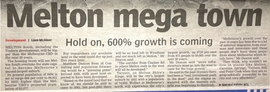
Newspaper, Development of Melton Newspaper articles, 2011, 2015
... Landscapes of significance...Melton City Libraries 31 McKenzie Street Melton melbourne Landscapes of significance Newspaper articles from Melton leader and Star Real Estate relating to the development of Melton South Development of Melton Newspaper articles Newspaper Barrie Collection Star Real Estate Melton Leader ...Newspaper articles from Melton leader and Star Real Estate relating to the development of Melton Southlandscapes of significance -
 Melton City Libraries
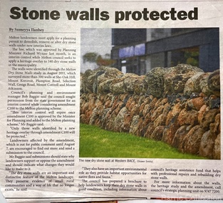
Newspaper, Stone Walls protected, 2015
... Landscapes of significance...It also seeks to increase the level of training of skilled and semi skilled wallers, and the gaining of rudimentary skills by farmers so that they can maintain their own walls". Landscapes of significance Melton Star Weekly article about the Stone Walls Stone Walls protected Newspaper Melton Star Weekly Barrie Collection ...Dry stone construction as a technique is used for much more than paddock walls. Across the volcanic plains of western Victoriaare marvelous sheep dips, stock loading ramps, huts, dams, retaining walls, and the rich and largely undiscovered heritage of indigenous dry stone structures. Dry stone walls indicate many aspects of our rural environment; the geological beginnings of the way the landscape was created, the patterns of early settlement by pastoralists and squatters, the types of stock that grazed the land and the methods of cattle and sheep management, of the efforts to thwart the spread of rabbits .... "For the casual but interested observer dry stone walls are good to look at, to photograph, to get up alongside and see the way they are constructed, to appreciate the varying shapes and sizes of stones and learn of the techniques of keeping often quite rounded stones in place. Apart from walls and other dry stone structures on grazing land we can also see dry stone techniques used in other places and in other phases of our history. Indigenous Australians have built, and continue to build, structures for shelter or hunting or trapping eels and fish in rivers and estuaries around the country. At spots around our coast line there is evidence of simple stone structures built by early maritime explorers. Prospectors in early mining encampments used dry stone construction to build retaining walls or the low walls of rudimentary shelters. If the future of dry stone walls in the Australian landscape is to be assured. wall owners and local governments have to accept and embrace their custodial role in assuring the preservation and celebration of walls. This is not an easy task, but, along with putting the necessary statutory mechanisms to ensure their retention, it is a task that must be pursued. The Dry Stone Walls Association of Australia has as its primary goal the increase in awareness of wall owners and local governments of the importance of dry stone walls. It also seeks to increase the level of training of skilled and semi skilled wallers, and the gaining of rudimentary skills by farmers so that they can maintain their own walls". Melton Star Weekly article about the Stone Wallslandscapes of significance -
 Melton City Libraries
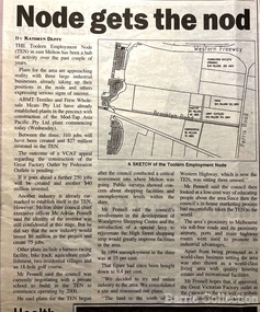
Newspaper, Node gets the nod, 1998
... Landscapes of significance...Melton City Libraries 31 McKenzie Street Melton melbourne Landscapes of significance Express Telegraph article about the Future Project for the Toolern Employment Node Node gets the nod Newspaper Barrie Collection Express telegraph ...Express Telegraph article about the Future Project for the Toolern Employment Nodelandscapes of significance -
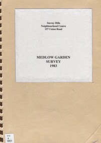
 Surrey Hills Historical Society Collection
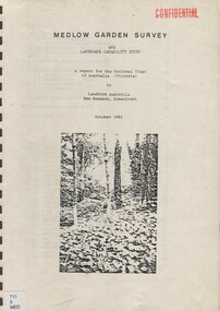
Book, Medlow Garden Survey and Landscape capability study 1983, Oct-83
... Includes landscape history, cultural significance, particulars about vegetarian, garden, rehabilitation and plans....Includes landscape history, cultural significance, particulars about vegetarian, garden, rehabilitation and plans. 38 p ill...Includes landscape history, cultural significance, particulars about vegetarian, garden, rehabilitation and plans. 38 p ill Medlow Garden Survey and Landscape capability study 1983. ...Includes: Plan of Subdivision, Detailed plan, map of garden, Auctioneer's plan for 1854 sale, Botanical plan of Medlow & Landscape history notes. Full title : Medlow Garden survey and landscape capability survey. A report for the National Trust of Australia (Victoria) A report detailing the landscape survey of Medlow Garden estate. Includes landscape history, cultural significance, particulars about vegetarian, garden, rehabilitation and plans.A report detailing the landscape survey of Medlow Garden estate. Includes landscape history, cultural significance, particulars about vegetarian, garden, rehabilitation and plans. 38 p illland surveys, medlow garden, bismark estate, rosalie estate, warrigal road, surrey hills, bismarck avenue, warwick avenue, t p payne, (mr) hugh glass, boroondara, (maj.) (mr) - cairncross, (mrs) mary jane cairncross, (dr)(mr) richard joseph bull, (mrs) catherine grace bull, (miss) norma bull, (mr) ronald richard bull, medlow, house names, (mr) rex swanson, landform australia -
 Surrey Hills Historical Society Collection
Book, Medlow Garden Survey and Landscape capability study 1983, Oct-83
... Includes landscape story, cultural significance, particulars about vegetarian, garden, rehabilitation and plans....Includes landscape story, cultural significance, particulars about vegetarian, garden, rehabilitation and plans. 38 pages with illustrations....Includes landscape story, cultural significance, particulars about vegetarian, garden, rehabilitation and plans. 38 pages with illustrations. ...Includes: Plan of Subdivision, Detailed plan, map of garden, Auctioneer's plan for 1854 sale, Botanical plan of Medlow & Landscape history notes. Full title : Medlow Garden survey and landscape capability survey. A report for the National Trust of Australia (Victoria) A report giving a detailed landscape survey of Medlow Garden estate. Includes landscape story, cultural significance, particulars about vegetarian, garden, rehabilitation and plans.Copy of a report giving a detailed landscape survey of Medlow Garden estate. Includes landscape story, cultural significance, particulars about vegetarian, garden, rehabilitation and plans. 38 pages with illustrations.land surveys, medlow garden, bismark estate, rosalie estate, warrigal road, surrey hills, bismarck avenue, warwick avenue, t p payne, (mr) hugh glass, boroondara, (mr) (maj) - cairncross, (mrs) mary jane cairncross, (dr) (mr) richard joseph bull, (mrs) catherine grace bull, (miss) norma bull, (mr) ronald richard bull, medlow -
 Ballarat Heritage Services
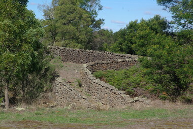
Photograph - Colour, Bessibelle Drystone Sheep Wash, 2016, 24/04/2016
... The Bessiebelle sheepwashes and yards are of landscape significance as a cultural landscape which has been both modified by, and cleverly adapted to, an annual process that was of critical importance within the pastoral calendar. ...The Bessiebelle sheepwashes and yards are of landscape significance as a cultural landscape which has been both modified by, and cleverly adapted to, an annual process that was of critical importance within the pastoral calendar. ...The Bessiebelle Sheepwashes and Yards complex is located on the former 14,000 acre Ardonachie Run, established in 1848 by pastoralist Samuel Gorrie, then carrying 6,000 sheep. In 1864 this run was subdivided into smaller runs, and the sheep washes were located within Mount Eccles and Lake Gorrie Run. The date of construction of the washes and walls is not known, although they were probably constructed within the period 1848-1864. The Bessiebelle Sheepwashes and Yards are probably the largest and most sophisticated surviving example of a traditional pastoral property sheepwash in Victoria. They clearly demonstrate the large network of races, yards and folds necessary for washing thousands of sheep over a short period of time. The Bessiebelle sheep washes apparently predate later technological changes and the necessity for hot water washing. The Bessiebelle sheepwashes and yards are of landscape significance as a cultural landscape which has been both modified by, and cleverly adapted to, an annual process that was of critical importance within the pastoral calendar. The drystone walls and races appear to evolve from the rocky terrain, and have a strong organic affinity with the prevailing harsh landscape. The drystone walls demonstrate a high level of craftsmanship and skill in their construction, and reflect the extensive scale of pastoral operations across the landscape. The Bessiebelle sheepwashes and yards are of archaeological significance to the State of Victoria. The site has not been fully surveyed but its complexity strongly suggests a potential to reveal more about the washing processes and associated pastoral occupation and activity in the area.(Heritage Victoria)drystone, bessibell, sheep race, sheep wash, agriculture -
 Eltham District Historical Society Inc
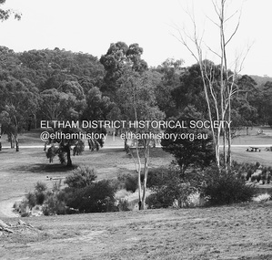
Photograph - Digital Photograph, Alan King, Alistair Knox Park, Eltham, 2008
... Covered under National Trust of Australia (Victoria) Landscape Significance and Heritage Overlay, Nillumbik Planning Scheme. ...Covered under National Trust of Australia (Victoria) Landscape Significance and Heritage Overlay, Nillumbik Planning Scheme. ...Alistair Knox Park, an oasis of peace and beauty. Covered under National Trust of Australia (Victoria) Landscape Significance and Heritage Overlay, Nillumbik Planning Scheme. Published: Nillumbik Now and Then / Marguerite Marshall 2008; photographs Alan King with Marguerite Marshall.; p173 It is hard to imagine that the Alistair Knox Park, an oasis of peace and beauty beside busy Main Road, Eltham, was once the township’s rubbish dump. It was only in the 1970s that the tip was transformed into this beautiful six hectare space, which later earned it a National Trust Landscape classification. Before its life as a dump, the area was used for small farms. Thanks largely to the foresight and efforts of local environmental builder Alistair Knox, the park was designed sympathetically with the character of the wider Eltham landscape. Then, appropriately, the park was named after Knox, who was an Eltham Shire Councillor from 1971 to 1975 and Shire President in 1975. The park designers were four major forces in the urban bush landscape garden –Knox, landscape designer Gordon Ford, artist Peter Glass and landscaper Ivan Stranger. The National Trust citation for the park, originally called Eltham Town Park, includes the Eltham railway trestle bridge and the Shillinglaw Cottage. The citation states ‘the semi-natural setting of the parkland provides a landscape which is evocative of the history of the area’. Manna Gums (Eucalyptus viminalis) and Candlebarks (Eucalyptus rubida) are significant features. Most of the park’s construction was directed by Bob Grant, Superintendent of the Parks and Gardens Department for the Eltham Shire Council. First plantings occurred in Arbour Week in 1973, then the lake and botanic area were completed in 1975, with Federal Government funding, and the toilet block in 1978. Bounded by the Eltham railway line, Panther Place, Main Road, Bridge and Susan Streets, the park is in a valley about a kilometre wide overlooked by steep hills at the east and west. The Diamond Creek flows through it and the picturesque historic timber trestle railway bridge edges the north. Informal plantings of Australian indigenous and native species in open and undulating grassed settings blend with the natural landscape of the Diamond Creek to the west. The bush-style plants, particularly around the creek, balance with open lawns, paths and a cascade flowing from a small lake to another below. A footbridge over the creek leads to the park’s west. The park includes an adventure playground and barbecue areas. The park stands on part of the land bought from the Crown in 1851 by Josiah Holloway, who subdivided it into allotments and which he called Little Eltham. Most of the land was subdivided into residential lots, but the creek valley, on which the park stands, was subdivided into farm-size lots, used mainly for orchards and grazing. One of the earliest owners was John Hicks Petty, who in 1874 bought a plot from Holloway. Other families who owned properties in that area, included Rees, Clark, Waterfall, Graham, Hill and Morant. In 1901 the railway was built through the area. Jock Read, an Eltham resident since around 1920, remembers several farms in the 1920s and ’30s that occupied the site of today’s park. A poultry farm, which extended from present day Panther Place, was owned by the Gahan family. Next to that farm was another for grazing cattle owned by Jack Carrucan. Beside this was land owned by John Lyon. A doctor lived beside this, and at the north-west corner of Bridge Street and Main Road stood a memorial to the soldiers who died in World War One, which was later moved to the RSL site. Mr Read also remembers other farms and orchards west of the creek In the early 1960s the Eltham Council began buying these farms and in the late 1960s turned the areas east of the Diamond Creek into a garbage tip. When this was filled above the creek’s flood plain, the tip was moved to the west of the creek.This collection of almost 130 photos about places and people within the Shire of Nillumbik, an urban and rural municipality in Melbourne's north, contributes to an understanding of the history of the Shire. Published in 2008 immediately prior to the Black Saturday bushfires of February 7, 2009, it documents sites that were impacted, and in some cases destroyed by the fires. It includes photographs taken especially for the publication, creating a unique time capsule representing the Shire in the early 21st century. It remains the most recent comprehenesive publication devoted to the Shire's history connecting local residents to the past. nillumbik now and then (marshall-king) collection, alistair knox park, eltham -
 Warrnambool and District Historical Society Inc.
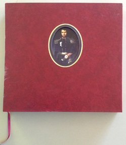
Book, La Trobe Journal and Art Works Vol 1 & Vol 2, 1999
... landscapes and sketches of Charles La Trobe, the Superintendent of the Port Phillip District of New South Wales (1839- 1851) and Lieutenant Governor of the colony of Victoria (1851-54 ). La Trobe is regarded as the man most responsible for the establishment of Warrnambool in 1847. His diaries document his trips to the Warrnambool region in 1845, 1846, 1848 and 1849 before and after the town site was settled. These volumes are of artistic significance ...These volumes reproduce the diary material and the landscapes and sketches of Charles La Trobe, the Superintendent of the Port Phillip District of New South Wales (1839- 1851) and Lieutenant Governor of the colony of Victoria (1851-54 ). La Trobe is regarded as the man most responsible for the establishment of Warrnambool in 1847. His diaries document his trips to the Warrnambool region in 1845, 1846, 1848 and 1849 before and after the town site was settled.These volumes are of artistic significance being beautifully and expensively produced. The volumes contain information of vital importance to our knowledge of our early Warrnambool history. Other important details in the diary include information on early shipwrecks and the first settlers in our district in our district, especially the Allan brothers..1 This is a burgundy leather bound book of 380 pages. It has gold lettering on the cover and the spine and an oval inset in the centre of the front cover containing a coloured portrait of Charles La Trobe. The pages contain black and white and coloured art works and sketches and printed material. There is a burgundy coloured ribbon for marking pages The book is encased in a hard leather cover with a cut out window with gold edging. .2 This is a burgundy leather bound book of 343 pages. It has gold lettering on the cover and the spine and a rectangular inset in the centre of the front cover containing a coloured sketch of a rock, sea and cliffs drawn by Charles La Trobe. The pages contain sepia and black and white drawings and printed material. There is a burgundy coloured ribbon for marking pages. The book is encased in a hard leather cover with a cut out window with gold edging . .1 Charles Joseph La Trobe AUSTRALIAN NOTES 1839-1854 .2 Charles Joseph La Trobe LANDSCAPES AND SKETCHES charles la trobe, early warrnambool, la trobe journals -
 Kiewa Valley Historical Society
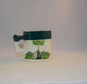
Mug Stoneware
... Due to the connections Bill Waters has with the Bogong High Plains and Mt Bogong this cup has a lot of significance to the social history of the area.. fowler ceramics local alpine history alpine rovers scouts mugs mt bogong bogong high plains Written inscription on the front "Bill Bogong's Mug" in large print and beneath it, in smaller print, "with compliments from Flinders Petrie Rover Crew" The other side of the mug is a free hand landscaped drawing of green bush and blue hills with a tree supporting a tent and a camp fire (with smoke rising from it).To the left of the inscription is the Scout (Rover) emblem coloured black with an unraveled and unwritten signage scroll Round glazed stoneware mug, white in colour, with a heritage green coloured band covering the top rim and handle. ...This ceramic mug is titled "Bill Bogong's Mug" in honour of one of Australia's Scouting (Rovers) notable office holders, Mr.W.F."Bill" Waters. He was born on 22nd August 1897 in Taralgon, Victoria, Australia and died 8th October 1968 in Fitzroy, Victoria. He was instrumental in the Rovers building two chalets in the Victorian Alps. The Victorian Award of the National Rover Service Award(1980) has been named after Bill Waters. Bill Waters was also the leader of the first team that climbed Mount Bogong in winter in 1929. Also was part of rescue team of what is now know as the Cleve Cole tragedy on Mt Bogong in the mid 1930's. There is also a water fall named after him Waters Falls on the Bogong High Plains. W.F."Bill" Waters aka "Bill Bogong" (Bogong mountain, were his ashes were scattered), was not only a prominent bush walker (Melbourne Walking Club) of the high country (Victorian Alps) but was instrumental in establishing two Chalets. One of these Chalets was the first one to be built on the Bogong High Plains. This item, "Bill Bogong's Mug" is what the Flinders Petrie(famous English Egyptologist/Archaelogist) Rover Crew(formed in 1940) presented newly invested members of the exclusive(200 membership) Alpine Rover Crew. The Melbourne Walking Club has a long history with the Victorian High Plains area, of which the Kiewa Valley is an integral part of the Victorian Alpine Region. Due to the connections Bill Waters has with the Bogong High Plains and Mt Bogong this cup has a lot of significance to the social history of the area.. Round glazed stoneware mug, white in colour, with a heritage green coloured band covering the top rim and handle. Written inscription on the front "Bill Bogong's Mug" in large print and beneath it, in smaller print, "with compliments from Flinders Petrie Rover Crew" The other side of the mug is a free hand landscaped drawing of green bush and blue hills with a tree supporting a tent and a camp fire (with smoke rising from it).To the left of the inscription is the Scout (Rover) emblem coloured black with an unraveled and unwritten signage scroll fowler ceramics, local alpine history, alpine rovers, scouts, mugs, mt bogong, bogong high plains