
Showing 177 items matching "line marking"
-
 Ballaarat Mechanics' Institute (BMI Ballarat)
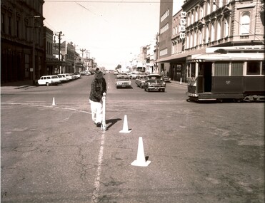
Armstrong St line marking
... Armstrong St line marking...Please contact BMI for all print and usage inquiries. ballarat armstrong st roadworks 1960s Armstrong St line marking ...This photograph is from the Max Harris Collection held by the Ballaraat Mechanics' Institute. Please contact BMI for all print and usage inquiries. ballarat, armstrong st, roadworks, 1960s -
 Melbourne Tram Museum
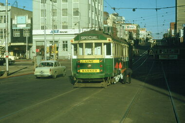
Slide - Melbourne tram works La Trobe and Elizabeth Sts, Warren Doubleday, 5/73
... ...line marking...Set of 3 colour slides of overhead and tram track line marking at the intersection of Elizabeth and La Trobe St as part of the work for the future work on Melbourne Museum station and the removal of buildings along La Trobe St and the connecting curve between La Trobe and Elizabeth Sts. ...Set of 3 colour slides of overhead and tram track line marking at the intersection of Elizabeth and La Trobe St as part of the work for the future work on Melbourne Museum station and the removal of buildings along La Trobe St and the connecting curve between La Trobe and Elizabeth Sts. ...Set of 3 colour slides of overhead and tram track line marking at the intersection of Elizabeth and La Trobe St as part of the work for the future work on Melbourne Museum station and the removal of buildings along La Trobe St and the connecting curve between La Trobe and Elizabeth Sts. Early May 1973. Has the line marker tram W2 233 in operations and photos of the overhead trucks. In the background are the ANZ Bank and the Argus buildings,Yields information about La Trobe St prior to the construction of Melbourne Central station work commencing.Colour slide - Kodak cardboard mount - set of 3Has in pencil slide number "5/7/8 to 10"tramways, la trobe st, museum station, elizabeth st, overhead, w2 class, line marking, tram 233 -
 Tatura Irrigation & Wartime Camps Museum
Template - shoe sole, 1940's
... Has small holes punched around edge and pencil line markings...Has small holes punched around edge and pencil line markings Template - shoe sole ...Made by internee in Camp 3hardcard template/pattern for shoe sole. Has small holes punched around edge and pencil line markingsG W Neutatura, trades, leatherworking -
 Melbourne Tram Museum
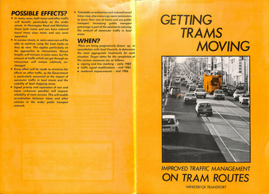
Pamphlet, Minister of Transport, "Getting Trams Moving - Improved Traffic Management on Tram Routes", 1984
... Has diagrams of the various roads and line markings. Published by the Ministry of Transport 1984....Has diagrams of the various roads and line markings. Published by the Ministry of Transport 1984. ...Pamphlet - special size - printed on orange paper, four fold titled "Getting Trams Moving - Improved Traffic Management on Tram Routes" giving details of new road traffic regulations for line marking on roads used by trams. Gives background to the work, traffic signals controlled by SCRAM and dates. Has diagrams of the various roads and line markings. Published by the Ministry of Transport 1984.trams, tramways, traffic control, traffic lights, tramways, rta -
 Ballarat Clarendon College
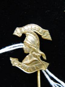
Lapel pin
... Pin stem has four line markings at midway point. ...Pin stem has four line markings at midway point. Lapel pin Lapel pin ...Lapel pin worn by Alister Cannon in 1953. Alister boarded at Ballarat College 1950-1953. UniqueGold-plated lapel pin featuring Minerva head with upper and lower scrolls. Upper scroll engraved with 'BALLARAT' and lower scroll with 'COLLEGE'. Pin stem has four line markings at midway point. alister-cannon, lapel-pin, ballarat-college, boarding -
 Lakes Entrance Historical Society
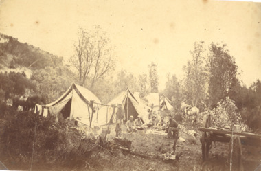
Photograph, Geodetic line, the border between NSW and Victoria, 1860 c
... Sepia toned photograph showing Geodetic camp of the survey team working on the Geodetic line marking the border between N S W and Victoria from Cape Howe to nearest source of the Murrary River Gippsland Victoria...Public Works Road Construction and Maintenance Sepia toned photograph showing Geodetic camp of the survey team working on the Geodetic line marking the border between N S W and Victoria from Cape Howe to nearest source of the Murrary River Gippsland Victoria Geodetic line, the border between NSW and Victoria Photograph ...Sepia toned photograph showing Geodetic camp of the survey team working on the Geodetic line marking the border between N S W and Victoria from Cape Howe to nearest source of the Murrary River Gippsland Victoriapublic works, road construction and maintenance -
Clunes Museum
Equipment - PLUMB BOB
... ATTACHED TO THE END OF THE TAPE IS A BRASS CONNECTOR AND A BRASS WEIGHT WITH NUMBERS AND LINE MARKINGS. WEIGHT TAPERS TO A POINT....ATTACHED TO THE END OF THE TAPE IS A BRASS CONNECTOR AND A BRASS WEIGHT WITH NUMBERS AND LINE MARKINGS. WEIGHT TAPERS TO A POINT. Equipment PLUMB BOB ...TOOL HAS A WOODEN HANDLE PAINTED BLACK AND A ROLL OF METAL TAPE. THERE IS A STAINLESS STEEL HANDLE TO WIND TAPE IN AND OUT. ATTACHED TO THE END OF THE TAPE IS A BRASS CONNECTOR AND A BRASS WEIGHT WITH NUMBERS AND LINE MARKINGS. WEIGHT TAPERS TO A POINT.J RABONE & SONS MADE IN ENGLAND I.P.M. 9surveying, plumb bob, equipment -
The 5th/6th Battalion Royal Victoria Regiment Historical Collection
Container - Candelarbra, Silver 3 prong Candelarbra
... Large 3 pronged candelarbra in line. No markings or inscriptions present. Ornate decrotive markings all round....Candelarbra 5-6 RVR BHQ Large 3 pronged candelarbra in line. No markings or inscriptions present. Ornate decrotive markings all round. ...CandelarbraLarge 3 pronged candelarbra in line. No markings or inscriptions present. Ornate decrotive markings all round.5-6 rvr bhq -
 Melbourne Tram Museum
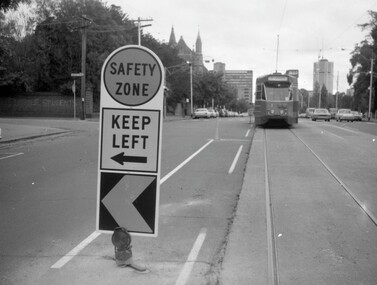
Negative - Safety Zone sign - Nicholson St, Hugh Ballment, c1976
... Would appear that line marking and sign is new. Photo taken near the Exhibition buildings, c1976 - possibly part of the project described in item 342....Would appear that line marking and sign is new. Photo taken near the Exhibition buildings, c1976 - possibly part of the project described in item 342. ...The photograph shows a safety zone sign in Nicholson St Fitzroy, with Z class tram No. 3 in the distance. Would appear that line marking and sign is new. Photo taken near the Exhibition buildings, c1976 - possibly part of the project described in item 342.Yields information about the installation of a safety zone in Nicholson St c1976.Negative - 127 film black and white.tramways, tramcars, z class, tram 3, nicholson st, safety zone -
 Glenelg Shire Council Cultural Collection
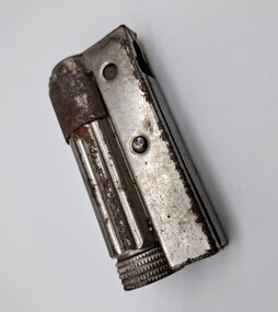
Functional object - Cigarette Lighter, Imco Triplex, mid 1900s
... It has a cylinder to one side which has vertical line markings. The cylinder also has a rusted metal band around it. ...It has a cylinder to one side which has vertical line markings. The cylinder also has a rusted metal band around it. ...Silver coloured metal lighter. It has a cylinder to one side which has vertical line markings. The cylinder also has a rusted metal band around it. The top of the cylinder has 5 lines of little dot markings which go round the circumference of the top. Attached to the cylinder is a rectangular piece of metal. This has the spark wheel in it. The spark wheel is at the same end as the rusted metal band. The base of the lighter has a maker's mark attributing it to Imco Triplex.IMCO TRIPLEX / Patent Austria -
 Ballarat Tramway Museum
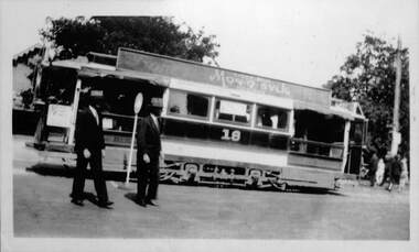
Photograph - Laminated - ESCo 18 Wendouree Parade
... The safety zone and line markings are unusual in Ballarat where passengers alighted or boarded on the lake side of the roadway. ...The safety zone and line markings are unusual in Ballarat where passengers alighted or boarded on the lake side of the roadway. ...Photograph of Electric Supply Co. of Vic (ESCo) Ballarat tram 18 in Wendouree Parade with the Gardens Kiosk in the background. Tram has a roof advertisement for Monosylk hosiery. There is a safety zone sign and two gentlemen standing alongside. The safety zone and line markings are unusual in Ballarat where passengers alighted or boarded on the lake side of the roadway. A related item could be 5904 which shows ESCo tram 9 offloading passengers on the "wrong side" for Ballarat at this location and a sign in position. Possibly a special event or a trial. Photo possibly mid 1920sYields information about the use of a safety zone sign in Ballarat and tram 18Laminated laser print photograph black and whitesafety zone, wendouree parade, ballarat, tram 18, esco, events, monosvlk -
 Ballarat Tramway Museum
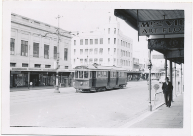
Photograph - SECV Geelong 39 in Ryrie St, Wal Jack, 1/01/1956
... Note the parking signs and the line marking on the roadway for car parking. The tram in the distance could be No. 5. i1 - scan of print in the album i2 - rear of image i3 - scan of negative at 3200dpi added 27/6/2020. ...Note the parking signs and the line marking on the roadway for car parking. The tram in the distance could be No. 5. i1 - scan of print in the album i2 - rear of image i3 - scan of negative at 3200dpi added 27/6/2020. ...Black and White print contained within the Wal Jack Bendigo and Geelong Album, see Reg Item 5003 for more details. Photo of Geelong No 39 in Ryrie St, 1-1-1956. Photo by Wal Jack. Tram has the destination of West. In the background is the T&G building, Belchers Corner, Miss Vic? Art Florist store. Note the parking signs and the line marking on the roadway for car parking. The tram in the distance could be No. 5. i1 - scan of print in the album i2 - rear of image i3 - scan of negative at 3200dpi added 27/6/2020. Black & White photo with photographers notes on the rear and an associated negative.On rear in ink SEC Geelong, No. 39 (now Ballarat's 41) from East to West, Ryrie St Geelong 1-1-56". Has the Wal Jack copyright stamp in the top right hand corner with the number T1297 written in.trams, tramways, geelong, ryrie st, tram 39 -
 Tennis Australia
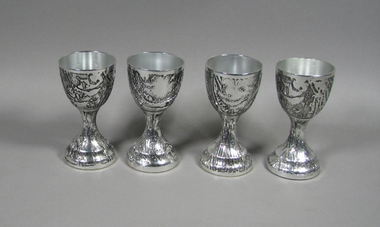
Drinking vessel, Don Shiel, 1970s
... From his Stalactite series. Suede lined bases. No markings. Materials: Metal, Suede leather ...From his Stalactite series. Suede lined bases. No markings. Materials: Metal, Suede leather Drinking vessel Don Shiel ...Set of four textured silver(plated) goblets made by Don Shiel. From his Stalactite series. Suede lined bases. No markings. Materials: Metal, Suede leather tennis -
 Bendigo Historical Society Inc.
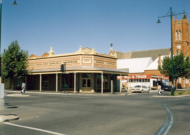
Photograph - BUSH'S STORES, c2001
... Stanyers Auctions on right hand side, St Paul's Cathedral on right hand side of Stanyers. Note blue line marking on roadway for the Easter Procession. ...Stanyers Auctions on right hand side, St Paul's Cathedral on right hand side of Stanyers. Note blue line marking on roadway for the Easter Procession. ...Color photograph. 'Bush's Stores' corner Williamson & Myer Sts, Bendigo. Established 1857 by Albert Bush. Stock feed, pet supplies, hardware, garden supplies. Stanyers Auctions on right hand side, St Paul's Cathedral on right hand side of Stanyers. Note blue line marking on roadway for the Easter Procession. Physical description: loose photo. Inscriptions/Markings: Bush's Store, Corner Williamson & Myer St. Bendigo St Paul's Cathedral at R. April 2001. Copy of an article in the Bendigo Weekly Friday january 15 2016 written by James Lerk. The original of this article has been placed in the box marked James Lerk.organization, business, bush's stores -
 Melbourne Tram Museum
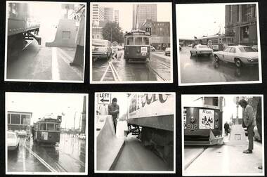
Document - Report, Melbourne & Metropolitan Tramways Board (MMTB), "Interim Report - Nicholson Street Safety Bars", 1978c, 1973
... with caption "prow replacing type 2 (Hairpin sign) with both original (white) and new MCC (Yellow) line marking on approach". .17 - Bourke St - looking west at Kings St and caption "Prow replacing type 2 (Hairpin sign) with original line marking on approach. .16 and .17 taken on Polaroid Instamatic cameras....with caption "prow replacing type 2 (Hairpin sign) with both original (white) and new MCC (Yellow) line marking on approach". .17 - Bourke St - looking west at Kings St and caption "Prow replacing type 2 (Hairpin sign) with original line marking on approach. .16 and .17 taken on Polaroid Instamatic cameras. ...Report and photographs of various mechanisms to identify and check clearances for Safety Zones on tramways. .1 - Report - 4 pages stapled in top left hand corner - titled "Interim Report - Nicholson Street Safety Bars", dated 20/6/1978 signed by R. G. Vanselow. Describes the work involved in providing a type of "jiggle bars" leading up to the safety zone. Many photographs of the various types of safety zone marks were included within the folder. The photos of 912 are related to the clearance testing carried out during 1973 for the Z class. See also Reg Item 480? .2 - tram 912 fitted with a wooden device to measure clearances - with a concrete safety zone being checked. .3 - tram 1040 in Bourke St with a Safety Zone sign on the left - King St? .4 - tram and traffic at the Bourke St terminus. .5 - not used. .6 - tram 1000 at ditto on a wet day .7 - as for .2 .8 - ditto .9 - ditto .10 - side on view of W2 447 with a concrete prow fitted with a set of flashing lights. .11 - to .15 - series of large prints of enlarged 35mm negatives of night testing of safety zone sign taken at South Melbourne Depot and in St Kilda Road. .16 Bourke St - looking west at Russell St? with caption "prow replacing type 2 (Hairpin sign) with both original (white) and new MCC (Yellow) line marking on approach". .17 - Bourke St - looking west at Kings St and caption "Prow replacing type 2 (Hairpin sign) with original line marking on approach. .16 and .17 taken on Polaroid Instamatic cameras.Some of the photos have captions written on the rear.trams, tramways, tram stops, bourke st, safety zone, testing, z class, safety, tram 912, tram 1040, tram 1000, tram 447 -
 Bendigo Historical Society Inc.
Slide - DIGGERS & MINING: DIGGERS AND MINERS, c1800s
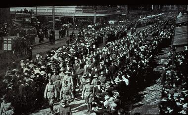
... Many people lined up to watch. Markings: VISAR COPYRIGHT SET - THE DIGGERS, 1. ...Many people lined up to watch. Markings: VISAR COPYRIGHT SET - THE DIGGERS, 1. ...Diggers & Mining: The Diggers. Parade of Diggers some appear to be in civilian clothes. Many people lined up to watch. Markings: VISAR COPYRIGHT SET - THE DIGGERS, 1. Used as a teaching aid.Visaireducation, tertiary, diggers -
 Sunshine and District Historical Society Incorporated
Administrative record - City of Sunshine - Commissioner Mr Alexander Alex George Gillon Collection 1976 - 1982 - Report of works forward planning committee meeting 15th July 1980, City of Sunshine, 22nd July 1980
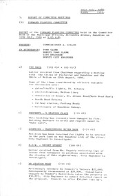
... Wright Street 88 Station Road Naming of Lanes Leading to Our Lady's Youth Centre off Devonshire Road Particular Reference to Byron Lane & Shelley Lane Omar Street Intersection Line Marking Devonshire Road Land North West Corner Wright Street and Hampshire Road Acquisition Naming of Reserves all names are to be registered with the Place Names Committee...Wright Street 88 Station Road Naming of Lanes Leading to Our Lady's Youth Centre off Devonshire Road Particular Reference to Byron Lane & Shelley Lane Omar Street Intersection Line Marking Devonshire Road Land North West Corner Wright Street and Hampshire Road Acquisition Naming of Reserves all names are to be registered with the Place Names Committee Foolscap sized document. ...Report of works Forward Planning Committee Meeting 15th July 1980 Vic Rail Gates / Traffic Lights St. Albans, Melton Line Electrification, Demolition of House St. Albans Road / Main Road East, South Road Estate, Railway Station Furlong Road and Maintenance of Sunshine Subway Property 4 Station Place Sunshine Damage By Fire Lighting Maribyrnong River Bank Petition Closing of R.O.W. Wright Street 88 Station Road Naming of Lanes Leading to Our Lady's Youth Centre off Devonshire Road Particular Reference to Byron Lane & Shelley Lane Omar Street Intersection Line Marking Devonshire Road Land North West Corner Wright Street and Hampshire Road Acquisition Naming of Reserves all names are to be registered with the Place Names Committeest. albans road, main road east, south road, furlong road, braybrook, st. albans, station place, sunshine, maribyrnong river, maribyrnong, wright street, station road, deer park, omar street, maidstone, devonshire road, hampshire road -
 The Beechworth Burke Museum
Photograph
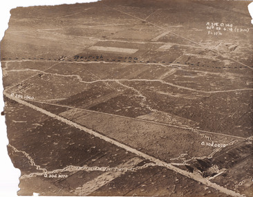
... It is believed that the line marking on this record denotes a section of the Western Front. ...It is believed that the line marking on this record denotes a section of the Western Front. ...Taken some time between 1914-18, the photograph depicts an aerial view of trenches in France. The image mostly shows rural landscape, although there is a house in the bottom right corner. A dotted line has been drawn across the photograph, marking the section of trenches that belonged to British forces during World War I. It is believed that the line marking on this record denotes a section of the Western Front. The Western Front was the main theatre of war during World War I. Following the outbreak of war in August 1914, the German Army opened the Western Front by invading Luxembourg and Belgium, then gaining military control of important industrial regions in France. The German advance was halted with the Battle of the Marne. Following the Race to the Sea, both the French-British and German armies dug in along a meandering line of fortified trenches, stretching from the North Sea to the Swiss frontier with France. Between 1915 and 1917 there were several offensives along the Western Front. The attacks employed massive artillery bombardments and massed infantry advances. Entrenchments, machine gun emplacements, barbed wire and artillery repeatedly inflicted severe casualties during attacks and counter-attacks and no significant advances were made. Among the most notable of these offensives were the Battle of Verdun (1916), the Battle of the Somme (1916), and the Battle of Passchendaele (1917).The record is historically significant due to its connection to World War I. This conflict is integral to Australian culture as it was the single greatest loss of life and the greatest repatriation of casualties in the country's history. Australia’s involvement in the First World War began when the Australian government established the Australian Imperial Force (AIF) in August 1914. Immediately, men were recruited to serve the British Empire in the Middle East and on the Western Front. The record has strong research potential. This is due to the ongoing public and scholarly interest in war, history, and especially the ANZAC legend, which is commemorated annually on 25 April, known as ANZAC Day.Sepia rectangular photograph printed on matte photographic paper.Obverse: A.3FE.O.146 / G2R 29 . 6 . 18 (Y p.m) / F= 10 1/4 / British Line / ------------------------------------------ / P. 250 1040 / 0. 30d. 0010 / 0. 30d. 3070 /military album, military, war, wwi, world war i, france, great britain, trenches, village, rural, western front -
 City of Kingston
Pamphlet - Colour, Moorabbin News Print, Auction = Sale Heather Grove Estate, c. 1914
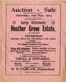
... Handwritten in grey pencil on subdivision 1: Sold / 20/- Handwritten in grey pencil on subdivision 2: 25/- Handwritten in grey pencil on subdivision 3: 30/- Handwritten in grey pencil on subdivision 4: 110 / 30/- Handwritten in grey pencil on subdivisions 1, 11, 10, 9 and 8: Sold Handwritten in grey pencil beneath 'Heather Grove': 20/- 20/- 20/- 20/- Handwritten in black ink on subdivison 12 and 7: £85 Handwritten in back ink on subdivision 5: £60 Handwritten in back ink on subdivision 6: £65 Handwritten in grey pencil above subdivision map: 1-8-9-10-11 Handwritten in grey pencil above subdivision map: [enclosed in a circle] 12- / £75 Handwritten in grey pencil above subdivision map: [enclosed in a circle] 2 / £85 Handwritten in grey pencil above subdivision map: [enclosed in a circle] 3 / £100 Handwritten in grey pencil above subdivision map: [enclosed in a circle] 4 / £100 Handwritten in grey pencil above subdivision map: [enclosed in a circle] 5 / £60 Handwritten in grey pencil above subdivision map: [enclosed in a circle] 6 / £65 Handwritten in grey pencil above subdivision map: [enclosed in a circle] 7 / £25- Handwritten in grey pencil above subdivision map: [enclosed in a circle] £125 / [indecipherable] Handwritten in grey pencil above subdivision map: 37.00 / 18.10 / 56.80 / 3 / [horizontal line] / 59 8 Handwritten in grey pencil along railway line marking: 21/6 / 12/6 / 13/- / 19/-...Land sales estate Cheltenham Handwritten in grey pencil on subdivision 1: Sold / 20/- Handwritten in grey pencil on subdivision 2: 25/- Handwritten in grey pencil on subdivision 3: 30/- Handwritten in grey pencil on subdivision 4: 110 / 30/- Handwritten in grey pencil on subdivisions 1, 11, 10, 9 and 8: Sold Handwritten in grey pencil beneath 'Heather Grove': 20/- 20/- 20/- 20/- Handwritten in black ink on subdivison 12 and 7: £85 Handwritten in back ink on subdivision 5: £60 Handwritten in back ink on subdivision 6: £65 Handwritten in grey pencil above subdivision map: 1-8-9-10-11 Handwritten in grey pencil above subdivision map: [enclosed in a circle] 12- / £75 Handwritten in grey pencil above subdivision map: [enclosed in a circle] 2 / £85 Handwritten in grey pencil above subdivision map: [enclosed in a circle] 3 / £100 Handwritten in grey pencil above subdivision map: [enclosed in a circle] 4 / £100 Handwritten in grey pencil above subdivision map: [enclosed in a circle] 5 / £60 Handwritten in grey pencil above subdivision map: [enclosed in a circle] 6 / £65 Handwritten in grey pencil above subdivision map: [enclosed in a circle] 7 / £25- Handwritten in grey pencil above subdivision map: [enclosed in a circle] £125 / [indecipherable] Handwritten in grey pencil above subdivision map: 37.00 / 18.10 / 56.80 / 3 / [horizontal line] / 59 8 Handwritten in grey pencil along railway line marking: 21/6 / 12/6 / 13/- / 19/- Colour pamphlet advertising auction of Heather Grove Estate, Cheltenham. ...Sales plan for land in the suburb of Cheltenham, bounded by Tulip Grove and Heather Grove.The developing urban area of Highett within the City of Kingston. This land sale pamphlet illustrates the subdivision of land within the municipality and the changing demographic of the district as new houses are constructed close to infrastructure.Colour pamphlet advertising auction of Heather Grove Estate, Cheltenham. Incorporates a map of the estate bordered by Wickham Road, Railway Parade, Highett Road and Point Nepean Road.Handwritten in grey pencil on subdivision 1: Sold / 20/- Handwritten in grey pencil on subdivision 2: 25/- Handwritten in grey pencil on subdivision 3: 30/- Handwritten in grey pencil on subdivision 4: 110 / 30/- Handwritten in grey pencil on subdivisions 1, 11, 10, 9 and 8: Sold Handwritten in grey pencil beneath 'Heather Grove': 20/- 20/- 20/- 20/- Handwritten in black ink on subdivison 12 and 7: £85 Handwritten in back ink on subdivision 5: £60 Handwritten in back ink on subdivision 6: £65 Handwritten in grey pencil above subdivision map: 1-8-9-10-11 Handwritten in grey pencil above subdivision map: [enclosed in a circle] 12- / £75 Handwritten in grey pencil above subdivision map: [enclosed in a circle] 2 / £85 Handwritten in grey pencil above subdivision map: [enclosed in a circle] 3 / £100 Handwritten in grey pencil above subdivision map: [enclosed in a circle] 4 / £100 Handwritten in grey pencil above subdivision map: [enclosed in a circle] 5 / £60 Handwritten in grey pencil above subdivision map: [enclosed in a circle] 6 / £65 Handwritten in grey pencil above subdivision map: [enclosed in a circle] 7 / £25- Handwritten in grey pencil above subdivision map: [enclosed in a circle] £125 / [indecipherable] Handwritten in grey pencil above subdivision map: 37.00 / 18.10 / 56.80 / 3 / [horizontal line] / 59 8 Handwritten in grey pencil along railway line marking: 21/6 / 12/6 / 13/- / 19/-land sales, estate, cheltenham -
 Bendigo Historical Society Inc.
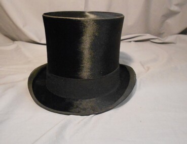
Clothing - MAN'S SILK TOP HAT, Top Hat, Late 1800's-early 1900's
... Upper part of crown is lined with cream silk. Marking on leather band ;W2637, also written in biro RHSV. ...Upper part of crown is lined with cream silk. Marking on leather band ;W2637, also written in biro RHSV. ...Fine smooth black silk. Brim bound with black fabric. Side edges of brim rolled inwards. A 4cm wide felt band runs around the base of the crown. Underside of brim lined with black fabric. A 6.5cm wide band of cream leather lines the crown. A fine one cm wide silk ribbon bow finishes the seam of the leather. Upper part of crown is lined with cream silk. Marking on leather band ;W2637, also written in biro RHSV. In hat box 11400.835, packed in Clothing Box 158.HILHOLISE & Co, Hat and Cap Makers, 11,New Bond Street, London.costume, male, man's silk top hat -
 Sunshine and District Historical Society Incorporated
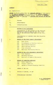
Administrative record - City of Sunshine - Commissioner Mr Alexander Alex George Gillon Collection 1976 - 1982 - Notice of ordinary meeting of the council 17th July 1979, City of Sunshine, 11th July 1979
... Albans Statcon Programme Additions to Network Relocation of Public Telephones Ballarat Road Corner Station Road to Outside 809 & 811 Ballarat Road Deer Park Traffic Engineering & Associated Works Billingham Road / Kororoit Creek / Robinsons Road Deer Park Street Light Replacement With Plastic Signs Traffic Engineering & Associated Works Sydney Street Corner King Edward Avenue Child Care Centre New Guardrail Traffic Engineering & Associated Works Warrs Road Maribyrnong New Guardrails Traffic Engineering & Associated Works Anderson Road at Ballarat Road Line marking Alterations Traffic Engineering & Associated Works Glengala Road / Anderson Road Intersection Line Marking Alterations Sewerage Facilities Deer Park R.S.L. ...Albans Statcon Programme Additions to Network Relocation of Public Telephones Ballarat Road Corner Station Road to Outside 809 & 811 Ballarat Road Deer Park Traffic Engineering & Associated Works Billingham Road / Kororoit Creek / Robinsons Road Deer Park Street Light Replacement With Plastic Signs Traffic Engineering & Associated Works Sydney Street Corner King Edward Avenue Child Care Centre New Guardrail Traffic Engineering & Associated Works Warrs Road Maribyrnong New Guardrails Traffic Engineering & Associated Works Anderson Road at Ballarat Road Line marking Alterations Traffic Engineering & Associated Works Glengala Road / Anderson Road Intersection Line Marking Alterations Sewerage Facilities Deer Park R.S.L. ...Notice of Ordinary Meeting of the Council 17th July 1979 Report of the Town Clerk's Department Report of the Town Clerk Tax Sharing increase in Local Government Proportion Deer Park Drainage Scheme Decision by Tribunal Proposed Variations to M.O.A. Award Travelling Allowances The Sir Robert Menzies Memorial Trust Request for Financial Assistance Land Transfer to the Council Dickson Street Melbourne & Metropolitan Board of Works Representative Melbourne & Metropolitan Board of Works Proposed Increase in Rates Loan Borrowings Supplementary Valuations Report of the Co-Ordinator of Welfare Services Seminar Local Government and Welfare for Migrants Report of the Chief Health Surveyor Application for Transfer of Proprietorship of Premises Under the Health Act Health Act Registrations for 1979 Roberts Crescent Infant Welfare Centre 22 Roberts Crescent Sunshine West Offensive Trades Asbestos Protean Holdings Corner Boundary Road and Fitzgerald Road Regulations Relating to Offensive Trades M.M.B.W. Sewerage Discharge Maribyrnong River Braybrook Report of the Medical Officer of Health Report of the Chief By-Laws Officer Animal Care Seminar R.S.P.C.A. (Vic) Council Reserves By-Law Report of the City Librarian Highpoint West Library Report of the Municipal Recreation Officer Municipal Recreation Officers' Conference 31st July 1979 2nd August 1979 Use of House at Selwyn Park by Outreach Worker Sunshine North Tennis Club & Albion Tennis Club School Revue Sunshine North Technical School Report of the City Engineer Planning Permit Application Private Tip Part Lot 35 Reid Street Albion Planning Permit Application Four Service Premises Additions to Existing Cluster Housing Development 104 Station Road Deer Park Planning Permit Application Buildings or Works Within 30 Metres of the Kororoit Creek Mernda Street Sunshine West Planning Permit Application Amusement Machines Lot 460 Fitzgerald Road Sunshine West Planning Permit Application Six Factories Lot 1 Berkshire Road Sunshine North Planning Permit Application Cafe Lot 4 Glengala Road Sunshine West Planning Permit Application Fitness Centre Hook Street and Vule Street St. Albans Planning Permit Application Factory Lots 52 & 53 Judge Street Sunshine Planning Permit Application Display Homes and Associated Commercial Vehicle Park Lot 29 Station Road Deer Park Planning Permit Application Sky sign Lot 1 Sunshine Road Planning Permit Store Lot 24 Cromer Avenue Sunshine North Planning Permit Application Retail Plant Nursery Railway Lot 81 Sunshine Road Planning Permit Application Subdivision and Detached Houses Neale Road Planning Permit Application Flats 20 Forrest Street Albion Amendment No 70 Part 4B to the Melbourne Metropolitan Planning Scheme Planning Permit Application Alterations to Existing Abattoirs Armbrook Siding Off Somerville Road Tottenham Planning Permit Application Proposed Pole Sign Corner Berkshire Road Steers Street Sunshine North Planning Permit Application Consulting Room (Doctors Surgery) 88 Ashley Street Maidstone Planning Permit Application Transport Depot and Warehouse Berkshire Road Sunshine North Planning Permit Application Extension of Existing Shop Hot Bread Kitchen Ballarat Road Deer Park Planning Permit Application Place of Assembly Scovell Reserve Scovell Crescent Planning Permit Application Apex Quarries Aggregate Distribution Depot Jones Road & Bunting Road Brooklyn Planning Permit Application Eight Flats Lots 1 & 2 Fraser Street Sunshine Plans of Transfer & Consolidation Somerville Road Smorgans Consolidated Industries, Mahemoff Nominees Pty Ltd & Lysaght Durham Chemical Company Subdivision Tentative Plan of Subdivision South East Corner Furlong Road & St. Albans Road Plan of Creation of Easement 463 & 465 Ballarat Road Subdivision Sunshine Consolidation of Title Geelong Road and Burgess Road for B.P. Petrol Fueling Station Plan of Subdivision 10 Chicago Street Princess Highway West Street Lighting Costs Footpath South Side of Cordite Avenue West Road to The Main Gate Maribyrnong Explosive Factory Sewerage Reticulation Area No 4046 St. Albans Mobil Oil Altona to Somerton Pipeline Statcon Works Programme Intersection Treatment East Esplanade / Main Road West / Main Road East St. Albans Statcon Programme Additions to Network Relocation of Public Telephones Ballarat Road Corner Station Road to Outside 809 & 811 Ballarat Road Deer Park Traffic Engineering & Associated Works Billingham Road / Kororoit Creek / Robinsons Road Deer Park Street Light Replacement With Plastic Signs Traffic Engineering & Associated Works Sydney Street Corner King Edward Avenue Child Care Centre New Guardrail Traffic Engineering & Associated Works Warrs Road Maribyrnong New Guardrails Traffic Engineering & Associated Works Anderson Road at Ballarat Road Line marking Alterations Traffic Engineering & Associated Works Glengala Road / Anderson Road Intersection Line Marking Alterations Sewerage Facilities Deer Park R.S.L. Land Dickson Street Proposed Development Sunshine View Estate Stage 2 Underground Drainage Stancon / Metcon Maintenance Police 1979/80 Financial Year R.O.S.T.A. Bulletin 1979 Installation of Traffic Signals Under Statcon Programme Ballarat Road / McIntyre Road / Anderson Road Remodelling of Existing Signals Footbridge Programme Further Report Alteration to Grandstand Skinner Reserve Proposed Toilet Block Hume Street Deer Park Sunshine Swimming Pool Proposed Extension to United Social Cricket Club Scovell Reserve Removal of Nissan Huts Rear of D.J. Evans Hall Ravenhall Street Report of the Building Surveyor Building Over Easement Lot 188 Neale Road Deer Park Building on Flood Prone Land 16 The Esplanade Maribyrnong Siting of Building 2 Laurel Street St. Albans Scaffolding Permit Fees Orders of the Day Accounts Submitted for Payment as at 30th June 1979 Proposal to Construct Easement Drainage in the Area Bounded by Robinsons Road, Ballarat Road, Orama Street, Doherty Street and Quinn Street Under the Provisions of Section 651 and 578 of the Local Government Act 1958 Confirmation of Load with the Local Authorities Superannuation Boardrsl, dickson street, sunshine, r.s.l., roberts crescent, sunshine west, protean holdings, boundary road, fitzgerald road, laverton north, maribyrnong river, braybrook, highpoint west library, rosamond road, maribyrnong, sunshine north tennis club, albion tennis club, selwyn park, selwyn street, albion, sunshine north technical school, reid street, station road, deer park, kororoit creek, mernda street, berkshire road, sunshine north, glengala road, hook street, vule street, st. albans, judge street, cromer avenue, sunshine road, tottenham, neale road, forrest street, armbrook siding, steers street, ashley street, maidstone, ballarat road, scovell reserve, scovell crescent, jones road, bunting road, fraser street, smorgans consolidated industries, mahemoff nominees, lysaght durham chemical company, furlong road, st. albans road, geelong road, burgess road, chicago street, princess highway, cordite avenue, maribyrnong explosive factory, east esplanade, main road west, main road east, billingham road, robinsons road, sydney street, king edward avenue, sydney street child care centre, warrs road, anderson road, mcintyre road, skinner reserve, churchill avenue, hume street, sunshine swimming pool, united social cricket club, d.j. evans hall, ravenhall street, the esplanade, laurel street, orama street, doherty street, quinn street, roberts crescent infant welfare centre -
 Sunshine and District Historical Society Incorporated
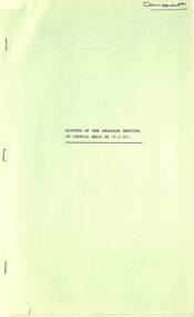
Administrative record - City of Sunshine - Commissioner Mr Alexander Alex George Gillon Collection 1976 - 1982 - Minutes of the ordinary meeting of council held on 17th July 1979, City of Sunshine, 17th July 1979
... Albans Statcon Programme Additions to Network Relocation of Public Telephones Ballarat Road Corner Station Road to Outside 809 & 811 Ballarat Road Deer Park Traffic Engineering & Associated Works Billingham Road / Kororoit Creek / Robinsons Road Deer Park Street Light Replacement With Plastic Signs Traffic Engineering & Associated Works Sydney Street Corner King Edward Avenue Child Care Centre New Guardrail Traffic Engineering & Associated Works Warrs Road Maribyrnong New Guardrails Traffic Engineering & Associated Works Anderson Road at Ballarat Road Line marking Alterations Traffic Engineering & Associated Works Glengala Road / Anderson Road Intersection Line Marking Alterations Sewerage Facilities Deer Park R.S.L. ...Albans Statcon Programme Additions to Network Relocation of Public Telephones Ballarat Road Corner Station Road to Outside 809 & 811 Ballarat Road Deer Park Traffic Engineering & Associated Works Billingham Road / Kororoit Creek / Robinsons Road Deer Park Street Light Replacement With Plastic Signs Traffic Engineering & Associated Works Sydney Street Corner King Edward Avenue Child Care Centre New Guardrail Traffic Engineering & Associated Works Warrs Road Maribyrnong New Guardrails Traffic Engineering & Associated Works Anderson Road at Ballarat Road Line marking Alterations Traffic Engineering & Associated Works Glengala Road / Anderson Road Intersection Line Marking Alterations Sewerage Facilities Deer Park R.S.L. ...Minutes of the Ordinary Meeting of Council held on 17th July 1979 Report of the Town Clerk's Department Report of the Town Clerk Tax Sharing increase in Local Government Proportion Deer Park Drainage Scheme Decision by Tribunal Proposed Variations to M.O.A. Award Travelling Allowances The Sir Robert Menzies Memorial Trust Request for Financial Assistance Land Transfer to the Council Dickson Street Melbourne & Metropolitan Board of Works Representative Melbourne & Metropolitan Board of Works Proposed Increase in Rates Loan Borrowings Supplementary Valuations Report of the Co-Ordinator of Welfare Services Seminar Local Government and Welfare for Migrants Report of the Chief Health Surveyor Application for Transfer of Proprietorship of Premises Under the Health Act Health Act Registrations for 1979 Roberts Crescent Infant Welfare Centre 22 Roberts Crescent Sunshine West Offensive Trades Asbestos Protean Holdings Corner Boundary Road and Fitzgerald Road Regulations Relating to Offensive Trades M.M.B.W. Sewerage Discharge Maribyrnong River Braybrook Report of the Medical Officer of Health Report of the Chief By-Laws Officer Animal Care Seminar R.S.P.C.A. (Vic) Council Reserves By-Law Report of the City Librarian Highpoint West Library Report of the Municipal Recreation Officer Municipal Recreation Officers' Conference 31st July 1979 2nd August 1979 Use of House at Selwyn Park by Outreach Worker Sunshine North Tennis Club & Albion Tennis Club School Revue Sunshine North Technical School Report of the City Engineer Planning Permit Application Private Tip Part Lot 35 Reid Street Albion Planning Permit Application Four Service Premises Additions to Existing Cluster Housing Development 104 Station Road Deer Park Planning Permit Application Buildings or Works Within 30 Metres of the Kororoit Creek Mernda Street Sunshine West Planning Permit Application Amusement Machines Lot 460 Fitzgerald Road Sunshine West Planning Permit Application Six Factories Lot 1 Berkshire Road Sunshine North Planning Permit Application Cafe Lot 4 Glengala Road Sunshine West Planning Permit Application Fitness Centre Hook Street and Vule Street St. Albans Planning Permit Application Factory Lots 52 & 53 Judge Street Sunshine Planning Permit Application Display Homes and Associated Commercial Vehicle Park Lot 29 Station Road Deer Park Planning Permit Application Sky sign Lot 1 Sunshine Road Planning Permit Store Lot 24 Cromer Avenue Sunshine North Planning Permit Application Retail Plant Nursery Railway Lot 81 Sunshine Road Planning Permit Application Subdivision and Detached Houses Neale Road Planning Permit Application Flats 20 Forrest Street Albion Amendment No 70 Part 4B to the Melbourne Metropolitan Planning Scheme Planning Permit Application Alterations to Existing Abattoirs Armbrook Siding Off Somerville Road Tottenham Planning Permit Application Proposed Pole Sign Corner Berkshire Road Steers Street Sunshine North Planning Permit Application Consulting Room (Doctors Surgery) 88 Ashley Street Maidstone Planning Permit Application Transport Depot and Warehouse Berkshire Road Sunshine North Planning Permit Application Extension of Existing Shop Hot Bread Kitchen Ballarat Road Deer Park Planning Permit Application Place of Assembly Scovell Reserve Scovell Crescent Planning Permit Application Apex Quarries Aggregate Distribution Depot Jones Road & Bunting Road Brooklyn Planning Permit Application Eight Flats Lots 1 & 2 Fraser Street Sunshine Plans of Transfer & Consolidation Somerville Road Smorgans Consolidated Industries, Mahemoff Nominees Pty Ltd & Lysaght Durham Chemical Company Subdivision Tentative Plan of Subdivision South East Corner Furlong Road & St. Albans Road Plan of Creation of Easement 463 & 465 Ballarat Road Subdivision Sunshine Consolidation of Title Geelong Road and Burgess Road for B.P. Petrol Fueling Station Plan of Subdivision 10 Chicago Street Princess Highway West Street Lighting Costs Footpath South Side of Cordite Avenue West Road to The Main Gate Maribyrnong Explosive Factory Sewerage Reticulation Area No 4046 St. Albans Mobil Oil Altona to Somerton Pipeline Statcon Works Programme Intersection Treatment East Esplanade / Main Road West / Main Road East St. Albans Statcon Programme Additions to Network Relocation of Public Telephones Ballarat Road Corner Station Road to Outside 809 & 811 Ballarat Road Deer Park Traffic Engineering & Associated Works Billingham Road / Kororoit Creek / Robinsons Road Deer Park Street Light Replacement With Plastic Signs Traffic Engineering & Associated Works Sydney Street Corner King Edward Avenue Child Care Centre New Guardrail Traffic Engineering & Associated Works Warrs Road Maribyrnong New Guardrails Traffic Engineering & Associated Works Anderson Road at Ballarat Road Line marking Alterations Traffic Engineering & Associated Works Glengala Road / Anderson Road Intersection Line Marking Alterations Sewerage Facilities Deer Park R.S.L. Land Dickson Street Proposed Development Sunshine View Estate Stage 2 Underground Drainage Stancon / Metcon Maintenance Police 1979/80 Financial Year R.O.S.T.A. Bulletin 1979 Installation of Traffic Signals Under Statcon Programme Ballarat Road / McIntyre Road / Anderson Road Remodelling of Existing Signals Footbridge Programme Further Report Alteration to Grandstand Skinner Reserve Proposed Toilet Block Hume Street Deer Park Sunshine Swimming Pool Proposed Extension to United Social Cricket Club Scovell Reserve Removal of Nissan Huts Rear of D.J. Evans Hall Ravenhall Street Report of the Building Surveyor Building Over Easement Lot 188 Neale Road Deer Park Building on Flood Prone Land 16 The Esplanade Maribyrnong Siting of Building 2 Laurel Street St. Albans Scaffolding Permit Fees Orders of the Day Accounts Submitted for Payment as at 30th June 1979 Proposal to Construct Easement Drainage in the Area Bounded by Robinsons Road, Ballarat Road, Orama Street, Doherty Street and Quinn Street Under the Provisions of Section 651 and 578 of the Local Government Act 1958 Confirmation of Load with the Local Authorities Superannuation Boardrsl, dickson street, sunshine, r.s.l., roberts crescent infant welfare centre, roberts crescent, sunshine west, boundary road, fitzgerald road, protean holdings, laverton north, maribyrnong river, braybrook, highpoint west library, rosamond road, maribyrnong, sunshine north tennis club, albion tennis club, selwyn park, selwyn street, albion, reid street, sunshine north technical school, station road, deer park, kororoit creek, mernda street, berkshire road, sunshine north, glengala road, hook street, vule street, st. albans, judge street, sunshine road, tottenham, cromer avenue, neale road, forrest street, armbrook siding, steers street, ashley street, maidstone, ballarat road, scovell reserve, scovell crescent, jones road, bunting road, brooklyn, fraser street, smorgans consolidated industries, mahemoff nominees, lysaght durham chemical company, furlong road, st. albans road, geelong road, burgess road, chicago street, princess highway, cordite avenue, maribyrnong explosive factory, east esplanade, main road west, main road east, billingham road, robinsons road, king edward avenue, syndey street, sydney street child care centre, warrs road, anderson road, mcintyre road, skinner reserve, hume street, sunshine swimming pool, united social cricket club, d.j. evans hall, ravenhall street, laurel street, orama street, doherty street, quinn street, churchill avenue -
 Bendigo Historical Society Inc.
Document - MCCOLL, RANKIN AND STANISTREET COLLECTION: NEW STAR GOLD MINE HARRIETVILLE NL, 1935
... , Jamie Jeps ? Markings: pencil line through Gold Mining Lease No. 5187 change to a Leasehold Estate, line through January to be changed to March. c/ Indenture (copy of b/ with adjustments made) New Star Gold Mine Harrietville NL with Kong Meng Gold Reefs NL. ..., Jamie Jeps ? Markings: pencil line through Gold Mining Lease No. 5187 change to a Leasehold Estate, line through January to be changed to March. c/ Indenture (copy of b/ with adjustments made) New Star Gold Mine Harrietville NL with Kong Meng Gold Reefs NL. ...McColl Rankin & Stanistreet, New Star Gold Mine Harrietville NL. a/ Agreement to purchase the mining operations and land at Black Snake Creek, Dargo, Mining District of Gippsland. For Mining Leases numbers 5187 & 5195, 31 acres. The purchaser Company is to be called Kong Meng Gold Reefs NL. Dated: 16/2/1935. Signed: J A Michelsen?, C Kingsley?, J Stanistreet, E R Grelis & ??? Inscriptions: Signed sealed and delivered by the said Ronald Alexander Rankin in the presence of E R Grelis. b/ Leasehold. Transfer of Land situated in the Parish of Dargo County of Dargo Mining District of Gippsland from New Star Gold Mine Harrietville NL to Kong Meng Gold Reefs NL. Dated: 12/3/1935. Signed: G ??, Geo ??, Stanistreet, G ??, Jamie Jeps ? Markings: pencil line through Gold Mining Lease No. 5187 change to a Leasehold Estate, line through January to be changed to March. c/ Indenture (copy of b/ with adjustments made) New Star Gold Mine Harrietville NL with Kong Meng Gold Reefs NL. Dated 13/3/1935. Signed: G ??, Geo ??, Stanistreet, G ??, Jamie Jeps ?, Stanistreet. d/ Carbon copy of a/. Signed: J A Michelsen?, C Kingsley?, J Stanistreet, E R Grelis & ??? Inscriptions: Signed sealed and delivered by the said Ronald Alexander Rankin in the presence of E R Grelis, J Stanistreet. e/ Indenture, agreement between New Star Gold Mining Harriet NL and Kong Meng Gold Reefs NL, was on the 9/3/1935 registered and Incorporated under the Companies act 1928 Part 2. Signed: E R Grelis, J Stanistreet, G ??, Geo ??, Stanistreet, G M?, Stanistreet. Dated: 12/3/1935.organization, business, gold mine, mccoll rankin & stanistreet new star gold mine harrietville nl black snake creek parish of dargo county of dargo mining district of gippsland mining leases numbers 5187 & 5195 kong meng gold reefs nl 1935 -
 Flagstaff Hill Maritime Museum and Village
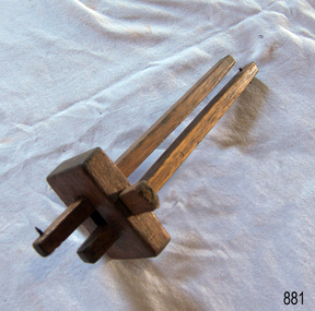
Tool - Marking Gauge, Believed to be homemade between 1900 to 1940s given no makers marks and the naivety of its construction
... A marking gauge, also known as a scratch gauge, is used in woodworking and metalworking to mark out lines for cutting or other operations. The purpose of the gauge is to scribe a line...A marking gauge, also known as a scratch gauge, is used in woodworking and metalworking to mark out lines for cutting or other operations. The purpose of the gauge is to scribe a line ...A marking gauge, also known as a scratch gauge, is used in woodworking and metalworking to mark out lines for cutting or other operations. The purpose of the gauge is to scribe a line parallel to a reference edge or surface. It is used in joinery and sheet metal work operations. The gauge consists of a beam, a headstock, and a scribing or marking implement, typically a pin, knife, pen or wheel. The headstock slides along the beam and is locked in place by various means: a locking screw, cam lever, or a wedge. The marking implement is fixed to one end of the beam. These types of gauges have been in use for many centuries and have not changed much in their design.An item that has not changed in use since its inception many hundreds of years ago. These types of marking gauges used by cabinet and joinery makers to mark or scribe their work for cutting are still produced and used today in many sizes by professional cabinet makers and individuals.Cabinet makers marking gauge, wooden, two adjustable staffs secured be a wedge through the block. Each staff has a metal nail in the end.Noneflagstaff hill, warrnambool, shipwrecked-coast, flagstaff-hill, flagstaff-hill-maritime-museum, maritime-museum, shipwreck-coast, flagstaff-hill-maritime-village -
 Flagstaff Hill Maritime Museum and Village
Panel Gauge
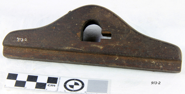
... Panel Gauge marking tool used for scribing a line parallel with the edge of a large work piece such as a panel. ...flagstaff hill warrnambool shipwrecked-coast flagstaff-hill flagstaff-hill-maritime-museum maritime-museum shipwreck-coast flagstaff-hill-maritime-village panel gauge gauge Panel Gauge marking tool used for scribing a line parallel with the edge of a large work piece such as a panel. ...Panel Gauge marking tool used for scribing a line parallel with the edge of a large work piece such as a panel. Only have the "Block" of the gaugeflagstaff hill, warrnambool, shipwrecked-coast, flagstaff-hill, flagstaff-hill-maritime-museum, maritime-museum, shipwreck-coast, flagstaff-hill-maritime-village, panel gauge, gauge -
 Flagstaff Hill Maritime Museum and Village
Tool - Marking Gauge
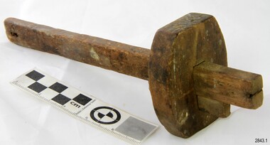
... marking gauge has a round head. It is a hand-powered tool and is used to measure and mark a scribed line onto the surface of the wood for the purpose of cutting or aligning. ...marking gauge has a round head. It is a hand-powered tool and is used to measure and mark a scribed line onto the surface of the wood for the purpose of cutting or aligning. ...This marking gauge has a round head. It is a hand-powered tool and is used to measure and mark a scribed line onto the surface of the wood for the purpose of cutting or aligning. It would have been used by a tradesperson such as a cabinet maker, wood worker or carpenter. The hand tool shows signs of much use. It appears to be appreciated as a tool due to the initials carved into the side of the block. The marking gauge is an example of a hand powered woodworking tool used over the past few centuriesMarking gauge: wooden staff with half-round block secured by a wedge. there is a metal marker on one end. Inscription "WS" crudely engraved in end of block.Carved "W.S."flagstaff hill, warrnambool, maritime museum, maritime village, shipwreck coast, hand tool, woodwork, marking gauge, w.s., measuring tool -
 Flagstaff Hill Maritime Museum and Village
Tool - Marking Gauge, Prior to 1950
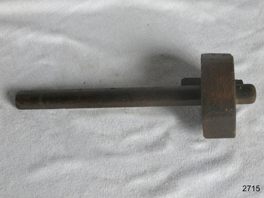
... A marking gauge, also known as a scratch gauge, and] is used in woodworking and metalworking to mark out lines for cutting or other operations. The purpose of the gauge is to scribe a line...A marking gauge, also known as a scratch gauge, and] is used in woodworking and metalworking to mark out lines for cutting or other operations. The purpose of the gauge is to scribe a line ...A marking gauge, also known as a scratch gauge, and] is used in woodworking and metalworking to mark out lines for cutting or other operations. The purpose of the gauge is to scribe a line parallel to a reference edge or surface. It is used in joinery and sheet metal operations. The gauge consists of a beam, a headstock, and a scribing or marking implement, typically a pin, knife, pen or wheel. The headstock slides along the beam, and is locked in place by various means: a locking screw, cam lever, or a wedge. The marking implement is fixed to one end of the beam.A tool that has been in use since woodworking began for hundreds if not thousands of years without much change to the design or how the tool is used. Its use to scribe a line in various material as a cutting guide and is still in use today by many trades. Wooden marking Gauge, smallNonewarrnambool, flagstaff-hill, flagstaff-hill-maritime-museum, maritime-museum, shipwreck-coast, flagstaff-hill-maritime-village, marking gauge, woodworking, carpenters tools, tool -
 Flagstaff Hill Maritime Museum and Village
Tool - Saw, 1905-1913
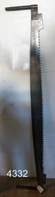
... The toolbox has carvings and markings that make it unique and connect it to the Marjorie Craig. The Craig Line of sailing ships was from Auckland, New Zealand, and traded in timber and some coal from New Zealand ports to Australia, including Sydney, Adelaide, Melbourne and Warrnambool. ...The toolbox has carvings and markings that make it unique and connect it to the Marjorie Craig. The Craig Line of sailing ships was from Auckland, New Zealand, and traded in timber and some coal from New Zealand ports to Australia, including Sydney, Adelaide, Melbourne and Warrnambool. ...This crosscut saw was originally part of the equipment on the barque Marjorie Craig, which brought New Zealand timber into Warrnambool from about 1908 to 1912 for the local merchants P J McGennan & Co. The toolbox was donated by a member of a local family connected with the La Bella rescue in 1905. The toolbox has carvings and markings that make it unique and connect it to the Marjorie Craig. The Craig Line of sailing ships was from Auckland, New Zealand, and traded in timber and some coal from New Zealand ports to Australia, including Sydney, Adelaide, Melbourne and Warrnambool. They returned with produce from Australia as ballast. In 1912 the Craig fleet included the Ihumata, Inga, Jessie Craig, Marjorie Craig, Louisa Craig and Joseph Craig. The steel barque Marjorie Craig, 500 ton, was built in 1891 as the 'Hirotha', in Ardrossan, Scotland for Norwegian owners. The ship was sold to Auckland’s Donald Ross and others in 1900, then in 1905 it was sold, registered by J.J. Craig in Auckland, New Zealand and renamed Marjorie Craig. Marjorie Craig’s commanders included Master R A Campbell in 1907, J MacFarlane in 1909 and Master R.G. Holmes in 1913. From February 1908, the Marjorie Craig was regularly seen in the Port of Warrnambool with loads of timber for merchants P J McGennan & Co. In February 1912 Marjorie Craig delivered white pine for P J McGennan & Co. In April of the same year, she brought 500,000 feet of timber for McGennan & Co and again in May 1912. On May 12 1912 Marjorie left the Port of Warrnambool with 500 tons of flour for New Zealand; it seems that this was her last time at Warrnambool. Prior to 1908, the vessel Speculant brought in timber from New Zealand for the McGennan firm. The Marjorie Craig had a strong reputation for being a ‘Fast Flyer’, breaking the sailing records for voyages between New Zealand and Australia. It was reported that she made passages with a speed equal to steamboats on several occasions. One of her records was from Warrnambool to Hokianga, NZ in eight-and-a-half days. The ship broke the record in October 1913 for the time from Adelaide to Auckland, sailing in 28 days, even with a damaged ship, and the owner presented Captain Holmes with a gold watch and chain. By the end of December 1913, the Craig Line’s last two surviving sailing ships, Marjorie Craig and Jessie Craig, had been purchased by Huddart, Parker & Co. Ltd. to work as coal hulks, one in Melbourne and one in Hobart.The saw is significant for being created for use in 1905 when the steel barque Marjorie Craig was purchased by J J Craig and given that name. The saw would be part of the sip's equipment and could have been used for the timber carried as cargo on the Marjorie Craig. The saw is significant for its association with the well-known Marjorie Craig, a frequent visitor to the Port of Warrnambool 1908 to 1912, a supplier of New Zealand timber for the local firm P J McGennan & Co, and one of the fastest inter-colonial sailing ships that broke numerous records for its speed including the fastest sailing from Warrnambool to Hokianga. Crosscut saw; blade attached to wooden handles by wingnut each end. The saw has 63 teeth. Also has a tag attached with an inscription. The saw was ship's equipment on the barque, Marjorie Craig.Handwritten on tab: "From sailing ship Marjorie Craig early 1900 Port of Warrnambool"flagstaff hill, maritime museum, maritime village, warrnambool, great ocean road, shiopwreck coast, woodworking tool, crosscut saw, shipwright tool, saw, marine trade, carpenter, marjorie craig, j j craig, craig line, 1905-1912 -
 Flagstaff Hill Maritime Museum and Village
Cap Liner, Between 1870 and 1908
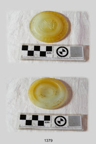
... The Maltese Cross and “BOYD’S GENUINE PORCELAIN LINED” lettering are unique to this piece. However, it is evident from the markings and materials of the other cap liners, that they originally formed sets or series. ...The Maltese Cross and “BOYD’S GENUINE PORCELAIN LINED” lettering are unique to this piece. However, it is evident from the markings and materials of the other cap liners, that they originally formed sets or series. ...This Zinc Cap Porcelain Liner was recovered from the (1908) shipwreck site of the FALLS OF HALLADALE. The purpose of cap liners was to assist with the safe preserving and storage of perishable foodstuffs in an age when refrigeration was generally unavailable. These round, coarse-glass inserts formed part of the screw lids used with the Ball Mason style of canning fruit jars. The liner was placed inside the zinc cap to stop the contents of the jar reacting with the zinc. It prevented the metallic tainting of food as well as the corrosion of the metallic lid. On March 30, 1869, Lewis R Boyd was issued with patent # 88439 for an “Improved Mode of Preventing Corrosion in Metallic Caps”. From the 1870s to the 1950s, large quantities of these liners were produced by a number of glass manufacturing companies. They are consequently difficult to date or identify. “It is assumed that most of the earlier versions of these liners have the name ‘BOYD’S’ or ‘BOYD’ embossed on them. Later versions may or may not have the name included in the lettering”. (http://www.glassbottlemarks.com). Only a few were made of porcelain, the great majority being made first of transparent and later of translucent or opaque glass. The different emblems of triangles, circles, and crosses embossed on the front face of the liners are assumed to signify mould or model types rather than the company that produced them. This particular artefact is one of 14 cap liners that were retrieved from the shipwreck site and are now part of the Flagstaff Hill Maritime Village collection. The Maltese Cross and “BOYD’S GENUINE PORCELAIN LINED” lettering are unique to this piece. However, it is evident from the markings and materials of the other cap liners, that they originally formed sets or series. Six are larger (8 mm depth x 85mm diameter), of greenish hue with ground glass texture, and support the raised emblem of a compass needle. Two are medium-sized (75mm diameter) with two raised dots in a central circle and the lettering “Patd. APR 25.82”. This particular cap liner is likely to have also been one of a mass-produced line being imported from America. The iron-hulled sailing ship FALLS OF HALLADALE was a bulk carrier of general cargo en route from New York to Melbourne and Sydney. In her hold, along with 56,763 tiles of unusual beautiful green American slates (roofing tiles), 5,673 coils of barbed wire, 600 stoves, 500 sewing machines, 6500 gallons of oil, 14400 gallons of benzene, and many other manufactured items, were 117 cases of crockery and glassware. The FALLS OF HALLADALE came aground on a reef off the Peterborough headland at 3 am on the morning of the 15th of November, 1908. The captain and 29 crew members all survived, but her valuable cargo was largely lost, despite two salvage attempts in1908-09 and 1910. The iron-hulled, four-masted barque, the Falls of Halladale, was a bulk carrier of general cargo. She left New York in August 1908 on her way to Melbourne and Sydney. In her hold, along with 56,763 tiles of unusual beautiful green American slates (roofing tiles), 5,673 coils of barbed wire, 600 stoves, 500 sewing machines, 6500 gallons of oil, 14400 gallons of benzene, and many other manufactured items, were 117 cases of crockery and glassware. Three months later and close to her destination, a navigational error caused the Falls of Halladale to be wrecked on a reef off the Peterborough headland at 3 am on the morning of the 15th of November, 1908. The captain and 29 crew members all survived, but her valuable cargo was largely lost, despite two salvage attempts in 1908-09 and 1910. ABOUT THE ‘FALLS OF HALLADALE’ (1886 - 1908) Built: in1886 by Russell & Co., Greenock shipyards, River Clyde, Scotland, UK. The company was founded in 1870 (or 1873) as a partnership between Joseph Russell (1834-1917), Anderson Rodger and William Todd Lithgow. During the period 1882-92 Russell & Co., they standardised designs, which sped up their building process so much that they were able to build 271 ships over that time. In 1886 they introduced a 3000 ton class of sailing vessel with auxiliary engines and brace halyard winches. In 1890 they broke the world output record. Owner: Falls Line, Wright, Breakenridge & Co, 111 Union Street, Glasgow, Scotland. Configuration: Four masted sailing ship; iron-hulled barque; iron masts, wire rigging, fore & aft lifting bridges. Size: Length 83.87m x Breadth 12.6m x Depth 7.23m, Gross tonnage 2085 ton Wrecked: the night of 14th November 1908, Curdies Inlet, Peterborough south west Victoria Crew: 29 The Falls of Halladale was a four-masted sailing ship built-in 1886 in Glasgow, Scotland, for the long-distance cargo trade and was mostly used for Pacific grain trade. She was owned by Wright, Breakenridge & Co of Glasgow and was one of several Falls Line ships, all of which were named after waterfalls in Scotland. The lines flag was of red, blue and white vertical stripes. The Falls of Halladale had a sturdy construction built to carry maximum cargo and able to maintain full sail in heavy gales, one of the last of the ‘windjammers’ that sailed the Trade Route. She and her sister ship, the Falls of Garry, were the first ships in the world to include fore and aft lifting bridges. Previous to this, heavily loaded vessels could have heavy seas break along the full length of the deck, causing serious injury or even death to those on deck. The new, raised catwalk-type decking allowed the crew to move above the deck stormy conditions. This idea is still used today on the most modern tankers and cargo vessels and has proved to be an important step forward in the safety of men at sea. On 4th August 1908, with new sails, 29 crew, and 2800 tons of cargo, the Falls of Halladale left New York, bound for Melbourne and Sydney via the Cape of Good Hope. The cargo on board was valued at £35,000 and included 56,763 tiles of American slate roofing tiles (roof slates), 5,673 coils of barbed wire, 600 stoves, 500 sewing machines, 6,500 gallons of oil, 14,400 gallons of benzene, plumbing iron, 117 cases of crockery and glassware and many other manufactured items. The Falls of Halladale had been at sail for 102 days when, at 3 am on the night of 14th November 1908, under full sail in calm seas with a six knots breeze behind and misleading fog along the coast, the great vessel rose upon an ocean swell and settled on top of a submerged reef near Peterborough on south-west Victoria’s coast. The ship was jammed on the rocks and began filling with water. The crew launched the two lifeboats and all 29 crew landed safely on the beach over 4 miles away at the Bay of Islands. The postmistress at Peterborough, who kept a watch for vessels in distress, saw the stranding and sent out an alert to the local people. A rescue party went to the aid of the sailors and the Port Campbell rocket crew was dispatched, but the crew had all managed to reach shore safely by the time help arrived. The ship stayed in full sail on the rocky shelf for nearly two months, attracting hundreds of sightseers who watched her slowly disintegrate until the pounding seas and dynamiting by salvagers finally broke her back, and her remains disappeared back into deeper water. The valuable cargo was largely lost, despite two salvage attempts in 1908-09 and 1910. Further salvage operations were made from 1974-1986, during which time 22,000 slate tiles were recovered with the help of 14 oil drums to float them, plus personal artefacts, ship fittings, reams of paper and other items. The Court of Marine Inquiry in Melbourne ruled that the foundering of the ship was entirely due to Captain David Wood Thomson’s navigational error, not too technical failure of the Clyde-built ship. The shipwreck is a popular site for divers, about 300m offshore and in 3 – 15m of water. Some of the original cargo can be seen at the site, including pieces of roof slate and coils of barbed wire. The Falls of Halladale shipwreck is listed on the Victorian Heritage Register (No. S255). She was one of the last ships to sail the Trade Routes. She is one of the first vessels to have fore and aft lifting bridges. She is an example of the remains of an International Cargo Ship and also represents aspects of Victoria’s shipping industry. The wreck is protected as a Historic Shipwreck under the Commonwealth Historic Shipwrecks Act (1976). A circular translucent glass disc in good condition with raised upper case lettering around 8mm rim – “BOYD’S GENUINE PORCELAIN LINED” - and a raised central emblem of a Maltese Cross. On the reverse face in the centre of the disc, there is a raised numeral “3”. falls of halladale, wright, breakenridge & co of glasgow, unusual beautiful green american slates (roofing tiles), warrnambool, shipwrecked-coast, flagstaff-hill, flagstaff-hill-maritime-museum, maritime-museum, shipwreck-coast, flagstaff-hill-maritime-village, shipwrecked-artefact, zinc cap porcelain liner, boyd’s genuine porcelain lined, glass lid, opaque disc, food preserving, fruit bottling, cap liner, shipwrecked coast, flagstaff hill maritime museum, shipwreck artefact, 1908 shipwreck -
 Flagstaff Hill Maritime Museum and Village
Mirror
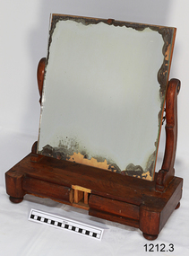
... flagstaff hill warrnambool shipwrecked-coast flagstaff-hill flagstaff-hill-maritime-museum maritime-museum shipwreck-coast flagstaff-hill-maritime-village mirror dresser mirror furniture 19th century bedroom furniture Marking on base in black crayon “6 2”, and pencil letters on 1 drawer “& &”, and “S S” (or “”S 8”). Swivel mirror mounted medium brown, wooden mantle stand with 2 drawers in base, Drawers are lined with green and yellow floral paper. ...Swivel mirror mounted medium brown, wooden mantle stand with 2 drawers in base, Drawers are lined with green and yellow floral paper. Drawer fronts are rounded wood; one drawer has a front piece missing. Wooden uprights are a decorative, curved shape. Base has 4 round, turned wooded feet (5th foot now detached, was located in centre front between drawers). Mirror has lost its reflective coating around edges. It rests, at about 70 degree angle, on metal bracket. Marking on base in black crayon “6 2”, and pencil letters on 1 drawer “& &”, and “S S” (or “”S 8”). flagstaff hill, warrnambool, shipwrecked-coast, flagstaff-hill, flagstaff-hill-maritime-museum, maritime-museum, shipwreck-coast, flagstaff-hill-maritime-village, mirror, dresser mirror, furniture, 19th century, bedroom furniture
