
Showing 55 items matching "lower plenty river bridge."
-
 Greensborough Historical Society
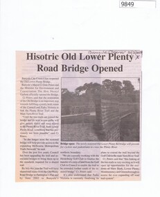
Newspaper - Newspaper Clipping, Banyule Observer, Historic Old Lower Plenty Road Bridge Opened, 31/03/2001
... lower plenty bridge...lower plenty river...Banyule City Council has reopened the Old Lower Plenty Bridge. lower plenty bridge lower plenty river bridge. plenty river Newspaper clipping with black text with black and white photo. ...Banyule City Council has reopened the Old Lower Plenty Bridge.Newspaper clipping with black text with black and white photo.lower plenty bridge, lower plenty river bridge., plenty river -
 Greensborough Historical Society
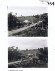
Photograph - Photograph (copy), Old Bridge and Hotel Lower Plenty, 1925c
... lower plenty...lower plenty hotel...plenty river...lower plenty river bridge... lower plenty river bridge. A4 photocopy of 2 black and white photographs Old Bridge and Hotel Lower Plenty Photograph Photograph (copy) Noel Withers ...2 historical views of the Lower Plenty bridge and hotel. Original photographs are in the Victorian State Library collection.Both the bridge and hotel remain but are in a very different landscape. This shows the area about 110 years ago.A4 photocopy of 2 black and white photographslower plenty, lower plenty hotel, plenty river, lower plenty river bridge. -
 Greensborough Historical Society
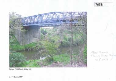
Photograph - Photograph (Copy), Anne Paul, Old Plenty Bridge Lower Plenty, 2003_05
... lower plenty...main road lower plenty...edward willis drive lower plenty...plenty river bridge...Various views of entry into Lot 2A Main Road Lower Plenty, now Edward Willis Drive, including the old Plenty River Bridge....Various views of entry into Lot 2A Main Road Lower Plenty, now Edward Willis Drive, including the old Plenty River Bridge. lower plenty main road lower plenty edward willis drive lower plenty plenty river bridge plenty river forum 3 colour photographs printed on paper, handwritten or typed captions Old Plenty Bridge Lower Plenty Photograph Photograph (Copy) Anne Paul Fred Buono ...Various views of entry into Lot 2A Main Road Lower Plenty, now Edward Willis Drive, including the old Plenty River Bridge.3 colour photographs printed on paper, handwritten or typed captionslower plenty, main road lower plenty, edward willis drive lower plenty, plenty river bridge, plenty river forum -
 Greensborough Historical Society
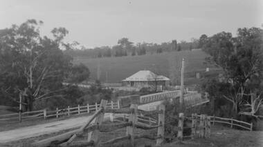
Photograph - Digital Image, Plenty Bridge Hotel, Lower Plenty, 1870s
... lower plenty...plenty river...plenty bridge... crossings in the mid 19th century lower plenty plenty river plenty bridge hotel lower plenty bridge lower plenty hotel Digital copy of black and white photograph Plenty Bridge Hotel, Lower Plenty Photograph - Digital Image ...Lower Plenty Hotel. This photograph shows the original Plenty Bridge hotel with Lower Plenty bridge in the foreground. The hotel was built c1858 and the bluestone bridge in the 1860s to replace the earlier toll bridge built in 1858.The close proximity of the hotel to the bridge is an indication of the importance of these river crossings in the mid 19th centuryDigital copy of black and white photographlower plenty, plenty river, plenty bridge hotel, lower plenty bridge, lower plenty hotel -
 Greensborough Historical Society
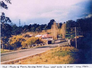
Photograph - Digital image, Plenty Bridge Hotel from west side of river, 1950s
... Colour photograph of Plenty Bridge Hotel (Lower Plenty) from west side of river. Also shows bluestone bridge over Plenty River at Lower Plenty....Colour photograph of Plenty Bridge Hotel (Lower Plenty) from west side of river. Also shows bluestone bridge over Plenty River at Lower Plenty. lower plenty plenty bridge hotel On front of photograph: "15d Plenty Bridge Hotel from west side of river circa 1950s" Digital copy of colour photograph. ...Colour photograph of Plenty Bridge Hotel (Lower Plenty) from west side of river. Also shows bluestone bridge over Plenty River at Lower Plenty.Digital copy of colour photograph.On front of photograph: "15d Plenty Bridge Hotel from west side of river circa 1950s"lower plenty, plenty bridge hotel -
 Greensborough Historical Society
Article, The Willis Diary by Anne Paul. Based on A Pioneer Squatter's Life, 09/04/1837o
... plenty river...lower plenty...james willis...bridge...Lower Plenty, just near where the hotel and old bridge are today. Anne has reviewed and analysed this chapter from Historical Records of Victoria, Vol. 6. The Crown, the land, and the squatter, 1835-1840. She includes further information on the Willis family and photographs of the archaeological dig at the Bridge Inn Hotel Mernda in 2017. Diary of James L Willis from 1837, portraying hardships suffered in the young colony of Victoria. willis family plenty river ...The Willis Diary by GHS member Anne Paul is based on A Pioneer Squatter's Life (Item158). The Willis family were early settlers at Lower Plenty, just near where the hotel and old bridge are today. Anne has reviewed and analysed this chapter from Historical Records of Victoria, Vol. 6. The Crown, the land, and the squatter, 1835-1840. She includes further information on the Willis family and photographs of the archaeological dig at the Bridge Inn Hotel Mernda in 2017.Diary of James L Willis from 1837, portraying hardships suffered in the young colony of Victoria.15 page, text and colour illustrations. Digital copy.willis family, plenty river, lower plenty, james willis, bridge inn hotel mernda -
Greensborough Historical Society
Article, A Squatter's life on the Plenty River at 'Wanstead' by Anne Paul, 09/04/1837o
... plenty river...lower plenty...james willis...bridge...Lower Plenty, just near where the hotel and old bridge are today. Anne has reviewed and analysed this chapter from Historical Records of Victoria, Vol. 6. The Crown, the land, and the squatter, 1835-1840. She includes further information on the Willis family and photographs of the archaeological dig at the Bridge Inn Hotel Mernda in 2017. Diary of James L Willis from 1837, portraying hardships suffered in the young colony of Victoria. willis family plenty river ...The Willis Diary by GHS member Anne Paul is based on A Pioneer Squatter's Life (Item158). The Willis family were early settlers at Lower Plenty, just near where the hotel and old bridge are today. Anne has reviewed and analysed this chapter from Historical Records of Victoria, Vol. 6. The Crown, the land, and the squatter, 1835-1840. She includes further information on the Willis family and photographs of the archaeological dig at the Bridge Inn Hotel Mernda in 2017.Diary of James L Willis from 1837, portraying hardships suffered in the young colony of Victoria.10 pages, text and colour illustrations. Abridged hard copy of item 4491.willis family, plenty river, lower plenty, james willis, bridge inn hotel mernda -
 Greensborough Historical Society
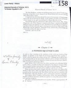
Article - Article, Journal, Public Records Office Victoria, A Pioneer Squatter's Life, 2006
... Lower Plenty, just near where the hotel and old bridge are today. This is a chapter from Historical Records of Victoria / editor-in-chief, Michael Cannon ; [compiled by the Public Records Office]. Vol. 6. The Crown, the land, and the squatter, 1835-1840. Diary of James L Willis from 1837, portraying hardships suffered in the young colony of Victoria. willis family plenty river ...The Willis family were early settlers at Lower Plenty, just near where the hotel and old bridge are today. This is a chapter from Historical Records of Victoria / editor-in-chief, Michael Cannon ; [compiled by the Public Records Office]. Vol. 6. The Crown, the land, and the squatter, 1835-1840.Diary of James L Willis from 1837, portraying hardships suffered in the young colony of Victoria.24 page photocopy of chapter of a book. Digitised copy included.Handwritten inscription on front page: Willis family of Lower Plentywillis family, plenty river, yarra river, lower plenty, james willis -
 Greensborough Historical Society
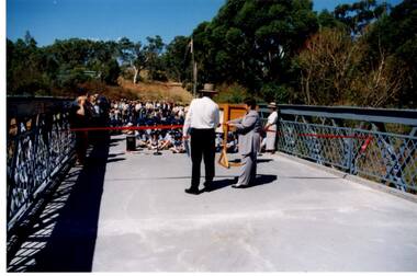
Photograph - Digital Image, Anne Paul, Opening of restored Old Lower Plenty Bridge 2001, 14/03/2001
... The opening of the restored Old Lower Plenty Bridge, opened on 14/03/2001 by the Minister for Environment and Conservation Sherryl Garbutt MLA and Mayor of Banyule Cr Dale Peters. The project was jointly funded by Banyule Council and Parks Victoria. The restored bridge is the oldest remaining bridge in the former Shire of Eltham and forms part of the Plenty River...The opening of the restored Old Lower Plenty Bridge, opened on 14/03/2001 by the Minister for Environment and Conservation Sherryl Garbutt MLA and Mayor of Banyule Cr Dale Peters. The project was jointly funded by Banyule Council and Parks Victoria. The restored bridge is the oldest remaining bridge in the former Shire of Eltham and forms part of the Plenty River ...The opening of the restored Old Lower Plenty Bridge, opened on 14/03/2001 by the Minister for Environment and Conservation Sherryl Garbutt MLA and Mayor of Banyule Cr Dale Peters. The project was jointly funded by Banyule Council and Parks Victoria. The restored bridge is the oldest remaining bridge in the former Shire of Eltham and forms part of the Plenty River Trail.Digital copy of colour photographlower plenty, lower plenty bridge, sherryl garbutt, dale peters, banyule council, parks victoria -
 Greensborough Historical Society
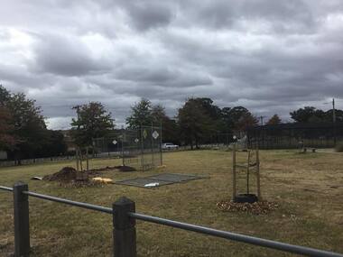
Photograph - Digital Image, Anne Paul, Opening of restored Old Lower Plenty Bridge 2001 - area adjacent, 14/03/2001
... The opening of the restored Old Lower Plenty Bridge, opened on 14/03/2001 by the Minister for Environment and Conservation Sherryl Garbutt MLA and Mayor of Banyule Cr Dale Peters. The project was jointly funded by Banyule Council and Parks Victoria. The restored bridge is the oldest remaining bridge in Nillumbik and forms part of the Plenty River...The opening of the restored Old Lower Plenty Bridge, opened on 14/03/2001 by the Minister for Environment and Conservation Sherryl Garbutt MLA and Mayor of Banyule Cr Dale Peters. The project was jointly funded by Banyule Council and Parks Victoria. The restored bridge is the oldest remaining bridge in Nillumbik and forms part of the Plenty River ...The opening of the restored Old Lower Plenty Bridge, opened on 14/03/2001 by the Minister for Environment and Conservation Sherryl Garbutt MLA and Mayor of Banyule Cr Dale Peters. The project was jointly funded by Banyule Council and Parks Victoria. The restored bridge is the oldest remaining bridge in Nillumbik and forms part of the Plenty River Trail. this photograph shows the area adjacent to the bridge on the day of the opening.Digital copy of colour photographlower plenty, lower plenty bridge, sherryl garbutt, dale peters, banyule council, parks victoria -
 Greensborough Historical Society
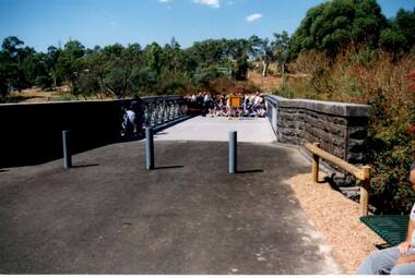
Photograph - Digital Image, Anne Paul, Opening of restored Old Lower Plenty Bridge 2001 - bridge and community, 14/03/2001
... The opening of the restored Old Lower Plenty Bridge, opened on 14/03/2001 by the Minister for Environment and Conservation Sherryl Garbutt MLA and Mayor of Banyule Cr Dale Peters. The project was jointly funded by Banyule Council and Parks Victoria. The restored bridge is the oldest remaining bridge in the former Shire of Eltham and forms part of the Plenty River...The opening of the restored Old Lower Plenty Bridge, opened on 14/03/2001 by the Minister for Environment and Conservation Sherryl Garbutt MLA and Mayor of Banyule Cr Dale Peters. The project was jointly funded by Banyule Council and Parks Victoria. The restored bridge is the oldest remaining bridge in the former Shire of Eltham and forms part of the Plenty River ...The opening of the restored Old Lower Plenty Bridge, opened on 14/03/2001 by the Minister for Environment and Conservation Sherryl Garbutt MLA and Mayor of Banyule Cr Dale Peters. The project was jointly funded by Banyule Council and Parks Victoria. The restored bridge is the oldest remaining bridge in the former Shire of Eltham and forms part of the Plenty River Trail. This photograph shows the bridge area ready for the opening ceremony and the assembled community members attending the function.Digital copy of colour photographlower plenty, lower plenty bridge, sherryl garbutt, dale peters, banyule council, parks victoria -
 Greensborough Historical Society
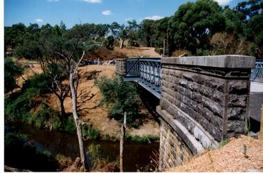
Photograph - Digital Image, Anne Paul, Opening of restored Old Lower Plenty Bridge 2001 - side view of bridge, 14/03/2001
... The opening of the restored Old Lower Plenty Bridge, opened on 14/03/2001 by the Minister for Environment and Conservation Sherryl Garbutt MLA and Mayor of Banyule Cr Dale Peters. The project was jointly funded by Banyule Council and Parks Victoria. The restored bridge is the oldest remaining bridge in the former Shire of Eltham and forms part of the Plenty River...The opening of the restored Old Lower Plenty Bridge, opened on 14/03/2001 by the Minister for Environment and Conservation Sherryl Garbutt MLA and Mayor of Banyule Cr Dale Peters. The project was jointly funded by Banyule Council and Parks Victoria. The restored bridge is the oldest remaining bridge in the former Shire of Eltham and forms part of the Plenty River ...The opening of the restored Old Lower Plenty Bridge, opened on 14/03/2001 by the Minister for Environment and Conservation Sherryl Garbutt MLA and Mayor of Banyule Cr Dale Peters. The project was jointly funded by Banyule Council and Parks Victoria. The restored bridge is the oldest remaining bridge in the former Shire of Eltham and forms part of the Plenty River Trail. This photograph shows the bridge from the side elevation, showing the bluestone and iron construction.Digital copy of colour photographlower plenty, lower plenty bridge, sherryl garbutt, dale peters, banyule council, parks victoria -
 Greensborough Historical Society
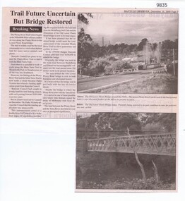
Newspaper - Newspaper Clipping, Banyule Observer, Trail Future Uncertain But Bridge Restored, 16/12/2000
... lower plenty bridge...plenty river...Plenty River Trail future uncertain but Lower Plenty bridge has been restored...Plenty River Trail future uncertain but Lower Plenty bridge has been restored lower plenty bridge plenty river heritage trail Newspaper clipping with black text and black and white photo. ...Plenty River Trail future uncertain but Lower Plenty bridge has been restored Newspaper clipping with black text and black and white photo.lower plenty bridge, plenty river heritage trail -
 Greensborough Historical Society
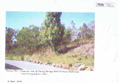
Photograph - Photograph (Copy), Anne Paul, Plenty Bridge Hotel site, 2003_03
... plenty bridge hotel...lower plenty...plenty river...21st century photograph of heritage site: former Plenty bridge Hotel and Tollhouse, situated on the eastern side of Old Lower Plenty Road, near the Old Lower Plenty Road Bridge on the east bank of the Plenty River. ...21st century photograph of heritage site: former Plenty bridge Hotel and Tollhouse, situated on the eastern side of Old Lower Plenty Road, near the Old Lower Plenty Road Bridge on the east bank of the Plenty River. ...21st century photograph of heritage site: former Plenty bridge Hotel and Tollhouse, situated on the eastern side of Old Lower Plenty Road, near the Old Lower Plenty Road Bridge on the east bank of the Plenty River. Although the Hotel burnt down, poplar trees still exist on the site.3 pages, 1 x colour photograph printed on paper, 1 x Heritage Inventory (text) and 1 historic black and white photo.On colour photograph: Close-up site of Plenty Bridge Hotel (H7922-0265) and surviving poplar tree. A. Paul 3/03plenty bridge hotel, lower plenty, plenty river -
 Greensborough Historical Society
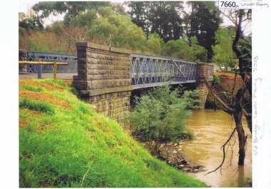
Photograph - Photograph (Copy), Anne Paul, Old bridge, Lower Plenty 2003, 2003_12
... Two views of the old bridge over the Plenty River in Lower Plenty....Two views of the old bridge over the Plenty River in Lower Plenty. lower plenty plenty river floods edward willis drive lower plenty 2 colour photographs printed on paper, handwritten captions Old bridge, Lower Plenty 2003 Photograph Photograph (Copy) Anne Paul ...Two views of the old bridge over the Plenty River in Lower Plenty.2 colour photographs printed on paper, handwritten captionslower plenty, plenty river, floods, edward willis drive lower plenty -
 Greensborough Historical Society
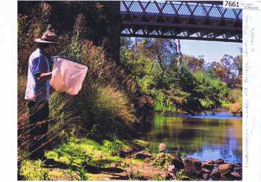
Photograph - Photograph (Copy), Anne Paul, Water Watch under old bridge, Lower Plenty 1990s, 1990s
... Two views of "Waterwatch" working around the bridge over the Plenty River in Lower Plenty....Two views of "Waterwatch" working around the bridge over the Plenty River in Lower Plenty. lower plenty plenty river waterwatch 2 colour photographs printed on paper, handwritten captions Water Watch under old bridge, Lower Plenty 1990s Photograph Photograph (Copy) Anne Paul ...Two views of "Waterwatch" working around the bridge over the Plenty River in Lower Plenty.2 colour photographs printed on paper, handwritten captionslower plenty, plenty river, waterwatch -
 Greensborough Historical Society
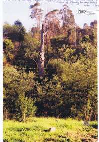
Photograph - Photograph (Copy), Anne Paul, Squizzy Taylor's target tree, taken from old road in front of Plenty Bridge Hotel, Lower Plenty 2003, 2003_05
... lower plenty...plenty river...squizzy taylor...plenty bridge...Plenty Bridge Hotel, Lower Plenty 2003. It is believed that Squizzy Taylor hid at the Plenty Bridge Hotel and used this tree for target practice. lower plenty plenty river squizzy taylor plenty bridge hotel 2 colour photographs printed on paper, handwritten captions Squizzy Taylor's target tree, taken from old road in front of Plenty Bridge Hotel, Lower Plenty 2003 Photograph Photograph (Copy) Anne Paul ...Squizzy Taylor's target tree, taken from old road in front of Plenty Bridge Hotel, Lower Plenty 2003. It is believed that Squizzy Taylor hid at the Plenty Bridge Hotel and used this tree for target practice.2 colour photographs printed on paper, handwritten captionslower plenty, plenty river, squizzy taylor, plenty bridge hotel -
 Greensborough Historical Society
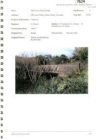
Document - Document Collection, Allom Lovell & Associates, Old Lower Plenty Bridge, 2001
... plenty river...plenty river trail...old lower plenty bridge...Heritage citation for the Old Lower Plenty Bridge, copied from Banyule Heritage Places Study; a short history of the bridge and a news clipping, dated 2001 reporting on the re-opening of the bridge as a link in the Plenty River Trail....Heritage citation for the Old Lower Plenty Bridge, copied from Banyule Heritage Places Study; a short history of the bridge and a news clipping, dated 2001 reporting on the re-opening of the bridge as a link in the Plenty River Trail. plenty river plenty river trail old lower plenty bridge lower plenty 4 p., illus. ...Heritage citation for the Old Lower Plenty Bridge, copied from Banyule Heritage Places Study; a short history of the bridge and a news clipping, dated 2001 reporting on the re-opening of the bridge as a link in the Plenty River Trail.4 p., illus. Heritage citation, 2p.; history of bridge, 1p.; newspaper clipping, 1p. plenty river, plenty river trail, old lower plenty bridge, lower plenty -
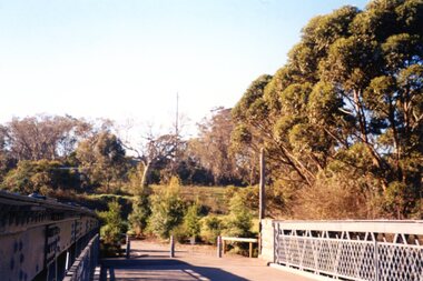 Greensborough Historical Society
Photograph - Photograph Collection, Anne Paul, Lower Plenty Bridge and surrounds, 2002c
... lower plenty...plenty river...old plenty bridge...Six photographs of the area surrounding the Old Plenty Bridge in Lower Plenty lower plenty plenty river old plenty bridge 6 colour photographs Lower Plenty Bridge and surrounds Photograph Photograph Collection Anne Paul ...Six photographs of the area surrounding the Old Plenty Bridge in Lower Plenty6 colour photographs lower plenty, plenty river, old plenty bridge -
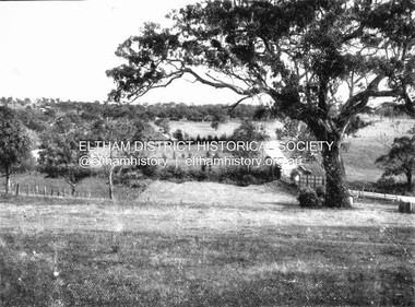 Eltham District Historical Society Inc
Negative - Photograph, Coghill & Haughton, On the banks of the Plenty, c.1924
... Bridge...Bryn Teg...Bryn Teg Hill's Estate...Coghill & Haughton...Heidelberg Golf Club Hotel...houses...Lower Plenty...Lower Plenty Bridge...Lower Plenty Road...Main Road...Mrs M Thomas...Plenty River...Negative copy and associated print of detail from original Sales Brochure: Plenty Township Estate and Bryn Teg Hill's Estate, Coghill & Haughton, Melbourne (c.1924) Bridge Bryn Teg Bryn Teg Hill's Estate Coghill & Haughton Heidelberg Golf Club Hotel houses Lower Plenty Lower Plenty Bridge Lower Plenty Road Main Road Mrs M Thomas Plenty River Plenty Township Estate Real Estate Agent Sales Brochure Film - Agfa Ortho 25 Roll of 35mm Black and White negative film, 3 strips, (1 of 14 frames) Print 10 x 15 cm On the banks of the Plenty Negative Photograph Coghill & Haughton ...Negative copy and associated print of detail from original Sales Brochure: Plenty Township Estate and Bryn Teg Hill's Estate, Coghill & Haughton, Melbourne (c.1924)Roll of 35mm Black and White negative film, 3 strips, (1 of 14 frames) Print 10 x 15 cmFilm - Agfa Ortho 25bridge, bryn teg, bryn teg hill's estate, coghill & haughton, heidelberg golf club hotel, houses, lower plenty, lower plenty bridge, lower plenty road, main road, mrs m thomas, plenty river, plenty township estate, real estate agent, sales brochure -
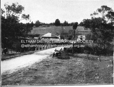 Eltham District Historical Society Inc
Negative - Photograph, Coghill & Haughton, Old bridge over the Plenty River near Plenty Hotel, c.1924
... Lower Plenty...Bridge...hotels...Lower-Plenty-Road...Plenty-Hotel...plenty-river...Negative copy and associated print of detail from original Sales Brochure: Plenty Township Estate and Bryn Teg Hill's Estate, Coghill & Haughton, Melbourne (c.1924) Bryn Teg Hill's Estate Coghill & Haughton Sales Brochure Lower Plenty Bridge hotels Lower-Plenty-Road Plenty-Hotel plenty-river Film - Agfa Ortho 25 Roll of 35mm Black and White negative film, 3 strips, (1 of 14 frames) Print 10 x 15 cm Old bridge over the Plenty River near Plenty Hotel Negative Photograph Coghill & Haughton ...Negative copy and associated print of detail from original Sales Brochure: Plenty Township Estate and Bryn Teg Hill's Estate, Coghill & Haughton, Melbourne (c.1924)Roll of 35mm Black and White negative film, 3 strips, (1 of 14 frames) Print 10 x 15 cmFilm - Agfa Ortho 25bryn teg hill's estate, coghill & haughton, sales brochure, lower plenty, bridge, hotels, lower-plenty-road, plenty-hotel, plenty-river -
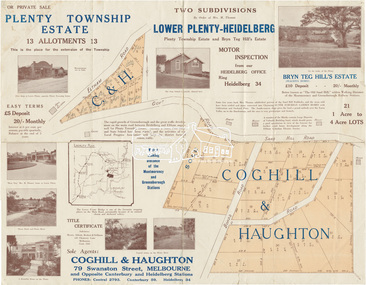 Eltham District Historical Society Inc
Map (item) - Sales Brochure, Plenty Township Estate and Bryn Teg Hill's Estate, Coghill & Haughton, Melbourne, c.1924
... bridge...bryn teg hill's estate...coghill & haughton...eltham road...heidelberg golf club hotel...houses...lower plenty...lower plenty bridge...lower plenty road...main road...plenty hotel...plenty river...The establishment of Lower Plenty as a suburban growth area supported by easy commuting facilitated by the elctrification of the Eltham railway line bonds road bridge bryn teg hill's estate coghill & haughton eltham road heidelberg golf club hotel houses lower plenty lower plenty bridge lower plenty road main road plenty hotel plenty river plenty township estate real estate agent sales brochure sand hills road the old sand hill sand hill paddocks woodfull road old eltham road bryn teg Mrs M Thomas Fold out glossy paper brochure (three half-folds - 16 panels) Includes locality plan, and 8 small photographs: 3 scenes on the Plenty River; State School; First shops at Lower Plenty; "Bryn Teg" home of Mrs M. ...Plenty Township Estate "The rapid growth of Greensborough and the great traffic development on the main road between Heidelberg and Eltham augurs well for Plenty Township Estate. Already a Store, Post Office and State School have been started, and the activities of the Local Progress Association will help the district forward considerably. Within walking distance of the Montmorency and Greensborough stations." Bryn Teg Hill's Estate "Better known as "The Old Sand Hill, "within walking distance of the Montmorency and Greensborough railways stations." "Some few years back Mrs Thomas subdivided portion of the Sand Hill Paddocks, and the areas sold have been settled and many converted into charming outer suburban garden homes with cultivation and orchard plots. The south-eastern slope gives the land a grand outlook over the Yarra Valley on to the Dandenoings, and the are is very picturesque and homely." "A number of the blocks contain large deposits of valuable building sand, which should prove good speculation in view of the forecast for further rapid home development along the Eltham Suburban Electric Service." Sand Hills Road (Old Eltham Road) Date estimated as c.1924 - Electricification of railway line to Eltham referenced on map occured April 1923 and Mrs Mary Thomas died August 1925. Her home Bryn Teg became part of the Heidelberg Golf Club in 1927.The establishment of Lower Plenty as a suburban growth area supported by easy commuting facilitated by the elctrification of the Eltham railway linebonds road, bridge, bryn teg hill's estate, coghill & haughton, eltham road, heidelberg golf club hotel, houses, lower plenty, lower plenty bridge, lower plenty road, main road, plenty hotel, plenty river, plenty township estate, real estate agent, sales brochure, sand hills road, the old sand hill, sand hill paddocks, woodfull road, old eltham road, bryn teg, mrs m thomas -
 Eltham District Historical Society Inc
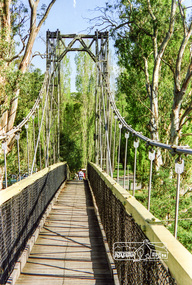
Photograph, Pedestrian suspension bridge over the Yarra River at Lower Plenty, 18 Apr 1998, 1998
... Pedestrian suspension bridge over the Yarra River at Lower Plenty, 18 Apr 1998...bridge...lower plenty...odyssey house...seminary...yarra river...Lower Plenty Heritage Excursion included the former monastery of the Blessed Sacrament Fathers, now Odyssey House, and its suspension footbridge across the Yarra River. Odyssey House drug rehabilitation centre in Bonds Road, Lower Plenty is a distinctive landmark, especially when viewed from across the Yarra at Templestowe. It was built in the 1950’s as a seminary for the Blessed Sacrament Fathers. Because of the poor and circuitous road access, a suspension footbridge was built across the river. As well as providing easy access for the priests residents of Templestowe could attend services at the seminary. The bridge... is now part of the Yarra Trails system. activities blessed sacrament fathers bonds road bridge foot bridge lower plenty odyssey house seminary yarra river Kodak Gold 200-6 Roll of 35mm colour negative film, 6 strips Also photographic prints 10 x 15 cm Pedestrian suspension bridge over the Yarra River at Lower Plenty, 18 Apr 1998 Photograph ...Lower Plenty Heritage Excursion included the former monastery of the Blessed Sacrament Fathers, now Odyssey House, and its suspension footbridge across the Yarra River. Odyssey House drug rehabilitation centre in Bonds Road, Lower Plenty is a distinctive landmark, especially when viewed from across the Yarra at Templestowe. It was built in the 1950’s as a seminary for the Blessed Sacrament Fathers. Because of the poor and circuitous road access, a suspension footbridge was built across the river. As well as providing easy access for the priests residents of Templestowe could attend services at the seminary. The bridge is now part of the Yarra Trails system.Roll of 35mm colour negative film, 6 strips Also photographic prints 10 x 15 cmKodak Gold 200-6activities, blessed sacrament fathers, bonds road, bridge, foot bridge, lower plenty, odyssey house, seminary, yarra river -
 Eltham District Historical Society Inc
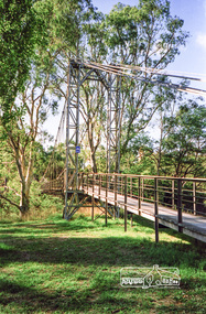
Photograph, Pedestrian suspension bridge over the Yarra River at Lower Plenty, 18 Apr 1998, 1998
... Pedestrian suspension bridge over the Yarra River at Lower Plenty, 18 Apr 1998...bridge...lower plenty...odyssey house...seminary...yarra river...Lower Plenty Heritage Excursion included the former monastery of the Blessed Sacrament Fathers, now Odyssey House, and its suspension footbridge across the Yarra River. Odyssey House drug rehabilitation centre in Bonds Road, Lower Plenty is a distinctive landmark, especially when viewed from across the Yarra at Templestowe. It was built in the 1950’s as a seminary for the Blessed Sacrament Fathers. Because of the poor and circuitous road access, a suspension footbridge was built across the river. As well as providing easy access for the priests residents of Templestowe could attend services at the seminary. The bridge... is now part of the Yarra Trails system. activities blessed sacrament fathers bonds road bridge foot bridge lower plenty odyssey house seminary yarra river Kodak Gold 200-6 Roll of 35mm colour negative film, 6 strips Also photographic prints 10 x 15 cm Pedestrian suspension bridge over the Yarra River at Lower Plenty, 18 Apr 1998 Photograph ...Lower Plenty Heritage Excursion included the former monastery of the Blessed Sacrament Fathers, now Odyssey House, and its suspension footbridge across the Yarra River. Odyssey House drug rehabilitation centre in Bonds Road, Lower Plenty is a distinctive landmark, especially when viewed from across the Yarra at Templestowe. It was built in the 1950’s as a seminary for the Blessed Sacrament Fathers. Because of the poor and circuitous road access, a suspension footbridge was built across the river. As well as providing easy access for the priests residents of Templestowe could attend services at the seminary. The bridge is now part of the Yarra Trails system.Roll of 35mm colour negative film, 6 strips Also photographic prints 10 x 15 cmKodak Gold 200-6activities, blessed sacrament fathers, bonds road, bridge, foot bridge, lower plenty, odyssey house, seminary, yarra river -
 Eltham District Historical Society Inc
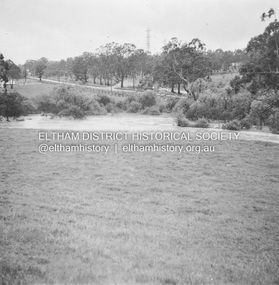
Album - Photograph, J.A. McDonald, Eltham-Yarra Glen Road, 18 Oct. 1956
... bridge construction...Eltham-Yarra Glen Road...1956-10-18...floods...Floodwater...Lower Plenty...Plenty River...Plenty River at Lower Plenty. Floods 18th October 1956. Record of various Shire of Eltham infrastructure works undertaken during the period of 1952-1962 involving bridge and road reconstruction projects, sometimes with Eltham Shire Council Project Reference numbers quoted. ...Eltham-Yarra Glen Road Proposed crossing of Plenty River at Lower Plenty. Floods 18th October 1956.Record of various Shire of Eltham infrastructure works undertaken during the period of 1952-1962 involving bridge and road reconstruction projects, sometimes with Eltham Shire Council Project Reference numbers quoted. It was during this period that a number of significant improvements were made to roads and new bridges constructed within the shire that remain in place as of present day (2022). In many situations, the photos provide a tangible visible record of infrastructure that existed throughout the early days of the Shire. The album was put together by or under the direction of the Shire Engineer, J.A. McDonald.infrastructure, road construction, shire of eltham, bridge construction, eltham-yarra glen road, 1956-10-18, floods, floodwater, lower plenty, plenty river -
 Eltham District Historical Society Inc
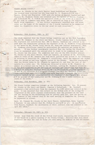
Document - Property Binder, Plenty River Bridge, Main Road, Lower Plenty
... Plenty River Bridge, Main Road, Lower Plenty...Plenty Bridge, 3 September1862, 10 May 1865, 22 May 1865, 5 June 1865 , 10 October1866, 14 November1866, 13 February 1867. Main Road Property Houses Shops Businesses Plenty Bridge Miscellaneous clippings, notes, photocopies, etc held on the subject property. Plenty River Bridge, Main Road, Lower ...Extracts Heidelberg Council Minutes re Plenty Bridge, 3 September1862, 10 May 1865, 22 May 1865, 5 June 1865 , 10 October1866, 14 November1866, 13 February 1867.main road, property, houses, shops, businesses, plenty bridge -
 Eltham District Historical Society Inc
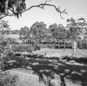
Negative - Photograph, J.A. McDonald, Eltham-Yarra Glen Road, Lower Plenty, c. July 1962
... Lower Plenty Bridge near turn-off for the Golf Club Hotel. Present-day Lower Plenty Road follows a revised alignment across a new bridge. The former bridge is now part of the Plenty River...Lower Plenty Bridge near turn-off for the Golf Club Hotel. Present-day Lower Plenty Road follows a revised alignment across a new bridge. The former bridge is now part of the Plenty River ...View looking west across the Eltham-Yarra Glen Road approaching the Lower Plenty Bridge near turn-off for the Golf Club Hotel. Present-day Lower Plenty Road follows a revised alignment across a new bridge. The former bridge is now part of the Plenty River Trail and Edward Willis Court now follows this section of the original Eltham-Yarra Glen Road.. The Golf Club Hotel is gone and a new Lower Plenty Hotel was built slightly further up the hill.Record of various Shire of Eltham infrastructure works undertaken during the period of 1952-1962 involving bridge and road reconstruction projects, sometimes with Eltham Shire Council Project Reference numbers quoted. It was during this period that a number of significant improvements were made to roads and new bridges constructed within the shire that remain in place as of present day (2022). In many situations, the photos provide a tangible visible record of infrastructure that existed throughout the early days of the Shire. The album was put together by or under the direction of the Shire Engineer, J.A. McDonald.1962-07, shire of eltham, old eltham road, edward willis court, eltham-yarra glen road, golf club hotel, infrastructure, lower plenty, road construction -
 Eltham District Historical Society Inc
Album - Photograph Album, J.A. McDonald, Bridge and Road Reconstruction Works, Shire of Eltham, 1952-1962
... Lower Plenty Bridge...Lower Plenty Footbridge...Lower Plenty Oval...Lower Plenty Road...Lower Plenty...Main Road...Methodist Church...Montmorency...Mount Pleasant Road...New Holland...Old Healesville Road...Opening Ceremony...Oxley Bridge...Para Road...Paul Creek Bridge...Paul Creek Road...Paul Krafeznk...Pinnacle Lane...Plaques...Plenty River...Jolly Kangaroo Ground Kangaroo Ground-Queenstown Road Kangaroo Ground-St Andrews Road Lilydale Shire Office Long Gully Bridge Long Gully Creek Long Gully Road Long Gully Lower Plenty Bridge Lower Plenty Footbridge Lower Plenty Oval Lower Plenty Road Lower Plenty Main Road Methodist Church Montmorency Mount Pleasant Road New Holland Old Healesville Road Opening Ceremony Oxley Bridge Para Road Paul Creek Bridge Paul Creek Road Paul Krafeznk Pinnacle Lane Plaques Plenty River Trail Plenty River Presbyterian Church Prof Donald Thomson Pryor Street railway crossing Railway Parade Rattray Road Reconstruction works Reichelt Avenue Research (Vic.) ...J.A. McDonald produced this record in the course of his responsibilities as Shire Engineer for Eltham Shire Council.Record of various Shire of Eltham infrastructure works undertaken during the period of 1952-1962 involving bridge and road reconstruction projects, sometimes with Eltham Shire Council Project Reference numbers quoted. It was during this period that a number of significant improvements were made to roads and new bridges constructed within the shire that remain in place as of present day (2022). In many situations, the photos provide a tangible visible record of infrastructure that existed throughout the early days of the Shire. The album was put together by or under the direction of the Shire Engineer, J.A. McDonald.a. gillies, alistair knox park, benchmark studies, bend of islands, blease road, box hill state school, box hill teachers college, box hill tip, bridge construction, bridge street bridge, bridge, brisbane street, brougham steet, bulldozer, cecil street, charis pelling, cherry tree road, city of preston, cr. a. brinkkotter, cr. charis pelling, cranes, cromwell street, diamond creek (creek), diamond street, dixons creek bridge, dixon's creek road, drott, eltham leisure centre, eltham north, eltham police station, eltham, eltham-yarra glen road, f. wood, fitzsimons lane bridge, flat rock road, flood damage, floods, floodwater, footpaths and gutters, ford service garage, g. blair, garden hill, glen park bridge, glenauburn road, grand hotel, haldane road, healesville, healesville-yarra glen road, heidelberg-kinglake road, henley road bridge, henley road, hill property, hurstbridge water scheme, hurstbridge, hurstbridge-arthurs creek road, infrastructure, j. jolly, kangaroo ground, kangaroo ground-queenstown road, kangaroo ground-st andrews road, lilydale shire office, long gully bridge, long gully creek, long gully road, long gully, lower plenty bridge, lower plenty footbridge, lower plenty oval, lower plenty road, lower plenty, main road, methodist church, montmorency, mount pleasant road, new holland, old healesville road, opening ceremony, oxley bridge, para road, paul creek bridge, paul creek road, paul krafeznk, pinnacle lane, plaques, plenty river trail, plenty river, presbyterian church, prof donald thomson, pryor street, railway crossing, railway parade, rattray road, reconstruction works, reichelt avenue, research (vic.), research oval, road construction, rymers corner, shire of eltham, shire of whittlesea, silvan road bridge, silver street bridge, silver street, sir dallas brooks, smedley property, st andrews, steels creek, susan street, tarrawarra, tony carberry, uniting church, upper yarra dam, upper yarra reservoir, w.e. wolf, waterfall property, watsons creek, wattletree road bridge, wattletree road, wattletree road bridge, worlingworth, yarra glen, york street, yow yow creek -
 Eltham District Historical Society Inc
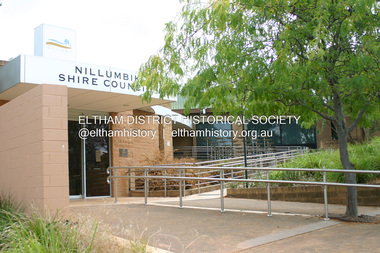
Photograph - Digital Photograph, Alan King, Nillumbik Shire Offices, Greensborough, 30 March 2008
... Plenty River. From this committee arose the Eltham District Road Board, in 1856, which was the precursor to the Eltham Shire Council. The Board’s first chairman was Kangaroo Ground farmer, John Barr. Secretary was the former committee’s secretary, Andrew Ross, Kangaroo Ground’s first school teacher, and founder of the district newspaper, The Evelyn Observer.2 Most of the board’s income came from a toll-house north of the Lower Plenty Bridge, which funded such projects as a road from Kangaroo Ground to the Caledonia Diggings. ...Plenty River. From this committee arose the Eltham District Road Board, in 1856, which was the precursor to the Eltham Shire Council. The Board’s first chairman was Kangaroo Ground farmer, John Barr. Secretary was the former committee’s secretary, Andrew Ross, Kangaroo Ground’s first school teacher, and founder of the district newspaper, The Evelyn Observer.2 Most of the board’s income came from a toll-house north of the Lower Plenty Bridge, which funded such projects as a road from Kangaroo Ground to the Caledonia Diggings. ...Nillumbik Shire Council transferred to the former Diamond Valley Shire Offices in Greensborough after municipal restructuing. The offices became the official Nillumbik Shire Council Offices on 16 October 1995. The former Shire of Diamond Valley Civic Centre or Shire Office building was officially opened on 26th February 1972. Archtiects were A.K. Lines, McFarlane & Marshall and it was built by L.U. Simon Pty Ltd, The Diamond Valley Shire had been created in 1964 from part of the City of Heidelberg. On December 15, 1994 the Shire of Nillumbik was established. Under the Council amalgamations imposed by the Kennett government, the Shire of Eltham, Shire of Diamond Valley and City of Heidelberg ceased to exist with the establishment of Nillumbik Shire Council and the City of Banyule.The new Nillumbik shire surrended the west riding from Eltham to Banyule but in place gained parts of the former Diamond Valley Shire which itself had been created in 1964 from parts of the City of Heidelberg. Three unelected and non-local Commissioners were put in place by the government bringing democracy into question by many members of the local community. The Commissioners determined to abandon the former Shire of Eltham offices located in Main Road, Eltham and in turn occupy the former Shire of Diamond Valley offices located at the boundary of the new shire with Banyule, in Civic Drive, Greensborough. In July 1996 the Commissioners sold the former Eltham Shire Offices and had them bulldozed leading to many years of communiity protest over the process and future development applications. The site has remained vacant ever since. Published: Nillumbik Now and Then / Marguerite Marshall 2008; photographs Alan King with Marguerite Marshall.; p43 It was the need for roads that led to this district’s first council. In 1853 a committee was formed to improve the rough roads, some in Kangaroo Ground being almost impassable in winter.1 The committee fundraised by voluntary levies and grants to improve in particular, the main road between Kangaroo Ground and the Plenty River. From this committee arose the Eltham District Road Board, in 1856, which was the precursor to the Eltham Shire Council. The Board’s first chairman was Kangaroo Ground farmer, John Barr. Secretary was the former committee’s secretary, Andrew Ross, Kangaroo Ground’s first school teacher, and founder of the district newspaper, The Evelyn Observer.2 Most of the board’s income came from a toll-house north of the Lower Plenty Bridge, which funded such projects as a road from Kangaroo Ground to the Caledonia Diggings. In 1871 the Shire of Eltham was proclaimed, with its boundaries the same as those of the Road Board, and Councillor A Donaldson of Kangaroo Ground was the first president. Eltham was at the southern tip of the shire, which extended north to Kinglake and east beyond Yarra Glen. In 1878, part of Kinglake was added to the shire, while the area east of Watts River, near Healesville was removed. In 1912, then again in 1958, the shire was further reduced. Yarra Glen, Steels Creek, Tarrawarra, parts of Healesville and Christmas Hills, were transferred to the Shire of Healesville. In 1972 a smaller area, at Kinglake, was transferred to the Shire of Yea, leaving 277 square kilometres in the Eltham Shire. Perhaps no other Victorian municipality has had so many meeting places. Although from 1858 to 1904, the council convened at the office in the home of Secretary Charles Wingrove, the board, and later the council, also met at other more central locations.3 The board moved from the Fountain of Friendship Hotel to the Eltham Courthouse, to the Kangaroo Ground schoolhouse. It then met at the Kangaroo Ground Hotel, which some considered put it in danger of interruptions by people ‘the worse for liquor’.4 In 1885 the council met at the hall on Mr J Donaldson’s land at Kangaroo Ground. After Wingrove’s retirement, the council rented space at the Kangaroo Ground General Store and Post Office. Then, in 1917, the council bought the former office of The Evelyn Observer, after its printing works transferred to Hurstbridge. In 1934, fire destroyed the shire office, which was temporarily relocated to the Kangaroo Ground home of Shire Secretary, Mr P J McMahon. In 1941, the shire office moved to a new building (which included a public hall) in Eltham, at the corner of Arthur Street and Main Road, where the Eltham Village Shopping Centre was eventually built. Growth required new offices, which opened in 1965, on the former Shillinglaw property in Main Road.5 In 1994, as part of municipal restructuring under the Jeff Kennett Liberal Government, most of the Eltham Shire formed part of the new Shire of Nillumbik. It joined with the north section of the Diamond Valley Shire and parts of the Healesville and Whittlesea municipalities. The Diamond Valley Shire had been created in 1964, from part of the City of Heidelberg. Turbulence followed Nillumbik Shire’s formation. Under the Commissioners the council transferred to the former Diamond Valley Shire offices in Greensborough, and the Eltham council offices were demolished. In March 1997 the first five-member Nillumbik Council was elected. But, in October 1998, the government suspended the council and appointed an administrator . Early in 1999, shire residents voted to increase councillors to nine: comprising five ward councillors and four shire-wide councillors. Elections were held in March 1999. Then, before the March 2002 elections, nine new wards were created.6 In 2008 these were reduced to seven. Today [2008] the council governs a varied population of more than 60,000 people living in townships and on bush properties in the green wedge.This collection of almost 130 photos about places and people within the Shire of Nillumbik, an urban and rural municipality in Melbourne's north, contributes to an understanding of the history of the Shire. Published in 2008 immediately prior to the Black Saturday bushfires of February 7, 2009, it documents sites that were impacted, and in some cases destroyed by the fires. It includes photographs taken especially for the publication, creating a unique time capsule representing the Shire in the early 21st century. It remains the most recent comprehenesive publication devoted to the Shire's history connecting local residents to the past. nillumbik now and then (marshall-king) collection, greensborough, nillumbik shire council offices, civic drive -
 Eltham District Historical Society Inc
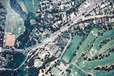
Slide - Photograph, Aerial Photo (c.1987): Main Road, Lower Plenty from Heidelberg Golf Course to Plenty River, c.Aug. 1990
... Lower Plenty...Lower Plenty Bridge...Main Road...Plenty River...In the byways category are views of some iof the Shire's bicycle paths including then recently completed sections of the Main Yarra Trail at Lower Plenty. infrastructure roads aerial photographs Heidelberg Golf Club Lower Plenty Lower Plenty Bridge Main Road Plenty River 35mm colour positive transparency (1 of 37) Mount - Agfachrome Agfa CS System black 8 dots Aerial Photo (c.1987): Main Road, Lower Plenty from Heidelberg Golf Course to Plenty River Slide Photograph ...Part of a presentation, "Roads and Byways of the Shire of Eltham", by Russell Yeoman to the 12 September 1990 Society meeting. Slides shown included copies of old photos and recent images ranging from the suburban streets of Eltham and Montmorency to the mountain roads of Kinglake. In the byways category are views of some iof the Shire's bicycle paths including then recently completed sections of the Main Yarra Trail at Lower Plenty.35mm colour positive transparency (1 of 37) Mount - Agfachrome Agfa CS System black 8 dotsinfrastructure, roads, aerial photographs, heidelberg golf club, lower plenty, lower plenty bridge, main road, plenty river
