
Showing 260 items matching "maritime navigation"
-
 Flagstaff Hill Maritime Museum and Village
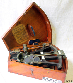
Instrument - Octant, mid 1800's
... ...maritime navigation...The octant, the forerunner of the sextant, was a significant step in providing accuracy of a sailors latitude position at sea & his vessels distance from land when taking sightings of land-based landmarks. flagstaff hill warrnambool shipwrecked-coast flagstaff-hill flagstaff-hill-maritime-museum maritime-museum shipwreck-coast flagstaff-hill-maritime-village maritime navigation navigation instrument migration captain chisholm farquhar chisholm sailing ship the elizabeths thomas l. ainsley l. simons shields england octant john hadley chisholm Label inside case "Thomas L. ...An Octant is a doubly reflecting navigation instrument used primarily by sailors to measure the angular distance between two visible objects and was a forerunner of the sextant. The name comes from the Latin octo, or "one-eighth of a circle," for the Octan'ts arc which spans 45°, or one-eighth of a circle. The primary use of an Octant is to measure the angle between an astronomical object and the horizon for celestial navigation. The estimation of this angle, is known as sighting or shooting the object, or taking a sight. The angle, and the time when it was measured, can be used to calculate a position line on a nautical chart (latitude), for example, sighting the Sun at noon or Polaris at night (in the Northern Hemisphere) gives an angle by which the latitude can then be estimated. Sighting the height of a landmark on land can also give a measure of distance. This fine octant once belonged to Captain Farquhar Chisholm and was donated by his granddaughter, Margaret Ruth Greer (nee Chisholm, born 1914). The label inside the Octant's box reads “Thomas L. Ainsley, Instrument Maker … etc”. Farquhar Chisholm was born in 1832 in Inverness, Scotland. He regularly sailed on perilous voyages between Quebec, Canada and the Baltic ports of Europe. In 1854 he migrated to Australia during the Gold Rush, to a place called Fiery Creek (near Beaufort Victoria) where he was fairly successful in his quest for gold. In the years of the Great Gold Rush, it was said that there were over 40,000 diggers in the goldfields of the Beaufort area! In 1857 having made sufficient money, he hired another crew and returned to Clachnacuddin, Inverness shire, Scotland and in that same year, he studied and obtained his Master Mariner Certificate (which would have included the use of an octant for navigation). He was appointed to Mr George (or James) Walker, as commander of his sailing ship, the 3-masted ELIZABETH, built 1859 and known as “The Walker barque”. In 1870 he married, then in 1887 returned to Australia with his wife and children (Kenneth Chisholm (1871), Mary Bremner Chisholm (1873), Margaret Hood Chisholm (1874), Farquhar Chisholm (1878)). They arrived in Port Melbourne, Victoria and sadly, only six weeks after landing, his wife Caroline passed away (in Geelong,1888). In 1900 Capt. Chisholm lived in Camperdown (Victoria) and not long after this his daughter Margaret died of consumption. In his later years, he went to live in the manse of St. Paul’s Presbyterian Church, Wangaratta, with his son, Rev. Farquhar Chisholm. He died there on Sat, 23rd March 1912, 80 years old. He was known as “… quiet, unobtrusive and competent, respected by all with whom he came in contact”. Some other members of Captain Chisholm’s family are; his older son Kenneth Chisholm, who was a contractor in Camperdown; a nephew Donald Macintosh (of 23 Douglas Row, Inverness); a grandson Brian Jones (son of Caroline Belle-Jones nee Chisholm, who lived in Camperdown in the earlier part of her life).The octant, the forerunner of the sextant, was a significant step in providing accuracy of a sailors latitude position at sea & his vessels distance from land when taking sightings of land-based landmarks.Octant, once belonging to Captain Farquhar Chisholm. Wedge shape (the size of an eighth of a circle), made of wood, glass and metal. Used in the 1880s. Maker’s name across centre “L. SIMON - - - SHIELDS”. Three (3) light filtering, coloured glass shades. Two (2) eyepieces. Scale attached for measuring angles. Label inside the fitted, wedge-shaped case "Thomas L. Ainsley, Optician"Label inside case "Thomas L. Ainsley, Optician" Maker’s name across centre “L. SIMON - - - SHIELDS”.flagstaff hill, warrnambool, shipwrecked-coast, flagstaff-hill, flagstaff-hill-maritime-museum, maritime-museum, shipwreck-coast, flagstaff-hill-maritime-village, maritime navigation, navigation instrument, migration, captain chisholm, farquhar chisholm, sailing ship, the elizabeths, thomas l. ainsley, l. simons, shields england, octant, john hadley, chisholm -
 Flagstaff Hill Maritime Museum and Village
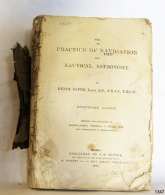
Book - Technical Reference, Henry Raper, Lieut. R.N, The Practice of Navigation and Nautical Astronomy, 1891
... Flagstaff Hill Maritime Village...book...navigation...This technical book was very popular as a textbook for students of maritime navigation, written and updated by members of the British Royal Navy and relied upon for accurate advice and information. ...This technical textbook is the nineteenth edition of the book by Henry Raper, Lieutenant in the Royal Navy with awards that include F.R.A.S. (Fellow of the Royal Astronomical Society) and F.R.G.S. (Friend of the Royal Geographical Society). The book is dedicated in honour of Rear-Admiral Sir Francis Beaufort K.C.B., Hydrographer to the Admiralty. He was awarded the title K.C.B. (King's Commander) as a Member of the Order of Bath, an order of British Chivalry, The book was first published in 1840 and soon became a resource for navigation students. It includes topics on nautical navigation, astronomy, navigation charts, calculations and mathematical tables, time, tides, ships, longitude, and position at sea. Thomas A. Hull, who revised and expanded this edition, was a Commander in the Royal Navy and had previously been Superintendent of Admiralty Charts used for navigation worldwide by seamen from many walks of life. The publisher, J D Potter of London, was at that time the sole agent for the Admiralty Charts produced by the Royal Navy. Printer Spottswoode and Co.,. was established by William Strachan in 1738. In 1819 his nephews A and R Spottswoode took over the business and bought premises in New-Street Square and Shoe Lane. In 1850 over 200 workers were employed by the firm. and five years later the business became Spottswoode & Co. Andrew Spottswoode invented the Spottswoode Press.This technical book was very popular as a textbook for students of maritime navigation, written and updated by members of the British Royal Navy and relied upon for accurate advice and information. The first edition was published in 1840, this edition was updated, expanded and published in 1891 when ports around the world were filling with travellers, merchants and business people. Title: The Practice of Navigation and Nautical Astronomy Author: Henry Raper, Lieut, R.N., F.R.A.S., F.R.G.S. Nineteenth Edition, revised and enlarged by Commander Thomas A. Hull, R.N., Late Superintendant of Admiralty Charts Dedication: To Rear-Admiral Sir Francis Beaufort K.C.B. Publisher: J D Potter, London, sole agent for the sale of Admiralty Charts Printer: Spottswoode and Co. New-Street Square, London Date: 1891 Small leather hardcover book with gold embossed text and lines on the spine. The Dedication in the book is as follows: - "To Rear-Admiral Sir Francis Beaufort K.C.B. Hydrographer to the Admiralty. Sir, The eminent station which you occupy in the naval scientific world renders it highly gratifying to me to dedicate the following Work to you as a testimony of my regard and esteem; while the general accordance of my views on the subject with those of your more experienced judgement, gives me the greater confidence in laying my labours before the Public. I have the honour to be, Sir, Your obedient servant, HENRY RAPER"flagstaff hill maritime museum, maritime museum, shipwreck coast, flagstaff hill, warrnambool, flagstaff hill maritime village, book, navigation, nautical astronomy, hydrography, nautical charts, nautical navigation, astronomical navigation, admiralty charts, henry raper, thomas a. hull, royal navy, j d potter, royal astronomical society, royal geographical society, calculations, mathematical tables, longitude, latitude, nautical time, location at sea, position at sea, maritime, practical navigation, spottswoode and co., sir francis beaufort, k.c.b., rear-admiral sir francis beaufort, hydrographer to the admiralty, scientific book, naval science -
 Flagstaff Hill Maritime Museum and Village
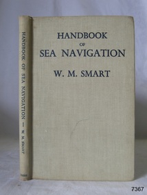
Book - Reference guide, William Marshall Smart (W M Smart), Professor of Astronomy, A Handbook of Sea Navigation, 1943
... ...Maritime handbook...navigation... Maritime handbook navigation instructiono sea navigation Pencil: "12/6" [12 shillings 6 pence] Sticker: "G.F. ...Author W M Smart, M.A., D.SC., F.R.A.S. (William Marshall Smart), (1889-1975) Regius Professor of Astronomy in the University of Glasgow, Instructor-Lieut. in the Royal Navy during World War I. and John Couch Adams Astronomer in the University of Cambridge. In 1943 he was elected as a fellow of the Royal Society of Edinburg. From 1949-1951 he was President of the Royal Astronomical Society and a member of the Royal Institute of Navigation. In 1958 he was awarded the Lorimer Medal of the Astronomical Society of Edinburgh. The publisher firm, Longmans, Green & Co, was originally founded in 1724 in London by Thomas Longman under the name Longman. In August of that year, he bought the two shops and goods of William Taylor and set up his publishing house there at 39 Paternoster Row. The shops were called Black Swan and Ship, and it is said that the 'ship' sign was the inspiration for Longman's Logo. After many changes of name and management, the firm was incorporated in 1926 as Longmans, Green & Co. Pty Ltd. The firm was acquired by Pearson in 1968 and was known as Pearson Longman or Pearson PLC. The book was sold by Collins Book Depot which was founded by Frederick Henry (Harry) Slamen in 1922. In 1929 the form became a Proprietary Limited Company with an additional two stores, at 95 Elizabeth and 361 Swanston Streets, Melbourne. Collins Booksellers is still owned by the Stamen family. It is the largest Australian-owned bookselling chain.The book is significant due to its connection with navigation at sea. Its author W M Smart was a learned astronomer and an Instructor-Lieutenant for the Royal Navy during World War I. His achievements were recognised in 1958 when he was awarded the Lorimer Medal of the Astronomical Society of Edinburgh.A Handbook of Sea Navigation: The Theory & Practice of Astronomical Navigation at Sea, with diagrams and charts Author: W M Smart, M.A., D.SC., F.R.A.S. (William Marshall Smart) Publisher: Longmans, Green and Co Printer: Collins Book Depot Date: 1943 Textured green hardcover book. Inscriptions on the Fly page.Pencil: "12/6" [12 shillings 6 pence] Sticker: "G.F. Byrne / Faunce Crescent / O'Connor, A.C.T. / Australia 2001" Stamp: "COLLINS BOOK DEPOT PTY. LTD. / Technical Book Department / 361 Swanston St., Melb. G - - -"flagstaff hill, flagstaff hill maritime museum and village, warrnambool, maritime museum, maritime village, great ocean road, shipwreck coast, longmans green and co., thomas longman, paternoster row london, w m smart, william marshall smart, astronomer, navigator, professor of astronomy, 1943, g.f. byrne, collins book depot, technical book department, 361 swanston st., melbourne, frederick henry (harry) slamen, 361 swanston street melbourne, a handbook of sea navigation, maritime handbook, navigation instructiono, sea navigation -
 Flagstaff Hill Maritime Museum and Village
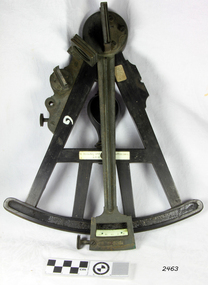
Octant, Late 18th to mid-19th century
... flagstaff-hill-maritime-village...navigation...It also demonstrates the skill and workmanship of the early instrument makers that operated from London at this time and provided most of the navigational instrumentation use by commercial and military navies of the time. flagstaff hill warrnambool shipwrecked-coast flagstaff-hill flagstaff-hill-maritime-museum maritime-museum shipwreck-coast flagstaff-hill-maritime-village navigation navigational instrument instrument used for navigation sextant henry hemsley instrument maker london octant "H. ...An Octant is a doubly reflecting navigation instrument used primarily by sailors to measure the angular distance between two visible objects and was a forerunner of the sextant. The name comes from the Latin octo, or “one-eighth of a circle,” for the Octant’s arc which spans 45°, or one-eighth of a circle. The primary use of an Octant is to measure the angle between an astronomical object and the horizon for the purposes of celestial navigation. The estimation of this angle is known as sighting or shooting the object, or taking a sight. The angle, and the time when it was measured, can be used to calculate a position line on a nautical chart (latitude), for example, sighting the Sun at noon or Polaris at night (in the Northern Hemisphere) gives an angle by which the latitude can then be estimated. Sighting the height of a landmark on land can also give a measure of distance. History: The principle of the Octant as an instrument to measure ones latitude was first implemented around 1742-present but was superseded by the improvement of the octant to a sextant, a very similar instrument, better made and able to measure bigger angles 120°, allowing the measurement of Luna distances to give longitude when used with an accurate chronometer. The sextant started to appear around 1730 and had been attributed to by John Hadley (1682–1744) and Thomas Godfrey (1704–1749), but reference to the sextant was also found later in the unpublished writings of Isaac Newton (1643–1727). Earlier links can be found to Bartholomew Gosnold (1571–1607) indicating that the use of a Sextant for nautical navigation predates Hadley's implementation. In 1922, the sextant was modified for aeronautical navigation by Portuguese navigator and naval officer Gago Coutinho. Henry Hemsley was a lesser-known instrument maker and optician working in London in the late 17th and early 18th century. However, it should be noted that there were two Henry Hemsley opticians and instrument makers around this period. (Henry Hemsley 1, 1786-89, who had premises at 85 Fleet St London and Henry Hemsley 2, 1828-56), whose workshop was at 135-138 Radcliff Highway London. Therefore, based on the inscribed workshop address Henry Hemsley 2 is responsible for making this example.The octant is representative of its type and although not fully complete it demonstrates how 18th and 19th-century mariners determined their latitude on a chart to navigate their way across the world's oceans in the 18th and 19th century. It also demonstrates the skill and workmanship of the early instrument makers that operated from London at this time and provided most of the navigational instrumentation use by commercial and military navies of the time.Octant, ebony wooden frame and handle. Scale is missing from recess in frame. "H. Hemsley 135-138 Ratliff Highway, London", no box"H. Hemsley 135-138 Ratcliff Highway, London"flagstaff hill, warrnambool, shipwrecked-coast, flagstaff-hill, flagstaff-hill-maritime-museum, maritime-museum, shipwreck-coast, flagstaff-hill-maritime-village, navigation, navigational instrument, instrument used for navigation, sextant, henry hemsley, instrument maker, london, octant -
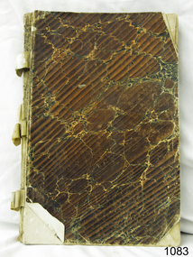 Flagstaff Hill Maritime Museum and Village
Book
... flagstaff-hill-maritime-village...navigation...navigational calculations at an advance level. In German. flagstaff hill warrnambool shipwrecked-coast flagstaff-hill flagstaff-hill-maritime-museum maritime-museum shipwreck-coast flagstaff-hill-maritime-village navigation navigation school book book Navigation School Book Book ...Joachim Popp Hamburg Trigonometric navigational calculations at an advance level. In German.Navigation School Bookflagstaff hill, warrnambool, shipwrecked-coast, flagstaff-hill, flagstaff-hill-maritime-museum, maritime-museum, shipwreck-coast, flagstaff-hill-maritime-village, navigation, navigation school book, book -
 Flagstaff Hill Maritime Museum and Village
Functional object - Navigation Side Lamp, early 20th century
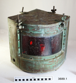
... flagstaff hill maritime village...navigation...This pair of navigational lamps or lights was fitted to the vessel S.S. Rowitta when it was renovated to become a display passenger ferry at Flagstaff Hill Maritime Village from 1976-2015. ...The vessel was an example of a ferry built in the early 20th century that served many different roles over its lifetime of over 100 years. flagstaff hill warrnambool flagstaff hill maritime museum maritime museum flagstaff hill maritime village navigation lamp navigation light navigation equipment starboard patt 8025 ship’s fitting rowitta tarkarri speculant purdon & featherstone of hobart passenger ferry 1909 vessel display rowitta display passenger ferry Sorrento Impressed on 3689.2; “STARBOARD PATT 8025” Two side navigation ship's lamps, quarter circle shaped metal boxes with glass window and removable lid. ...This pair of navigational lamps or lights was fitted to the vessel S.S. Rowitta when it was renovated to become a display passenger ferry at Flagstaff Hill Maritime Village from 1976-2015. Navigation lamps are used to indicate a vessel’s position and direction of travel to other vessels nearby. This system of coloured lamps is standardised throughout the world for all marine vessels, red is for port and green for starboard, (red is for the boats right hand side). These navigation lamps were not the original fittings for this vessel but had come from a similar vessel of the same era of the early 1900’s. The history of the lamp fittings at this time is unknown. SS ROWITTA: - The 1909 steam ferry, SS Rowitta, was installed as an exhibit at Flagstaff Hill in 1975 and was enjoyed by many visitors for 40 years. Rowitta was a timber steam ferry built in Hobart in 1909 using planks of Huon and Karri wood. She was a favourite of sightseeing passengers along Tasmania’s Tamar and Derwent rivers for 30 years. Rowitta was also known as Tarkarri and Sorrento and had worked as a coastal trading vessel between Devonport and Melbourne, and Melbourne Queenscliff and Sorrento. In 1974 Rowitta was purchased by Flagstaff Hilt to convert into a representation of the Speculant, a historic and locally significant sailing ship listed on the Victorian Heritage Database. (The Speculant was built in Scotland in 1895 and traded timber between the United Kingdom and Russia. Warrnambool’s P J McGennan & Co. then bought the vessel to trade pine timber from New Zealand to Victorian ports and cargo to Melbourne. She was the largest ship registered with Warrnambool as her home port, playing a key role in the early 1900s in the Port of Warrnambool. In 1911, on her way to Melbourne, she was wrecked near Cape Otway. None of the nine crew lost their lives.) The promised funds for converting Rowitta into the Speculant were no longer available, so she was restored back to her original configuration. She represented the importance of coastal traders to transport, trade and communication in Australia times before rail and motor vehicles. Sadly, in 2015 the time had come to demolish the Rowitta due to her excessive deterioration and the high cost of on-going repairs. She had given over 100 years of service and pleasure to those who knew her. These lamps are an historical example of navigational equipment used in the early 20th century, adhering to a navigational standard that is worldwide, and a design similar to what is still being used today. They were used on the display vessel at Flagstaff Hill Maritime Village as an aid to maritime education. The Rowitta represents the importance of coastal traders to transport, trade and communication along the coast of Victoria, between states, and in Australia before rail and motor vehicles. The vessel was an example of a ferry built in the early 20th century that served many different roles over its lifetime of over 100 years. Two side navigation ship's lamps, quarter circle shaped metal boxes with glass window and removable lid. The lid attaches to the box using four brackets, wingnuts and screws that swing down out of the way. The window of double-thickness glass is inserted on the curved side of the box and attached by screws around the frame. The inner glass panel is coloured according to the lamp’s use; port is red and starboard green. The port lamp has a round hole cut into each of the two straight sides and an electrical fitting inside. The starboard lamp also has a hole in each straight side (one with a threaded fitting). Its lid has an additional cross bar on top that has a circular space in the centre, nuts and screws fit through holes in the ends and a folding handle is attached across the centre space. The lamps were once fitted onto the vessel Rowitta. The starboard lamp has an inscription stamped into the metal. Impressed on 3689.2; “STARBOARD PATT 8025” flagstaff hill, warrnambool, flagstaff hill maritime museum, maritime museum, flagstaff hill maritime village, navigation lamp, navigation light, navigation equipment, starboard patt 8025, ship’s fitting, rowitta, tarkarri, speculant, purdon & featherstone of hobart, passenger ferry 1909, vessel, display rowitta, display passenger ferry, sorrento -
 Phillip Island and District Historical Society Inc.
Letter, Letter from Mrs Ethel Cleeland re Island history 1968, 15/7/1968
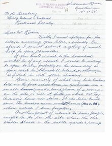
... ...maritime safety...Navigation...Historical Newhaven Mrs Ethel Cleeland Back to Phillip Island 1968 cape woolamai granite quarry maritime safety Navigation Light Mr Finn stonemason san remo - newhaven punt Cattle transport Newhaven school Boat building Newhaven Handwritten 5 page letter to Mr Harris, secretary of PIDHS, re places of interest in Newhaven area and their history. ...She was Ethel Hartley who married John Blake Cleeland and died in 1984.The 1968 "back to" was to commemorate 100 years of settlement on the Island.HistoricalHandwritten 5 page letter to Mr Harris, secretary of PIDHS, re places of interest in Newhaven area and their history. Dated 15/7/1968 and written at Woolamai House, Newhaven. This was for the Back to Phillip Island in 1968.newhaven, mrs ethel cleeland, back to phillip island 1968, cape woolamai granite quarry, maritime safety, navigation light, mr finn stonemason, san remo - newhaven punt, cattle transport, newhaven school, boat building newhaven -
 Flagstaff Hill Maritime Museum and Village
Functional object - Fresnel Glass Lens, Early 20th century
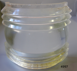
... Maritime Light...Ships Navigation Light...The subject item at this time cannot be associated with a historical event, person or place, provenance is unknown, the item is a replacement for a ships navigation light and it is believed to have been produced before 1950. Warrnambool Flagstaff-Hill Flagstaff-Hill-Maritime-Museum Maritime-Museum Shipwreck-coast Flagstaff-Hill-Maritime-Village Fresnel Lens Maritime Light Ships Navigation Light Augustin-Jean Fresnel Lighthouse Lenses Lighthouse Navigation Warning Light None Fresnel glass replacement lens for a navigation lamp of a ship. ...A Fresnel lens is a type of composite compact lens developed by the French physicist Augustin-Jean Fresnel (1788–1827) for use primarily in lighthouses. Made from high-quality glass Fresnel lenses were used originally in lighthouses and later for many other applications They were later being used for automobile headlamps, brake, parking, and turn signal lenses, and many other applications. Fresnel lenses used in lighthouses were considered state of the art from the late 19th through to the middle of the 20th century. The subject item is a Fresnel replacement lens used in a ships navigation light. For lighthouses, these lenses have now been replaced with much less expensive and more durable aerobeacons, which themselves often contain plastic Fresnel lenses. The lens design allows the construction of lenses of large aperture and short focal length without the mass and volume of material that would be required by a lens of conventional design. A Fresnel lens can be made much thinner than a comparable conventional lens, in some cases taking the form of a flat sheet. The simpler dioptric (purely refractive) form of the lens was first proposed by Count Buffon and independently reinvented by Fresnel. The catadioptric form of the lens, entirely invented by Fresnel, has outer elements that use total internal reflection as well as refraction; it can capture more oblique light from a light source making the light visible from greater distances.The subject item at this time cannot be associated with a historical event, person or place, provenance is unknown, the item is a replacement for a ships navigation light and it is believed to have been produced before 1950.Fresnel glass replacement lens for a navigation lamp of a ship. None warrnambool, flagstaff-hill, flagstaff-hill-maritime-museum, maritime-museum, shipwreck-coast, flagstaff-hill-maritime-village, fresnel lens, maritime light, ships navigation light, augustin-jean fresnel, lighthouse lenses, lighthouse, navigation, warning light -
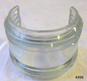 Flagstaff Hill Maritime Museum and Village
Functional object - Fresnel Glass Lens, Early 20th century
... Maritime Light...Ships Navigation Light...The subject item at this time cannot be associated with a historical event, person or place, provenance is unknown, the item is a replacement for a ships navigation light and it is believed to have been produced before 1950. Warrnambool Flagstaff-Hill Flagstaff-Hill-Maritime-Museum Maritime-Museum Shipwreck-coast Flagstaff-Hill-Maritime-Village Fresnel Lens Maritime Light Ships Navigation Light Augustin-Jean Fresnel Lighthouse Lenses Lighthouse Navigation Warning Light None Fresnel glass replacement lens for a navigation mast headlamp of a ship. ...A Fresnel lens is a type of composite compact lens developed by the French physicist Augustin-Jean Fresnel (1788–1827) for use primarily in lighthouses. Made from high-quality glass Fresnel lenses were used originally in lighthouses and later for many other applications They were later being used for automobile headlamps, brake, parking, and turn signal lenses, and many other applications. Fresnel lenses used in lighthouses were considered state of the art from the late 19th through to the middle of the 20th century. The subject item is a Fresnel replacement lens used in a ships navigation light. For lighthouses, these lenses have now been replaced with much less expensive and more durable aerobeacons, which themselves often contain plastic Fresnel lenses. The lens design allows the construction of lenses of large aperture and short focal length without the mass and volume of material that would be required by a lens of conventional design. A Fresnel lens can be made much thinner than a comparable conventional lens, in some cases taking the form of a flat sheet. The simpler dioptric (purely refractive) form of the lens was first proposed by Count Buffon and independently reinvented by Fresnel. The catadioptric form of the lens, entirely invented by Fresnel, has outer elements that use total internal reflection as well as refraction; it can capture more oblique light from a light source making the light visible from greater distances.The subject item at this time cannot be associated with a historical event, person or place, provenance is unknown, the item is a replacement for a ships navigation light and it is believed to have been produced before 1950.Fresnel glass replacement lens for a navigation mast headlamp of a ship. Nonewarrnambool, flagstaff-hill, flagstaff-hill-maritime-museum, maritime-museum, shipwreck-coast, flagstaff-hill-maritime-village, fresnel lens, maritime light, ships navigation light, augustin-jean fresnel, lighthouse lenses, lighthouse, navigation, warning light -
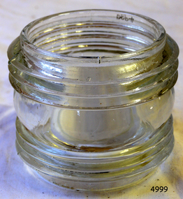 Flagstaff Hill Maritime Museum and Village
Functional object - Fresnel Glass Lens, Early 20th century
... Maritime Light...Ships Navigation Light...The subject item at this time cannot be associated with a historical event, person or place, provenance is unknown, the item is a replacement for a ships navigation light and it is believed to have been produced before 1950. Warrnambool Flagstaff-Hill Flagstaff-Hill-Maritime-Museum Maritime-Museum Shipwreck-coast Flagstaff-Hill-Maritime-Village Fresnel Lens Maritime Light Ships Navigation Light Augustin-Jean Fresnel Lighthouse Lenses Lighthouse Navigation Warning Light None Fresnel round glass masthead replacement lens for a navigation lamp of a ship. ...A Fresnel lens is a type of composite compact lens developed by the French physicist Augustin-Jean Fresnel (1788–1827) for use primarily in lighthouses. Made from high-quality glass Fresnel lenses were used originally in lighthouses and later for many other applications They were later being used for automobile headlamps, brake, parking, and turn signal lenses, and many other applications. Fresnel lenses used in lighthouses were considered state of the art from the late 19th through to the middle of the 20th century. The subject item is a Fresnel replacement lens used in a ships navigation light. For lighthouses, these lenses have now been replaced with much less expensive and more durable aerobeacons, which themselves often contain plastic Fresnel lenses. The lens design allows the construction of lenses of large aperture and short focal length without the mass and volume of material that would be required by a lens of conventional design. A Fresnel lens can be made much thinner than a comparable conventional lens, in some cases taking the form of a flat sheet. The simpler dioptric (purely refractive) form of the lens was first proposed by Count Buffon and independently reinvented by Fresnel. The catadioptric form of the lens, entirely invented by Fresnel, has outer elements that use total internal reflection as well as refraction; it can capture more oblique light from a light source making the light visible from greater distances.The subject item at this time cannot be associated with a historical event, person or place, provenance is unknown, the item is a replacement for a ships navigation light and it is believed to have been produced before 1950.Fresnel round glass masthead replacement lens for a navigation lamp of a ship. Nonewarrnambool, flagstaff-hill, flagstaff-hill-maritime-museum, maritime-museum, shipwreck-coast, flagstaff-hill-maritime-village, fresnel lens, maritime light, ships navigation light, augustin-jean fresnel, lighthouse lenses, lighthouse, navigation, warning light -
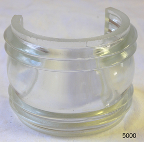 Flagstaff Hill Maritime Museum and Village
Functional object - Fresnel Glass Lens, Early 20th century
... Maritime Light...Ships Navigation Light...The subject item at this time cannot be associated with a historical event, person or place, provenance is unknown, the item is a replacement for a ships navigation light and it is believed to have been produced before 1950. Warrnambool Flagstaff-Hill Flagstaff-Hill-Maritime-Museum Maritime-Museum Shipwreck-coast Flagstaff-Hill-Maritime-Village Fresnel Lens Maritime Light Ships Navigation Light Augustin-Jean Fresnel Lighthouse Lenses Lighthouse Navigation Warning Light None Fresnel glass lens for a ships masthead navigation lamp. ...A Fresnel lens is a type of composite compact lens developed by the French physicist Augustin-Jean Fresnel (1788–1827) for use primarily in lighthouses. Made from high-quality glass Fresnel lenses were used originally in lighthouses and later for many other applications They were later being used for automobile headlamps, brake, parking, and turn signal lenses, and many other applications. Fresnel lenses used in lighthouses were considered state of the art from the late 19th through to the middle of the 20th century. The subject item is a Fresnel replacement lens used in a ships navigation light. For lighthouses, these lenses have now been replaced with much less expensive and more durable aerobeacons, which themselves often contain plastic Fresnel lenses. The lens design allows the construction of lenses of large aperture and short focal length without the mass and volume of material that would be required by a lens of conventional design. A Fresnel lens can be made much thinner than a comparable conventional lens, in some cases taking the form of a flat sheet. The simpler dioptric (purely refractive) form of the lens was first proposed by Count Buffon and independently reinvented by Fresnel. The catadioptric form of the lens, entirely invented by Fresnel, has outer elements that use total internal reflection as well as refraction; it can capture more oblique light from a light source making the light visible from greater distances.The subject item at this time cannot be associated with a historical event, person or place, provenance is unknown, the item is a replacement for a ships navigation light and it is believed to have been produced before 1950.Fresnel glass lens for a ships masthead navigation lamp. Nonewarrnambool, flagstaff-hill, flagstaff-hill-maritime-museum, maritime-museum, shipwreck-coast, flagstaff-hill-maritime-village, fresnel lens, maritime light, ships navigation light, augustin-jean fresnel, lighthouse lenses, lighthouse, navigation, warning light -
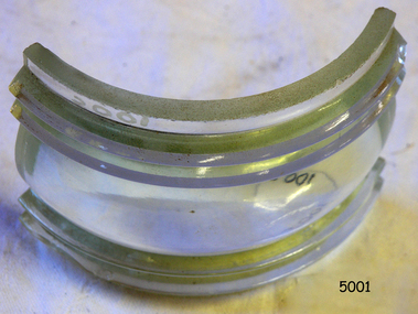 Flagstaff Hill Maritime Museum and Village
Functional object - Fresnel Glass Lens, Early 20th century
... Maritime Light...Ships Navigation Light...The subject item at this time cannot be associated with a historical event, person or place, provenance is unknown, the item is a replacement for a ships navigation light and it is believed to have been produced before 1950. Warrnambool Flagstaff-Hill Flagstaff-Hill-Maritime-Museum Maritime-Museum Shipwreck-coast Flagstaff-Hill-Maritime-Village Fresnel Lens Maritime Light Ships Navigation Light Augustin-Jean Fresnel Lighthouse Lenses Lighthouse Navigation Warning Light None Fresnel glass replacement lens for a navigation side lamp of a ship. ...A Fresnel lens is a type of composite compact lens developed by the French physicist Augustin-Jean Fresnel (1788–1827) for use primarily in lighthouses. Made from high-quality glass Fresnel lenses were used originally in lighthouses and later for many other applications They were later being used for automobile headlamps, brake, parking, and turn signal lenses, and many other applications. Fresnel lenses used in lighthouses were considered state of the art from the late 19th through to the middle of the 20th century. The subject item is a Fresnel replacement lens used in a ships navigation light. For lighthouses, these lenses have now been replaced with much less expensive and more durable aerobeacons, which themselves often contain plastic Fresnel lenses. The lens design allows the construction of lenses of large aperture and short focal length without the mass and volume of material that would be required by a lens of conventional design. A Fresnel lens can be made much thinner than a comparable conventional lens, in some cases taking the form of a flat sheet. The simpler dioptric (purely refractive) form of the lens was first proposed by Count Buffon and independently reinvented by Fresnel. The catadioptric form of the lens, entirely invented by Fresnel, has outer elements that use total internal reflection as well as refraction; it can capture more oblique light from a light source making the light visible from greater distances.The subject item at this time cannot be associated with a historical event, person or place, provenance is unknown, the item is a replacement for a ships navigation light and it is believed to have been produced before 1950.Fresnel glass replacement lens for a navigation side lamp of a ship. Nonewarrnambool, flagstaff-hill, flagstaff-hill-maritime-museum, maritime-museum, shipwreck-coast, flagstaff-hill-maritime-village, fresnel lens, maritime light, ships navigation light, augustin-jean fresnel, lighthouse lenses, lighthouse, navigation, warning light -
 Glenelg Shire Council Cultural Collection
Functional object - Lamp, Navigation Lamp, n.d
... ... navigation... maritime...Port of Portland Authority Collection Port of Portland navigation maritime technology Navigation light, acetylene type. ...Port of Portland Authority CollectionNavigation light, acetylene type. Steel and bronze body painted grey, glass lens cover, triangular sections; bronze and brass chimney painted grey silver. Thumb screw toggled latch.port of portland, navigation, maritime technology -
Glenelg Shire Council Cultural Collection
Functional object - Telescope, n.d
... ... navigation... maritime...navigational tool navigation maritime Extending telescope in attached leather case, with straps, separate cup shaped pieces of leather over eye piece and lens Functional object Telescope ...Extending telescope in attached leather case, with straps, separate cup shaped pieces of leather over eye piece and lensnavigational tool, navigation, maritime -
 Glenelg Shire Council Cultural Collection
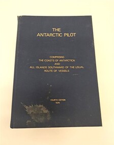
Book, Hydrographer of the Navy, The Antarctic Pilot, 1974
... ...Navigation...Maritime...maritime history of Portland and the surrounding region. This object is part of a collection belonging to local Portland fisherman Robert Hodgson who also worked for Shore Line Engineering. Naval Navigation ...A reference book detailing the coast and islands of AntarcticaNavy blue hardback book. Gold lettering on the front cover and spine. There is a splash of dirt on the bottom lefthand corner of the front cover. The top of the spine is slightly ripped. It describes the coasts of Antarctica and surrounding islands.non-fictionA reference book detailing the coast and islands of Antarcticanaval, navigation, maritime, nautical, antarctica, portland, glenelg, glenelg shire, vessel, research -
 Flagstaff Hill Maritime Museum and Village
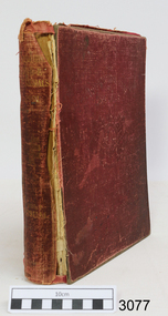
Book, His Majesty's Stationery Office, The 1931 International Code of Signals : Volume 1 for Visual and Sound Signalling, 1932
... maritime museum...shipwreck coast...book...1931 international code of signals...the 1931 international code of signals : volume 1 for visual and sound signalling...communication...navigation...warrnambool flagstaff hill maritime museum shipwreck coast book 1931 international code of signals the 1931 international code of signals : volume 1 for visual and sound signalling communication navigation maritime signals The 1931 International Code of Signals : Volume 1 for Visual and Sound Signalling. ...The 1931 International Code of Signals : Volume 1 for Visual and Sound Signalling. Published and printed in London by His Majesty's Stationery Office, 1932. Hard cover, burgundy coloured. Price printed on fly page "15s 0d"warrnambool, flagstaff hill maritime museum, shipwreck coast, book, 1931 international code of signals, the 1931 international code of signals : volume 1 for visual and sound signalling, communication, navigation, maritime signals -
 Flagstaff Hill Maritime Museum and Village
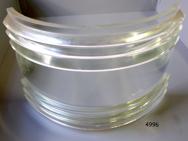
Functional object - Fresnel Glass Lens, Early 20th century
... Maritime Light...Ships Navigation Light...The subject item at this time cannot be associated with a historical event, person or place, provenance is unknown, the item is a replacement for a ships navigation light and it is believed to have been produced before 1950. Warrnambool Flagstaff-Hill Flagstaff-Hill-Maritime-Museum Maritime-Museum Shipwreck-coast Flagstaff-Hill-Maritime-Village Fresnel Lens Maritime Light Ships Navigation Light Augustin-Jean Fresnel Lighthouse Lenses Lighthouse Navigation Warning Light W.T.G (S) and 10x7 S.STR.ENGL.125 Fresnel glass replacement lens for a navigation side lamp of a ship. ...A Fresnel lens is a type of composite compact lens developed by the French physicist Augustin-Jean Fresnel (1788–1827) for use primarily in lighthouses. Made from high-quality glass Fresnel lenses were used originally in lighthouses and later for many other applications They were later being used for automobile headlamps, brake, parking, and turn signal lenses, and many other applications. Fresnel lenses used in lighthouses were considered state of the art from the late 19th through to the middle of the 20th century. The subject item is a Fresnel replacement lens used in a ships navigation light. For lighthouses, these lenses have now been replaced with much less expensive and more durable aerobeacons, which themselves often contain plastic Fresnel lenses. The lens design allows the construction of lenses of large aperture and short focal length without the mass and volume of material that would be required by a lens of conventional design. A Fresnel lens can be made much thinner than a comparable conventional lens, in some cases taking the form of a flat sheet. The simpler dioptric (purely refractive) form of the lens was first proposed by Count Buffon and independently reinvented by Fresnel. The catadioptric form of the lens, entirely invented by Fresnel, has outer elements that use total internal reflection as well as refraction; it can capture more oblique light from a light source making the light visible from greater distances.The subject item at this time cannot be associated with a historical event, person or place, provenance is unknown, the item is a replacement for a ships navigation light and it is believed to have been produced before 1950.Fresnel glass replacement lens for a navigation side lamp of a ship. W.T.G (S) and 10x7 S.STR.ENGL.125warrnambool, flagstaff-hill, flagstaff-hill-maritime-museum, maritime-museum, shipwreck-coast, flagstaff-hill-maritime-village, fresnel lens, maritime light, ships navigation light, augustin-jean fresnel, lighthouse lenses, lighthouse, navigation, warning light -
 Flagstaff Hill Maritime Museum and Village
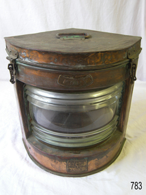
Equipment - Navigation Lamp, Port, Genton & Kessler Ltd, 1900 -1920
... Maritime-Village...Alfred Frederick Samuel Genton...Birmingham...Genton & Kessler...ship lamp...Bingley Works...J E & H Player...Alfred F S Genton...navigation...Flagstaff Hill Warrnambool Shipwrecked-coast Flagstaff-Hill Flagstaff-Hill-Maritime-Museum Maritime-Museum Shipwreck-coast Flagstaff-Hill-Maritime-Village Alfred Frederick Samuel Genton Birmingham Genton & Kessler ship lamp Bingley Works J E & H Player Alfred F S Genton navigation lamp port lamp bow side lamp lighting device navigation Seahorse Great Britain Genton & Kessler Ltd. ...Alfred Frederick Samuel Genton was born in Switzerland around 1869 and arrived in England, date unclear. By 1901, the Kelly’s Directory of Birmingham had listed the Genton & Kessler company as manufacturers of all kinds of ship and railway lamps, fog horns and general ship fittings, with their factory listed as the Bingley Works, King Edward Place, Birmingham, UK, which is listed in 1896 as being owned and run by J E & H Player. Then in February 1905 it appears the partnership of Alfred F S Genton & Julius Rudolf Kessler was dissolved and Alfred F S Genton continued to carry on the business on his own. The company continued to be managed by family members until 1961, when it ceased trading.A marine lamp made by a significant maker in Birmingham, England, in the early part of the 20th century. This item is now regarded as a collector's item. Brass lamp marked 'Port', with two small chains and hook locking mechanisms, and a hinged lid. It has a clear ribbed glass front with a red lens filter. The fuel tank and wick burner were removed. Inscriptions marked on the lamp. Manufacturer: Seahorse in Great Britain.Stamped: "Seahorse GB trade mark" "No. 54987" "PORT"flagstaff hill, warrnambool, shipwrecked-coast, flagstaff-hill, flagstaff-hill-maritime-museum, maritime-museum, shipwreck-coast, flagstaff-hill-maritime-village, alfred frederick samuel genton, birmingham, genton & kessler, ship lamp, bingley works, j e & h player, alfred f s genton, navigation lamp, port lamp, bow side lamp, lighting device, navigation, seahorse, great britain, genton & kessler ltd. -
 Flagstaff Hill Maritime Museum and Village
Equipment - Distant Signal, 1897-1931
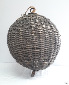
... maritime signal...ball signal...signal shape...flagstaff signal...signal station...masthead signal...communications...marine technology...signals...marine signals...flaghoists...International Marine Conference...International Code of Signals...signal codes...marine safety...signal flags...day shape...daymark...day symbol...navigation...The same shapes continue to be used today for the sets of Day Shapes used as marine navigational signals that are mandatory on certain-sized vessels. Flagstaff Hill Flagstaff Hill Maritime Museum and Village Warrnambool Maritime Museum Maritime Village Great Ocean Road Shipwreck Coast distant signal signal maritime signal ball signal signal shape flagstaff signal signal station masthead signal communications marine technology signals marine signals flaghoists International Marine Conference International Code of Signals signal codes marine safety signal flags day shape daymark day symbol navigation Warrnambool flagstaff 1854 1857 1931 1887 1897 Distant Signal Ball, part of a Flagstaff signal set. ...This three-dimensional Distant Signal is part of a Flagstaff Signal set of ball, cone and drum shapes. It has been woven and then fabricated with strong metal swivel fittings and loops for suspending from a high point on a flagstaff at a signal station or on a ship’s masthead. The cane signal was constructed to withstand all weather and to be visible from a long distance. The gaps between the woven cane allow air to pass through, minimising possible swaying. Similar sets were made from rope or fabric. Warrnambool's Flagstaff was erected in 1854. Its primary use was to display visual signals that could convey messages between land and sea. It was also used to notify the local population of the approach of ships. One of the popular signalling codes in use in the early-to-mid 1800s was the Marryat’s Code but there were others in use as well; there was no one standard code. In 1857 the International Marine Conference adopted an International Code of Signals as a standard communications system for all vessels that could be understood in many different languages. The Normanby Advertiser reported on June 5th 1857 a query from the Post Master General as to whether the request of the Chief Harbour Master would be carried out, in that Warrnambool would receive a new flagstaff and a set of Marryatt’s signal flags. The Table of Codes was published, showing how to use combinations of these flags to send messages. The Code was revised in 1887 to cover situations where distance, light, wind and weather conditions affected the visibility of the flags and prevented clear communication. The first report of the International Code of Signals Committee of 1897 warned signalmen not to rely on ordinary semaphore flags and introduced a Distant Signal Code using either particular semaphore flags or the three-dimensional shapes of a ball, cone and drum that aligned with the semaphore flag shapes of a circle, pennant and square. International Code of Signals In 1931, after World War I’s experiences in using signal codes, the International Code of Signals conference in Washington revised and published the rules for the conduct of signalling. One of the changes was that “the use of the Distant Signals and of fixed semaphore was abandoned”. It is of interest to know that modern marine law in many countries insists that a set of Day Shapes must be carried onboard vessels of a certain size. These highly visible geometric shapes are used at sea in daylight to communicate messages between vessels. They are used in a similar way to the Distant Signals, in that different combinations of shapes represent different messages. The set of shapes includes a ball, cylinder, cone and diamond. The shapes are hung between the top of the vessel’s foremast and the front of the vessel. They are only coloured black and are about 1.5 metres high. The vertical line of shapes can mean messages such as Boat not under command, Fishing, and Under sail and power.Distant Signals were an important means of marine communication from the late 1880s to the early 1930s, including during World War I. They were an advancement to the International Shipping Codes and safety. The cane signals’ shapes appear to be the same from whatever direction they are viewed, removing confusion about the message they convey. The same shapes continue to be used today for the sets of Day Shapes used as marine navigational signals that are mandatory on certain-sized vessels.Distant Signal Ball, part of a Flagstaff signal set. A round woven cane ball, painted black, with a metal rod passing through the centre. The rod has a loop at each end, then a concave, octagonal metal plate that rests on the outside surface of the ball, serving as a washer. The rod has swivels at each end.flagstaff hill, flagstaff hill maritime museum and village, warrnambool, maritime museum, maritime village, great ocean road, shipwreck coast, distant signal, signal, maritime signal, ball signal, signal shape, flagstaff signal, signal station, masthead signal, communications, marine technology, signals, marine signals, flaghoists, international marine conference, international code of signals, signal codes, marine safety, signal flags, day shape, daymark, day symbol, navigation, warrnambool flagstaff, 1854, 1857 1931, 1887, 1897 -
 Flagstaff Hill Maritime Museum and Village
Equipment - Distant Signal, 1897-1931
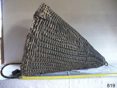
... Maritime Museum and village...Shipwreck Coast...Marine Navigation...The same shapes continue to be used today for the sets of Day Shapes used as marine navigational signals that are mandatory on certain-sized vessels. flagstaff hill warrnambool flagstaff Hill Maritime Museum and village Shipwreck Coast Marine Navigation Marine communications Communication Signal Lifesaving ship at sea day shape masthead signal day signal day mark signals marine technology safety equipment navigation equipment marine day shape day marker cane day shape signal cone day signal cone cone signal cone day shape distant signal flagstaff signal signal station communications signals marine signals flaghoists International Marine Conference International Code of Signals signal codes marine safety signal flags daymark day symbol navigation Warrnambool flagstaff 1854 1857 1931 1887 1897 Distant Signal Cone, part of a Flagstaff signal set. ...This three-dimensional Distant Signal is part of a Flagstaff Signal set of ball, cone and drum shapes. It has been woven and then fabricated with strong metal swivel fittings and loops for suspending from a high point on a flagstaff at a signal station or on a ship’s masthead. The cane signal was constructed to withstand all weather and to be visible from a long distance. The gaps between the woven cane allow air to pass through, minimising possible swaying. Similar sets were made from rope or fabric. Warrnambool's Flagstaff was erected in 1854. Its primary use was to display visual signals that could convey messages between land and sea. It was also used to notify the local population of the approach of ships. One of the popular signalling codes in use in the early-to-mid 1800s was the Marryat’s Code but there were others in use as well; there was no one standard code. In 1857 the International Marine Conference adopted an International Code of Signals as a standard communications system for all vessels that could be understood in many different languages. The Normanby Advertiser reported on June 5th 1857 a query from the Post Master General as to whether the request of the Chief Harbour Master would be carried out, in that Warrnambool would receive a new flagstaff and a set of Marryatt’s signal flags. The Table of Codes was published, showing how to use combinations of these flags to send messages. The Code was revised in 1887 to cover situations where distance, light, wind and weather conditions affected the visibility of the flags and prevented clear communication. The first report of the International Code of Signals Committee of 1897 warned signalmen not to rely on ordinary semaphore flags and introduced a Distant Signal Code using either particular semaphore flags or the three-dimensional shapes of a ball, cone and drum that aligned with the semaphore flag shapes of a circle, pennant and square. International Code of Signals In 1931, after World War I’s experiences in using signal codes, the International Code of Signals conference in Washington revised and published the rules for the conduct of signalling. One of the changes was that “the use of the Distant Signals and of fixed semaphore was abandoned”. It is of interest to know that modern marine law in many countries insists that a set of Day Shapes must be carried onboard vessels of a certain size. These highly visible geometric shapes are used at sea in daylight to communicate messages between vessels. They are used in a similar way to the Distant Signals, in that different combinations of shapes represent different messages. The set of shapes includes a ball, cylinder, cone and diamond. The shapes are hung between the top of the vessel’s foremast and the front of the vessel. They are only coloured black and are about 1.5 metres high. The vertical line of shapes can mean messages such as Boat not under command, Fishing, and Under sail and power.Distant Signals were an important means of marine communication from the late 1880s to the early 1930s, including during World War I. They were an advancement to the International Shipping Codes and safety. The cane signals’ shapes appear to be the same from whatever direction they are viewed, removing confusion about the message they convey. The same shapes continue to be used today for the sets of Day Shapes used as marine navigational signals that are mandatory on certain-sized vessels.Distant Signal Cone, part of a Flagstaff signal set. A woven cane cone, painted black, with a metal rod passing through the centre and two crossed metal bars at the base. The central rod has a loop at the top and passes through the bars at the base, finishing in a metal loop. The rod has swivels at each end.flagstaff hill, warrnambool, flagstaff hill maritime museum and village, shipwreck coast, marine navigation, marine communications, communication signal, lifesaving, ship at sea, day shape, masthead signal, day signal, day mark signals, marine technology, safety equipment, navigation equipment, marine day shape, day marker, cane day shape, signal cone, day signal cone, cone signal, cone day shape, distant signal, flagstaff signal, signal station, communications, signals, marine signals, flaghoists, international marine conference, international code of signals, signal codes, marine safety, signal flags, daymark, day symbol, navigation, warrnambool flagstaff, 1854, 1857 1931, 1887, 1897 -
 Flagstaff Hill Maritime Museum and Village
Equipment - Distant Signal, 1897-1931
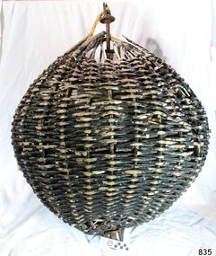
... Maritime Museum and village...Shipwreck Coast...Marine Navigation...The same shapes continue to be used today for the sets of Day Shapes used as marine navigational signals that are mandatory on certain-sized vessels. flagstaff hill warrnambool flagstaff Hill Maritime Museum and village Shipwreck Coast Marine Navigation Marine communications Communication Signal Lifesaving ship at sea day shape masthead signal day signal day mark signals marine technology safety equipment navigation equipment marine day shape day marker cane day shape signal ball day signal ball Ball signal ball day shape distant signal flagstaff signal signal station communications signals marine signals flaghoists International Marine Conference International Code of Signals signal codes marine safety signal flags daymark day symbol navigation Warrnambool flagstaff 1854 1857 1931 1887 1897 Distant Signal Ball, part of a Flagstaff signal set. ...This three-dimensional Distant Signal is part of a Flagstaff Signal set of ball, cone and drum shapes. It has been woven and then fabricated with strong metal swivel fittings and loops for suspending from a high point on a flagstaff at a signal station or on a ship’s masthead. The cane signal was constructed to withstand all weather and to be visible from a long distance. The gaps between the woven cane allow air to pass through, minimising possible swaying. Similar sets were made from rope or fabric. Warrnambool's Flagstaff was erected in 1854. Its primary use was to display visual signals that could convey messages between land and sea. It was also used to notify the local population of the approach of ships. One of the popular signalling codes in use in the early-to-mid 1800s was the Marryat’s Code but there were others in use as well; there was no one standard code. In 1857 the International Marine Conference adopted an International Code of Signals as a standard communications system for all vessels that could be understood in many different languages. The Normanby Advertiser reported on June 5th 1857 a query from the Post Master General as to whether the request of the Chief Harbour Master would be carried out, in that Warrnambool would receive a new flagstaff and a set of Marryatt’s signal flags. The Table of Codes was published, showing how to use combinations of these flags to send messages. The Code was revised in 1887 to cover situations where distance, light, wind and weather conditions affected the visibility of the flags and prevented clear communication. The first report of the International Code of Signals Committee of 1897 warned signalmen not to rely on ordinary semaphore flags and introduced a Distant Signal Code using either particular semaphore flags or the three-dimensional shapes of a ball, cone and drum that aligned with the semaphore flag shapes of a circle, pennant and square. International Code of Signals In 1931, after World War I’s experiences in using signal codes, the International Code of Signals conference in Washington revised and published the rules for the conduct of signalling. One of the changes was that “the use of the Distant Signals and of fixed semaphore was abandoned”. It is of interest to know that modern marine law in many countries insists that a set of Day Shapes must be carried onboard vessels of a certain size. These highly visible geometric shapes are used at sea in daylight to communicate messages between vessels. They are used in a similar way to the Distant Signals, in that different combinations of shapes represent different messages. The set of shapes includes a ball, cylinder, cone and diamond. The shapes are hung between the top of the vessel’s foremast and the front of the vessel. They are only coloured black and are about 1.5 metres high. The vertical line of shapes can mean messages such as Boat not under command, Fishing, and Under sail and power.Distant Signals were an important means of marine communication from the late 1880s to the early 1930s, including during World War I. They were an advancement to the International Shipping Codes and safety. The cane signals’ shapes appear to be the same from whatever direction they are viewed, removing confusion about the message they convey. The same shapes continue to be used today for the sets of Day Shapes used as marine navigational signals that are mandatory on certain-sized vessels.Distant Signal Ball, part of a Flagstaff signal set. A round woven cane ball, painted black, with a metal rod passing through the centre. The rod has a loop at each end, then a concave, octagonal metal plate that rests on the outside surface of the ball, serving as a washer. The rod has swivels at each end.flagstaff hill, warrnambool, flagstaff hill maritime museum and village, shipwreck coast, marine navigation, marine communications, communication signal, lifesaving, ship at sea, day shape, masthead signal, day signal, day mark signals, marine technology, safety equipment, navigation equipment, marine day shape, day marker, cane day shape, signal ball, day signal ball, ball signal, ball day shape, distant signal, flagstaff signal, signal station, communications, signals, marine signals, flaghoists, international marine conference, international code of signals, signal codes, marine safety, signal flags, daymark, day symbol, navigation, warrnambool flagstaff, 1854, 1857 1931, 1887, 1897 -
 Flagstaff Hill Maritime Museum and Village
Print - Vessel, Steamship, A.V. Gregory, SS Casino off Point Lonsdale, ca. 1899-1932
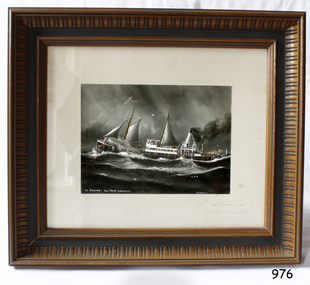
... Maritime Village...Great Ocean Road...Shipwreck Coast...newcastle and hunter river steam navigation...Flagstaff Hill Flagstaff Hill Maritime Museum and Village Warrnambool Maritime Museum Maritime Village Great Ocean Road Shipwreck Coast newcastle and hunter river steam navigation company belfast and koroit steam navigation company h. sautau and sons s.s. casino west coast trader s.s. casino victorian coastal trader captain boyd captain w. robertson captain chapman captain middleton apollo bay shipwreck s.s. casino at lady bay warrnambool saltau and osburne a v gregory arthur victor gregory Melbourne artist Signed "A V Gregory" Hand painted title "SS Casino off Point Lonsdale" Print with hand-painted watercolour highlights depicting the port side steamship SS Casinounderway in a heavy sea, merchant flag flying at the stern. ...Print of a picture of the S.S. Casino, This print is from an original painting by the Australian marine artist A V Gregory (1867-1957), also known as Arthur Victor Gregory. Gregory lived and worked in South Melbourne. He took over the Gregory Studio owned by his father, George Frederick Gregory, painting actively between 1899 and 1932. He usually signed his works as ‘A V Gregory’. Some of his original works have been sold for thousands of dollars. The S.S. Casino was a passenger and freight steamer built in Dundee, Scotland, in 1882 for the Newcastle and Hunter River Steam Navigation Company of N.S.W. She weighed 425 tons gross with a length of 160.4 feet, beam of 24.1 feet and a depth of 10.2 feet. She had saloon accommodation for 35 people, a fore cabin for 25 more people, and she carried 300 tons of cargo. While on her delivery journey on May 30th 1882 the S.S. Casino called in at the Port of Warrnambool for coal ., narrowly escaping going ashore in gale force winds due to the quick action of the pilot. At that time, still at anchor, she impressed the directors of the Belfast and Koroit Steam Navigation Company so much that they bought her immediately; she was ideal for trade along the West Coast of Victoria. (The Belfast and Koroit Steam Navigation Company was first managed by Messers. Saltau and Osburne and after the passing of Mr. Osburne, by produce merchants Messers H. Sautau and Sons, who had a hay and corn store and shipping agency on the corner of Liebig and Koroit Streets in Warrnambool. ) The S.S. Casino became “the most famous steamer to operate in Victorian waters along the West Coast” by author Jack Loney. Captain Boyd was her first Master, followed by Captain Chapman, who stayed with her from 1890 until 1924. Captain W. Robertson followed for a short term, and then Captain Middleton then took command from 1925 - 1932. The S.S. Casino had several mishaps during her life. One was on 3rd January 1898 when she collided with the S.S. Flinders in Apollo Bay with minor damage. Another was on 24th October 1924 when she grounded on a reef at Point Hawdon near Grey River and most of her cargo (of Christmas goods) had to be dumped into the sea. Then in February 1929 she was ‘holed’ when she struck a submerged object as she entered Lady Bay, Warrnambool. On the morning of 10th July 1932, after attempting to berth at Apollo Bay jetty in heavy seas, Captain Middleton decided to take her out into the bay and wait until the seas abated. It was not realised that the anchor used to steady her as she manoeuvred to her berth had pierced her hull. She put about and headed for the beach but sank. Captain Middleton and nine others lost their lives; nine people were rescued including the two female passengers. Captain Middleton had been in charge of the S.S. Casino for seven years. He was the first ship’s Master to lose his life in a shipwreck in the West Coast trade. In the years following the turn of the century, the S.S. Casino remained the only regular trader with normal passenger accommodation along the West Coast. From 1882 she had made at least 2,500 voyages on the one run. Flagstaff Hill’s collection has a photograph of a portrait of Captain Chapman, , a ship model of the S.S. Casino that shows both forms of power under which she sailed, steam and sail. The ship is painted green and flies three flags. The inscription across the case of the ship model, incorrectly dated, tells the sad story of the wreck of the ship and the loss of lives on July 10th 1932 at Apollo Bay. A print in the Collection shows S.S. Casino underway in the heavy sea off Point Lonsdale, another two photographs show her at the Port of Warrnambool, leaving from the Breakwater in Lady Bay and another identifies the S.S. Casino as a ship from the Belfast and Koroit Steam Navigation Company. (Belfast is the original name for the township of Port Fairy).This print of the S.S. Casino is of significance for its association with the coastal trader S.S. Casino. The wreck of the S.S. Casino is considered an important part of Victorian and Australian cultural heritage and as such has been declared and protected as an Historic Shipwreck under State and Commonwealth Law in the Commonwealth Historic Shipwrecks Act (1976). The detailed image of the vessel depicted in this print shows one of the many sail and steam vessels painted by the renowned Victorian marine artist A V Gregory, whose original works are highly valued today by marine collectors.Print with hand-painted watercolour highlights depicting the port side steamship SS Casinounderway in a heavy sea, merchant flag flying at the stern. Mounted in a decorative wooden frame behind glass. The original painting was by A V Gregory. The title of the picture is repeated in handwritten words on the matte below the artist's signature on the print.Signed "A V Gregory" Hand painted title "SS Casino off Point Lonsdale"flagstaff hill, flagstaff hill maritime museum and village, warrnambool, maritime museum, maritime village, great ocean road, shipwreck coast, newcastle and hunter river steam navigation company, belfast and koroit steam navigation company, h. sautau and sons, s.s. casino, west coast trader s.s. casino, victorian coastal trader, captain boyd, captain w. robertson, captain chapman, captain middleton, apollo bay shipwreck, s.s. casino at lady bay warrnambool, saltau and osburne, a v gregory, arthur victor gregory, melbourne artist -
 Flagstaff Hill Maritime Museum and Village
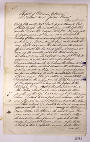
Document, 12-01-1882
... maritime village...victoria steam navigation board...The Leeuwin (Julia Percy) is listed on the Victorian Heritage Register as being historically significant ‘as one of only four wrecks of steamships in Victorian waters associated with the western district of Victoria’s coastal steamship trade. flagstaff hill flagstaff hill –maritime museum maritime museum shipwreck coast flagstaff hill maritime village victoria steam navigation board captain frederick chapman captain thomas smith thomas wingate & company steamer julia percy steamer leeuwin steamer nelson steam ship warrnambool steam packet company t. h. ostorne western steam navigation co. charles cutler reference on letter in left margin "S82/12" Reports of Victoria Steam Navigation Board about the collision on 25th December 1881 between the steamers " Julia Percy" and "Nelson". ...This hand written letter, in black ink script on blue lined paper, is impressed with the official stamp of the Victoria Steam Navigation Board. The left margin has the reference “S82/12" It is transcribed: "Victoria Steam Navigation Board, Melbourne, January 12th 1882 To Frederick Chapman, Master, S.S. "Julia Percy" You are herewith furnished with a copy of the report of the Official Court which assembled to enquire into the circumstances attending the collision between the steamers "Julia Percy" and "Nelson" off Apollo Bay near Cape Otway on the morning of the 25th December 1881, and you are hereby expected to attend at the Board Room, Custom House, Melbourne, at 2pm, on 13th January instant to show cause why you should not be censured accordingly. [Signature] Secretary" This document refers to the matter of a collision between two steamships, the Julia Percy and the Nelson, on 25th December 1881. The Julia Percy was at that time owned by her first owners, the Warrnambool Steam Packet Company, and she sailed under the command of Captain Chapman. She had left Melbourne the evening of 24th December, with about 150 passengers, sailing in fine weather through Port Phillip Heads around 9pm. She was headed for Warrnambool, Belfast (now named Port Fairy) and Portland. The Julia Percy was off Apollo Bay when Captain Chapman was woken by the ship’s whistle after midnight, the steamer Nelson being on a collision course with the Julia Percy.[See Link.] The Nelson struck Julia Percy midship. Boats were lowered from the ship (apart from a damaged lifeboat) and about 30-40 of the passengers boarded the Nelson. The engine room and the forehold were checked and found clear of water. The company manager, Mr Evans, had been on the Nelson, so he boarded and inspected the Julia Percy and the decision was made to continue on to Warrnambool with the passengers as there appeared to be no immediate danger. However, Captain Thomas Smith said the Nelson was taking on water, so Julia Percy followed her for about an hour towards Melbourne on standby in case of need. Then Julia Percy turned around towards Warrnambool again. Shortly afterwards the Nelson turned to follow her, the ships stopped and passengers were returned to Julia Percy, and three from Julia Percy boarded the Nelson. Both ships proceeded on their way. Julia Percy passed Cape Otway light afterwards, signalling that there had been a collision. It was discovered later that one of the passengers was missing, then thought to have boarded the Nelson but later thought to have fallen into the sea and drowned while trying to jump from Julia Percy to Nelson. There had been 3 tickets purchased under the same name of that passenger “Cutler”; a father, son and friend named Wordsworth, which had caused quite some confusion. No further mishap occurred to either ship and both the Julia Percy and the Nelson reached their destinations safely. An enquiry was instigated by the Victoria Steam Navigation Board regarding the cause of the accident between the two steamships, in connection with the death of Cutler who was supposed to have lost his life by the collision. The enquiry resulted in the following decision: "The Victorian Steam Navigation Board having taken into consideration the points urged by Captain Thos [Thomas] Smith and also by his legal advisers, is of opinion that the charge prepared against him has been sustained, but taking into consideration Captain Smith’s previous good conduct and character, the board suspends his master’s certificate No 227 issued by this board for a period of six calendar months from this date – Robert Fullarton, Chairman. “The Victorian Steam Navigation Board having beard the statement of Captain Frederick Chapman urged in his defense to the charge of dereliction of duty as master of the Julia Percy, in having no standing order on board that vessel to be called in the event of any approaching steamer’s lights being seen, find such charge sustained, and censure him accordingly – Robert Fullarton, Chairman.” ABOUT “JULIA PERCY” The S.S. Julia Percy (later named Leeuwin ) was an iron passenger-cargo steam ship built in 1876. At one point in time the Julia Percy would sail from Warrnambool to Melbourne every Friday and return from Melbourne to Warrnambool every Tuesday. The cost of a return ticket for a Saloon Fare was £1.0.0. She would sail “if practical and weather permitting”. Shipping was the cheapest and most practical means of carrying produce and goods during the period 1840-1890. Regular domestic steamer services commenced in the Warrnambool district in the late 1850’s and by 1870 the passenger trade was booming. Produce was loaded from the jetty into ‘lighters’ (small boats), which took it to the ships at anchorage in the bay. Passengers were taken to the ship’s side then climbed aboard up ladders or gangways. The coming of the railway in October 1889 meant the gradual decline and end of the steam shipping era. The Julia Percy was built in Glasgow by Thomas Wingate & Company, Whiteinch, in 1876 for the Warrnambool Steam Packet Company, which commissioned her for trade in Victoria’s western district. She was first registered in Warrnambool, Victoria in 1876. The Julia Percy changed hands several times. Her next owner was the Western Steam Navigation Co (1887), managed by Mr. T.H. Osborne (the company’s office was on the corner of Timor and Liebig Streets, Its north-western wall is now part of the current Warrnambool Regional Art Gallery. ) The Melbourne Steamship Co became the next owners (1890), followed by William Howard Smith and Sons (1901) for use in Queensland coastal trades, then she was bought by George Turnbull in 1903 and used for local mail contract in Western Australia. The Julia Percy was sold to the Melbourne Steamship Company Ltd. (1906) and re-named the “Leeuwin” but continued in her Western Australian coastal run. She was converted into a coal hulk in Melbourne in 1910 as a result of damaged caused when she was driven against the jetty at Dongara during a gale. The ship was eventually dismantled and scuttled in Bass Strait on 28 December 1934. The document is significant for its association with the wreck of the Leeuwin (Julia Percy), which is on the Victorian Heritage Register, VHR S413. . It is historically significant for being a rare artefact that has potential to interpret aspects of Western Victoria’s 19th century steamship trade and Victorian cultural history. The Leeuwin (Julia Percy) is listed on the Victorian Heritage Register as being historically significant ‘as one of only four wrecks of steamships in Victorian waters associated with the western district of Victoria’s coastal steamship trade. Reports of Victoria Steam Navigation Board about the collision on 25th December 1881 between the steamers " Julia Percy" and "Nelson". Letter from Victoria Steam Navigation Board, Melbourne to Frederick Chapman, Master, S.S. "Julia Percy", dated January 12th 1882. reference on letter in left margin "S82/12"flagstaff hill, flagstaff hill –maritime museum, maritime museum, shipwreck coast, flagstaff hill maritime village, victoria steam navigation board, captain frederick chapman, captain thomas smith, thomas wingate & company, steamer julia percy, steamer leeuwin, steamer nelson, steam ship, warrnambool steam packet company, t. h. ostorne, western steam navigation co., charles cutler -
 Flagstaff Hill Maritime Museum and Village
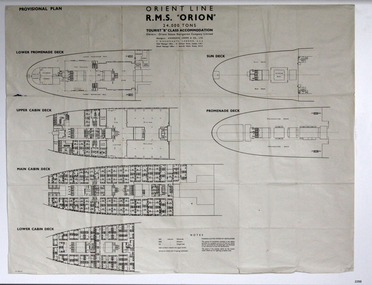
Plan - Ship Plan, Orient Steam Navigation Company, Orient Line, RMS Orion, ca. 1934
... Maritime Village...Great Ocean Road...Shipwreck Coast...RMS ORION...Plan...ship plan...provisional plan...Orient Line...Orient ship...Vissel Orion...Class B Passenger Accommodation...Punkah Louvre System of Ventilation...deck plan...ship ventilation...ship floor plan...orient steam navigation...Flagstaff Hill Flagstaff Hill Maritime Museum and Village Warrnambool Maritime Museum Maritime Village Great Ocean Road Shipwreck Coast RMS ORION Plan ship plan provisional plan Orient Line Orient ship Vissel Orion Class B Passenger Accommodation Punkah Louvre System of Ventilation deck plan ship ventilation ship floor plan orient steam navigation company limited Anderson Green & Co Ltd steamship ocean liner war ship troop carrier Printed on the plan: "PROVISIONAL PLAN" "LOWER PROMENADE DECK" "UPPER CABIN DECK" "MAIN CABIN DECK" "LOWER CABIN DECK" "SUN DECK" "PROMENADE DECK" "ORIENT LINE / R.M.S. ...The Orient Steam Navigation Company Limited launched the Ocean Liner RMS Orion in 1934 and it remained in operation until 1963. The twin screw steamship was built to carry first class and tourist class passengers, over 1100 in all, plus almost 500 crew from Europe to Australia in comfort. The ship had a single funnel and a single mast. During WWII the vessel served as a troop carrier. The ventilation system noted on the plan, Punkah Louvre System, was designed for heating fresh air ventilation in buildings, ships and railroads. The system originated from Thermotank in Glasgow, Scotland. The ship plan for the RMS Orion is significant for its connection with the vessel. The ship was a leader, with several 'firsts'; the first Orient Line ship to be built with a single funnel since 1902, and the first to be painted in the Orient Line's livery, with a corn-coloured hull. It was the first liner to use chromium and bakelite materials for the surfaces throughout the ship, which provided greater resistance to the sea. It was also the first British ship to be fitted with air conditioning.Plan: printed provisional line drawing of the Orient line vessel "R.M.S. Orion". Inscriptions are printed on the plan. There are diagrams of six decks included in the plan. The ship is built for tourist "B" accommodation. The plan's Notices include details of the cabins including wardrobes, drawers, hinged seats, mattresses and bunk numbers. It also notes that there is a Punkah-Louvre System of Ventilation.Printed on the plan: "PROVISIONAL PLAN" "LOWER PROMENADE DECK" "UPPER CABIN DECK" "MAIN CABIN DECK" "LOWER CABIN DECK" "SUN DECK" "PROMENADE DECK" "ORIENT LINE / R.M.S. "ORION" / 24,000 TONS / TOURIST "B" CLASS ACCOMMODATION" "Owners: Orient Steam Navigation Company Limited"' "Managers : ANDERSON, GREEN & CO. LTD" "7 BISHOPS GATE, LONDON, E.C.2" "Chief Passenger Office : 14 Cockspur Street, London, S.W.1" "Branch Passenger Office : 1 Australia House, Strand, W.C.2" "notices"flagstaff hill, flagstaff hill maritime museum and village, warrnambool, maritime museum, maritime village, great ocean road, shipwreck coast, rms orion, plan, ship plan, provisional plan, orient line, orient ship, vissel orion, class b passenger accommodation, punkah louvre system of ventilation, deck plan, ship ventilation, ship floor plan, orient steam navigation company limited, anderson green & co ltd, steamship, ocean liner, war ship, troop carrier -
 Flagstaff Hill Maritime Museum and Village
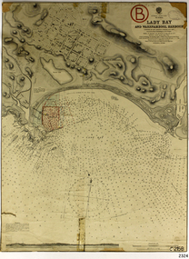
Document - Navigation Chart, Admiralty Office, Lady Bay and Warrnambool Harbour, 1893
... Maritime Village...shipwreck coast...Map...chart...Navigation...Flagstaff Hill Warrnambool Flagstaff Hill Maritime Museum & Village Maritime Museum Maritime Village shipwreck coast Map chart Navigation chart plan Lady Bay Warrnambool Harbour Port of Warrnambool Breakwater Jetty Pier Dock extension proposed extension VHR H2024 1870 1893 1910 1925 Warrnambool town late 1800s Warrnambool streets late 1800s Royal Commission 1923 Public Works Water Commission Harbour Trust Victorian Harbours Sir Jon Coode Stamp, rectangular, including "AUG 1910" Stamp, double oval " - - - -CHART" Stamp, hand drawn, red circle, with "B" inside Hand written note "22-8-1910 - - - - - of surveying C. ...This navigation cart of Lady Bay and Warrnambool Harbour was originally surveyed in 1870 but this version includes the update for magnetic variation in 1893. Since the printing of the chart several annotations have been added. These include an additional stamp dated 15-8-1910, a handwritten comment across the top of the page dated August 1910, and another handwritten comment regarding the ‘Proposed Extension of Dock’ dated 19-2-1925, plus connected drawings, notes and figures. The 1925 proposal on this chart may have been a reaction to the Royal Commission of 1923, when the damaged stonework on the seaward side of the Warrnambool Breakwater, caused by the action of the sea, was the subject of enquiry. A conference between the Public Works, Water Commission and the Harbour Trust concluded that it would less costly to make repairs to prevent further damage rather than replaced the damage portion of the wall. A contract was raised in late 1924 to deposit rubble on the damaged side of the breakwater to minimise the Southern Ocean’s destructive action and work had started by August 1925. The Breakwater construction had begun in 1874 and was completed in 1890. The Victorian Government had commissioned Sir John Coode, a British harbour engineer, to present a plan to complete the Warrnambool Breakwater but his original plan was too expensive. He prepared a revised plan for a shorter structure. The construction proved to be too short to protect adequately from the weather and didn't allow enough depth for larger vessels to come into port. The decreasing trade was further affected by siltation in the bay due to the breakwater, and the completion of the railway line. The situation of the harbour became a real problem by 1910 and required continuous dredging. In 1914 the Breakwater was extended but proved to be a failure because the work began to subside and by 1920 about two thirds of the harbour was silted up. Alterations made in the 1920's increased the silting problem and by the 1940's the harbour was no longer used. More alterations were made in the 1950's and 1960's. This chart is significant for its strong connection to the maritime history of Warrnambool Harbour and Lady Bay and the Warrnambool Breakwater. The Warrnambool Breakwater is registered as a place of significance on the Victorian Heritage Database (VHR H2024). The Warrnambool Breakwater is one of the most important late 19th century maritime engineering projects in Victoria and significant in the development of Victorian coastal shipping. It is also significant for its connection with British harbour engineer, Sir John Coode. The chart is a historical record of structures existing in 1893; the Warrnambool Jetties, Warrnambool Breakwater in Lady Bay, the leading lights (lighthouses), streets, roads, bridges and many buildings. It also shows the lay of the land and seabed. Navigation Chart: Lady Bay and Warrnambool Harbour, Australia - South Coast - Victoria. Surveyed by Nav. Lieut. H.J. Stanley, R.N., 1870. Updated for Magnetic Variation, 1893. The rectangular chart is printed on heavy cream paper. Stamps are shaped rectangular, oval and round. Around the Breakwater and Jetty area are handwritten notes, dotted and joined lines, numbers and signatures, and shading of red and green. The chart shows the surrounds of Warrnambool Harbour, Lady Bay, the Breakwater and Jetty, roads, bridges and the streets in Warrnambool. It has sounding details, and angles of line from the leading lights.Stamp, rectangular, including "AUG 1910" Stamp, double oval " - - - -CHART" Stamp, hand drawn, red circle, with "B" inside Hand written note "22-8-1910 - - - - - of surveying C. Ca - - - request of 15-8-10 [initials] " Notes and lines in red pen, including a grid of sounding numbers: "1300" "1050" "1200" "Possible Extension of Dock" "19-2-25" "Dock Dredged to 20 Ft" Notes and lines in blue pen "Extension of Dock to accommodate vessels drawing 20 Feet" and "Light not visible south of this line" Red dots (4) with yellow highlight at both leading lights, breakwater and jettyflagstaff hill, warrnambool, flagstaff hill maritime museum & village, maritime museum, maritime village, shipwreck coast, map, chart, navigation chart, plan, lady bay, warrnambool harbour, port of warrnambool, breakwater, jetty, pier, dock extension, proposed extension, vhr h2024, 1870, 1893, 1910, 1925, warrnambool town late 1800s, warrnambool streets late 1800s royal commission, 1923, public works, water commission, harbour trust, victorian harbours, sir jon coode -
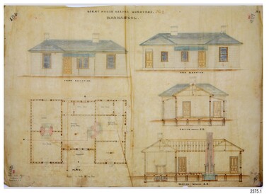 Flagstaff Hill Maritime Museum and Village
Document - Plans, Lighthouse Keeper's Quarters Warrnambool, 1858-1909
... navigational function of the Lighthouses, a function still being performed to this day. The plans are also significant as an example of a product from the Public Works Department in Victoria in the mid-to-late 19th century. The structures built to these plans still stand strong. flagstaff hill warrnambool lighthouse keeper's cottage lighthouse residence lighthouse plans public works melbourne flagstaff hill maritime museum maritime museum shipwreck coast flagstaff Hill maritime village chart room quarters privy middle island beach lighthouse obelisk lighthouse keeper assistant keeper lighthouse complex lady bay lady bay complex keepers upper lighthouse lower lighthouse ports and harbours cottage harbour board flagstaff hill planning board meteorological record Robert Deverell Andrew Farncombe Warrnambool port Warrnambool harbour residence alterations repairs department of works light keeper Dec. 1858 - Lighthouse Keepers Quarters No.2 Warrnambool. ...The set of seven 1858 plans shows proposed plans for the original Lighthouse Complex that was built on Middle Island in 1858-1859. The whole complex was then transferred to Flagstaff Hill in 1871. The plan, dated 1909, is for proposed additions and repairs to the Quarters at Flagstaff Hill. The plan 'Alterations and Additions' shows alternate plans for changes to the quarters at the Flagstaff Hill location. This plan has no date. The Complex comprised the Lighthouse, the Lighthouse Keepers’ Quarters, the Store (now called the Chart Room) and a Privy, which was not included in these plans. The Keeper’s bluestone Quarters was a cottage divided into two compartments, one for each keeper and his family. The bluestone Store was divided into three; a store, a workshop an oil store (or office). The Privy comprised of a small building also divided into two separate, back-to-back toilets, one for each Keeper and his family. The Flagstaff Hill Keeper's Quarters have had extensions and additions at various times, and these have also been removed at various other times. THE PLANS - *Dec. 1858 (12/58) ‘Lighthouse Keepers Quarters No.2 Warrnambool’ (2375.01)* Public Works Office Melbourne – Front and Back elevations, sections, and floor plan. The drawing shows timber walls. [The floor plan is the closest plan to the current building, however, the walls are timber in this plan.] *Nov. 1858 – No.3 ‘Lighthouse Keepers Quarters Warrnambool’ (2375.02)* Office of Public Works, Melbourne – Back and End elevations and section through. The drawing shows stone walls. One side; Senior Keeper’s bedroom, living room and kitchen with storeroom. Another side; is the Assistant’s bedroom, living room and storeroom. *Nov. 1858 - No.4 ‘Lighthouse Stores Warrnambool’ (2375.03)* Office of Public Works – Front, Side and end elevations, centre section. The drawing shows stone walls. *Nov. 1858 – No.4, ‘Lighthouse Stores No. 2 Warrnambool’ (2375.04)* Office of Public Works – Front, side and end elevations, centre section. The drawing shows timber walls. *Nov. 1858 – ‘Details Lighthouse Keepers Quarters No. 2 Warrnambool’ (2375.05)* Public Works Office Melbourne. The plan shows the foundations, joists and eaves. The drawing shows timber walls. (Nov. 1858 – ‘No.4 ‘Lighthouse No. 2 – Warrnambool’ (2375.06)* Public Works Melbourne (Part of the paper is missing). This plan shows an octagonal tower, internal stairs, a balcony landing, and a weather vane on top. *November 1858 – No. 1, ‘Lighthouse – Warrnambool’ (2375.07)* Office of Public Works Melbourne. This plan shows a round tower, including the stairs, windows on the tower and the weather vane on the top. *4/3/9 [1909] – ‘Additions and Repairs, Lighthouse Quarters, Warrnambool, General Plan’ (2375.8)* Department of Public Works Melbourne’s official stamp is signed by Croft. It shows the floor plans of the Store, Upper Lighthouse and the Quarters. The Store building has three sections; a Store, Work-Shop and Office, with an internal wall between them and separate entries. The Quarters are divided into two dwellings. The Senior Keeper’s side on the left has fireplaces in two of the three bedrooms and there is a pantry and wash house. The Assistant’s side has no fireplaces in the bedrooms and there’s no pantry or washhouse. These plans include proposed changes to the buildings. The Senior Keeper’s Quarters would have a partition on bedroom 2, a bath with plumbing and drainage, a wall moved and a built-in side porch. The Store would also have a built-in porch. The undated plan 'Additions and Alterations' (2375.9) shows alternative arrangements for water tanks, plumbing and such. WARRNAMBOOL'S LADY BAY LIGHTHOUSES- In the 1800s ships sailing from England to Australia began to use Bass Strait as a faster route to Melbourne. Small navigation errors led to many tragic shipwrecks. From 1848 lighthouses were operating along Victoria’s southern coast as a guide for sailors. Coastal towns such as Warrnambool grew and the exchange of trade and passengers were of great benefit. However, the uncertain weather changes, relatively shallow waters and treacherous, hidden rocky reefs were not suitable for a Harbour and in the 1840s and 1850s there were many shipwrecks in the area, with some even stranded in its Lady Bay harbour. A jetty was built in 1850 and a flagstaff to guide seafarers was placed up high on what became known now as Flagstaff Hill. In November 1857 the Victorian Government recommended that Warrnambool Harbour had beacons and two lighthouses to guide vessels into and out of the Harbour safely. The white light of the Middle Island lighthouse was to be used for the first time on September 1, 1859. The red light of the Beach Lighthouse, a wooden obelisk structure, was first operated on March 25, 1860, but in 1868 this light was ‘discontinued’ due to it being too low. Melbourne’s Department of Public Works decided to relocate the Middle Island Lighthouse Complex - Lighthouse, Keeper’s Quarters, Privy, Store Room and even water tanks - to Flagstaff Hill. The lower obelisk was shortened, and a protruding gallery, railing, and external ladder were added, as well as the light from the Beach Lighthouse. A green guiding light was erected on the end of the jetty. The transfer of the Complex began in March 1871. Each shaped stone of the lighthouse was carefully numbered, removed then reassembled on Flagstaff Hill. In 1872 the well was sunk behind the Lighthouse Keeper’s Cottage. The Keepers and families had left Middle Island in April and moved to Flagstaff Hill in October 1871. Vessels entering Lady Bay align the Upper and Lower Lighthouse towers during the day and the lights at night. The Upper Lighthouse is a round tower, the Lower Light is square. The Lighthouses were categorised as harbour lights rather than coastal lights, so they remain under the control of the Victorian Government’s Ports and Harbours section. The lights were originally powered by oil, then acetylene gas, later by electricity, and then converted to solar power in 1988. In 1993 the solar panel was replaced by a battery charger. A decision was made in 1936 to replace the lighthouses’ lights with unattended lights that no longer required Keepers and Assistants. At least 29 Keepers had attended to the lighthouse from its opening in 1859 to when the last official Lightkeepers left In April 1916. The Warrnambool Harbour Board rented out the Quarters from 1916 to 1936. The Board closed down but the rentals continued with other unknown landlords. In the 1970s the Flagstaff Hill Planning Board was set up under the chairmanship of John Lindsay. The Board was to make recommendations to the Warrnambool City Council regarding the use of the buildings and the rest of the Crown Land on the site. The Flagstaff Hill Maritime Village opened in 1975 and began renovating the Cottage in stages, during which time evidence of a 1920s fire was found in the eastern section of the cottage. Additions of a porch on the west and a washroom on the east were made in the 1980s. The western part of the building is now a Shipwreck Museum and the east has returned to a late 19th-century Lighthouse Keeper’s cottage and includes the screen made by Assistant Lighthouse Keeper Thomas Hope during one of his two periods of service there. THE LIGHTHOUSE KEEPERS Lighthouse Keepers were responsible for keeping their Lighthouse’s lights shining at night. They kept a lookout for passing vessels and changes in weather. They were expected to clean, polish and maintain the equipment and buildings. They kept regular and detailed records of who was on watch, and the time the light was lit, trimmed and extinguished. They kept a journal about other events that occurred. They keep regular, accurate Meteorological Logs. It was expected that they were competent in Morse code signalling. They would be called to help in times of disasters and shipwrecks, and to give official statements about these events. Many Lighthouse Keepers also volunteered as members of the lifeboat crew. The Lady Bay lighthouses were officially classified as small, so the Keepers had the official titles of Senior Assistant Lighthouse Keeper and Assistant Lighthouse Keeper. They were employed by the Public Service and paid rent to live in the Lighthouse Quarters. They were compulsorily retired at the age of 60, with most receiving a superannuation payment. Despite their time-consuming duties, there was time to follow hobbies and crafts such as growing vegetables, playing musical instruments, making models of buildings including lighthouses, and crafting furniture pieces. An example of a keeper’s skills is the carved fire screen made by /assistant Keeper Thomas Hope in the early 20th century and displayed in the Lighthouse Keeper’s cottage at Flagstaff Hill. The last occupants of the Middle Island Complex were Senior Keeper Robert Deverell, his Assistant Keeper, Andrew Farncombe, and their families. They all became the first occupants at the Lady Bay Lighthouse Keepers’ Quarters on Merri Street. The Warrnambool Lighthouse Complex plans are the origin of what is now the Lady Bay Lighthouse Complex. They are a record of the people, process and departments involved in bringing the complex into fruition. The plans are significant to the Complex, which is now listed on the Victorian Heritage Register, H1520, for being of historical, scientific (technological) and architectural significance to the State of Victoria. The Complex is significant as an example of early colonial development. The plan are significant for their connection with the important navigational function of the Lighthouses, a function still being performed to this day. The plans are also significant as an example of a product from the Public Works Department in Victoria in the mid-to-late 19th century. The structures built to these plans still stand strong. Plans for the Lighthouse Complex in Warrnambool, including Lighthouses, Keeper's Quarters and Stores. Seven of the plans are on thin fragile paper, one is on thicker, stronger paper. The drawings have been made in pens coloured red and black. They originate from Public Works in Melbourne. Seven were drawn in 1858, one in 1904, the other is not dated.Dec. 1858 - Lighthouse Keepers Quarters No.2 Warrnambool. Public Works Office Melbourne. Nov. 1858 - No.3 ‘Lighthouse Keepers Quarters Warrnambool. Public Works Office Melbourne. Nov. 1858 - No.4 ‘Lighthouse Stores Warrnambool. Office of Public Works. Nov. 1858 - No.4, ‘Lighthouse Stores No. 2 Warrnambool. Office of Public Works. Nov. 1858 - Details Lighthouse Keepers Quarters No. 2 Warrnambool. Public Works Office Melbourne. Nov. 1858 - No.4 ‘Lighthouse No. 2 – Warrnambool. Public Works Melbourne. Nov. 1858 - No. 1, Lighthouse - Warrnambool. Office of Public Works Melbourne. 4/3/9 [1909] - Additions and Repairs, Lighthouse Quarters, Warrnambool, General Plan. Department of Public Works Melbourne. SIGNED "Croft" "15A" on reverse [no date] - Lighthouse Quarters Warrnambool, Additions and Alterations. "9A" on reverseflagstaff hill, warrnambool, lighthouse keeper's cottage, lighthouse residence, lighthouse, plans, public works, melbourne, flagstaff hill maritime museum, maritime museum, shipwreck coast, flagstaff hill maritime village, chart room, quarters, privy, middle island, beach lighthouse, obelisk, lighthouse keeper, assistant keeper, lighthouse complex, lady bay, lady bay complex, keepers, upper lighthouse, lower lighthouse, ports and harbours, cottage, harbour board, flagstaff hill planning board, meteorological record, robert deverell, andrew farncombe, warrnambool port, warrnambool harbour, residence, alterations, repairs, department of works, light keeper -
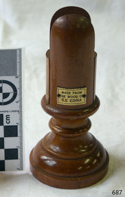 Flagstaff Hill Maritime Museum and Village
Domestic object - Card Holder, c. 1854 - 1957
... maritime exhibition 1934...a brief review of steam navigation in victoria...The SS Edina’s original ‘fair maid of Judea’ figurehead was broken to pieces in a collision with another vessel (the SS Dandenong) in a gale off Warrnambool, Victoria, in 1870. warrnambool shipwrecked coast flagstaff hill flagstaff hill maritime museum maritime museum shipwreck coast flagstaff hill maritime village shipwrecked artefact Barclay & Curle figurehead 'fair maid of Judea' centenary maritime exhibition 1934 a brief review of steam navigation in victoria pleasure steamer edina trade and travel late 19th and early 20th century trade melbourne to geelong screw steamer Edina coastal trader Edina lighter Dinah cargo carrying for cremean war cargo carrying for American civil war passenger and trade in western district of victoria export gold and currency and gold diggers to New Zealand export vessel to h r h the duke of edinburgh melbourne - warrnambool - port fairy - portland cargo run warrnambool steam packet company stephen henty captain john thompson chief engineer john davies lady bay warrnambool lighter Edina shipping Victoria port phillip bay steamers steamship great Britain Edina, VHR S199 Victorian Heritage Database card holder menu holder table number holder souvenir of the ss edina Printed on plaque "MADE FROM / THE WOOD OF / S.S. ...This wooden cardholder was made from the wood of the screw steamer S.S. Edina, most probably after she was broken up in 1957, but could have been made after one of several renovations during her lifetime. The slotted design of the cardholder allows a card to stand vertically, and the base is made wider to stabilise the holder. It could be used for holding items such as place cards, menus, and table numbers. ABOUT THE SS EDINA: - The three-masted, iron-hulled screw steamer SS Edina was built in Glasgow, Scotland, in 1854 by Barclay and Curle and launched on the Clyde on May 4th, 1854. The 322-ton, three-masted ship was 171 feet long, 23 feet 6 inches broad, and 12 feet 7 inches deep (52.12 L x 7.16 B x 3.84 D metres). The traditional figurehead of Edina, the ‘fair maid of Judea’, adorned its bow. The Edina later became famous worldwide for being the longest-serving screw steamer. (The term screw steamer comes from being driven by a single propeller, sometimes called a screw, driven by a steam engine.) During its long working life, SS Edina had its accommodation enlarged for war service, was completely overhauled and serviced several times; boilers were replaced, masts were reduced to one, and later added then reduced, a Poop Deck, Forecastle and additional accommodation were added, the hull was gutted completely, new decks and bulwarks, saloon was redecorated and upgraded, and several changes of commander. The busy vessel also survived several mishaps at sea. SS Edina’s interesting history includes English Channel runs, carrying stores and horses to the Black Sea in the Crimean War as HMS Edina 1864-55. The vessel then sailed to Europe and the UK before being sold and used for further service in 1861 as a blockade runner in the American Civil War. The vessel later served as a coastal trader in the western district of Victoria and Queensland, then carried gold, currency, and gold prospectors from Australia to New Zealand. SS Edina was an escort vessel to H.R.H. the Duke of Edinburgh during his visit to Australia in 1867. SOME EVENTS in the life of SS EDINA: - The SS Edina had voyaged to Australia under sail. Owners Leith, Hull & Hamburg Steam Packet Co. sold the SS Edina in March 1863 at Port Phillip Bay, Melbourne, to Stephen Henty of Portland, Victoria; Edina was perfect for working the West Coast cargo and passenger run between Melbourne and Portland, via the Port of Warrnambool, and Port Fairy. It first visited Warrnambool on April 4, 1863. SS Edina briefly worked the run from Australia to New Zealand, then returned to the West Coast run; the cargo included bales of wool produced in the western district of Victoria. In 1867-68, Stephen Henty sold SS Edina to the Warrnambool Steam Packet Company to continue trading along the coast of western Victoria. Captain John Thompson was the commander, and John Davies was the Chief Engineer. In 1870, SS Edina was in Lady Bay, Warrnambool, when a gale sprang up and caused a collision with the iron screw steamer SS Dandenong. SS Edina’s figurehead was broken into pieces and was never replaced. The Edina was refitted that year for use as a coastal trader in Queensland for a period, named R.M.S. Edina. It then went to Melbourne and carried cargo and passengers between there and Geelong from 1880 to 1938, with modifications in 1917; the ship was extensively overhauled, radically changing its appearance. It returned to having two masts, and the funnel, bridge, engines, and promenade deck were upgraded, and the saloon reupholstered. By 1924, Edina had made over 12,000 journeys, carrying over one million travellers between Melbourne and Geelong. In 1937, Australian Steamships Pty Ltd advertised in The Argus its Bay Excursions on the SS Edina from Portarlington and Geelong; it promoted, “Splendid Beaches, Excellent Bathing Facilities, and Light Refreshments available on board”. After several collisions, the SS Edina was taken out of service in 1938 and sold by its owner, Howard Smith Ltd., to a Williamstown shipbreaker, Mr George Burton. The Melbourne Harbour Trust permitted Burton to strip the hull and sell all parts at auction. The fittings were sold by auctioneers J.W. Styles & Son, c. 1938, on site at the Port of Melbourne and became widely dispersed. Victorian Lighterage Pty Ltd. purchased the hull, removed the engine and superstructure, and repurposed it as a ‘lighter’ named Dinah. It was loaded with wool and general cargo, then towed behind small tugs around the bay between Melbourne and Geelong. In 1957, after 104 years of activity, the SS Edina was broken up on the banks of the Maribyrnong River, Footscray, Melbourne, and used as landfill. A piece of the hull with Victorian Heritage significance is buried in the river. This card holder is made from wood from the SS Edina and is significant for its association with that vessel. The SS Edina is heritage listed on the Victorian Heritage Database VHR S199. She had endeared herself to the people of Port Phillip Bay as a passenger ferry, part of their history and culture. She played a significant role in the Crimean War, the American Civil War and the gold rush in New Zealand. She also served Western Victoria for many years in her cargo and passenger runs. The SS Edina is famous for being the longest-serving screw steamer in the world. After spending her first nine years overseas, she arrived in Melbourne, and her work included running the essential service of transporting cargo and passengers between Melbourne and the western Victoria ports of Warrnambool, Port Fairy and Portland. The SS Edina was purchased in the late 1860s by local Warrnambool business, the Warrnambool Steam Packet Co. and continued trading from there as part of the local business community. The SS Edina’s original ‘fair maid of Judea’ figurehead was broken to pieces in a collision with another vessel (the SS Dandenong) in a gale off Warrnambool, Victoria, in 1870. Card holder, made from the wood from the SS Edina (screw steamer ship). Holder is cylindrical shape, wider turned wood base. Top is divided with a space in the centre tor inserting a card. Rectangular metal plaque, gold-coloured, has a printed inscription within black border. Made c. 1854 - 1957.Printed on plaque "MADE FROM / THE WOOD OF / S.S. EDINA"warrnambool, shipwrecked coast, flagstaff hill, flagstaff hill maritime museum, maritime museum, shipwreck coast, flagstaff hill maritime village, shipwrecked artefact, barclay & curle, figurehead 'fair maid of judea', centenary maritime exhibition 1934, a brief review of steam navigation in victoria, pleasure steamer edina, trade and travel late 19th and early 20th century, trade melbourne to geelong, screw steamer edina, coastal trader edina, lighter dinah, cargo carrying for cremean war, cargo carrying for american civil war, passenger and trade in western district of victoria, export gold and currency and gold diggers to new zealand, export vessel to h r h the duke of edinburgh, melbourne - warrnambool - port fairy - portland cargo run, warrnambool steam packet company, stephen henty, captain john thompson, chief engineer john davies, lady bay warrnambool, lighter edina, shipping victoria, port phillip bay steamers, steamship great britain, edina, vhr s199 victorian heritage database, card holder, menu holder, table number holder, souvenir of the ss edina -
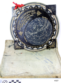 Flagstaff Hill Maritime Museum and Village
Planisphere, Early 20th Century
... maritime-village...planisphere...star map...marine navigation...A significant item of celestial mapping used by marine navigators This particular item was made and used in the first quarter to half of the 20th century flagstaff hill warrnambool shipwrecked-coast flagstaff-hill flagstaff-hill-maritime-museum maritime-museum shipwreck-coast flagstaff-hill-maritime-village planisphere star map marine navigation maps george philip & sons "Made in Germany for GEORGE PHILIP & SONS Ltd. ...The word Planisphere (Latin planisphaerium) was originally used in the second century by Claudius Ptolemy to describe the representation of a spherical Earth by a map drawn in the plane. This usage continued into the Renaissance: for example Gerardus Mercator described his 1569 world map as a Planisphere. The word describes the representation of the star-filled celestial sphere on the plane. The first star chart to have the name "Planisphere" was made in 1624 by Jacob Bartsch. Bartsch was the son-in-law of Johannes Kepler, discoverer of Kepler's laws of planetary motion. A significant item of celestial mapping used by marine navigators This particular item was made and used in the first quarter to half of the 20th centuryPlanisphere of northern hemisphere, with canvas bag. Planisphere consists of a circular star chart attached at its centre to an opaque circular overlay that has a clear elliptical window or hole so that only a portion of the sky map will be visible in the window or hole area at any given time. The chart and overlay are mounted so that they are free to rotate about a common pivot point at their centres. The star chart contains the brightest stars, constellations and (possibly) deep-sky objects visible from a particular latitude on Earth. The night sky that one sees from the Earth depends on whether the observer is in the northern or southern hemispheres and the latitude. A Planisphere window is designed for a particular latitude and will be accurate enough for a certain band either side of that. Planisphere makers will usually offer them in a number of versions for different latitudes. Planispheres only show the stars visible from the observer's latitude; stars below the horizon are not included. A complete twenty-four-hour time cycle is marked on the rim of the overlay. A full twelve months of calendar dates are marked on the rim of the starchart. The window is marked to show the direction of the eastern and western horizons. The disc and overlay are adjusted so that the observer's local time of day on the overlay corresponds to that day's date on the star chart disc. The portion of the star chart visible in the window then represents (with a distortion because it is a flat surface representing a spherical volume) the distribution of stars in the sky at that moment for the Planispheres designed location. Users hold the Planisphere above their head with the eastern and western horizons correctly aligned to match the chart to actual star positions. "Made in Germany for GEORGE PHILIP & SONS Ltd. Geographical and Educational Depot, 32 Fleet Street, London" Canvas bag has "Capt. H (Howard) Tyler from Captain H. F. Woolf" "Tyler 22 ? St East Brighton" also "13 Halls St Flinders"flagstaff hill, warrnambool, shipwrecked-coast, flagstaff-hill, flagstaff-hill-maritime-museum, maritime-museum, shipwreck-coast, flagstaff-hill-maritime-village, planisphere, star map, marine navigation, maps, george philip & sons -
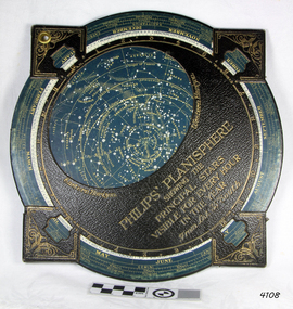 Flagstaff Hill Maritime Museum and Village
Planisphere, Early 20th Century
... maritime-village...Star map...marine navigation...Bartsch was the son-in-law of Johannes Kepler, discoverer of Kepler's laws of planetary motion A significant item of celestial mapping used by marine navigators This particular item was made and used in the first quarter to half of the 20th century. flagstaff hill warrnambool shipwrecked-coast flagstaff-hill flagstaff-hill-maritime-museum maritime-museum shipwreck-coast flagstaff-hill-maritime-village Star map marine navigation maps George Philip & Sons "Sold by J DONNE & SON, Booksellers & Stationers, 349 Post Office Place Melbourne 349. ...The word Planisphere (Latin planisphaerium) was originally used in the second century by Claudius Ptolemy to describe the representation of a spherical Earth by a map drawn in the plane. This usage continued into the Renaissance: for example Gerardus Mercator described his 1569 world map as a Planisphere. The word describes the representation of the star-filled celestial sphere on the plane. The first star chart to have the name "Planisphere" was made in 1624 by Jacob Bartsch. Bartsch was the son-in-law of Johannes Kepler, discoverer of Kepler's laws of planetary motionA significant item of celestial mapping used by marine navigators This particular item was made and used in the first quarter to half of the 20th century.Planisphere consists of a circular star chart attached at its centre to an opaque circular overlay that has a clear elliptical window or hole so that only a portion of the sky map will be visible in the window or hole area at any given time. The chart and overlay are mounted so that they are free to rotate about a common pivot point at their centers. The star chart contains the brightest stars, constellations and (possibly) deep-sky objects visible from a particular latitude on Earth. The night sky that one sees from the Earth depends on whether the observer is in the northern or southern hemispheres and the latitude. A Planisphere window is designed for a particular latitude and will be accurate enough for a certain band either side of that. Planisphere makers will usually offer them in a number of versions for different latitudes. Planispheres only show the stars visible from the observer's latitude; stars below the horizon are not included. A complete twenty-four-hour time cycle is marked on the rim of the overlay. A full twelve months of calendar dates are marked on the rim of the star chart. The window is marked to show the direction of the eastern and western horizons. The disc and overlay are adjusted so that the observer's local time of day on the overlay corresponds to that day's date on the star chart disc. The portion of the star chart visible in the window then represents (with a distortion because it is a flat surface representing a spherical volume) the distribution of stars in the sky at that moment for the Planispheres designed location. Users hold the Planisphere above their head with the eastern and western horizons correctly aligned to match the chart to actual star positions. "Sold by J DONNE & SON, Booksellers & Stationers, 349 Post Office Place Melbourne 349. Admiralty Chart Agents" and " Made in Germany for George Philip & Son Ltd" England . Signature "Capt E. B. ?..id, 22 Baund St"flagstaff hill, warrnambool, shipwrecked-coast, flagstaff-hill, flagstaff-hill-maritime-museum, maritime-museum, shipwreck-coast, flagstaff-hill-maritime-village, star map, marine navigation, maps, george philip & sons -
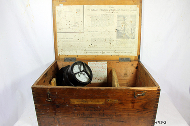 Flagstaff Hill Maritime Museum and Village
Instrument - Ship Log, Early 20th Century
... maritime-village...ships log...thomas walker & son...Electric ships log...marine navigation...maritime industry. His patent of 1897, the ‘Cherub’ log, was a notable departure from the past providing a far more accurate reading and replacing the majority of logs of the age. They were the first to produce an electric log (Trident) and the Walker factory was one of the first to introduce the 48-hour work week for employees. The ship log was invented and made by a significant marine instrument maker and innovator of machinery. It demonstrates the huge leap taken to improve navigational ...In times past the only way to measure a ship’s speed was to throw a wood log into the water and observe how fast it moved away from the ship. In the 16th century, the log was fastened to a rope knotted at set intervals. The log was thrown over the stern (back) of the vessel and a crew member counted the number of knots that were paid out in a set time. From this, they could estimate the vessel's speed through the water. This was known as streaming the log and is also the derivation of the knot as a measurement of nautical speed. Various manufacturers of nautical equipment had sought over the years to perfect the operation of determining a ship's speed and it wasn't until Thomas Walker and his son Ferdinand developed a mechanical system that eventually made this task became easy for marine navigators. Thomas Walker & Son were internationally renowned in the manufacturing of ship logs the founding father, Thomas Walker (1805–1871), an engineer in Birmingham, patented his mechanical log in 1878 which was a recording instrument that attached to a rail at the stern of a vessel connected by a long cord with a rotor which was towed behind the ship. The instrument dial then recorded the distance travelled. Thomas Walker first went into business to manufacture stoves at 58 Oxford Street Birmingham. Walker’s self-feeding stove was widely lauded at the Paris Exhibition of 1855, winning a prize medal and kickstarting the first of many notable innovations for the Walker family's manufacturing business. However, it wasn’t until working on an earlier ship’s log model invented by his Uncle that Thomas Walker became interested in the further development of this device, used to ascertain a ship’s speed. Walker continued to improve on the common log for the company of Massey & Sons and these improvements were deemed revolutionary. This log became a firm favourite of the West India Association (a British-based organisation promoting ties and trade with the British Caribbean), being the most common log in use for two generations. It took until 1861 for Thomas Walker and his son, Thomas Ferdinand Walker (1831-1921) to patent the first Walker log of many. Together, with the introduction of the A1 Harpoon Log two years later, they established the Walker Log Business as a force to be reckoned with. By his passing in 1871, Thomas Walker Snr had not only founded a family business with considerable staying power but also instilled a tradition of public service. Having sat as a representative on the Birmingham Town Council for 15 years and played an active role in public works, he was soon given the nickname of ‘Blue Brick Walker’. Much like his father, Thomas Ferdinand Walker changed the face of the maritime industry. His patent of 1897, the ‘Cherub’ log, was a notable departure from the past providing a far more accurate reading and replacing the majority of logs of the age. They were the first to produce an electric log (Trident) and the Walker factory was one of the first to introduce the 48-hour work week for employees.The ship log was invented and made by a significant marine instrument maker and innovator of machinery. It demonstrates the huge leap taken to improve navigational accuracy at sea with an instrument that was in use for decades.Ships Log, Walker Trident electric motor, in wooden box with instructions inside box. The motor dial with electric cord is still inside box.Inscription "Admiralty patent number 3332" and "Walker Trident Electric Ship Log (Mark III), 15-25 volt". On top of lid, hand written, is "G TAYLOR"flagstaff hill, warrnambool, shipwrecked-coast, flagstaff-hill, flagstaff-hill-maritime-museum, maritime-museum, shipwreck-coast, flagstaff-hill-maritime-village, ships log, thomas walker & son, electric ships log, marine navigation, thomas ferdinand walker, ship log
