
Showing 93 items matching "maroondah river"
-
 Marysville & District Historical Society
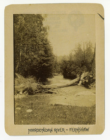
Photograph (Item) - Black and white photograph, Maroondah River - Fernshaw, c1900
... Maroondah River - Fernshaw......maroondah river...The photograph has been incorrectly labeled as the Maroondah River - Fernshaw....The photograph has been incorrectly labeled as the Maroondah River - Fernshaw. watts river fernshaw maroondah river victoria ARMSTRONG COLLECTION 42 STATION STREET/ SANDRINGHAM 3191/ TEL. (03) 9521 5442/ IAN M.L. ...An early black and white photograph of the Watts River at Fernshaw. The photograph has been incorrectly labeled as the Maroondah River - Fernshaw.An early black and white photograph of the Watts River at Fernshaw. The photograph has been incorrectly labeled as the Maroondah River - Fernshaw.ARMSTRONG COLLECTION 42 STATION STREET/ SANDRINGHAM 3191/ TEL. (03) 9521 5442/ IAN M.L. ARMSTRONG OAMwatts river, fernshaw, maroondah river, victoria -
 Greensborough Historical Society
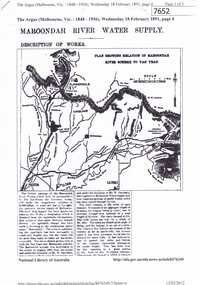
Article - Newspaper Clipping (copy), The Argus, Maroondah River water supply 1891, 18/02/1891
... Maroondah River water supply 1891...maroondah aqueduct...yan yean reservoir...greensborough...plenty river...An historical account of the development of Melbourne's Maroondah River water supply, including a description of works undertaken in the 1890s....Includes transcript in Word document. Maroondah River water supply 1891 Article Newspaper Clipping (copy) The Argus ...An historical account of the development of Melbourne's Maroondah River water supply, including a description of works undertaken in the 1890s.3 p., photocopy of article, downloaded from Trove. Includes transcript in Word document.melbourne water, mmbw, maroondah aqueduct, yan yean reservoir, greensborough, plenty river -
 Greensborough Historical Society
Pamphlet, Lower Plenty River concept plan, summary report: Maroondah Pipetrack to Yarra River, 1992_07
... Lower Plenty River concept plan, summary report: Maroondah Pipetrack to Yarra River...river...maroondah aqueduct...This draft concept plan covers the lower Plenty River from the Maroondah Pipe track in Greensborough to where the Plenty meets the Yarra. ...Lower Plenty River concept plan, summary report: Maroondah Pipetrack to Yarra River Pamphlet Pamphlet Melbourne Water ...This draft concept plan covers the lower Plenty River from the Maroondah Pipe track in Greensborough to where the Plenty meets the Yarra. Melbourne Water was the lead agency, assisted by the Shires of Eltham and Diamond Valley, City of Heidelberg, the EPA and Department of Planning and Housing.Coloured pamphlet, photograph and plans 12 pages. 2 copies.plenty river, maroondah aqueduct, melbourne water -
 Eltham District Historical Society Inc
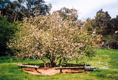
Photograph, The Batman Tree; heirloom apple tree purchased by John Batman and planted by Mr Frederick Flintoff in 1838 in the orchard of Mr Bosch, near Greensborough, now a small river flat near the Maroondah aqueduct crossing, Plenty River Walk, Greensborough, c.1989, 1989c
... The Batman Tree; heirloom apple tree purchased by John Batman and planted by Mr Frederick Flintoff in 1838 in the orchard of Mr Bosch, near Greensborough, now a small river flat near the Maroondah aqueduct crossing, Plenty River Walk, Greensborough, c.1989......plenty river walk...maroondah...greensborough plenty river walk maroondah aqueduct batman apple tree Colour photograph originally located in a magnetic style album titled 'Greensborough Bypass 1990s 5' suffering significant degradation. ...Colour photograph originally located in a magnetic style album titled 'Greensborough Bypass 1990s 5' suffering significant degradation. No information contained in album or on reverse of photos except where noted. Relocated to archival photosafe storage.greensborough, plenty river walk, maroondah aqueduct, batman apple tree -
 Greensborough Historical Society
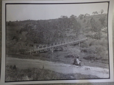
Photograph (copy), Aqueduct over the Plenty River / photographer unknown, 1920c
... maroondah aqueduct...plenty river...View of the Maroondah Aqueduct where it crosses the Plenty River in Greensborough....View of the Maroondah Aqueduct where it crosses the Plenty River in Greensborough. maroondah aqueduct plenty river Black and white photograph, enlarged and laminated. ...View of the Maroondah Aqueduct where it crosses the Plenty River in Greensborough.Black and white photograph, enlarged and laminated.maroondah aqueduct, plenty river -
 Greensborough Historical Society
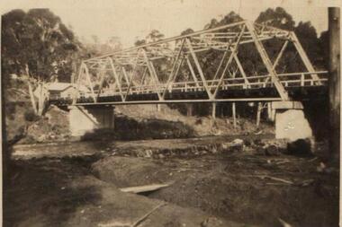
Photograph - Digital Image, Pipes over the Plenty River, 1950c
... maroondah aqueduct...plenty river...An early photograph of the Maroondah Aqueduct pipes crossing the Plenty River....An early photograph of the Maroondah Aqueduct pipes crossing the Plenty River. maroondah aqueduct plenty river Digital copy of black and white photograph. ...An early photograph of the Maroondah Aqueduct pipes crossing the Plenty River.Digital copy of black and white photograph.maroondah aqueduct, plenty river -
 Greensborough Historical Society
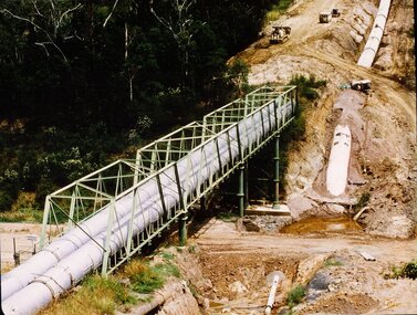
Photograph - Digital image, New pipeline replacing Watts Reservoir aqueduct, 1977_
... ...maroondah aqueduct...plenty river...Photograph of new aqueduct pipe near Plenty River Greensborough. aqueduct maroondah aqueduct plenty river Digital copy of colour photograph. ...Photograph of new aqueduct pipe near Plenty River Greensborough.Digital copy of colour photograph.aqueduct, maroondah aqueduct, plenty river -
![Photograph - Digital image, Pioneer Children's Cemetery [from above], 1985_](/media/collectors/4f729f5697f83e03086015b8/items/54bb56202162f10ca8d79013/item-media/54bb56452162f10ca8d79127/item-fit-380x285.jpg?cb=6) Greensborough Historical Society
Greensborough Historical SocietyPhotograph - Digital image, Pioneer Children's Cemetery [from above], 1985_
... river...maroondah aqueduct...This photograph is taken from above the cemetery site looking towards the Plenty River with the Maroondah Aqueduct in the background....An important historical site in Greensborough. pioneer childrens cemetery plenty river maroondah aqueduct partington whatmough Digital copy of colour photograph. ...The unmarked graves of the children of two Greensborough pioneer families lie in a private cemetery on the Plenty River. Burials occurred between 1848 and 1860. This photograph is taken from above the cemetery site looking towards the Plenty River with the Maroondah Aqueduct in the background.An important historical site in Greensborough.Digital copy of colour photograph.pioneer childrens cemetery, plenty river, maroondah aqueduct, partington, whatmough -
 Greensborough Historical Society
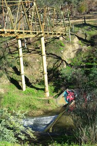
Photograph - Digital Image, Marilyn Smith, Plenty River at the aqueduct crossing Greensborough 2019, 02/07/2019
... ...maroondah aqueduct...plenty river...The Plenty River at the aqueduct crossing, 2019, showing graffiti on the river bank rocks. Originally part of the Maroondah Aqueduct pipeline, all that remains is the bridge that once carried the pipe over the Plenty River. ...This photograph was taken from the Plenty River Trail in Greensborough. plenty river trail maroondah pipetrack maroondah aqueduct plenty river graffiti 2 colour digital photographs Plenty River at the aqueduct crossing Greensborough 2019 Photograph - Digital Image Marilyn Smith ...The Plenty River at the aqueduct crossing, 2019, showing graffiti on the river bank rocks. Originally part of the Maroondah Aqueduct pipeline, all that remains is the bridge that once carried the pipe over the Plenty River. This photograph was taken from the Plenty River Trail in Greensborough. 2 colour digital photographsplenty river trail, maroondah pipetrack, maroondah aqueduct, plenty river, graffiti -
 Greensborough Historical Society
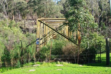
Photograph - Photograph - Digital Image, Marilyn Smith, Aqueduct crossing the Plenty River, Greensborough 2019, 02/07/2019
... ...maroondah aqueduct...plenty river...The aqueduct crossing the Plenty River, 2019, overgrown with vegetation. Originally part of the Maroondah Aqueduct pipeline, all that remains is the bridge that once carried the pipe over the Plenty River. ...This photograph was taken from the Plenty River Trail in Greensborough. plenty river trail maroondah pipetrack maroondah aqueduct plenty river graffiti 3 colour digital photographs Aqueduct crossing the Plenty River, Greensborough 2019 Photograph Photograph - Digital Image Marilyn Smith ...The aqueduct crossing the Plenty River, 2019, overgrown with vegetation. Originally part of the Maroondah Aqueduct pipeline, all that remains is the bridge that once carried the pipe over the Plenty River. This photograph was taken from the Plenty River Trail in Greensborough. 3 colour digital photographsplenty river trail, maroondah pipetrack, maroondah aqueduct, plenty river, graffiti -
 Greensborough Historical Society
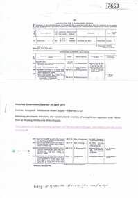
Article - Journal - Excerpt, Victorian Government Gazette, Melbourne water supply 1879, 25/04/1879
... ...maroondah aqueduct...plenty river...Masonry abutments and piers, also construction and erection of wrought iron aqueduct over Plenty River at Morang. 5250 pounds. History of the Maroondah aqueduct melbourne water mmbw maroondah aqueduct plenty river 1 p., photocopy of article, downloaded from State Library of Victoria Melbourne water supply 1879 Article Journal - Excerpt Victorian Government Gazette ...An historical account from the Victorian Government Gazette 25/04/1879: Contract accepted - Melbourne Water Supply - B. Barnes & Co. Masonry abutments and piers, also construction and erection of wrought iron aqueduct over Plenty River at Morang. 5250 pounds.History of the Maroondah aqueduct1 p., photocopy of article, downloaded from State Library of Victoriamelbourne water, mmbw, maroondah aqueduct, plenty river -
 Greensborough Historical Society
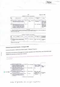
Article - Journal - Excerpt, Victorian Government Gazette, Melbourne water supply 1890, 15/08/1890
... ...maroondah aqueduct...plenty river...Addition and extension to Watts River Scheme. History of the Maroondah aqueduct melbourne water mmbw maroondah aqueduct plenty river watts river 1 p., photocopy of article, downloaded from State Library of Victoria Melbourne water supply 1890 Article Journal - Excerpt Victorian Government Gazette ...An historical account from the Victorian Government Gazette 15/08/1890: Contract accepted - Melbourne Water Supply - Mephan Ferguson. Manufacture and erection of wrought iron tubular aqueduct over Plenty River near Greensborough. Addition and extension to Watts River Scheme.History of the Maroondah aqueduct1 p., photocopy of article, downloaded from State Library of Victoriamelbourne water, mmbw, maroondah aqueduct, plenty river, watts river -
 Greensborough Historical Society
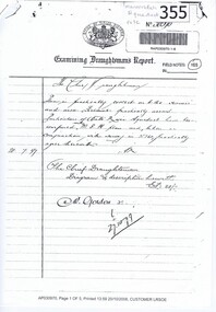
Document - Report, Examining Draughtsman's Report - Watts River Aqueduct, 20/07/1897
... maroondah aqueduct...watts river...This Field Survey was commissioned by the Melbourne Board of Works and was used to position the Maroondah Aqueduct bridge north of Greensborough at its crossing point on the Plenty River. ...It features a traverse of the Plenty River The Maroondah Aqueduct bridge is a significant example of late 19th century engineering. maroondah aqueduct watts river aqueduct bridge greensborough office of titles 1897 wrought iron water pipes plenty river melbourne board of works Copy of handwritten report includes maps. ...This Field Survey was commissioned by the Melbourne Board of Works and was used to position the Maroondah Aqueduct bridge north of Greensborough at its crossing point on the Plenty River. It incorporated the use of wrought iron water pipes and therefore is of lighter construction than other similar bridges in the district. It features a traverse of the Plenty RiverThe Maroondah Aqueduct bridge is a significant example of late 19th century engineering. A 4 page reproduction of an Office of Titles document. Copy of handwritten report includes maps.maroondah aqueduct, watts river aqueduct, bridge, greensborough, office of titles, 1897, wrought iron water pipes, plenty river, melbourne board of works -
 Greensborough Historical Society
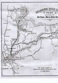
Map, The School Paper, Melbourne Water Supply Plan: showing the Yan Yean and Watts River Systems, 1895
... river...maroondah aqueduct...Map of Melbourne Water Supply Plan: showing the Yan Yean and Watts River Systems the school paper MMBW melbourne water yan yean watts river maroondah aqueduct Black and white map laminated Melbourne Water Supply Plan: showing the Yan Yean and Watts River Systems Map Map The School Paper ...Map of Melbourne Water Supply Plan: showing the Yan Yean and Watts River SystemsBlack and white map laminatedthe school paper, mmbw, melbourne water, yan yean, watts river, maroondah aqueduct -
 Marysville & District Historical Society
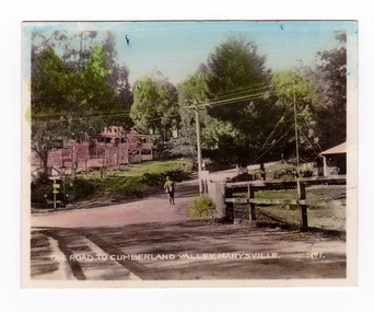
Photograph (item) - Colour tinted photograph, Valentine Publishing Co. Pty. Ltd, The Road to Cumberland Valley, Marysville. No. 1, 1923-1963
... River. In the background can be seen the Poontawan Guest House which later became the Marysville Chalet Guest House which was on the site of the original Steavenson's Hotel. That guest house no longer exists and the Christ Church stands on the land where the guest house once stood. This photograph was published by the Valentine Publishing Co Pty. Ltd as a souvenir of Marysville. marysville victoria marysville chalet guest house crossways hotel christ church marysville poontawan guest house steavenson's hotel valentine publishing co souvenir yarra track wood's point road mining buxton-marysville road marysville-wood's point road maroondah highway alexandra An early colour tinted photograph of the intersection of the Buxton Marysville Road and the Marysville-Wood's Point Road. ...An early colour tinted photograph of the intersection of the Buxton Marysville Road and the Marysville-Wood's Point Road.An early photograph of the Buxton Marysville Road and the Marysville-Wood's Point Road intersection. The Marysville-Buxton Road joins the Maroondah Highway which leads to Alexandra. The Marysville-Woods Point Road was originally part of the Yarra Track, constructed in the early 1860s to provide access between Healesville and the Woods Point Goldfields. Despite the steep terrain and engineering difficulties, the Yarra Track soon became a busy route used by pack horses, horse-drawn drays, and wagons. Today this sealed mountain road is a popular scenic drive between Marysville and Warburton. On the right of the photograph can be seen 'The Crossways Hotel' which is circa 1920 and one of the oldest buildings still standing in Marysville. 'The Crossways Hotel' survived the 2009 Black Saturday bushfires, through the efforts of the owner using buckets of water from the nearby Steavenson River. In the background can be seen the Poontawan Guest House which later became the Marysville Chalet Guest House which was on the site of the original Steavenson's Hotel. That guest house no longer exists and the Christ Church stands on the land where the guest house once stood. This photograph was published by the Valentine Publishing Co Pty. Ltd as a souvenir of Marysville.marysville, victoria, marysville chalet guest house, crossways hotel, christ church marysville, poontawan guest house, steavenson's hotel, valentine publishing co, souvenir, yarra track, wood's point road, mining, buxton-marysville road, marysville-wood's point road, maroondah highway, alexandra -
 Marysville & District Historical Society
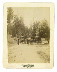
Photograph (Item) - Black and white photograph, Fernshaw, c1900
... river...orchard...berry orchard...blacks spur...black spur...mount juliet...mount mondah...maroondah...In 1886 the Melbourne and Metropolitan Board of Works began work on the Watts River water catchment scheme – later to become Maroondah – and the Board obtained approval for the catchment country to be reserved and kept free of settlement. ...An early black and white photograph taken at Fernshaw.An early black and white photograph taken at Fernshaw. Fernshaw was a rural township 63 km north-east of Melbourne and 10 km north-east of Healesville. Situated on the Watts River, near where a log had fallen making a convenient crossing, Fernshaw was settled in the 1860s. It provided good country for orchards and berry growing. The location was at the foot of Blacks Spur, with Mounts Juliet and Mondah rising on either side, providing spectacular scenery. There were nearby fern gullies giving rise to the name – ‘shaw’ is old English for thicket or wood. By 1875 Fernshaw had a post office (1865), two hotels, a school (1871) and stores. It was famed for its beauty, attracting tourists. In 1886 the Melbourne and Metropolitan Board of Works began work on the Watts River water catchment scheme – later to become Maroondah – and the Board obtained approval for the catchment country to be reserved and kept free of settlement. This required the removal of the Fernshaw township, which was completed by about 1890. The area was described in the 1903 Australian handbook:ARMSTRONG COLLECTION 42 STATION STREET/ SANDRINGHAM 3191/ TEL. (03) 9521 5442/ IAN M.L. ARMSTRONG OAMfernshaw, healesville, watts river, orchard, berry orchard, blacks spur, black spur, mount juliet, mount mondah, maroondah dam, victoria -
 Marysville & District Historical Society
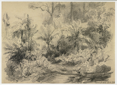
Artwork, other (Item) - Pencil Sketch, Louis Buvelot, Fernshaw 17.2.83, 1883
... In 1886 the Melbourne and Metropolitan Board of Works began work on the Watts River water catchment scheme – later to become Maroondah – and the Board obtained approval for the catchment country to be reserved and kept free of settlement. ...A copy of an early pencil sketch of Fernshaw in Victoria.A copy of an early pencil sketch of Fernshaw in Victoria by Louis Buvelot. Louis Buvelot ( 1814–1888), born Abram-Louis Buvelot, was a Swiss landscape painter who lived 17 years in Brazil and following 5 years back in Switzerland stayed 23 years in Australia, where he influenced the Heidelberg School of painters. Arriving in Melbourne in February 1865, after leaving the cold of Switzerland, which was impacting on his health, for the warmth of Australia, Buvelot was in business as a photographer in Bourke Street for a year but soon resumed his painting. He lived in Melbourne for a number of years before moving to Fitzroy. The National Gallery of Victoria purchased two of his paintings and he continued painting until his death in 1888. He was buried at the Boroondara Cemetery, where a large monument was erected in his memory. Fernshaw was a rural township 63 km northeast of Melbourne and 10 km northeast of Healesville. Situated on the Watts River, near where a log had fallen making a convenient crossing, Fernshaw was settled in the 1860s. It provided good country for orchards and berry growing. The location was at the foot of Blacks Spur, with Mounts Juliet and Mondah rising on either side, providing spectacular scenery. There were nearby fern gullies giving rise to the name – ‘shaw’ is old English for thicket or wood. By 1875 Fernshaw had a post office (1865), two hotels, a school (1871), and stores. It was famed for its beauty, attracting tourists. In 1886 the Melbourne and Metropolitan Board of Works began work on the Watts River water catchment scheme – later to become Maroondah – and the Board obtained approval for the catchment country to be reserved and kept free of settlement. This required the removal of the Fernshaw township, which was completed by about 1890.Fernshaw 17.2.83louis buvelot, fernshaw, victoria, national gallery of victoria, switzerland, boroondara cemetery, kew cemetery, artist -
 Marysville & District Historical Society
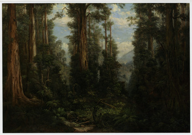
Painting (Item) - Oil painting, Isaac Whitehead, A spring morning near Fernshaw 1880, 1880
... In 1886 the Melbourne and Metropolitan Board of Works began work on the Watts River water catchment scheme – later to become Maroondah – and the Board obtained approval for the catchment country to be reserved and kept free of settlement. ...A copy of an early oil painting of Fernshaw in Victoria.A copy of an early oil painting of Fernshaw in Victoria by Isaac Whitehead. Isaac Whitehead (1819–1881) was an Irish-Australian artist who worked in watercolour and pastel. He was also a picture framer and art promoter. It is believed that Isaaz Whitehead emigrated to Australia with his family in either 1853 or 1858. Isaac Whitehead died at his home 50 Punt Road, Prahran, Melbourne, on 21 April 1881. Isaac Whitehead had established himself as the foremost picture framer in Melbourne by 1860, known for his highly ornate frames with floral decorations. Among the clients of his framing business were Louis Buvelot, Nicholas Chevalier, and Eugene von Guérard. In his own paintings, he painted a number of scenes of the forests of Gippsland, Victoria. His work focused on the rich landscapes with trees and ferns, with a high degree of botanical detail. His work won him two medals and his work was posthumously exhibited at 1884 Victorian Jubilee Exhibition, the 1886 London Colonial and Indian Exhibition, and the 1888 Melbourne Centennial Intercolonial Exhibition. Fernshaw was a rural township 63 km northeast of Melbourne and 10 km northeast of Healesville. Situated on the Watts River, near where a log had fallen making a convenient crossing, Fernshaw was settled in the 1860s. It provided good country for orchards and berry growing. The location was at the foot of Blacks Spur, with Mounts Juliet and Mondah rising on either side, providing spectacular scenery. There were nearby fern gullies giving rise to the name – ‘shaw’ is old English for thicket or wood. By 1875 Fernshaw had a post office (1865), two hotels, a school (1871), and stores. It was famed for its beauty, attracting tourists. In 1886 the Melbourne and Metropolitan Board of Works began work on the Watts River water catchment scheme – later to become Maroondah – and the Board obtained approval for the catchment country to be reserved and kept free of settlement. This required the removal of the Fernshaw township, which was completed by about 1890.isaac whitehead, fernshaw, victoria, louis buvelot, nicholas chevalier, eugene von guerard, gippsland, victorian jubilee exhibition, london colonial and indian exhibition, melbourne centennial intercolonial exhibition, watts river, healesville, blacks spur, mount juliet, mount mondah -
 Marysville & District Historical Society
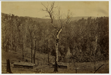
Photograph (Item) - Black and white photograph, Fred Kruger, Scene on the Watts River near Fernshaw, Unknown
... In 1886 the Melbourne and Metropolitan Board of Works began work on the Watts River water catchment scheme – later to become Maroondah – and the Board obtained approval for the catchment country to be reserved and kept free of settlement. ...A copy of a black and white photograph on the Watts River near Fernshaw in Victoria.A copy of a black and white photograph on the Watts River near Fernshaw in Victoria taken by Fred Kruger. Fred Kruger (born Johan Friedrich Carl Kruger, 18 April 1831 – 15 February 1888) was a German-born photographer noted for his early photography of landscape and indigenous peoples in Victoria, Australia. Fernshaw was a rural township 63 km northeast of Melbourne and 10 km northeast of Healesville. Situated on the Watts River, near where a log had fallen making a convenient crossing, Fernshaw was settled in the 1860s. It provided good country for orchards and berry growing. The location was at the foot of Blacks Spur, with Mounts Juliet and Mondah rising on either side, providing spectacular scenery. There were nearby fern gullies giving rise to the name – ‘shaw’ is old English for thicket or wood. By 1875 Fernshaw had a post office (1865), two hotels, a school (1871), and stores. It was famed for its beauty, attracting tourists. In 1886 the Melbourne and Metropolitan Board of Works began work on the Watts River water catchment scheme – later to become Maroondah – and the Board obtained approval for the catchment country to be reserved and kept free of settlement. This required the removal of the Fernshaw township, which was completed by about 1890.fernshaw, watts river, victoria, fred kruger, photograph -
 Marysville & District Historical Society
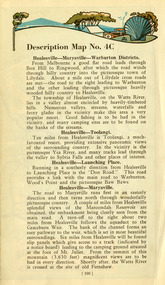
Ephemera (Item) - Book page, Unknown
... river...sylvia falls...don road...wood's point...baw baws...maroondah...A page from a unknown book regarding Marysville and the surrounding district including Narbethong, Healesville and Warburton. marysville victoria narbethong healesville warburton toolangi launching place box hill ringwood lilydale watts river yea river sylvia falls don road wood's point baw baws maroondah reservoir graceburn weir mt juliet fernshaw A page from a unknown book regarding Marysville and the surrounding district including Narbethong, Healesville and Warburton. ...A page from a unknown book regarding Marysville and the surrounding district including Narbethong, Healesville and Warburton.A page from a unknown book regarding Marysville and the surrounding district including Narbethong, Healesville and Warburton.marysville, victoria, narbethong, healesville, warburton, toolangi, launching place, box hill, ringwood, lilydale, watts river, yea river, sylvia falls, don road, wood's point, baw baws, maroondah reservoir, graceburn weir, mt juliet, fernshaw -
 Marysville & District Historical Society
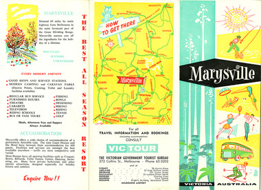
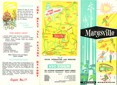
Ephemera (Item) - Tourist brochure, Victorian Government Tourist Bureau, Marysville Victoria Australia, Unknown
... maroondah dam...alexandra...mansfield...jamieson...wood's point...eildon weir...snob's creek...rubicon...lake mountain...marysville tourist and progress association...the cumberland...kerami guest house...kooringa guest house...marylands guest house...marylyn guesthouse...marysville hotel...mount kitchener house...barton brothers' store...fruit salad farm...marysville dairy...marysville caravan park...marysville garage...marysville riding school...marysville theatre...mckenzie's tourist services...potters fruit and milk bar...arosa holiday cottages...scenic motel...beauty spot walk...red hill walk...wishing well...taggerty river...A tourist brochure on Marysville and the surrounding area published by the Victorian Government Tourist Bureau for the Marysville Tourist and Progress Association. marysville victoria tourist brochure victorian government tourist bureau cumberland valley cumberland falls cora-lyn falls robart's lookout meeting of the waters warburton acheron way healesville launching place reefton spur upper yarra dam maroondah highway black spur maroondah dam alexandra mansfield jamieson wood's point eildon weir snob's creek rubicon lake mountain marysville tourist and progress association the cumberland kerami guest house kooringa guest house marylands guest house marylyn guesthouse marysville hotel mount kitchener house barton brothers' store fruit salad farm marysville dairy marysville caravan park marysville garage marysville riding school marysville theatre mckenzie's tourist services potters fruit and milk bar arosa holiday cottages scenic motel beauty spot walk red hill walk wishing well taggerty river mount gordon steavenson falls keppel's lookout keppel's falls A tourist brochure on Marysville and the surrounding area published by the Victorian Government Tourist Bureau for the Marysville Tourist and Progress Association. ...A tourist brochure on Marysville and the surrounding area published by the Victorian Government Tourist Bureau for the Marysville Tourist and Progress Association.A tourist brochure on Marysville and the surrounding area published by the Victorian Government Tourist Bureau for the Marysville Tourist and Progress Association.marysville, victoria, tourist brochure, victorian government tourist bureau, cumberland valley, cumberland falls, cora-lyn falls, robart's lookout, meeting of the waters, warburton, acheron way, healesville, launching place, reefton spur, upper yarra dam, maroondah highway, black spur, maroondah dam, alexandra, mansfield, jamieson, wood's point, eildon weir, snob's creek, rubicon, lake mountain, marysville tourist and progress association, the cumberland, kerami guest house, kooringa guest house, marylands guest house, marylyn guesthouse, marysville hotel, mount kitchener house, barton brothers' store, fruit salad farm, marysville dairy, marysville caravan park, marysville garage, marysville riding school, marysville theatre, mckenzie's tourist services, potters fruit and milk bar, arosa holiday cottages, scenic motel, beauty spot walk, red hill walk, wishing well, taggerty river, mount gordon, steavenson falls, keppel's lookout, keppel's falls -
 Marysville & District Historical Society
Ephemera (Item) - Tourist brochure, Victorian Government Tourist Bureau, Marysville Victoria Australia, Unknown
... maroondah dam...alexandra...mansfield...jamieson...wood's point...eildon weir...snob's creek...rubicon...lake mountain...marysville tourist and progress association...the cumberland...kerami guest house...kooringa guest house...marylands guest house...marylyn guesthouse...marysville hotel...mount kitchener house...barton brothers' store...fruit salad farm...marysville dairy...marysville caravan park...marysville garage...marysville riding school...marysville theatre...mckenzie's tourist services...potters fruit and milk bar...arosa holiday cottages...scenic motel...beauty spot walk...red hill walk...wishing well...taggerty river...A tourist brochure on Marysville and the surrounding area published by the Victorian Government Tourist Bureau for the Marysville Tourist and Progress Association. marysville victoria tourist brochure victorian government tourist bureau cumberland valley cumberland falls cora-lyn falls robart's lookout meeting of the waters warburton acheron way healesville launching place reefton spur upper yarra dam maroondah highway black spur maroondah dam alexandra mansfield jamieson wood's point eildon weir snob's creek rubicon lake mountain marysville tourist and progress association the cumberland kerami guest house kooringa guest house marylands guest house marylyn guesthouse marysville hotel mount kitchener house barton brothers' store fruit salad farm marysville dairy marysville caravan park marysville garage marysville riding school marysville theatre mckenzie's tourist services potters fruit and milk bar arosa holiday cottages scenic motel beauty spot walk red hill walk wishing well taggerty river mount gordon steavenson falls keppel's lookout keppel's falls A tourist brochure on Marysville and the surrounding area published by the Victorian Government Tourist Bureau for the Marysville Tourist and Progress Association. ...A tourist brochure on Marysville and the surrounding area published by the Victorian Government Tourist Bureau for the Marysville Tourist and Progress Association.A tourist brochure on Marysville and the surrounding area published by the Victorian Government Tourist Bureau for the Marysville Tourist and Progress Association.marysville, victoria, tourist brochure, victorian government tourist bureau, cumberland valley, cumberland falls, cora-lyn falls, robart's lookout, meeting of the waters, warburton, acheron way, healesville, launching place, reefton spur, upper yarra dam, maroondah highway, black spur, maroondah dam, alexandra, mansfield, jamieson, wood's point, eildon weir, snob's creek, rubicon, lake mountain, marysville tourist and progress association, the cumberland, kerami guest house, kooringa guest house, marylands guest house, marylyn guesthouse, marysville hotel, mount kitchener house, barton brothers' store, fruit salad farm, marysville dairy, marysville caravan park, marysville garage, marysville riding school, marysville theatre, mckenzie's tourist services, potters fruit and milk bar, arosa holiday cottages, scenic motel, beauty spot walk, red hill walk, wishing well, taggerty river, mount gordon, steavenson falls, keppel's lookout, keppel's falls -
 Greensborough Historical Society
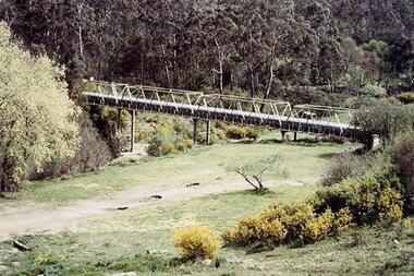
Photograph - Digital Image, Aqueduct Greensborough, 1960c
... River. The use of wrought iron meant the pipes were 75% lighter than cast iron, with the bridge construction reflecting this innovation. Photograph of the Maroondah...The eastern side of the bridge is reinforced with a bluestone abutment at the river bank. maroondah aqueduct aqueduct pipe bridge greensborough Digital copy of colour photograph. ...The Pipe Bridge at Greensborough is a significant and highly visible part of the system. It was constructed to carry the wrought iron aqueduct pipes over the Plenty River. The use of wrought iron meant the pipes were 75% lighter than cast iron, with the bridge construction reflecting this innovation. Photograph of the Maroondah Aqueduct pipe bridge at Greensborough. The Pipe Bridge is 210 feet long, divided into 4 spans. The main girders are light lattice 11 feet deep and 11 ft 4 inches apart. The bridge carried two wrought iron tubular mains, 53 inches in diameter, supported at intervals by cross girders and chairs, placed between the main girders. The bridge is carried on braced cast-iron columns, 18 inches in diameter, set on concrete foundations, with a clear headway of 20 feet above the Plenty River. The eastern side of the bridge is reinforced with a bluestone abutment at the river bank.Digital copy of colour photograph.maroondah aqueduct, aqueduct pipe bridge greensborough -
 Greensborough Historical Society
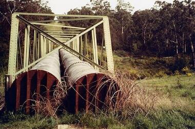
Photograph - Digital Image, Dual pipes: Aqueduct Greensborough, 2000c
... Photograph of section of the Maroondah aqueduct over the Plenty River at Greensborough....Photograph of section of the Maroondah aqueduct over the Plenty River at Greensborough. maroondah aqueduct aqueduct greensborough Digital copy of colour photograph. ...Photograph of section of the Maroondah aqueduct over the Plenty River at Greensborough.Digital copy of colour photograph.maroondah aqueduct, aqueduct greensborough -
 Greensborough Historical Society
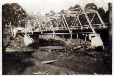
Photograph - Digital Image, Pipes over Plenty, construction of original bridge for Watts Reservoir aqueduct, 1950-1970
... maroondah aqueduct...aqueduct...plenty river...Photograph of the Maroondah aqueduct bridge over the Plenty River in Greensborough....Photograph of the Maroondah aqueduct bridge over the Plenty River in Greensborough. maroondah aqueduct aqueduct plenty river Digital copy of black and white photograph. ...Photograph of the Maroondah aqueduct bridge over the Plenty River in Greensborough.Digital copy of black and white photograph.maroondah aqueduct, aqueduct, plenty river -
![Photograph - Digital image, Pioneer Children's Graves [graves and aqueduct], 1985_](/media/collectors/4f729f5697f83e03086015b8/items/54bb57442162f10ca8d7a0b6/item-media/54bb57762162f10ca8d7a408/item-fit-380x285.jpg?cb=6) Greensborough Historical Society
Greensborough Historical SocietyPhotograph - Digital image, Pioneer Children's Graves [graves and aqueduct], 1985_
... River. Burials occurred between 1848 and 1860. This photograph shows the cemetery site with jonquils in bloom and the Maroondah Aqueduct in the background....River. Burials occurred between 1848 and 1860. This photograph shows the cemetery site with jonquils in bloom and the Maroondah Aqueduct in the background. ...The unmarked graves of the children of two Greensborough pioneer families lie in a private cemetery on the Plenty River. Burials occurred between 1848 and 1860. This photograph shows the cemetery site with jonquils in bloom and the Maroondah Aqueduct in the background. An important historical site in Greensborough.Digital copy of colour photograph.pioneer childrens cemetery, maroondah aqueduct, whatmough, partington -
 Greensborough Historical Society
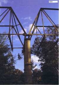
Photograph, Maroondah aqueduct pipe bridge 2011, 2011_
... in 1891 the Watts River (near Healesville) was tapped. It supplied water to Melbourne, via the Maroondah aqueduct. ...in 1891 the Watts River (near Healesville) was tapped. It supplied water to Melbourne, via the Maroondah aqueduct. ...in 1891 the Watts River (near Healesville) was tapped. It supplied water to Melbourne, via the Maroondah aqueduct. The Maroondah Reservoir, northeast of Melbourne, was completed in 1927 and water was piped via the Maroondah aqueduct to the northern suburbs. It was replaced by large pipes in the 1980s. Parts of the aqueduct structure remain.Copy of colour photographaqueduct pipe bridge greensborough, maroondah aqueduct -
 Greensborough Historical Society
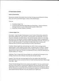
Folder of Documents, Anne Paul, Plenty River Heritage sites / Anne Paul, 1937_
... This collection of correspondence, articles and photographs was collected by GHS member Anne Paul in support of Heritage overlays for the Pioneer Children's Graves, Batman Apple Tree and Maroondah Aqueduct. anne paul pioneer childrens cemetery batman apple tree maroondah aqueduct Blue plastic folder containing a large number of documents and images. Plenty River Heritage sites / Anne Paul Folder of Documents Anne Paul ...This collection of correspondence, articles and photographs was collected by GHS member Anne Paul in support of Heritage overlays for the Pioneer Children's Graves, Batman Apple Tree and Maroondah Aqueduct.Blue plastic folder containing a large number of documents and images.anne paul, pioneer childrens cemetery, batman apple tree, maroondah aqueduct -
 Greensborough Historical Society
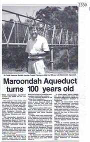
Newspaper clipping, Diamond Valley Leader, Maroondah Aqueduct turns 100 years old, 1991c
... River near Healesville and Preston Reservoir. Parts have been replaced by pipes. The aqueduct formed a major link in Melbourne's water distribution system after supplies from Yan Yean Reservoir were considered insufficient in the 1870s. maroondah aqueduct russell yeomans Photographic copy, text with photo of Russell Yeomans Maroondah Aqueduct turns 100 years old. ...Aqueduct of 66 km built between 1886 and 1891 between Watts River near Healesville and Preston Reservoir. Parts have been replaced by pipes.The aqueduct formed a major link in Melbourne's water distribution system after supplies from Yan Yean Reservoir were considered insufficient in the 1870s.Photographic copy, text with photo of Russell Yeomansmaroondah aqueduct, russell yeomans -
 Greensborough Historical Society
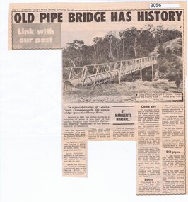
Newspaper Clipping, Diamond Valley News, Old pipe bridge has history, by Marguerite Marshall, 1891o
... The aqueduct siphon bridge over the Plenty River, opened in 1891, was part of the pipeline bringing water from the service reservoir at Healesville, prior to the construction of the Maroondah Reservoir....The aqueduct siphon bridge over the Plenty River, opened in 1891, was part of the pipeline bringing water from the service reservoir at Healesville, prior to the construction of the Maroondah Reservoir. aqueduct pipe bridge greensborough News article, black and white text and photograph. ...The aqueduct siphon bridge over the Plenty River, opened in 1891, was part of the pipeline bringing water from the service reservoir at Healesville, prior to the construction of the Maroondah Reservoir.News article, black and white text and photograph.aqueduct pipe bridge greensborough
