Showing 2 items matching "meridian lines"
-
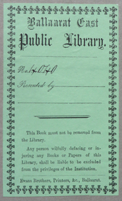 Federation University Historical Collection
Book, Mechanics' Magazine vol. 3, 1825 (exact)
... ...meridian lines...Barker Library (top floor) Mount Helen goldfields car newton fire shipwreck bell naval architecture locomotive ballaarat east public library ballarat east public library ballarat east library henry brougham potassium meridian lines pit saw self moving carriage lord worcestor steam engine cameron s soda water astronomy royal mint mechanical geometry lifting ships by steam voltaic mechanic agent steam navigation hand mill brown s pneumatic engine triple pump cycloidal chuck potato washer sand clock galvanic electricity perpetual motion hadley s quadrent wollaston s night bolt rope bridges boring machinery steam engines new london bridge steam and water wheel spencer s patent forge boat with wings ivory profile portraits jenning s gas burner ramage s telescope washing machine tallow lamp iron masts self regulating pendulum prismatic compass simple blowpipe bookplate Green book plate: Ballaarat east Public Library No. 4040. ...Hardcovered book, half leather bound with marbled paper. Formerly book number 4040 from the Ballaarat East Public Library. Contents include: new pit-saw, self-moving carriage (car), Lord Worcestor's steam engine, extinction of fires, Cameron's Soda Water Apparatus, Newton's Lectures on Astronomy, coining at the Royal Mint, mechanical geometry, lifting ships by steam, voltaic-mechanic agent, steam navigation, portable hand-mill, Brown's pneumatic engine, Bell's invention for saving lives from shipwreck, triple pump, cycloidal chuck, potato-washer, sand clock, Galvanic electricity, perpetual motion, Hadley's Quadrent, Wollaston's Night-Bolt, rope bridges, boring machinery, locomotive steam-engines, new London Bridge, naval architecture, steam and water wheel, Spencer's Patent Forge, boat with wings, ivory profile portraits, Jenning's Gas burner, Ramage's Telescope, washing machine, tallow lamp, iron masts, self regulating pendulum, prismatic compass, simple blowpipe. Includes image of Henry Brougham, and many drawings of inventions.non-fictioncar, newton, fire, shipwreck, bell, naval architecture, locomotive, ballaarat east public library, ballarat east public library, ballarat east library, henry brougham, potassium, meridian lines, pit saw, self moving carriage, lord worcestor, steam engine, cameron s, soda water, astronomy, royal mint, mechanical geometry, lifting ships by steam, voltaic mechanic agent, steam navigation, hand mill, brown s pneumatic engine, triple pump, cycloidal chuck, potato washer, sand clock, galvanic electricity, perpetual motion, hadley s quadrent, wollaston s night bolt, rope bridges, boring machinery, steam engines, new london bridge, steam and water wheel, spencer s patent forge, boat with wings, ivory profile portraits, jenning s gas burner, ramage s telescope, washing machine, tallow lamp, iron masts, self regulating pendulum, prismatic compass, simple blowpipe, bookplate -
 Bendigo Military Museum
Map - RASvy " Map Makers Exhibition 2025 "- Map display, RAN Hydrographic Office, 1972 - 1992
... Of Particular note these charts were used to plot "Rhumb Lines or loxodromes" where a course crosses all Meridians (Lines of latitude and longitude) at the same angle. ...Of Particular note these charts were used to plot "Rhumb Lines or loxodromes" where a course crosses all Meridians (Lines of latitude and longitude) at the same angle. ...All of these Charts / Maps were used for the RSL Museum display " The Mapmakers " ( of RASvy. ) 10 Jun - 10 Aug 2025. .1 Catalogue of Tactical Pilotage Charts, 1:500 000 Scale. Digital Data Base available as at 30Jun 92. This catalogue page shows the extent of the Australian area of responsibility for aeronautical charting. .2 RAAF PLOTTING CHART. NP 22-2 (Navigational Plotting) Tasmania. MERCATOR PROJECTION. This series of charts were used for the training of RAAF Navigators. These charts were produced and printed at the Army Survey Regiment, Bendigo. .3 RAAF PLOTTING CHART AUSTRALIA - SOUTHEAST. NP 27 is Based on LAMBERT CONFORMAL CONIC PROJECTION. This series of charts was used by RAAF Navigators for the planning of RAAF flights. These charts were produced and printed at the Army Survey Regiment, Bendigo. .4 RAAF LONG RANGE PLOTTING CHART. NP 43-4 AUSTRALIA WESTERN. MERCATOR PROJECTION. This series of maps were used for the planning of RAAF flights. Of Particular note these charts were used to plot "Rhumb Lines or loxodromes" where a course crosses all Meridians (Lines of latitude and longitude) at the same angle. On Mercator projection charts Rhumb lines are conveniently shown as straight lines and are also lines of constant compass bearing. Rhumb lines are usually longer than the shortest distance between two points. The shortest distance between two points on the earth's surface is called a "Great Circle Route" which is a route on a circular path on the surface of the earth where the centre of that circle is also the centre of the earth. Great Circle Routes on a Mercator Projection are however curves and harder to plot. These charts were produced and printed at the Army Survey Regiment, Bendigo. .5 RAAF LONG RANGE PLOTTING CHART. NP 43-7 SOLOMON ISLANDS. MERCATOR PROJECTION. Used for the planning of RAAF flights. .6 RAAF AIR STAFF PLANNING CHART NS 137-1 DARWIN NORTH WEST. AZIMUTHAL EQUIDISTANT PROJECTION. This series of charts were used for planning by the staff. The whole chart was produced by joining the four quadrant maps together. The charts are based on a single point of tangency (in this case Darwin) and shows radius (distance) in nautical miles to and from that point. A series of charts were produced centred on each of the major airfields in Northern Australia. These charts were produced and printed at the Army Survey Regiment, Bendigo. .7 RAAF AIR STAFF PLANNING CHART NS 137-2 DARWIN NORTH EAST. AZIMUTHAL EQUIDISTANT PROJECTION. Used for the planning by the staff. The charts are based on a point of tangency and show radius in nautical miles. .8 RAAF AIR STAFF PLANNING CHART NS 137-4 DARWIN SOUTH WEST. AZIMUTHAL EQUIDISTANT PROJECTION. Used for the planning by the staff. The charts are based on a point of tangency and show radius in nautical miles. .9 RAAF AIR STAFF PLANNING CHART NS 137-3 DARWIN SOUTH EAST. AZIMUTHAL EQUIDISTANT PROJECTION. Used for the planning by the staff. The charts are based on a point of tangency and show radius in nautical miles. .10 TACTICAL PILOTAGE CHART. TPC R-13B. LAMBERT CONFORMAL PROJECTION. Used by pilots for flight planning and could be used in flight if necessary for visual navigation using major ground features shown on the chart. These charts also contained aeronautical information such as airfields, radio navigation beacons and obstructions. Contours and height information was shown in feet to be compatible with aircraft altimeters. Each graticule square also contained a Maximum Safe Elevation Figure (MEF) also in feet. Coverage of this series over Australia's area of interest were produced and printed at the Army Survey Regiment, Bendigo. .11 HYDROGRAPHIC CHART. AUS 158. PORT PHILLIP SOUTH and WEST CHANNELS. PROJECTION TRANSVERSE MERCATOR. Used by all people needing to navigate a vessel. Hydrographic charts were printed at the Army Survey Regiment, Bendigo. .12 HYDROGRAPHIC CHART. AUS 157. GEELONG HARBOUR and APPROACHES. PROJECTION TRANSVERSE MERCATOR. Used by all people needing to navigate a vessel. .13 EN ROUTE CHART. AUSTRALIA ERC HIGH. H1 and H2. LAMBERT CONFORMAL CONIC PROJECTION. This series of charts were regularly produced by the RAAF Aeronautical Information Service (AIS) and contained current aeronautical information for pilots. These charts were printed at the Army Survey Regiment, Bendigo..1 Tactical Pilotage Chart Series Catalogue. Current as at 30 Jun 92. .2 Extract of Navigational Plotting Chart " NP22-2 Tasmania " .3 Extract of Navigational Plotting Chart " NP 27 RAAF PLOTTING CHART AUSTRALIA - SOUTHEAST " .4 Extract of Navigational Plotting Chart " RAAF LONG RANGE PLOTTING CHART NP43-4 AUSTRALIA WESTERN " .5 Extract of Navigational Plotting Chart " RAAF LONG RANGE PLOTTING CHART NP43-7 SOLOMON ISLANDS " .6 Extract of Navigational Series " RAAF AIR STAFF PLANNING CHART NS 137-2 DARWIN NORTH WEST " .7 Extract of Navigational Series " RAAF AIR STAFF PLANNING CHART NS 137-1 DARWIN NORTH EAST " .8 Extract of Navigational Series " RAAF AIR STAFF PLANNING CHART NS 137-4 DARWIN SOUTH WEST " .9 Extract of Navigational Series " RAAF AIR STAFF PLANNING CHART NS 137-3 DARWIN SOUTH EAST " .10 Extract of Tactical Pilotage Chart " TPC R-13B " .11 Extract of Hydrographic Chart " PORT PHILLIP SOUTH and WEST CHANNELS " .12 Extract of Hydrographic Chart " GEELONG HARBOUR and APPROACHES " .13 Extract of En Route Chart " AUSTRALIA ERC HIGH " " H1 and H2 " royal australian survey corps, rasvy, fortuna, detachment - army survey regiment, army svy regt, asr