Showing 1056 items matching "military map"
-
 4th/19th Prince of Wales's Light Horse Regiment Unit History Room
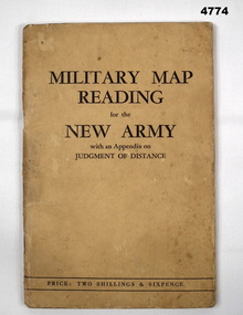
Booklet, Capt W Stanley Lewis MSc, FRGS, Military Map Reading for the New Army, Feb 1941
... Military Map Reading for the New Army...Soft covered booklet covering various details of military maps and how to read them. ...4th/19th Prince of Wales's Light Horse Regiment Unit History Room 4/19 PWLH Regiment, Building 78 Simpson Barracks Macleod melbourne Manual map reading Price Two shillings and six pence Soft covered booklet covering various details of military maps and how to read them. Military Map Reading for the New Army Booklet Capt W Stanley Lewis MSc, FRGS Specialty Press Pty Ltd ...Soft covered booklet covering various details of military maps and how to read them. Price Two shillings and six pencemanual, map reading -
 Ringwood and District Historical Society
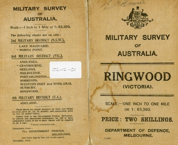
Map, Commonwealth Department of Defence, Military Survey map of Ringwood, 1916, Jun-16
... Military Survey map of Ringwood, 1916...Military Survey map of Ringwood +Additional Keywords: Hutchins,L... Survey map of Ringwood +Additional Keywords: Hutchins,L Military Survey map of Ringwood, 1916 Map Commonwealth Department of Defence ...Map prepared by Commonwealth Section Imperial General Staff given to Ringwood Historical SocietyMilitary Survey map of Ringwood +Additional Keywords: Hutchins,LL.Hutchins, 16 King's Rd. Marysville 3779. Received by postpak -
 Bendigo Military Museum
Booklet, CAPT W STANLEY LEWIS et al, Military Map Reading for the New Army, 1941
... Military Map Reading for the New Army...Map Reading Judging distance Military Map Reading for the New Army Marked inside the cover is VX88615. ...Military Map Reading for the New ArmyCardboard Covered booklet. This has 64 pages with illustrations. It is bound with 2 staples.Military Map Reading for the New Armymap reading, judging distance -
 Bendigo Military Museum
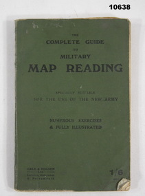
Book - MAP READING, WW1, Gale & Polden Ltd, Wellington works, Complete Guide to Military Map Reading, 1917
... Complete Guide to Military Map Reading....Complete Guide to Military Map Reading. Book MAP READING, WW1 Gale & Polden Ltd, Wellington works. ...This was issued in 1917 for the use of the new army in the UK. Small green covered book with approx 120 pages outlining the techniques of map reading. Contents gave instructions and advise on how to read a map including numerous exercises and illustrations, includes some fold out inserts.Some calculations scribbled in the back.ww1, map reading, book -
4th/19th Prince of Wales's Light Horse Regiment Unit History Room
Pamphlet (2 copies), Map Marking. Military Symbols, abt 1960's
... Map Marking. Military Symbols...A soft covered pamphlet showing the military map symbols agreed for use in the forces of SEATO, with explanations...4th/19th Prince of Wales's Light Horse Regiment Unit History Room 4/19 PWLH Regiment, Building 78 Simpson Barracks Macleod melbourne map symbols A soft covered pamphlet showing the military map symbols agreed for use in the forces of SEATO, with explanations Map Marking. ...A soft covered pamphlet showing the military map symbols agreed for use in the forces of SEATO, with explanationsmap symbols -
 Dandenong/Cranbourne RSL Sub Branch
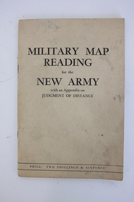
Booklet, Robertson & Mullens Ltd et al, Miltary Map Reading for the New Army with an Appendix on Judgment of Distance, 1941
... military map reading...Front: "MILITARY MAP / READING / for the / NEW ARMY / with an Appendix on / JUDGMENT OF DISTANCE / PRICE: TWO SHILLINGS & SIXPENCE"...military map reading orientation navigation Front: "MILITARY MAP / READING / for the / NEW ARMY / with an Appendix on / JUDGMENT OF DISTANCE / PRICE: TWO SHILLINGS & SIXPENCE" Beige booklet bound with two staples. ...Beige booklet bound with two staples. White pages within with black illustrations and type. 64 pages.Front: "MILITARY MAP / READING / for the / NEW ARMY / with an Appendix on / JUDGMENT OF DISTANCE / PRICE: TWO SHILLINGS & SIXPENCE"military map reading, orientation, navigation -
 Flagstaff Hill Maritime Museum and Village
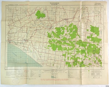
Document - Map, Department of Lands & Survey, Victoria / Panmure, 1942
... ...Military map...Military map of Panmure, Victoria, Australia; part of the W.R. ...Printed in black; 'Victoria / Panmure", "No. 930 / Zone 6" Printed in red; “EMERGENCY EDITION”, “THIS MAP IS AN OFFICIAL DOCUMENT. IF FOUND, IT MUST BE HANDED / IN TO THE NEAREST MILITARY HEADQUARTERS OR POLICE STATION” Stamped: within concentric ovals (“- - - FOR SALE / PRICE 2/- / - - - - - OF THE ARMY”)...The collection includes Dr Angus’s Army objects and is significant as an example of items issued to Doctors and Surgeons in the Medical Services of the Australian Army in World War II flagstaff hill warrnambool flagstaff hill maritime museum maritime museum shipwreck coast flagstaff hill maritime village great ocean road dr w r angus dr ryan warrnambool base hospital flying doctor surgeon captain australian department of defence royal australian army world war 2 map panmure 1942 Roy Angus Port Medical Officer Nhill Base Hospital Military map Emergency Map Military Service Australian Army Department of Army Department of Lands and Survey A.H.Q. ...This Emergency Edition of the map of Panmure, Victoria, is part of the W.R. Angus Collection. It was printed in 1942 during World War II. It is one of two maps donated to Flagstaff Hill Maritime Village by the family of Doctor William Roy Angus, who served as Surgeon Captain in the Australian Defence Department. The map was compiled for the Dept. of Army by the Dept. of Lands and Survey in Melbourne, prepared by the Australian Section of the Imperial General Staff, which was a British Government body created in 1907 to co-ordinate the defence of Britain and its Empire. It was printed by A.H.Q. Cartographic Company, Survey Corps, which was formed in 1941. The Corp changed its name to L.H.Q. Cartographic Company of Bendigo. In 1947 the name reverted back to the A.H.Q. Cartographic Company until 1955 when it became the A.H.Q. Survey Regiment. The W.R. Angus Collection includes historical medical equipment, surgical instruments and material once belonging to Dr Edward Ryan and Dr Thomas Francis Ryan, (both of Nhill, Victoria) as well as Dr Angus’ own belongings. The Collection’s history spans the medical practices of the two Doctors Ryan, from 1885-1926 plus that of Dr Angus who began practice in 1924. Dr. Angus served with the Australian Department of Defence as a Surgeon Captain during the Second World Was from 1942 to 1945. He served in Ballarat, Victoria, and in Bonegilla, N.S.W. until he suffering from a heart attack just before the war ended. ABOUT THE “W.R.ANGUS COLLECTION” - Doctor William Roy Angus M.B., B.S., Adel., 1923, F.R.C.S. Edin.,1928, was generally known as Dr Roy Angus. His working life included a position as a doctor with the Flying Doctor Service in Australia’s rural and remote areas. After many varied experiences Dr Angus and his family moved to Warrnambool in 1939 where he purchased “Birchwood,” the 1852 home and medical practice of Dr John Hunter Henderson. He was appointed on a part-time basis as Port Medical Officer in Warrnambool and held this position until the 1940’s when the government no longer required the service of a Port Medical Officer. Dr Angus was a surgeon at the Warrnambool Base Hospital 1939-1942. After further studies he commenced practice as an ophthalmologist in Warrnambool, pioneering in artificial eye improvements. He was Honorary Consultant Ophthalmologist to Warrnambool Base Hospital for 31 years and made monthly visits to Portland to perform eye surgery. Dr Angus and his wife Gladys were very involved in Warrnambool’s community with a strong interest in civic affairs. They were both involved in the creation of Flagstaff Hill Maritime Village, including the layout of the gardens. After his death on 28th March 1970 his family requested his practitioner’s plate, medical instruments and some personal belongings be displayed in the Port Medical Office surgery at Flagstaff Hill Maritime Village, and be called the “W. R. Angus Collection”. This Emergency Edition of the Map of Panmure is significant as an example of the documents prepared for the defence of Australia in World War 2. The Map is also significant for its connection between the Australian Army and the involvement of Dr WR Angus as a Surgeon in the Medical Services during World War II. The W.R. Angus Collection is significant for still being located at the site it is connected with, Doctor Angus being the last Port Medical Officer in Warrnambool. The collection of medical instruments and other equipment is culturally significant, being an historical example of medicine, administration, household equipment and clothing from late 19th to mid-20th century. Dr Angus assisted Dr Tom Ryan, a pioneer in the use of X-rays and in ocular surgery. The collection includes Dr Angus’s Army objects and is significant as an example of items issued to Doctors and Surgeons in the Medical Services of the Australian Army in World War IIMilitary map of Panmure, Victoria, Australia; part of the W.R. Angus Collection. Rectangular coloured map on cream paper for the Australian Army. Details include sea, waterways and land, contour lines, grid lines, names of districts, towns and roads, bridges, swamps, rail lines, cuttings, tracks, buildings (including blacksmiths), pumps, lighthouses, telegraph, telephones and electric transmission lines, and fire stations. The map has margin notes that include distances in miles to nearby towns. The map was compiled for the Dept. of Army by the Dept. of Lands and Survey in Melbourne, prepared by the Australian Section, Imperial General Staff and printed by A.H.Q. Cartographic Company, Melbourne in 1942. Crown Copyright Reserved. Inscriptions in red print state that it is and Emergency Edition and an Official document. An oval purple stamp includes the price.Printed in black; 'Victoria / Panmure", "No. 930 / Zone 6" Printed in red; “EMERGENCY EDITION”, “THIS MAP IS AN OFFICIAL DOCUMENT. IF FOUND, IT MUST BE HANDED / IN TO THE NEAREST MILITARY HEADQUARTERS OR POLICE STATION” Stamped: within concentric ovals (“- - - FOR SALE / PRICE 2/- / - - - - - OF THE ARMY”)flagstaff hill, warrnambool, flagstaff hill maritime museum, maritime museum, shipwreck coast, flagstaff hill maritime village, great ocean road, dr w r angus, dr ryan, warrnambool base hospital, flying doctor, surgeon captain, australian department of defence, royal australian army, world war 2, map panmure 1942, roy angus, port medical officer, nhill base hospital, military map, emergency map, military service australian army, department of army, department of lands and survey, a.h.q. cartographic company melbourne, panmure 1942, australian section, imperial general staff -
 Flagstaff Hill Maritime Museum and Village
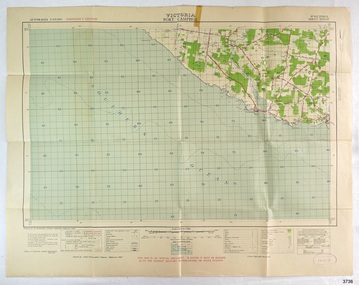
Document - Map, Department of Lands & Survey, Victoria / Port Campbell, 1942
... ...Military map...Military map of Port Campbell, Victoria, Australia; part of the W.R. ...Printed in black; 'Victoria / Port Campbell", "No. 932 / Zone 6" Printed in red; “EMERGENCY EDITION”, “THIS MAP IS AN OFFICIAL DOCUMENT. IF FOUND, IT MUST BE HANDED / IN TO THE NEAREST MILITARY HEADQUARTERS OR POLICE STATION” Stamped: within concentric ovals (“- - - FOR SALE / PRICE 2/- / - - - - - OF THE ARMY”)...The collection includes Dr Angus’s Army objects and is significant as an example of items issued to Doctors and Surgeons in the Medical Services of the Australian Army in World War II flagstaff hill warrnambool flagstaff hill maritime museum maritime museum shipwreck coast flagstaff hill maritime village great ocean road dr w r angus dr ryan warrnambool base hospital nhill base hospital flying doctor surgeon captain map port campbell 1942 Roy Angus Port Medical Officer Military map Emergency Map Australian Department of Defence Royal Australian Army Military Service Australian Army Department of Army Department of Lands and Survey World War 2 A.H.Q. ...This Emergency Edition of the map of Port Campbell, Victoria, is part of the W.R. Angus Collection. It was printed in 1942 during World War II. It is one of two maps donated to Flagstaff Hill Maritime Village by the family of Doctor William Roy Angus, who served as Surgeon Captain in the Australian Defence Department. The map was compiled for the Dept. of Army by the Dept. of Lands and Survey in Melbourne, prepared by the Australian Section of the Imperial General Staff, which was a British Government body created in 1907 to co-ordinate the defence of Britain and its Empire. It was printed by A.H.Q. Cartographic Company, Survey Corps, which was formed in 1941. The Corp changed its name to L.H.Q. Cartographic Company of Bendigo. In 1947 the name reverted back to the A.H.Q. Cartographic Company until 1955 when it became the A.H.Q. Survey Regiment. The W.R. Angus Collection includes historical medical equipment, surgical instruments and material once belonging to Dr Edward Ryan and Dr Thomas Francis Ryan, (both of Nhill, Victoria) as well as Dr Angus’ own belongings. The Collection’s history spans the medical practices of the two Doctors Ryan, from 1885-1926 plus that of Dr Angus who began practice in 1924. Dr Angus served with the Australian Department of Defence as a Surgeon Captain during the Second World Was from 1942 to 1945. He served in Ballarat, Victoria, and in Bonegilla, N.S.W. until he suffering from a heart attack just before the war ended. ABOUT THE “W.R.ANGUS COLLECTION” - Doctor William Roy Angus M.B., B.S., Adel., 1923, F.R.C.S. Edin.,1928, was generally known as Dr Roy Angus. His working life included a position as a doctor with the Flying Doctor Service in Australia’s rural and remote areas. After many varied experiences Dr Angus and his family moved to Warrnambool in 1939 where he purchased “Birchwood,” the 1852 home and medical practice of Dr John Hunter Henderson. He was appointed on a part-time basis as Port Medical Officer in Warrnambool and held this position until the 1940’s when the government no longer required the service of a Port Medical Officer. Dr Angus was a surgeon at the Warrnambool Base Hospital 1939-1942. After further studies he commenced practice as an ophthalmologist in Warrnambool, pioneering in artificial eye improvements. He was Honorary Consultant Ophthalmologist to Warrnambool Base Hospital for 31 years and made monthly visits to Portland to perform eye surgery. Dr Angus and his wife Gladys were very involved in Warrnambool’s community with a strong interest in civic affairs. They were both involved in the creation of Flagstaff Hill Maritime Village, including the layout of the gardens. After his death on 28th March 1970 his family requested his practitioner’s plate, medical instruments and some personal belongings be displayed in the Port Medical Office surgery at Flagstaff Hill Maritime Village, and be called the “W. R. Angus Collection”. This Emergency Edition of the Map of Port Campbell is significant as an example of the documents prepared for the defence of Australia in World War 2. The Map is also significant for its connection between the Australian Army and the involvement of Dr WR Angus as a Surgeon in the Medical Services during World War II. The W.R. Angus Collection is significant for still being located at the site it is connected with, Doctor Angus being the last Port Medical Officer in Warrnambool. The collection of medical instruments and other equipment is culturally significant, being an historical example of medicine, administration, household equipment and clothing from late 19th to mid-20th century. Dr Angus assisted Dr Tom Ryan, a pioneer in the use of X-rays and in ocular surgery. The collection includes Dr Angus’s Army objects and is significant as an example of items issued to Doctors and Surgeons in the Medical Services of the Australian Army in World War IIMilitary map of Port Campbell, Victoria, Australia; part of the W.R. Angus Collection. Rectangular coloured map on cream paper for the Australian Army. Details include sea, waterways and land, contour lines, grid lines, names of districts, towns and roads, bridges, swamps, rail lines, cuttings, tracks, buildings (including blacksmiths), pumps, lighthouses, telegraph, telephones and electric transmission lines, and fire stations. The map has margin notes that include distances in miles to nearby towns. The map was compiled for the Dept. of Army by the Dept. of Lands and Survey in Melbourne, prepared by the Australian Section, Imperial General Staff and printed by A.H.Q. Cartographic Company, Melbourne in 1942. Crown Copyright Reserved. Inscriptions in red print state that it is and Emergency Edition and an Official document. An oval purple stamp includes the price.Printed in black; 'Victoria / Port Campbell", "No. 932 / Zone 6" Printed in red; “EMERGENCY EDITION”, “THIS MAP IS AN OFFICIAL DOCUMENT. IF FOUND, IT MUST BE HANDED / IN TO THE NEAREST MILITARY HEADQUARTERS OR POLICE STATION” Stamped: within concentric ovals (“- - - FOR SALE / PRICE 2/- / - - - - - OF THE ARMY”)flagstaff hill, warrnambool, flagstaff hill maritime museum, maritime museum, shipwreck coast, flagstaff hill maritime village, great ocean road, dr w r angus, dr ryan, warrnambool base hospital, nhill base hospital, flying doctor, surgeon captain, map port campbell 1942, roy angus, port medical officer, military map, emergency map, australian department of defence, royal australian army, military service australian army, department of army, department of lands and survey, world war 2, a.h.q. cartographic company melbourne, australian section, imperial general staff, port campbell 1942 -
 Bendigo Military Museum
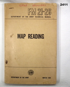
Manual - MAP READING, Department of Army, C. 1956
... ...military...Map...Bendigo Military Museum 37 - 39 Pall Mall Bendigo goldfields books - manuals military Map reading “12843 WILLIAMS” Soft cover, brown manual, Map Reading, RM21-26 Department of Army Technical Manual March 1956. 216 pages with fold out sections, photos, sketches, graphs & technical data. ...Soft cover, brown manual, Map Reading, RM21-26 Department of Army Technical Manual March 1956. 216 pages with fold out sections, photos, sketches, graphs & technical data.“12843 WILLIAMS”books - manuals, military, map reading -
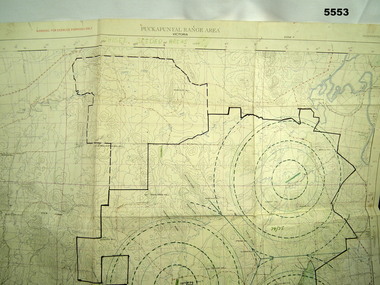
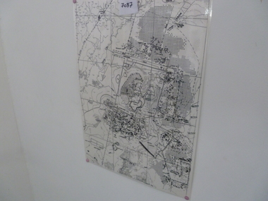
 Bendigo Military Museum
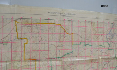
Map - MAP - PUCKAPUNYAL RANGE AREA, Royal Australian Survey Corps, Bendigo, 1958
... ...Military Map...Passchendaele Barracks Trust PBT? Military Map ”Puckapunyal Range Area Military Survey Australia 1.25,000. ...Military Survey, First Edition 1958.Large waterproof map of Puckapunyal Range area compiled by the Royal Australian Survey Corps in 1958 detailing Reference locations in and around Puckapunyal area.”Puckapunyal Range Area Military Survey Australia 1.25,000. First Edition”passchendaele barracks trust, pbt?, military map -
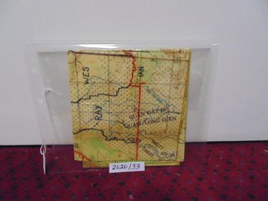 National Vietnam Veterans Museum (NVVM)
Map
... A laminated coloured military map showing topography of areas around Nui Dat with divisional sections hand drawn in black....National Vietnam Veterans Museum (NVVM) 25 Veterans Drive Newhaven phillip-island-and-the-bass-coast Map Nui Dat McPhail Collection A laminated coloured military map showing topography of areas around Nui Dat with divisional sections hand drawn in black. ...A laminated coloured military map showing topography of areas around Nui Dat with divisional sections hand drawn in black.map, nui dat, mcphail collection -
 Bendigo Military Museum
Map - MAP of PUCKAPUNYAL, RAAF et al, 1958
... ...Military Training...Map...map, printed in colour on one side only. Scale 1:25,999. The grid squares are 1000 x 1000 metres. it shows the camp, ranges and bush areas used by the military....The grid squares are 1000 x 1000 metres. it shows the camp, ranges and bush areas used by the military. Map MAP of PUCKAPUNYAL RAAF Survey Regiment ...Refer to Cat 5547, Matheson.This is a large map, printed in colour on one side only. Scale 1:25,999. The grid squares are 1000 x 1000 metres. it shows the camp, ranges and bush areas used by the military.This map is covered in a large number of added colour shadings, nav lines, airstrips and circles.puckapunyal army base, military training, map -
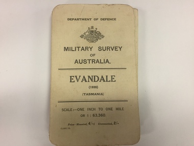 The 5th/6th Battalion Royal Victoria Regiment Historical Collection
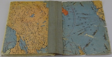
Map, Military Survey of Australia. Evandale (1939) (Tasmania), 1939
... Military...Survey...Map...The 5th/6th Battalion Royal Victoria Regiment Historical Collection 202 Burwood Rd Hawthorn melbourne Military Survey Map Tasmania WW2 Wark VC Club Fabric backed colour map, with card cover that folds into a small book. ...Fabric backed colour map, with card cover that folds into a small book. Scale one inch= one mile.military, survey, map, tasmania, ww2, wark vc club -
 Bendigo Military Museum
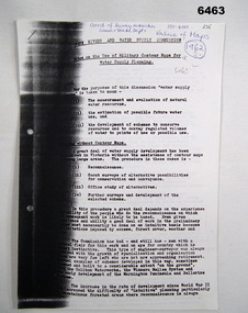
Administrative record - Use of Military maps for water supply planning, 1962
... These are typed notes on the use of Military maps for water supply planning. This demonstrates the value of Military Mapping containing accurate relief information that can then be used for water supply planning....Royal Australian Survey Corps RASvy Fortuna Army Survey Regiment Army Svy Regt ASR State Rivers and Water Supply Commission 5 x A4 pages of typed notes, poorly photocopied Use of Military maps for water supply planning Administrative record Use of Military maps for water supply planning State Rivers and water supply Commision, Division of National Mapping ...These are typed notes on the use of Military maps for water supply planning. This demonstrates the value of Military Mapping containing accurate relief information that can then be used for water supply planning.5 x A4 pages of typed notes, poorly photocopiedroyal australian survey corps, rasvy, fortuna, army survey regiment, army svy regt, asr, state rivers and water supply commission -
 Bendigo Military Museum
Manual - DRAFT SPECIFICATIONS FOR TOPOGRAPHIC MAP SERIES, Specifications for 1:50000 and 1:25000 maps produced in Australia, Circa 1973
... These draft Specifications set out the Standards for the production of topographic maps within the Commonwealth of Australia at scales of 1:50000 and 1:25000 and are designed to satisfy the basic requirements of both civil and military map users....Bendigo Military Museum 37 - 39 Pall Mall Bendigo goldfields These draft Specifications set out the Standards for the production of topographic maps within the Commonwealth of Australia at scales of 1:50000 and 1:25000 and are designed to satisfy the basic requirements of both civil and military map users. ...These draft Specifications set out the Standards for the production of topographic maps within the Commonwealth of Australia at scales of 1:50000 and 1:25000 and are designed to satisfy the basic requirements of both civil and military map users.Hard cover, cloth, Red, 11 Annexes, Supplementary documents.royal australian survey corps, rasvy, fortuna, army survey regiment, asr -
Frankston RSL Sub Branch
Rule, Scale, E. ESDAILE & SONS, 1942
... A scale rule used by artillery units to measure distance between map co-ordinates on the 1 to 25,000 scale military map series. The rule is accurately machined from flat stainless steel strip and is stamped with Imperial measurements (thousands of yards) and metric measurements (thousands of metres)....Frankston RSL Sub Branch 183 Cranbourne Road Frankston mornington-peninsula artillery rule scale imperial metric distance world war 2 ww2 The rule is stamped with the following: "SCALE, ARTY, No 2, MKI, E.ESDAILE & SONS, D^D, 1942" A scale rule used by artillery units to measure distance between map co-ordinates on the 1 to 25,000 scale military map series. The rule is accurately machined from flat stainless steel strip and is stamped with Imperial measurements (thousands of yards) and metric measurements (thousands of metres). ...A scale rule used by artillery units to measure distance between map co-ordinates on the 1 to 25,000 scale military map series. The rule is accurately machined from flat stainless steel strip and is stamped with Imperial measurements (thousands of yards) and metric measurements (thousands of metres).The rule is stamped with the following: "SCALE, ARTY, No 2, MKI, E.ESDAILE & SONS, D^D, 1942"artillery, rule, scale, imperial, metric, distance, world war 2, ww2, -
 Bendigo Military Museum
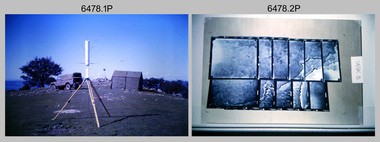
Photograph - Royal Australian Survey Corps - Map Production Processes, c1990
... School of Military Survey...Army Map...The field party occupying the survey station was likely from a Map Control Survey course conducted by the School of Military Survey, Bonegilla. ...This is a collection of 20 photographs of map production processes taken at the School of Military Survey, Bonegilla, the Army Survey Regiment, Bendigo, and the Army Map Depot, Bandiana circa 1990. ...Photo .19P depicts a map of RASvy’s ARA units before the disbandment of 5th Field Survey Squadron, Perth and 2nd Field Survey Squadron, Sydney in 1990. Royal Australian Survey Corps RASvy Army Survey Regiment Army Svy Regt Fortuna ASR School of Military Survey Army Map Depot .1P, .3P to .20P - Some equipment is identified on the frame of the 35mm slides. ...This is a collection of 20 photographs of Royal Australian Survey Corps phases of map production at the School of Military Survey, Bonegilla, the Army Survey Regiment, Bendigo, and the Army Map Depot, Bandiana circa 1990. Colour photos are on 35mm slide film and were scanned at 96 dpi. They are part of the Army Survey Regiment’s Collection. Photo .1P was probably taken on a survey station overlooking Lake Hume near Albury-Wodonga. The field party occupying the survey station was likely from a Map Control Survey course conducted by the School of Military Survey, Bonegilla. This survey station was part of a geodetic network used in field survey training and RASvy’s Lake Hume Test Range. Photos .3P to .16P were taken at the Army Survey Regiment, Bendigo and photos .17P & .18P were taken at the Army Map Depot, Bandiana. Photo .19P depicts a map of RASvy’s ARA units before the disbandment of 5th Field Survey Squadron, Perth and 2nd Field Survey Squadron, Sydney in 1990. This is a collection of 20 photographs of map production processes taken at the School of Military Survey, Bonegilla, the Army Survey Regiment, Bendigo, and the Army Map Depot, Bandiana circa 1990. Colour photos are on 35mm slide film and were scanned at 96 dpi. They are part of the Army Survey Regiment’s Collection. Photo .2P is printed on photographic and scanned at 300 dpi. .1) – Photo, colour, c1980s. Geodetic Surveying: AN/PRR-14 Geoceiver antenna on hill surrounding Lake Hume. Series 3 Land Rover, field party tent and survey station beacon in background. .2) – Photo, black & white, c1980s. Geodetic Surveying: AN/PRR-14 Geoceiver antennas set up at the School of Military Survey, Bonegilla, Victoria. .3) – Photo, colour, c1990. Aerotriangulation: Wild PUG4 point transfer device, SSGT Bruce Hammond. .4) – Photo, colour, c1990. Aerotriangulation: Zeiss (Jena) Stecometer, SSGT Bruce Hammond. .5) – Photo, colour, c1990. Aerotriangulation: computer tape maintenance, SSGT Noel McNamara. .6) – Photo, colour, c1990. AUTOMAP 2: computer tape maintenance, SPR Nadine (Paul) Read. .7) - Photo, colour, c1990s. AUTOMAP 2: Optronics 4040 scanning/film output in Lithographic Squadron, SGT Sherri (Dally) Burke. .8) - Photo, colour, c1990s. AUTOMAP 2: Benson verification plotter output, SPR Nadine (Paul) Read. .9) – Photo, colour, c1990. Aerotriangulation: data management, SGT Neil ‘Ned’ Kelly. .10) & .11) - Photo, colour, c1990s. AUTOMAP 2: Wild B8 Aviograph stereoplotter Feature Extraction, unidentified technician. .12) - Photo, colour, c1990s. AUTOMAP 2: Graphic Edit Workstation, SPR Nadine (Paul) Read. .13) - Photo, colour, c1990s. AUTOMAP 2: Graphic Edit Workstation, SPR Dawn Hoadley. .14) & .15) - Photo, colour, c1990s. AUTOMAP 2: Graphic Edit Workstation, unidentified technician. .16) – Photo, colour, c1990s. Heidelberg Speedmaster 102 computer-controlled five colour lithographic offset printing press. .17) & .18) – Photo, colour, c1990s. Army Map Depot, unidentified storeman, Bandiana. .19) – Photo, colour, c1990. RASvy ARA Unit Locations before disbandment of field units in Perth and Sydney. .20) – Photo, colour, c1990. Set of overlapping aerial photography..1P, .3P to .20P - Some equipment is identified on the frame of the 35mm slides.royal australian survey corps, rasvy, army survey regiment, army svy regt, fortuna, asr, school of military survey, army map depot -
 Bendigo Military Museum
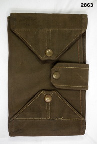
Equipment - MAP CASE, Army Issue, Post WW2 possibly
... military equipment...containers...Map...Bendigo Military Museum 37 - 39 Pall Mall Bendigo goldfields military equipment containers Map Passchendaele barracks trust Map Case, khaki canvas outer, tri-fold with clear perspex sections for securing map inside. ...Map Case, khaki canvas outer, tri-fold with clear perspex sections for securing map inside. Fastens with two canvas flaps & brass press studs & a canvas strap. Small pocket on outside. military equipment, containers, map, passchendaele barracks trust -
 City of Greater Bendigo - Civic Collection
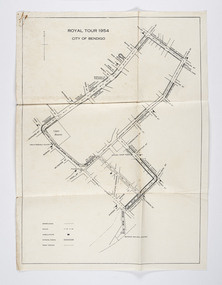
Document - Set of correspondence re Queen Elizabeth tour of Bendigo, Mrs T. R. Mannix, February 8th, 1954
... Set of correspondence including typed gatefold letter, typed plans for placement of visitors and role of the military and maps of CBD Bendigo and of Upper Reserve....maps of the royal tour through the streets of Bendigo starting and finishing at the train station. Queen Elizabeth Duke of Edinburgh Boy Scout Association Mayor Clayton City of Greater Bendigo Royal Visits City of Greater Bendigo Community Groups City of Greater Bendigo Tourism Set of correspondence including typed gatefold letter, typed plans for placement of visitors and role of the military and maps of CBD Bendigo and of Upper Reserve. ...Correspondence between Mrs T. R. Mannix, Swan Hill Wolf Cub Pack master to District Scout Commissioner Mr J. I. Samson for an invitation to be included with the local scout groups in functions to welcome Queen Elizabeth and the Duke of Edinburgh to Bendigo on Friday, the 5th of March 1954. The response from the Commissioner included typed plans of the event and maps of the royal tour through the streets of Bendigo starting and finishing at the train station.Set of correspondence including typed gatefold letter, typed plans for placement of visitors and role of the military and maps of CBD Bendigo and of Upper Reserve.queen elizabeth, duke of edinburgh, boy scout association, mayor clayton, city of greater bendigo royal visits, city of greater bendigo community groups, city of greater bendigo tourism -
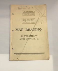 The 5th/6th Battalion Royal Victoria Regiment Historical Collection
Booklet - Book, Map Reading No. 13 1942, 1942
... Military guide to map reading...The 5th/6th Battalion Royal Victoria Regiment Historical Collection 202 Burwood Rd Hawthorn melbourne Military guide to map reading wark vc club military manuals ww2 Regimental Property Book made of yellowed paper with black print. ...Military guide to map readingBook made of yellowed paper with black print. It is bound by two staples and has three holes punched into the left side for storage in a ring binder. There is a crease that runs from the bottom left to the top right of the cover.wark vc club, military manuals, ww2, regimental property -
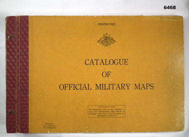 Bendigo Military Museum
Album - Australian Army Catalogue of Official Military Maps, Survey Directorate, Army Headquarters, 1962
... This is a catalog of Australian Military maps prior to 1 Nov 1962. Later Catalogs exist showing much more map coverage, but this example is valuable as it shows the limit of Australian military mapping existing at the time. ...Australian Army Catalogue of Official Military Maps Album Australian Army Catalogue of Official Military Maps Survey Directorate, Army Headquarters ...This is a catalog of Australian Military maps prior to 1 Nov 1962. Later Catalogs exist showing much more map coverage, but this example is valuable as it shows the limit of Australian military mapping existing at the time. This Catalog was donated by Stephen King nephew of the owner 52878 SGT JD King who served at the Army Headquarters Survey Regiment, Fortuna, Bendigo in the 1960's.Large book, heavy orange cover, red binding, held together with Chicago screws. Commonwealth of Australia badge on cover contains diagrams and text.Hand written "SGT TD KING" top right hand cornerroyal australian survey corps, rasvy, fortuna, army survey regiment, army svy regt, asr -
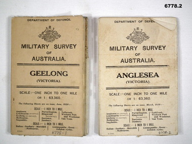 Bendigo Military Museum
Map - MAPS, GEELONG & ANGLESEA, 1928 - 1929
... 1. Military Survey map of Australia - Geelong, Vic. ...Swatton, Refer to Cat 6719.2P Anglesea Military Survey maps Geelong Victoria Passchendaele barracks trust 1. ...J.W. Swatton, Refer to Cat 6719.2P1. Military Survey map of Australia - Geelong, Vic. One inch to One mile - the map is in colour print. The two outer covers are cardboard, the map then opens up in a multifold manner. Date June 1928 2. Military Survey map of Australia - Anglesea, Vic. One inch to one mile - the map is in colour print. The two outer covers are cardboard. The map then opens up in a multi fold manner. Date March 1929.anglesea, military survey maps, geelong, victoria, passchendaele barracks trust -
 National Vietnam Veterans Museum (NVVM)
Map, Map of Area Surround Luscombe Airfield
... Laminated map of military installations surrounding Luscombe Airfield. ...National Vietnam Veterans Museum (NVVM) 25 Veterans Drive Newhaven phillip-island-and-the-bass-coast Luscombe Field Laminated map of military installations surrounding Luscombe Airfield. ...Laminated map of military installations surrounding Luscombe Airfield. No identification of the map.luscombe field -
 Bendigo Military Museum
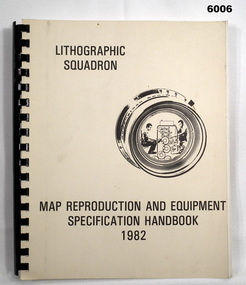
Manual - Map Reproduction and Equipment Specification Handbook, 1982
... Part 1 comprised technical descriptions and photos of lithographic equipment used in military map production. Part 2 provided various tables such as printing sizes conversion tables. ...Part 1 comprised technical descriptions and photos of lithographic equipment used in military map production. Part 2 provided various tables such as printing sizes conversion tables. ...This handbook provided comprehensive technical information principally to the lithographic technician and to other Royal Australian Survey Corps technical trades. Part 1 comprised technical descriptions and photos of lithographic equipment used in military map production. Part 2 provided various tables such as printing sizes conversion tables. Part 3 provided technical guidance on the stipples and screens utilised in the map reproduction process. Part 4 detailed the Pantone Matching System printing colours for map and chart products. Part 5 was a Glossary of Lithographic Technical Terms.Army Survey Regiment Manual/handbook with a manilla cover comprising approximately 100 pages. The pages in the document are in black and white paper providing technical information and photograph identifying lithographic equipment and other information to lithographic technicians. Printed on standard paper bound by a by a black plastic spiral spline.royal australian survey corps, rasvy, fortuna, army svy regt, asr, army survey regiment -
 Bendigo Military Museum
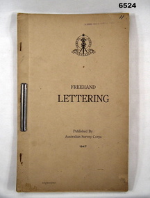
Pamphlet - Australian Survey Corps - Freehand Lettering Pamphlet 1947, Australian Survey Corps, Balcombe, 1947
... Initially all text on military maps was hand lettered in ink and an extremely high level of proficiency was required. ...Initially all text on military maps was hand lettered in ink and an extremely high level of proficiency was required. ...All members of the Australian Survey Corps, that was later renamed the Royal Australian Survey Corps were expected to be proficient at freehand lettering and figuring. Initially all text on military maps was hand lettered in ink and an extremely high level of proficiency was required. Later technology changes meant that there was less reliance on hand lettering. This 17 x foolscap sized page booklet with light buff coloured cardboard covers held together with an ARNOS fastener was used to teach members of the Australian Survey Corps how to Hand Letter in 1947. Example practice lettering style work sheets are included at the rear of the document.17 x foolscap sized pages with light buff coloured cardboard covers held together with an ARNOS fastener. Example lettering style work sheets at the rear of the document. Cover has Australian Survey Corps Theodolite Badge in black and white above the Title "Freehand Lettering Published By Australian Survey Corps 1947.Hand-written No"11" in top RH corner. Has a stamp " E COMD FIELD SURVEY Unit"royal australian survey corps, rasvy, fortuna, army survey regiment, army svy regt, asr, school of military survey, sms, balcombe -
 Bendigo Military Museum
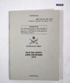
Booklet - Australian Army - Map Reading Aide-Memoire 1973, Australian Army, 31 August 1973
... This booklet is designed to assist the military user with their map reading and navigation skills....Bendigo Military Museum 37 - 39 Pall Mall Bendigo goldfields This booklet is designed to assist the military user with their map reading and navigation skills. ...This booklet is designed to assist the military user with their map reading and navigation skills.A small stapled A6 sized grey covered booklet of 26 Pages. Front Cover has Australian Army Insignia and Title.DSN 7610-66-058-5570royal australian survey corps, rasvy, fortuna, army survey regiment, army svy regt, asr -
 Tatura Irrigation & Wartime Camps Museum
Book, Oswald Volkmann, Under Consideration, 1941
... Covers feature maps (military). Inside front and back cover features sections of cartoons. ...Covers feature maps (military). Inside front and back cover features sections of cartoons. ...Booklet of poems in two languages by Dunera internee Oswald Volkmann, No.35271, at Camp 4, Tatura.Soft cover handmade/compiled book of typed poems. Covers feature maps (military). Inside front and back cover features sections of cartoons. Housed in a light green cardboard conservation box.Tatura 28 Okt 1941oswald volkmann, camp 4, internees, poetry -
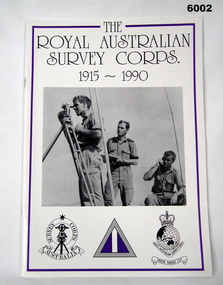 Bendigo Military Museum
Booklet - Booklet Royal Australian Survey Corps History 1915 - 1990, Royal Australian Survey Corps, " The Royal Australian Survey Corps " 1915-1990, c, 1995
... " The availability of comprehensive and up-to-date military maps and charts ... is fundamental to the effective conduct of military operations." ...Bendigo Military Museum 37 - 39 Pall Mall Bendigo goldfields " The availability of comprehensive and up-to-date military maps and charts ... is fundamental to the effective conduct of military operations." ..." The availability of comprehensive and up-to-date military maps and charts ... is fundamental to the effective conduct of military operations." The Honourable K.C. Beazley, M.P. 1987 This article was presented as a paper to the 1990 Australian War Memorial History Conference to mark the 75th anniversary of the formation of the "Australian Survey Corps" on 1 July 1915. The Corps has since been renamed as the Royal Australian Survey Corps. Lieutenant-Colonel Clem Sargent, Colonel Commandant of the Corps from 1983 to 1993, accepted the challenge and published an account of the history of RA Svy on the occasion of the seventy-fifth anniversary. The Royal Australian Survey Corps, I9I5 - 1990 was first published in October 1990 in the journal of the Military Historical Society of Australia, Sabretache. The article was later published in the Australian Surveyor and is now reproduced as a booklet by kind permission of the author. This condensed history of the Royal Australian Survey Corps provides a record of military mapping in Australia and as such is a valuable part of Corps doctrine. Colonel S.W. Lemon, Director of Survey, March 1995Booklet, A4, 13 Pages, Cardboard Cover, Colour, Maps, Photographs, Black and White. Held together by metal staplesroyal australian survey corps, rasvy, fortuna, army survey regiment, army svy regt, asr -
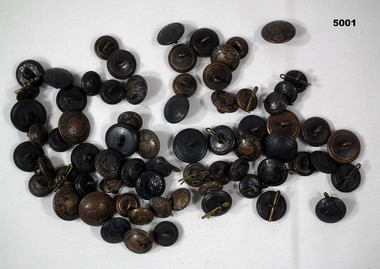 Bendigo Military Museum
Uniform - BUTTONS, Australian Army, c1939-1945
... The motif is Australian Military Forces with a map of Australia. They are of copper metal, darkened with a black paint. ...The motif is Australian Military Forces with a map of Australia. They are of copper metal, darkened with a black paint. ...Refer to Cat 4967.2. Service of John Robert Attwood.These buttons are of three different sizes. The motif is Australian Military Forces with a map of Australia. They are of copper metal, darkened with a black paint. They have brass "Keepers",ww2, uniforms, buttons, uniorms -
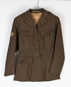 Montmorency–Eltham RSL Sub Branch
Uniform - Jacket, Khaki, Service Dress WW2 (Womens), 1943
... Two pleated pockets over the left and right breasts with flaps and small metal buttons inscribed Australian Military Forces with a map of Australia in the center with a crown at the top of the map. ...Two pleated pockets over the left and right breasts with flaps and small metal buttons inscribed Australian Military Forces with a map of Australia in the center with a crown at the top of the map. ...Dress jacket worn by Corporal Kathleen Phyllis Gill from Toorak Hill, Casterton. Army No. VF345716 Unit LHQ (Mil. Sec)Lined women's khaki dress jacket. Long sleeved. Wool polyester. Four metal buttons down the front with the inscription Australian Military Forces with a map of Australia in the center with a crown at the top of the map. Two hip pockets on the left and right with a flap on each. Two pleated pockets over the left and right breasts with flaps and small metal buttons inscribed Australian Military Forces with a map of Australia in the center with a crown at the top of the map. Australian Military Forces badge on the upper left lapel Two epaulets on the left and right shoulders with two small buttons inscribed Australian Military Forces with a map of Australia in the center with a crown at the top of the map. AWAS (Australian Women's Army Service) badges at the base of each epaulet. Corporal's stripes 6 cm down the right sleeve. Unit patch red over black - LHQ (Mill Sec). Two vertical belt loops at the back on the left and right. Pleat opening at the back. Horizontal strip of material inside the collar at the back of the neck to hang jacket. Tag sewn onto the lining at the back 2.5 cm down from the top stating - V 579 Made in Australia D. broad arrow D. 1943 Size kathleen gill, wool polyester, women's dress jacket