
Showing 6 items matching "moorabool valley"
-
 Federation University Historical Collection
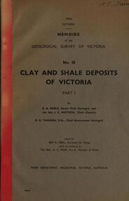
Book, Memoirs of the Geological Survey of Victoria; No 18, Clay and Shale Deposits of Victoria, 1952
... ...moorabool valley...r a keble senior field geologist j c watson chief chemist d e watson chief government geologist g c moss minister of mines mallee plains avoca valley loddon valley campaspe valley goulburn valley kiewa mitta glenelg valley pitfield valley otway area moorabool valley darley fireclay campbellfield clay latrobe river valley hendley ball clays felspars pegmatities quartz pakenham fireclay bulla china clay kaolin terracotta stoneware ballan dyke-belt egerton gordon ballan llandeilo colbrook elaine lal lal maryborough ballarat ringwood siliceous clay stawell dromana ptways bulla pyalong china clay linton china clay wedderburn clays lal lal china clays ballan dyke belt Reginald Callister knight's koalin pottery china clay ferdinand krause clarendon bittern frichot hunt's dam vaughan rosenow hickey malone claypits ballarat dyke belt stawell dyke belt maryborough dyke belt guildford daylesford ovens valley Grey soft covered book with red tape spine. ...Grey soft covered book with red tape spine. The 76 pages clay deposits, composition of Victorian clays, clay localities, granitic clays, Residual Clays, Clay-Shales, Jurassic clay shales.r a keble, senior field geologist, j c watson, chief chemist, d e watson, chief government geologist, g c moss, minister of mines, mallee plains, avoca valley, loddon valley, campaspe valley, goulburn valley, kiewa, mitta, glenelg valley, pitfield valley, otway area, moorabool valley, darley fireclay, campbellfield clay, latrobe river valley, hendley, ball clays, felspars, pegmatities, quartz, pakenham fireclay, bulla china clay, kaolin, terracotta, stoneware, ballan dyke-belt, egerton, gordon, ballan, llandeilo, colbrook, elaine, lal lal, maryborough, ballarat, ringwood, siliceous clay, stawell, dromana, ptways, bulla, pyalong china clay, linton china clay, wedderburn clays, lal lal china clays, ballan dyke belt, reginald callister, knight's koalin pottery, china clay, ferdinand krause, clarendon, bittern, frichot, hunt's dam, vaughan, rosenow, hickey, malone, claypits, ballarat dyke belt, stawell dyke belt, maryborough dyke belt, guildford, daylesford, ovens valley -
 Federation University Historical Collection
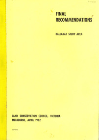
Book, Final recommendations Ballarat Study Area Land Conservation Council, Victoria, 1982, 1982
... moorabool reservoir...korweinguboora...korweinguborra reservoir...learmonth bores...sago hill...illabarook reservoir...ballarat water commission...dunneworthy...mount cole...mont lonarch...ben major...waterloo...trawalla...linton...ross creek...canadian...shepherds flat...lal lal...mount doran...raglan...chute...carngham...buninyong...watsons hill...enfield...cape clear...illabrook...rokewood junction...mount warrenheip...nerrina...jubilee...golden stream...australasian deep lead mine...happy valley...land conservation authority ballarat endowment plantations pine plantations langi ghiran state park mount buangor state park enfield state park ballarat-creswick regional park rossbridge black lake flax mill swamp dereel lagoon lake bolac lake wongan langi ghiran reservoir gong gong reservoir pincotts reservoir beales reservoir wilsons reservoir moorabool reservoir korweinguboora korweinguborra reservoir learmonth bores sago hill illabarook reservoir ballarat water commission dunneworthy mount cole mont lonarch ben major waterloo trawalla linton ross creek canadian shepherds flat lal lal mount doran raglan chute carngham buninyong watsons hill enfield cape clear illabrook rokewood junction mount warrenheip nerrina jubilee golden stream australasian deep lead mine happy valley school piggoreet berringa bulldog ballarat common wildlife water timber flora rivers geology agriculture warrenheip biodiversity Yellow soft covered report of 95 pages . ...Yellow soft covered report of 95 pages . The contents of the report include: Parks, reference areas, wildlife reserves, water production, hardwood production, softwood production, flora Reserves and Flora and Fauna reserves, bushland reserves, historic area and reserves, rivers and streams, Roadside conservation and Highway parks, Education areas and School Plantations, Lake Reserves, geological reserves, recreation, scenic reserves, agriculture, mineral and stone production, utilities and survey, township land, Uncommitted Land, military training, other reserves and public land. Maps include: The Study area 1: 250 000 Supplementary Mapsland conservation authority, ballarat, endowment plantations, pine plantations, langi ghiran state park, mount buangor state park, enfield state park, ballarat-creswick regional park, rossbridge, black lake, flax mill swamp, dereel lagoon, lake bolac, lake wongan, langi ghiran reservoir, gong gong reservoir, pincotts reservoir, beales reservoir, wilsons reservoir, moorabool reservoir, korweinguboora, korweinguborra reservoir, learmonth bores, sago hill, illabarook reservoir, ballarat water commission, dunneworthy, mount cole, mont lonarch, ben major, waterloo, trawalla, linton, ross creek, canadian, shepherds flat, lal lal, mount doran, raglan, chute, carngham, buninyong, watsons hill, enfield, cape clear, illabrook, rokewood junction, mount warrenheip, nerrina, jubilee, golden stream, australasian deep lead mine, happy valley school, piggoreet, berringa, bulldog, ballarat common, wildlife, water, timber, flora, rivers, geology, agriculture, warrenheip, biodiversity -
 Federation University Historical Collection
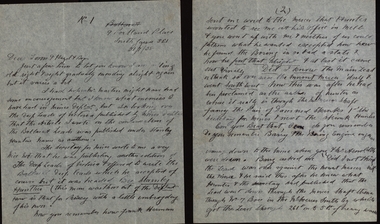
Letter, Letters written by Richard Squire to his son Tom Squire 1938
... Valley and Lead...Stand and Deliver Demands...Sheehan's...Smeaton Hotel...John Charleson...Ballarat Main Lead...Goon...Dereel...The Bay Leads...Avoca Field...Ballarat Alluvials...Haddon Field...Courier...School of Mines...Bewick Mining & Co....Broken Hill Syndicate...Morrison's Lead...Baragwanath...Creswick...Duke of Wellington Plant...The Moorabool...Special Supply Store Geological Branch Shell Coy Lawaluk Almanac McBinny Bingley's Paddock Cargaire Valley and Lead Stand and Deliver Demands Sheehan's Smeaton Hotel John Charleson Ballarat Main Lead Goon Dereel The Bay Leads Avoca Field Ballarat Alluvials Haddon Field Courier School of Mines Bewick Mining & Co. Broken Hill Syndicate Morrison's Lead Baragwanath Creswick Duke of Wellington Plant The Moorabool ...In 1905 Richard Squire was manager of the West Berry Consols at Allendale, and developed an improved system of mine ventilation, which was supported in "The Age."[4] He was successful in combating and remedying the gas and ventilation troubles of the Deep Mines of Creswick and Allendale Districts after all had failed. MINE MANAGERS’ ASSOCIATION. Ballarat Branch. ... Mr R. B. Squire, manager of the West Berry Consols, at Allendale, submitted a paper detailing what he had done tor the betterment of ventilation in the alluvial mines of Smeaton and Mary borough districts- Members gave Mr Squire every credit for the results that he claimed to have effected; the adoption of his ideas had testified to their value to mine-owners. It was painted out, however, that for want of a thorough debate of the subject with experienced men the author had unwittingly included some general statements that required modifying in some points and extending in others, in justice to other workers among the earlier and the present day managers of mines. It was decided to invite the author to meet a sub-committee on this subjectHandwritten letters written by Richard Squire to his son Tom Squire 1938 on lined paperrichard squire, tom squire, hazel squire, jack squire, jim squire, ned, mt mercer, plant, skids, pump, poppet, carburetor, shaft, balance weight, pulleys, syndicate, suction, lease, reports, estimates, flat fields, reef, trucks, pipeclay, sandstone, suction pipe, valves, honeycomb rock, yarrowee, ballarat, reef combs, cheques, yellow slate, leigh river, dyke, quartz, ballarat deep leads, ballarat deep leads extension, bore, reads, bedrock, cemented sand, g m of a, gold mines of australia, liz the car, geoff squire, lode, hayes timber, ethel, ross creek field, ross creek gold mining co., frank herman, lillas, jack hayes, eyres brothers, g.gay & co, buninyong, glenfine, the star mine of avoca fields, talbot alluvials, guildford plateau, a.b.c. special supply store, geological branch, shell coy, lawaluk, almanac, mcbinny, bingley's paddock, cargaire valley and lead, stand and deliver demands, sheehan's, smeaton hotel, john charleson, ballarat main lead, goon, dereel, the bay leads, avoca field, ballarat alluvials, haddon field, courier, school of mines, bewick mining & co., broken hill syndicate, morrison's lead, baragwanath, creswick, duke of wellington plant, the moorabool lead, kohinoor band and alluvian, star of the east, bonshaw, epidemic, polio, k.w. steedman, mr newman, allendale mines, professor mica smith, alfred mica smith, mr hodge, w. taylor, mcpherson's reward coy, mr mitchell, billy thomas, john bull, albert, nina, stanley hunter, frederick the great, ross creek south, bislolo, brilolo, birlolo, ballarat east coy, maxwells, reginald murray, bob allan, vendetta, john lynch, dodson, mnster of mines, e.j. hogan, jonah ward, mcnaughton's paddock, bellesby, alec peacock, jenkins, h.c. jenkins, conspiracy, argus, mr ellerby, dr lawrence, occulist, mining -
 Ballarat Heritage Services
Booklet, Golden Plains Heritage Study Stage 2
... valley...ross creek...wallinduc...maude...murgheboluc...Clyde company station...Wurrook homestead...Lullote homestead...geringhap...moorabool...Golden Plains heritage Bannockburn lethbridge linton meredith rokewood scarsdale shelford croindhap inverleigh Smythesdale steiglitz BErringa cape cear Woodbrook homestead shellford McMillans Bridge Jubilee Company Quartz mine glenfine homestead werneth Laurence Park Homestead Darriwil Park House Naringal private cemetery Batesford happy valley ross creek wallinduc maude murgheboluc Clyde company station Wurrook homestead Lullote homestead geringhap moorabool burunah plains Nintingbool A study into the Heritage of Golden Plains Golden Plains Heritage Study Stage 2 Booklet ...A study into the Heritage of Golden Plainsgolden plains, heritage, bannockburn, lethbridge, linton, meredith, rokewood, scarsdale, shelford, croindhap, inverleigh, smythesdale, steiglitz, berringa, cape cear, woodbrook homestead, shellford, mcmillans bridge, jubilee company quartz mine, glenfine homestead, werneth, laurence park homestead, darriwil park house, naringal private cemetery, batesford, happy valley, ross creek, wallinduc, maude, murgheboluc, clyde company station, wurrook homestead, lullote homestead, geringhap, moorabool, burunah plains, nintingbool -
 Ballarat Heritage Services
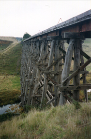
Photograph - Photograph - Colour, Clare Gervasoni, Nimon's Bridge, 1999, 04/10/1999
... Moorabool and Taradale, in the late 1850s. Approached by a deep cutting and high embankment at either end, the bridge represents a very cost-effective late 19th century engineering solution to the characteristic physiography of western Victoria with flat basalt plains intersected by deep wide valleys occasionally subject to severe flooding. ...Moorabool and Taradale, in the late 1850s. Approached by a deep cutting and high embankment at either end, the bridge represents a very cost-effective late 19th century engineering solution to the characteristic physiography of western Victoria with flat basalt plains intersected by deep wide valleys occasionally subject to severe flooding. ...Nimons Bridge was built in 1890, as part of the then Ballarat-Linton railway. The bridge is 17 spans with tall timber piers of four driven piles each, with triple sets of diagonal cross-bracing and walers and a single row of longitudinal horizontal bracing between piers. The spans are of a uniform twenty feet (6.1 metres), originally supported by four 21-inch x 9-inch (535 mm x 230 mm) Kauri timber beams per span, following the standard V.R. design of the period. When the superstructure was rebuilt after the 1953 fire, the timber beams were replaced with two 24-inch (610mm) deep rolled-steel-joists on each span. These are marked 'Lancashire Steel Co., Scotland' and are believed to have been second-hand. The deck of transverse-timber planks is 103.6 metres in length. Overall the bridge has an impressive appearance with its exceptionally tall triple-cross-braced piers creating a 'three-tiered' effect, with the deck 19.2 metres above the Woady Yaloak River. The Ballarat-Skipton line closed in 1985. Nimons Bridge has been recently restored, as part of the Ballarat-Skipton Rail Trail. How is it significant? Nimons Bridge is significant for technical, historic and aesthetic reasons at a State level. Why is it significant? Nimons Bridge is technically significant as Victoria's fourth-tallest timber trestle bridge when built, and as the third-tallest surviving example. It is also the second-largest composite bridge combining traditional timber piers with RSJ spans and a timber deck and falls within a select group of fewer than ten timber railway bridges with horizontal longitudinal bracing between the piers and three sets of double cross-bracing on its tallest piers, creating a visually striking 'three tiered' effect that enhances its viaduct form. Nimons Bridge is historically significant as having served initially the mining community at Linton, then the Western District agricultural area and in later years a kaolin quarry at Pittong. Nimons Bridge is historically significant as a representative of the 'light' branch line methodology that stimulated the explosion of railway construction in Victoria during the 1880s, and provides an interesting contrast with the more solid and vastly more expensive railway viaducts built in similar terrain on Victorian main lines, at Moorabool and Taradale, in the late 1850s. Approached by a deep cutting and high embankment at either end, the bridge represents a very cost-effective late 19th century engineering solution to the characteristic physiography of western Victoria with flat basalt plains intersected by deep wide valleys occasionally subject to severe flooding. Nimons Bridge is aesthetically significant for its visually impressive viaduct form, crossing a deep and steep-sided valley that is part of a rich cultural landscape. Within close proximity of the bridge are mullock dumps, tailings, shaft sites and other relics of the deep-lead alluvial mining era. The bridge is the most visually spectacular timber-trestle rail bridge in Western Victoria and is among the most spectacular timber-trestle rail bridges surviving anywhere in Victoria. It is part of the Ballarat-Skipton Rail Trail. Classified by the National Trust :02/10/2000 (http://vhd.heritagecouncil.vic.gov.au/places/67986)Colour photograph of a log bridge known as Nimon's Bridge.ballarat-linton, nimons bridge, nimon's bridge, log bridge, viaduct, timber-trestle rail bridge -
Bacchus Marsh & District Historical Society
Plaque, Shire of Bacchus Marsh Coat of Arms
... valley with two rivers running through it. This early coat of arms was superseded by the slightly different design shown here. When this change took place is not known. When the Bacchus Marsh Shire amalgamated with other Shires to form Moorabool...valley with two rivers running through it. This early coat of arms was superseded by the slightly different design shown here. When this change took place is not known. When the Bacchus Marsh Shire amalgamated with other Shires to form Moorabool ...Coat of Arms used by the Shire of Bacchus Marsh in the 1980s and 1990s. A coat of arms has been in use in the Shire at least from the early 20th century. This earlier coat of arms described in 1910 featured two cows standing on two bales of lucerne hay, with lucerne fields and fruit trees and rolling hills all round a central valley with two rivers running through it. This early coat of arms was superseded by the slightly different design shown here. When this change took place is not known. When the Bacchus Marsh Shire amalgamated with other Shires to form Moorabool Shire in 1994 this design was superseded.The plaque showing the Bacchus Marsh Shire Coat of Arms is in near perfect condition and as such is an excellent example of the physical symbols used to demonstrate the presence of local government in the Bacchus Marsh region. The images on the coat of arms also depict key economic and agricultural activities in the region which provides historical information about the region in a visual and artistic way.Painted cast bronze plaque with inscription on outer white band in black capital lettering: SHIRE OF BACCHUS MARSH. Inner circle painted blue with shield and decorative branches bearing yellow leaves on either side. Shield quartered and surmounted by stylised sunrise. In four quarters, representations of significant local primary and secondary industries. SHIRE OF BACCHUS MARSH.coats of arms, shire of bacchus marsh
