
Showing 27 items matching "municipal infrastructure"
-
 Broadmeadows Historical Society & Museum
Letter, R.G. Moody, Westmeadows Rate Construction Scheme Public Meeting Notice, 20 August 1982
... ...Municipal infrastructure...It informed residents of a proposed Rate Construction Scheme under Section 280A of the Local Government Act and invited property owners to a public meeting regarding road paving, drainage works, easements and associated infrastructure improvements. This document provides evidence of municipal planning and infrastructure development in Westmeadows during the early 1980s. ...This letter was distributed by the City of Broadmeadows during planning and infrastructure improvements in Westmeadows. It informed residents of a proposed Rate Construction Scheme under Section 280A of the Local Government Act and invited property owners to a public meeting regarding road paving, drainage works, easements and associated infrastructure improvements. This document provides evidence of municipal planning and infrastructure development in Westmeadows during the early 1980s. It illustrates the relationship between local government and residents in the implementation of urban improvement schemes and documents community consultation processes undertaken by the City of Broadmeadows.Typed municipal letter on City Engineer's Department letterhead, addressed to a householder regarding a proposed Rate Construction Scheme in Westmeadows. Single sheet with municipal reference numbers and City Engineer's signature block.Front: Hand written notes in ink: RANG 30_8/Lot 63 (Mr.R.Staggard circled in ink) Back: Yellow label top left: WI-01254 White label top right: WI 2736 (crossed out with blue ink) westmeadows, city of broadmeadows, local government, road construction, urban development, municipal infrastructure, rate construction scheme, community consultation, public meetings -
Broadmeadows Historical Society & Museum
Document - Notice Paper, City of Broadmeadows Council, Notice Paper – Meeting of Council, 3 March 1980, 1980
... ...Municipal infrastructure...This document provides evidence of municipal governance and decision-making in Broadmeadows in 1980. It reflects planning, infrastructure, public health, and administrative priorities of the period....Local government Broadmeadows Council Urban planning Municipal infrastructure Public health administration 1980s local history Multi-page printed document stapled; black-and-white typed text with appended plans and diagrams. ...This document provides evidence of municipal governance and decision-making in Broadmeadows in 1980. It reflects planning, infrastructure, public health, and administrative priorities of the period.The item is significant as primary evidence of local governance, planning decisions, and community issues in Broadmeadows in 1980. It contributes to understanding the development and administration of the municipality.Multi-page printed document stapled; black-and-white typed text with appended plans and diagrams.local government, broadmeadows council, urban planning, municipal infrastructure, public health administration, 1980s local history -
Broadmeadows Historical Society & Museum
Document - Report Extract, City of Broadmeadows Council, Finance Committee Meeting 19/3/79, March 1979
... Municipal finance...Public infrastructure (car parks)...infrastructure development in the Broadmeadows area during the 1970s. It documents the lifecycle of rate-funded public works and provides insight into fiscal decision-making, community contributions, and urban development. Local government administration Municipal ...This document reflects local government financial management practices in the City of Broadmeadows area in the late 1970s, specifically the use of “separate rate schemes” to fund infrastructure such as public car parks at Glenroy Railway Station.This record has historic significance as evidence of local government financial strategies and infrastructure development in the Broadmeadows area during the 1970s. It documents the lifecycle of rate-funded public works and provides insight into fiscal decision-making, community contributions, and urban development. This record has historic significance as evidence of local government financial strategies and infrastructure development in the Broadmeadows area during the 1970s. It documents the lifecycle of rate-funded public works and provides insight into fiscal decision-making, community contributions, and urban development.Typed document, 8 pages, black text on white paper; includes tabulated financial data and headings; extracted pages from a larger bound or compiled report.Examples include: • “Finance Committee Meeting Page 9 19/3/79” (header) • “APPENDIX ‘B’ AGENDA 19/3/79 CLAUSE 11” • Numeric markings (e.g., “4077”) on some pages • Back page yellow label: WI-3708local government administration, municipal finance, public infrastructure (car parks), glenroy railway precinct, broadmeadows council history -
 Broadmeadows Historical Society & Museum
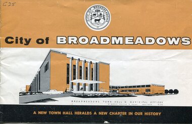
Booklet - Souvenir booklet, City of Broadmeadows Council, A New Town Hall Heralds a New Chapter in Our History, c.1964
... It highlights municipal governance, infrastructure development, and population growth during this period....It highlights municipal governance, infrastructure development, and population growth during this period. ...A commemorative booklet issued for the opening of the Broadmeadows Town Hall, providing historical background, civic information, and promotional content celebrating the municipality and its development.Stapled booklet comprising 16 pages, printed on semi gloss paper. The publication measures approximately 138 mm high × 222 mm wide (landscape format). Bound at the centre with two metal staples. Rust staining is present around both staples. The cover is worn and beginning to split along the spine, with loss to the lower centre section. Corresponding loss and chipping is evident on pages 3–4 in the same area. General wear consistent with age and handling.non-fictionA commemorative booklet issued for the opening of the Broadmeadows Town Hall, providing historical background, civic information, and promotional content celebrating the municipality and its development.broadmeadows town hall, municipal government, local history, urban development, commemorative publications -
 Broadmeadows Historical Society & Museum
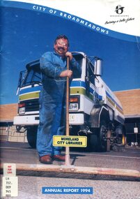
Administrative record - Annual Report, Phillip Shannihan, City of Broadmeadows Annual Report 1994, 1994
... Municipal Administration...Annual Reports...Community Services...Infrastructure...Annual reports documented municipal governance, financial management, infrastructure projects, community services and council achievements. ...The publication has research significance as a primary source providing evidence of local government administration, urban development, municipal infrastructure and community services in Broadmeadows during 1994. ...Official annual report of the City of Broadmeadows for 1994. Includes reports on council operations, administration, finance, infrastructure, community services, planning activities and municipal achievements. The publication serves as a primary source documenting local government functions and community development within Broadmeadows during 1994.Printed annual report comprising paper text pages with colour printed paper cover. The front cover depicts a municipal street-sweeping vehicle and a municipal works employee standing with a long-handled broom. The title "CITY OF BROADMEADOWS" appears at the top of the cover, with the municipal logo and slogan "Building a better future". The publication bears evidence of former ownership by Moreland City Libraries, including labels and classification markings. Softcover publication; paper and paperboard construction.non-fictionOfficial annual report of the City of Broadmeadows for 1994. Includes reports on council operations, administration, finance, infrastructure, community services, planning activities and municipal achievements. The publication serves as a primary source documenting local government functions and community development within Broadmeadows during 1994.city of broadmeadows, local government, municipal administration, annual reports, community services, infrastructure, urban development, council governance, broadmeadows history, hume region. -
 Flagstaff Hill Maritime Museum and Village
Book - Reference/Legal Statutes, John Ferres, Government Printer, The Victorian Legal Statutes Vol 3, Receiver Paymaster/Warrnambool, 1866
... . · Public Works and Infrastructure: The acts authorising the construction of roads, bridges, and early municipal water supplies across the fast-growing colony. · Railways: The specific general legislation governing the expansion of Victoria's heavily subsidised, state-expanding railway networks. · Property and Land Transfer: Crucial laws managing land ownership, inheritance, and the foundational transfers of property as the colony shifted away from old squatter runs to permanent towns. · Wines, Beer, and Spirits: The colonial acts regulating the licensing of hotels and public houses, and managing the highly lucrative, tightly controlled alcohol trade. ...This volume is part of the first comprehensive consolidation of laws for the Colony of Victoria after it separated from New South Wales and established its own parliament. Specifically, Volume 3 is the final part of the core "Public and General" Victorian colonial laws. The first three volumes of the 1866 consolidation were organised alphabetically by legal topic. Volume 3 specifically contains all the major public acts running from P to W. Because it covers the tail end of the alphabet, it holds some of the most critical laws that built day-to-day society in 19th-century Victoria. These include: · Police Offences and Public Order: The legal frameworks for policing the goldfield boomtowns, managing public behaviour, and running early colonial prisons. · Public Works and Infrastructure: The acts authorising the construction of roads, bridges, and early municipal water supplies across the fast-growing colony. · Railways: The specific general legislation governing the expansion of Victoria's heavily subsidised, state-expanding railway networks. · Property and Land Transfer: Crucial laws managing land ownership, inheritance, and the foundational transfers of property as the colony shifted away from old squatter runs to permanent towns. · Wines, Beer, and Spirits: The colonial acts regulating the licensing of hotels and public houses, and managing the highly lucrative, tightly controlled alcohol trade.The Victorian Statutes Vol 3 Various Legal Statues /Warrnambool Publisher: John Ferres Government Printer Melbourne Date: 1866 Further Information: Three quarter leather. Corners worn lettering in gilt. non-fictionThis volume is part of the first comprehensive consolidation of laws for the Colony of Victoria after it separated from New South Wales and established its own parliament. Specifically, Volume 3 is the final part of the core "Public and General" Victorian colonial laws. The first three volumes of the 1866 consolidation were organised alphabetically by legal topic. Volume 3 specifically contains all the major public acts running from P to W. Because it covers the tail end of the alphabet, it holds some of the most critical laws that built day-to-day society in 19th-century Victoria. These include: · Police Offences and Public Order: The legal frameworks for policing the goldfield boomtowns, managing public behaviour, and running early colonial prisons. · Public Works and Infrastructure: The acts authorising the construction of roads, bridges, and early municipal water supplies across the fast-growing colony. · Railways: The specific general legislation governing the expansion of Victoria's heavily subsidised, state-expanding railway networks. · Property and Land Transfer: Crucial laws managing land ownership, inheritance, and the foundational transfers of property as the colony shifted away from old squatter runs to permanent towns. · Wines, Beer, and Spirits: The colonial acts regulating the licensing of hotels and public houses, and managing the highly lucrative, tightly controlled alcohol trade.flagstaff hill, warrnambool, shipwrecked coast, flagstaff hill maritime museum, maritime museum, shipwreck coast, flagstaff hill maritime village, great ocean road, book, pattison collection, warrnambool library, warrnambool mechanics’ institute, ralph eric pattison, corangamite regional library service, warrnambool city librarian, mechanics’ institute library, victorian library board, warrnambool books and records, warrnambool children’s library -
 Eltham District Historical Society Inc
Document - Report, Paul Jerome, Advisory Committee on a Proposed Convenience Centre and an Alternative Shire Proposal - Eltham Gateway Community Precinct Concept Plan - 895 Main Road Eltham, October 1997
... municipal offices at 895 Main Road, Eltham. In summary, the terms of reference for the Advisory Committee required it to: • consider the merits of the Council proposal • examine the merits of both proposals in terms of net community benefit • address the report of the previous Advisory Committee on the Convenience Centre proposal The Advisory Committee inspected the site and considered all the material before It including submissions made by all parties to the previous Advisory Committee and correspondence received by the Department of Infrastructure both before and after that Committee submltted its report. ...municipal offices at 895 Main Road, Eltham. In summary, the terms of reference for the Advisory Committee required it to: • consider the merits of the Council proposal • examine the merits of both proposals in terms of net community benefit • address the report of the previous Advisory Committee on the Convenience Centre proposal The Advisory Committee inspected the site and considered all the material before It including submissions made by all parties to the previous Advisory Committee and correspondence received by the Department of Infrastructure both before and after that Committee submltted its report. ...On 15 December 1994 the former Shire of Eltham ceased to exist following the Liberal Kennett Government local council amalgamations. A new Nillumbik Shire Council was established with unelected commissioners appointed. That Council sold the former Eltham Shire Council Offices and land at 89S Main Road Eltham to Dallas Price Homes Pty. Ltd. the sale being conditional upon the granting of a planning permit for a petrol station/convenience store, fast food and video outlet. The sale was conditional that if the permit was not granted by 30 August. 1997, the contract could be avoided by either the purchaser or the vendor. The proposed development consisted of a petrol station with undercover fuelling facilities, convenience shopping, a drive through service facility for fast food, an 80 seat cafe, automated banking, a children's play area and retail space. In addition, the proposal included a 200 square metre community facility for Council use, provision of on site carparking over 2 levels for 83 vehicles, and advertising signage. An Advisory Committee consisting of Dimitry Reed and Margaret Pitt was appointed under Section 151 of the Planning and Environment Act 1987 to hear submissions on the proposal to develop the land at 895 Main Road Eltham, the site of the former Eltham Shire Offices. In September 1996, two applications were made by Contour Consultants Australia Pty Ltd on behalf of Dallas Price Homes Ply Ltd, to Nillumbik Shire Council. After extensive notification, the Council received 213 objections and a petition of over 1400 signatures. On October 9, 1996, Nillumbik Shire Council issued Notices of Decision to Grant Permit on Applications number 96/03376 and 96/0377 for the use and development of the land as a convenience Centre consisting of a petrol station, convenience store, cafe/takeaway food premises, a retail facility and a community facility, with associated advertising signs. Objectors to the proposals lodged Planning Appeals number 96/40724 and 96/40812 with the Administrative Appeals Tribunal on November 1, 1996. The grounds of appeal can be summarised as: inappropriate development, insufficient carparking, traffic and access issues, unsatisfactory design, inadequate permit conditions, the proposal being out of character with the area. and being contrary to the purpose and orderly development of the Eltham Town Centre, excessive noise, lack of consultation and unsuitable signage. On November 13, 1996, the Minister for Planning and Local Government directed the Registrar of the Administrative Appeals Tribunal. under Section 41 (1) (a) of the Planning Act 1980, to refer the Appeals to the Governor in Council for determination without a hearing or recommendation by the Tribunal. The Minister for Planning and Local Government called in the Appeals as he considered that they raised major issues of policy relating to the facilitation of development in accordance with the objectives set out in Section 4 of the Planning and Environment Act 1987, and that determination of the Appeals could have a substantial effect on the achievement of these planning objectives. The Minister required the Advisory Committee to consider the planning merits of the proposed use and development, and to address the issues raised in the objections. The Advisory Committee was required to produce a report providing: • The Committee's response to the matters detailed; • Relevant supporting information for the Advisory Committee's recommendation; and • A description of the proceedings conducted by the Advisory Committee and a list of those consulted or heard by the Committee. In March 1997, elections were held in the Shire of Nillumbik and the view of the new Council to this proposal differed from the view held by the earlier Council Hence the Submission made to the Committee by the Shire was against the decision by the Shire of Nillumbik to issue the Notices of Decision to Grant a Permit. The Recommendations of the Advisory Committee were: i. The cafe and take away food premises are as of right uses and are therefore allowable, but that shop and petrol station are unacceptable uses. A community facility is a discretionary use and is acceptable. ii. A development of the type and scale proposed is totally inappropriate for this land and that the Applications number 96/03376 and 96/0377 for the use and development of the land as a convenience Centre consisting of a petrol station, convenience store, café/takeaway food premises, a retail facility and a community facility, with associated advertising signs, be refused. iii. The land should be rezoned for public purposes and should remain in the community's ownership for community use. Following this, the Minister for Planning and Local Government, the Hon. Robert Maclellan, appointed Mr. Paul Jerome as an Advisory Committee under section 151 of the Planning and Environment Act 1987 to consider a Convenience Centre and an alternative proposal by Iha Shire of Nillumbik being the Eltham Gateway Community Precinct Concept Plan for the site of the former Shire of Eltham municipal offices at 895 Main Road, Eltham. In summary, the terms of reference for the Advisory Committee required it to: • consider the merits of the Council proposal • examine the merits of both proposals in terms of net community benefit • address the report of the previous Advisory Committee on the Convenience Centre proposal The Advisory Committee inspected the site and considered all the material before It including submissions made by all parties to the previous Advisory Committee and correspondence received by the Department of Infrastructure both before and after that Committee submltted its report. The Advisory Committee also held discussions with the following people: • Cr. Robert Marshall • Cr. Margaret Jennings • Cr. Lex de Man • Mr. Dallas Howgate of Dallas Price Properties, also Dallas Price Homes • Mr. Barry Rochford, CEO, Shire of Nillumbik • Ms. Yvonne Rust, Planning Officer, Shire of Nillumbik • Mr. Gregory Burgess, Architect of the Eltham Library and of Council’s Community Precinct Concept Plan • Mr. Jim Connor representing Mrs Thelma Barkway of the Eltham Senior Citizens Club Having considered all the material before it, the Committee arrived at two basic conclusions. First, the DPP proposal should be rejected because, on its merits, It does not sufficiently satisfy the requirements of the planning scheme which is a statutory document. The planning scheme requires that, before making a decision on the permit applications for the DPP proposal, a range of matters must be considered. It follows that consideration of these matters should Influence the decision. These matters include local policies relating to character and amenity. In particular, these policies seek • to conserve and enhance the bushland/country atmosphere, artistic heritage and strong sense of community of the Eltham Town Centre by ensuring that the design and height of any new development is sympathetic to existing buildings • to achieve a pleasing physical environment within the Eltham Town Centre by encouraging a high standard of architecture and urban design • to encourage Improvement to pedestrian amenity through such facilities as open and shattered rest areas and meeting places, crossing facilities, pedestrian arcades, pedestrian links to car parks and pedestrian weather protection • to reduce conflict between vehicular traffic and pedestrian flows, and • to encourage pedestrian thoroughfares It is submitted, as set out In the main body of this report, that the DPP proposal fails substantially to meet these policies and In so doing does not merit the exercise of discretion In Its favour with the Issuing of a permit. This finding is not offset by the investment and employment attributes of the proposal. They do not override the need to comply with the planning scheme. Second, the Council proposal, on Its own merits, substantially meets all statutory requirements applicable to this site with a possible reservation about car parking and traffic management which need further definition and assessment as the concept is refined. The Council proposal, however, has a serious weakness in that Its financial viability has not been adequately tested. The Committee refers to 'financial' rather than 'commercial' viability in recognition that Council owns the land and may enter into a range of agreements and partnerships to realise its concept some of which may be truly commercial and some of which may involve an element of subsidy arising from Council's involvement as a public body acting on behalf of its community. The Committee concludes that Council should be given the opportunity, within a reasonable timeframe to establish the financial feasibility of its concept and should develop a strategy for the future of Its land asset at 895 Main Road in the event that Its concept for the site cannot be realised. 895 main road, advisory committee, dallas price homes, eltham, eltham shire office, nillumbik shire council, planning application, administrative appeals tribunal -
 Eltham District Historical Society Inc
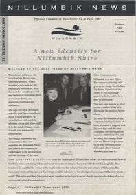
Journal - Newsletter, Nillumbik Shire Council, Nillumbik News, October 2000
... Municipal Road Safety Strategy...Infrastructure...October 2000 articles include: Safer roads for the Shire Eltham Festival program announced Commercial Place design released 2000-2003 Council Plan Released National Reconciliation Framework Living and Learning Centres More Playgrounds Susan St Pavilion completed Study to plan for BMX/skate track Wattle Glen Township Strategy Community Weed Control Program Count Koala Day Environment Centre proposed for Edendale Farm Open Space Strategy findings Neighbourhood Character Study and Residential Design Guidelines Friends groups Clean Drains – Living Creeks, National Water Week Nillumbik Shire Council Cultural Plan 2000-2005 adopted 2001 Alan Marshall Short Story Award Artists’ Open Studios program Kangaroo Ground Tower Advisory Committee Environment leaders at Eltham North primary Dollars saved by regular road maintenance Regional Road upgrades Rural roads grading program Stormwater Management Plan Locality boundary update Council Newsletters Nillumbik News Nillumbik Shire Council Council Plan 2000–2003 Municipal Road Safety Strategy Infrastructure services Stormwater Management Plan Locality boundary review Rates Sustainable agriculture rebate Capital works program road maintenance Better Roads Victorian program eltham - yarra glen road Warrandyte - Kangaroo Ground Road Rural roads grading program Commercial Place Public space public infrastructrue meals on wheels Eltham Living and Learning Centre Living and Learning Centre adult community education volunteer programs Australia Day Awards community groups environmental protection sustainability Community weed control landcare koalas Drainage works waterway protection indigenous grass environmental education Open Space public parkland playgrounds bike trail Adventure Playground community reserves Kangaroo Ground Tower reserve Cultural plan Eltham festival Artists Open Studios cultural tourism Alan Marshall Short Story Award Montsalvat community arts program garden walks Eltham Fun Run community market mudbrick tours CERES Environmental Education Centre Nillumbik Tourism Association Food and Wine trail Yarra Valley Tourism campaign road safety Adrian Cully Alan Marshall Andrew Port Anne Connor Catherine Dale Chris Wallace-Crabbe Claire Harris David Scott David Yencken Dean Stewart Deb Ganderton Debra Wilkinson Denis Ward drew gregory Daryl Taylor Fiona Austin Frank Butters Frank Nolan Gavin Jordan Glen Jameson Grace Mitchell Greg Scott Harry Gilham Helen Ash Jane Annois jane viola Jan Kelly Jenneke Korteweg Jenni Mitchell Jessica Davison Jill Forrest john hewish Jules Burns Julius Peiker kay steventon Kayte Nunn Lesley Shuttleworth leslie Avril Louise Heathcote Marg Jeffery Margaret Jennings Martin Wright Mathew Hodsnesse Maurice Stabb Megan McCarthy Mervyn Hannan Michael Jansz michael skewes Mick Woiwod nel ten wolde Nicholas Pelling Ona Henderson Peter Burn Piers Bateman reg cox Reg Evans Robert Boyle Robert Hay Robert Theobald shan shnookal Sigmund Jorgensen Stuart Menzies Steven White Vonnie Frazer Eltham District Historical Society Council for Aboriginal Reconciliation Eltham North Primary School Wattle Glen Primary School Eltham Arts Council Churinga Arts Harvey World Travel (Eltham) Eltham Little Book Shop Do Lunch Cafe Volumes Cafe Grovedale Cottage Lovegrove Winery Cottles Bridge Yarrambat Golf Club Eltham Football Club Eltham Rugby Football Club Lower Eltham Cricket Club Susan Street Oval Syd Tunn Jack Rasterhoff A4. monotone print, double stapled, 4 pages Nillumbik News Journal Newsletter Nillumbik Shire Council ...The newsletter outlines local government initiatives, community events, environmental programs, infrastructure projects, and cultural activities occurring in the Nillumbik Shire around October–November 2000. It highlights council plans, community participation opportunities, and local developments aimed at improving quality of life in the region. October 2000 articles include: Safer roads for the Shire Eltham Festival program announced Commercial Place design released 2000-2003 Council Plan Released National Reconciliation Framework Living and Learning Centres More Playgrounds Susan St Pavilion completed Study to plan for BMX/skate track Wattle Glen Township Strategy Community Weed Control Program Count Koala Day Environment Centre proposed for Edendale Farm Open Space Strategy findings Neighbourhood Character Study and Residential Design Guidelines Friends groups Clean Drains – Living Creeks, National Water Week Nillumbik Shire Council Cultural Plan 2000-2005 adopted 2001 Alan Marshall Short Story Award Artists’ Open Studios program Kangaroo Ground Tower Advisory Committee Environment leaders at Eltham North primary Dollars saved by regular road maintenance Regional Road upgrades Rural roads grading program Stormwater Management Plan Locality boundary update council newsletters, nillumbik news, nillumbik shire council, council plan 2000–2003, municipal road safety strategy, infrastructure services, stormwater management plan, locality boundary review, rates, sustainable agriculture rebate, capital works program, road maintenance, better roads victorian program, eltham - yarra glen road, warrandyte - kangaroo ground road, rural roads grading program, commercial place, public space, public infrastructrue, meals on wheels, eltham living and learning centre, living and learning centre, adult community education, volunteer programs, australia day awards, community groups, environmental protection, sustainability, community weed control, landcare, koalas, drainage works, waterway protection, indigenous grass, environmental education, open space, public parkland, playgrounds, bike trail, adventure playground, community reserves, kangaroo ground tower reserve, cultural plan, eltham festival, artists open studios, cultural tourism, alan marshall short story award, montsalvat, community arts program, garden walks, eltham fun run, community market, mudbrick tours, ceres environmental education centre, nillumbik tourism association, food and wine trail, yarra valley tourism campaign, road safety, adrian cully, alan marshall, andrew port, anne connor, catherine dale, chris wallace-crabbe, claire harris, david scott, david yencken, dean stewart, deb ganderton, debra wilkinson, denis ward, drew gregory, daryl taylor, fiona austin, frank butters, frank nolan, gavin jordan, glen jameson, grace mitchell, greg scott, harry gilham, helen ash, jane annois, jane viola, jan kelly, jenneke korteweg, jenni mitchell, jessica davison, jill forrest, john hewish, jules burns, julius peiker, kay steventon, kayte nunn, lesley shuttleworth, leslie avril, louise heathcote, marg jeffery, margaret jennings, martin wright, mathew hodsnesse, maurice stabb, megan mccarthy, mervyn hannan, michael jansz, michael skewes, mick woiwod, nel ten wolde, nicholas pelling, ona henderson, peter burn, piers bateman, reg cox, reg evans, robert boyle, robert hay, robert theobald, shan shnookal, sigmund jorgensen, stuart menzies, steven white, vonnie frazer, eltham district historical society, council for aboriginal reconciliation, eltham north primary school, wattle glen primary school, eltham arts council, churinga arts, harvey world travel (eltham), eltham little book shop, do lunch cafe, volumes cafe, grovedale cottage, lovegrove winery cottles bridge, yarrambat golf club, eltham football club, eltham rugby football club, lower eltham cricket club, susan street oval, syd tunn, jack rasterhoff -
 Eltham District Historical Society Inc
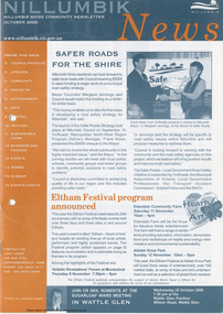
Journal - Newsletter, Nillumbik Shire Council, Nillumbik News, October 2000
... Municipal Road Safety Strategy...Infrastructure...October 2000 articles include: Safer roads for the Shire Eltham Festival program announced Commercial Place design released 2000-2003 Council Plan Released National Reconciliation Framework Living and Learning Centres More Playgrounds Susan St Pavilion completed Study to plan for BMX/skate track Wattle Glen Township Strategy Community Weed Control Program Count Koala Day Environment Centre proposed for Edendale Farm Open Space Strategy findings Neighbourhood Character Study and Residential Design Guidelines Friends groups Clean Drains – Living Creeks, National Water Week Nillumbik Shire Council Cultural Plan 2000-2005 adopted 2001 Alan Marshall Short Story Award Artists’ Open Studios program Kangaroo Ground Tower Advisory Committee Environment leaders at Eltham North primary Dollars saved by regular road maintenance Regional Road upgrades Rural roads grading program Stormwater Management Plan Locality boundary update Council Newsletters Nillumbik News Nillumbik Shire Council Council Plan 2000–2003 Municipal Road Safety Strategy Infrastructure services Stormwater Management Plan Locality boundary review Rates Sustainable agriculture rebate Capital works program road maintenance Better Roads Victorian program eltham - yarra glen road Warrandyte - Kangaroo Ground Road Rural roads grading program Commercial Place Public space public infrastructrue meals on wheels Eltham Living and Learning Centre Living and Learning Centre adult community education volunteer programs Australia Day Awards community groups environmental protection sustainability Community weed control landcare koalas Drainage works waterway protection indigenous grass environmental education Open Space public parkland playgrounds bike trail Adventure Playground community reserves Kangaroo Ground Tower reserve Cultural plan Eltham festival Artists Open Studios cultural tourism Alan Marshall Short Story Award Montsalvat community arts program garden walks Eltham Fun Run community market mudbrick tours CERES Environmental Education Centre Nillumbik Tourism Association Food and Wine trail Yarra Valley Tourism campaign road safety Adrian Cully Alan Marshall Andrew Port Anne Connor Catherine Dale Chris Wallace-Crabbe Claire Harris David Scott David Yencken Dean Stewart Deb Ganderton Debra Wilkinson Denis Ward drew gregory Daryl Taylor Fiona Austin Frank Butters Frank Nolan Gavin Jordan Glen Jameson Grace Mitchell Greg Scott Harry Gilham Helen Ash Jane Annois jane viola Jan Kelly Jenneke Korteweg Jenni Mitchell Jessica Davison Jill Forrest john hewish Jules Burns Julius Peiker kay steventon Kayte Nunn Lesley Shuttleworth leslie Avril Louise Heathcote Marg Jeffery Margaret Jennings Martin Wright Mathew Hodsnesse Maurice Stabb Megan McCarthy Mervyn Hannan Michael Jansz michael skewes Mick Woiwod nel ten wolde Nicholas Pelling Ona Henderson Peter Burn Piers Bateman reg cox Reg Evans Robert Boyle Robert Hay Robert Theobald shan shnookal Sigmund Jorgensen Stuart Menzies Steven White Vonnie Frazer Eltham District Historical Society Council for Aboriginal Reconciliation Eltham North Primary School Wattle Glen Primary School Eltham Arts Council Churinga Arts Harvey World Travel (Eltham) Eltham Little Book Shop Do Lunch Cafe Volumes Cafe Grovedale Cottage Lovegrove Winery Cottles Bridge Yarrambat Golf Club Eltham Football Club Eltham Rugby Football Club Lower Eltham Cricket Club Susan Street Oval Syd Tunn Jack Rasterhoff A4. two colour print (orange/blue), double stapled, 16 pages Nillumbik News Journal Newsletter Nillumbik Shire Council ...The newsletter outlines local government initiatives, community events, environmental programs, infrastructure projects, and cultural activities occurring in the Nillumbik Shire around October–November 2000. It highlights council plans, community participation opportunities, and local developments aimed at improving quality of life in the region. October 2000 articles include: Safer roads for the Shire Eltham Festival program announced Commercial Place design released 2000-2003 Council Plan Released National Reconciliation Framework Living and Learning Centres More Playgrounds Susan St Pavilion completed Study to plan for BMX/skate track Wattle Glen Township Strategy Community Weed Control Program Count Koala Day Environment Centre proposed for Edendale Farm Open Space Strategy findings Neighbourhood Character Study and Residential Design Guidelines Friends groups Clean Drains – Living Creeks, National Water Week Nillumbik Shire Council Cultural Plan 2000-2005 adopted 2001 Alan Marshall Short Story Award Artists’ Open Studios program Kangaroo Ground Tower Advisory Committee Environment leaders at Eltham North primary Dollars saved by regular road maintenance Regional Road upgrades Rural roads grading program Stormwater Management Plan Locality boundary update council newsletters, nillumbik news, nillumbik shire council, council plan 2000–2003, municipal road safety strategy, infrastructure services, stormwater management plan, locality boundary review, rates, sustainable agriculture rebate, capital works program, road maintenance, better roads victorian program, eltham - yarra glen road, warrandyte - kangaroo ground road, rural roads grading program, commercial place, public space, public infrastructrue, meals on wheels, eltham living and learning centre, living and learning centre, adult community education, volunteer programs, australia day awards, community groups, environmental protection, sustainability, community weed control, landcare, koalas, drainage works, waterway protection, indigenous grass, environmental education, open space, public parkland, playgrounds, bike trail, adventure playground, community reserves, kangaroo ground tower reserve, cultural plan, eltham festival, artists open studios, cultural tourism, alan marshall short story award, montsalvat, community arts program, garden walks, eltham fun run, community market, mudbrick tours, ceres environmental education centre, nillumbik tourism association, food and wine trail, yarra valley tourism campaign, road safety, adrian cully, alan marshall, andrew port, anne connor, catherine dale, chris wallace-crabbe, claire harris, david scott, david yencken, dean stewart, deb ganderton, debra wilkinson, denis ward, drew gregory, daryl taylor, fiona austin, frank butters, frank nolan, gavin jordan, glen jameson, grace mitchell, greg scott, harry gilham, helen ash, jane annois, jane viola, jan kelly, jenneke korteweg, jenni mitchell, jessica davison, jill forrest, john hewish, jules burns, julius peiker, kay steventon, kayte nunn, lesley shuttleworth, leslie avril, louise heathcote, marg jeffery, margaret jennings, martin wright, mathew hodsnesse, maurice stabb, megan mccarthy, mervyn hannan, michael jansz, michael skewes, mick woiwod, nel ten wolde, nicholas pelling, ona henderson, peter burn, piers bateman, reg cox, reg evans, robert boyle, robert hay, robert theobald, shan shnookal, sigmund jorgensen, stuart menzies, steven white, vonnie frazer, eltham district historical society, council for aboriginal reconciliation, eltham north primary school, wattle glen primary school, eltham arts council, churinga arts, harvey world travel (eltham), eltham little book shop, do lunch cafe, volumes cafe, grovedale cottage, lovegrove winery cottles bridge, yarrambat golf club, eltham football club, eltham rugby football club, lower eltham cricket club, susan street oval, syd tunn, jack rasterhoff -
 Eltham District Historical Society Inc
Photograph, Diamond Creek Bridge, Eltham North, c.1920
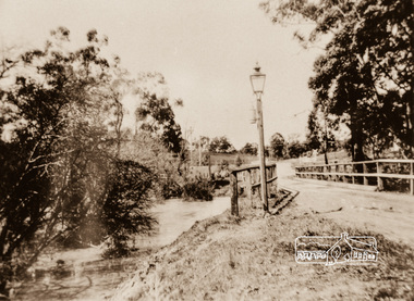
... municipal electricity grids were widely established. During the late Victorian and early Edwardian eras, major hubs like Melbourne relied on centralized coal-gas infrastructure. ...municipal electricity grids were widely established. During the late Victorian and early Edwardian eras, major hubs like Melbourne relied on centralized coal-gas infrastructure. ...View looking east across the Glen Park Bridge and the railway crossing towards Main Road circa 1920. The bridge was originally built as a replacement for an older private bridge built by a man named Foley around 1880. In 1911 Heidelberg and Eltham agreed to share the costs to build a new bridge (the Diamond Creek was the border between the two). Construction began in June 1915 and it was officially opened by Cr. Taylor on Cup Day, November 1915. This photo, dated around 1920, is of the Glen Park Bridge crossing over the Diamond Creek about 50 metres north of the present-day Wattletree tree Road Bridge. Glen Park Road intersected Main Rain Road along an alignment following present day Coleman Cresent. In this this picture we see the narrow wooden bridge over a high flowing Diamond Creek at Glen Park, now Eltham North. In the background is a railway crossing sign. There is a self-contained carbide streetlamp situated in front of the bridge. In the early 1900s, carbide (acetylene gas) streetlamps emerged as a lighting technology for regional towns across Victoria, Australia, before municipal electricity grids were widely established. During the late Victorian and early Edwardian eras, major hubs like Melbourne relied on centralized coal-gas infrastructure. However, small regional Victorian shires lacked the funds or population density to build large gasworks. When the commercial production of calcium carbide became viable around 1900, it offered a quantum leap in brightness over traditional kerosene streetlamps. Acetylene gas burned with an intense, crisp white flame—significantly brighter than oil or candles. Many rural towns used self-contained lampposts. A lamplighter had to climb each post daily to manually place calcium carbide pellets in a lower chamber and fill an upper chamber with water. The water dripped onto the carbide, producing acetylene gas to feed the burner. Lamplighters carefully measured the fuel amounts so the chemical reaction would naturally exhaust itself and "turn off" around midnight. While carbide streetlights provided unparalleled visibility for early motorists, cyclists, and pedestrians, they were incredibly labour-intensive and inherently volatile. The gas was highly explosive, prone to leaks, and left behind a pungent, sulphur-like odour. By the end of World War I, local Victorian councils rapidly phased out acetylene infrastructure in favour of safer, independent electric powerhouse generators. In the context of Eltham's local history, the Eltham Shire and surrounding Yarra Valley region actively relied on carbide streetlamps and kerosene lighting during the early 20th century before the expansion of the Melbourne electric grid. Eltham was an outer-rural, heavily timbered farming and orchard district at the turn of the century, it faced unique civic infrastructure challenges. In rural Eltham, early streetlamps were exceptionally sparse. The community relied heavily on "innkeeper laws" which dictated local hotels—such as the historic Eltham Hotel—were legally required to keep external oil, kerosene, or acetylene lamps burning through the night to illuminate the main roads for travellers and coaches. The volatile carbide and kerosene lamps on Eltham's main thoroughfares were progressively phased out during the 1920s. The district steadily transitioned to electricity, which allowed for developments like the installation of modern electrical wiring at the local fire station on Arthur Street by 1928. The Glen Park Bridge was a low structure and subject to flooding readily. In 1959 Eltham Council erected a new crossing over the Diamond Creek and realigned the road to the present-day Wattletree Road Bridge. Construction was not fully complete when on Sunday, 20 September 1959, heavy flooding occurred in the stream and at 3:53 pm the old bridge was washed away forever. - Research by Peter Pidgeon, EDHS, June 2026Photograph copy eltham north, wattletree road, coleman crescent, bridges, diamond creek (creek), bridge, carbide streetlamp, floodwater, glen park bridge, street lamp, glen park road, glen park estate -
Bendigo Historical Society Inc.
Document - History Notes - Information on Mining, statistics and early development of Bendigo, 1840-1990 approx
... Bendigo Became a municipal district in 1855, a town in 1861, a city in 1871, and changed its name from Sandhurst to Bendigo in 1891. Key Events: Establishment of hospital, police court, churches, schools, and infrastructure like railways and water supply.Governance and Civic Structure. ...Bendigo Became a municipal district in 1855, a town in 1861, a city in 1871, and changed its name from Sandhurst to Bendigo in 1891. Key Events: Establishment of hospital, police court, churches, schools, and infrastructure like railways and water supply.Governance and Civic Structure. ...Saddle, Fault, and Spur reefs are the main types, found in Ordovician slates and sandstones folded into anticlines and synclines. Major Productive Reefs: Hustlers, Garden Gully, Paddy's Gully, Sheepshead, New Chum, Nell Gwynne, and Carshalton.Mining Process: Gold is found in quartz lodes, extracted, crushed, and separated using mercury amalgamation. From 1851–1949, over 21 million ounces of gold were produced, valued at approximately £323 million (1964 prices). Located Bendigo is in central Victoria, north of the Dividing Range, between Campaspe Valley and Loddon flats; 100 miles from Melbourne. The City area is 8,030 acres; population around 40,000 (city), 47,000 (district).Climate is temperate, with average rainfall of 20 inches, and 320 sunny days per year. Gold First discovered in 1851 at Golden Square. Bendigo Became a municipal district in 1855, a town in 1861, a city in 1871, and changed its name from Sandhurst to Bendigo in 1891. Key Events: Establishment of hospital, police court, churches, schools, and infrastructure like railways and water supply.Governance and Civic Structure. Council Structure: 3 wards, each with 3 councillors serving 3-year terms; mayor elected by councillors. Main revenue from rates and property; principal duties include public works, health, parks, and enforcement of by-laws. Major Projects: Olympic swimming pool, market extensions, park improvements, road and drainage works.Economy and IndustryCommerce: 730 retail shops, 260 factories, and a major livestock market.Principal Industries: Meat processing, manufacturing (including ordnance, textiles, engineering), fruit and food processing, and egg production. Bendigo is Noted for sheep, lamb, fruit (especially tomatoes and apples), and dairy. Major rail and road hub with connections across Victoria and to New South Wales; tram and bus services.Education: Institute of Technology, Teachers College, multiple secondary and primary schools, and special education facilities. Several hospitals, aged care homes, and health services. 486 acres of parks and gardens, extensive sports facilities, and Lake Eppalock for water sports. Wide range of community, cultural, and sporting organizations. Regional library, art gallery, music and drama societies. Notable Figures and HeritageGeorge Lansell: Known as the "Gold King," a key figure in Bendigo's mining history. Transformation: From a sheep run to a major goldfield and then to a modern city with significant infrastructure and cultural assets. Motto Coat of Arms: Features symbols representing gold mining, agriculture, pioneering, and fruit growing.Motto: "Progress" in gold on a purple ribbon.Bendigo's history is marked by rapid growth from gold discovery, strong civic development, and a diverse economy, making it a significant regional center in Victoria.History Notes - Information on Mining, statistics and early development of Bendigo - author unknown This item contains the following document: 11217.65a Twelve Foolscap typed pages with information on Bendigonon-fictionbendigo, fortuna, george lansell, development of bendigo -
 Sunshine and District Historical Society Incorporated
Photograph - Albion Quarry Photographs
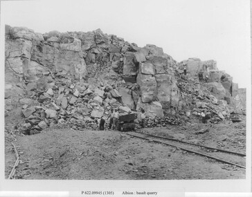
... municipal tip. Dumped into the hole included household waste, industrial waste, chemical waste, radioactive waste and large quantities of unknown fill. Dumping continued until 1990. In the 1990’s, a methane powered electricity plant was installed on the site, but it failed due to insufficient methane production. In 2019, the former quarry made national news due to ground contamination affecting 69 residential homes, 6 commercial properties and a community park. The site is now being reserved for the future Sunshine Energy Park and is awaiting redevelopment. This quarry is historically significant for its scale, its role in Melbourne’s infrastructure...municipal tip. Dumped into the hole included household waste, industrial waste, chemical waste, radioactive waste and large quantities of unknown fill. Dumping continued until 1990. In the 1990’s, a methane powered electricity plant was installed on the site, but it failed due to insufficient methane production. In 2019, the former quarry made national news due to ground contamination affecting 69 residential homes, 6 commercial properties and a community park. The site is now being reserved for the future Sunshine Energy Park and is awaiting redevelopment. This quarry is historically significant for its scale, its role in Melbourne’s infrastructure ...Albion Quarry began operations in 1888, and became one of the largest bluestone quarries in Australia, later it became the Sunshine municipal tip. In 1888, quarrying first began on the site by the Wales family. The quarry extracted high quality bluestone, ideal for road construction, railway ballast, culverts, bridges and public buildings and private homes. The site quickly became one of the most productive basalt quarries in the region. In 1907, the Albion Quarry Company was formed as a partnership between Alexander Wales, James Watter, Peter Rumpf, Thomas Adams, William Wright Wales and Alexander George Wales (later Sir George Wales, Lord Mayor of Melbourne) The company became the largest producer of quarry products in the Commonwealth. The quarry pit was, at one time, the largest in Australia. In January 1965, Boral acquired both Albion Quarry and Reid Quarry, merging them into Albion Reid Pty Ltd. Quarrying there continued until the late 1960s–early 1970s. After quarrying ceased, the enormous pit was used as the Sunshine municipal tip. Dumped into the hole included household waste, industrial waste, chemical waste, radioactive waste and large quantities of unknown fill. Dumping continued until 1990. In the 1990’s, a methane powered electricity plant was installed on the site, but it failed due to insufficient methane production. In 2019, the former quarry made national news due to ground contamination affecting 69 residential homes, 6 commercial properties and a community park. The site is now being reserved for the future Sunshine Energy Park and is awaiting redevelopment. This quarry is historically significant for its scale, its role in Melbourne’s infrastructure, and its later environmental legacy.These photographs document the initial phase of quarrying, featuring manual labour and transportation by horse and cart.Albion basalt quarryalbion quarry, ballarat road, albion, basalt, hulett street -
 Sunshine and District Historical Society Incorporated
Book - Victorian Municipal Directory Collection, Arnall & Jackson Pty Ltd, Victorian Municipal Directory
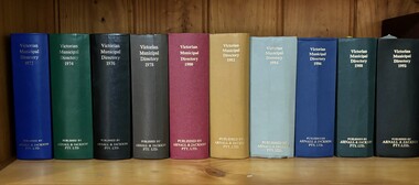
... Directory Victoria Thomas William "Bill" Deutschmann City of Sunshine The Victorian Municipal Directories were annual (or near‑annual) reference books published from the late 19th century through much of the 20th century that listed every municipality in Victoria, along with detailed information about councils, officers, rates, boundaries, services, infrastructure, and local institutions. ...The Victorian Municipal Directories were annual (or near‑annual) reference books published from the late 19th century through much of the 20th century that listed every municipality in Victoria, along with detailed information about councils, officers, rates, boundaries, services, infrastructure, and local institutions. They were the backbone of civic administration research before digitisation.Collection of 10 Victorian Municipal Directories Hard Covered Booksnon-fictionThe Victorian Municipal Directories were annual (or near‑annual) reference books published from the late 19th century through much of the 20th century that listed every municipality in Victoria, along with detailed information about councils, officers, rates, boundaries, services, infrastructure, and local institutions. They were the backbone of civic administration research before digitisation.directory, victoria, thomas william "bill" deutschmann, city of sunshine -
Broadmeadows Historical Society & Museum
Document - Correspondence, S. Gore, City Engineer, Guidelines for the Future Planning of the Glenroy Shopping Centre and Environs, 24 July 1979
... This letter is significant as evidence of late 1970s municipal planning in Glenroy, illustrating the City of Broadmeadows’ role in working with local traders to shape the development of a major suburban shopping centre during a period of growth and changing planning controls. Glenroy Shopping Centre Urban planning Local government Suburban commercial development City of Broadmeadows Zoning and infrastructure ...This item documents late 1970s City of Broadmeadows planning activities, showing local government engagement with traders over the rezoning, transport planning, and structured redevelopment of the Glenroy Shopping Centre during a period of suburban growth and wider Victorian planning reform.This letter is significant as evidence of late 1970s municipal planning in Glenroy, illustrating the City of Broadmeadows’ role in working with local traders to shape the development of a major suburban shopping centre during a period of growth and changing planning controls.One typed letter on City of Broadmeadows letterhead; black ink on white paper.“SG:JG.345” (top of first page) / “24th July, 1979” (letter body)glenroy shopping centre, urban planning, local government, suburban commercial development, city of broadmeadows, zoning and infrastructure planning, community consultation, melbourne northern suburbs -
 Sunshine and District Historical Society Incorporated
Document - Brimbank Rising, Tony Smith, 2018
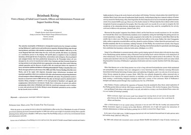
... Postwar flooding of the Harvester Works, and of the region with migrants, demanded major infrastructure investment and municipal capabilities which were consistent with wider suburbanisation and growing dominance of road transport without challenging the area’s politically safe status. ...Postwar flooding of the Harvester Works, and of the region with migrants, demanded major infrastructure investment and municipal capabilities which were consistent with wider suburbanisation and growing dominance of road transport without challenging the area’s politically safe status. ...The suburban municipality of Brimbank is strategically located across key transport corridors serving Melbourne’s rapid western and northwestern expansion. Brimbank Rising steps through local prehistory and history with attention to planning events from Hoddle’s 1840 survey to the recent Regional Rail Link which shape the area. Across five periods, this history sees planning as a contributory process to city shaping, with specific plans as snapshots in time of endorsed intentions, all through the lens of complexity, connectedness and contingency. Recent geological and ecological history had been productively harnessed by the Wurundjeri before all were disrupted by the arrival of unauthorised settlers from Tasmania and their livestock focused on serving markets in and using methods more appropriate to the other side of the world. Following colonial separation and the discovery of gold in 1851, the second part follows the expansion of heavy rail and the multifaceted influence of leading industrialist H V McKay’s Sunshine Harvester Works through and between the booms of the 1880s and 1920s. Postwar flooding of the Harvester Works, and of the region with migrants, demanded major infrastructure investment and municipal capabilities which were consistent with wider suburbanisation and growing dominance of road transport without challenging the area’s politically safe status. The penultimate section is focused on concurrent events in 2009 and how they play out through council in administration’s Sunshine Rising campaign to capitalise on the local potential of Sunshine’s rail upgrade and complementary infrastructure investments. Finally, there is discussion of current state policies and planning which relate to Brimbank and which the council and community need to continue to work with and advocate for further Rising to ensure Brimbank’s potential as service corridor for the Growth Areas is realised.Brimbank Rising From a History of Failed Local Councils, Officers and Administrators Promote and Support Sunshine Risingaboriginal, first nation, h.v. mckay, sunshine harvester factory -
 Kew Historical Society Inc
Plan, Dorner Rice Pty Ltd, City of Kew Municipal Depot, 1984
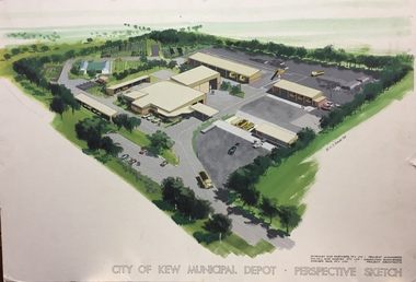
... municipal depots in the former City of Kew (now part of the City of Boroondara). This perspective sketch by Dorner Rice Pty Ltd represents the original design of the depot at 31-35 Hutchinson Drive, on the grounds of the former Kew Mental Hospital. The large perspective drawing by W.A.D. Brodie in 1984 is an important record of the depot as originally designed. This architectural sketch is a key piece of evidence about public infrastructure ...There have been a number of municipal depots in the former City of Kew (now part of the City of Boroondara). This perspective sketch by Dorner Rice Pty Ltd represents the original design of the depot at 31-35 Hutchinson Drive, on the grounds of the former Kew Mental Hospital. The large perspective drawing by W.A.D. Brodie in 1984 is an important record of the depot as originally designed.This architectural sketch is a key piece of evidence about public infrastructure developed in the former City of Kew. The facility has been modified from the original design.Large colour perspective drawing of the new Kew Municipal Depot at 31-35 Hutchinson Street, Kew. The drawing was completed by W.A.D. Brodie in 1984 on behalf of the project consortium. In addition to the projected layout of the depot, the drawing includes details of the consortium drawn together to bid for the project: project managers - McGinley & Partners; consulting engineers - D. G. Hill & Harvey Pty Ltd; and project architects - Dorner Rice Pty Ltd.Architectural Perspective Sketch : City of Kew Municipal Depot: Perspective sketch : W.A.D. Brodie 1984 : McGinley & Partners Pty Ltd Project Managers : D.G. Hill & Harvey Pty Ltd Project Engineers : Dorner Rice Pty Ltd Project Architectscity of kew (vic) - municipal depot, w.a.d. brodie, mcginley & partners pty ltd, d. g. hill & harvey pty ltd, dorner rice pty ltd -
 Whitehorse Historical Society Inc.
Document - Planning Scheme Amendment, Former Town Hall, 1/11/1998
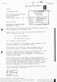
... infrastructure...whitehorse road...nunawading...no 360...municipal...city of whitehorse victoria. department of infrastructure whitehorse road nunawading no 360 municipal chambers city of nunawading whitehorse planning scheme shire of blackburn and mitcham Whitehorse Planning Scheme amendment L21, Part 2 with explanatory report and covering latter from Department of Infrastructure to City of Whitehorse regarding changed requirements affecting former town hall building, 360 - 362 Whitehorse Road, Nunawading. ...Whitehorse Planning Scheme amendment L21, Part 2 with explanatory report and covering latter from Department of Infrastructure to City of Whitehorse regarding changed requirements affecting former town hall building, 360 - 362 Whitehorse Road, Nunawading.city of whitehorse, victoria. department of infrastructure, whitehorse road, nunawading, no 360, municipal chambers, city of nunawading, whitehorse planning scheme, shire of blackburn and mitcham -
 Mont De Lancey
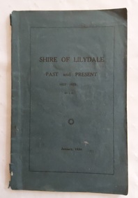
Book, James Rouget, Shire of Lilydale: Past and Present 1837 - January 1923, January 1924
... infrastructure. The 1882 railway line connecting Melbourne to Lilydale, along with later branches to Healesville and Warburton, transformed the shire into a major market center and tourist destination. Lilydale - History Early settlers Lilydale early settlers This book by James Rouget is a foundational local history. It meticulously chronicles the early settlement, the evolution of local municipal ...This book by James Rouget is a foundational local history. It meticulously chronicles the early settlement, the evolution of local municipal governance, and the pioneering spirit of Victoria's Yarra Valley.A thin blue paperback book titled The Shire of Lilydale: 1837 - 1923, which is printed in black lettering on the front cover surrounded by a black lined box around the edges. The initials of the author and date of publication are also printed. The title page has the same details. There are Contents, Preface, Introduction and Dedication pages. Pp. 73 non-fiction This book by James Rouget is a foundational local history. It meticulously chronicles the early settlement, the evolution of local municipal governance, and the pioneering spirit of Victoria's Yarra Valley.lilydale - history, early settlers, lilydale early settlers -
 Kew Historical Society Inc
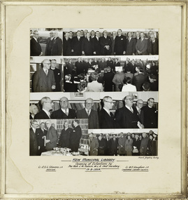
Photograph, Stuart Tompkins Studios, Kew Municipal Library: Opening of Extentions by The Hon. L.W. Balvin M.L.A. Chief Secretary, 19 October 1954
... An historically interesting photographic record of investment in public infrastructure and services by municipal councils during the 1950s. kew library cr a.s.c. stevens cr w.d. vaughan australian photographers - stuart tompkins studio [Inscription] "Kew Municipal Library: Opening of Extentions by The Hon. ...Kew Library history: 1860: Kew's first library was the Kew Literary and Scientific Society, which opened on 6 August 1860. 1884: Kew Town Hall was extended and the library transferred to a room on the upper floor. This was not an ideal arrangement as the room was required for Council purposes. 1904: A cottage adjoining Kew Town Hall was purchased for use as a library. 1937: The library was closed for a major overhaul of stock and renovation of the building. It reopened in December 1937 and remained there for more than 35 years. 1973: When the Civic Centre opened in Charles Street, Kew, the library moved in. 1987: Kew Library moved to its current location in the converted city hall, overlooking the beautiful Alexandra Gardens. The library was officially opened at this site on Friday 23 October 1987 by the Mayor of Kew, Cr James Tutt.An historically interesting photographic record of investment in public infrastructure and services by municipal councils during the 1950s. Framed photographic collage showing the opening of Extensions to the Kew Municipal Library by The Hon. L.W. Balvin M.L.A. Chief Secretary on 19 August 1954. The photos are in their original mount and frame.[Inscription] "Kew Municipal Library: Opening of Extentions by The Hon. L.W. Balvin M.L.A. Chief Secretary 19.8.1954, with Cr. A.S.C. Stevens J.P. Mayor and Cr. W.D. Vaughan J.P. Chairman Library Council". [Photographer] "Stuart Tompkins Studios."kew library, cr a.s.c. stevens, cr w.d. vaughan, australian photographers - stuart tompkins studio -
 Broadmeadows Historical Society & Museum
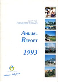
Book - Annual Report, Alex Simic et al, City of Broadmeadows Annual Report 1993, 1993
... Municipal Finance...Recreation Facilities...Infrastructure...infrastructure projects and community development initiatives of the City of Broadmeadows during 1993. It was produced during the final years of the municipality before the Victorian local government reforms of 1994, which resulted in the abolition of the City of Broadmeadows and incorporation of much of its area into the newly created City of Hume. The report provides evidence of local government priorities, population growth, community services, economic development and municipal...Front cover features the title City of Broadmeadows Annual Report 1993, municipal logo and slogan "Building a Better Future", and a series of colour photographs depicting community facilities, recreation spaces, commercial development and civic infrastructure....City of Broadmeadows Local Government Municipal Administration Annual Reports Civic Governance Community Services Urban Development Municipal Finance Recreation Facilities Infrastructure Broadmeadows Hume Region Victoria Local History Municipal Reform. ...The annual report presents an overview of municipal operations and achievements for 1993. Content typically includes reports from the Mayor and Chief Executive Officer, financial statements, departmental reports, community services, engineering and works programs, planning activities, recreation services, economic development initiatives, staffing information and statistical data relating to municipal governance and service delivery.28 pages including covers; colour printed publication with card cover and stapled binding. Front cover features the title City of Broadmeadows Annual Report 1993, municipal logo and slogan "Building a Better Future", and a series of colour photographs depicting community facilities, recreation spaces, commercial development and civic infrastructure.non-fictionThe annual report presents an overview of municipal operations and achievements for 1993. Content typically includes reports from the Mayor and Chief Executive Officer, financial statements, departmental reports, community services, engineering and works programs, planning activities, recreation services, economic development initiatives, staffing information and statistical data relating to municipal governance and service delivery.city of broadmeadows, local government, municipal administration, annual reports, civic governance, community services, urban development, municipal finance, recreation facilities, infrastructure, broadmeadows, hume region, victoria, local history, municipal reform. -
Broadmeadows Historical Society & Museum
Photograph (collection) - City of Broadmeadows Trucks, Don Woods, 1991
... Municipal vehicles...City of Broadmeadows...Local government...Local government infrastructure...Municipal vehicles City of Broadmeadows Local government Local government infrastructure Public works Council works depots Truck fleets Water tankers Utility trucks Vehicle livery Municipal branding Broadmeadows (Vic.) ...Created as part of City of Broadmeadows municipal operations. Later retained and archived by the Broadmeadows Historical Society.To document City of Broadmeadows municipal vehicles for operational, promotional, or record keeping purposes.Two colour photographs physically joined together with adhesive tape along the centre, forming a single composite photographic item. Original order maintained as received.Two colour photographs depicting City of Broadmeadows service vehicles parked at a municipal works depot: • An International ACCO 2250 water tanker marked “Broadmeadows” • An Isuzu FSR 450 tray truck bearing City of Broadmeadows livery Both images show vehicles in situ at the Broadmeadows depot.municipal vehicles, city of broadmeadows, local government, local government infrastructure, public works, council works depots, truck fleets, water tankers, utility trucks, vehicle livery, municipal branding, broadmeadows (vic.), victoria (australia), 1990s, urban services, australian local governmentmunicipal vehicles, city of broadmeadows, local government, local government infrastructure, public works, council works depots, truck fleets, water tankers, utility trucks, vehicle livery, municipal branding, broadmeadows (vic.), victoria (australia), 1990s, urban services, australian local government -
 Broadmeadows Historical Society & Museum
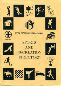
Document - Directory, City of Broadmeadows Sports and Recreation Directory, May 1993
... The directory documents the sporting, recreational and community infrastructure available to residents in May 1993 and provides a snapshot of community life, organisations and municipal services within the municipality at that time....The directory documents the sporting, recreational and community infrastructure available to residents in May 1993 and provides a snapshot of community life, organisations and municipal services within the municipality at that time. ...Printed directory comprising 53 pages including covers. Printed on tan-coloured paper with black ink text and illustrations. Originally bound with two metal staples along the spine, positioned near the top and bottom edges. Front cover substantially torn along the left spine edge. General wear, creasing and handling marks consistent with age and previous storage conditions. Damage is attributable to historic poor handling and storage practices.non-fictioncity of broadmeadows, recreation, sport, community organisations, local history, municipal services, clubs and societies, leisure activities, victoria -
 Broadmeadows Historical Society & Museum
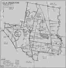
Map, City of Broadmeadows municipal map, February 1985, c. February 1985
... The map documents the City of Broadmeadows municipal area as it existed in February 1985. It records local government ward boundaries, infrastructure, reserves and neighbouring municipalities including Bulla, Whittlesea, Preston, Coburg, Essendon and Keilor. ...It documents municipal boundaries, infrastructure, public reserves and administrative divisions in 1985, providing valuable evidence for researchers studying local government, urban planning and community development in the Broadmeadows district. ...The map documents the City of Broadmeadows municipal area as it existed in February 1985. It records local government ward boundaries, infrastructure, reserves and neighbouring municipalities including Bulla, Whittlesea, Preston, Coburg, Essendon and Keilor. The map provides evidence of municipal organisation and land use in Broadmeadows during the mid-1980s.This map is significant as a historical record of the City of Broadmeadows shortly before substantial local government and urban development changes in Melbourne's northern suburbs. It documents municipal boundaries, infrastructure, public reserves and administrative divisions in 1985, providing valuable evidence for researchers studying local government, urban planning and community development in the Broadmeadows district.Single-sheet monochrome printed map on grey paper. Recto contains a detailed municipal map of the City of Broadmeadows. Verso is blank apart from labels and annotations. Fold marks visible.Recto, upper left: "CITY OF BROADMEADOWS" / "Metric Scale 1:40000" / "DATE FEB 1985" Verso, upper centre: "WI-3206" Verso, upper right: Handwritten and partially obscured notation present.broadmeadows (vic.), city of broadmeadows, local government, municipal boundaries, urban planning, roads, parks and reserves, cartography, melbourne northern suburbs, 1980s victoria. -
Broadmeadows Historical Society & Museum
Document - Program, Broadmeadows City Council, Official Opening of the Broadmeadows Valley Park, 1993
... It documents a specific civic event and demonstrates the role of local government in providing community infrastructure and celebrating municipal achievements. The document contributes to an understanding of the municipality's social and urban development during the early 1990s. ...Broadmeadows Valley Park forms part of the open-space and recreational infrastructure developed within the municipality of Broadmeadows. This program documents the formal opening of the park by the Mayor and illustrates local government involvement in community recreation, urban development and public ceremonies during the early 1990s.This item is significant for its association with the development and opening of public recreational facilities within the City of Broadmeadows. It documents a specific civic event and demonstrates the role of local government in providing community infrastructure and celebrating municipal achievements. The document contributes to an understanding of the municipality's social and urban development during the early 1990s.Two-page black-and-white printed Mayoral statement on paper. Municipal publication produced for a civic event.Front cover includes the title: "Official Opening of the Broadmeadows Valley Park by His Worship, The Mayor, Cr Erin Shira at 1 pm Saturday, 17th July, 1993"broadmeadows valley park, city of broadmeadows, parks and recreation, local government, civic ceremonies, erin shira, broadmeadows (vic.) -
Broadmeadows Historical Society & Museum
Book (series) - Report, E. Hamilton-Smith, A.U.A., (Youth Services Planning Division) et al, Broadmeadows – A Growing City, 1972
... infrastructure and services, leading to emerging social and economic pressures. This two-volume set is a key documentary record of Broadmeadows during a critical phase of post-war suburban expansion. It demonstrates early local government involvement in structured social research and welfare planning, providing detailed insight into the social effects of rapid population growth, Housing Commission development, and emerging municipal service responsibilities. ...Broadmeadows City Council; created through the Youth Services Planning Division with contributions from academic researchers and advisory committees.Produced as a commissioned study by the City of Broadmeadows to examine general welfare conditions and youth work needs within the municipality and to guide future planning, service provision, and community development.Two-volume set comprising: • Volume 1: Detailed survey data and working papers (207 pages) • Volume 2: Integrated summary, analysis, and recommendations (81 pages)A two-volume report documenting a comprehensive social survey of Broadmeadows, covering population growth, welfare services, youth needs, housing conditions, education, health, and employment. Volume 1 contains detailed data and statistical material, while Volume 2 synthesises findings and presents policy recommendations for municipal planning and community development.broadmeadows (vic.) — social conditions, local government — planning and policy, youth services — victoria, welfare services — urban communities, public housing — social impact, community developmentbroadmeadows (vic.) — social conditions, local government — planning and policy, youth services — victoria, welfare services — urban communities, public housing — social impact, community development -
Broadmeadows Historical Society & Museum
Document (collection) - Reports, Unknown, Documents relating to City of Broadmeadows Library Service, 1964/65, 1963-65
... municipal decision making. The records are socially significant for documenting the role of civic organisations—particularly women’s groups—in advocating for educational and cultural infrastructure. ...Created and accumulated by multiple related entities involved in library establishment efforts, including: • Free Library Service Board of Victoria (survey report) • Broadmeadows Library Promotion Committee • Community representatives and advocacy groups (including women’s organisations) • City of Broadmeadows Council (contextual administrative records) The documents were brought together through shared purpose and subject (library establishment).Created to document the planning, advocacy, and municipal decision making processes relating to the establishment of a public library service in the City of Broadmeadows. The records include: • A formal library survey and planning recommendations • Community advocacy and deputations to Council • Documentation of Council responses and financial considerations • Supporting speaking notes representing organised civic groupsArranged chronologically to reflect the development of the library proposal.Sub collection comprises four typed documents: Library Survey Report (1963) outlining staged development of a municipal library service; Council report and Library Promotion Committee statement (1964–1965) discussing funding and failed regional cooperation; Deputation to Council (15 March 1965) advocating urgent action and increased funding; Speaking notes by Mrs. D. A. Pyke representing women’s organisations (c. 1965)public libraries — victoria, local government — broadmeadows, community advocacy, urban development, education and information access, women’s organisationspublic libraries — victoria, local government — broadmeadows, community advocacy, urban development, education and information access, women’s organisations -
Broadmeadows Historical Society & Museum
Administrative record (sub-series) - Notice Paper, Notice papers and Agenda for meetings of the City of Broadmeadows, 1960
... Municipal administration...Public works...Infrastructure...Documents reflect systems of municipal governance, public works administration, and institutional ideology during a period of urban development and civic regulation. They demonstrate how authority, infrastructure...Local government Municipal administration Public works Infrastructure development Bureaucracy Governance and authority Urban history Notice papers and Agenda for meetings of the City of Broadmeadows Administrative record Notice Paper ...Created and accumulated by Broadmeadows Historical Society (Broadmeadows Museum). Maintained as working records and reference materials.Created to document, support, and justify administrative governance, institutional ideology, and the planning, approval, and execution of municipal works and civic infrastructure.Documents appear to have been kept in subject based groupings, combining technical records with ideological or interpretive material. Original order largely maintained, reflecting creator usage rather than chronological sequencing. Arranged in chronological order.Sub series comprises: • Administrative memoranda and ideological statements. • Municipal engineering and public works reports. • Construction, street, drainage, and infrastructure documentation. • Approval notes, official reports, and technical appendices. • Mixed manuscript and typescript material with annotations. local government, municipal administration, public works, infrastructure development, bureaucracy, governance and authority, urban historylocal government, municipal administration, public works, infrastructure development, bureaucracy, governance and authority, urban history
